Overview
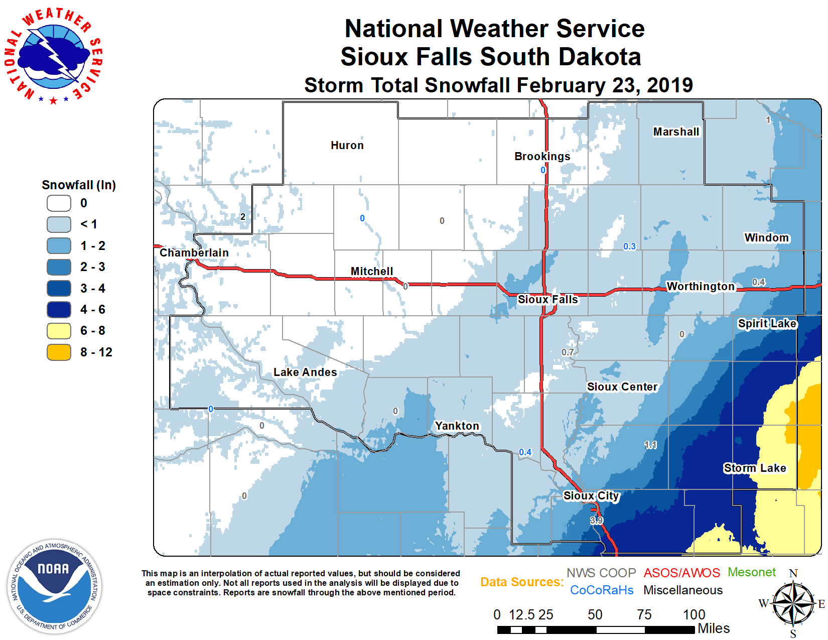
A tight gradient of moderate to heavy snowfall developed over northeast Nebraska into northwest Iowa and southwest Minnesota in the afternoon of Saturday, February 23, 2019. Snowfall totals generally ranged from 3 to 7 inches. However, Buena Vista and Clay Counties in northwest Iowa received the highest snow amounts of around 8 to 12 inches of snow.
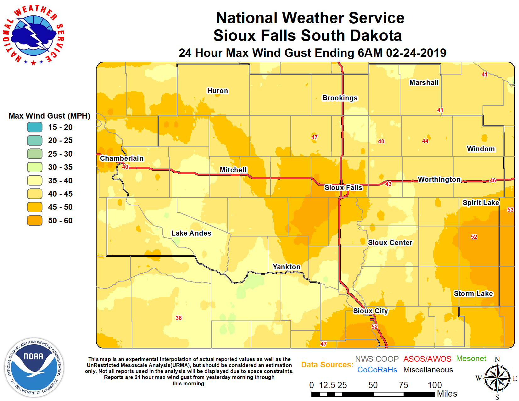
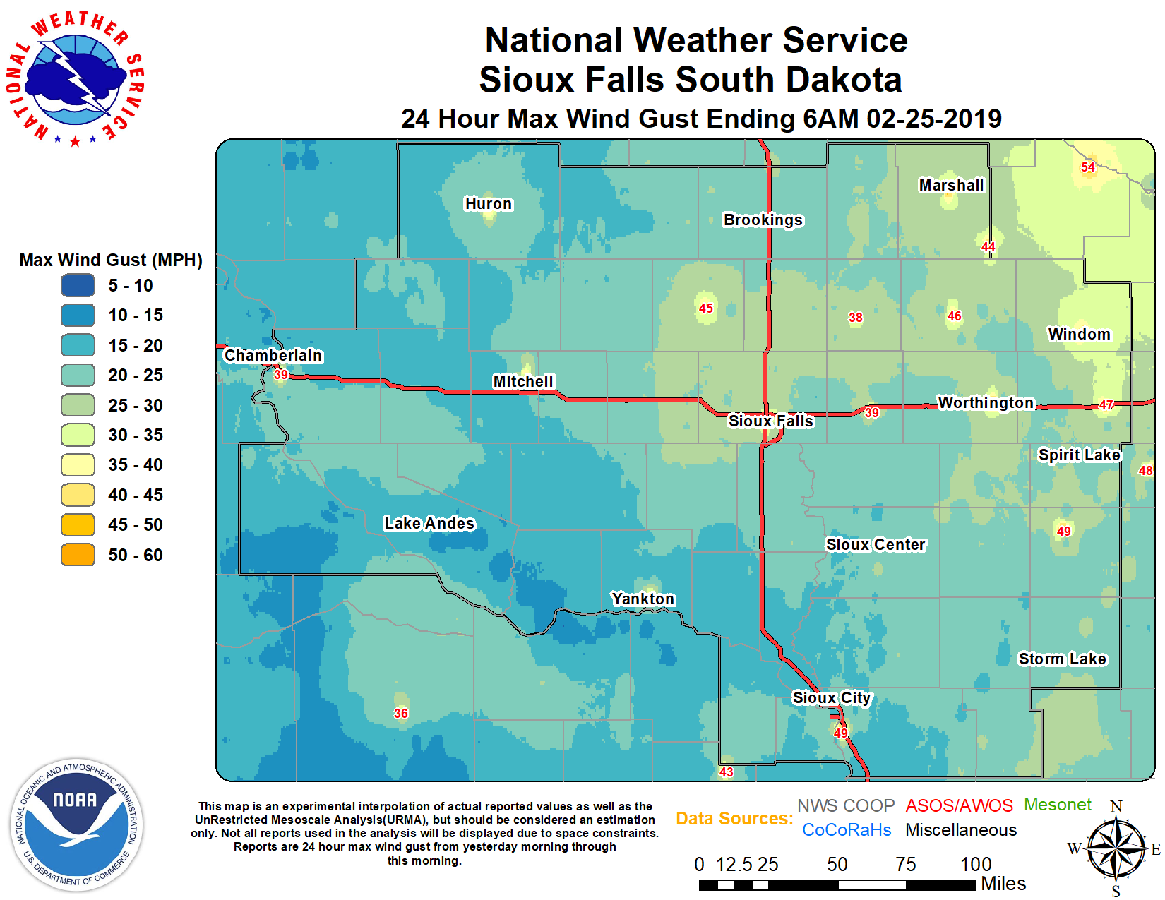
As the snow tapered off through the evening hours, strong northwesterly winds arrived across the area during the night of Saturday, February 23 and continued throughout the day on the 24th, leading to ground blizzard conditions. Areas of blowing and drifting snow as well as widespread whiteout conditions were reported across the region. Snowdrifts as high as one feet or more were observed in most locations, particularly in southwest Minnesota and northwest Iowa. Many roads were closed, including portions of Interstate 90 in southwest Minnesota. For many other areas, no travel was advised.
Photos & Video
 |
 |
 |
 |
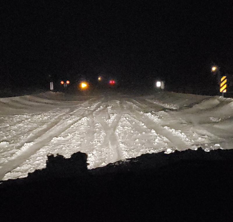
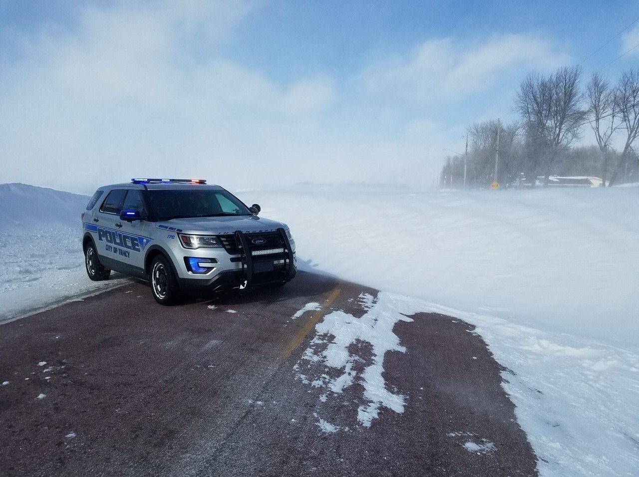
| Hazardous travel conditions near Highway 7 in Iowa on Saturday night (Source: City of Fonda, IA) |
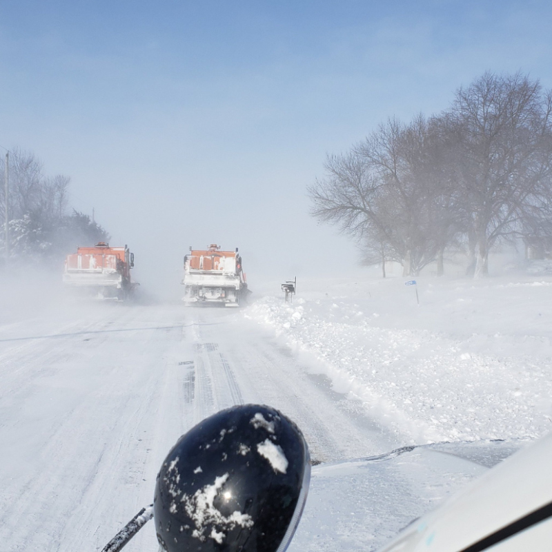
Conditions early Sunday morning near Pocahontas, IA (Source: City of Fonda, IA and Iowa Department of Transportation) |
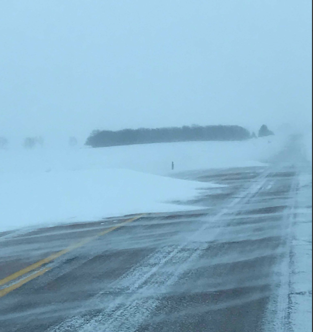
Low visibility and snowdrifts in Minnehaha County near Baltic (Source: Minnehaha County Sheriff) |
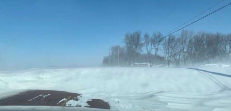
Impassable roads due to snowdrifts in Minnesota near Slayton (Source: KJP) |
 |
 |
 |
| Drifts measured in feet in Ruthon, Minnesota (Source: Pete Bouman) |
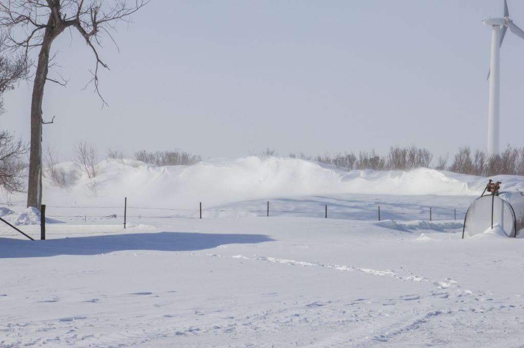
Road blocked by drifts near Tracy, Minnesota (Source: HSEM) |
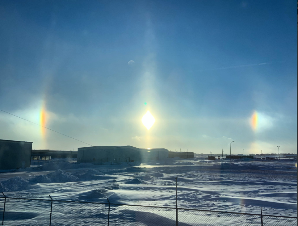
View of sun dog and snow drifts from the office (Sioux Falls Airport). |
Radar
 |
 |
| Radar Loop Saturday evening | Impressive Water Vapor Satellite loop showing the large storm system developing across the Central US on Saturday afternoon. |
 |
 |
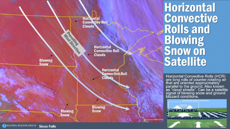 |
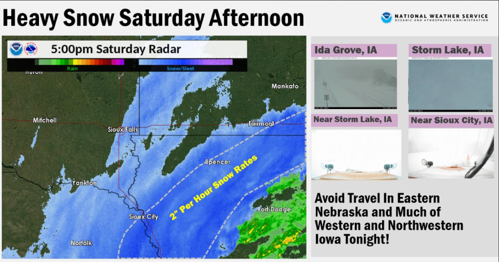
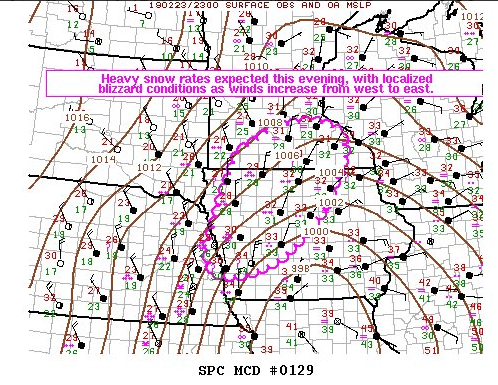
| 5:00 pm CST radar and webcams showing heavy snow and low visibility. Snow rates of 2 inches per hours were observed. | Mesoscale Discussion from the Storm Prediction Center (SPC). Heavy snow rates of 1-2 inches per hour (locally higher) were anticipated Saturday afternoon into the evening hours. | Signals of ground blizzard on satellite. Horizontal convective roll clouds are clearly visible, along with numerous pockets of blowing snow. These cloud rolls form in strong winds and run parallel to the prevailing wind direction. |
Storm Reports
 |
Media use of NWS Web News Stories is encouraged! Please acknowledge the NWS as the source of any news information accessed from this site. |
|


 Weather Story
 Weather Map
 Local Radar