Overview
|
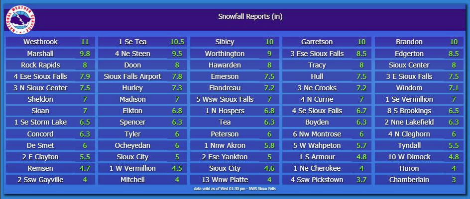
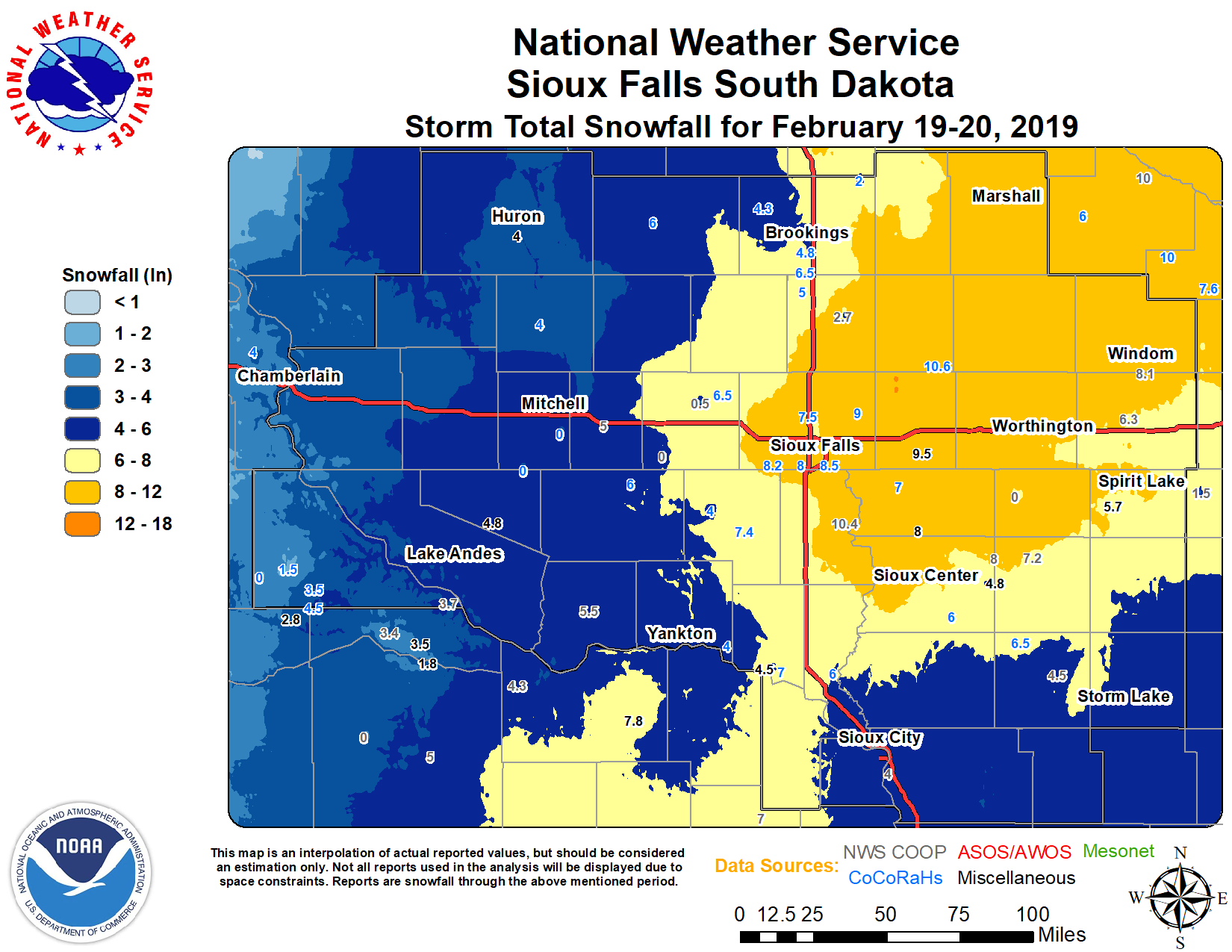
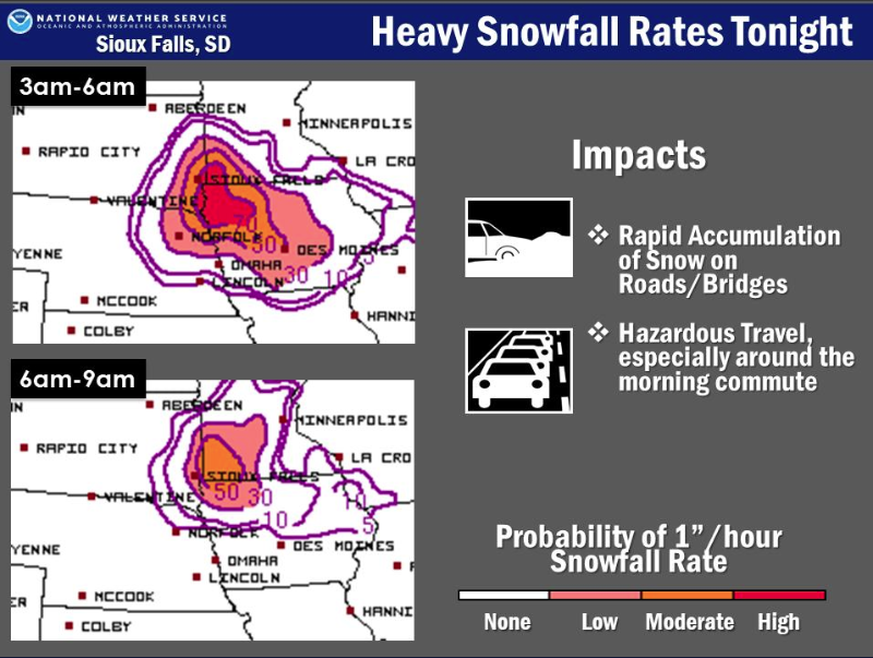
A strong low pressure system moved northeast into the region, bringing widespread snow during the evening of Tuesday, February 19, 2019 into Wednesday, February 20, 2019. Snowfall rates of around 2 inches per hour fell during the overnight hours into early Wednesday morning. Total snow accumulations averaged from 4 to 8 inches, mainly east of the James River, including southwest Minnesota and northwest Iowa. Snowfall amounts of 9 to 10+ inches were reported between I-29 corridor and Highway 60 in Iowa and Minnesota, with the highest snow total of 12.0" at Edgerton, MN. |
 |
Snow Reports
Snowfall Reports as of Noon (2/20/2019)
For the latest storm reports: https://www.weather.gov/source/crh/snowmap.html?sid=fsd
Photos & Video
Header
 |
 |
 |
 |
|
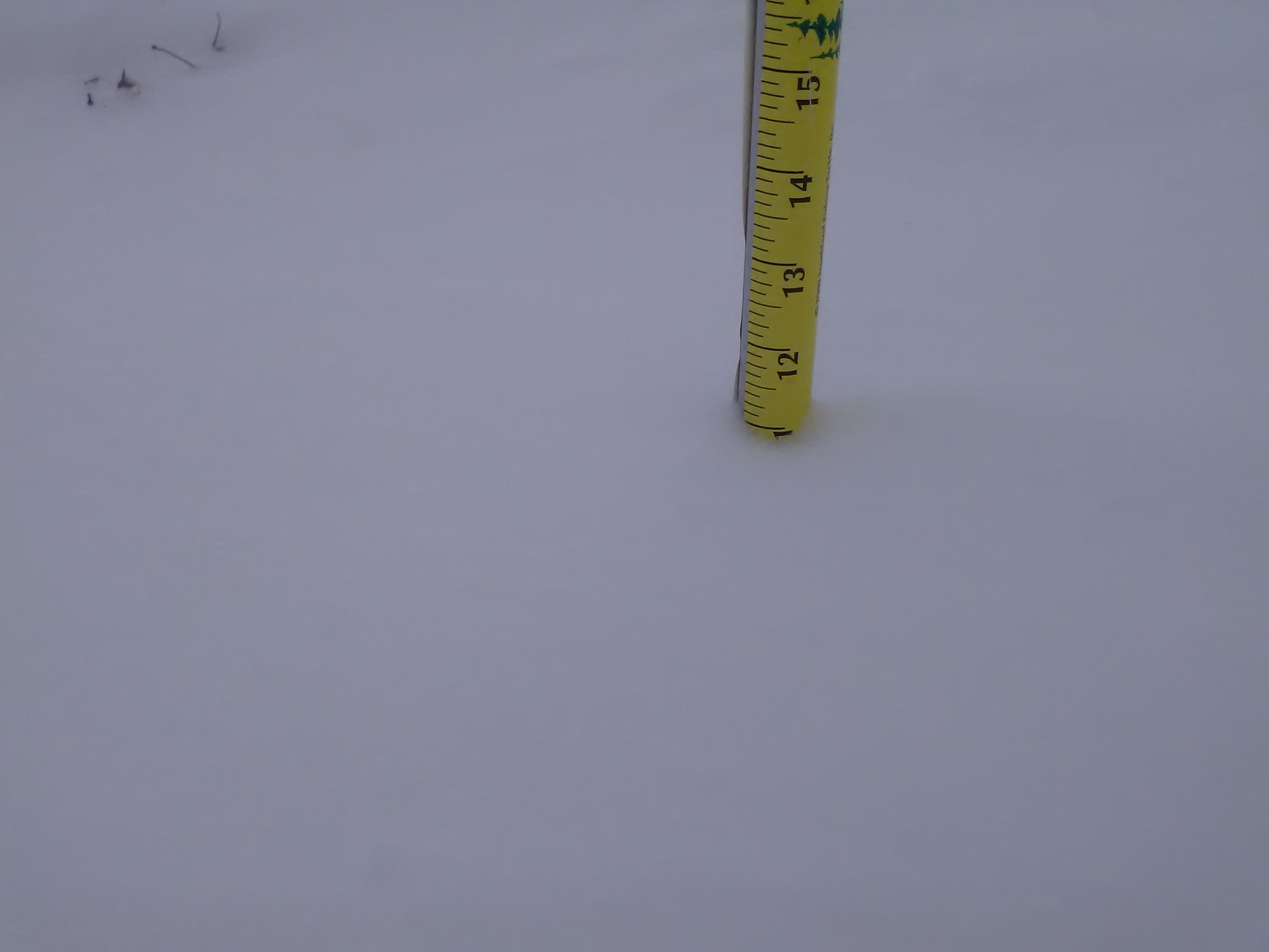
West of Sioux Falls, SD
|
Around 9 inches of snow in Larchwood, Iowa
|
Snow drifts and low visibility in Bruce, South Dakota.
|
Westbrook,Minnesota had 11 inches of new snowfall. (Credit: Paul Jones) |
Radar
Header
 |
|
 |
|
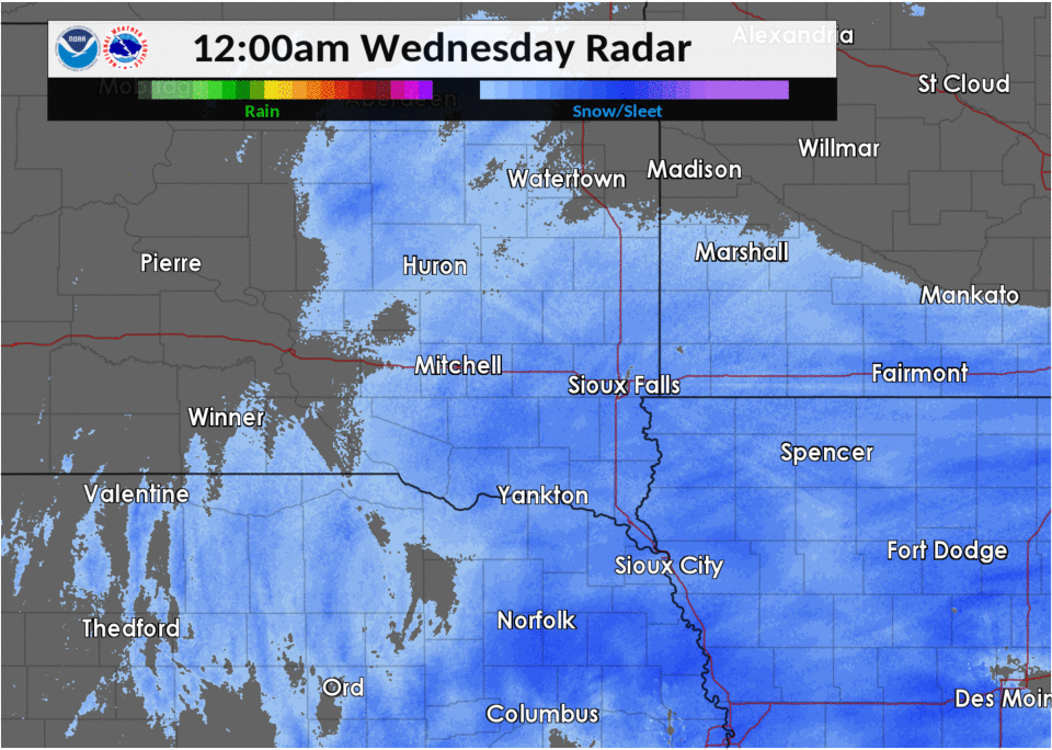
Overnight Radar Loop showing the widespread moderate to heavy snow over the region.
|
Regional Radar Loop from
|
Forecasted Snowfall Rates |
 |
Media use of NWS Web News Stories is encouraged! Please acknowledge the NWS as the source of any news information accessed from this site. |
|


 Weather Story
 Weather Map
 Local Radar