Overview
|
A powerful post-Christmas winter storm brought multiple hazards to the region. The storm started Wednesday with a quick round of snow for many locations before some switched over to rain or a rain/snow mix. By Thursday, most locations switched back over to snow with heavy snow observed across areas west of I-29 and into SW Minnesota. Strong northerly winds also greatly reduced visibility and resulted in blowing and drifting snow. Rainfall over NW Iowa also pushed some area rivers into minor flood stage. |
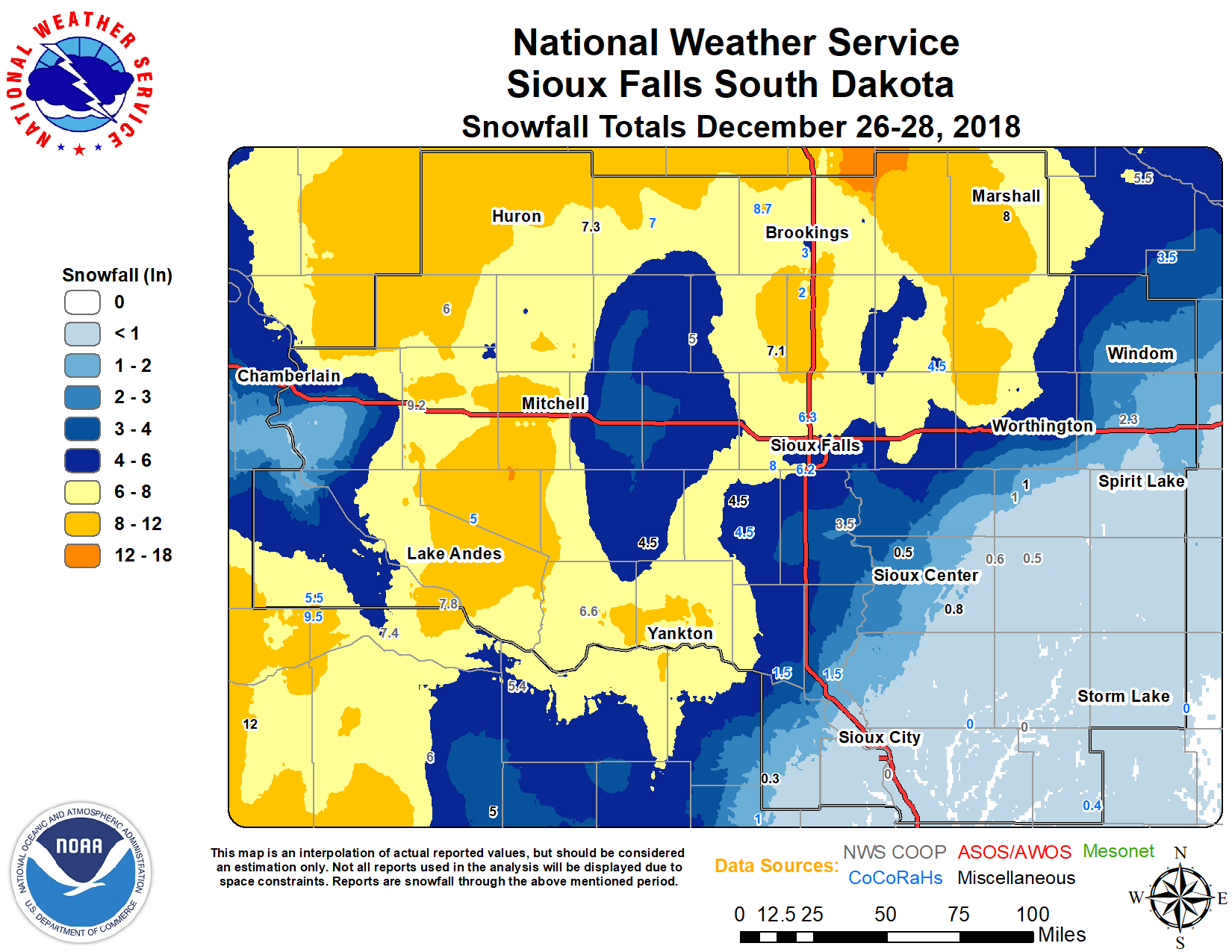 Storm Total Snowfall (Dec 26 - 28th) |
Snow Totals
Location                     Amount    Time/Date       Lat/Lon
Mitchell                     11.4 in   1100 PM 12/27   43.70N/98.04W
Marshall                     10.0 in   0900 AM 12/28   44.47N/95.80W
White Lake                   9.2 in    0700 AM 12/28   43.73N/98.72W
Stickney                     9.1 in    0200 PM 12/28   43.59N/98.43W
5 W Bruce                    8.7 in    0800 AM 12/28   44.43N/97.00W
Plankinton                   8.5 in    0200 PM 12/28   43.71N/98.48W
Wagner                       8.5 in    0200 PM 12/28   43.08N/98.30W
2 NE Brookings               8.1 in    0800 AM 12/28   44.32N/96.77W
Wall Lake                    8.0 in    0900 AM 12/28   43.53N/96.95W
1 SW Brookings               8.0 in    0800 AM 12/28   44.29N/96.80W
Marshall 0.6 S               8.0 in    0800 AM 12/28   44.44N/95.79W
2 S Armour                   8.0 in    0800 AM 12/28   43.30N/98.34W
Tyndall                      7.6 in    0800 AM 12/28   42.99N/97.86W
2 S Huron                    7.5 in    0641 AM 12/28   44.34N/98.22W
2 SE Yankton                 7.5 in    0630 AM 12/28   42.88N/97.36W
Chester 2n                   7.1 in    0700 AM 12/28   43.93N/96.93W
De Smet                      7.0 in    0700 AM 12/28   44.38N/97.55W
3 SW Sioux Falls             6.2 in    0700 AM 12/28   43.50N/96.79W
Wessington Springs           6.0 in    0700 AM 12/28   44.08N/98.57W
2 N Sioux Falls              4.7 in    0907 AM 12/28   43.57N/96.73W
Edgerton                     4.5 in    0600 AM 12/28   43.87N/96.13W
Hurley                       4.5 in    0600 AM 12/28   43.28N/97.09W
Canton                       3.5 in    0700 AM 12/28   43.31N/96.59W
Worthington                  3.0 in    0700 AM 12/28   43.65N/95.58W
Lakefield                    2.3 in    0700 AM 12/28   43.68N/95.18W
Rock Rapids                  1.0 in    0800 AM 12/28   43.43N/96.17W
Sibley                       1.0 in    0700 AM 12/28   43.45N/95.71W
Orange City                  0.8 in    0700 AM 12/28   43.00N/96.05W
Sanborn                      0.5 in    0800 AM 12/28   43.18N/95.66W
Cherokee                      T        0800 AM 12/28   42.76N/95.54W
Spirit Lake                   T        0700 AM 12/28   43.42N/95.10W
Kingsley                      T        0700 AM 12/28   42.58N/95.97W
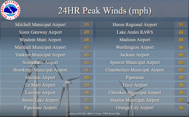
Wind Gusts
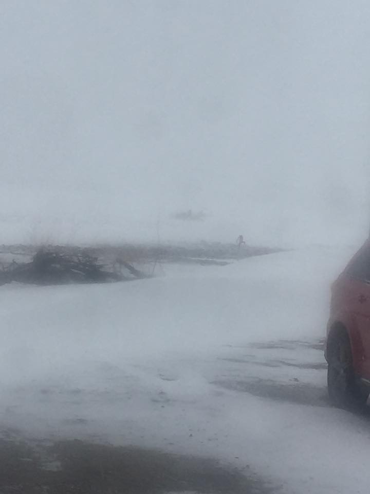
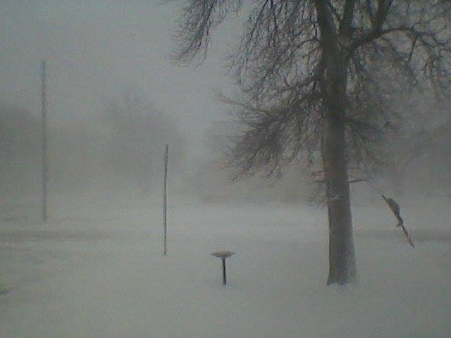
Photos & Video
 |
 |
 |
 |
||
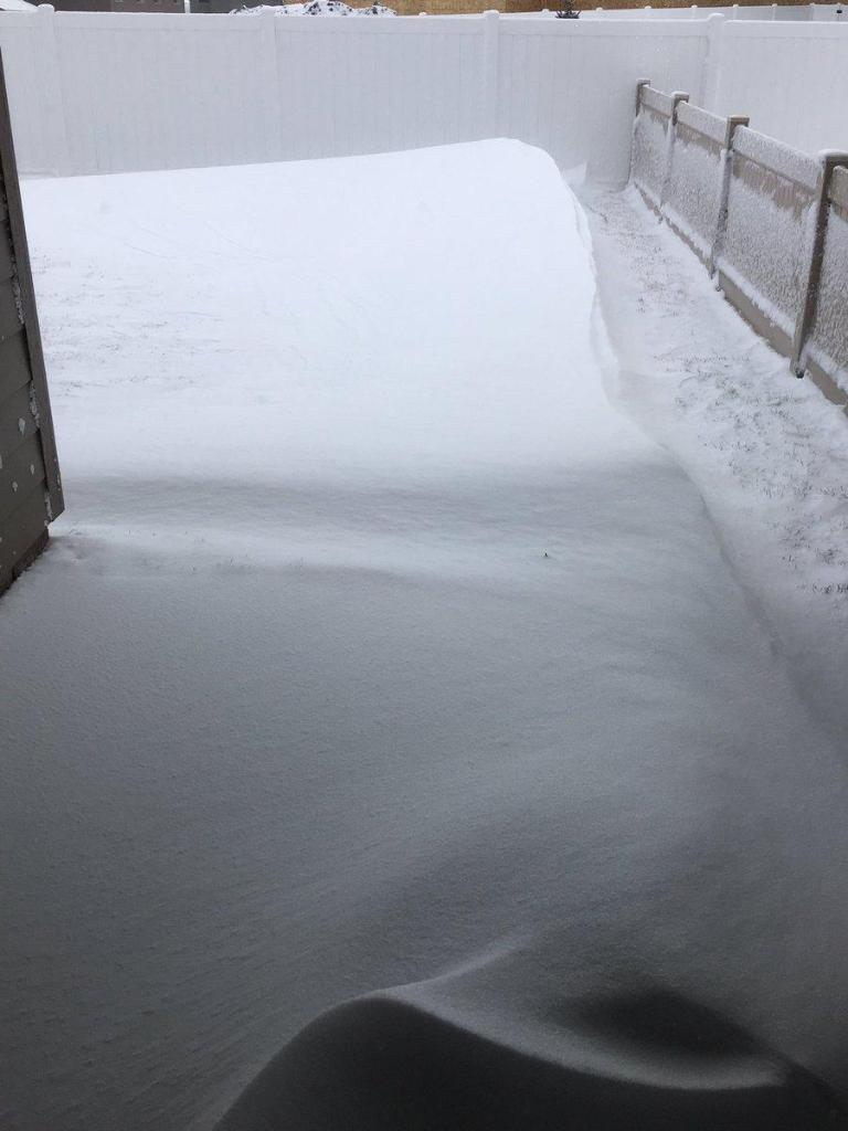
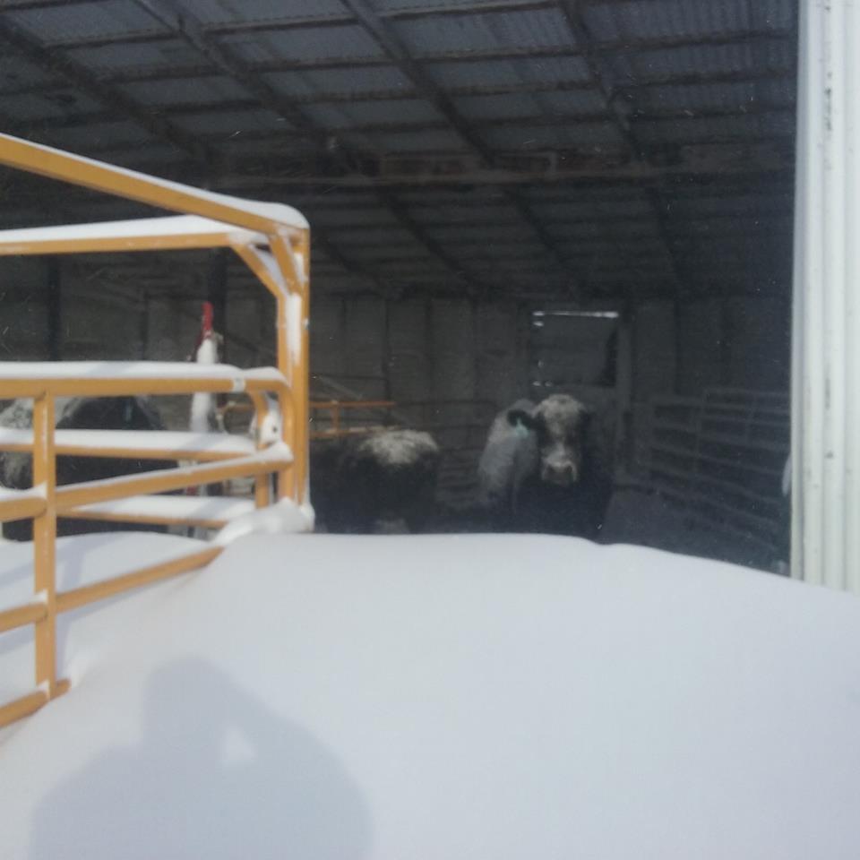
| Gayville, SD (Savannah Simmons) |
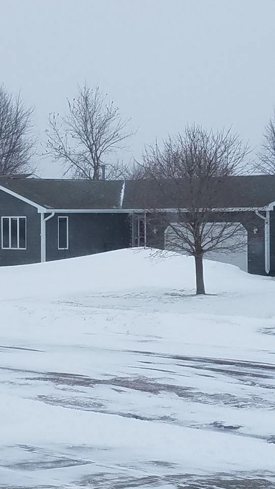
Round Lake, MN (Ida Reimer) |
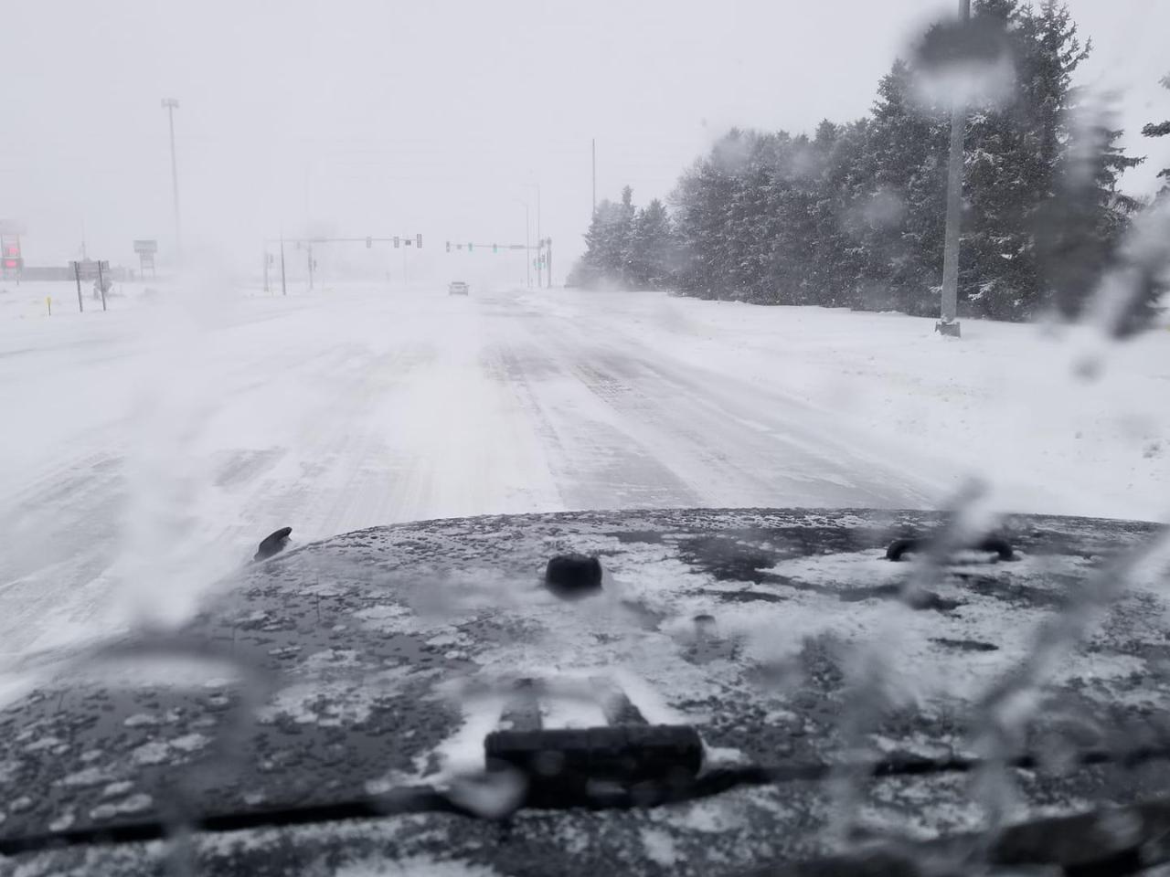
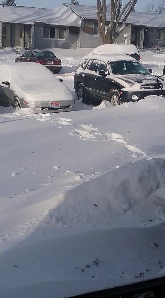
Sioux Falls, SD (Kyle Miller) |
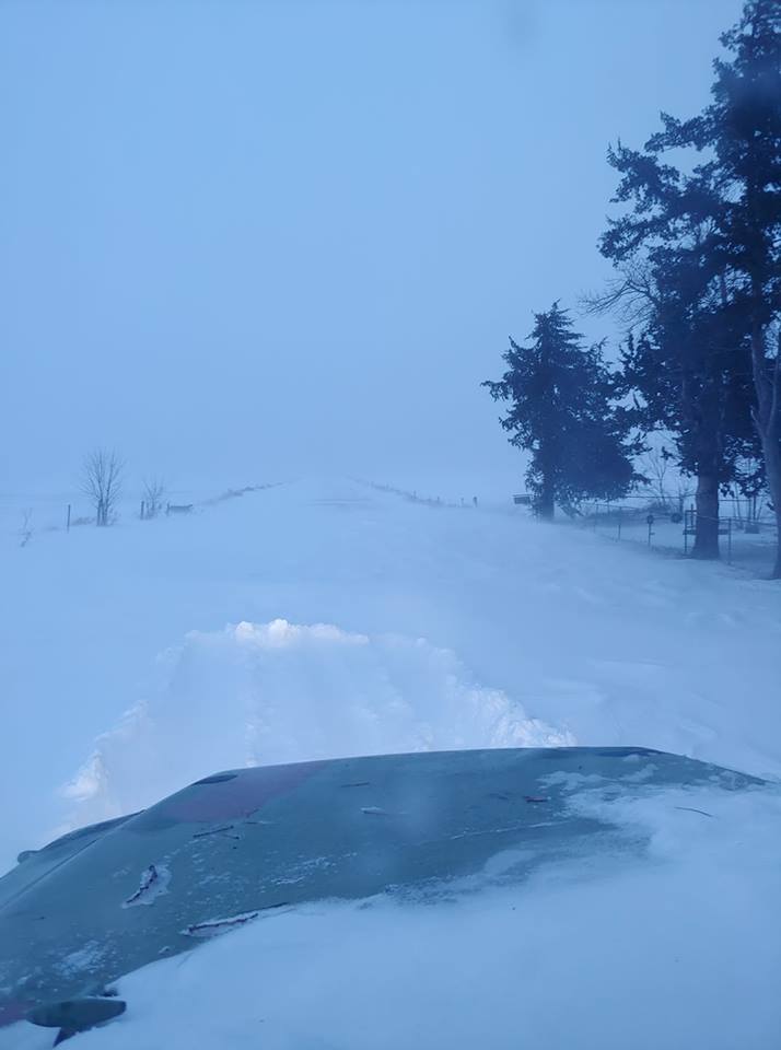
W of Yankton, SD (Christian Steffen) |
||
 |
 |
 |
 |
||
| Volga, SD (Kris Bishop) |
Yankton, SD (Connie Moore) |
Tripp, SD (Trish McMullan) |
Clear Lake, SD (Bonnie Svoboda) |
Radar
 |
 |
||
| Event Radar Loop | GOES East Water Vapor Loop |
 |
Media use of NWS Web News Stories is encouraged! Please acknowledge the NWS as the source of any news information accessed from this site. |
|


 Weather Story
 Weather Map
 Local Radar