Overview
|
Several rounds of thunderstorms moved through the region during the week of September 18 - 21, 2018. These thunderstorms brought heavy rain to the region, with widespread accumulations between 4 to 7 inches, and localized amounts greater than 10 inches. |
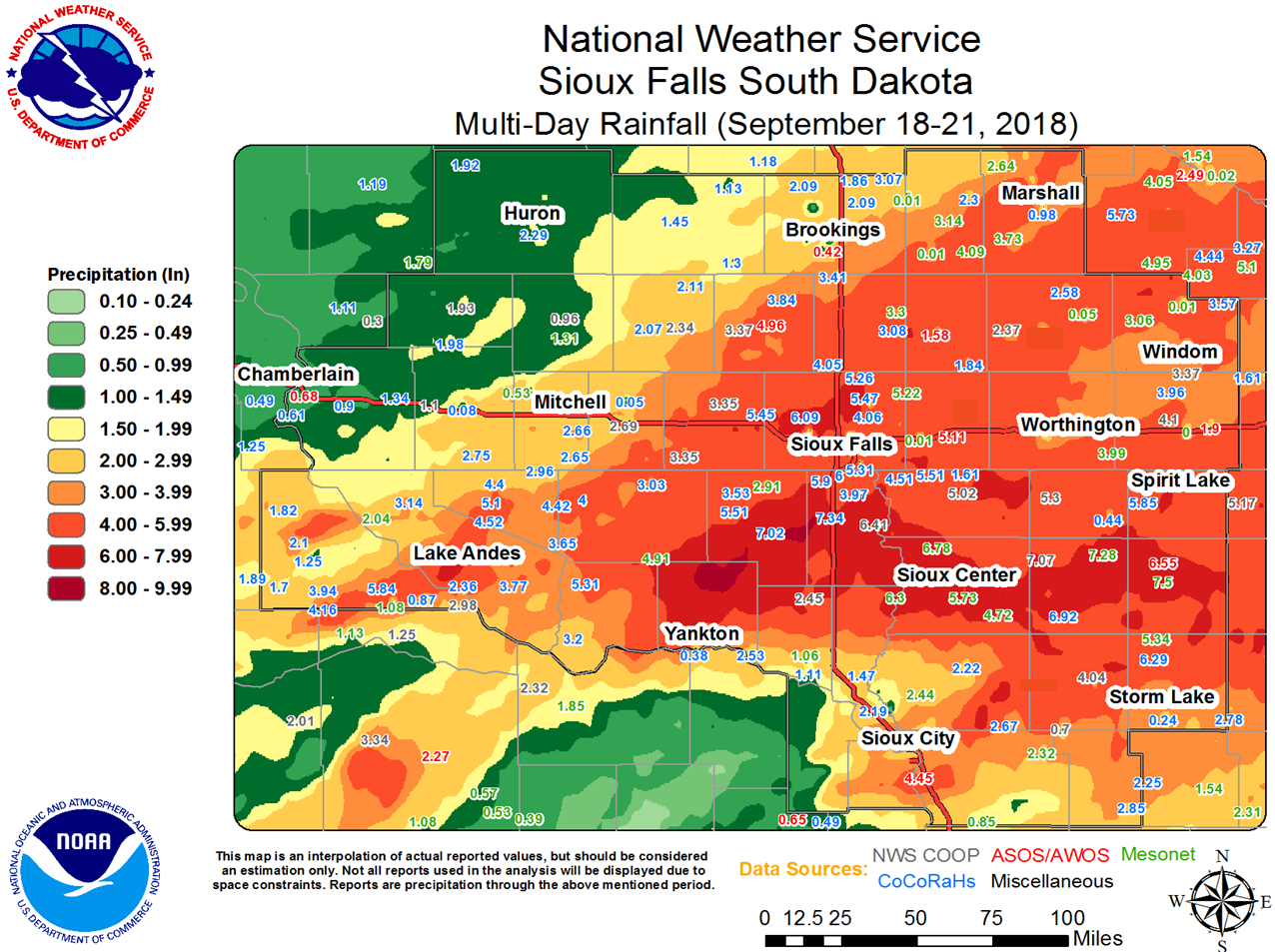 Storm Total Rainfall - September 18-21, 2018 |
 |
 |
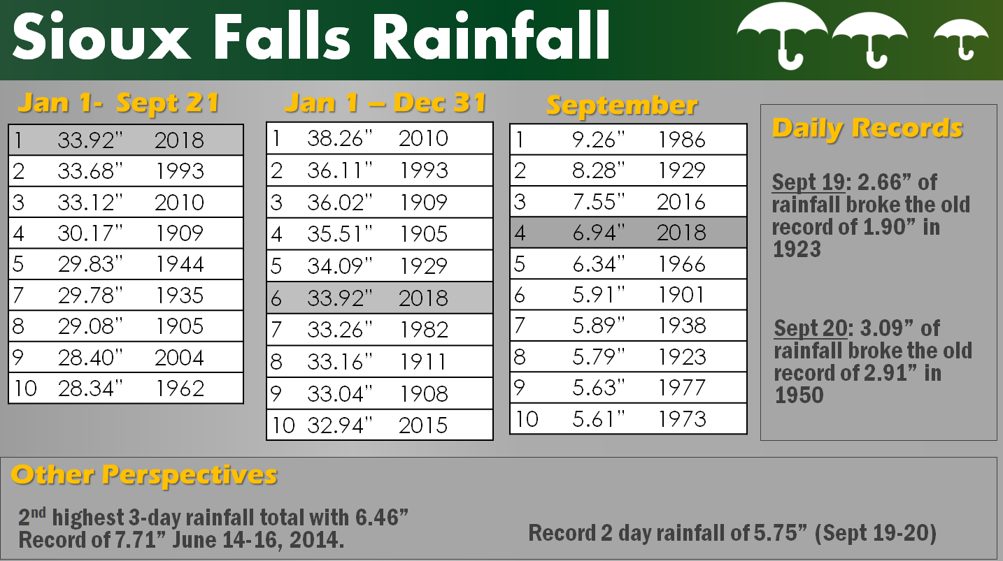 |
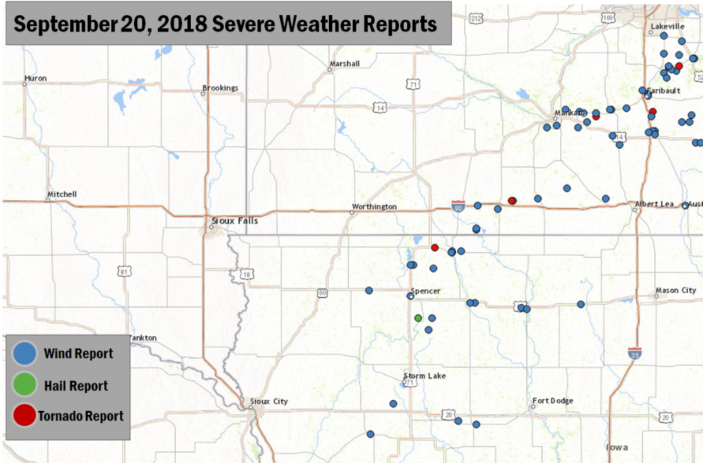
| Radar Overview | Severe Weather Reports | Rainfall Climatology - Sioux Falls |
Flooding/Photos
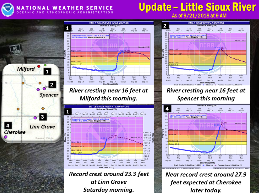
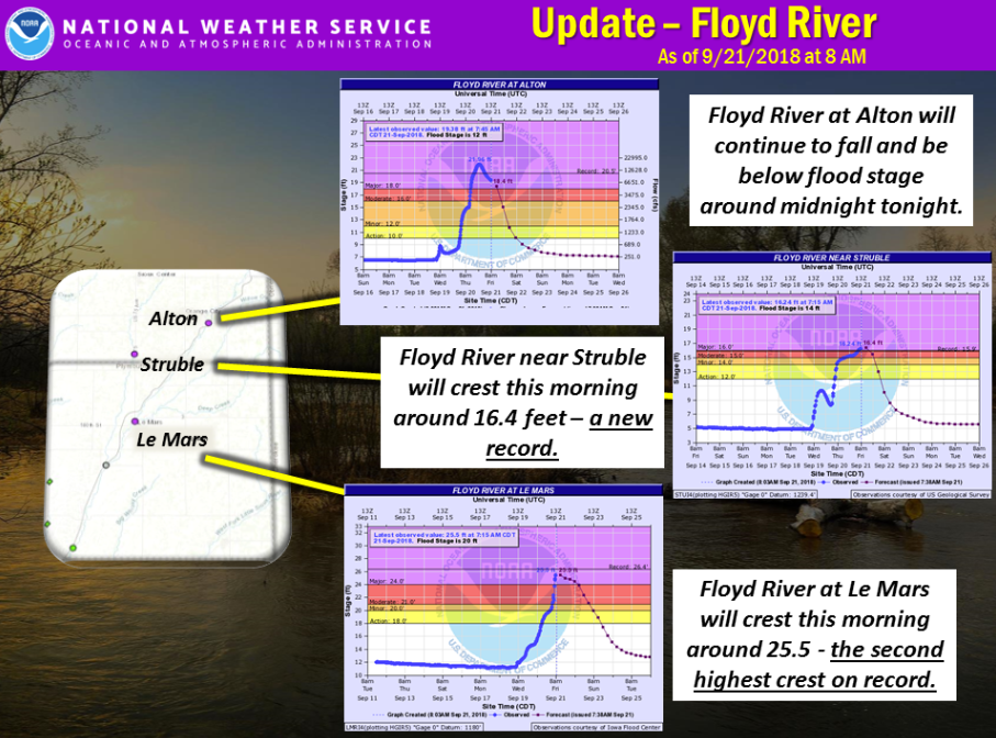
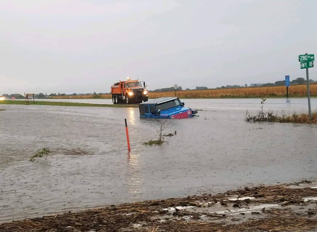
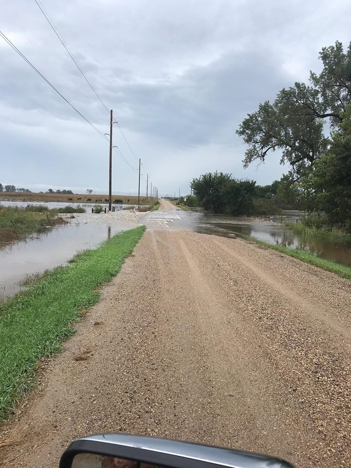
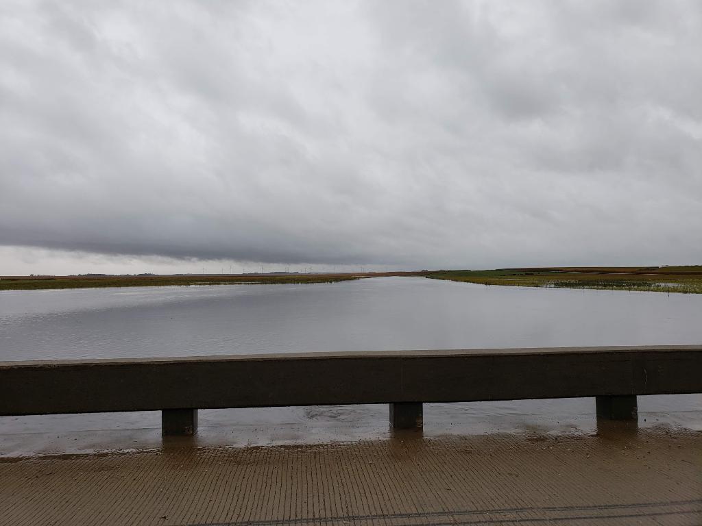
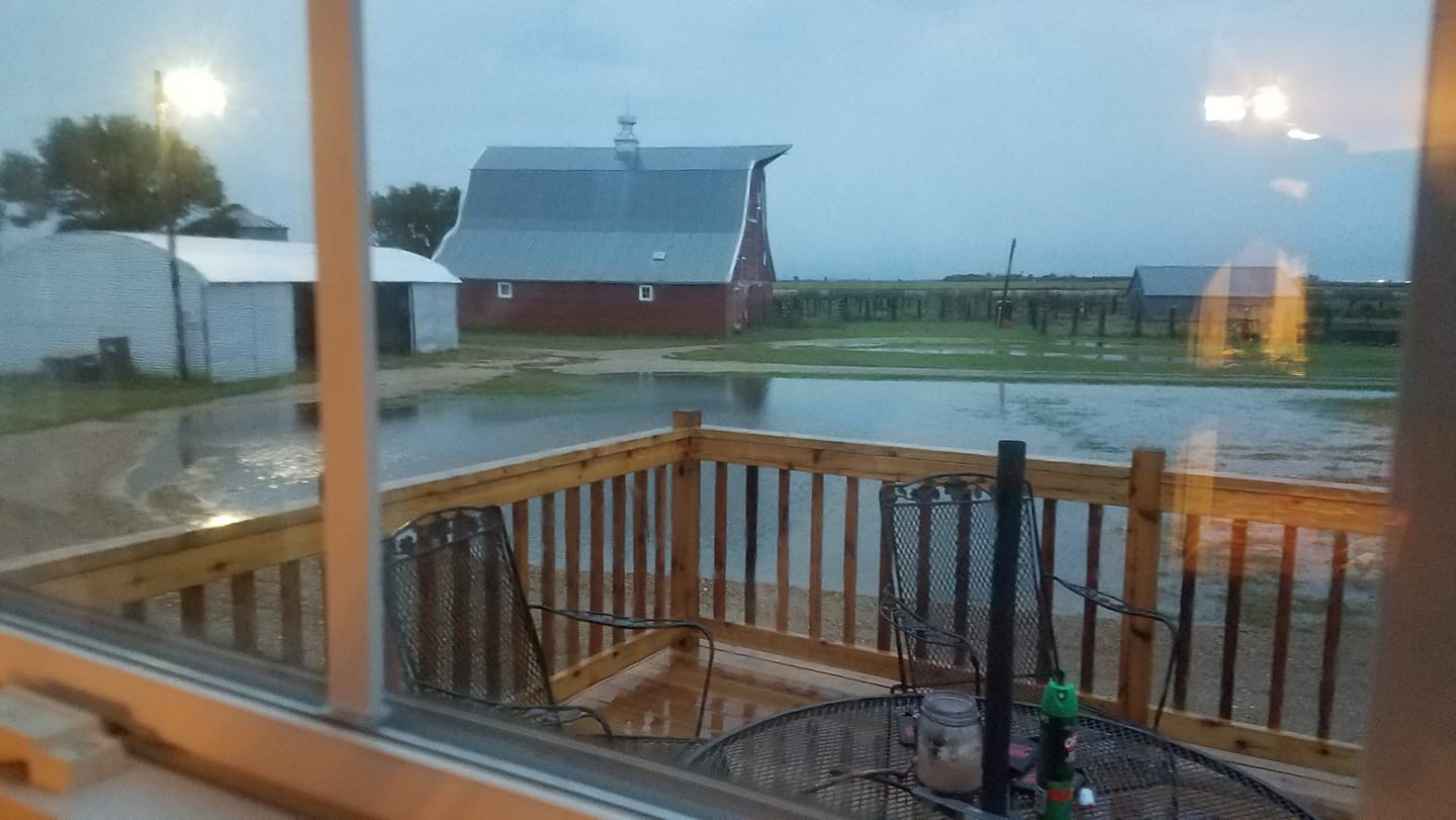
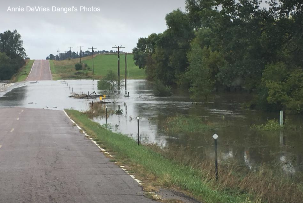
Major to record flooding was observed across the region due to the nearly 4 to 8 inches of rainfall. Here is a closer look at a few of the more active rivers across the area, along with flooding impacts observed in many sites.
Hydrographs
 |
 |
 |
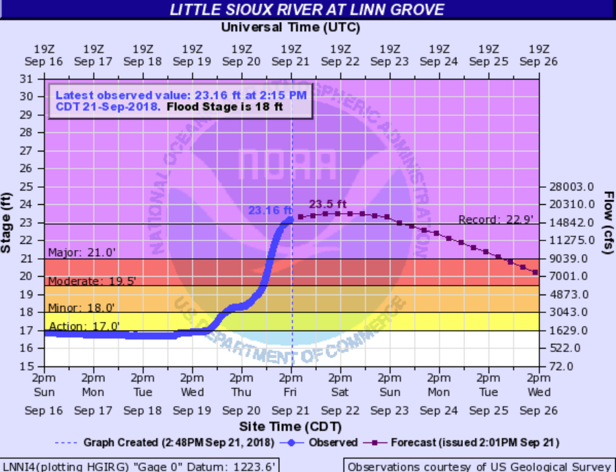 |
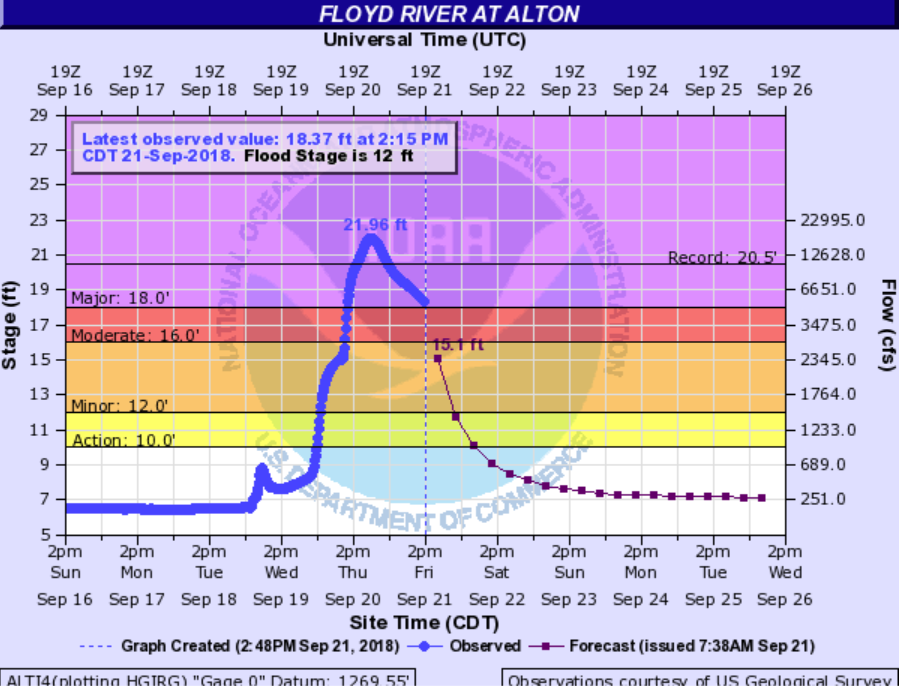
| Little Sioux Overview | Floyd River Overview | Record Alton Hydrograph | Linn Grove Hydrograph |
Flooding Impact Photos
 |
 |
 |
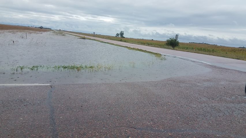 |
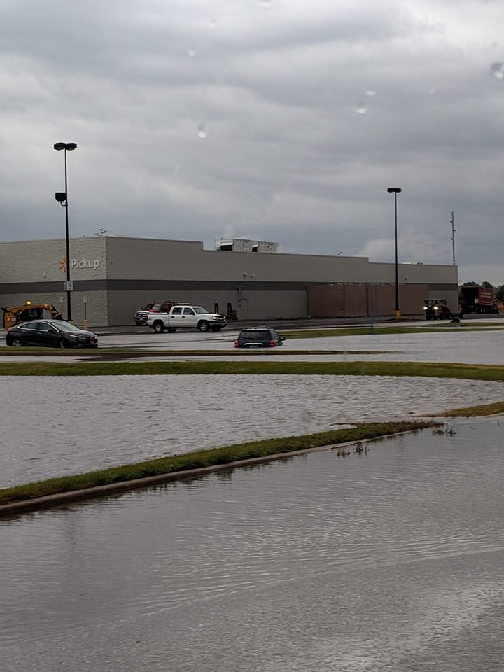
| Spencer, IA Walmart Flooding | Near Spencer (Photo: Mark Stover) | Scotland (Photo: Sonja Marie Baker) | (Photo: Melissa Schmidt) |
 |
 |
 |
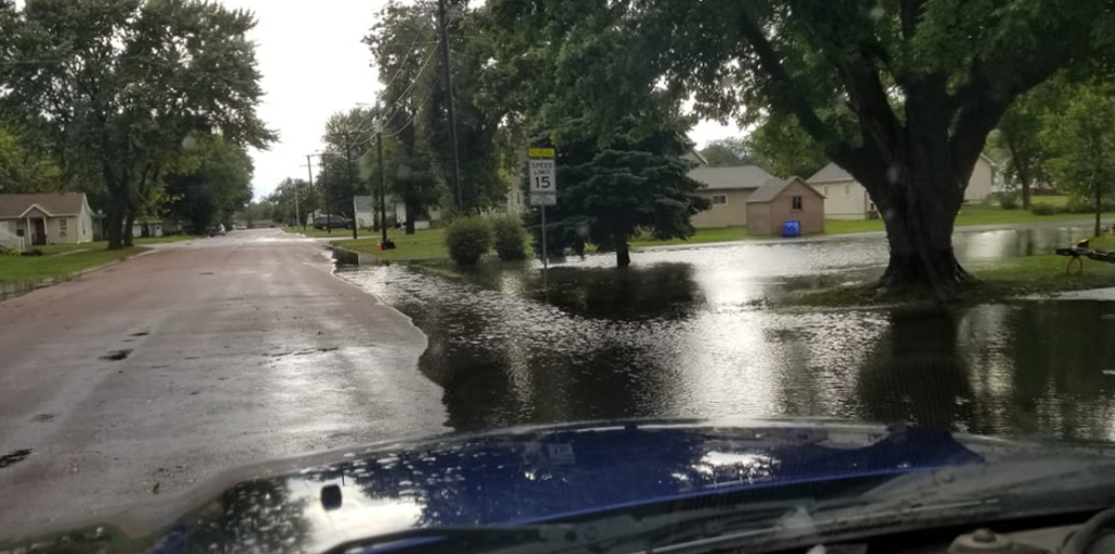 |
| LIttle Sioux River(Photo: Mike Ehret) | Tripp, SD (Photo: Melissa Schmidt) | Irene, SD (Photo: Angie Devries Dangel) | Beresford, SD |
Severe Weather:
Severe Weather Photos
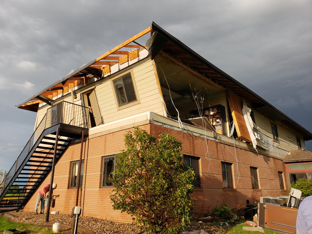
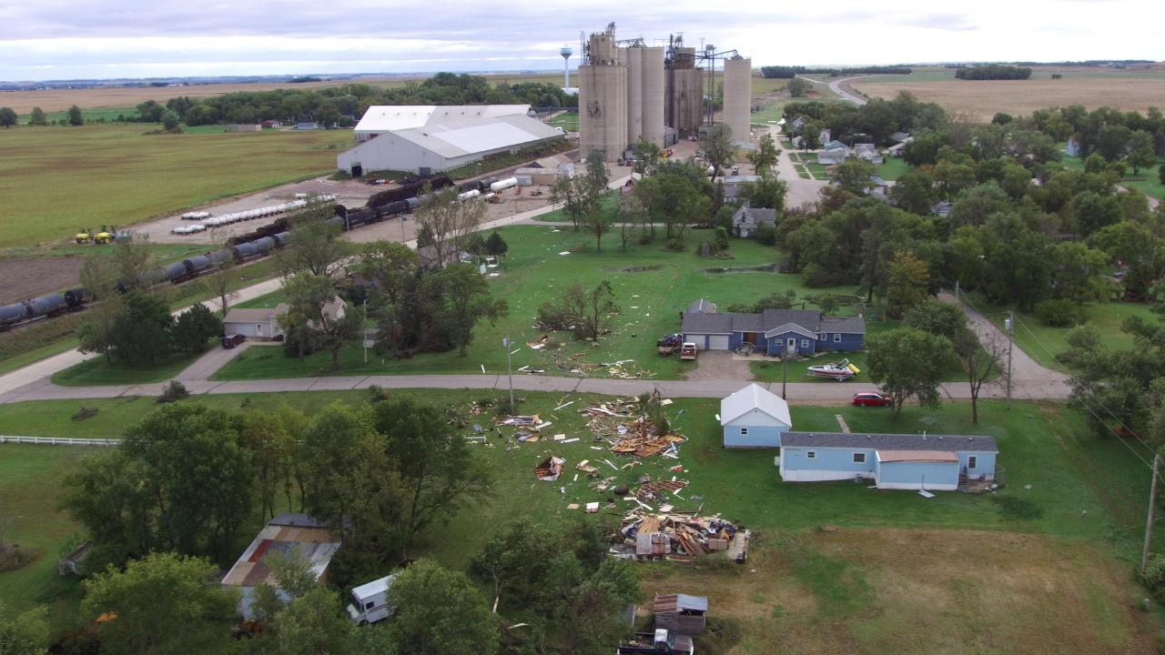
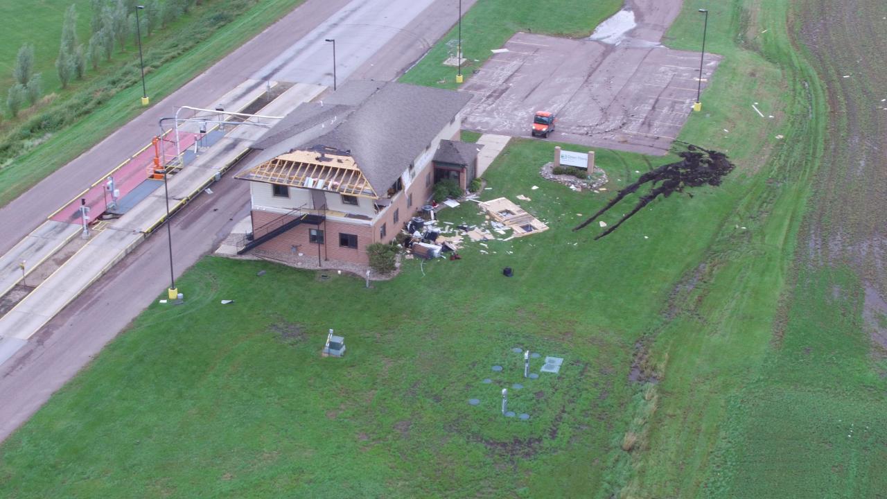
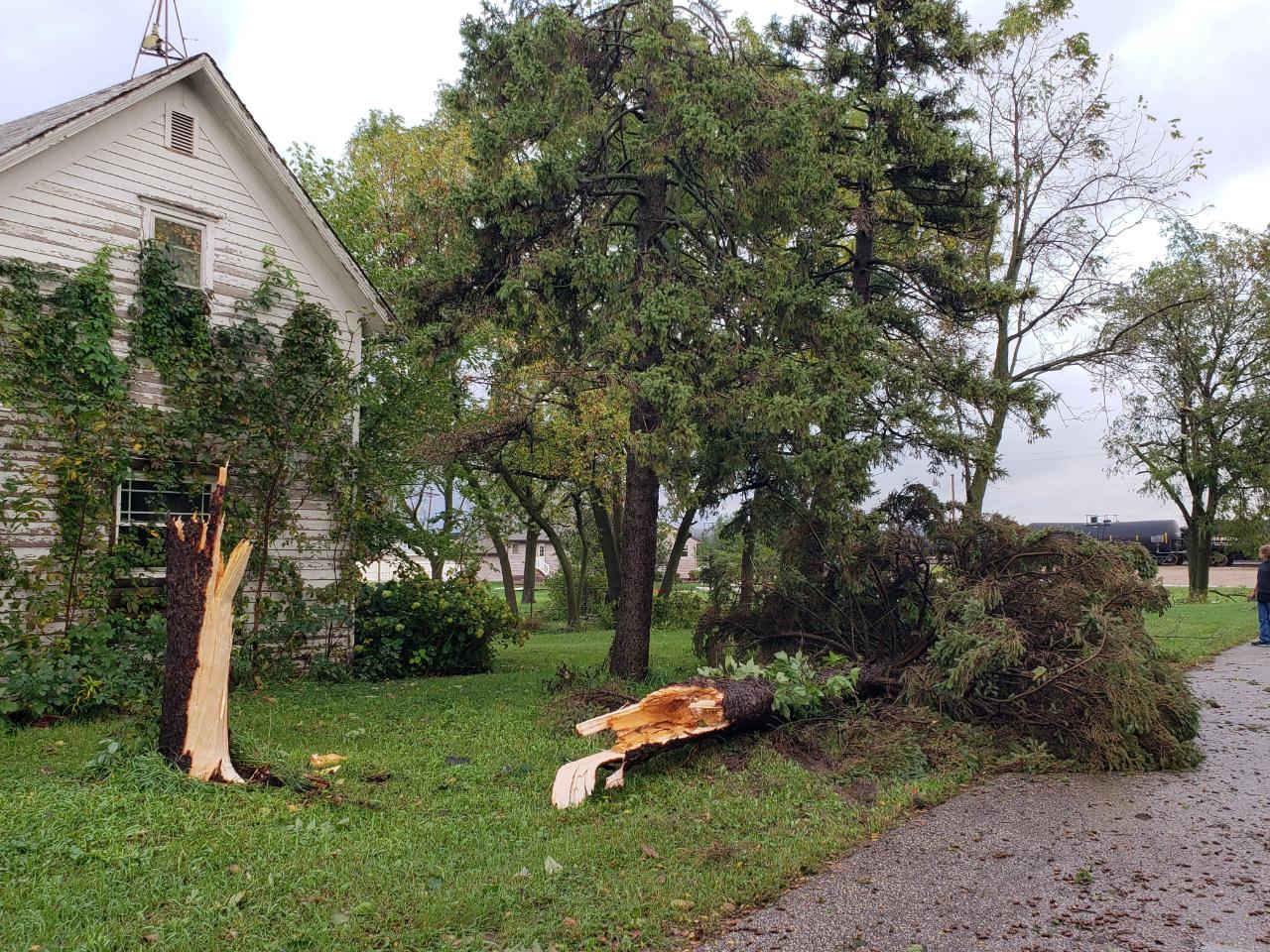
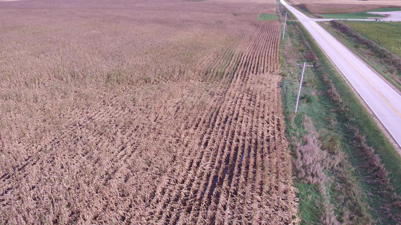
Here's a collection of severe weather and tornado related photos from September 18-21, 2018. A brief touchdown of an EF-1 tornado was confirmed in Superior, Iowa late in the afternoon hours of September 20. An observation site near Superior Ethanol measured a 99 mph wind as the tornado moved through.
 |
 |
.jpg) |
|
| Superior Ethanol (Photo: Mike Ehret) | VFW Building (Photo: Mike Ehret) | Tree Damage (Photo: Mike Ehret) | VFW Damage (Photo: Mike Ehret) |
 |
 |
 |
 |
| Superior Ethanol (Photo: Mike Ehret) | Superior Ethanol (Photo: Mike Ehret) | Superior, IA (Photo: Mike Ehret) | Superior, IA (Photo: Mike Ehret) |
Tornadoes:
|
Tornado - Superior, IA
Track Map 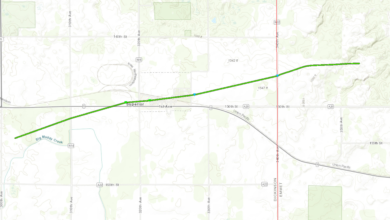 
|
||||||||||||||||
The Enhanced Fujita (EF) Scale classifies tornadoes into the following categories:
| EF0 Weak 65-85 mph |
EF1 Moderate 86-110 mph |
EF2 Significant 111-135 mph |
EF3 Severe 136-165 mph |
EF4 Extreme 166-200 mph |
EF5 Catastrophic 200+ mph |
 |
|||||
Storm Reports:
Here's an overview of severe weather and flooding reports from September 18-21, 2018. A brief touchdown of an EF-1 tornado was confirmed in Superior, Iowa late in the afternoon hours of September 20. An observation site near Superior Ethanol measured a 99 mph wind as the tornado moved through.
|
||||||||||||||||||||||||||||||||||||||||||||||||||||||||||||||||||||||||||||||||||||||||||||||||||||||||||||||||||||||||||||||||||||||||||||||||||||||||||||||||||||||||||||||||||||||||||||||||||||||||||||||||||||||||||||||||||||||||||||||||||||||||||||||||||||||||||||||||||||||||||||||||||||||||||||||||||||||||||||
|
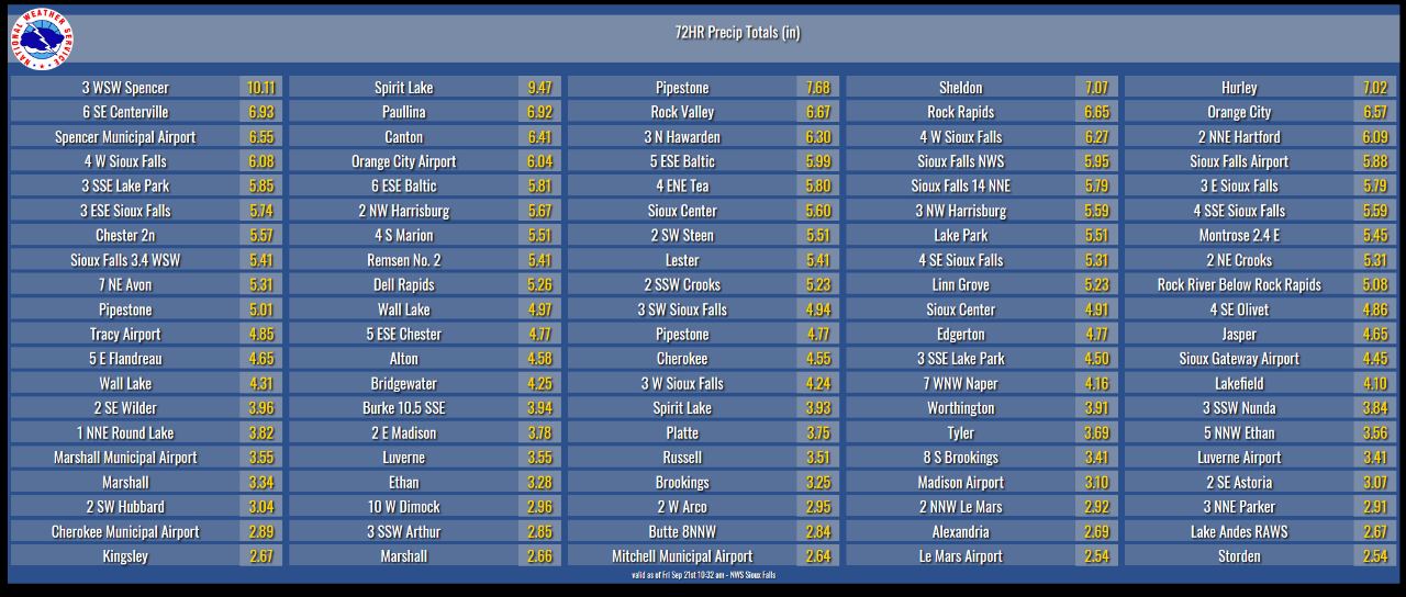
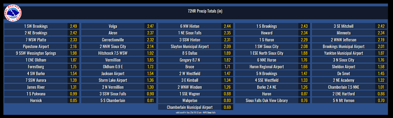
Rain Reports
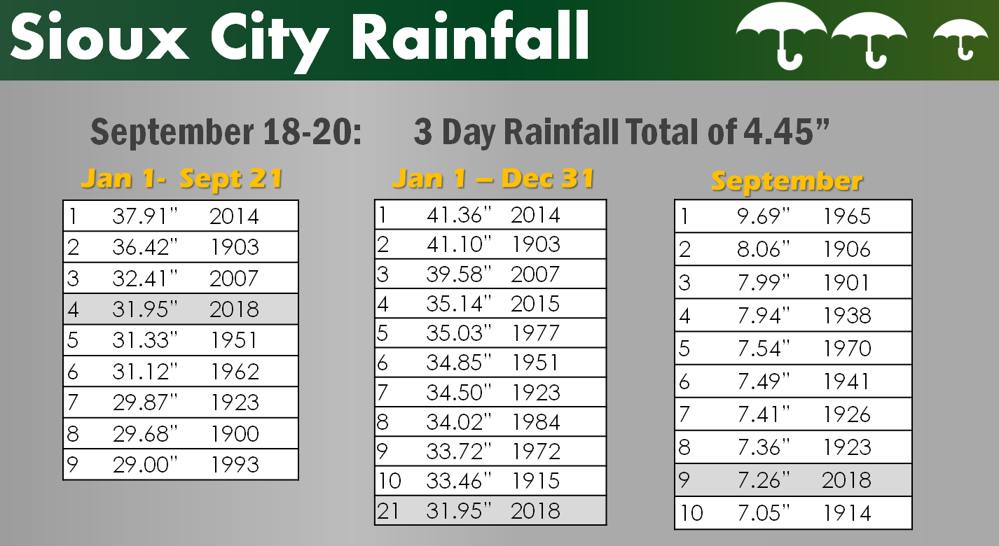
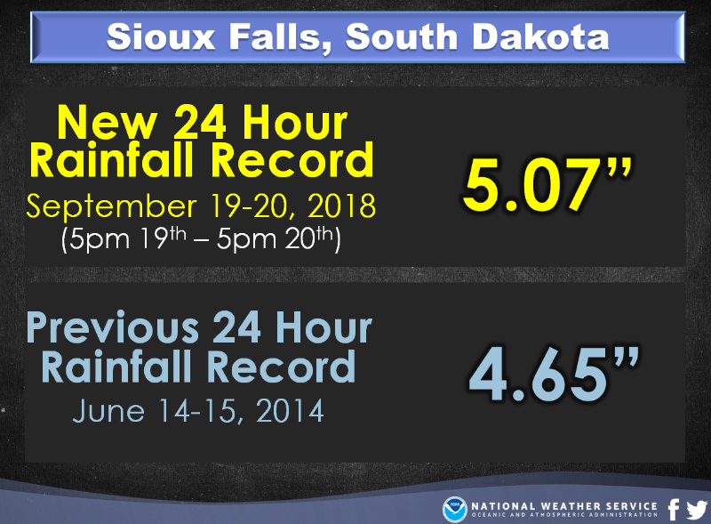
Here is a closer look at rainfall reports across the Tri-State area during the September 18-21, 2018 time frame. In many locations, this heavy rainfall approached a top 5 accumulations for both a 24 hour period and 2 day rainfall period. This rainfall has also pushed many locations towards the top of the list for year to date and yearly rainfall accumulations.
|
| Storm Total Accumulations September 18-21, 2018 |
|
 |
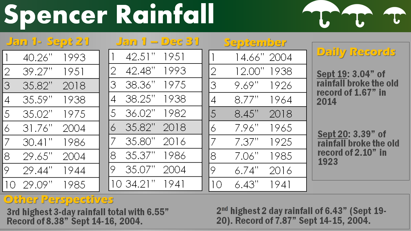 |
| Climatological Look At Heavy Rainfall | ||
 |
||
 |
 |
 |
Media use of NWS Web News Stories is encouraged! Please acknowledge the NWS as the source of any news information accessed from this site. |
|


 Weather Story
 Weather Map
 Local Radar