Overview
|
A compact strong upper wave moved east from northeast Nebraska into northern Iowa the night of April 17-18, bringing rain, sleet and snow across the area. As the system approached the region, rain and a mix of precipitation started to fall along the Missouri River into northwest Iowa shortly after midnight. Rain quickly changed to moderate snow (heavy at times) along and west of the I-29 corridor, while northwest Iowa were reporting thunder sleet and thunder snow early in the morning hours. Precipitation quickly changed to widespread snow after 4 am Wednesday, with snowfall rates of 1 to 2 inches per hour. Snowfall amounts range from 2 to 10 inches. Highest snow accumulations occurred from the Interstate 90 corridor and southward. |
 |
Snow/Ice
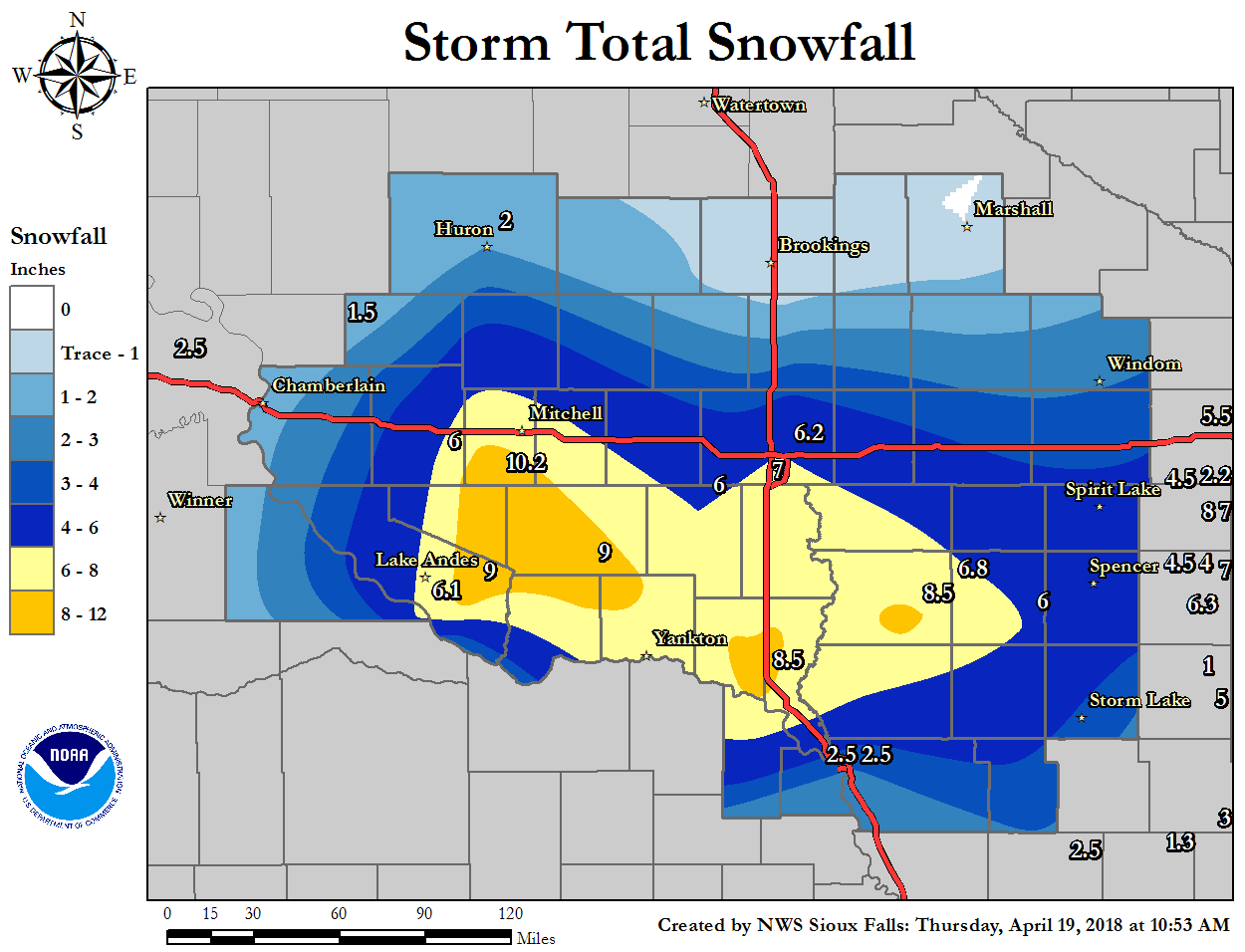
...48 Hour Snowfall Reports From April 18th...

Location                     Amount    Time/Date       Provider
10 W Dimock                  10.2 in   0800 AM 04/18   COCORAHS
Wall Lake                    10.0 in   0800 AM 04/19   COCORAHS
Tyndall                      9.0 in    0800 AM 04/19   COOP
Bridgewater                  7.5 in    0800 AM 04/19   COOP
4 N Cleghorn                 7.0 in    0700 AM 04/19   COCORAHS
Cherokee                     7.0 in    0800 AM 04/19   COOP
Sioux Falls Airport          6.2 in    0656 AM 04/19   ASOS
2 NE Crooks                  6.2 in    0700 AM 04/19   COCORAHS
3 WNW Everly                 6.0 in    0700 AM 04/19   COOP
Lakefield                    5.6 in    0700 AM 04/19   COOP
Sheldon                      5.5 in    0700 AM 04/19   COOP
Remsen No. 2                 5.4 in    0625 AM 04/19   COOP
2 NE Academy                 5.0 in    0900 AM 04/19   COOP
Orange City                  4.8 in    0700 AM 04/19   COOP
Salem 5NE                    4.7 in    0700 AM 04/19   COOP
White Lake                   4.3 in    0700 AM 04/19   COOP
Worthington                  4.2 in    0700 AM 04/19   COOP
4 SW Burke                   4.0 in    0700 AM 04/19   COCORAHS
Sioux City ANG               3.6 in    0600 AM 04/19   COOP
6 S Oacoma                   3.5 in    0630 AM 04/19   COCORAHS
7 WNW Naper                  3.0 in    0700 AM 04/19   COCORAHS
Chester 2N                   3.0 in    0700 AM 04/19   COOP
Burke 2.4 NE                 3.0 in    0700 AM 04/19   COCORAHS
8 S Dallas                   3.0 in    0700 AM 04/19   COCORAHS
Woonsocket                   2.9 in    0800 AM 04/19   UCOOP
Sioux Gateway Airport        2.5 in    0652 AM 04/19   ASOS
Chamberlain                  2.4 in    0530 AM 04/19   COCORAHS
Howard                       2.4 in    0630 AM 04/19   COOP
Huron Regional Airport       2.0 in    0655 AM 04/19   ASOS
2 E Madison                  1.5 in    0900 AM 04/19   COOP
Holly Springs 1NW            1.0 in    0700 AM 04/19   COOP

Observations are collected from a variety of sources with varying
equipment and exposures. We thank all volunteer weather observers
for their dedication. Not all data listed are considered official.
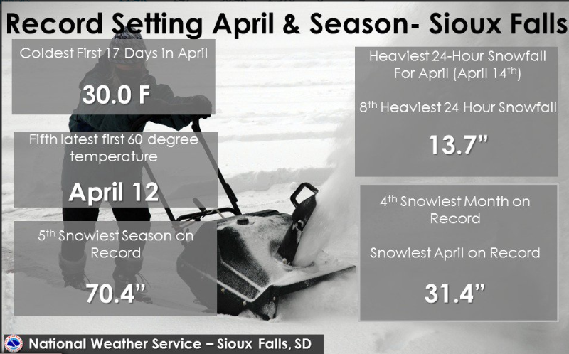
Record Snowfall
Photos & Video:
Header
 |
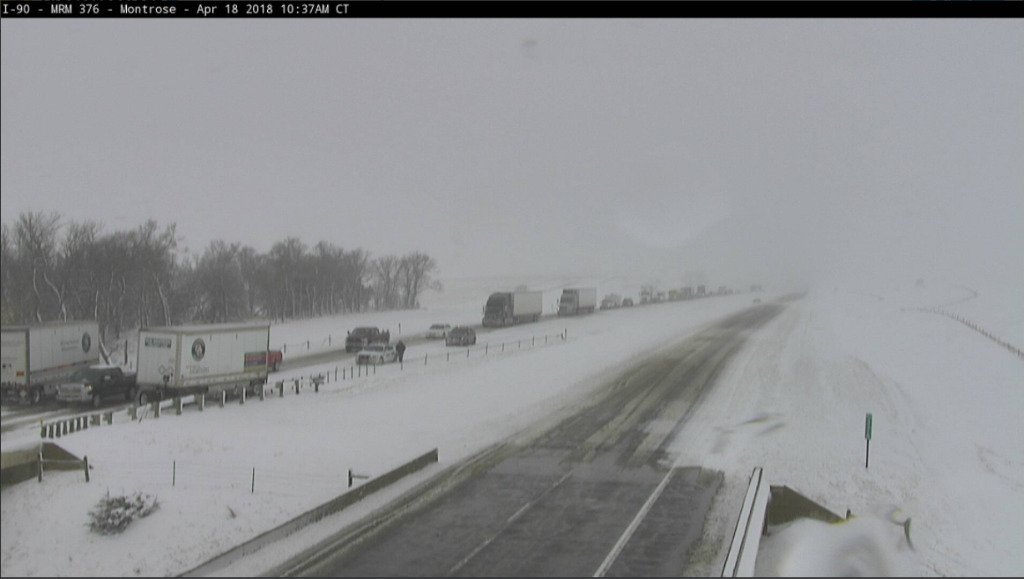 |
| Visible Satellite Imagery from GOES16 showing the system before it moved through the area. | Car Accident during the morning commute at I-90 near Montrose, SD (Courtesy of South Dakota Department of Transporation) |
Radar:
Header
 |
 |
 |
|
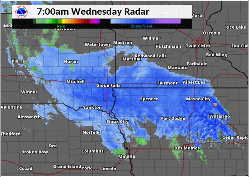
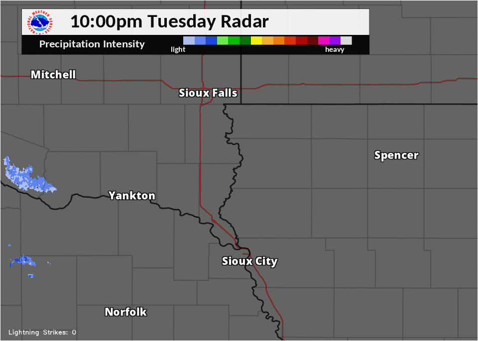
Radar Loop April 18, 2018 (1 am - 7 am) Areas of rain, snow and sleet quickly moving east-northeast into the region |
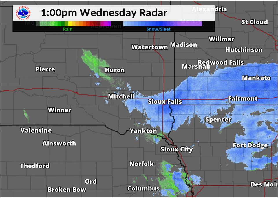
Radar Loop April 18, 2018 (7 am - 1 pm) Widespread snow, heavy at times, continues in the morning, impacting the morning commute. |
Radar Loop April 18, 2018 (1 pm - 7 pm) Snow gradually tapering off as the system moves out of the region. |
 |
|
Radar Reflectivity and Lighting (White Dots) Radar loop from 1 am to 7 am Wednesday Lightning Data Provided by the National Lightning Detection Network (NLDN) |
 |
Media use of NWS Web News Stories is encouraged! Please acknowledge the NWS as the source of any news information accessed from this site. |
|


 Weather Story
 Weather Map
 Local Radar