Overview
|
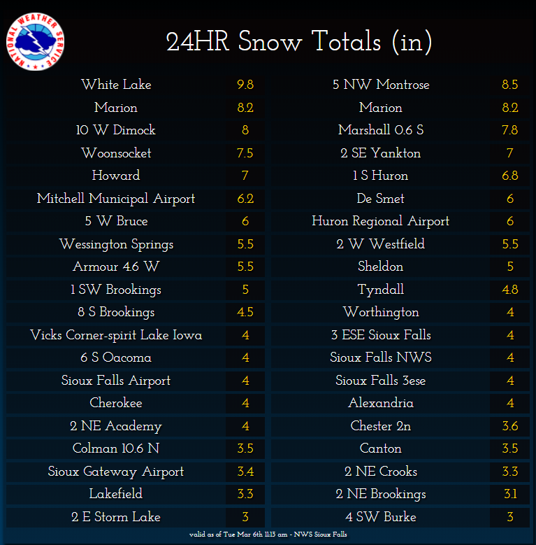
A potent late winter storm system impacted the region on Monday, March 5th through Tuesday, March 6th with moderate to heavy snow, and blizzard conditions across southeast and southcentral South Dakota. A line of thunderstorms began to develop east of the James River Valley into northwest Iowa early Monday morning, before changing to snow by mid to late morning. Snowfall totals from 4 to around 10 inches were reported. Highest snow accumulations were found west of the I-29 corridor, and along and north of Highway 14.
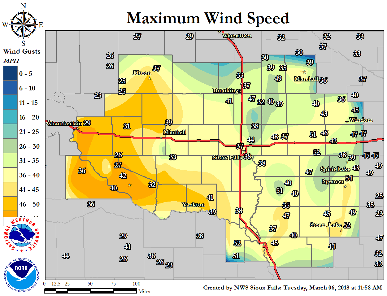
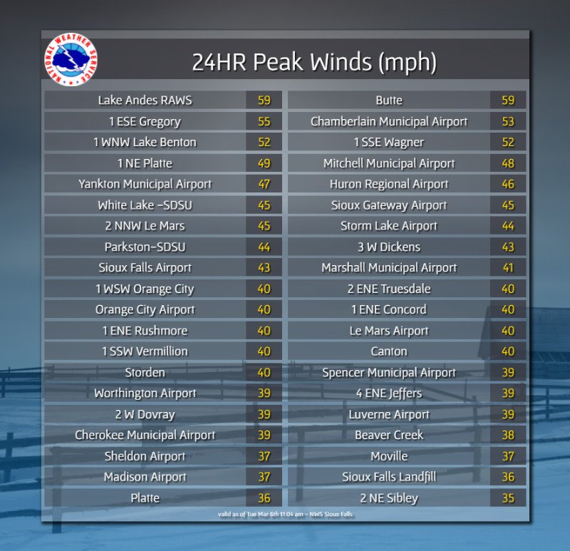
Very strong winds of 35 to almost 60 mph also affected the area, producing whiteout conditions, and considerable blowing snow. The peak wind gusts occurred along the Missouri River Valley, where Lake Andes, SD and Butte, NE reported 59 mph during the evening hours. |
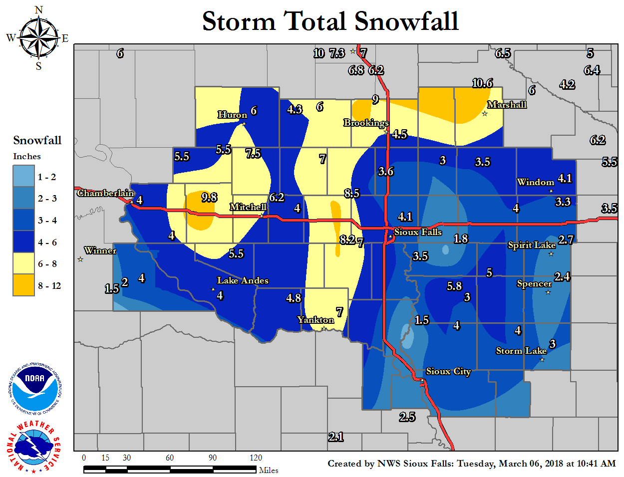 Storm Total Snowfall |
 |
 |
|
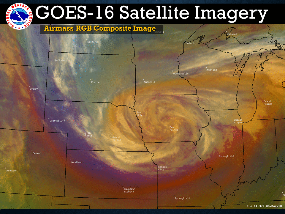
GOES East Satellite Imagery (Airmass RGB) showing a nice storm structure as it moves south-southeast of the area during the morning hours of March, 6th. |
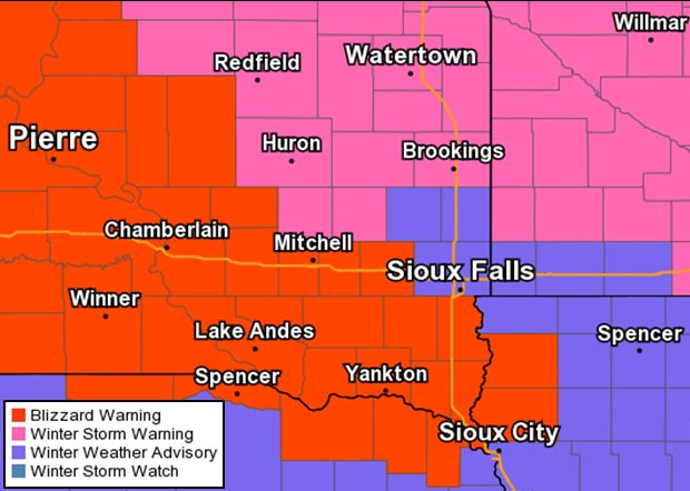
Winter Weather Warnings and Advisories issued for this storm. |
Wind:
Here is the peak wind gusts reported in 24 hours (March 5: 8 am - 8 am March 6)
 |
 |
Snow/Ice
.png)
Photos:
|
Yankton, SD Credit: Bonnie Newman Gusso |
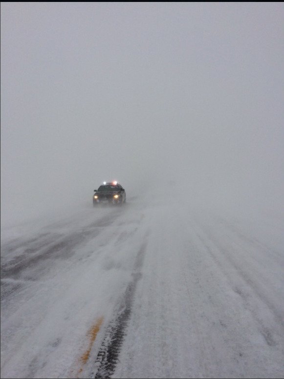
Photo taken by the South Dakota Highway Patrol showing blizzard conditions across the area. Credit: South Dakota Highway Patrol |
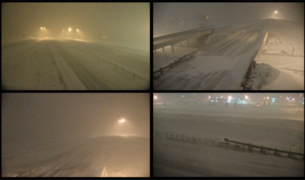
Different webcam photos showing blizzard conditions around southeast South Dakota during the overnight hours. Credit: South Dakota Department of Transportation |
Radar:
 |
Media use of NWS Web News Stories is encouraged! Please acknowledge the NWS as the source of any news information accessed from this site. |
|


 Weather Story
 Weather Map
 Local Radar