Overview
|
A line of thunderstorms formed across portions of western Minnesota and eastern South Dakota during the late afternoon hours of Friday August 18th. These thunderstorms initially were capable of very large hail and damaging winds, with 67 mph winds measured in Minneota, MN.
|
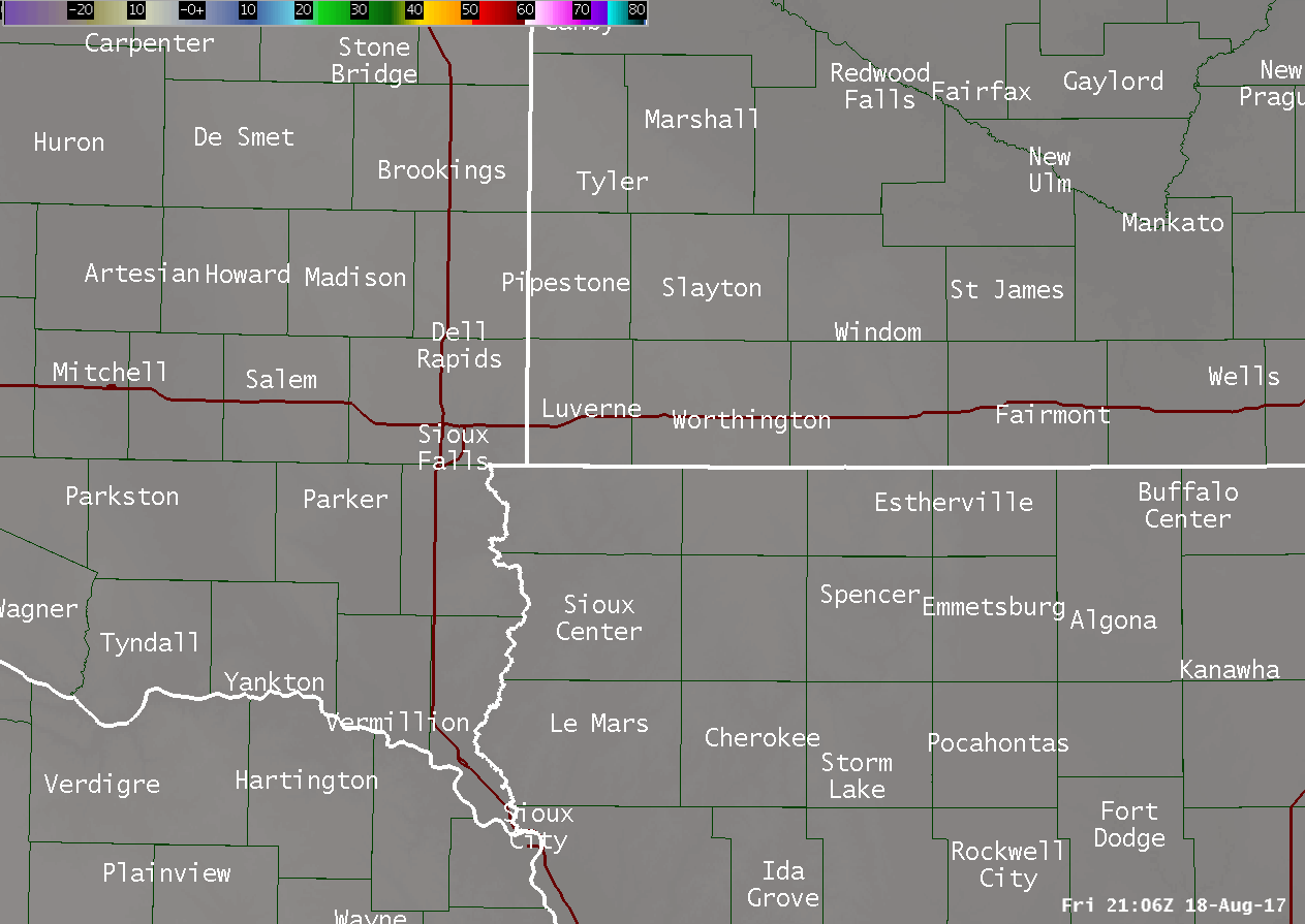 Radar Loop of the Event |
 |
 |
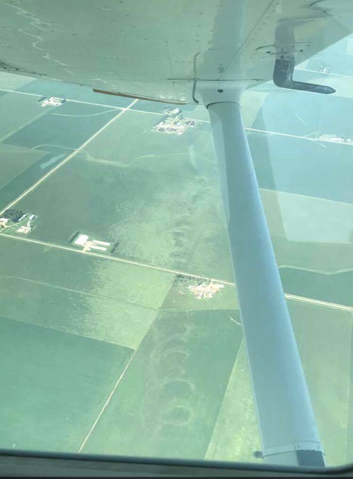 |
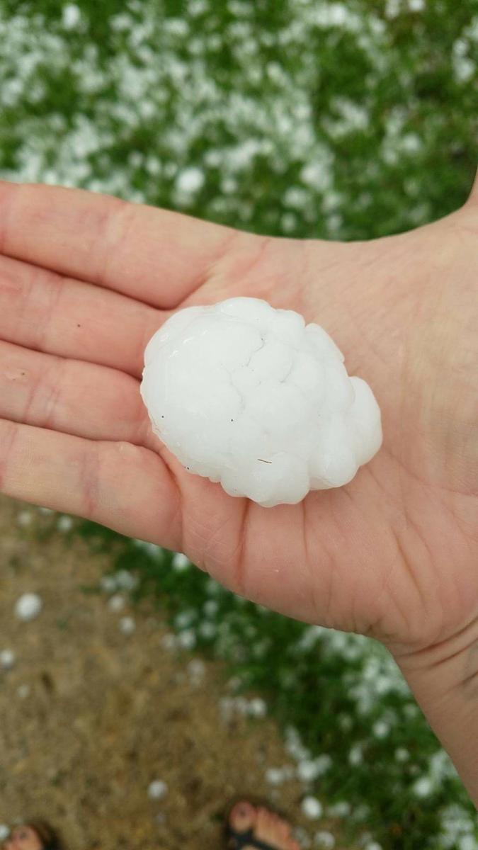
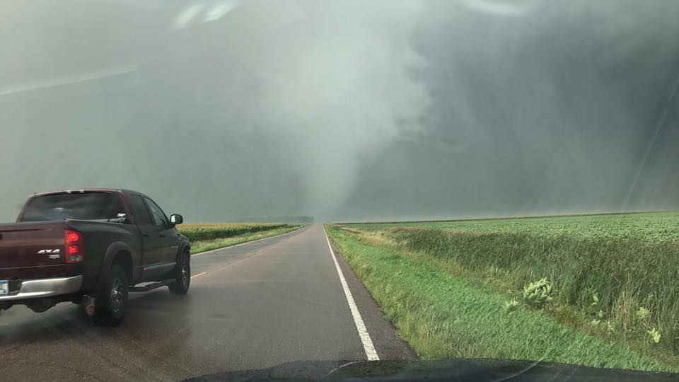
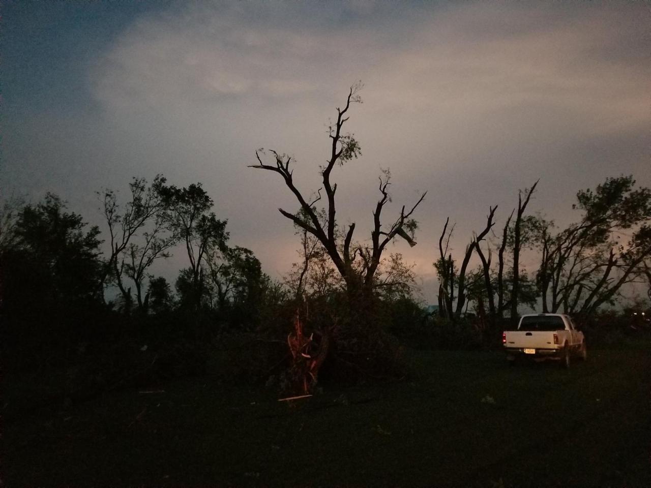
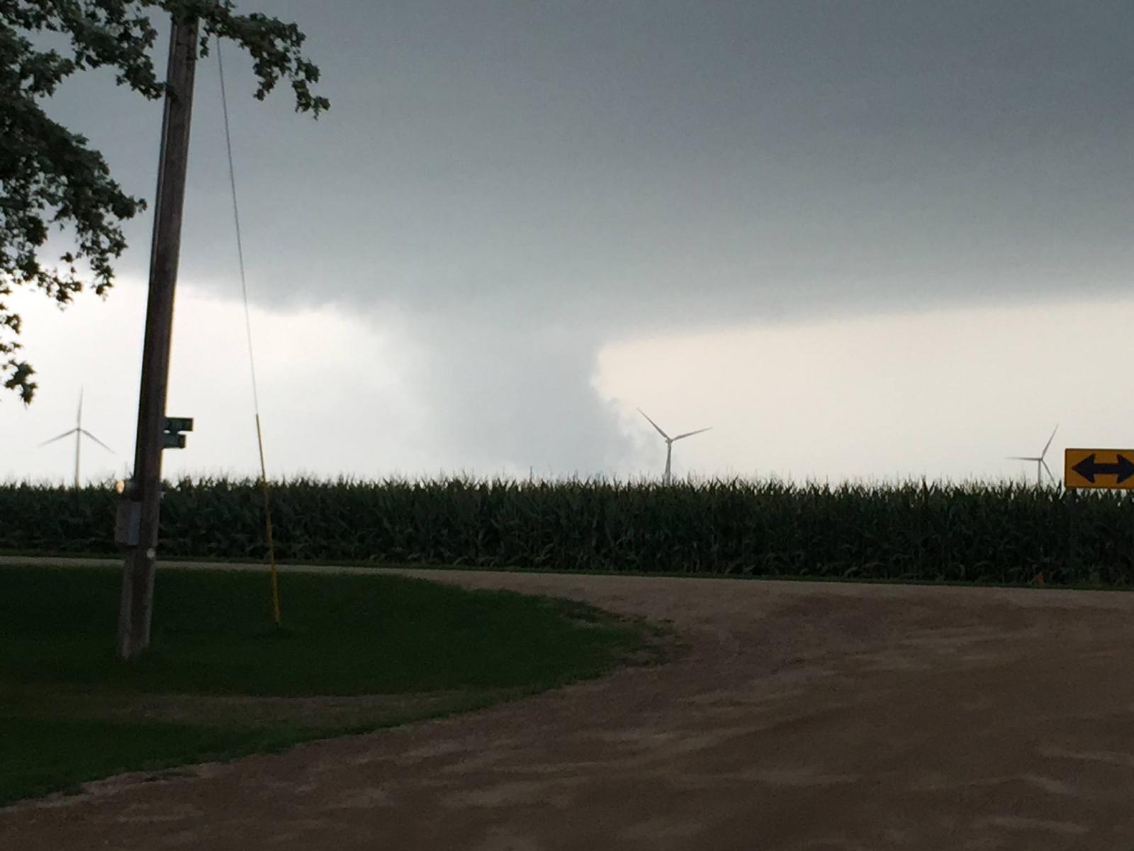
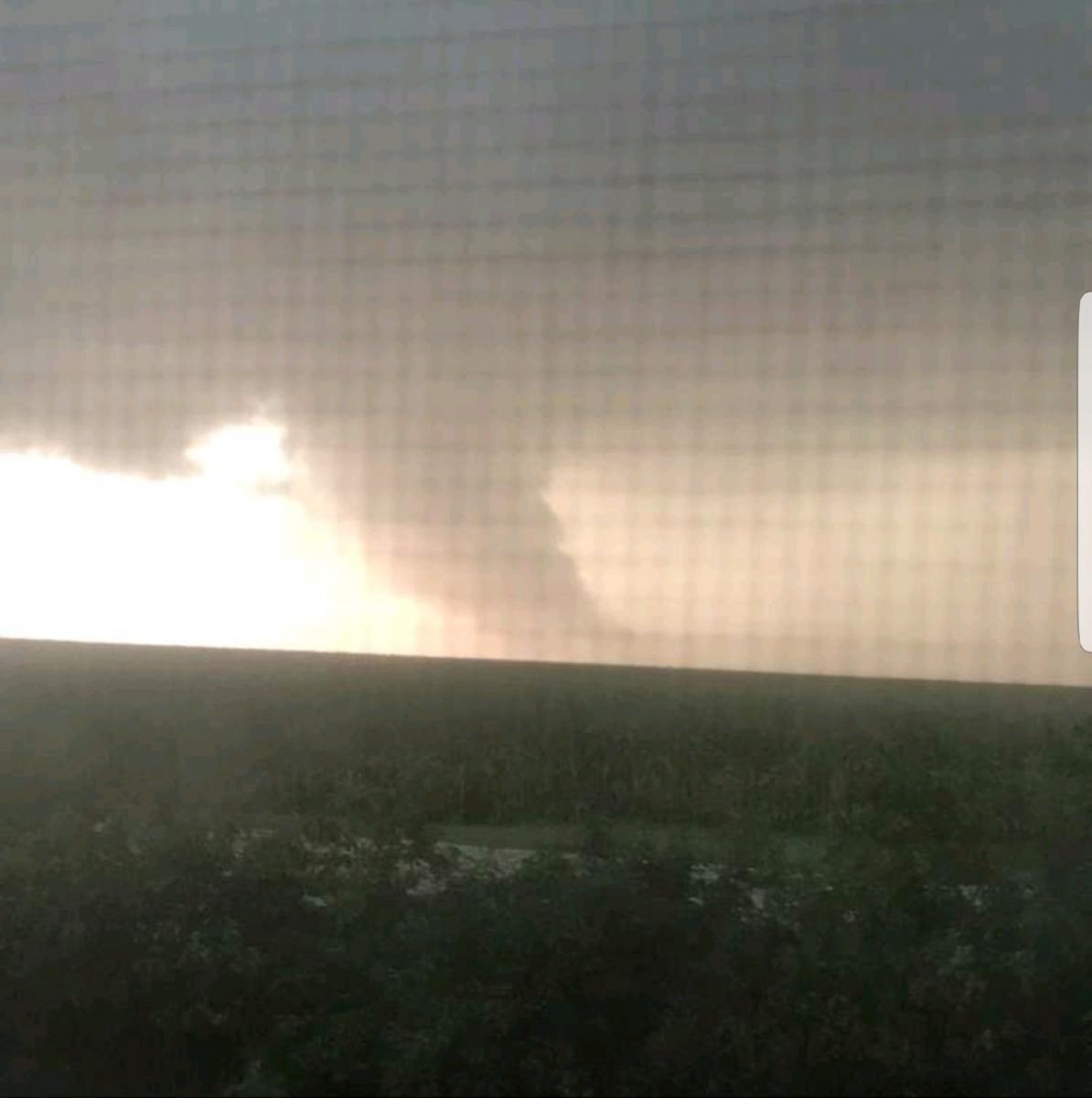
| Large Hail Near Wilmont, MN From Theresa Nequette | Tornado Near Bigelow, MN from Jill Heidebrink | Airplane Survey by Jordan E Grauer |
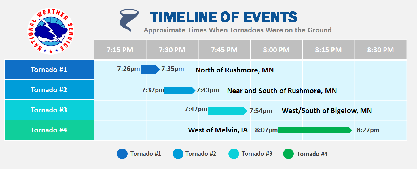
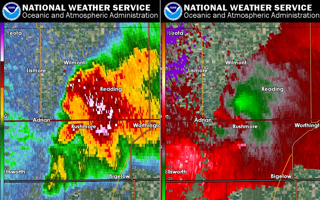
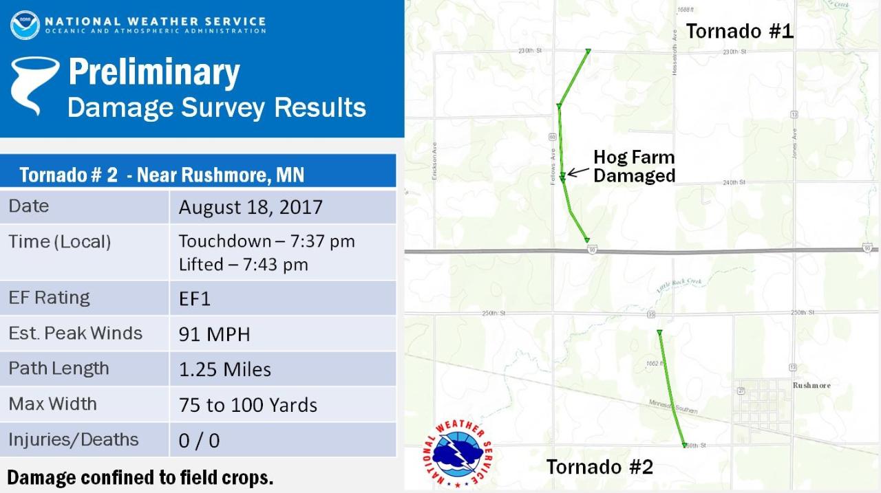
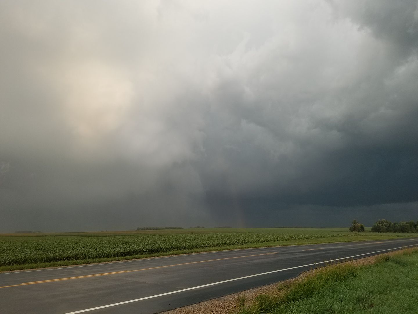
Tornadoes:
|
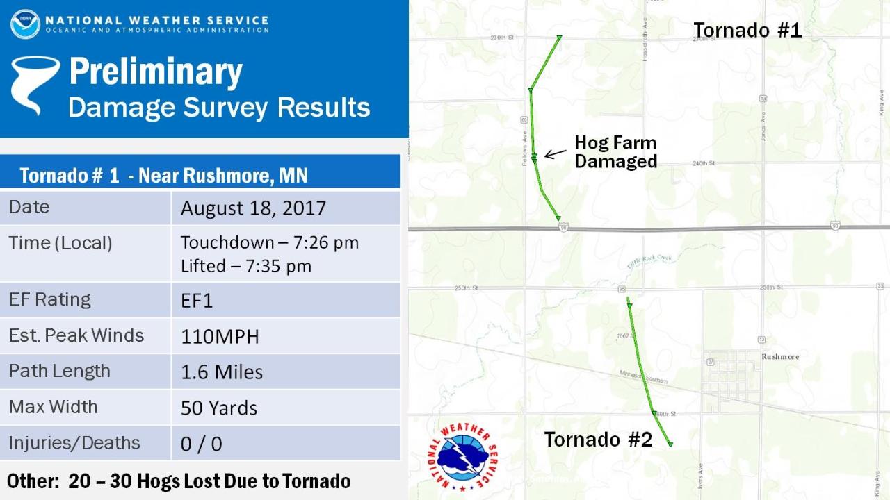
Tornado - Rushmore North of I-90
|
||||||||||||||||
|
|
Tornado - Rushmore South of I-90
|
||||||||
|
|
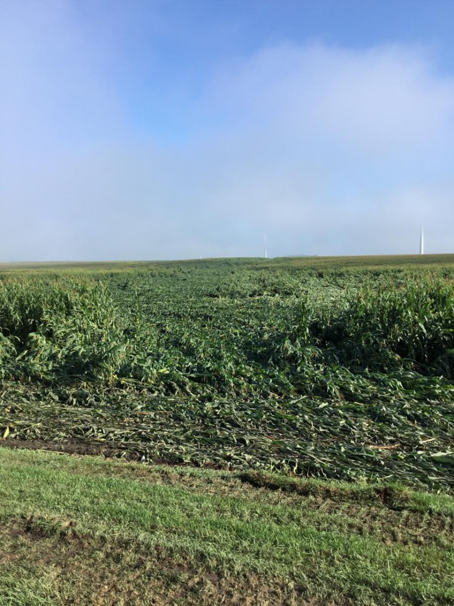
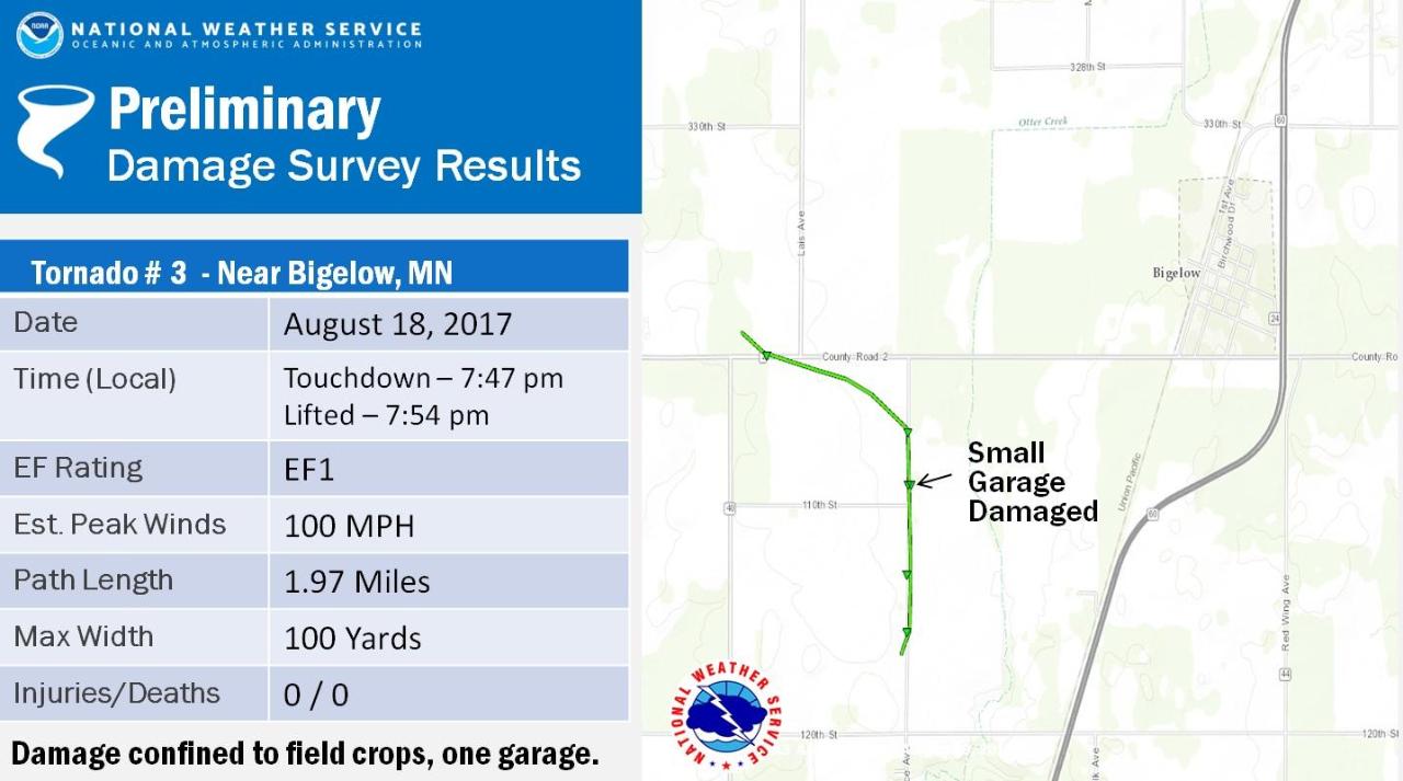
Tornado - Bigelow, MN into Northern Iowa
|
||||||||
|
|
Tornado - Near Melvin, IA
|
||||||||||||||||||||||||
|
The Enhanced Fujita (EF) Scale classifies tornadoes into the following categories:
| EF0 Weak 65-85 mph |
EF1 Moderate 86-110 mph |
EF2 Significant 111-135 mph |
EF3 Severe 136-165 mph |
EF4 Extreme 166-200 mph |
EF5 Catastrophic 200+ mph |
 |
|||||
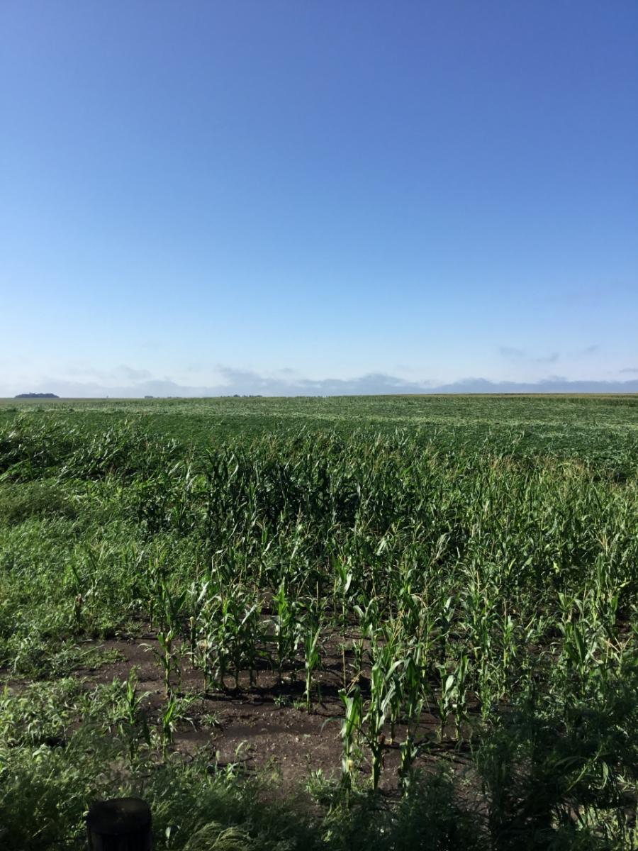
Wind & Hail:
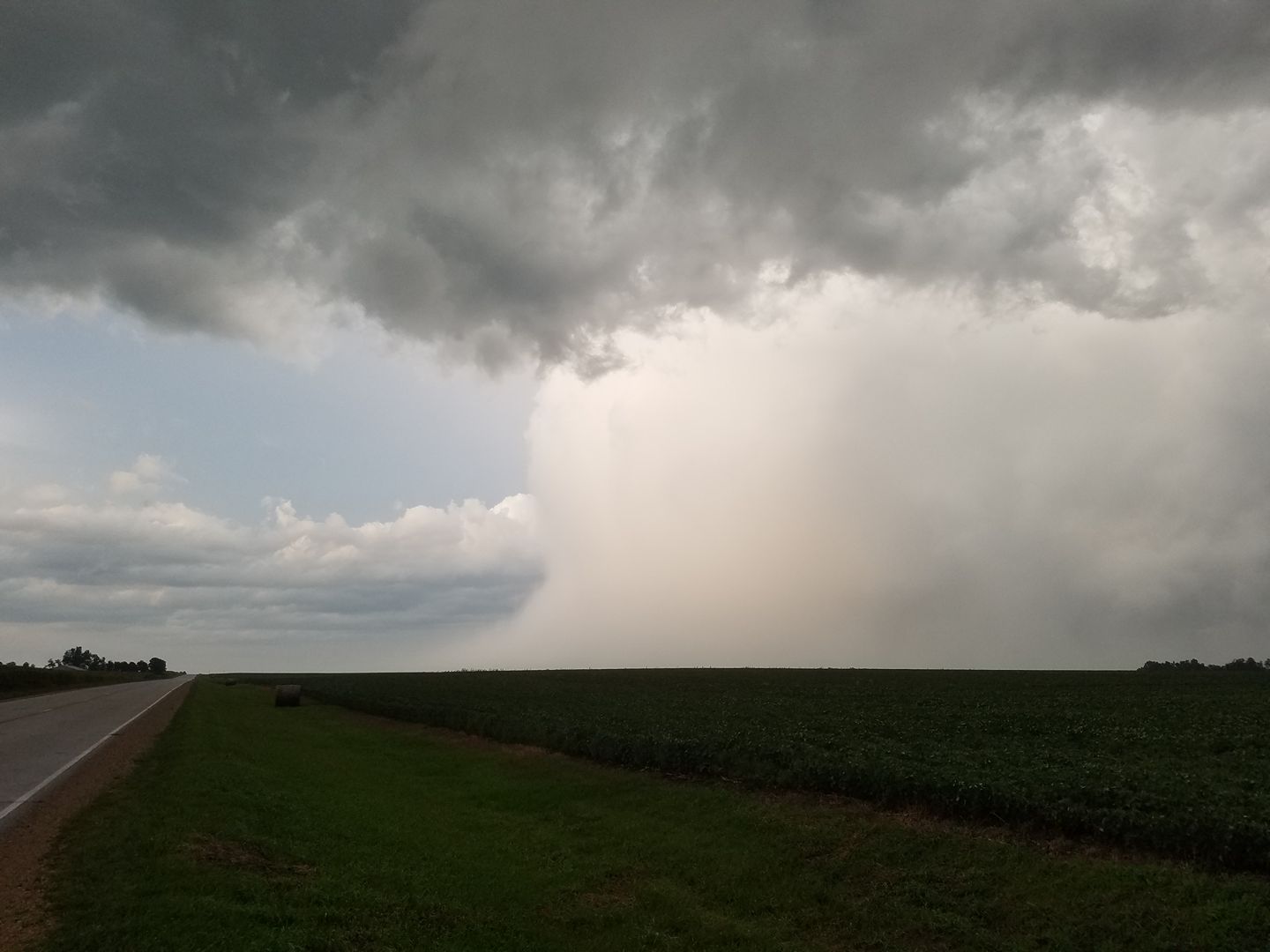
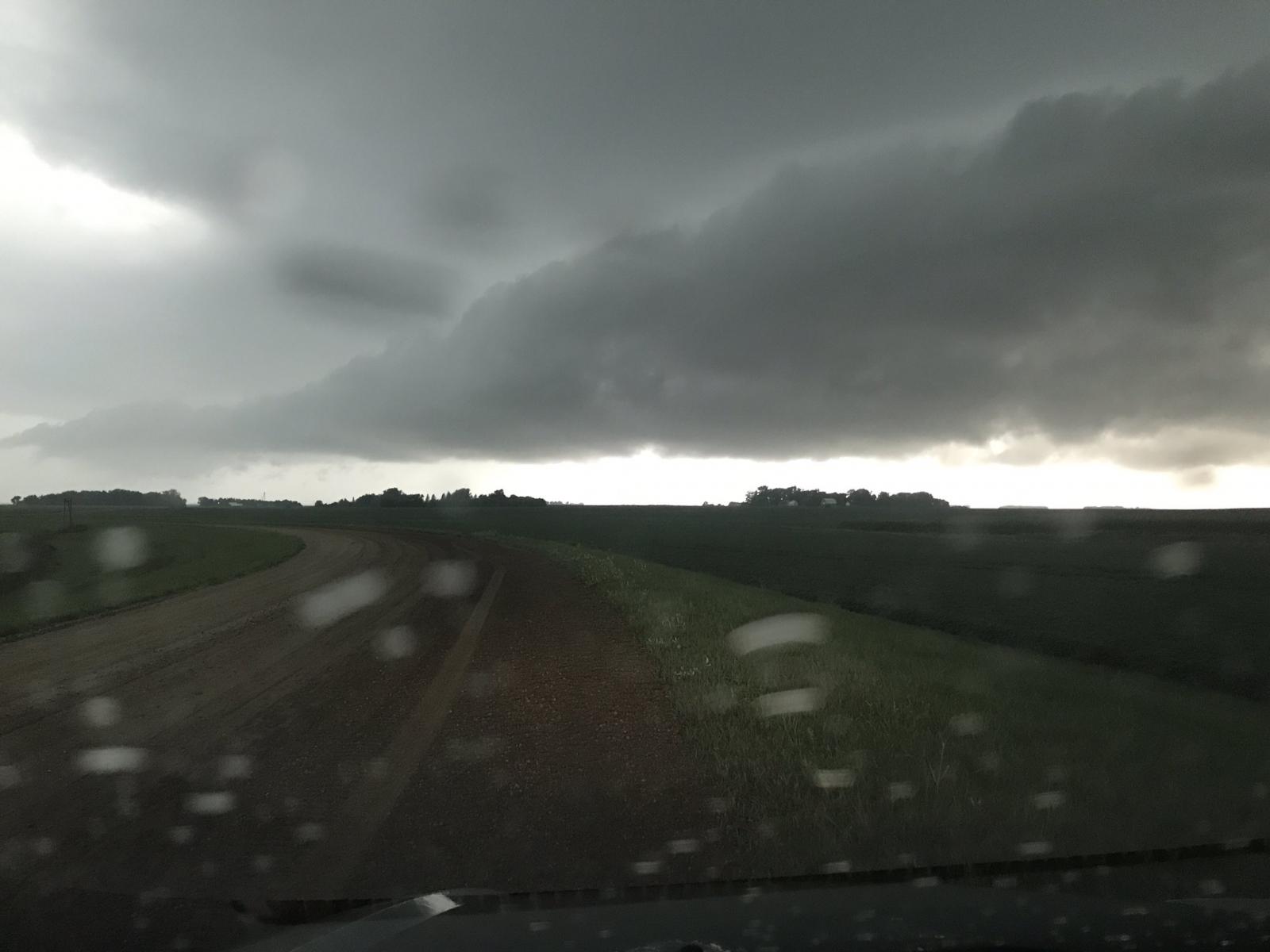
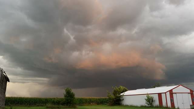
Wind Damage and Storm Structure Photos
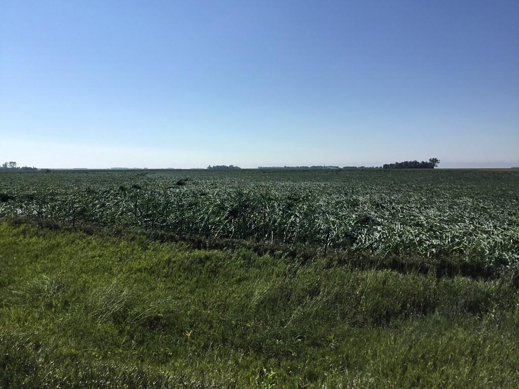
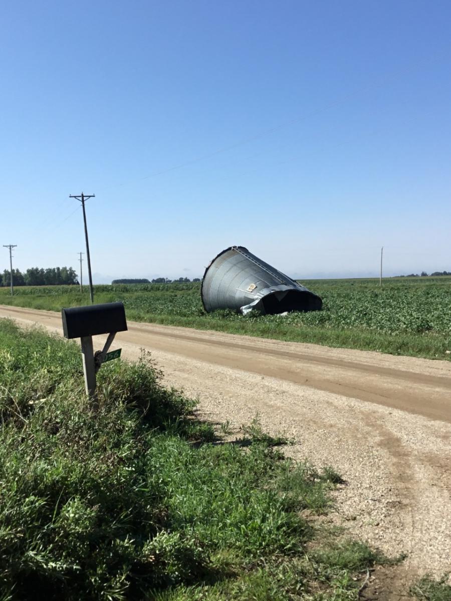
Wind damage, outside of related to tornadic activity was limited with these storms. Here is a look at various storm structure pictures from this event.
 |
 |
 |
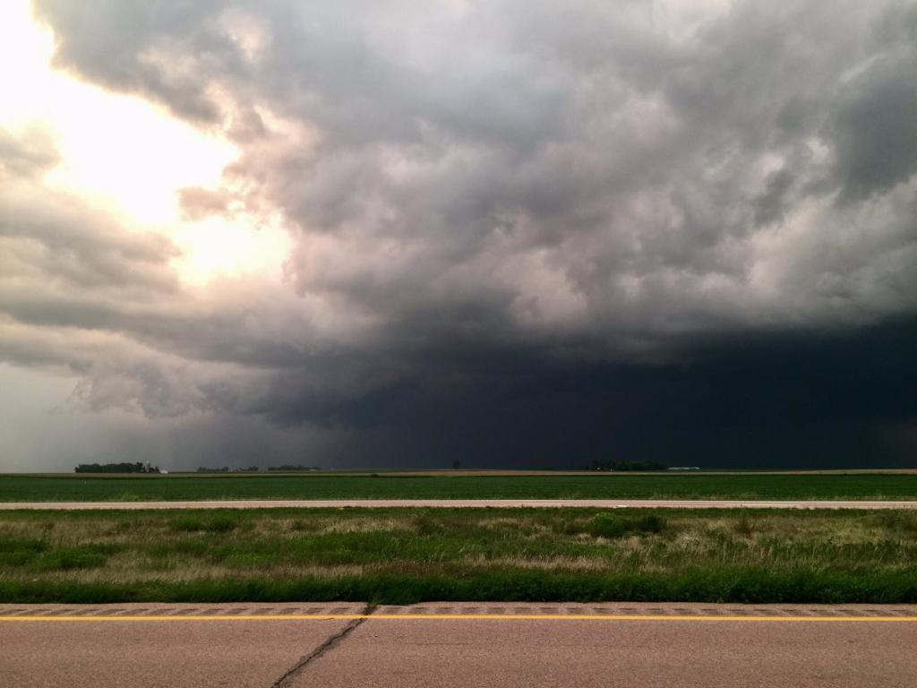 |
| Storm Near Bigelow, MN | Storm Near Brewster, MN from Chad Cummings | Storm Structure Near Little Rock from Nicole Jeeninga | Storm Near Melvin, IA From a Distance |
 |
 |
||
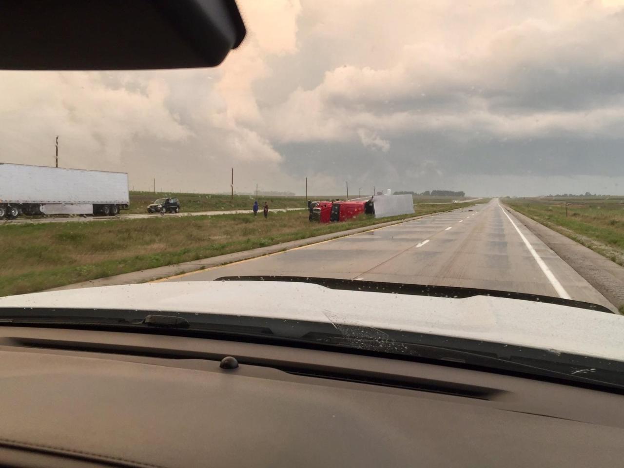
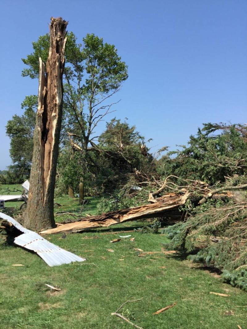
| Tree Damage From Dickinson County EMA | Overturned Semi from Dickinson County EMA |
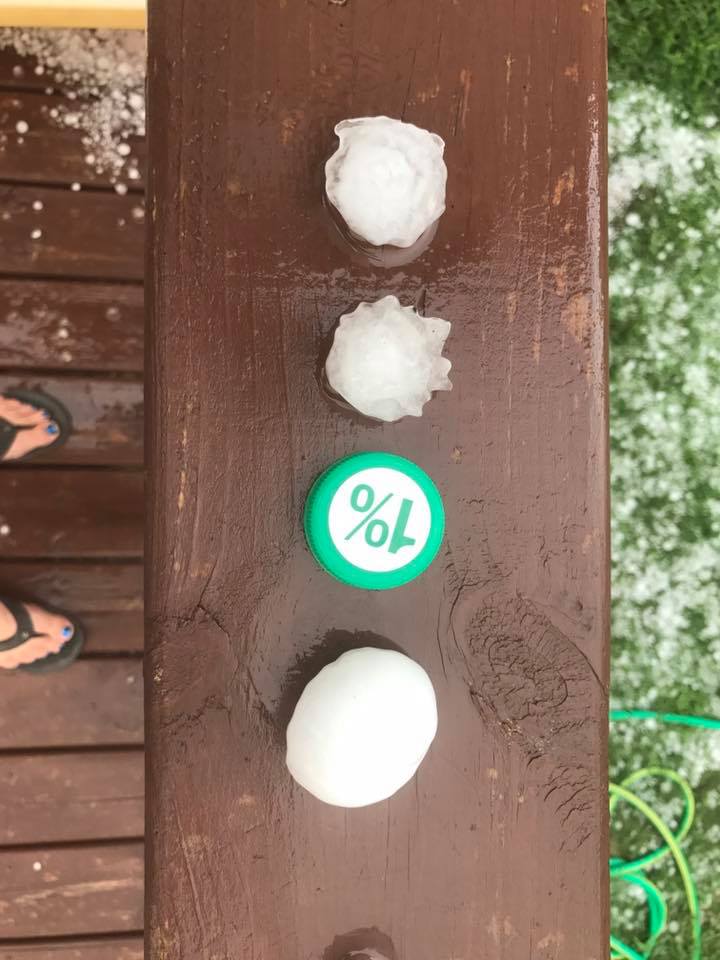
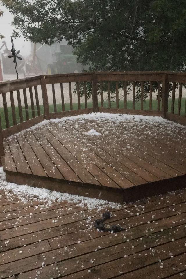
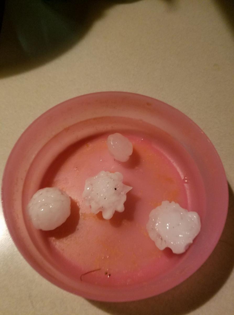
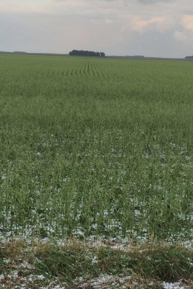
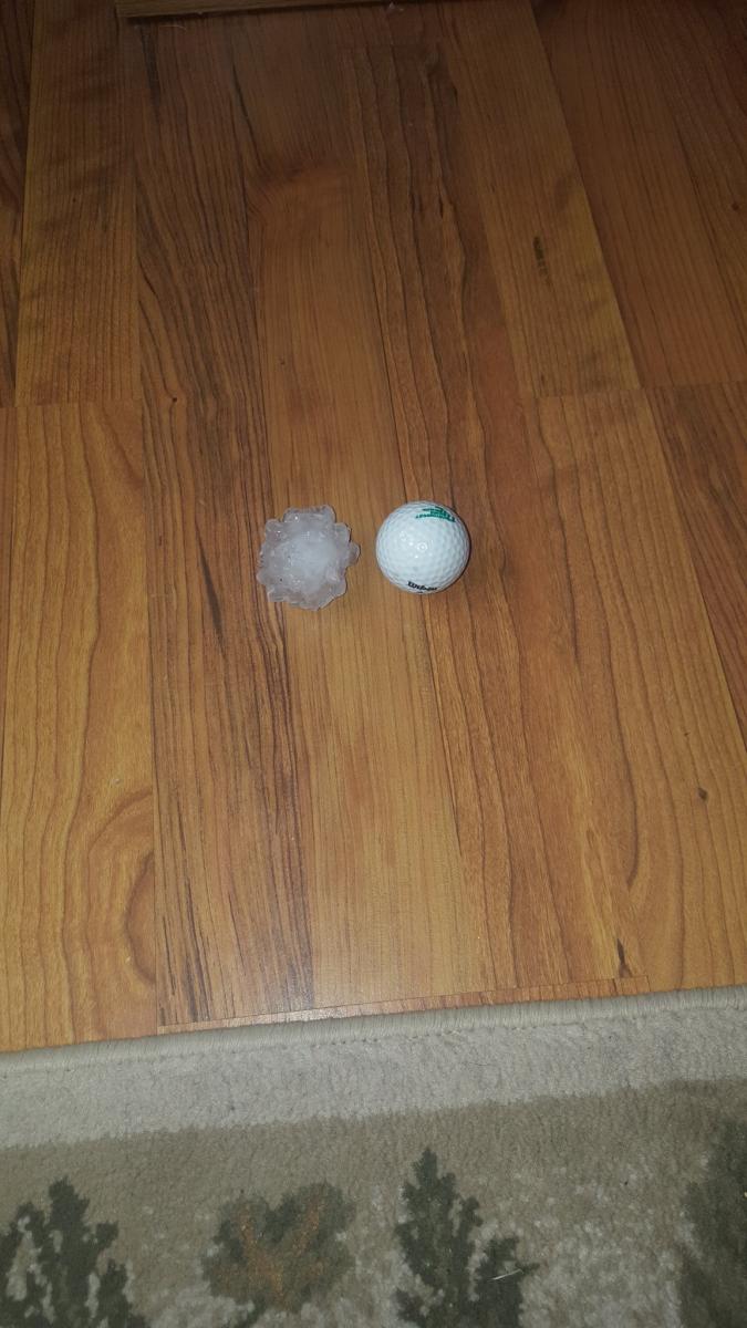
Hail
Several storms produced large hail anywhere from dime size all the way to baseball sized. Here is a look at hail pictures from across Southwest Minnesota and Northwest Iowa from August 18th.
 |
 |
 |
|
| Hail Near Rushmore, MN from Brandy Darling Harberts | Small Hail Unknown Location from Jes Hermeling | Hail Near Bigelow, MN from Staci Cauwels | Large Hail Near Wilmont, MN from Theresa Nequette |
 |
 |
 |
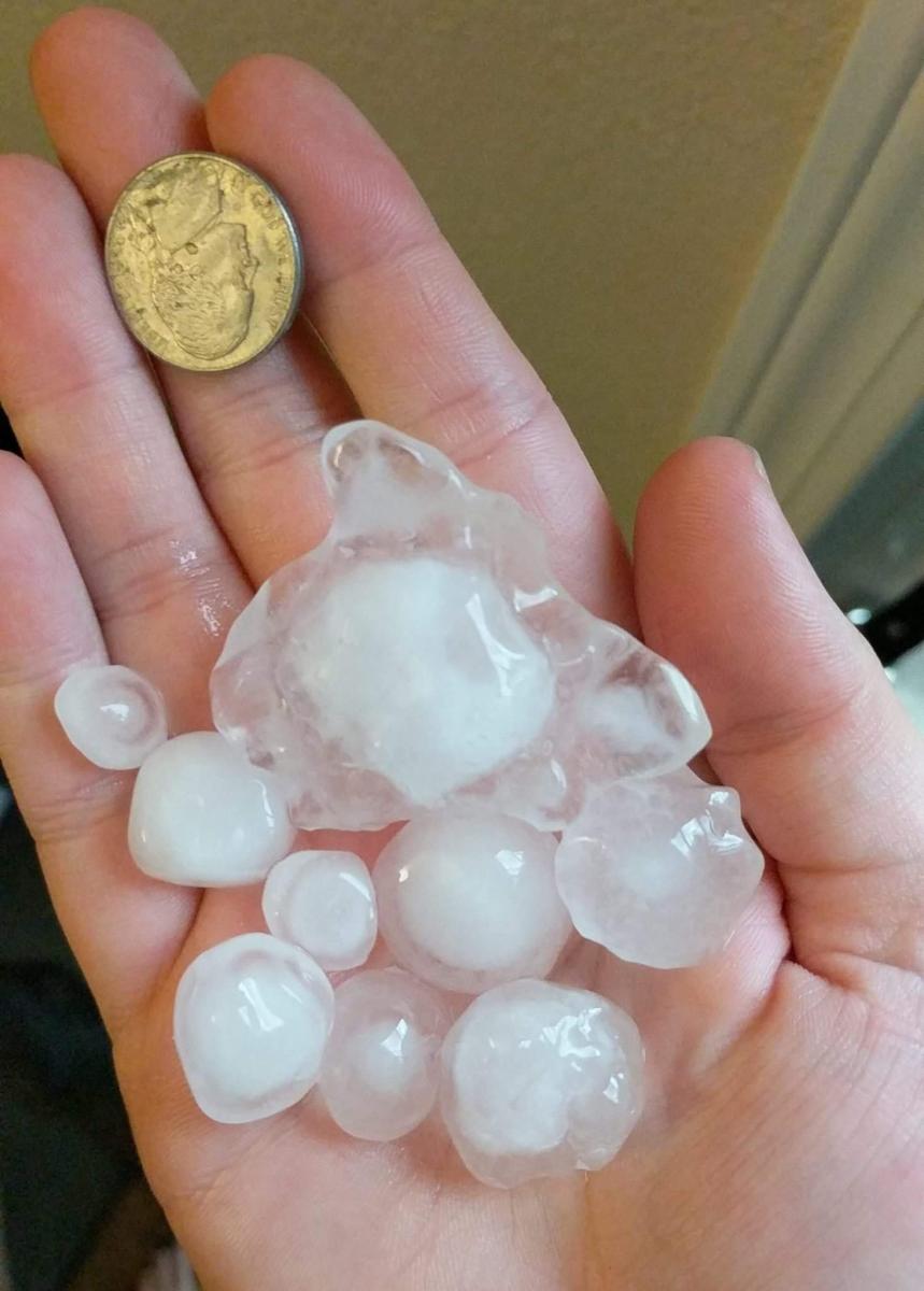 |
| Shredded Soybeans, Unknown Location from Jes Hermeling | Large Hail Near Bigelow, MN | Large Hail Near Bigelow, MN from Tara Svalland | Large Hail Near Sibley, IA from Josh Harms |
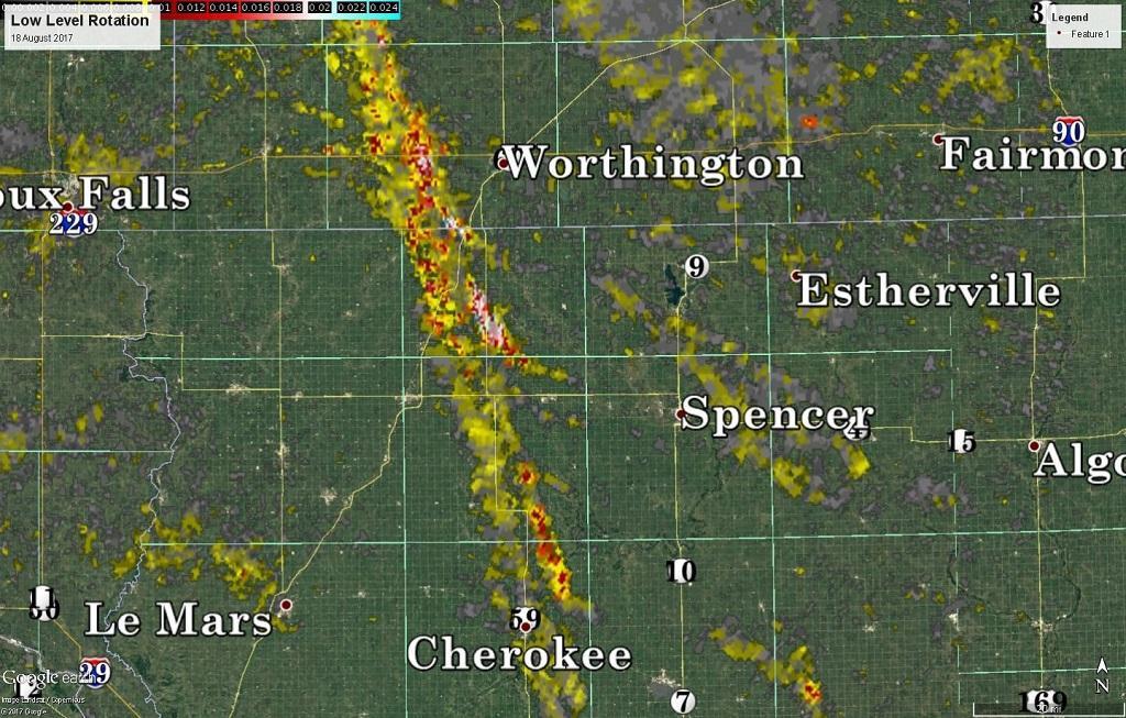
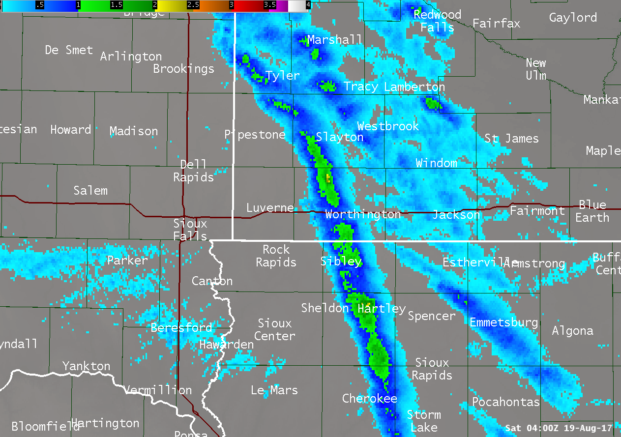
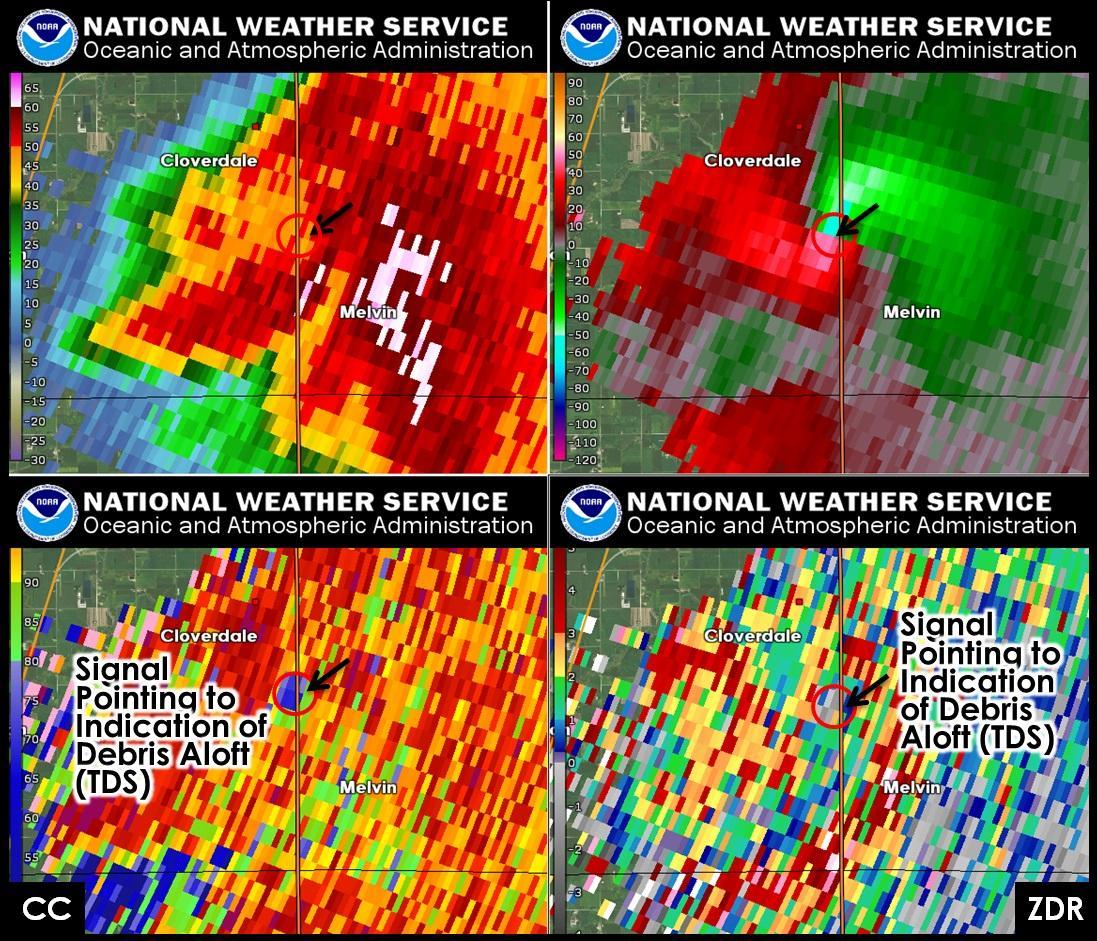
Radar:
Regional Radar Presentation and Individual Images of Tornado Supercells.
 |
 |
 |
 |
 |
| Low Level Rotational Tracks | Hail Tracks | Supercell Tracking Near Rushmore, MN | Supercell Tracking From Bigelow, MN to Melvin, IA. |
 |
|||
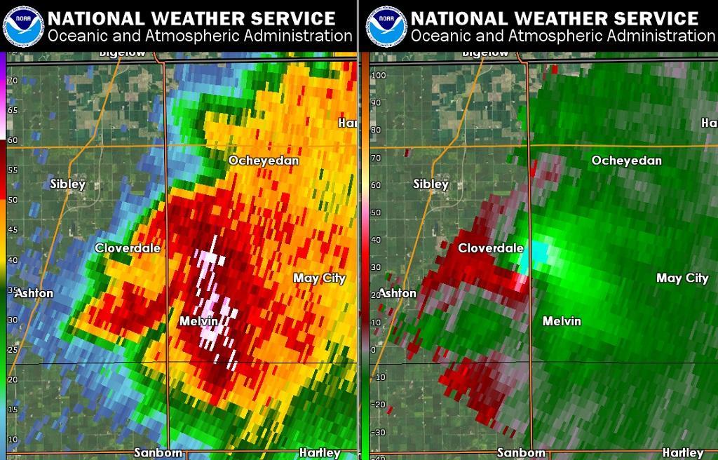
| Tornado Debris Signature Near Melvin, IA |
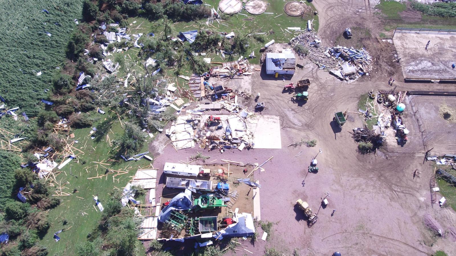
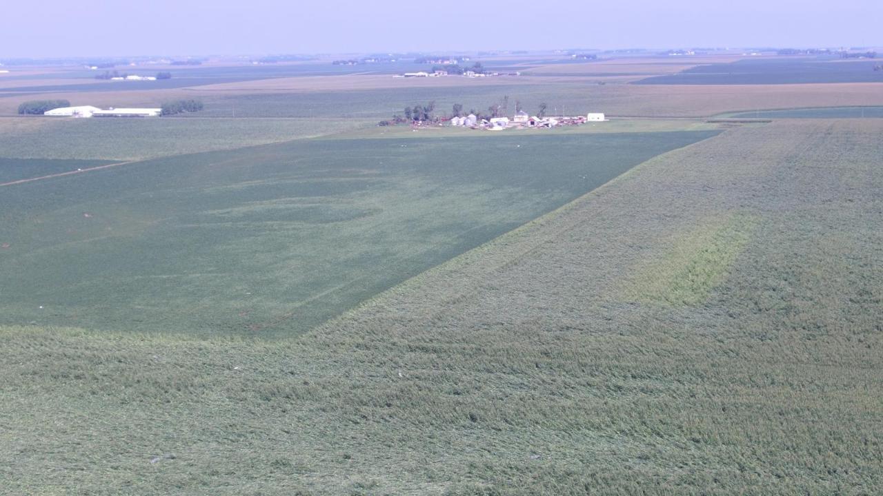
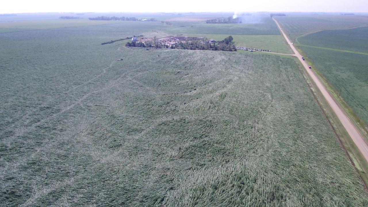
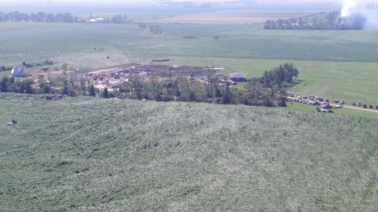
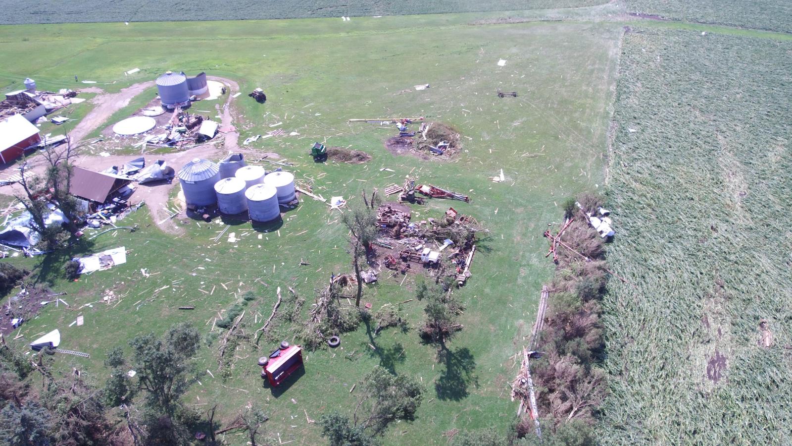
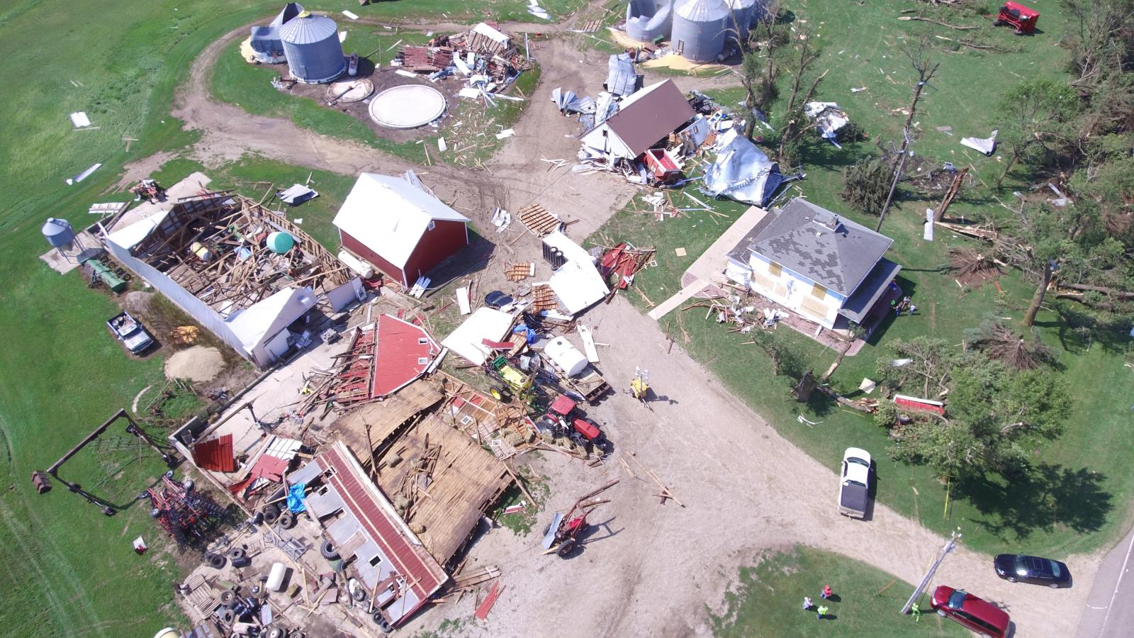
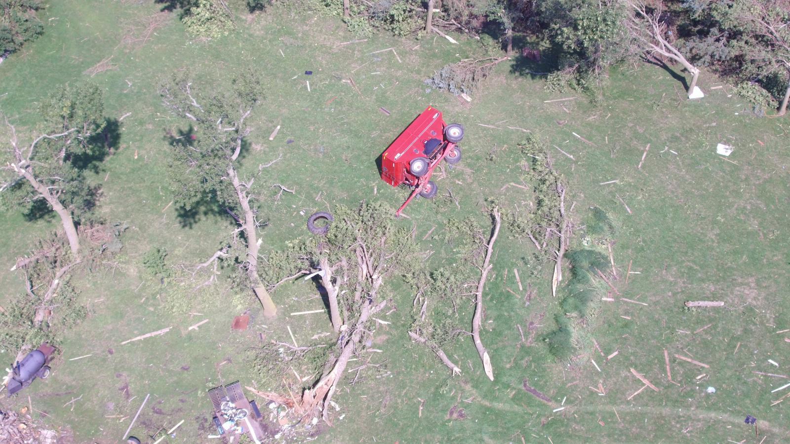
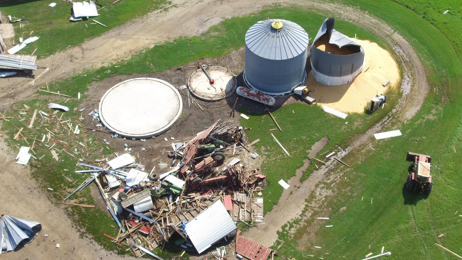
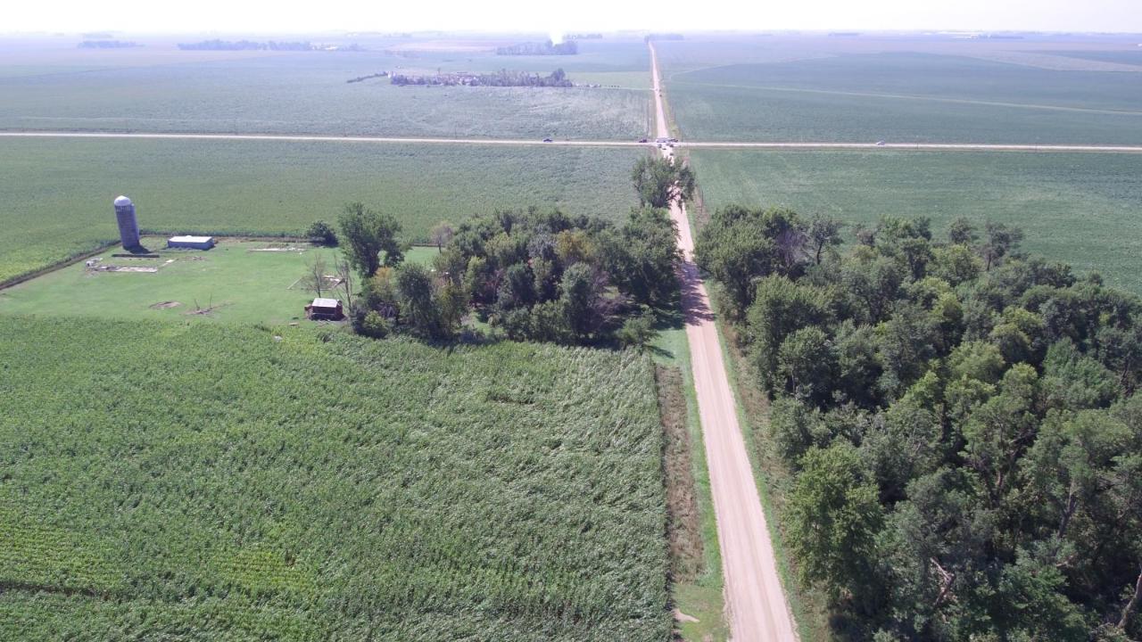
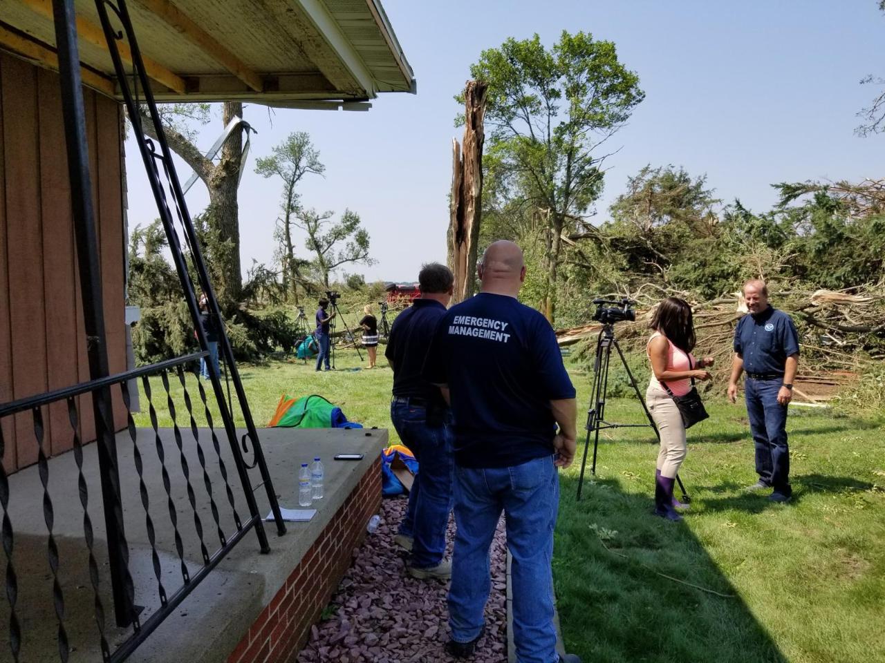
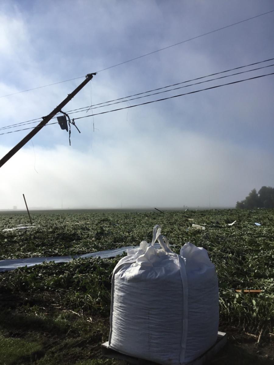
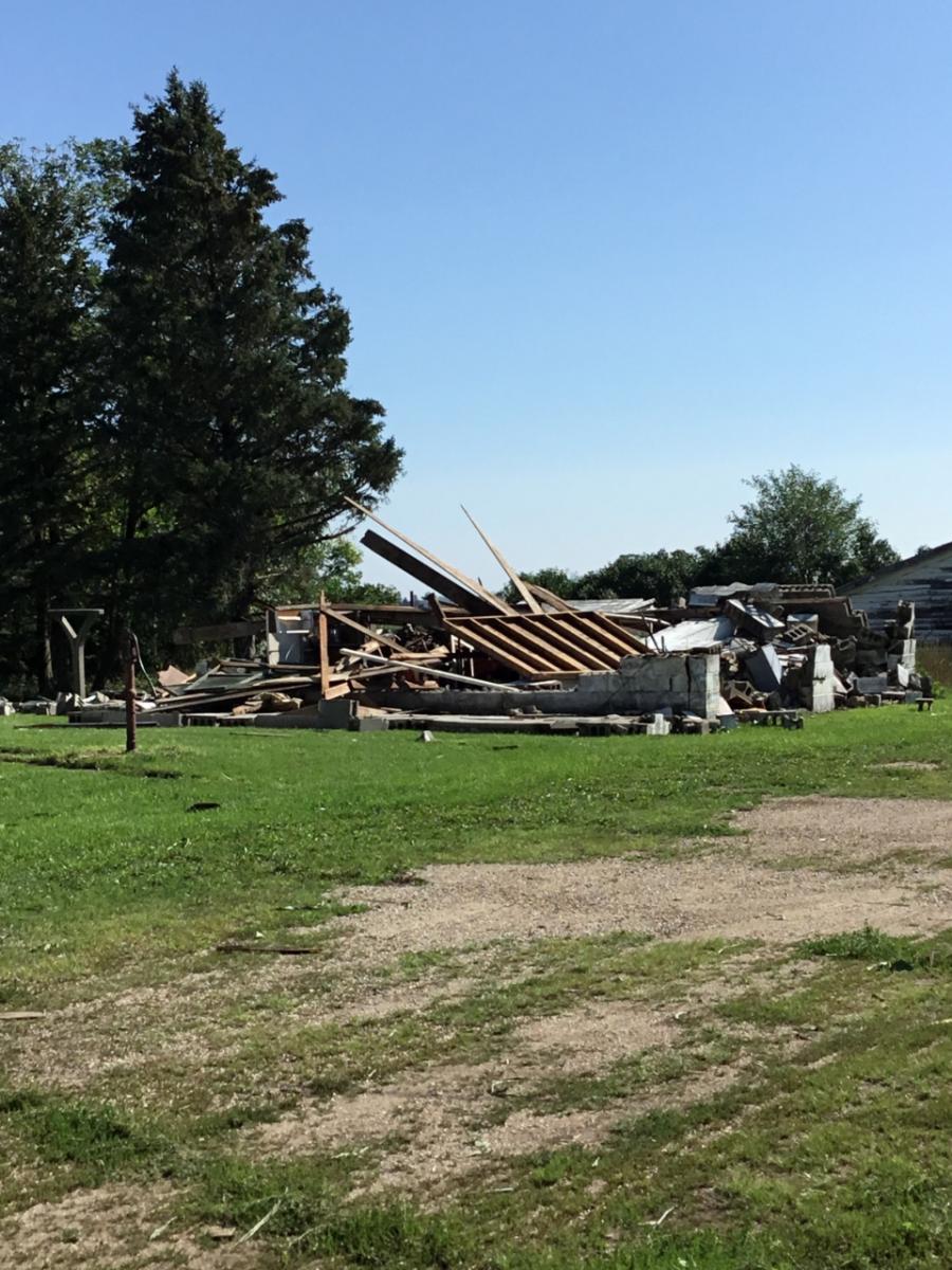
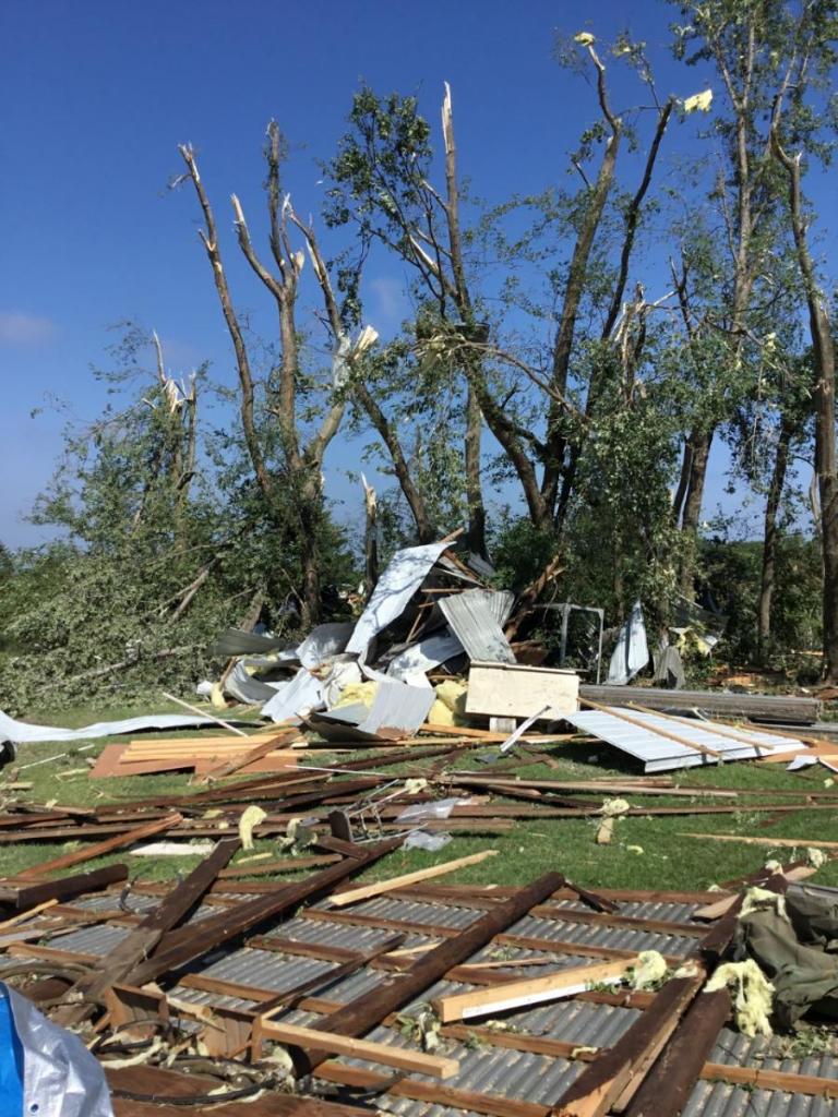
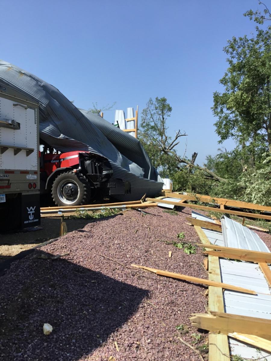
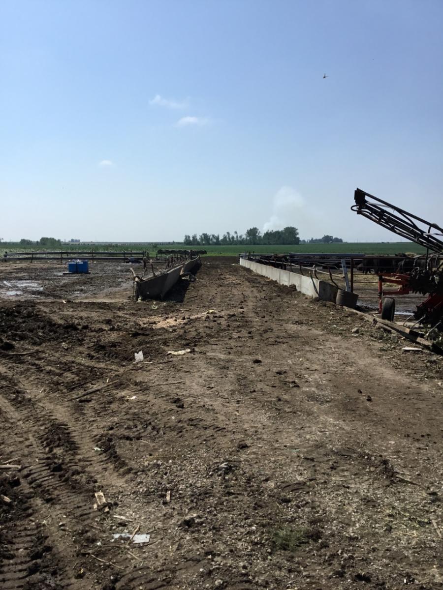
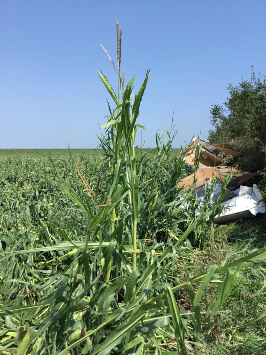
Storm Reports & Drone Survey
Thanks to our partners at the Dickinson County EMA, here is a collection of photos taken by a drone during our survey.
 |
 |
 |
 |
 |
 |
 |
 |
 |
 |
||
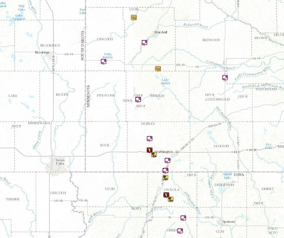
Here is a look at storm reports from the Sioux Falls Forecast area.
 |
| Report Time | Location | ST | Event Type | Mag. | Source | Remark |
| Fri Aug 18 2017 22:35:00 GMT-0500 (Central Daylight Time) | Minneota | MN | TSTM WND GST | 67 | storm chaser | winds gusting to 67 mph in minneota along with pea size hail and torrential rain. |
| Fri Aug 18 2017 22:54:00 GMT-0500 (Central Daylight Time) | 1 E Lake Benton | MN | HAIL | 1 | trained spotter | |
| Fri Aug 18 2017 23:00:00 GMT-0500 (Central Daylight Time) | Lynd | MN | HAIL | 1 | storm chaser | quarter size hail and widespread road flooding reported in lynd via social media. |
| Fri Aug 18 2017 23:25:00 GMT-0500 (Central Daylight Time) | Garvin | MN | TSTM WND GST | 60 | trained spotter | trained storm spotter estimated winds gusting to 60 mph. |
| Fri Aug 18 2017 23:40:00 GMT-0500 (Central Daylight Time) | 8 NNE Jeffers | MN | HAIL | 1 | public | |
| Fri Aug 18 2017 23:45:00 GMT-0500 (Central Daylight Time) | Lake Wilson | MN | TSTM WND GST | 60 | co-op observer | |
| Fri Aug 18 2017 23:45:00 GMT-0500 (Central Daylight Time) | Lake Wilson | MN | HAIL | 1 | co-op observer | pea to quarter size hail. |
| Sat Aug 19 2017 00:20:00 GMT-0500 (Central Daylight Time) | 2 S Wilmont | MN | HAIL | 1.5 | trained spotter | |
| Sat Aug 19 2017 00:26:00 GMT-0500 (Central Daylight Time) | 3 NW Rushmore | MN | TORNADO | 0 | nws storm survey | ef1 tornado traveled 1.6 miles with a 50 yard wide path. the tornado lifted at 7:35 just southwest of rushmore. |
| Sat Aug 19 2017 00:26:00 GMT-0500 (Central Daylight Time) | 3 NW Rushmore | MN | TORNADO | 0 | nws storm survey | tornado traveled 1.6 miles with a 50 yard wide path. the tornado lifted at 7:35 just southwest of rushmore. |
| Sat Aug 19 2017 00:40:00 GMT-0500 (Central Daylight Time) | 5 SW Worthington | MN | HAIL | 1.75 | public | |
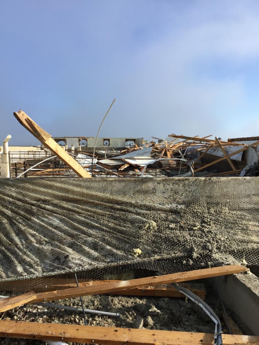
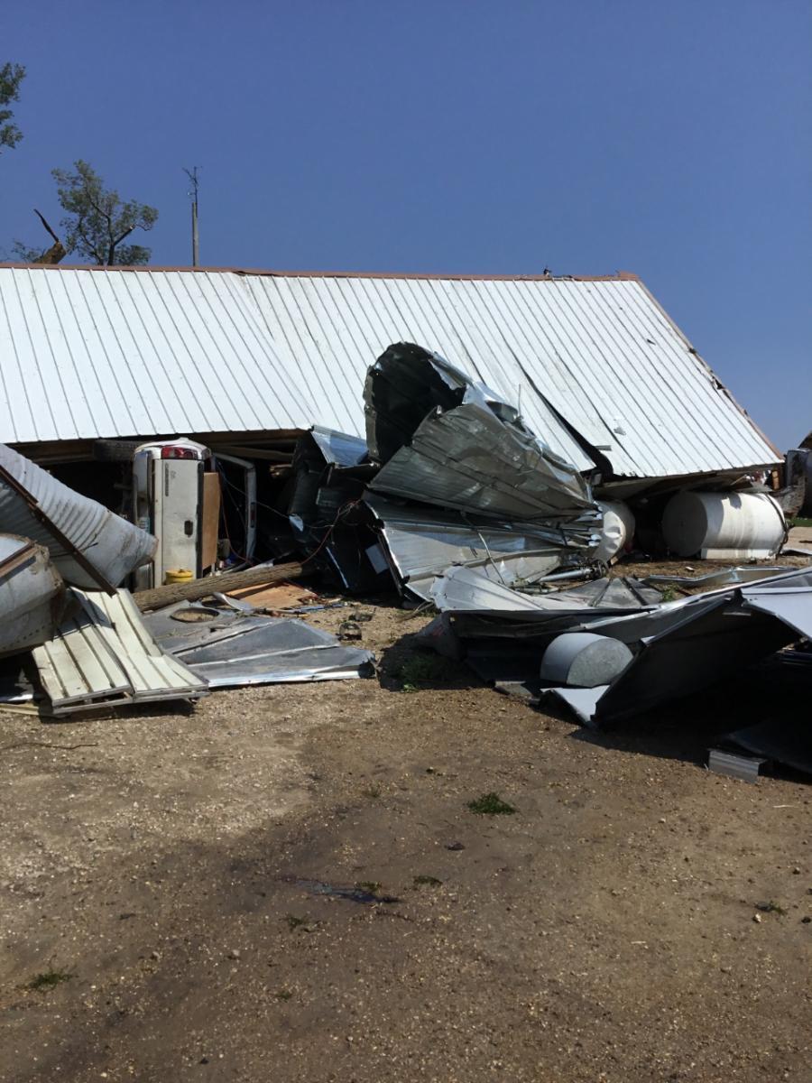
| Sat Aug 19 2017 00:46:00 GMT-0500 (Central Daylight Time) | NW Rushmore | MN | TSTM WND DMG | 0 | law enforcement | hog barn destroyed. |
| Sat Aug 19 2017 00:47:00 GMT-0500 (Central Daylight Time) | 1 W Bigelow | MN | TORNADO | 0 | nws storm survey | ef1 tornado traveled 1.97 miles with a 100 yard wide path. the tornado lifted at 7:54 about a mile southwest of bigelow. |
| Sat Aug 19 2017 00:47:00 GMT-0500 (Central Daylight Time) | Bigelow | MN | TORNADO | 0 | nws storm survey | ef1 tornado traveled 1.97 miles with a 100 yard wide path. the tornado lifted at 7:54 about a mile southwest of bigelow. |
| Sat Aug 19 2017 00:55:00 GMT-0500 (Central Daylight Time) | Bigelow | MN | HAIL | 2 | broadcast media | |
| Sat Aug 19 2017 01:07:00 GMT-0500 (Central Daylight Time) | 5 NW Melvin | IA | TORNADO | 0 | nws storm survey | ef2 tornado traveled 6 miles with a 250 yard wide path. the tornado lifted at 8:27 about a 1/2 mile southwest of melvin. |
| Sat Aug 19 2017 01:14:00 GMT-0500 (Central Daylight Time) | 3 S Bigelow | IA | TSTM WND DMG | 0 | public | tractor trailer overturned on highway 60. |
| Sat Aug 19 2017 01:30:00 GMT-0500 (Central Daylight Time) | 4 E Primghar | IA | HAIL | 1.75 | broadcast media | broadcast media relay of a public report. |
| Sat Aug 19 2017 01:41:00 GMT-0500 (Central Daylight Time) | 2 W Hartley | IA | HAIL | 1 | trained spotter | |
| Sat Aug 19 2017 01:50:00 GMT-0500 (Central Daylight Time) | 2 NW Melvin | IA | TSTM WND DMG | 0 | emergency mngr | farmstead damaged. no injuries. |
 |
Media use of NWS Web News Stories is encouraged! Please acknowledge the NWS as the source of any news information accessed from this site. |
|


.jpg)
 Weather Story
 Weather Map
 Local Radar