Overview
|
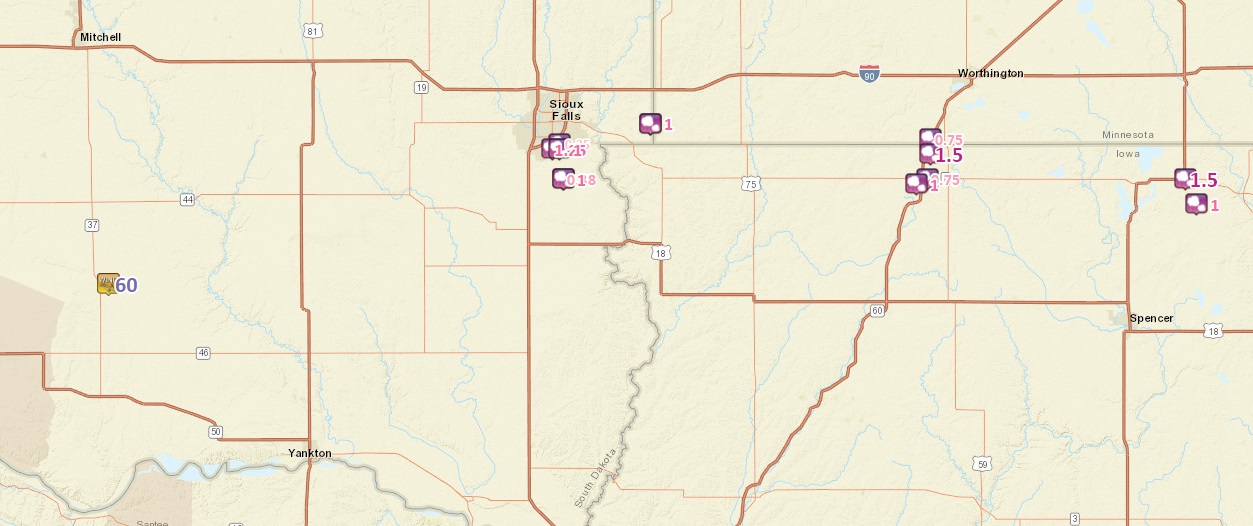
Severe storms developed late Tuesday afternoon along a boundary just south of the Interstate 90 corridor in southeast South Dakota. Large hail, dangerous lightning, and heavy rain accompanied these storms as they drifted southeast into northwest Iowa. Rainfall was also plentiful where storms tracked. Portions of the Sioux Falls area received upwards of an inch of rain in a short amount of time. |
 Radar Loop of the Event |
Storm Reports
 |
||||||||||||||||||||||||||||||||||||||||||||||||||||||||||||||||||||||||||||||||||||||||||||||||||||||||||||||||||||||||||||||||
|
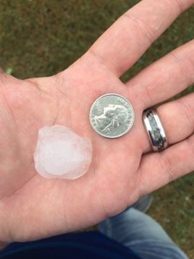
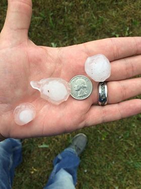
Hail
The largest hail across the area was reported near Sioux Falls and in portions of Northwest Iowa. 1.5" Hail shredded trees and dented vehicles.
 |
 |
 |
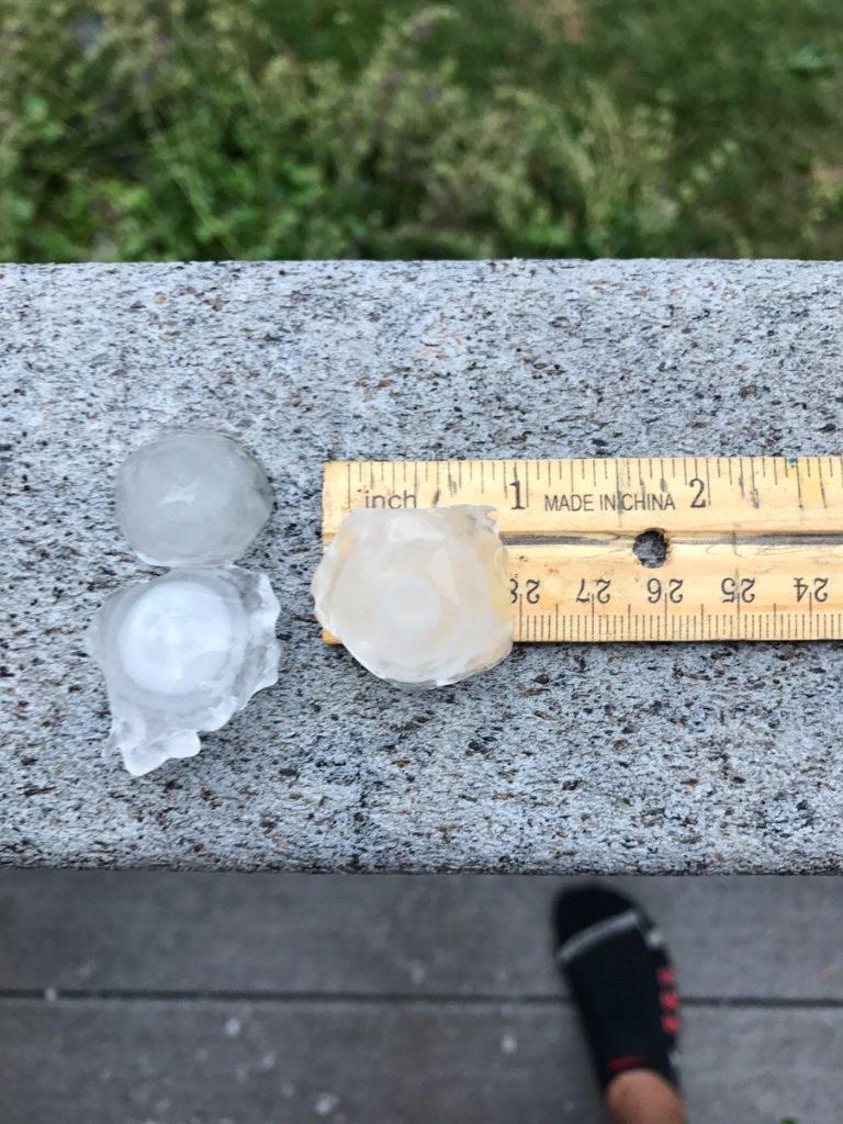 |
| Photo by Marc Janssen | Photo by Marc Janssen | Hail In Trampoline | Sioux Falls Hail Near 69th Street |
Radar:
Here are various looks at storms as the moved across the area.
|
 |
 |
| Radar Loop | Loops of Storms near Sioux Falls | How Quickly Storms Grow Near Sioux Falls |
 |
Media use of NWS Web News Stories is encouraged! Please acknowledge the NWS as the source of any news information accessed from this site. |
|


 Weather Story
 Weather Map
 Local Radar