Overview - June 11, 2017
|
A complex of thunderstorm developed early Sunday morning and moved quickly across eastern South Dakota and western Minnesota. These storms produced large hail and damaging wind gusts as they moved through. The largest hailstone reported was nearly 2.5" in Slayton, MN. Winds greater than 60 mph were reported along with the hail in many cases.
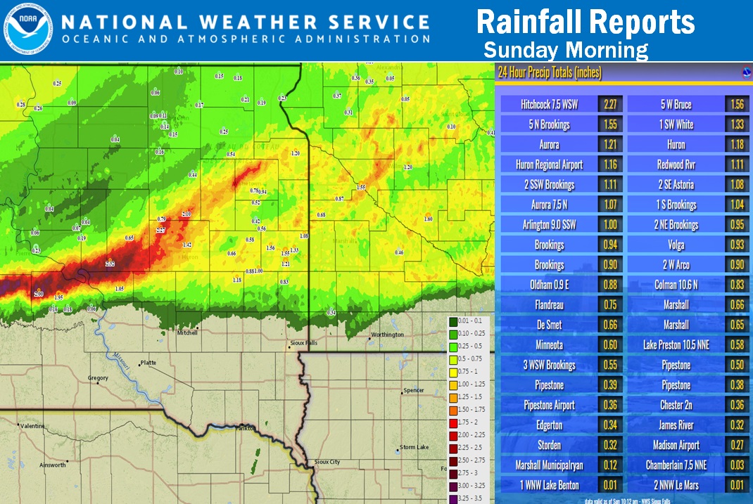
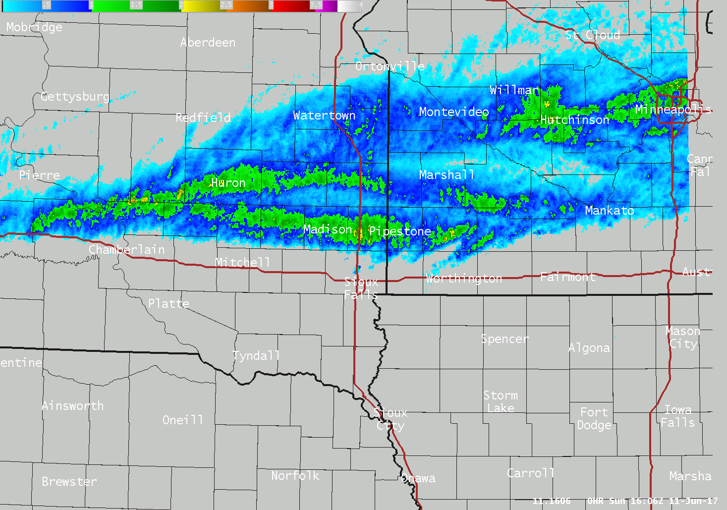
This thunderstorm complex brought much needed rainfall to portions of the region. The highest totals were reported up to 2" near Huron, SD With fairly widespread 0.5-2" totals where thunderstorms tracked. |
Regional Radar Loop |
 |
 |
 |
| Regional Satellite Loop | Regional Rainfall Totals | Preliminary Local Storm Reports |
Wind & Hail:
Hail and Wind
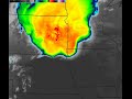
Large hail was reported across many areas of eastern South Dakota and western Minnesota. The largest hail was reported near Slayton, MN where hail up to 2.5" has fallen earlier this morning. |
 |
 |
 |
| Hail Near Slayton From Ashley Haken | Hail Near Wolsey, SD from Catie Arbogast | Slayton, MN Hail from Casey Gass | Slayton, MN Hail |
Radar Images
 |
 |
 |
|
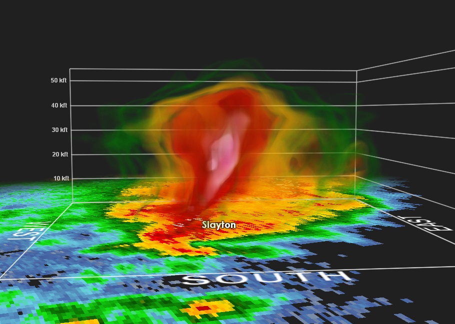
| 3D Radar Sampling of Supercell over Slayton, MN | Radar Cross-Section of Hail and Wind Producing Supercell Over Huron, SD | Algorithm Hail Tracks | Caption |
Storm Reports
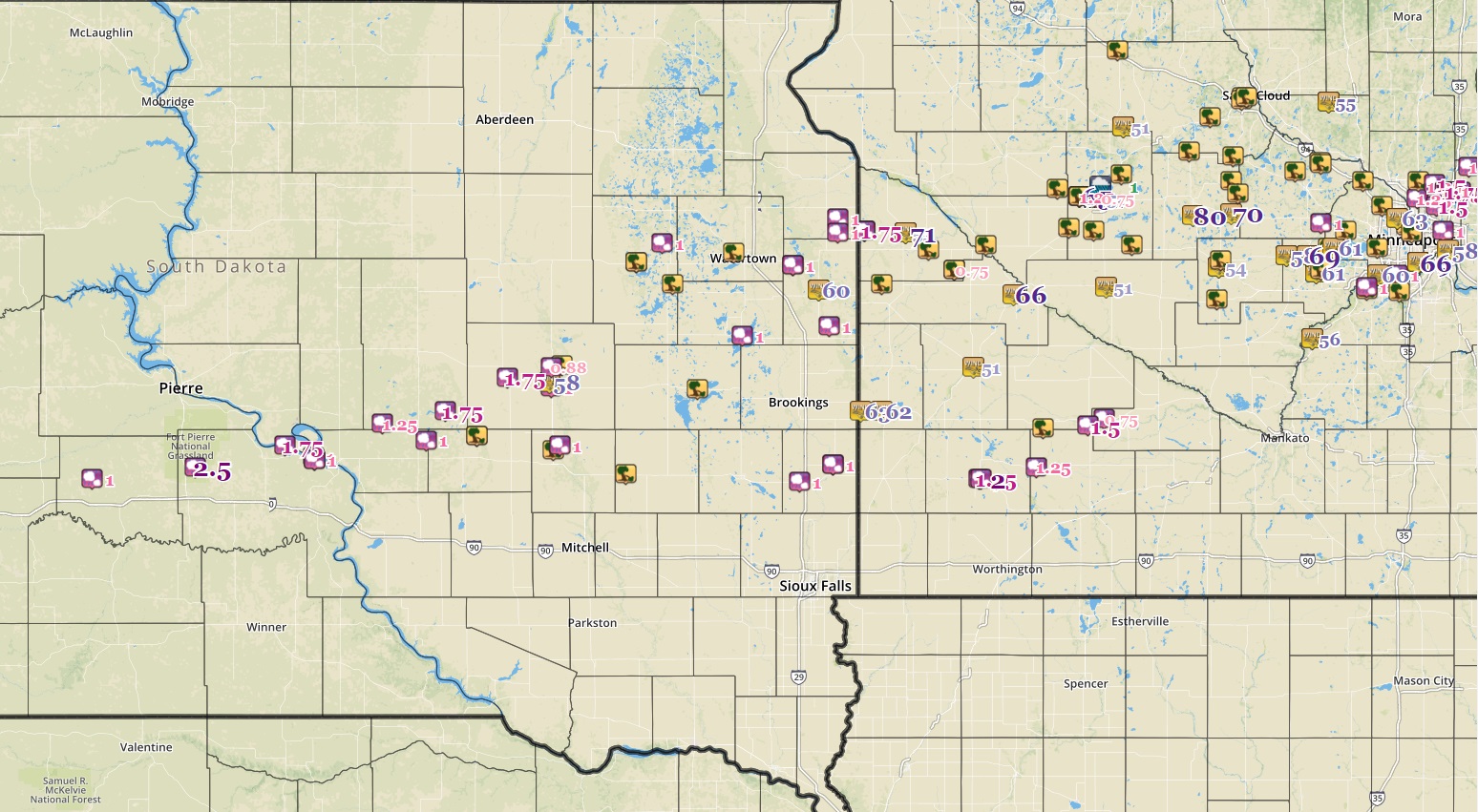
Here's a preliminary map of storm reports for this event. Additional reports are likely to be added, so please visit the interactive storm report page.

|
 |
Media use of NWS Web News Stories is encouraged! Please acknowledge the NWS as the source of any news information accessed from this site. |
|


 Weather Story
 Weather Map
 Local Radar