Overview
|
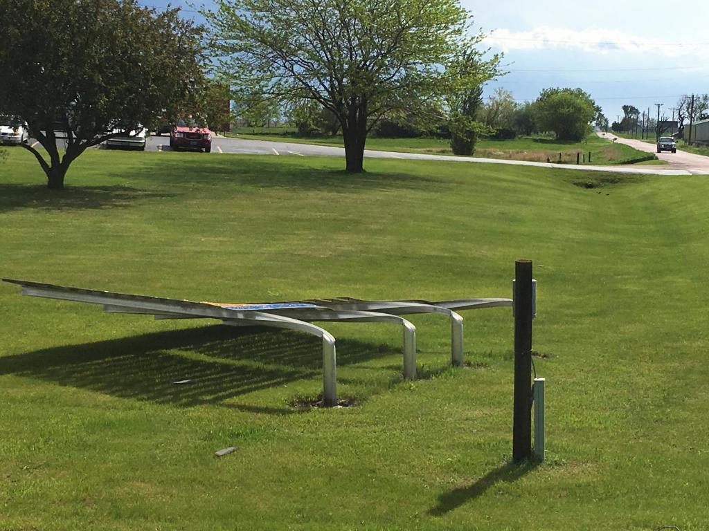
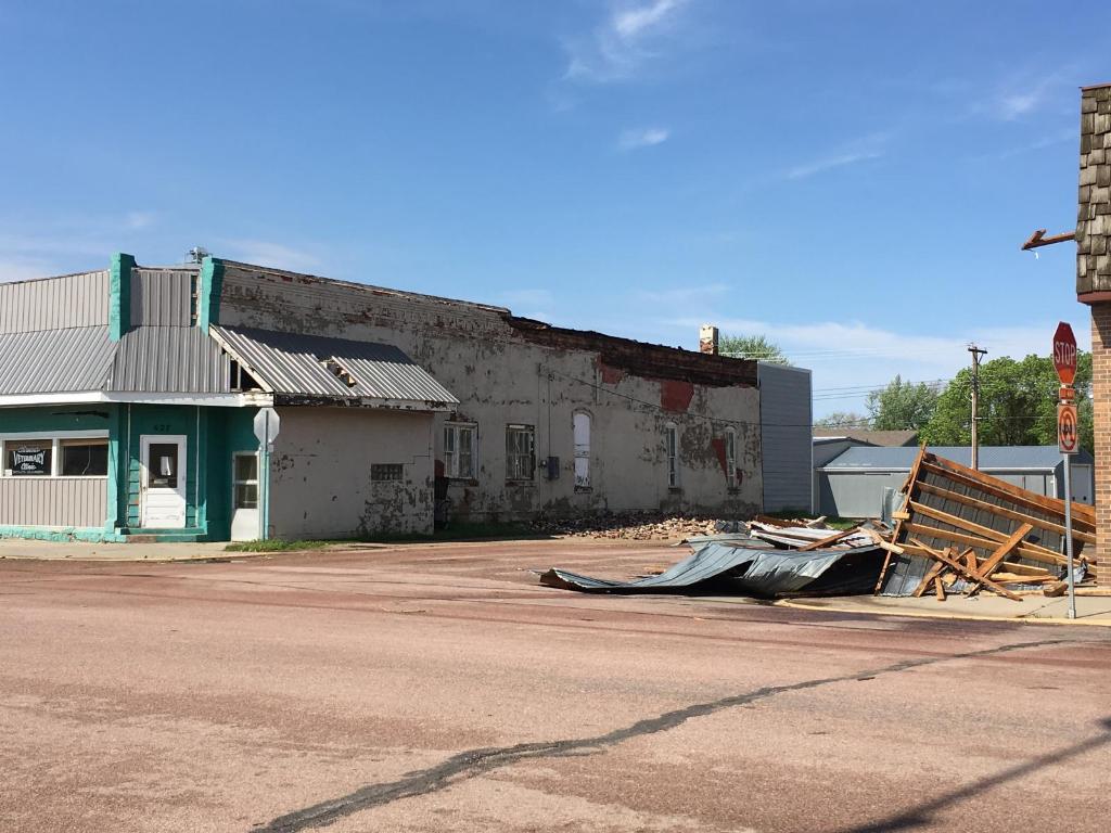
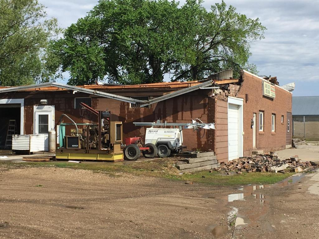
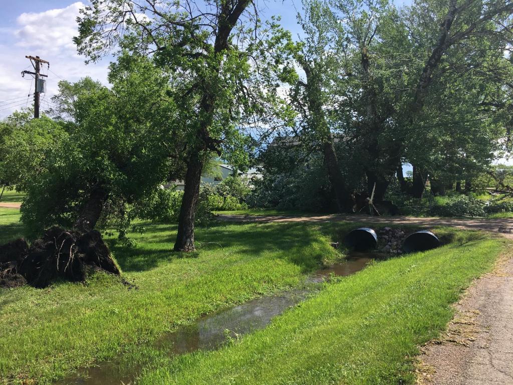
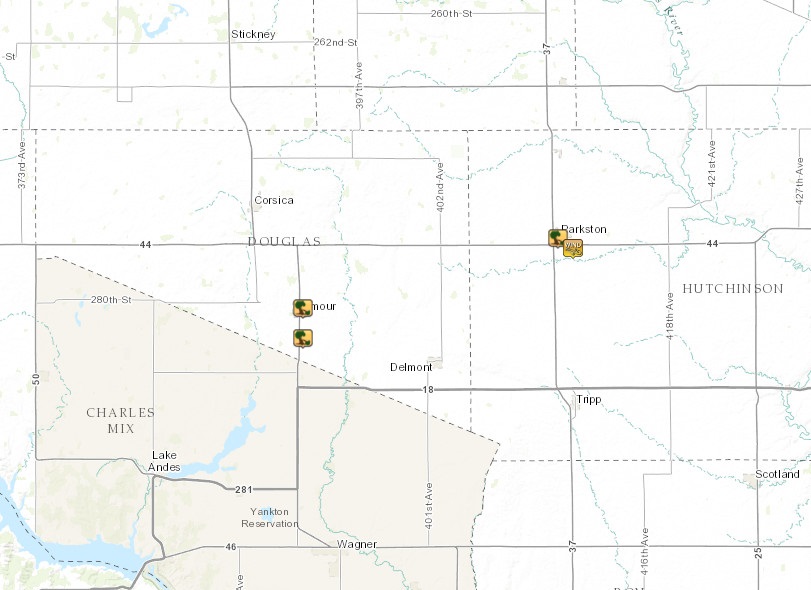
A cluster of severe thunderstorms with winds of 60 to 80 mph moved through south central South Dakota between 8 and 9 AM CDT on May 15, 2017. Wind gusts up 80 mph caused damage to trees and few buildings in Armour, South Dakota. There was also a recorded wind gust of 72 mph north of Armour. Damage was also reported in Parkston, South Dakota where a 63 mph wind gust was recorded with these storms at 830 AM CDT. A storm survey was done by the NWS Sioux Falls this morning. |
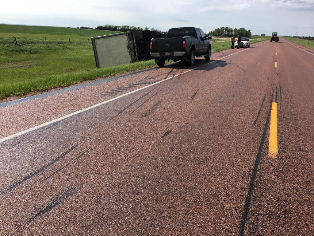 Semi-truck blown off the road south of Armour, SD |
 |
 |
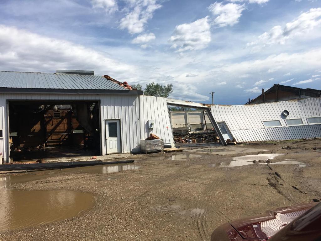 |
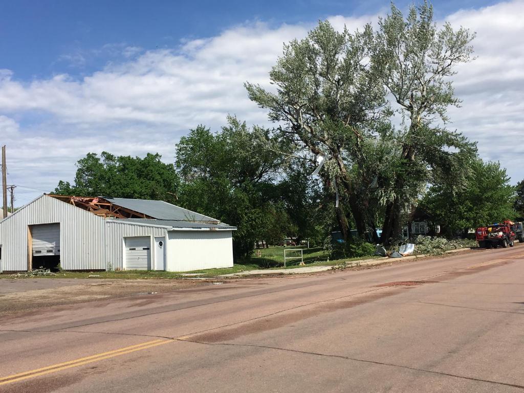
| Sign blown flat by 80 mph in Armour, SD | Damage to trees and building in Armour, SD | Damage to a metal shed in Armour, SD |
Photos & Video:
Header
 |
 |
 |
| Damage to building in Armour, SD (Photo by: National Weather Service) |
Damage to a second building in Armour, SD (Photo by: National Weather Service) |
Damage to trees in Armour, SD (Photo by: National Weather Service) |
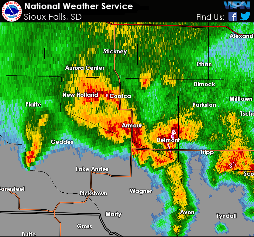
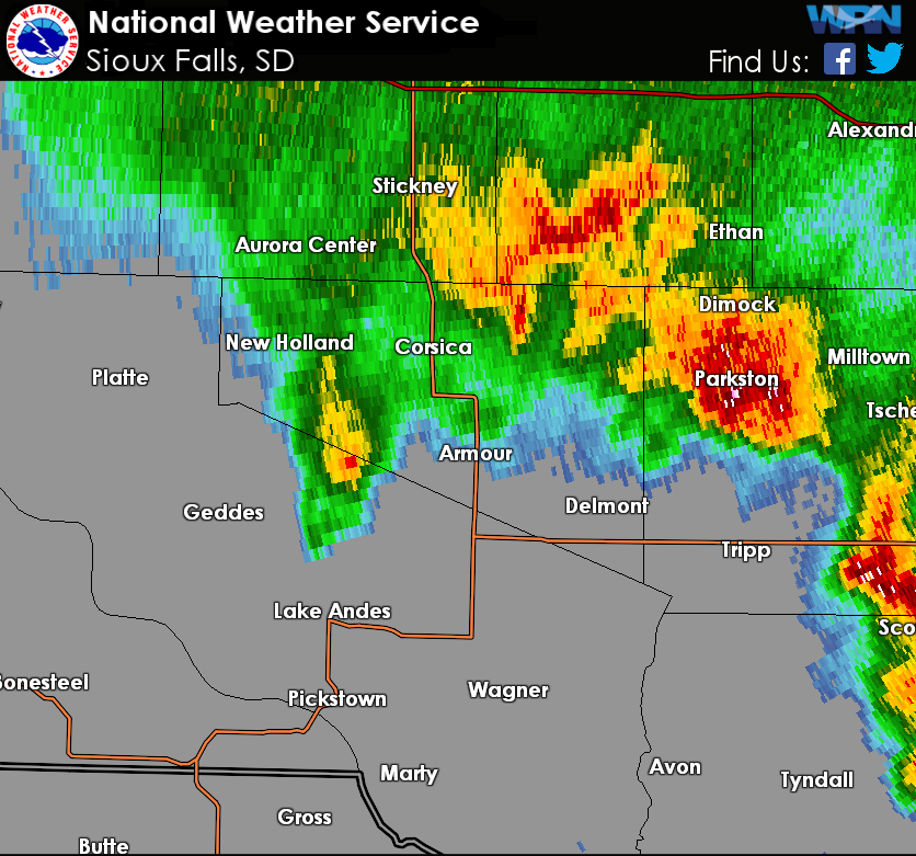
Radar:
Reflectivity images of severe thunderstorms that occurred during the morning of May 15, 2017.
 |
 |
 |
| Radar image at 8:04 AM CDT as damaging winds move through Armour, SD. | Radar image at 8:31 AM CDT as damaging winds up to 65 mph move through Parkston, SD. |
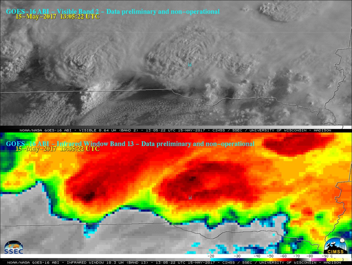
GOES-16 visible and infrared satellite image of storms over southern South Dakota as 80 mph winds reach Armour, SD. Courtesy of Scott Bachmeier, Cooperative Institute for Meteorological Satellite Studies |
Storm Reports
..TIME...   ...EVENT...      ...CITY LOCATION...     ...LAT.LON...
..DATE...   ....MAG....      ..COUNTY LOCATION..ST.. ...SOURCE....
            ..REMARKS..
0805 AM     TSTM WND DMG     ARMOUR                  43.32N 98.34W
05/15/2017                   DOUGLAS            SD   EMERGENCY MNGR

            SHINGLES OFF ROOFS, SOME BUILDING DAMAGE.
0805 AM     TSTM WND DMG     2 S ARMOUR              43.29N 98.34W
05/15/2017                   DOUGLAS            SD   EMERGENCY MNGR

            *** 1 INJ ***
            SEMI TRUCK BLOWN OFF THE ROAD.
0830 AM     TSTM WND DMG     PARKSTON                43.39N 97.99W
05/15/2017                   HUTCHINSON         SD   EMERGENCY MNGR

            8 INCH DIAMETER TREE BRANCHES DOWN.
0830 AM     TSTM WND GST     1 SE PARKSTON           43.38N 97.97W
05/15/2017  M63 MPH          HUTCHINSON         SD   MESONET

            SDSU MESONET STATION.
 |
Media use of NWS Web News Stories is encouraged! Please acknowledge the NWS as the source of any news information accessed from this site. |
|


 Weather Story
 Weather Map
 Local Radar