Overview
|
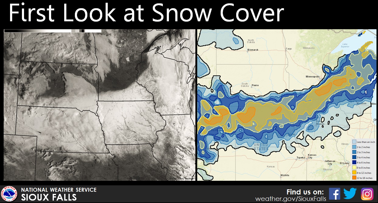
After an incredible stretch of warm weather during the middle of February, winter returned with a blast bringing widespread 6 to 12 inch snowfall reports to end the week. The heaviest snowfall had fallen across areas along or south of the Interstate 90 corridor, with upwards of a foot of snow from Valentine, NE northeast through Yankton, SD, Sioux City, IA, and Spencer, IA.
This storm broke one major record as it moved through. In Sioux City, 8.2" of snow had fallen on Thursday February 23rd, breaking the previous daily snow record of 5.5" set back in 1924. |
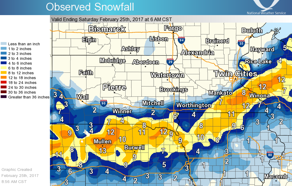 Regional Snowfall Map |
 |
 |
|
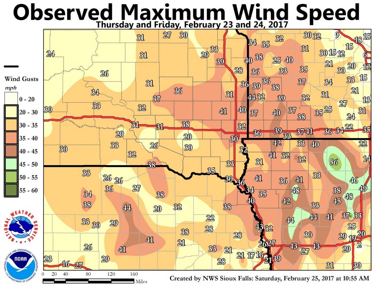
| Local Snowfall Map | Storm Radar Loop | Peak Wind Gusts |
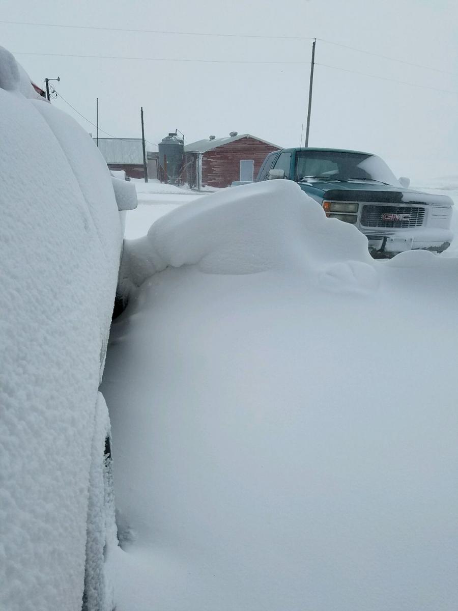
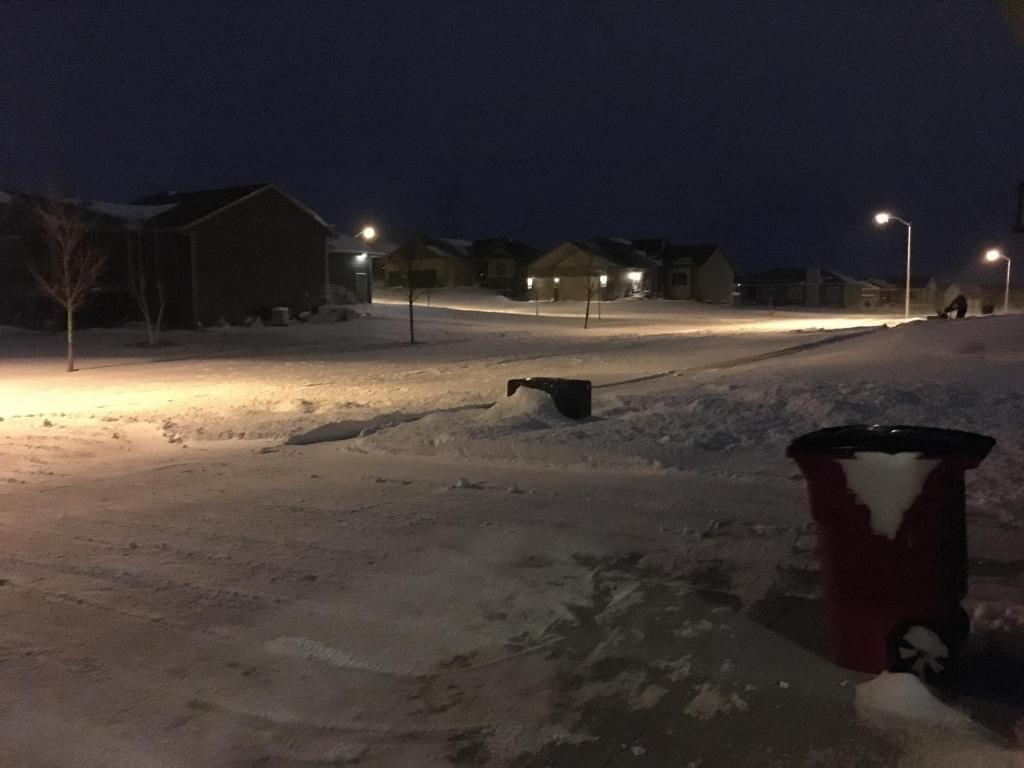
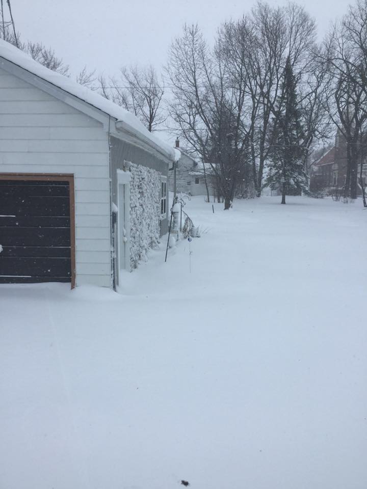
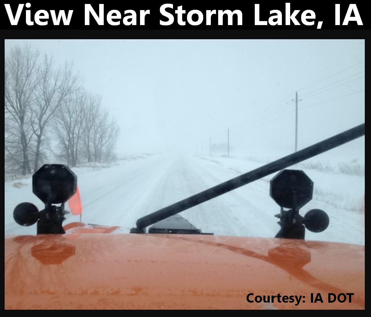
Snow Photos
Here are a few photos across the region from this snowfall.
 |
 |
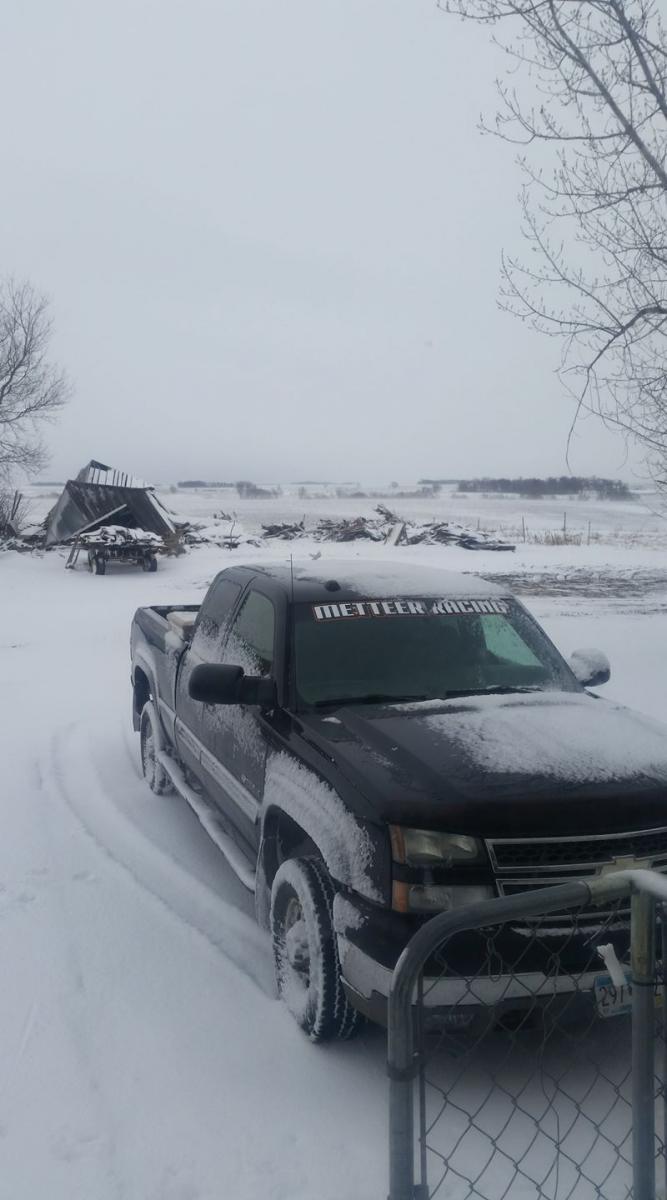 |
| Craig, IA | Eastern Sioux Falls | Windom, MN |
 |
 |
 |
| Sherburn, MN | Storm Lake, IA |
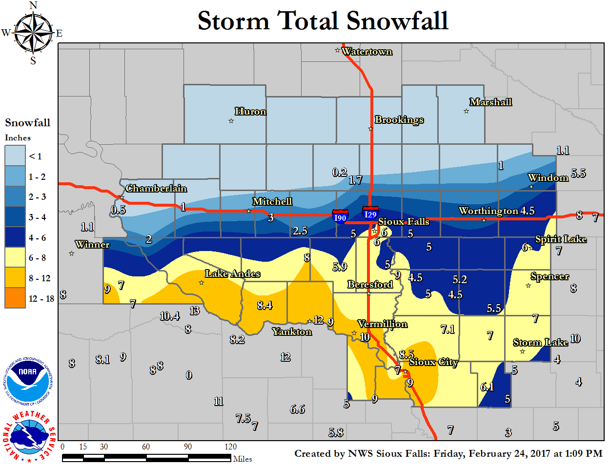
Storm Reports
Here is a local map showing snow reports during this winter storm event
|
| Local Snowfall Map |
.
Here is a text listing showing snow reports during this winter storm event included in the above map.
PRELIMINARY LOCAL STORM REPORT...SUMMARY
NATIONAL WEATHER SERVICE SIOUX FALLS SD
118 PM CST FRI FEB 24 2017

..TIME...   ...EVENT...      ...CITY LOCATION...     ...LAT.LON...
..DATE...   ....MAG....      ..COUNTY LOCATION..ST.. ...SOURCE....
            ..REMARKS..

1230 PM     HEAVY SNOW       EMERSON                 42.28N 96.73W
02/24/2017  M9.0 INCH        DAKOTA             NE   CO-OP OBSERVER

            .

1220 PM     HEAVY SNOW       HILLS                   43.53N 96.36W
02/24/2017  M5.0 INCH        ROCK               MN   CO-OP OBSERVER

            .

1220 PM     HEAVY SNOW       4 WSW SIOUX FALLS       43.53N 96.80W
02/24/2017  M6.8 INCH        MINNEHAHA          SD   CO-OP OBSERVER

            .

1200 PM     HEAVY SNOW       SERGEANT BLUFF          42.40N 96.36W
02/24/2017  M9.7 INCH        WOODBURY           IA   OFFICIAL NWS OBS

            STORM TOTAL SNOWFALL SO FAR UP TO 9.7, BUT
            STILL SNOWING AT NOON.

1200 PM     SNOW             BRIDGEWATER             43.55N 97.50W
02/24/2017  M2.5 INCH        MCCOOK             SD   CO-OP OBSERVER

            .

1141 AM     HEAVY SNOW       SUTHERLAND              42.97N 95.50W
02/24/2017  M5.5 INCH        O'BRIEN            IA   PUBLIC

            REPORT VIA SOCIAL MEDIA.

1140 AM     SNOW             2 NNE LAKEFIELD         43.70N 95.15W
02/24/2017  M4.5 INCH        JACKSON            MN   CO-OP OBSERVER

            .

1104 AM     HEAVY SNOW       1 SSW YANKTON           42.87N 97.40W
02/24/2017  E8.0 INCH        YANKTON            SD   PUBLIC

            REPORT VIA SOCIAL MEDIA.

1100 AM     HEAVY SNOW       3 ESE SIOUX FALLS       43.53N 96.67W
02/24/2017  M6.2 INCH        MINNEHAHA          SD   CO-OP OBSERVER

            .

1045 AM     HEAVY SNOW       2 SSE SIOUX CENTER      43.06N 96.15W
02/24/2017  E7.0 INCH        SIOUX              IA   CO-OP OBSERVER

            .

1032 AM     HEAVY SNOW       FREEMAN                 43.35N 97.43W
02/24/2017  E8.0 INCH        HUTCHINSON         SD   PUBLIC

            REPORT VIA SOCIAL MEDIA.

1030 AM     HEAVY SNOW       2 SSE NORTH SIOUX CITY  42.50N 96.49W
02/24/2017  M7.0 INCH        UNION              SD   BROADCAST MEDIA

            .

1023 AM     HEAVY SNOW       4 NW OKOBOJI            43.43N 95.18W
02/24/2017  M6.0 INCH        DICKINSON          IA   CO-OP OBSERVER

            .

1020 AM     HEAVY SNOW       REMSEN                  42.81N 95.98W
02/24/2017  M7.1 INCH        PLYMOUTH           IA   CO-OP OBSERVER

            .

1003 AM     SNOW             3 SE SIOUX CITY         42.47N 96.36W
02/24/2017  M10.5 INCH       WOODBURY           IA   BROADCAST MEDIA

            .

1000 AM     SNOW             ROCK VALLEY             43.20N 96.31W
02/24/2017  M4.5 INCH        SIOUX              IA   CO-OP OBSERVER

            .

1000 AM     HEAVY SNOW       4 N SIOUX CITY          42.56N 96.40W
02/24/2017  M8.5 INCH        PLYMOUTH           IA   PUBLIC

            REPORT VIA SOCIAL MEDIA.

0957 AM     SNOW             6 ESE VERMILLION        42.75N 96.83W
02/24/2017  E10.0 INCH       CLAY               SD   PUBLIC

            REPORT VIA SOCIAL MEDIA.

0945 AM     SNOW             13 WNW PLATTE           43.49N 99.06W
02/24/2017  M2.0 INCH        CHARLES MIX        SD   CO-OP OBSERVER

            .

0930 AM     SNOW             1 W ALEXANDRIA          43.65N 97.80W
02/24/2017  M3.0 INCH        HANSON             SD   CO-OP OBSERVER

            .

0930 AM     HEAVY SNOW       4 NNE BATTLE CREEK      42.37N 95.57W
02/24/2017  M6.1 INCH        IDA                IA   CO-OP OBSERVER

            .

0915 AM     HEAVY SNOW       1 W SPIRIT LAKE         43.42N 95.14W
02/24/2017  M7.2 INCH        DICKINSON          IA   CO-OP OBSERVER

            .

0915 AM     SNOW             ROCK RAPIDS             43.43N 96.17W
02/24/2017  M5.0 INCH        LYON               IA   CO-OP OBSERVER

            .

0915 AM     HEAVY SNOW       4 ESE SIOUX FALLS       43.53N 96.66W
02/24/2017  M6.3 INCH        MINNEHAHA          SD   NWS EMPLOYEE

            .

0900 AM     HEAVY SNOW       4 E SIOUX RAPIDS        42.89N 95.07W
02/24/2017  E7.0 INCH        BUENA VISTA        IA   CO-OP OBSERVER

            SNOWFALL 6 TO 8 INCHES, HARD TO PIN-POINT
            DUE TO WIND AND DRIFTING.

0900 AM     SNOW             1 SSE MADISON           43.99N 97.09W
02/24/2017  M0.2 INCH        LAKE               SD   CO-OP OBSERVER

            .

0840 AM     HEAVY SNOW       3 NNE SIOUX FALLS       43.58N 96.70W
02/24/2017  E7.5 INCH        MINNEHAHA          SD   PUBLIC

            REPORT VIA SOCIAL MEDIA.

0827 AM     HEAVY SNOW       SIOUX FALLS             43.54N 96.72W
02/24/2017  M6.5 INCH        MINNEHAHA          SD   BROADCAST MEDIA

            .

0822 AM     HEAVY SNOW       FAIRVIEW                43.22N 96.49W
02/24/2017  M9.0 INCH        LINCOLN            SD   PUBLIC

            REPORT VIA SOCIAL MEDIA.

0800 AM     SNOW             STORM LAKE              42.65N 95.19W
02/24/2017  E8.0 INCH        BUENA VISTA        IA   CO-OP OBSERVER

            STILL SNOWING AND DRIFTING.

0800 AM     SNOW             PIPESTONE               44.00N 96.31W
02/24/2017  M1.0 INCH        PIPESTONE          MN   MESONET

            MESONET STATION PIPESTONE /PIPM5/.

0800 AM     SNOW             1 ENE WALL LAKE         43.53N 96.95W
02/24/2017  M5.0 INCH        MINNEHAHA          SD   COCORAHS

            COCORAHS STATION WALL LAKE /SD-MH-8/.

0800 AM     SNOW             2 SE MITCHELL           43.71N 98.01W
02/24/2017  M2.0 INCH        DAVISON            SD   COCORAHS

            COCORAHS STATION 1 SE MITCHELL /SD-DV-7/.

0800 AM     SNOW             1 ENE CHEROKEE          42.76N 95.54W
02/24/2017  M7.0 INCH        CHEROKEE           IA   CO-OP OBSERVER

            .

0800 AM     SNOW             1 N ROCK RAPIDS         43.43N 96.17W
02/24/2017  M5.0 INCH        LYON               IA   CO-OP OBSERVER

            CO-OP OBSERVER STATION ROCK RAPIDS /RKRI4/.

0759 AM     HEAVY SNOW       HOSPERS                 43.07N 95.90W
02/24/2017  E4.5 INCH        SIOUX              IA   PUBLIC

            REPORT VIA SOCIAL MEDIA.

0750 AM     SNOW             1 WSW CANTON            43.30N 96.60W
02/24/2017  M5.0 INCH        LINCOLN            SD   CO-OP OBSERVER

            .

0745 AM     SNOW             AKRON                   42.83N 96.55W
02/24/2017  M7.0 INCH        PLYMOUTH           IA   CO-OP OBSERVER

            .

0743 AM     HEAVY SNOW       1 S YANKTON             42.87N 97.39W
02/24/2017  E7.0 INCH        YANKTON            SD   PUBLIC

            REPORT VIA SOCIAL MEDIA.

0735 AM     SNOW             TYNDALL                 42.99N 97.87W
02/24/2017  M8.4 INCH        BON HOMME          SD   CO-OP OBSERVER

            .

0733 AM     HEAVY SNOW       VERMILLION              42.78N 96.93W
02/24/2017  E8.0 INCH        CLAY               SD   PUBLIC

            REPORT VIA SOCIAL MEDIA.

0730 AM     HEAVY SNOW       PICKSTOWN               43.07N 98.53W
02/24/2017  M9.0 INCH        CHARLES MIX        SD   CO-OP OBSERVER

            .

0730 AM     HEAVY SNOW       3 E SIOUX FALLS         43.54N 96.67W
02/24/2017  M6.0 INCH        MINNEHAHA          SD   NWS EMPLOYEE

            .

0700 AM     SNOW             2 SSW GAYVILLE          42.86N 97.18W
02/24/2017  M9.0 INCH        YANKTON            SD   COCORAHS

            COCORAHS STATION GAYVILLE 1.8 SSW /SD-YN-3/.

0700 AM     SNOW             1 SE VERMILLION         42.77N 96.91W
02/24/2017  M8.5 INCH        CLAY               SD   COCORAHS

            COCORAHS STATION 1 ESE VERMILLION
            /SD-CY-10/.

0700 AM     SNOW             9 S DALLAS              43.11N 99.49W
02/24/2017  M9.0 INCH        GREGORY            SD   COCORAHS

            COCORAHS STATION 8 S DALLAS /SD-GY-1/.

0700 AM     SNOW             4 SW BURKE              43.14N 99.35W
02/24/2017  M7.0 INCH        GREGORY            SD   COCORAHS

            COCORAHS STATION 4 SW BURKE /SD-GY-15/.

0700 AM     SNOW             3 WSW SIOUX FALLS       43.52N 96.79W
02/24/2017  M8.5 INCH        MINNEHAHA          SD   COCORAHS

            COCORAHS STATION SIOUX FALLS 3.4 WSW
            /SD-MH-23/.

0700 AM     SNOW             WHITE LAKE              43.73N 98.71W
02/24/2017  M1.0 INCH        AURORA             SD   CO-OP OBSERVER

            .

0700 AM     SNOW             3 ESE SIOUX FALLS       43.53N 96.67W
02/24/2017  M6.3 INCH        MINNEHAHA          SD   COCORAHS

            COCORAHS STATION 3 ESE SIOUX FALLS
            /SD-MH-20/.

0700 AM     SNOW             2 ESE VERMILLION        42.77N 96.90W
02/24/2017  M8.5 INCH        CLAY               SD   COCORAHS

            .

0700 AM     SNOW             2 N CHESTER             43.93N 96.93W
02/24/2017  M1.7 INCH        LAKE               SD   CO-OP OBSERVER

            .

0700 AM     SNOW             WESTBROOK               44.04N 95.43W
02/24/2017  E1.0 INCH        COTTONWOOD         MN   PUBLIC

            .

0700 AM     SNOW             4 WNW ROWENA            43.55N 96.63W
02/24/2017  M6.5 INCH        MINNEHAHA          SD   COCORAHS

            COCORAHS STATION 3 WNW ROWENA /SD-MH-82/.

0700 AM     SNOW             4 SW SIOUX FALLS        43.50N 96.79W
02/24/2017  M6.4 INCH        MINNEHAHA          SD   COCORAHS

            COCORAHS STATION 3 SW SIOUX FALLS
            /SD-MH-41/.

0700 AM     SNOW             8 SSW HERRICK           43.00N 99.23W
02/24/2017  M7.0 INCH        GREGORY            SD   COCORAHS

            COCORAHS STATION 7 WNW NAPER /SD-GY-12/.

0700 AM     HEAVY SNOW       1 SE TEA                43.44N 96.82W
02/24/2017  E7.8 INCH        LINCOLN            SD   PUBLIC

            REPORT VIA SOCIAL MEDIA.

0700 AM     SNOW             6 SSW HERRICK           43.04N 99.23W
02/24/2017  M8.0 INCH        GREGORY            SD   COCORAHS

            COCORAHS STATION BURKE 10.5 SSE /SD-GY-18/.

0640 AM     SNOW             5 S ALTA                42.61N 95.31W
02/24/2017  M4.0 INCH        BUENA VISTA        IA   TRAINED SPOTTER

            .

0620 AM     HEAVY SNOW       1 W SPIRIT LAKE         43.42N 95.14W
02/24/2017  M7.0 INCH        DICKINSON          IA   CO-OP OBSERVER

            .

0605 AM     HEAVY SNOW       2 ESE YANKTON           42.88N 97.36W
02/24/2017  M12.0 INCH       YANKTON            SD   CO-OP OBSERVER

            .

0600 AM     SNOW             3 N SIOUX FALLS         43.59N 96.73W
02/24/2017  M5.1 INCH        MINNEHAHA          SD   OFFICIAL NWS OBS

            .

0600 AM     SNOW             3 SSE SIOUX FALLS       43.50N 96.71W
02/24/2017  M6.0 INCH        MINNEHAHA          SD   TRAINED SPOTTER

            .

0600 AM     SNOW             4 SSW ARTHUR            42.28N 95.36W
02/24/2017  M5.0 INCH        IDA                IA   COCORAHS

            COCORAHS STATION 3 SSW ARTHUR /IA-ID-4/.

0600 AM     SNOW             HURLEY                  43.28N 97.09W
02/24/2017  M5.9 INCH        TURNER             SD   COCORAHS

            COCORAHS STATION HURLEY /SD-TR-9/.

1150 PM     SNOW             2 S MITCHELL            43.70N 98.04W
02/23/2017  M2.4 INCH        DAVISON            SD   CO-OP OBSERVER

            CO-OP OBSERVER STATION MITCHELL /MCLS2/.
|
 |
Media use of NWS Web News Stories is encouraged! Please acknowledge the NWS as the source of any news information accessed from this site. |
|


 Weather Story
 Weather Map
 Local Radar