Overview
|
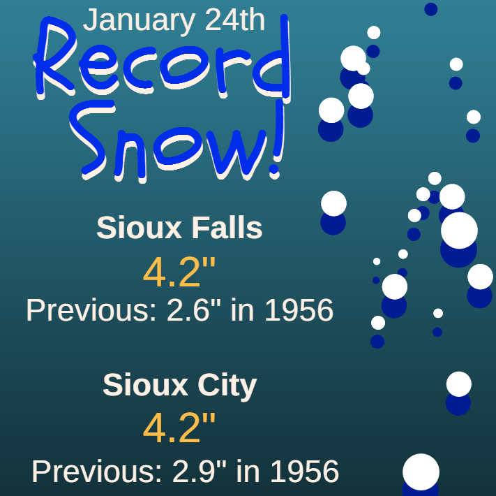
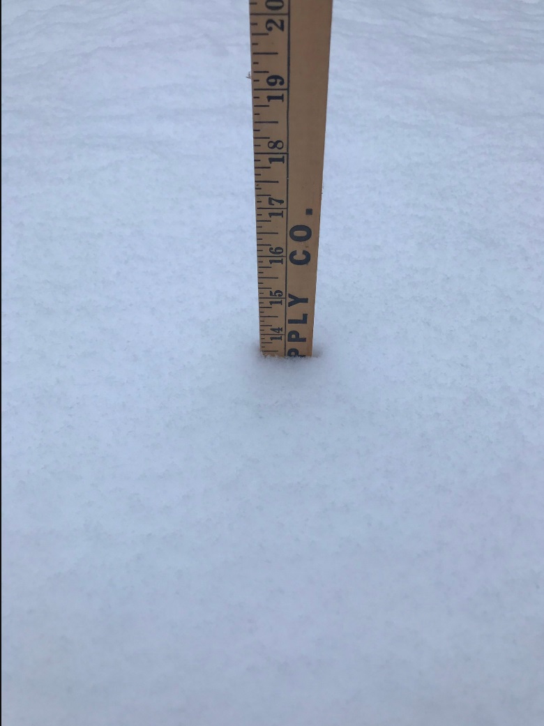
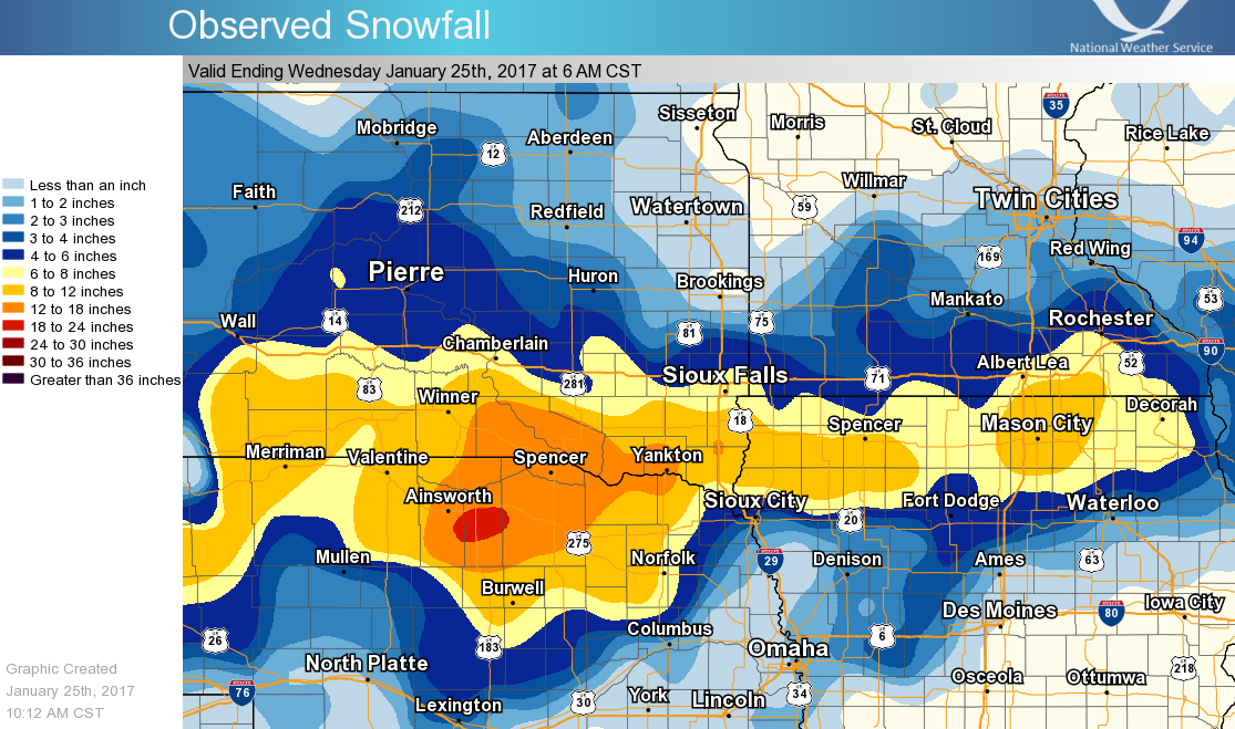
The first strong winter storm of 2017 moved across the Plains on January 24 and 25, bringing widespread heavy snow of 6 to 16" inches across the region. The snow quickly develop early Tuesday morning, as a heavy snow band lifted into the Missouri River Valley region. Snow amounts of 1 to 3" per hour were reported near Sioux City, IA. Snow continued to slowly lift northward into the evening, with an intense snow band rotating northwest into the Tri-State area. The heaviest snow was reported near Yankton, Lake Andes, Gregory, SD where over a foot of snow had fallen by Wednesday morning. However, the axis of a foot of snow extended eastward into Northwest Iowa, with 13" of snow in Beresford, SD and nearly 10" in Spencer IA. The highest snowfall report in the Sioux Falls forecast area was 18" in Pickstown, SD. The highest regional total was 20" reported in Spencer, NE. This storm broke daily records for snowfall and precipitation in both Sioux Falls and Sioux City, IA. |
 Regional Radar Loop |
 |
 |
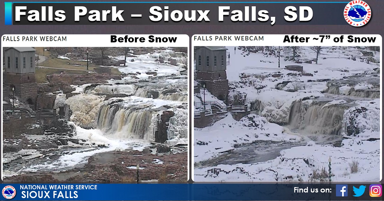 |
| January 24 Snow Records | Local Storm Reports in the Sioux Falls CWA | Falls Park in Sioux Falls |
Photos & Video:
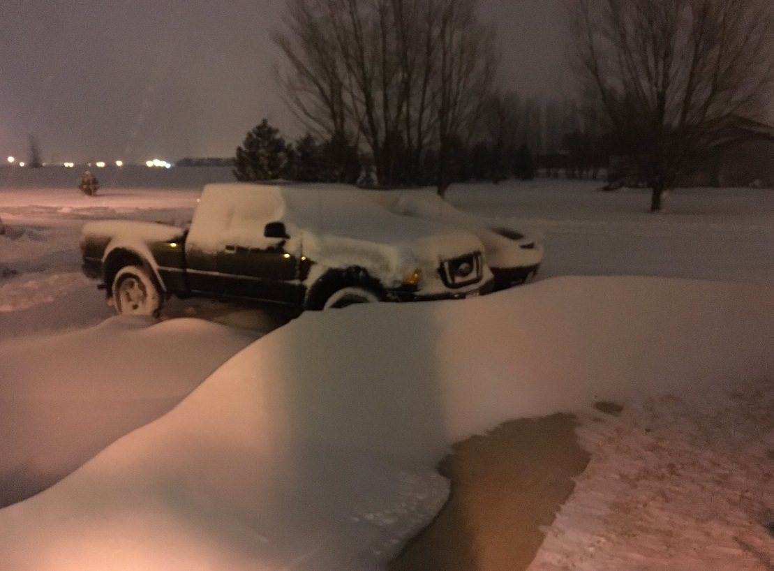
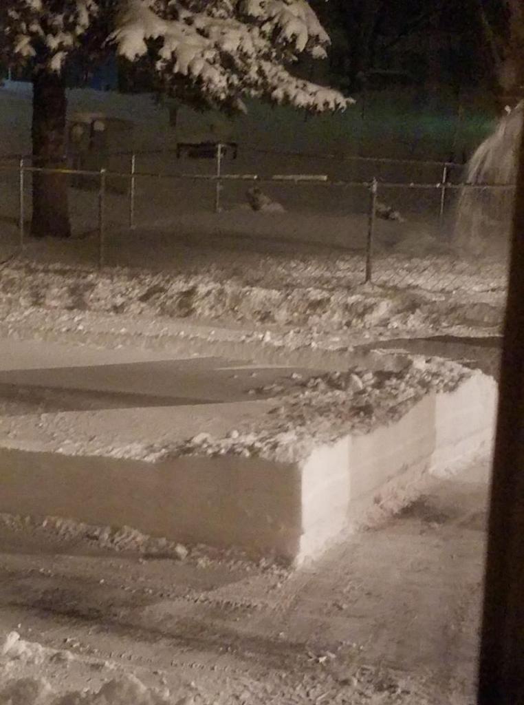
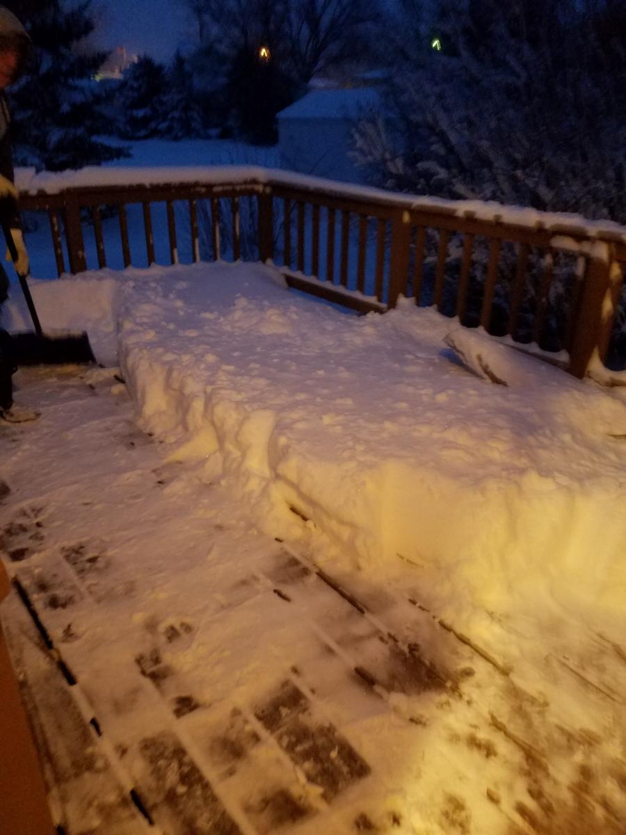
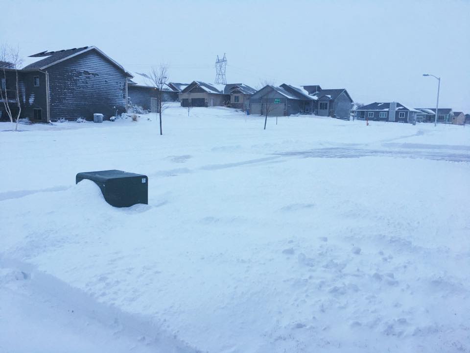
Winter Storm Photos
|
 |
 |
 |
| Falls Park - Sioux Falls (City of Sioux Falls) |
13" Snow Near Alcester, SD (@jzweifel72) |
2-3' Drifts in Spirit Lake (Danny Akers) |
15" of Snow in Yankton (Natalie Mae Pedersen) |
 |
 |
 |
 |
| 12" of Snow in Corsica, SD (Jackie Harrington) |
8" east Sioux Falls (Matthew Dux) |
Downtown Lennox, SD (Lennox Independent) |
Mount Marty College - Yankton (Mount Marty College) |
.PNG) |
|||
| 9.5" in Vermillion, SD (Allison Huff) |
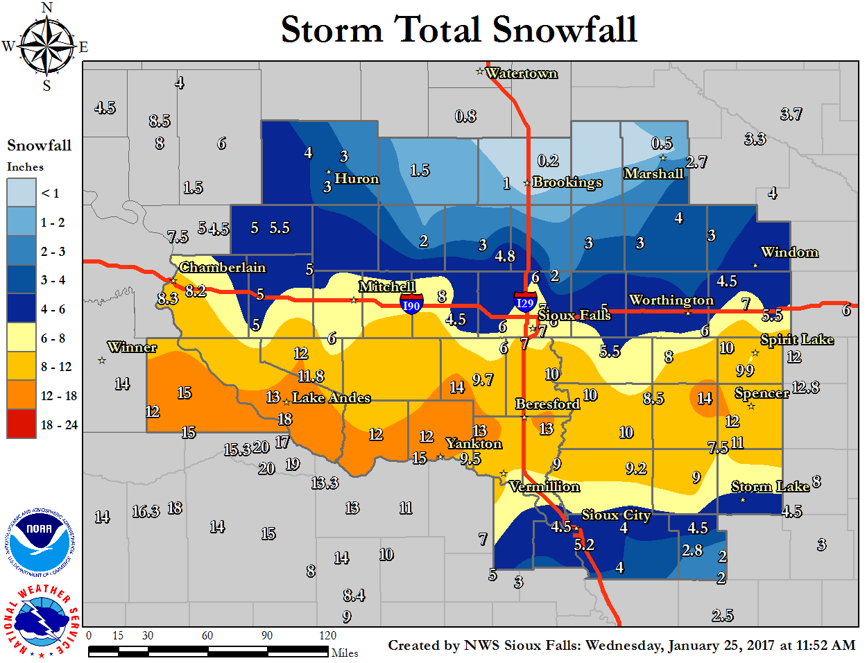
Snow Maps and Storm Reports
Here's a look at snow reports from across the region.
 |
|
||
| Regional Snow Reports - 7am January 24 to 10 am January 25 |
|
PRELIMINARY LOCAL STORM REPORT...SUMMARY
NATIONAL WEATHER SERVICE SIOUX FALLS SD
1210 PM CST WED JAN 25 2017
..TIME... ...EVENT... ...CITY LOCATION... ...LAT.LON...
..DATE... ....MAG.... ..COUNTY LOCATION..ST.. ...SOURCE....
..REMARKS..
1155 AM HEAVY SNOW HAWARDEN 43.00N 96.48W
01/25/2017 E14.5 INCH SIOUX IA PUBLIC
.
1100 AM HEAVY SNOW 1 W VERMILLION 42.78N 96.95W
01/25/2017 E11.8 INCH CLAY SD PUBLIC
REPORT VIA FACEBOOK.
1030 AM HEAVY SNOW 3 SSE SIOUX FALLS 43.50N 96.71W
01/25/2017 M7.4 INCH MINNEHAHA SD TRAINED SPOTTER
.
1007 AM HEAVY SNOW 2 SSE NORTH SIOUX CITY 42.50N 96.49W
01/25/2017 M4.5 INCH UNION SD BROADCAST MEDIA
.
1000 AM HEAVY SNOW 6 W YALE 44.45N 98.10W
01/25/2017 U3.0 INCH BEADLE SD TRAINED SPOTTER
.
1000 AM HEAVY SNOW 2 ENE SIOUX FALLS 43.55N 96.70W
01/25/2017 E8.0 INCH MINNEHAHA SD FIRE DEPT/RESCUE
.
1000 AM HEAVY SNOW 4 WSW SIOUX FALLS 43.53N 96.80W
01/25/2017 M7.5 INCH MINNEHAHA SD TRAINED SPOTTER
.
1000 AM HEAVY SNOW MILFORD 43.33N 95.15W
01/25/2017 E10.0 INCH DICKINSON IA PUBLIC
REPORT VIA FACEBOOK.
0951 AM HEAVY SNOW ROYAL 43.06N 95.28W
01/25/2017 E12.0 INCH CLAY IA PUBLIC
REPORT VIA FACEBOOK.
0930 AM SNOW REMSEN 42.81N 95.98W
01/25/2017 M9.2 INCH PLYMOUTH IA CO-OP OBSERVER
CO-OP OBSERVER STATION REMSEN NO. 2 /RMSI4/.
0920 AM HEAVY SNOW 1 ENE CHEROKEE 42.76N 95.54W
01/25/2017 M9.0 INCH CHEROKEE IA CO-OP OBSERVER
.
0920 AM SNOW PETERSON 42.92N 95.34W
01/25/2017 M7.5 INCH CLAY IA TRAINED SPOTTER
.
0918 AM SNOW BERESFORD 43.08N 96.78W
01/25/2017 M11.7 INCH UNION SD PUBLIC
REPORT VIA FACEBOOK.
0915 AM HEAVY SNOW PICKSTOWN 43.07N 98.53W
01/25/2017 M18.0 INCH CHARLES MIX SD CO-OP OBSERVER
.
0915 AM SNOW 2 NE LAKEFIELD 43.70N 95.15W
01/25/2017 M3.0 INCH JACKSON MN CO-OP OBSERVER
.
0910 AM HEAVY SNOW ROCK RAPIDS 43.43N 96.17W
01/25/2017 M5.5 INCH LYON IA CO-OP OBSERVER
.
0907 AM SNOW CORSICA 43.42N 98.41W
01/25/2017 E12.0 INCH DOUGLAS SD PUBLIC
REPORT VIA FACEBOOK.
0900 AM SNOW 1 ENE WALL LAKE 43.53N 96.95W
01/25/2017 M6.0 INCH MINNEHAHA SD COCORAHS
COCORAHS STATION WALL LAKE /SD-MH-8/.
0900 AM SNOW 6 W MADISON 44.00N 97.23W
01/25/2017 M3.0 INCH LAKE SD CO-OP OBSERVER
CO-OP OBSERVER STATION 2 E MADISON /MRFS2/.
0900 AM HEAVY SNOW 3 NW LAKE ANDES 43.19N 98.58W
01/25/2017 E13.0 INCH CHARLES MIX SD PUBLIC
.
0900 AM SNOW 1 SSE MADISON 43.99N 97.09W
01/25/2017 M3.0 INCH LAKE SD CO-OP OBSERVER
.
0849 AM SNOW 2 SSW BROADLAND 44.47N 98.36W
01/25/2017 E4.0 INCH BEADLE SD PUBLIC
REPORT VIA FACEBOOK.
0848 AM SNOW HURON 44.36N 98.22W
01/25/2017 E4.0 INCH BEADLE SD PUBLIC
REPORT VIA FACEBOOK.
0845 AM HEAVY SNOW CANTON 43.30N 96.58W
01/25/2017 M10.0 INCH LINCOLN SD CO-OP OBSERVER
.
0845 AM HEAVY SNOW 9 W WESSINGTON SPRINGS 44.08N 98.75W
01/25/2017 U5.0 INCH JERAULD SD EMERGENCY MNGR
0839 AM SNOW 1 WNW BROOKINGS 44.31N 96.82W
01/25/2017 E0.5 INCH BROOKINGS SD PUBLIC
REPORT VIA FACEBOOK.
0834 AM HEAVY SNOW ORANGE CITY 43.01N 96.06W
01/25/2017 E8.5 INCH SIOUX IA PUBLIC
REPORT FROM SOCIAL MEDIA. .
0829 AM HEAVY SNOW 6 ENE UTICA 43.01N 97.39W
01/25/2017 E10.0 INCH YANKTON SD PUBLIC
REPORT VIA FACEBOOK.
0828 AM HEAVY SNOW MILFORD 43.33N 95.15W
01/25/2017 E9.0 INCH DICKINSON IA EMERGENCY MNGR
.
0827 AM HEAVY SNOW 11 WSW LETCHER 43.86N 98.35W
01/25/2017 E5.0 INCH AURORA SD PUBLIC
REPORT VIA FACEBOOK.
0826 AM HEAVY SNOW BRANDON 43.59N 96.58W
01/25/2017 M6.0 INCH MINNEHAHA SD PUBLIC
REPORT VIA FACEBOOK.
0822 AM HEAVY SNOW SIBLEY 43.40N 95.74W
01/25/2017 E8.0 INCH OSCEOLA IA PUBLIC
REPORT VIA FACEBOOK.
0820 AM HEAVY SNOW 5 NW BRANDON 43.65N 96.65W
01/25/2017 E7.0 INCH MINNEHAHA SD PUBLIC
REPORT VIA FACEBOOK.
0817 AM HEAVY SNOW MITCHELL 43.73N 98.03W
01/25/2017 E6.0 INCH DAVISON SD PUBLIC
REPORT VIA FACEBOOK.
0816 AM HEAVY SNOW SPENCER 43.15N 95.15W
01/25/2017 E10.0 INCH CLAY IA PUBLIC
REPORT VIA FACEBOOK.
0816 AM HEAVY SNOW 3 WSW WEST OKOBOJI 43.33N 95.21W
01/25/2017 E9.0 INCH DICKINSON IA PUBLIC
REPORT VIA FACEBOOK.
0815 AM HEAVY SNOW WAKONDA 43.01N 97.11W
01/25/2017 E13.0 INCH CLAY SD PUBLIC
REPORT VIA FACEBOOK.
0810 AM HEAVY SNOW 1 S ARMOUR 43.30N 98.34W
01/25/2017 M11.8 INCH DOUGLAS SD EMERGENCY MNGR
.
0803 AM HEAVY SNOW 4 WSW SIOUX FALLS 43.52N 96.81W
01/25/2017 E8.0 INCH MINNEHAHA SD PUBLIC
REPORT VIA FACEBOOK.
0800 AM SNOW PIPESTONE 44.00N 96.32W
01/25/2017 M3.0 INCH PIPESTONE MN PUBLIC
.
0800 AM SNOW 2 NNE BROOKINGS 44.33N 96.77W
01/25/2017 M0.1 INCH BROOKINGS SD CO-OP OBSERVER
.
0800 AM SNOW HOWARD 44.01N 97.52W
01/25/2017 M2.0 INCH MINER SD CO-OP OBSERVER
.
0800 AM SNOW 1 N MARSHALL 44.47N 95.79W
01/25/2017 M0.5 INCH LYON MN CO-OP OBSERVER
.
0800 AM SNOW 4 NNE BATTLE CREEK 42.37N 95.57W
01/25/2017 M2.8 INCH IDA IA CO-OP OBSERVER
CO-OP OBSERVER STATION BATTLE CREEK 3NE
/BTLI4/.
0800 AM HEAVY SNOW 7 SE TABOR 42.89N 97.55W
01/25/2017 E15.0 INCH YANKTON SD PUBLIC
REPORT VIA FACEBOOK.
0800 AM SNOW 2 S ORANGE CITY 42.97N 96.06W
01/25/2017 M8.0 INCH SIOUX IA COCORAHS
COCORAHS STATION 2 S ORANGE CITY /IA-SX-6/.
0800 AM SNOW LAKE WILSON 44.00N 95.95W
01/25/2017 M3.0 INCH MURRAY MN CO-OP OBSERVER
CO-OP OBSERVER STATION LAKE WILSON /LKWM5/.
0800 AM SNOW 1 ESE WHITE 44.43N 96.62W
01/25/2017 M0.2 INCH BROOKINGS SD COCORAHS
COCORAHS STATION 1 ESE WHITE /SD-BK-33/.
0800 AM SNOW 1 NE BROOKINGS 44.32N 96.77W
01/25/2017 M0.1 INCH BROOKINGS SD CO-OP OBSERVER
CO-OP OBSERVER STATION 2 NE BROOKINGS
/BROS2/.
0800 AM SNOW 1 S HURON 44.35N 98.22W
01/25/2017 M3.9 INCH BEADLE SD COCORAHS
COCORAHS STATION 1 S HURON /SD-BD-20/.
0800 AM SNOW CANISTOTA 43.60N 97.29W
01/25/2017 E4.5 INCH MCCOOK SD PUBLIC
REPORT VIA FACEBOOK.
0800 AM HEAVY SNOW 1 W ROUND LAKE 43.54N 95.48W
01/25/2017 M6.0 INCH NOBLES MN PUBLIC
.
0800 AM HEAVY SNOW TYNDALL 42.99N 97.87W
01/25/2017 M12.0 INCH BON HOMME SD CO-OP OBSERVER
.
0800 AM SNOW 11 S WHITE LAKE 43.57N 98.74W
01/25/2017 M5.0 INCH AURORA SD COCORAHS
COCORAHS STATION 10 S WHITE LAKE /SD-AR-3/.
0800 AM SNOW PIPESTONE 44.00N 96.31W
01/25/2017 M3.0 INCH PIPESTONE MN MESONET
MESONET STATION PIPESTONE /PIPM5/.
0800 AM SNOW 10 W DIMOCK 43.50N 98.19W
01/25/2017 M6.0 INCH DOUGLAS SD COCORAHS
COCORAHS STATION 10 W DIMOCK /SD-DG-1/.
0755 AM HEAVY SNOW LAKE PARK 43.45N 95.32W
01/25/2017 E10.0 INCH DICKINSON IA EMERGENCY MNGR
.
0752 AM SNOW WESTBROOK 44.04N 95.43W
01/25/2017 M3.0 INCH COTTONWOOD MN PUBLIC
REPORT VIA FACEBOOK.
0750 AM SNOW LAKE WILSON 44.00N 95.95W
01/25/2017 M3.0 INCH MURRAY MN CO-OP OBSERVER
.
0740 AM HEAVY SNOW SIOUX FALLS 43.54N 96.73W
01/25/2017 M6.8 INCH MINNEHAHA SD BROADCAST MEDIA
AT KSFY 12TH ST. PLAZA.
0739 AM SNOW 2 S MITCHELL 43.70N 98.04W
01/25/2017 M7.4 INCH DAVISON SD OFFICIAL NWS OBS
.
0730 AM HEAVY SNOW DELL RAPIDS 43.82N 96.71W
01/25/2017 E6.0 INCH MINNEHAHA SD PUBLIC
REPORT VIA FACEBOOK.
0730 AM HEAVY SNOW ORANGE CITY 43.00N 96.05W
01/25/2017 M10.0 INCH SIOUX IA CO-OP OBSERVER
.
0730 AM SNOW 1 SSW YANKTON 42.87N 97.40W
01/25/2017 M11.5 INCH YANKTON SD PUBLIC
REPORT VIA FACEBOOK.
0730 AM SNOW AKRON 42.83N 96.55W
01/25/2017 M9.0 INCH PLYMOUTH IA CO-OP OBSERVER
.
0725 AM HEAVY SNOW 1 NNE INWOOD 43.31N 96.43W
01/25/2017 M10.8 INCH LYON IA PUBLIC
REPORT VIA FACEBOOK.
0722 AM HEAVY SNOW SALEM 43.72N 97.39W
01/25/2017 E8.0 INCH MCCOOK SD PUBLIC
REPORT VIA FACEBOOK.
0720 AM HEAVY SNOW SHELDON 43.18N 95.85W
01/25/2017 M8.5 INCH O'BRIEN IA CO-OP OBSERVER
.
0718 AM HEAVY SNOW HARTLEY 43.18N 95.48W
01/25/2017 E14.0 INCH O'BRIEN IA PUBLIC
REPORT VIA FACEBOOK.
0714 AM HEAVY SNOW ORANGE CITY 43.00N 96.06W
01/25/2017 E11.0 INCH SIOUX IA PUBLIC
REPORT VIA FACEBOOK.
0714 AM HEAVY SNOW VERMILLION 42.78N 96.93W
01/25/2017 M10.0 INCH CLAY SD PUBLIC
REPORT VIA FACEBOOK.
0712 AM HEAVY SNOW JACKSON 43.62N 94.99W
01/25/2017 M5.5 INCH JACKSON MN PUBLIC
REPORT VIA FACEBOOK.
0707 AM HEAVY SNOW 3 SW ROSSIE 42.98N 95.24W
01/25/2017 E11.0 INCH CLAY IA PUBLIC
REPORT VIA FACEBOOK.
0706 AM HEAVY SNOW 10 WSW HURLEY 43.24N 97.28W
01/25/2017 E14.0 INCH TURNER SD PUBLIC
REPORT VIA FACEBOOK.
0706 AM HEAVY SNOW YANKTON 42.89N 97.39W
01/25/2017 E16.0 INCH YANKTON SD PUBLIC
REPORT VIA FACEBOOK.
0704 AM SNOW 4 N CURRIE 44.13N 95.67W
01/25/2017 M4.0 INCH MURRAY MN AMATEUR RADIO
.
0702 AM HEAVY SNOW 4 SE SIOUX FALLS 43.50N 96.67W
01/25/2017 E7.0 INCH LINCOLN SD PUBLIC
REPORT VIA FACEBOOK.
0700 AM SNOW 1 S MARSHALL 44.44N 95.79W
01/25/2017 M2.2 INCH LYON MN COCORAHS
COCORAHS STATION MARSHALL 0.6 S /MN-LY-2/.
0700 AM SNOW ROCK VALLEY 43.20N 96.31W
01/25/2017 M10.0 INCH SIOUX IA CO-OP OBSERVER
CO-OP OBSERVER STATION ROCK VALLEY /RKVI4/.
0700 AM HEAVY SNOW 2 S MITCHELL 43.70N 98.04W
01/25/2017 M7.4 INCH DAVISON SD CO-OP OBSERVER
.
0700 AM SNOW WHITE LAKE 43.73N 98.71W
01/25/2017 M5.0 INCH AURORA SD CO-OP OBSERVER
.
0700 AM HEAVY SNOW WESSINGTON SPRINGS 44.08N 98.57W
01/25/2017 M5.5 INCH JERAULD SD CO-OP OBSERVER
.
0700 AM SNOW HOLSTEIN 42.49N 95.53W
01/25/2017 M4.5 INCH IDA IA CO-OP OBSERVER
CO-OP OBSERVER STATION HOLSTEIN /HSTI4/.
0700 AM HEAVY SNOW SIBLEY 43.40N 95.75W
01/25/2017 M7.5 INCH OSCEOLA IA CO-OP OBSERVER
.
0700 AM SNOW 2 SSW GAYVILLE 42.86N 97.18W
01/25/2017 M9.5 INCH YANKTON SD COCORAHS
COCORAHS STATION GAYVILLE 1.8 SSW /SD-YN-3/.
0700 AM SNOW 6 NW MONTROSE 43.77N 97.25W
01/25/2017 M4.8 INCH MCCOOK SD COCORAHS
COCORAHS STATION 5 NW MONTROSE /SD-MC-1/.
0700 AM SNOW 3 N HORNICK 42.28N 96.10W
01/25/2017 M4.0 INCH WOODBURY IA CO-OP OBSERVER
CO-OP OBSERVER STATION HOLLY SPRINGS 1NW
/HLYI4/.
0700 AM SNOW 2 S PUKWANA 43.75N 99.18W
01/25/2017 M8.2 INCH BRULE SD COCORAHS
COCORAHS STATION 1 S PUKWANA /SD-BL-11/.
0700 AM SNOW DE SMET 44.38N 97.55W
01/25/2017 M1.5 INCH KINGSBURY SD COCORAHS
COCORAHS STATION DE SMET /SD-KY-5/.
0700 AM SNOW 4 NNE SIBLEY 43.45N 95.71W
01/25/2017 M7.5 INCH OSCEOLA IA CO-OP OBSERVER
CO-OP OBSERVER STATION SIBLEY /SIBI4/.
0700 AM SNOW 4 SSE SIOUX FALLS 43.49N 96.71W
01/25/2017 M7.6 INCH LINCOLN SD CO-OP OBSERVER
CO-OP OBSERVER STATION 4 SSE SIOUX FALLS
/FUHS2/.
0700 AM SNOW 1 WNW LAKEFIELD 43.68N 95.18W
01/25/2017 M7.0 INCH JACKSON MN CO-OP OBSERVER
CO-OP OBSERVER STATION LAKEFIELD /LKFM5/.
0700 AM HEAVY SNOW 1 W SPIRIT LAKE 43.42N 95.14W
01/25/2017 M10.0 INCH DICKINSON IA CO-OP OBSERVER
.
0700 AM SNOW 4 SW SIOUX FALLS 43.50N 96.79W
01/25/2017 M7.0 INCH MINNEHAHA SD COCORAHS
COCORAHS STATION 3 SW SIOUX FALLS
/SD-MH-41/.
0700 AM SNOW UTICA 42.98N 97.50W
01/25/2017 M12.0 INCH YANKTON SD COCORAHS
COCORAHS STATION UTICA /SD-YN-22/.
0700 AM SNOW 4 NE BRUCE 44.48N 96.84W
01/25/2017 M0.5 INCH BROOKINGS SD COCORAHS
COCORAHS STATION BRUCE 4.1 NE /SD-BK-9/.
0700 AM SNOW 9 S DALLAS 43.11N 99.49W
01/25/2017 M12.0 INCH GREGORY SD COCORAHS
COCORAHS STATION 8 S DALLAS /SD-GY-1/.
0700 AM SNOW 2 NE WORTHINGTON 43.64N 95.58W
01/25/2017 M4.0 INCH NOBLES MN CO-OP OBSERVER
.
0700 AM SNOW 1 WNW CANTON 43.31N 96.59W
01/25/2017 M10.0 INCH LINCOLN SD CO-OP OBSERVER
CO-OP OBSERVER STATION CANTON /CNNS2/.
0700 AM HEAVY SNOW 3 ESE SIOUX FALLS 43.53N 96.67W
01/25/2017 M7.5 INCH MINNEHAHA SD CO-OP OBSERVER
.
0700 AM SNOW 8 SSW HERRICK 43.00N 99.23W
01/25/2017 M15.0 INCH GREGORY SD COCORAHS
COCORAHS STATION 7 WNW NAPER /SD-GY-12/.
0700 AM HEAVY SNOW 4 NNW HARRISBURG 43.48N 96.73W
01/25/2017 M6.0 INCH LINCOLN SD NWS EMPLOYEE
.
0700 AM SNOW 2 N CHESTER 43.93N 96.93W
01/25/2017 M4.8 INCH LAKE SD CO-OP OBSERVER
.
0700 AM SNOW 1 SE VERMILLION 42.77N 96.91W
01/25/2017 M7.0 INCH CLAY SD COCORAHS
COCORAHS STATION 1 ESE VERMILLION
/SD-CY-10/.
0700 AM SNOW 2 NE BURKE 43.21N 99.26W
01/25/2017 M15.0 INCH GREGORY SD COCORAHS
COCORAHS STATION BURKE 2.4 NE /SD-GY-17/.
0700 AM SNOW BROOKINGS 44.30N 96.79W
01/25/2017 M0.2 INCH BROOKINGS SD COCORAHS
COCORAHS STATION BROOKINGS /SD-BK-7/.
0700 AM SNOW 6 SSW HERRICK 43.04N 99.23W
01/25/2017 M14.0 INCH GREGORY SD COCORAHS
COCORAHS STATION BURKE 10.5 SSE /SD-GY-18/.
0700 AM HEAVY SNOW 3 E SIOUX FALLS 43.54N 96.67W
01/25/2017 M7.0 INCH MINNEHAHA SD NWS EMPLOYEE
.
0700 AM SNOW 4 WNW ROWENA 43.55N 96.63W
01/25/2017 M7.7 INCH MINNEHAHA SD COCORAHS
COCORAHS STATION 3 WNW ROWENA /SD-MH-82/.
0700 AM SNOW SHELDON 43.18N 95.85W
01/25/2017 M8.0 INCH O'BRIEN IA CO-OP OBSERVER
CO-OP OBSERVER STATION SHELDON /SHDI4/.
0700 AM SNOW 1 S BROOKINGS 44.29N 96.79W
01/25/2017 M0.5 INCH BROOKINGS SD COCORAHS
COCORAHS STATION 1 S BROOKINGS /SD-BK-43/.
0659 AM HEAVY SNOW 3 E SIOUX FALLS 43.54N 96.66W
01/25/2017 E7.0 INCH MINNEHAHA SD PUBLIC
REPORT VIA FACEBOOK.
0659 AM HEAVY SNOW 5 W TEA 43.45N 96.94W
01/25/2017 E6.0 INCH TURNER SD PUBLIC
.
0652 AM SNOW ARTHUR 42.34N 95.35W
01/25/2017 E2.0 INCH IDA IA PUBLIC
REPORT VIA FACEBOOK.
0648 AM SNOW 7 NW SHERMAN 43.83N 96.57W
01/25/2017 E2.0 INCH MINNEHAHA SD PUBLIC
REPORT VIA FACEBOOK.
0648 AM HEAVY SNOW 1 SSW TEA 43.43N 96.85W
01/25/2017 E10.0 INCH LINCOLN SD PUBLIC
REPORT VIA FACEBOOK.
0647 AM HEAVY SNOW SPIRIT LAKE 43.42N 95.11W
01/25/2017 E10.0 INCH DICKINSON IA PUBLIC
REPORT VIA FACEBOOK.
0647 AM HEAVY SNOW 1 W VERMILLION 42.78N 96.95W
01/25/2017 E10.5 INCH CLAY SD PUBLIC
REPORT VIA FACEBOOK.
0635 AM HEAVY SNOW CHEROKEE 42.75N 95.55W
01/25/2017 E10.0 INCH CHEROKEE IA PUBLIC
REPORT VIA FACEBOOK.
0635 AM SNOW MOVILLE 42.49N 96.07W
01/25/2017 E4.0 INCH WOODBURY IA PUBLIC
REPORT VIA FACEBOOK.
0633 AM HEAVY SNOW OKOBOJI 43.39N 95.14W
01/25/2017 E6.0 INCH DICKINSON IA PUBLIC
REPORT VIA FACEBOOK.
0630 AM HEAVY SNOW 2 SE TEA 43.43N 96.82W
01/25/2017 E10.0 INCH LINCOLN SD PUBLIC
REPORT VIA FACEBOOK.
0630 AM HEAVY SNOW 3 SSE SIOUX FALLS 43.50N 96.70W
01/25/2017 M7.8 INCH MINNEHAHA SD NWS EMPLOYEE
.
0628 AM HEAVY SNOW SIOUX CITY 42.50N 96.39W
01/25/2017 E5.5 INCH WOODBURY IA PUBLIC
REPORT VIA FACEBOOK.
0626 AM SNOW HERON LAKE 43.80N 95.32W
01/25/2017 M4.5 INCH JACKSON MN PUBLIC
REPORT VIA FACEBOOK.
0624 AM SNOW ALCESTER 43.02N 96.63W
01/25/2017 E13.0 INCH UNION SD PUBLIC
REPORT VIA FACEBOOK.
0622 AM SNOW 1 S VOLGA 44.31N 96.92W
01/25/2017 E1.0 INCH BROOKINGS SD PUBLIC
REPORT VIA FACEBOOK.
0615 AM HEAVY SNOW YANKTON 42.89N 97.39W
01/25/2017 M15.5 INCH YANKTON SD CO-OP OBSERVER
.
0615 AM SNOW 3 SSW BRANDON 43.55N 96.61W
01/25/2017 E7.5 INCH MINNEHAHA SD NWS EMPLOYEE
.
0614 AM SNOW LUVERNE 43.65N 96.21W
01/25/2017 E5.0 INCH ROCK MN PUBLIC
REPORT VIA FACEBOOK.
0613 AM HEAVY SNOW 1 ESE SIOUX FALLS 43.54N 96.70W
01/25/2017 E5.0 INCH MINNEHAHA SD PUBLIC
REPORT VIA FACEBOOK.
0610 AM SNOW 4 SSW ARTHUR 42.28N 95.36W
01/25/2017 M2.0 INCH IDA IA COCORAHS
COCORAHS STATION 3 SSW ARTHUR /IA-ID-4/.
0606 AM HEAVY SNOW 4 WSW SIOUX FALLS 43.51N 96.79W
01/25/2017 E8.0 INCH MINNEHAHA SD PUBLIC
REPORT VIA FACEBOOK.
0600 AM SNOW 8 SSW CHAMBERLAIN 43.71N 99.38W
01/25/2017 M8.3 INCH BRULE SD COCORAHS
COCORAHS STATION 6 S OACOMA /SD-BL-10/.
0600 AM SNOW BERESFORD 43.08N 96.78W
01/25/2017 M13.0 INCH UNION SD COCORAHS
COCORAHS STATION BERESFORD /SD-UN-5/.
0600 AM SNOW 3 N SIOUX FALLS 43.59N 96.73W
01/25/2017 M6.4 INCH MINNEHAHA SD OFFICIAL NWS OBS
.
0600 AM SNOW 2 S HURON 44.34N 98.22W
01/25/2017 M3.0 INCH BEADLE SD OFFICIAL NWS OBS
.
0600 AM SNOW SERGEANT BLUFF 42.40N 96.36W
01/25/2017 M5.2 INCH WOODBURY IA OFFICIAL NWS OBS
.
0600 AM SNOW HURLEY 43.28N 97.09W
01/25/2017 M9.7 INCH TURNER SD COCORAHS
COCORAHS STATION HURLEY /SD-TR-9/.
 |
Media use of NWS Web News Stories is encouraged! Please acknowledge the NWS as the source of any news information accessed from this site. |
|


 Weather Story
 Weather Map
 Local Radar