Overview
|
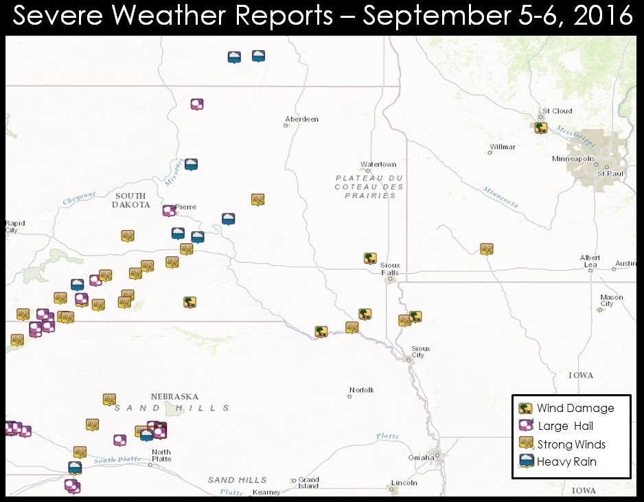
A line of strong to severe thunderstorms raced across the region during the early morning hours of Labor Day 2016. There were several pockets of severe weather, but the hardest hit areas were located in and around Springfield, SD. Widespread damage was reported due to intense straight line winds in excess of 100 mph in many areas. A National Weather Service survey team spent Labor day meeting with community members and members of the local government, observing the damage and collecting information in the aftermath of these storms. The following pages and sections on this website will provide details from a radar and damage perspective. |
Loop of Regional Radar Early Labor Day |
 |
 |
 |
| Regional Storm Reports | Springfield Damage Indications | Example of Storm Damage |
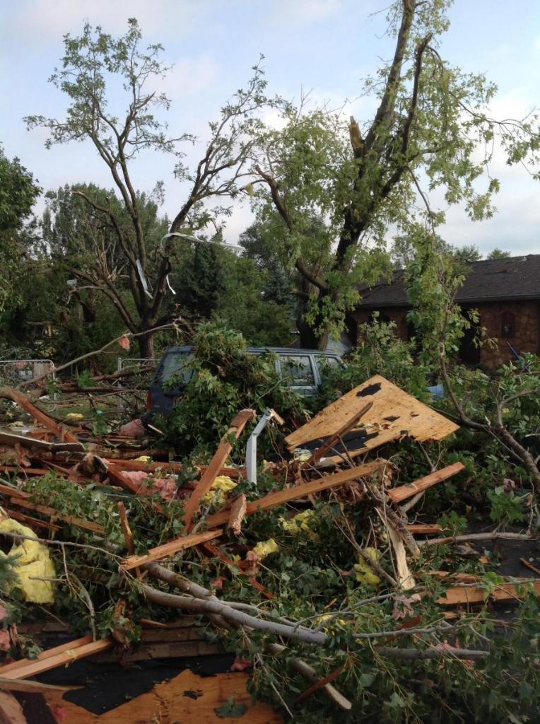
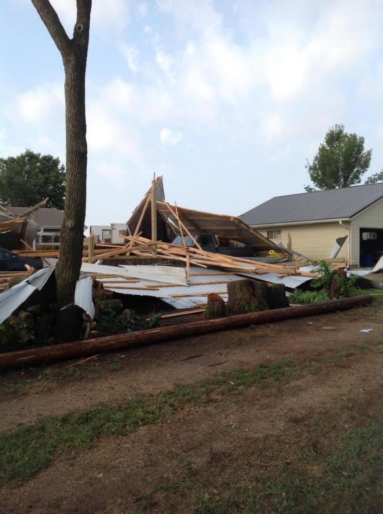
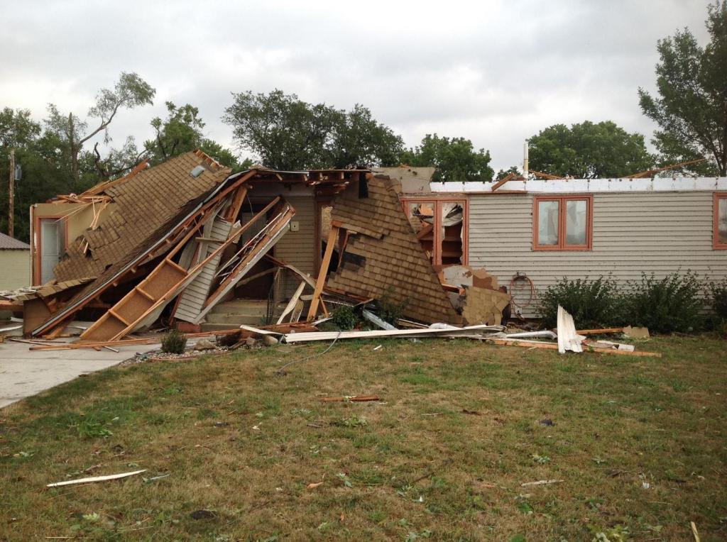
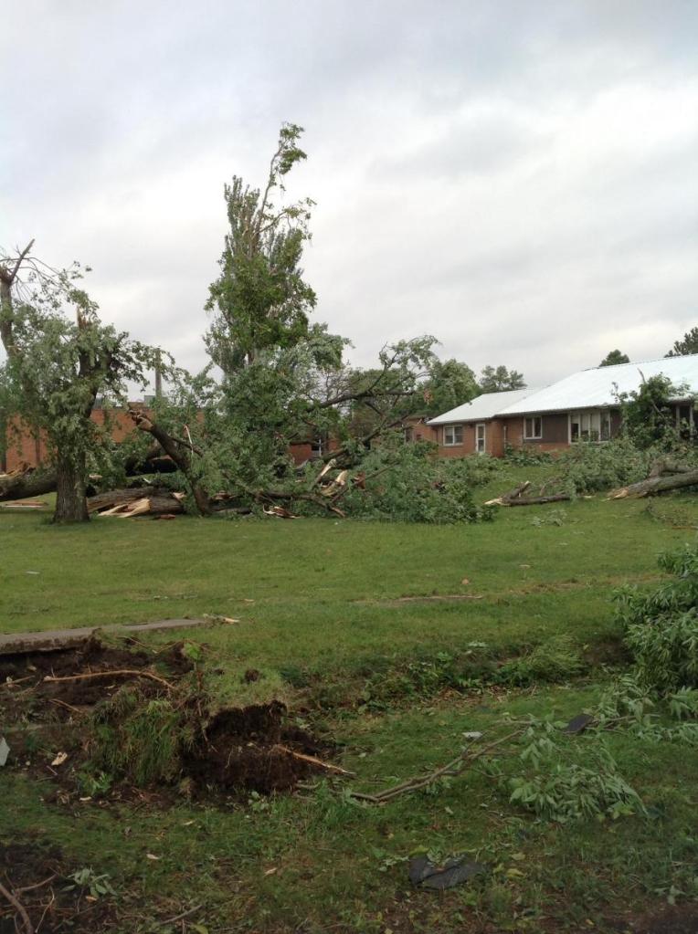
Storm Survey Photos and Results:
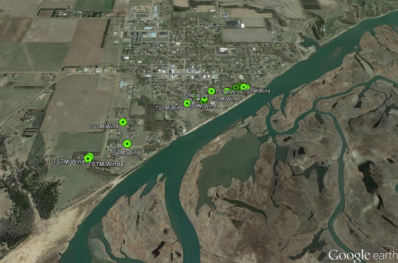
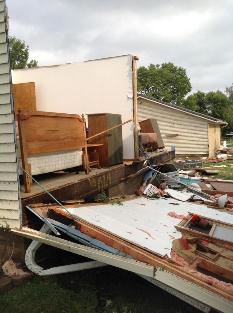
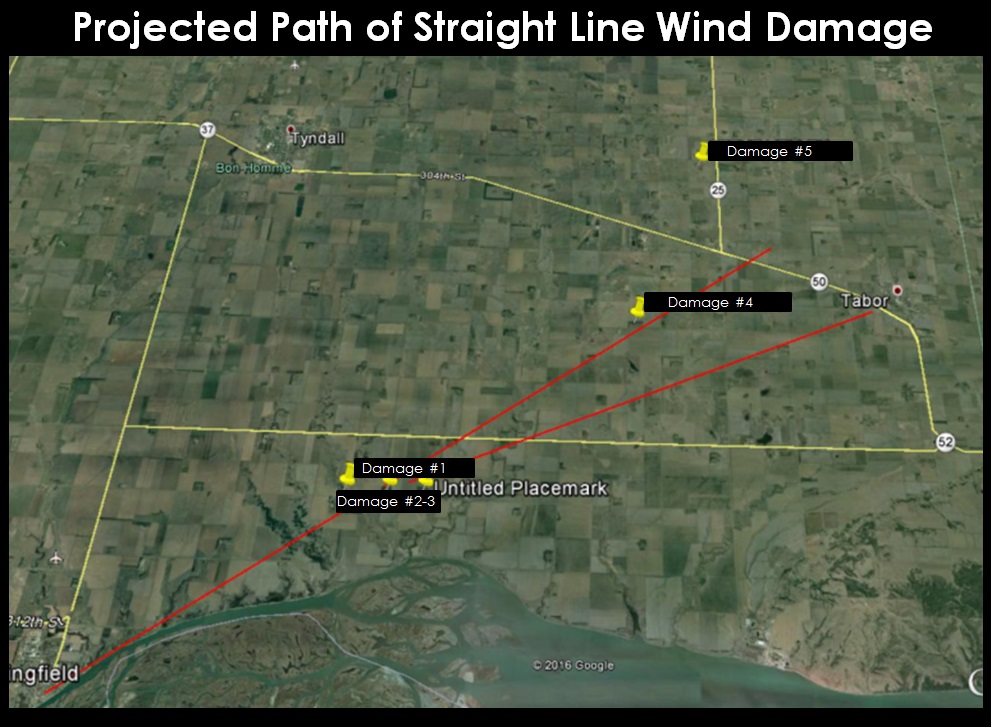
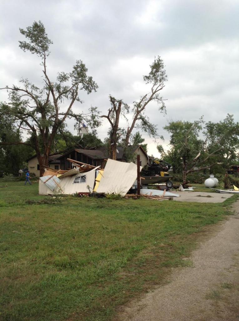
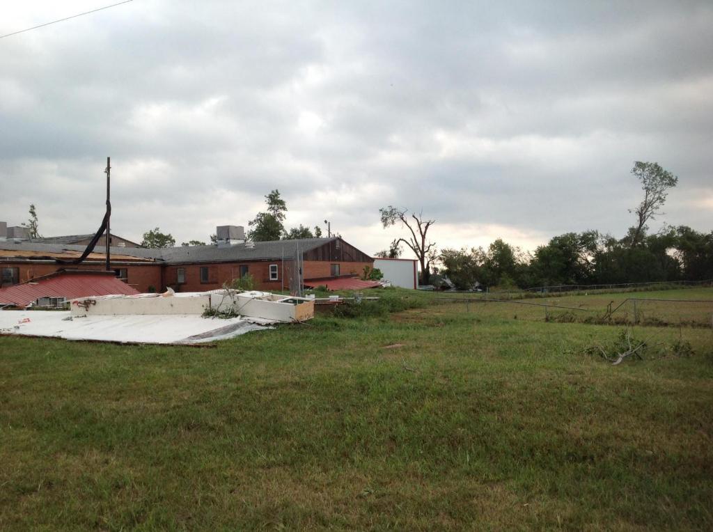
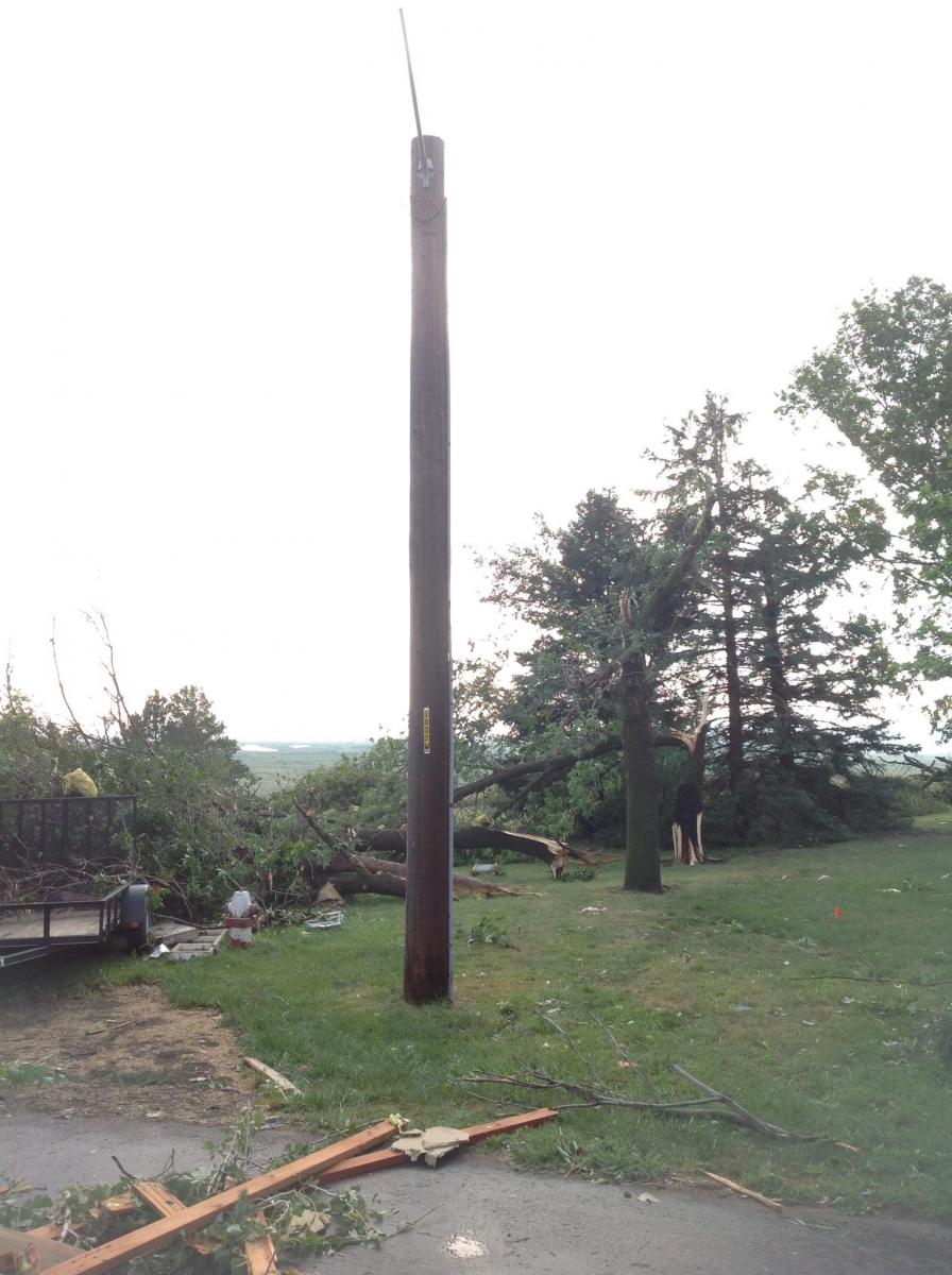
Extensive damage was reported in portions of Springfield, SD and and areas downstream including Tabor, SD. Here are a few pictures captured from our recent storm survey in the area. Survey results indicated much of the damage was due to severe straight-line winds in excess of 100 mph. Additional photos have been provided by the local county government officials.
|
 |
|
Damage Indications From NWS Storm Survey Results (Interactive KMZ File With Images Available on Request) |
Downstream Damage Indications From NWS Partner Surveys (Interactive KMZ File With Images Available on Request) |
 |
 |
 |
 |
|
 |
 |
 |
Public Information Statement Regarding the Springfield, SD Damage Survey:
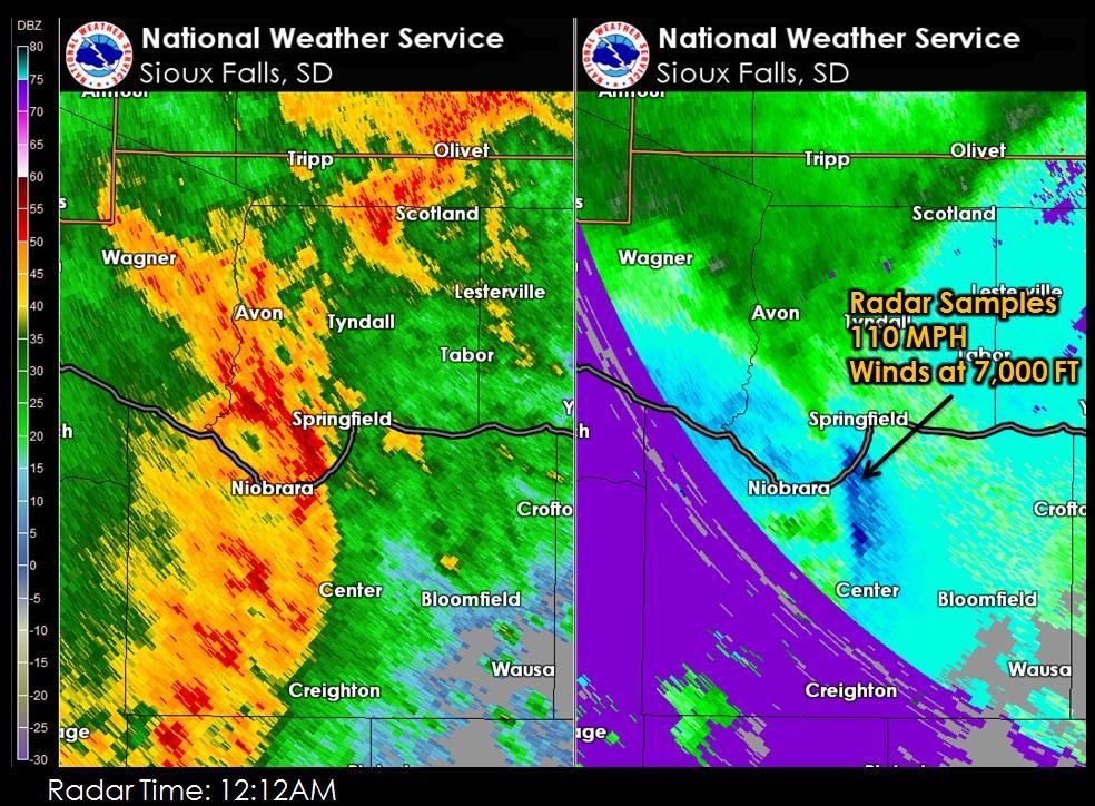
Public Information Statement
National Weather Service Sioux Falls SD
1100 AM CDT MON SEP 5 2016

...EARLY MORNING THUNDERSTORM WIND DAMAGE ON LABOR DAY...

A LARGE SQUALL LINE PRODUCED SEVERE WEATHER AS IT TRACKED EAST
ACROSS SOUTHWEST SOUTH DAKOTA AND NORTHEAST NEBRASKA LATE SUNDAY
NIGHT INTO EARLY MONDAY MORNING. THE GREATEST DAMAGE WAS REPORTED
IN SPRINGFIELD SOUTH DAKOTA AT AROUND 1215 AM CDT ON MONDAY.

THE NATIONAL WEATHER SERVICE SURVEYED THE DAMAGE IN THE
SPRINGFIELD AREA AND DETERMINED THAT THE CAUSE WAS VERY STRONG
STRAIGHT LINE WINDS. THESE WINDS WERE DETERMINED TO BE BETWEEN
100 AND 110 MPH.

THE GREATEST DAMAGE WAS FOUND ON THE SOUTH SIDE OF
SPRINGFIELD...IN PARTICULAR WHERE HIGHER TERRAIN IS LOCATED.
MULTIPLE HOMES AND OUTBUILDINGS SUSTAINED DAMAGE TO ROOFS...WALLS
AND SIDING. WIDESPREAD TREE DAMAGE WAS ALSO REPORTED. NO INJURIES
OR FATALITIES WERE REPORTED.
Radar:
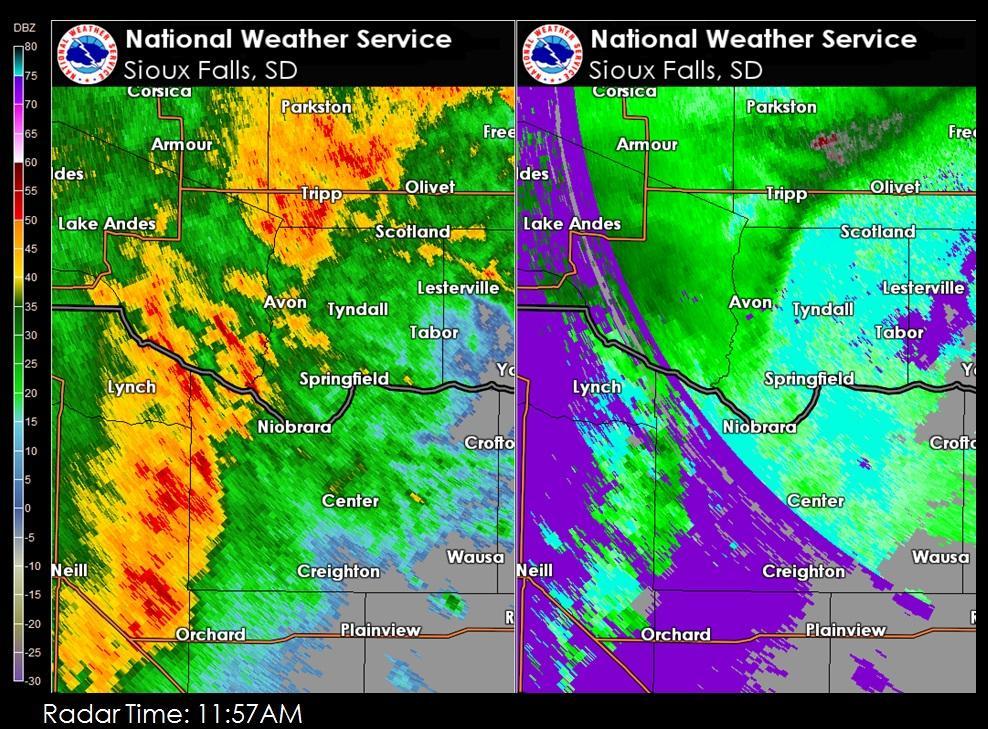
The following loop captures the severe storm as it moves through Springfield, SD and the surrounding Tri-State area.
| Radar Loop of Storm Impacting Springfield, SD and the surrounding Tri-State Area |
 |
 |
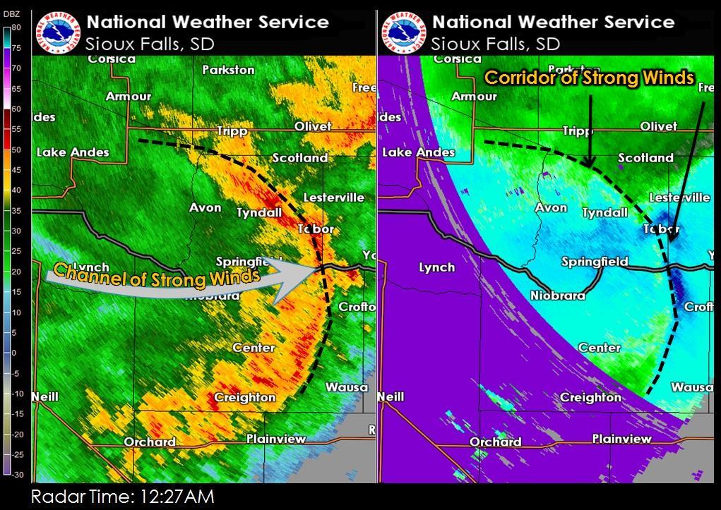 |
| 1157 AM Radar Image - Springfield, SD | 12:12 AM Radar Image - Springfield, SD | 12:27 AM Radar Image - Springfield, SD |
 |
 |
|
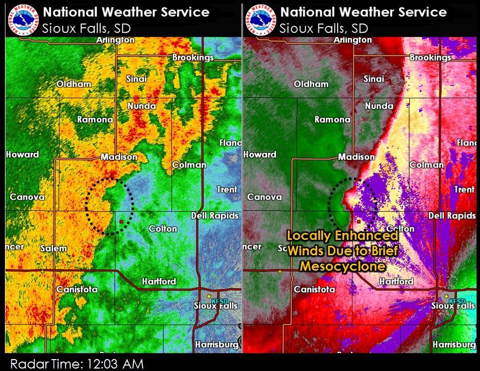
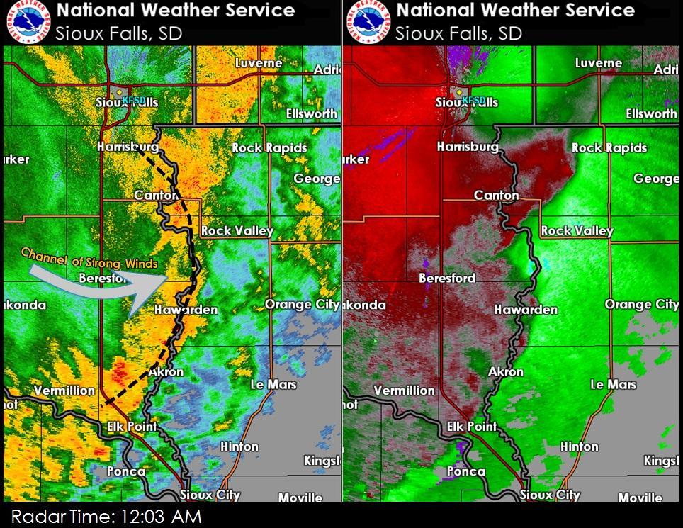
| Radar Near Madison, SD that Produced Damage | Radar Signature Near Hawarden, IA that Produced Damage around 130AM |
Storm Reports
Here's a regional map showing damage reports across the area.
|
| Report Time | County | Location | ST | Event Type | Mag. | Source | Remark |
| Mon Sep 05 2016 05:11:00 GMT-0500 (Central Daylight Time) | Minnehaha | 7 W Colton | SD | TSTM WND DMG | 0 | public | couple of 6 inch diameter tree limbs down. |
| Mon Sep 05 2016 05:15:00 GMT-0500 (Central Daylight Time) | Bon Homme | Springfield | SD | TSTM WND DMG | 0 | emergency mngr | trees down and some property damage. extent of damage unknown at this time. report time based on radar. |
| Mon Sep 05 2016 05:45:00 GMT-0500 (Central Daylight Time) | Yankton | 2 NNE Yankton | SD | TSTM WND GST | 61 | awos | . |
| Mon Sep 05 2016 05:51:00 GMT-0500 (Central Daylight Time) | Turner | Irene | SD | TSTM WND DMG | 0 | nws employee | widespread tree damage. time estimated based on radar. |
| Mon Sep 05 2016 06:25:00 GMT-0500 (Central Daylight Time) | Sioux | Hawarden | IA | TSTM WND GST | 50 | trained spotter | also 1/2 inch diameter hail and heavy rain. |
| Mon Sep 05 2016 06:32:00 GMT-0500 (Central Daylight Time) | Sioux | 5 N Ireton | IA | TSTM WND DMG | 0 | trained spotter | 4 inch in diameter tree limb sheared off mature tree. |
| Mon Sep 05 2016 07:19:00 GMT-0500 (Central Daylight Time) | Cottonwood | 3 N Windom | MN | TSTM WND GST | 62 | awos | . |
 |
Media use of NWS Web News Stories is encouraged! Please acknowledge the NWS as the source of any news information accessed from this site. |
|


 Weather Story
 Weather Map
 Local Radar