Overview
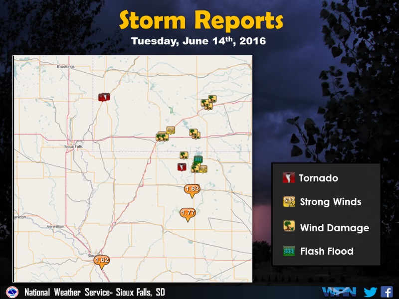
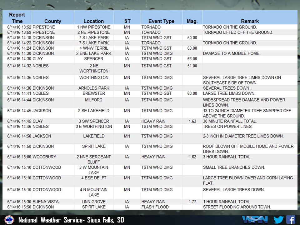
A line of severe thunderstorms developed late this morning and moved across parts of southwest Minnesota and northwest Iowa through the afternoon hours. There were 2 confirmed tornado touchdowns and also widespread wind damage as the line of storms moved northeastward. The damage was caused by winds of 60 to 70 mph. Heavy rain also brought flash flooding to portions of northwestern Iowa.
Tornadoes:
|
Tornado #1 - Pipestone, Minnesota
Track Map 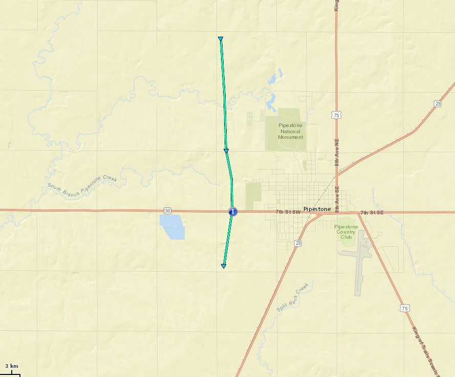
|
||||||||||||||||
|
||||||||||||||||
|
Tornado #2- 7 miles south of Lake Park, Iowa
Track Map 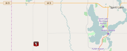 |
||||||||||||||||
|
||||||||||||||||
Track Map
The Enhanced Fujita (EF) Scale classifies tornadoes into the following categories:
| EF0 Weak 65-85 mph |
EF1 Moderate 86-110 mph |
EF2 Significant 111-135 mph |
EF3 Severe 136-165 mph |
EF4 Extreme 166-200 mph |
EF5 Catastrophic 200+ mph |
 |
|||||
Wind:
A line of severe thunderstorms moved across southwestern Minnesota and northwestern Iowa. These storms did tree damage as well as some damage to buildings around Worthington, Lakefield, and Mountain Grove in southwestern Minnesota and across Dickinson County in northwestern Iowa. A wind gust of 63 mph was recorded at Spencer, Iowa at 2:30 PM CDT
Wind
Here are photos of wind damage across Dickinson County, Iowa.
 |
 |
|
Tree damage in Arnolds Park, Iowa. Photo taken by Kirt Carstens. |
Tree damage in Arnold's Park, Iowa. |
 |
 |
| Trees across the road in Dickinson County, Iowa | Trees across another road in Dickinson County, Iowa |
 |
 |
| Damage to a structure in Dickinson County, Iowa | Tree uprooted onto home in Dickinson County, Iowa |
Radar:
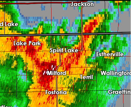
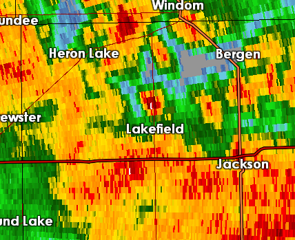
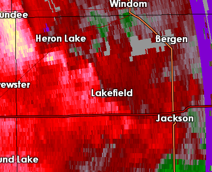
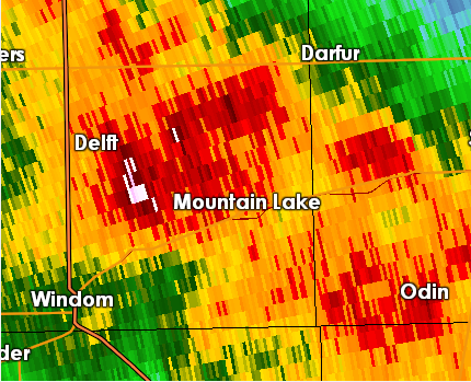
Radar images of severe winds over portions of southwestern Minnesota and northwestern Iowa.
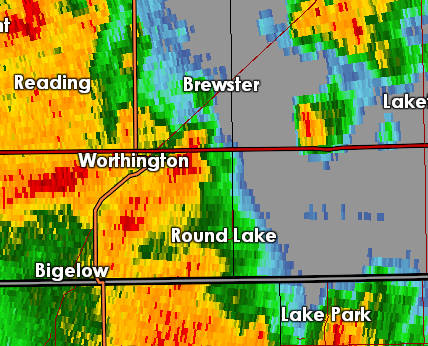 |
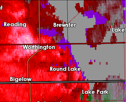 |
 |
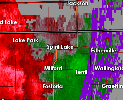 |
| Radar reflectivity image as damaging winds approach Worthington, Minnesota around 2:27 PM CDT. | Radar velocity image as damaging winds approaching Worthington, Minnesota around 2:27 PM CDT. | Radar reflectivity image as damaging winds approach Spirit Lake Iowa around 2:32 PM CDT. | Radar velocity image as damaging winds approaching Spirit Lake, Iowa around 2:32 PM CDT. |
 |
 |
 |
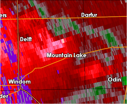 |
| Radar reflectivity image as damaging winds approach Lakefield, Minnesota around 2:46 PM CDT. | Radar velocity image as damaging winds approaching Lakefield, Minnesota around 2:46 PM CDT. | Radar reflectivity image as damaging winds move north of Mountain Lake, Minnesota around 3:18 PM CDT. | Radar velocity image as damaging winds move north of Mountain Lake, Minnesota around 3:18 PM CDT. |
Storm Reports
Rain Reports
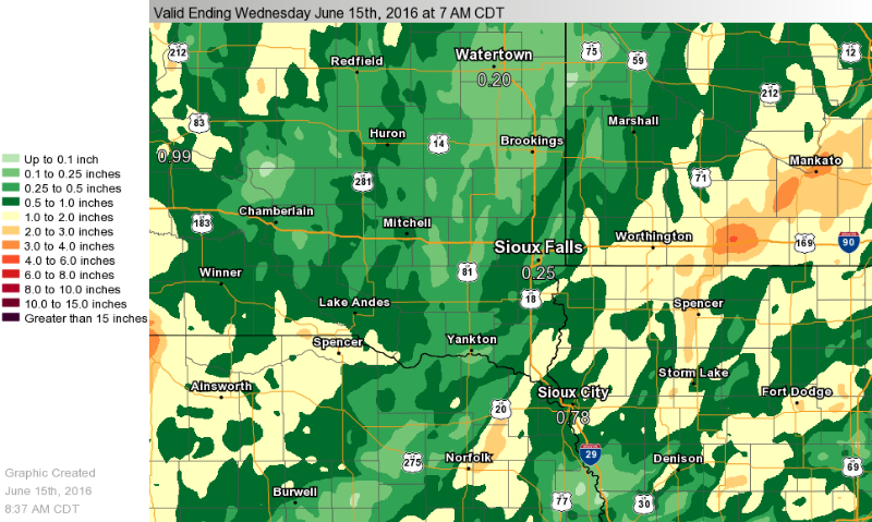
The heaviest rainfall in the last 24 hours fell over portions of northwestern Iowa and southwestern Minnesota where 2 to 4 inches of rain was observed. Portions of south central South Dakota as well as the Big Sioux River Valley north of Sioux Falls had from one-half to 1 inch of rainfall.
 |
Media use of NWS Web News Stories is encouraged! Please acknowledge the NWS as the source of any news information accessed from this site. |
 |