Sioux Falls, SD
Weather Forecast Office
Overview
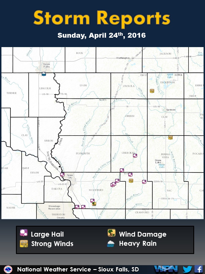
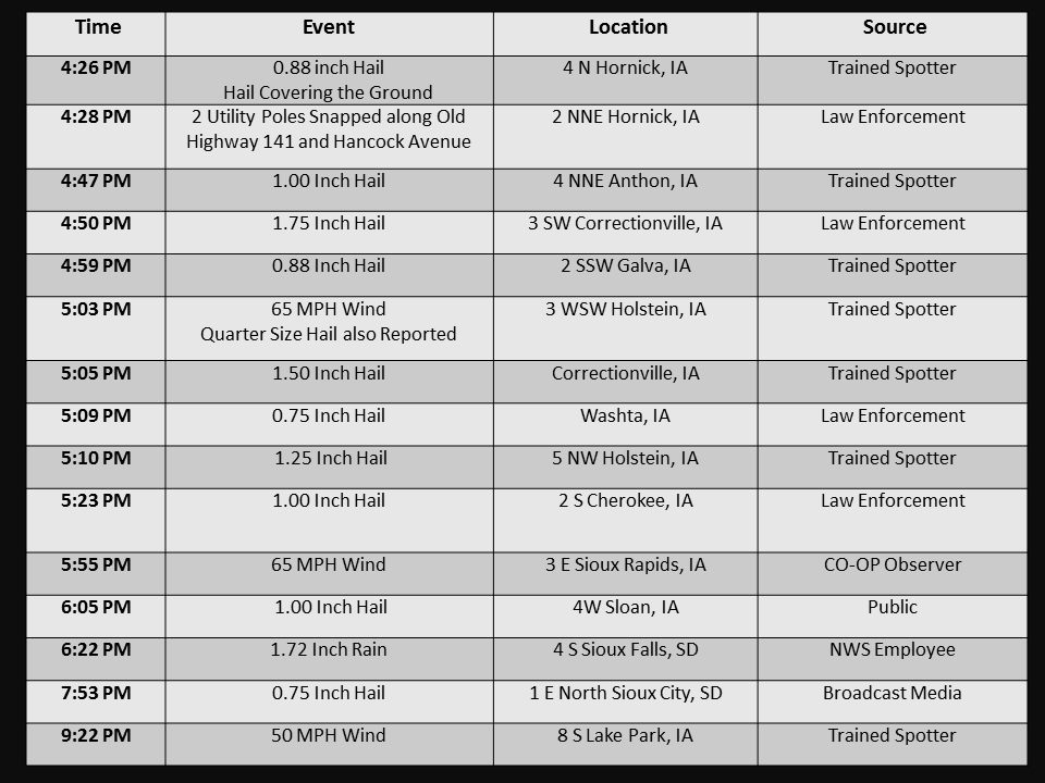
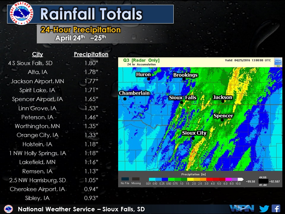
Thunderstorms developed across eastern Nebraska and western Iowa during the afternoon of April 24, 2016. These storms brought large hail and damaging winds to portions of northwestern Iowa. The largest hail reported was golf ball size near Correctionville, Iowa. Locally heavy rain also fell in part of southeastern South Dakota, southwestern Minnesota and northwestern Iowa. Around Sioux Falls, South Dakota, almost 2 inches of rain fell in less than 2 hours.Radar:
Loop of radar from 354 pm - 627 pm April 24, 2016
Storm Reports
Rain Reports
 |
Media use of NWS Web News Stories is encouraged! Please acknowledge the NWS as the source of any news information accessed from this site. |
|
Popular Pages
Past Weather Events
Regional Weather Roundup
Daily Temp/Precip
Hazardous Weather
Local Climate Archives
Climate Graphs and Data
Seasonal
EvapoTranspiration
Fire Weather
Grassland Fire Danger
Flooding (River)
Summer Weather
Travel Forecasts
Winter Weather
Winter Preparedness
Forecast Snowfall Graphic
Winter Temp Climatology
US Dept of Commerce
National Oceanic and Atmospheric Administration
National Weather Service
Sioux Falls, SD
26 Weather Lane
Sioux Falls, SD 57104-0198
605-330-4247
Comments? Questions? Please Contact Us.


 Weather Story
 Weather Map
 Local Radar