Sioux Falls, SD
Weather Forecast Office
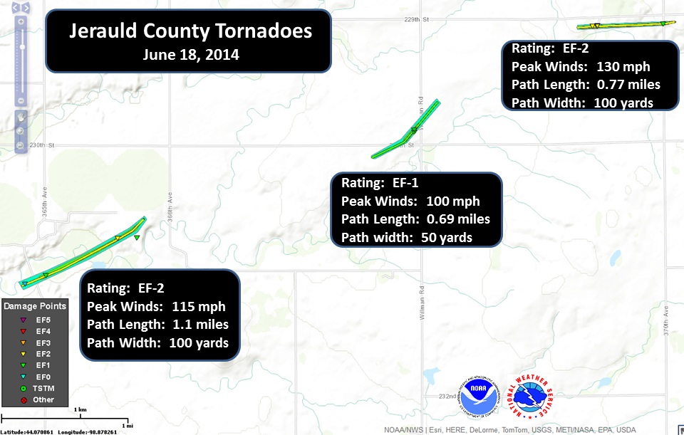
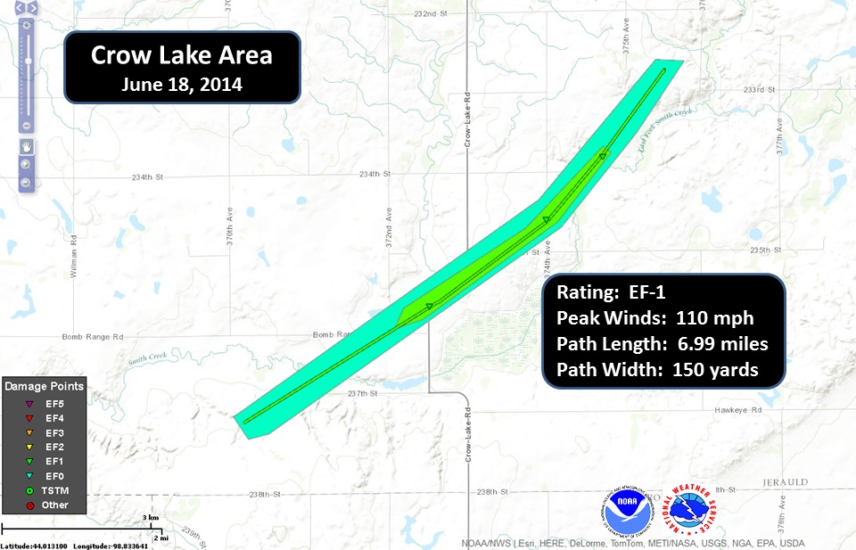
Multiple tornadoes occurred in Jerauld county during the evening of June 18, 2014 as supercell thunderstorms moved across the county. In many of these cases, the tornadoes that developed thankfully moved over open country thereby affecting the Fujita Scale rating. However, some of the tornadoes impacted farms resulting in a loss of outbuildings and livestock or poultry. In one location, the Spring Valley Colony, lost at least 10,000 turkeys as the tornado directly impacted one of their barns. The strongest tornado of these other tornadoes occurred west/southwest of Wessington Springs, SD where winds reached 130 mph as it moved through the farmstead. In all cases, tornado warnings were issued well in advance of the tornadoes allowing residents to seek shelter beforehand!
The Enhanced Fujita scale classifies tornadoes into the following categories.
EF0...Weak......65 to 85 mph
EF1...Weak......86 to 110 mph
EF2...Strong....111 to 135 mph
EF3...Strong....136 to 165 mph
EF4...Violent...166 to 200 mph
EF5...Violent...>200 mph
Popular Pages
Past Weather Events
Regional Weather Roundup
Daily Temp/Precip
Hazardous Weather
Local Climate Archives
Climate Graphs and Data
Seasonal
EvapoTranspiration
Fire Weather
Grassland Fire Danger
Flooding (River)
Summer Weather
Travel Forecasts
Winter Weather
Winter Preparedness
Forecast Snowfall Graphic
Winter Temp Climatology
US Dept of Commerce
National Oceanic and Atmospheric Administration
National Weather Service
Sioux Falls, SD
26 Weather Lane
Sioux Falls, SD 57104-0198
605-330-4247
Comments? Questions? Please Contact Us.


 Weather Story
 Weather Map
 Local Radar