Shortly before 1 am Friday morning, Chamberlain experienced a fairly rare weather event known as a convective heat burst. A heat burst occurs when warm air from 10,000 to 20,000 feet above the surface is forced to the ground. Typically when air comes down to the surface with thunderstorms, it is much colder than the air at the surface. However, especially during the late night and morning, very warm air can be forced to the surface if the air reaches the surface without rainfall occurring. When this happens, the temperature will rise as much as 30 degrees, and the dew point will drop by 20 to 30 degrees. Heat bursts are also accompanied by strong to damaging winds. However, unlike many cases with damaging thunderstorm winds, little to no rain will fall when the heat burst occurs. This is because if it were to rain, the air would rapidly cool and moisten due to evaporation.
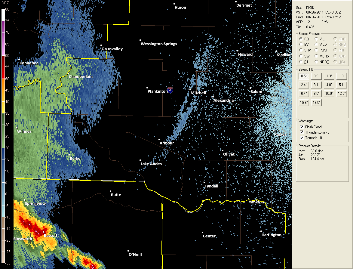
In this case, the main area of showers and thunderstorms which had occurred earlier in the evening across southwestern South Dakota were in the process of dissipating, with the main precipitation occurring well to the south in Nebraska. As the anvil of the dissipating storms moved across the area (the fuzzy green and blue returns around Chamberlain in the image below), the partial evaporative effects started the descent of air from the mid levels.

Figure 1. Radar image at 1249 am. Anvil area moving across Chamberlain.
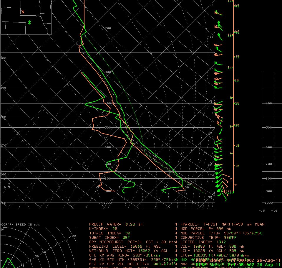
However, when precipitation was exhausted, there was no more insufficient cooling to offset the warming created by compressional warming as the air sinks. Therefore, the already warm air aloft was further warmed as it descended to the surface. The airmass in place aloft was quite warm and dry. With upper air stations across the central and eastern U.S. taking special observations in support of Hurricane Irene operations, we had a unique opportunity to get a real time picture of the actual thermal structure of the atmosphere at this time.

Figure 2. Soundings taken at 06Z 26 August 2011 for Rapid City, SD (orange) and North Platte, NE (green). Note the abunance of warm and dry air below cloud base.
Chamberlain experienced the impact of the heat burst shortly before 1 am CDT. Below (Fig. 3) is a trace of the temperature, dewpoint and wind from the one-minute data taken by the K9V9 Automated Surface Observing System (ASOS) at the Chamberlain airport. The heat burst is associated with a rapid 15 degree rise in temperature, 13 degree drop in dewpoint, and winds gusting to around 40 mph. Prior to the onset of strongest winds, there was a sharp drop in pressure, which reversed to a quick rise before resuming the rate of change of slow fall before the heat burst.
Figure 3. Plot of one-minute ASOS data for temperature, dewpoint and wind speed from Chamberlain, SD (K9V9).
Figure 4. Plot of station one-minute pressure data for Chamberlain, SD (K9V9). The asterisk in the image represents the time of strongest winds.