Sioux Falls, SD
Weather Forecast Office
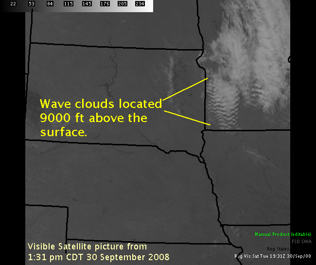
During the afternoon of Tuesday, September 30 numerous wave clouds formed over portions of southwest Minnesota. The visible satellite picture below shows the extent of the wave clouds around 2:30 pm CDT.
Below is a depiction of what causes these clouds to form.
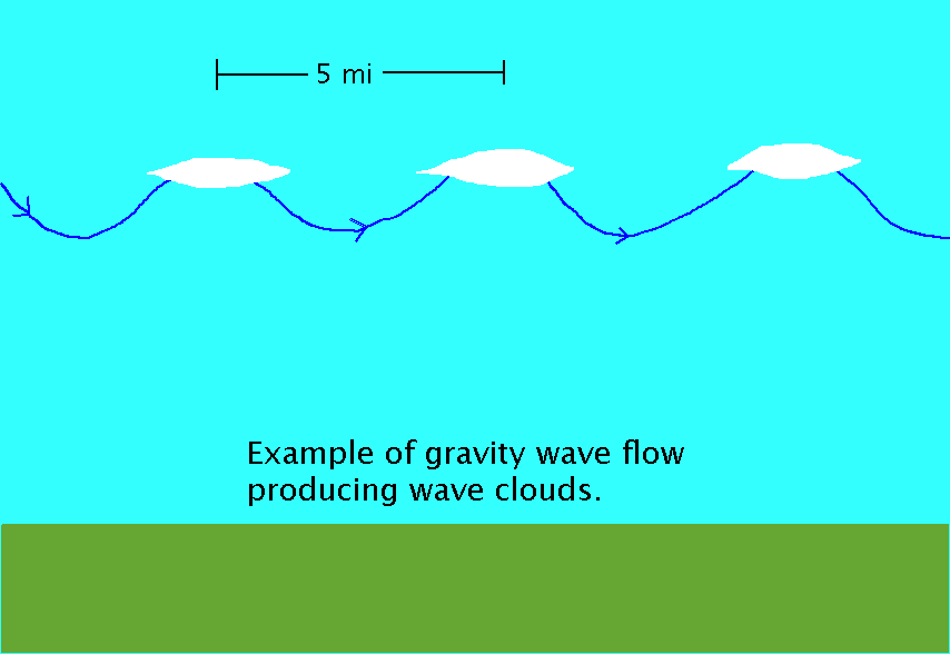
What happens is an atmospheric phenomenom called gravity waves, develop in the atmosphere. These cause very narrow areas of ascent and descent to develop - similar to a wave on a lake. Because the atmosphere is near saturation, as the air rises, clouds form. The clouds will be thin at the edges and then thicken at the top of the wave. As the air again descends, the clouds will thin and then dissappear. A new cloud will then form near the crest of the next wave. For the wave clouds that formed today, the distance between wave crests is approximately 5 miles.
While these clouds are common near mountains, where air is forced to ascend by the mountains, it is more rare to see wave clouds in the plains. They only occur when gravity waves are "trapped" below an atmospheric inversion within a layer that is near saturation.
Popular Pages
Past Weather Events
Regional Weather Roundup
Daily Temp/Precip
Hazardous Weather
Local Climate Archives
Climate Graphs and Data
Seasonal
EvapoTranspiration
Fire Weather
Grassland Fire Danger
Flooding (River)
Summer Weather
Travel Forecasts
Winter Weather
Winter Preparedness
Forecast Snowfall Graphic
Winter Temp Climatology
US Dept of Commerce
National Oceanic and Atmospheric Administration
National Weather Service
Sioux Falls, SD
26 Weather Lane
Sioux Falls, SD 57104-0198
605-330-4247
Comments? Questions? Please Contact Us.


 Weather Story
 Weather Map
 Local Radar