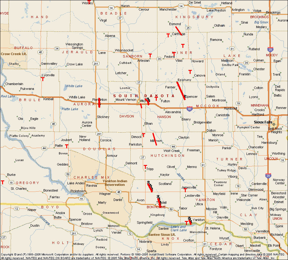
The National Weather Service in Sioux Falls has found evidence that 25 tornadoes touched down in southeast South Dakota between 4 PM and 10 PM CDT on May 5, 2007. The tornado paths are plotted on the map below. You may click on the map for a larger view of the tornado tracks. Below the map is a list of all the tornadoes that occurred, time of occurrence, and the Enhanced Fujita rating. A detailed survey was done on six of the tornadoes. Click on the link for that tornado to see more detail.
In addition to the above tornadoes, numerous locations saw large hail, damaging winds, and heavy rain/flash flooding on May 5, 2007. The complete summary of preliminary storm reports from this event is also available.


 Weather Story
 Weather Map
 Local Radar