Severe Weather and Flash Flooding – 16 June 2006
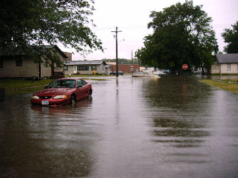 |
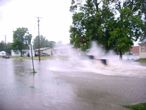
| Street flooding in S. Sioux City, NE. Photo provided by KMEG viewers. |
Event Summary:
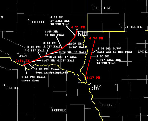
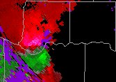
On 16 June 2006, severe thunderstorms moved across southeast South Dakota and northwest Iowa, leaving two swaths of damage in its wake (Fig 1). Shortly before 3:00 PM
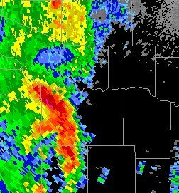
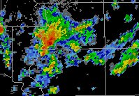
A well-defined supercell (Fig. 3) entered extreme southeastern Charles Mix and southern Bon Homme counties at 2:51 PM
As the line progressed through northwest
 |
|
Figure 1. Severe thunderstorm tracks across southeast South Dakota and northwest Iowa. |
 |
|
Figure 2. Radar reflectivity at 2:43 PM CDT showing severe storms leaving north central Nebraska. |
 |
 |
|
Figure 3. Radar reflectivity (L) and storm |
relative velocity at 2:51 PM CDT. |
 |
|
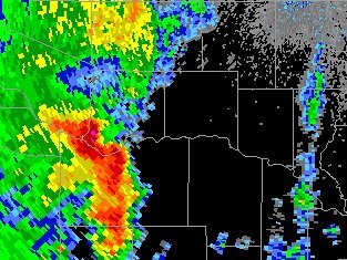
Figure 4. Radar reflectivity of the second severe cell in Sioux County, IA at 3:55 PM CDT. |
 |
|
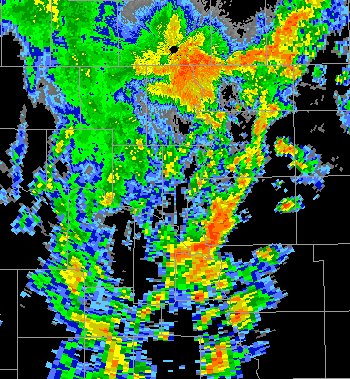
Figure 5. Radar reflectivity from 4:46 PM CDT showing the merger of two severe cells and the multicell line. |
 |
|
Figure 6. Radar estimated storm total overlayed with observed precipitation totals for June 16. |
 |
 |
|
Street flooding in S. Sioux City, NE. |
Photos provided by KMEG viewers. |


 Weather Story
 Weather Map
 Local Radar