
Tropical Depression Two is expected to gradually strengthen and could bring tropical storm conditions to the Florida Panhandle beginning late Monday. Areas of flash flooding will be possible through Thursday along the eastern and central Gulf Coast. Severe thunderstorms will develop and move along a cold front crossing the Upper Midwest Monday, and through the Ohio Valley/Mid-Atlantic on Tuesday. Read More >
El Paso, TX
Weather Forecast Office
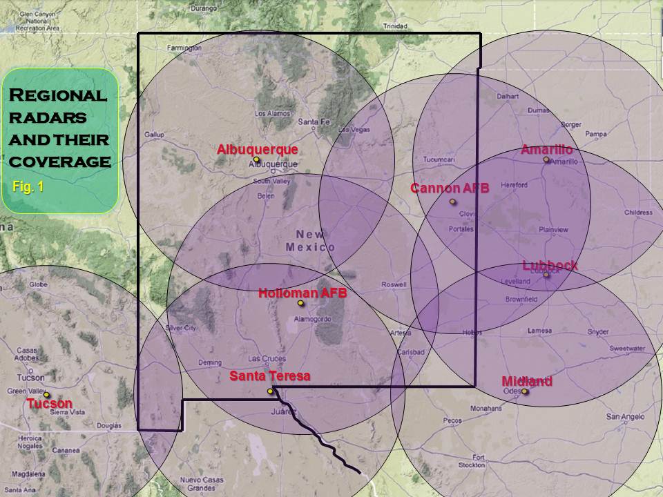
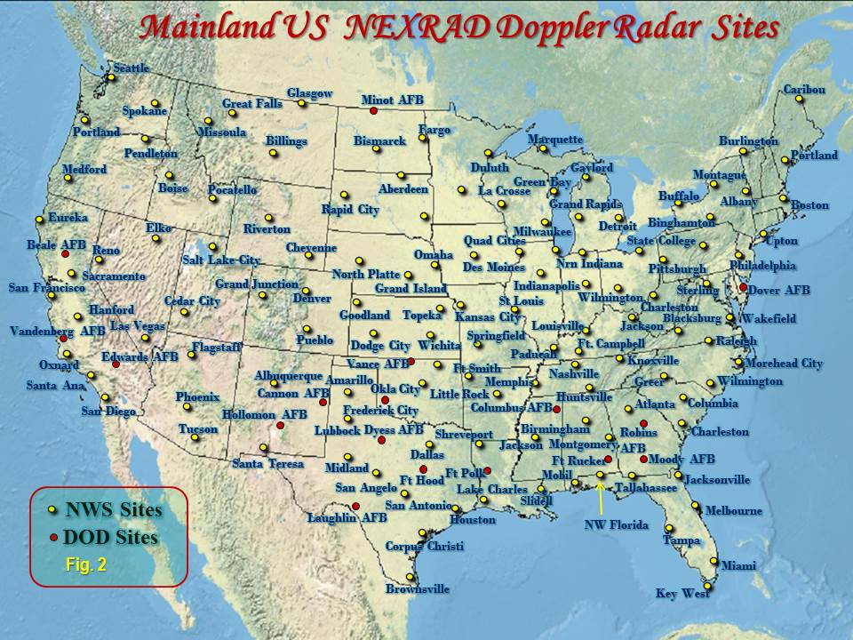
Fig. 1 depicts our regional NEXRAD radars and their “theoretical” areas of coverage. In reality, our weather radar coverage is about 80-90 percent of this theoretical coverage, due to beam attenuation and extreme height of the beam at longer distances. Additionally, mountains will block smaller scale areas, such as the Franklin Mountains blocking portions of El Paso and Hudspeth Counties. Larger areas void of data include the area north and west of Silver City and much of southern and eastern Hudspeth County.
Fig. 2 shows the NEXRAD radar network of the continental U.S., including NWS and Department of Defense sites.
Current Hazards
Outlooks
Hazardous Weather Outlook
Local Storm Reports
Public Information Statement
National
Heat Risk
Current Conditions
Satellite
Drought Monitor
Holloman AFB Radar
Regional highs/lows/precip
El Paso Radar
Rivers and Lakes
Local Observations
Forecasts
Forecast Discussion
Graphical Forecast
Hourly Forecast
Activity Planner
Fire Weather
Aviation Weather
Climate
El Paso Climate Data
Monthly Weather Digest
Climate Graphs
Monthly Climate Data
Climate Prediction
Storm Events Database
Santa Teresa Climate Data
US Dept of Commerce
National Oceanic and Atmospheric Administration
National Weather Service
El Paso, TX
7955 Airport Rd
Santa Teresa, NM 88008
(575) 589-4088
Comments? Questions? Please Contact Us.

