Tropical Depression in the Gulf; Severe Thunderstorms Monday
Tropical Depression Two is expected to gradually strengthen and could bring tropical storm conditions to the Florida Panhandle beginning late Monday. Areas of flash flooding will be possible through Thursday along the eastern and central Gulf Coast. Severe thunderstorms will develop and move along a cold front crossing the Upper Midwest Monday, and through the Ohio Valley/Mid-Atlantic on Tuesday.
Read More >
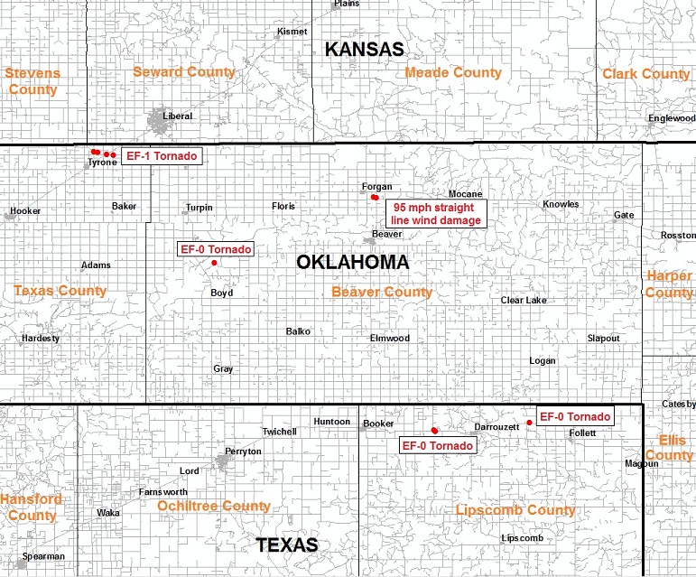
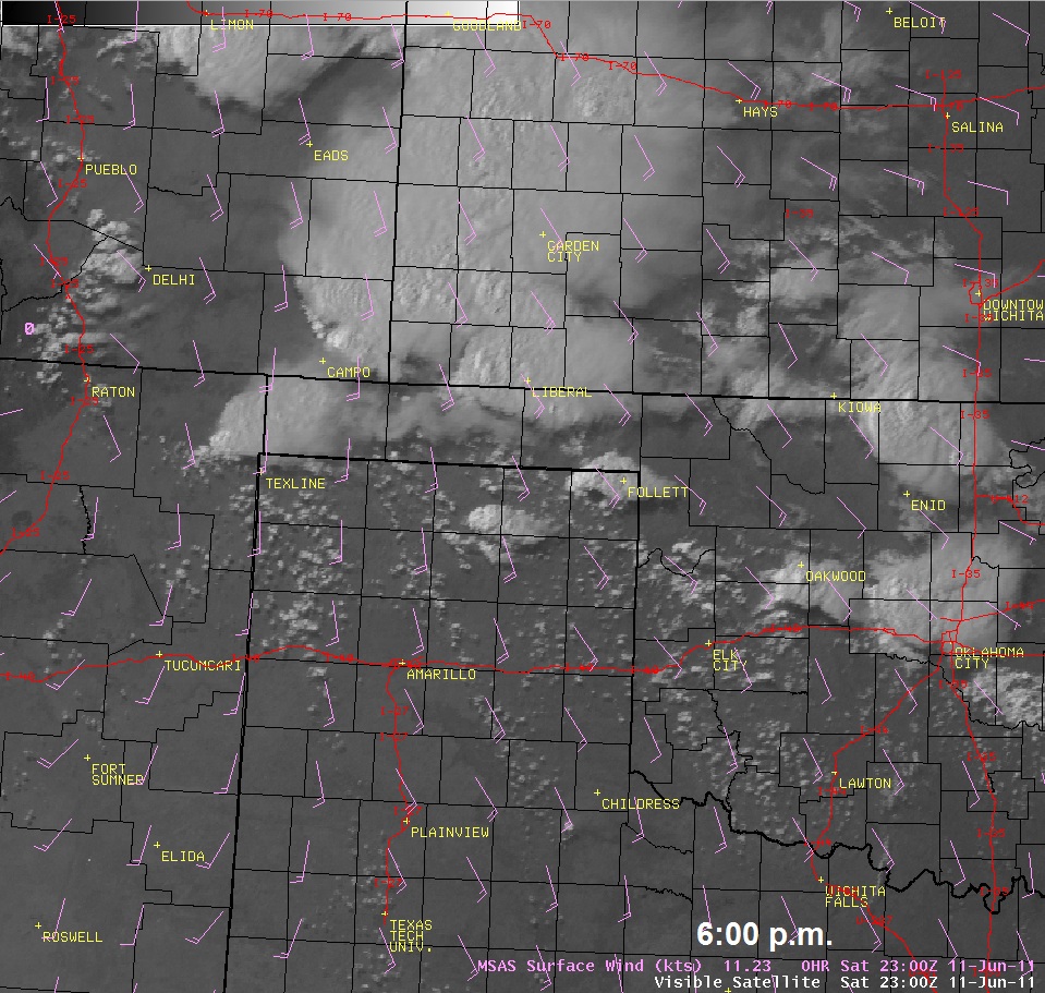
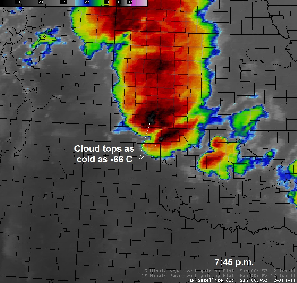
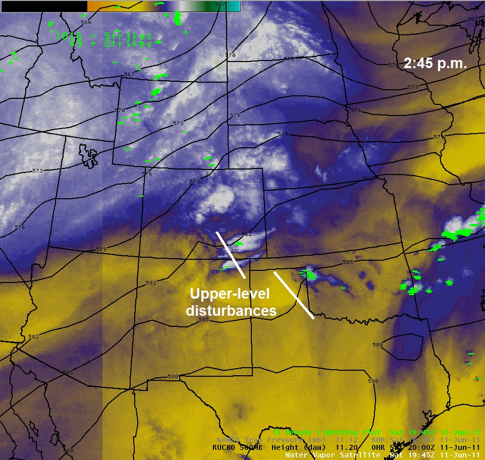
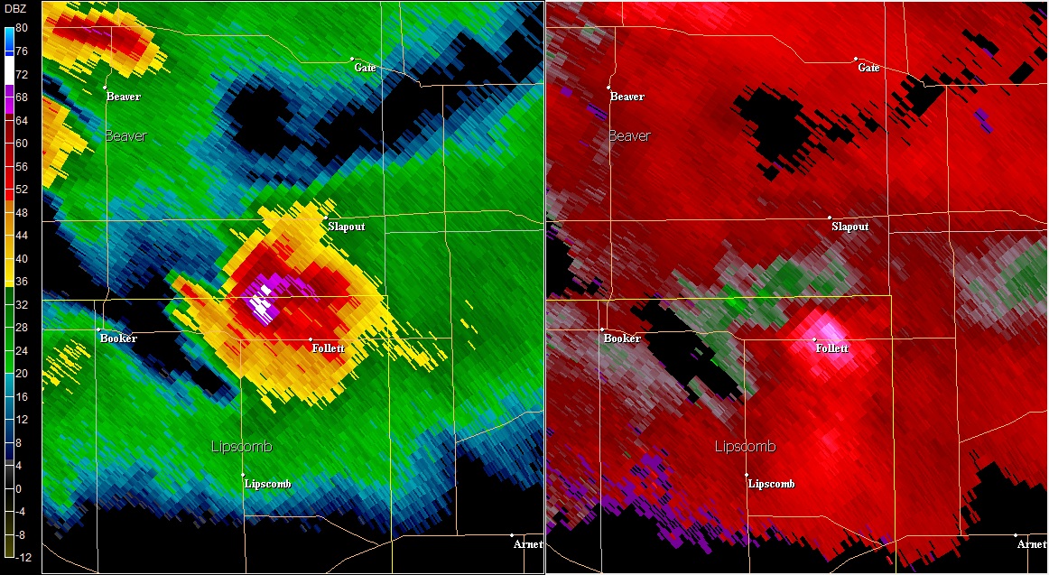
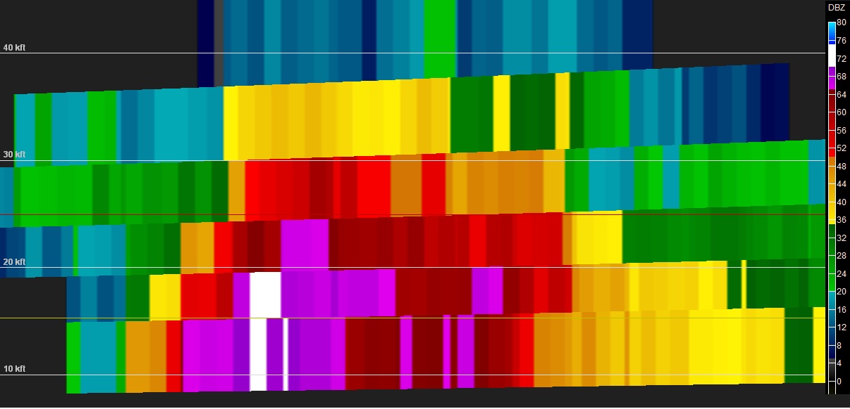
Severe weather has been a stranger to the Panhandles so far this spring. In fact, before June 11, this year marked the sixth latest date without a report of a tornado since 1950. However, that changed as a diffuse retreating warm front, a series of weak upper-level disturbances, and a moist surface upslope flow conspired to ignite thunderstorms across the Oklahoma Panhandle and the northeastern Texas Panhandle during the late afternoon hours of June 11. A favorable combination of instability and wind shear allowed severe supercell thunderstorms to develop quickly. These supercells were prolific hail producers, even dropping softball size hail 5 miles southwest of Beaver and 8 miles southwest of Darrouzett. The tornado drought ended as well. A storm survey crew from the National Weather Service in Amarillo confirmed that four tornadoes occurred in the area, including an EF-1 tornado near Tyrone, OK, an EF-0 just north of Boyd, OK, an EF-0 tornado near Darrouzett, TX, and another EF-0 tornado near Follett, TX. It was determined that very strong straight line winds up to 95 mph were responsible for overturning irrigation pivots and snapping a power pole near Forgan, OK. We would like to thank everyone that provided invaluable severe weather reports during this event!