
A Nor'easter will create hazardous marine and coastal conditions along the Mid-Atlantic coast through mid-week, with significant coastal flooding and beach erosion possible. Meanwhile, another strong storm system is forecast to bring high winds and heavy precipitation to portions of southern Alaska. Elsewhere, relatively benign weather is expected through the first half of the work week. Read More >
|
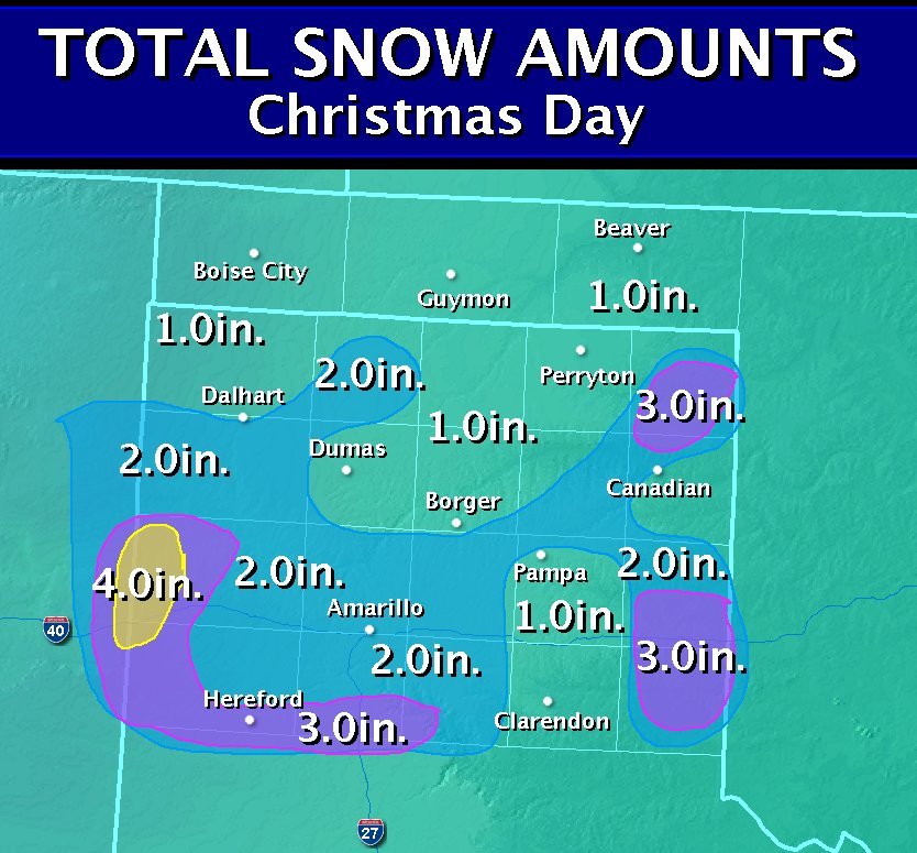
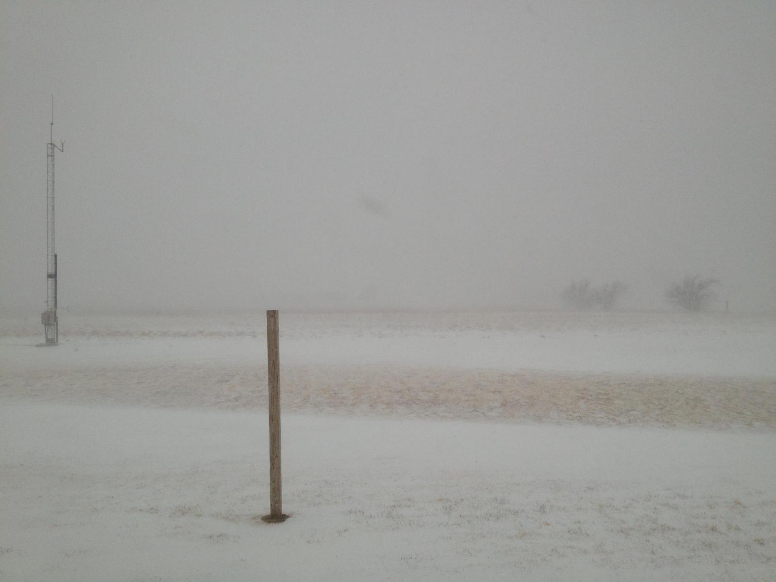
On Christmas Day 2012, a low pressure system moved across the region bringing very cold temperatures and the first snow of the season to much of the Panhandles. This happened to be the second Christmas in a row where Amarillo recorded snow with 4.2 inches back in 2011 and 2.1 inches this year. This is only the 2nd time that Amarillo has reported snow on back-to-back Christmas Days, with the last time being in 1894 and 1895. Most of the area reported 1-2 inches of snow, but isolated areas received 3 or more inches especially near the Texas-New Mexico border. Below is a map of snowfall totals from across the Texas and Oklahoma Panhandles. In addition to the snow, high winds caused blowing snow reducing visibilities less than 1/4 mile in places causing significant traffic delays across local highways and interstates. Wind gusts over 40mph were recorded in many areas across the region causing snow drifts to pile up multiple feet high. This same system brought blizzard conditions to Arkansas and tornadoes from Southeast Texas to Eastern Alabama. |
|||||
|
|
|||||
|
North West Amarillo (courtesy Scott Plischke) |
White Out conditions in Amarillo (courtesty of Daniell Raily Browning) |
||||
|
Borger, TX (courtesy of Nanner Boyett Natalie) |
NWS Amarillo Office |
||||
|
Palo Duro Canyon (courtesy of Jennifer Wilkinson) |
.jpg)
Sun Dog seen after the snow had fallen (follow the link for more information and pictures on sun dogs) |
||||


.jpg)
%20Danielle%20Raily%20Browning.jpg)
.jpg)
.jpg)
 Follow us on X
 Follow us on Facebook
 AMA RSS Feed