Tropical Depression Two is expected to gradually strengthen and could bring tropical storm conditions to the Florida Panhandle beginning late Monday. Areas of flash flooding will be possible through Thursday along the eastern and central Gulf Coast. Severe thunderstorms will develop and move along a cold front crossing the Upper Midwest Monday, and through the Ohio Valley/Mid-Atlantic on Tuesday. Read More >
| April 26, 2012 Severe Storms | ||||||||
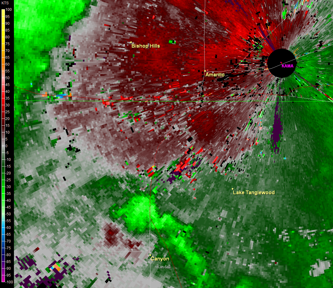
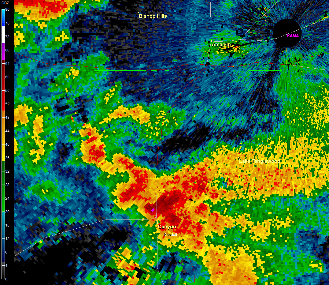
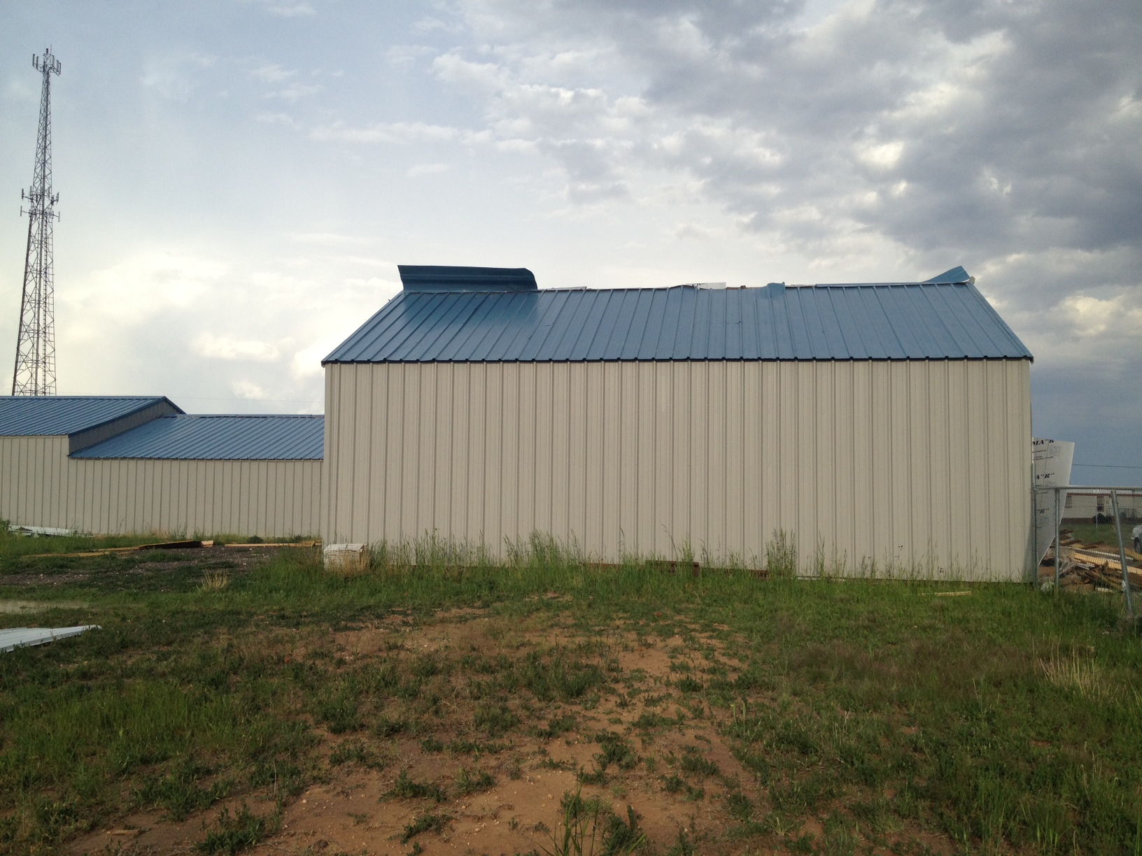
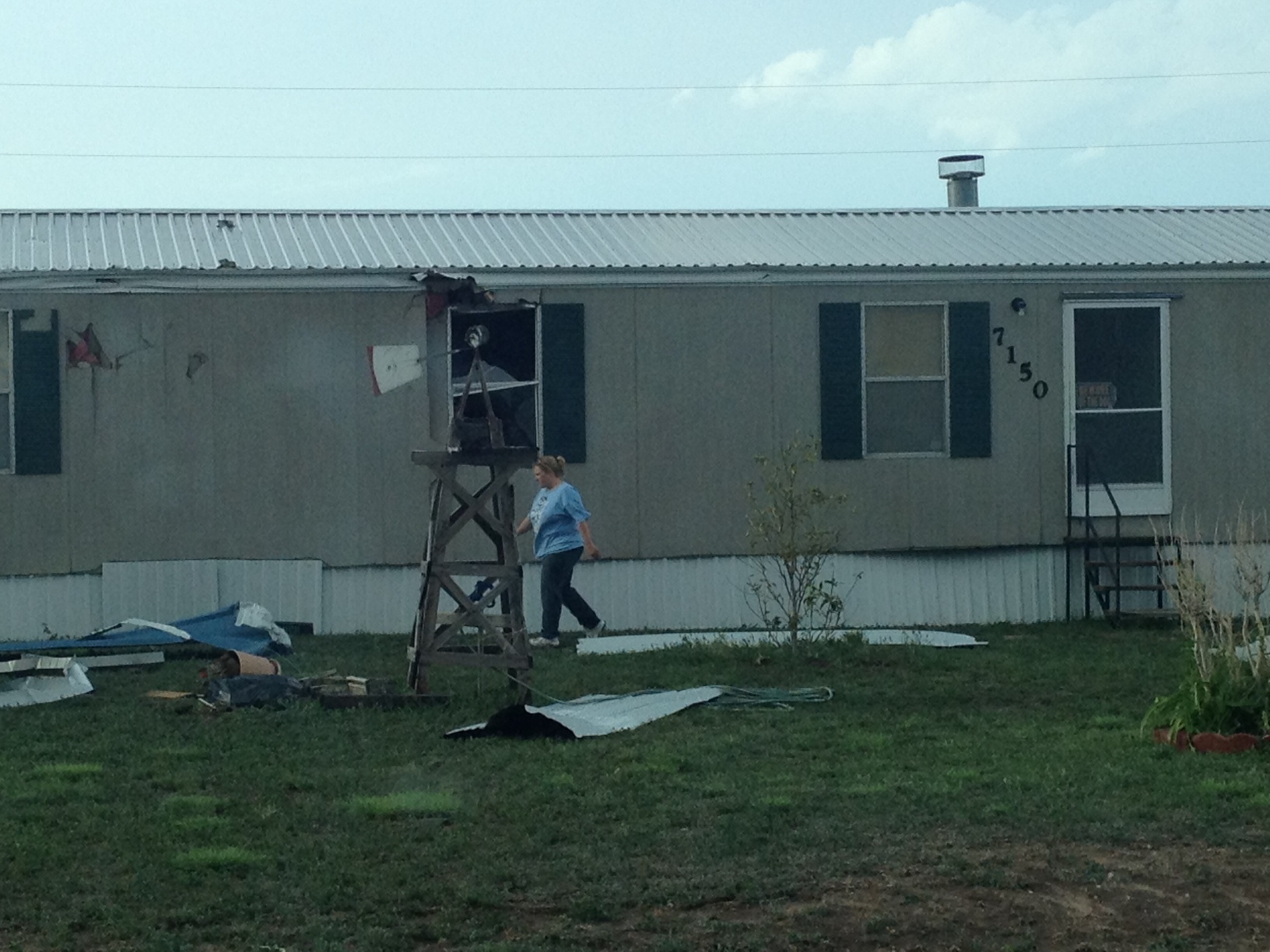
| As a strong upper-level disturbance encountered a moist, unstable air mass across the Texas and Oklahoma Panhandles, severe thunderstorms rapidly developed during the afternoon and evening hours of April 26. Most of the severe weather reports were concentrated around Potter and Randall Counties in Texas, including Amarillo. One severe thunderstorm in particular produced wind damage near Joy Avenue and I-27, approximately 4-5 miles north of Canyon. A storage unit at this location was heavily damaged (images below), and a storm survey estimated straight line wind speeds were likely between 70 and 75 mph. Large hail was also reported with some of the storms, including ping pong ball size (1.50 inches) hail near Washburn, TX and the Lake Tanglewood community in Randall County. In addition, heavy rain resulted in flash flooding issues in Amarillo and once again along Highway 287 between Amarillo and Dumas. | ||||||||
 |
||||||||
| RADAR IMAGES | ||||||||
|
||||||||
| DAMAGE IMAGES | ||||||||
|