
Tropical Depression Two is expected to gradually strengthen and could bring tropical storm conditions to the Florida Panhandle beginning late Monday. Areas of flash flooding will be possible through Thursday along the eastern and central Gulf Coast. Severe thunderstorms will develop and move along a cold front crossing the Upper Midwest Monday, and through the Ohio Valley/Mid-Atlantic on Tuesday. Read More >
| Microburst Impacts Amarillo on April 16 | |||||||||||||||||||||
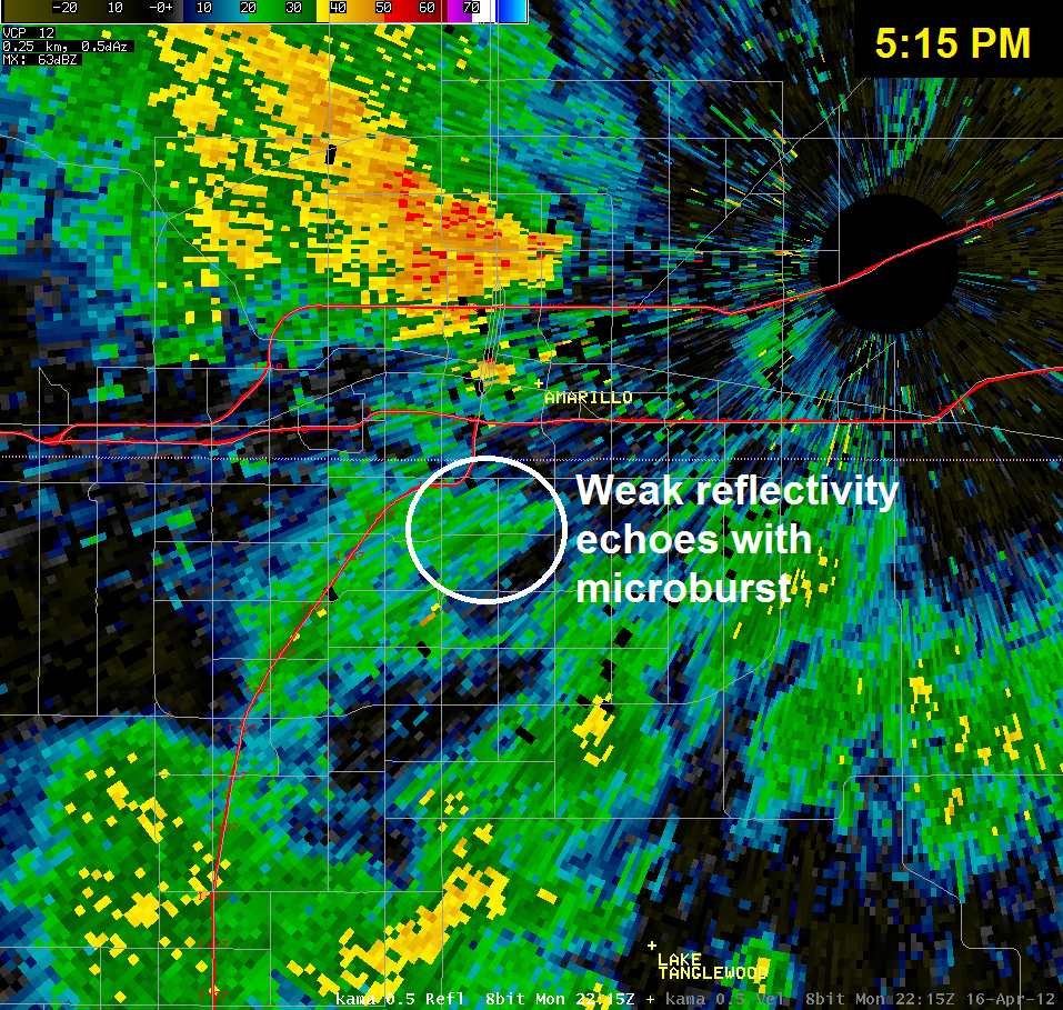
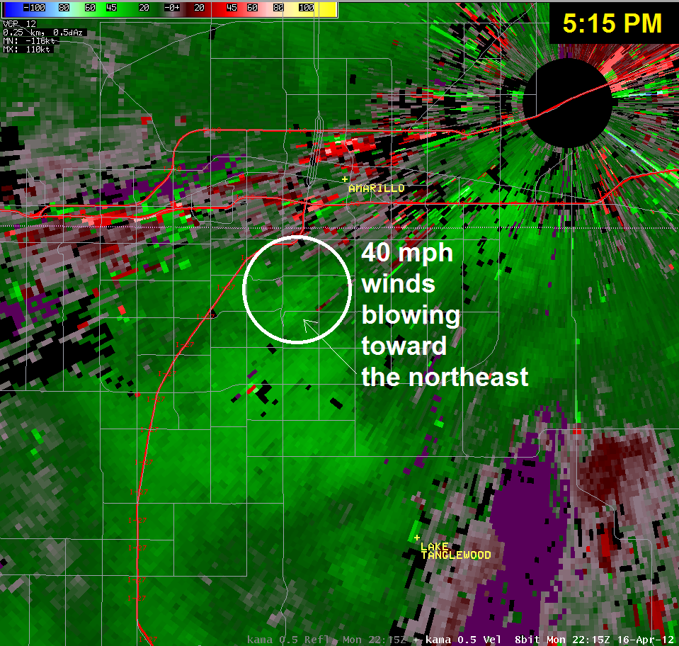
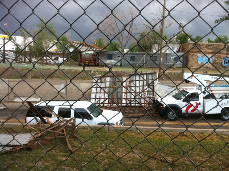
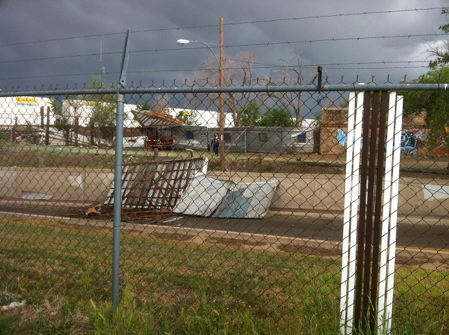
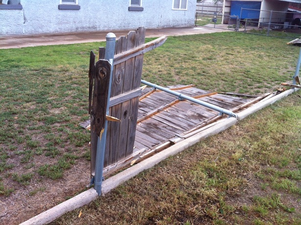
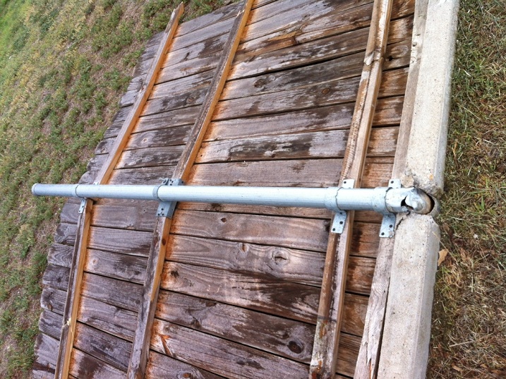
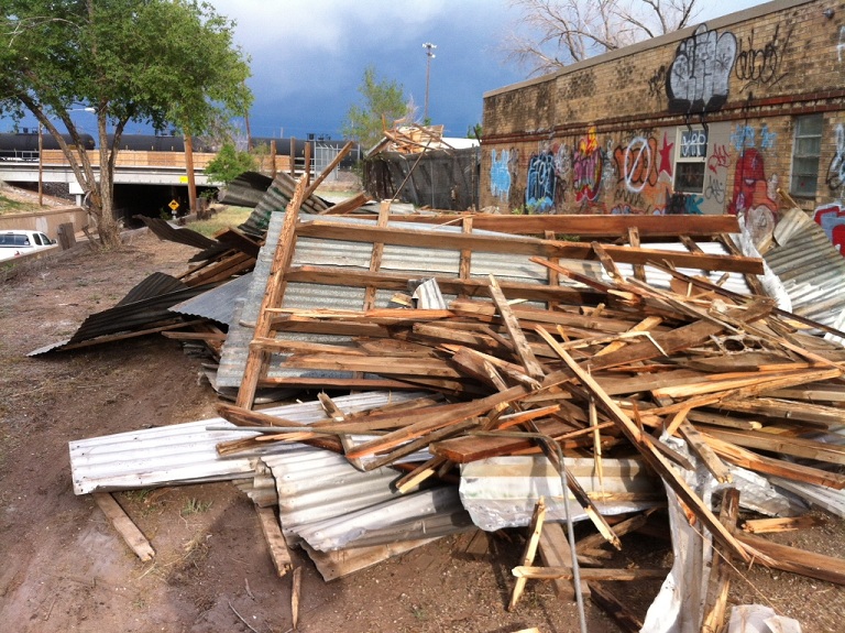
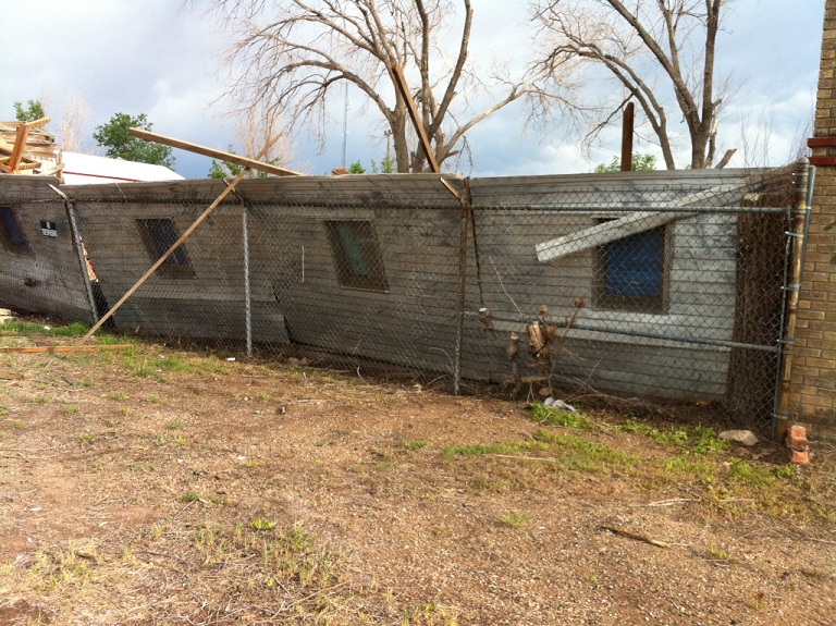
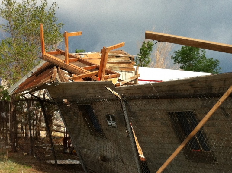
| A preliminary National Weather Service survey determined that a very localized microburst, packing winds between 65 and 70 mph, was responsible for some damage across southeast sections of Amarillo during the late afternoon hours of Monday, April 16. A microburst is a downdraft (sinking air) in a shower or thunderstorm that is less than 2.5 miles in scale. Some microbursts can pose a threat to life and property, but all microbursts pose a significant threat to aviation. Although microbursts are not as widely recognized as tornadoes, they can cause comparable, and in some cases, worse damage than some tornadoes produce. In fact, wind speeds as high as 150 mph are possible in extreme microburst cases. We would like to thank the Amarillo/Potter/Randall Office of Emergency Management for sending two of the damage images below. | |||||||||||||||||||||
| RADAR IMAGES | |||||||||||||||||||||
|
|||||||||||||||||||||
| DAMAGE IMAGES | |||||||||||||||||||||
|


