
Tropical Depression Two is expected to gradually strengthen and could bring tropical storm conditions to the Florida Panhandle beginning late Monday. Areas of flash flooding will be possible through Thursday along the eastern and central Gulf Coast. Severe thunderstorms will develop and move along a cold front crossing the Upper Midwest Monday, and through the Ohio Valley/Mid-Atlantic on Tuesday. Read More >
Overview
|
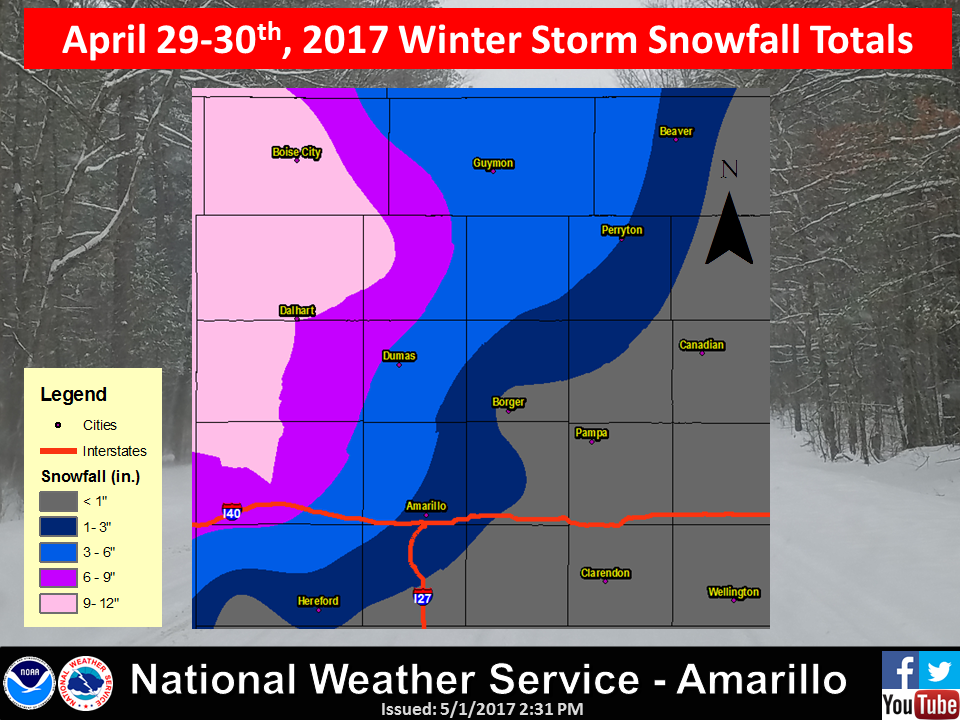
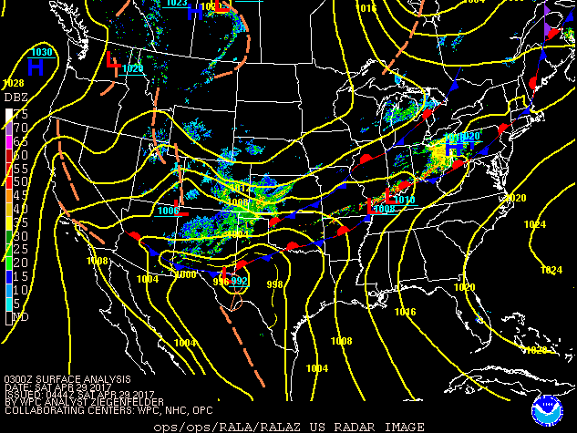
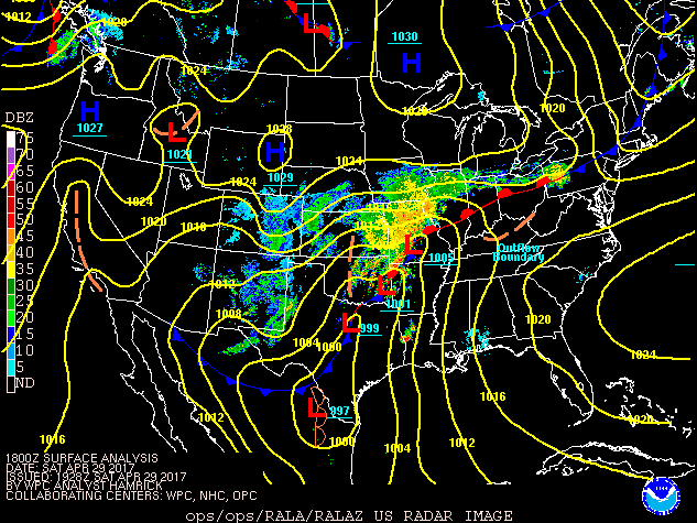
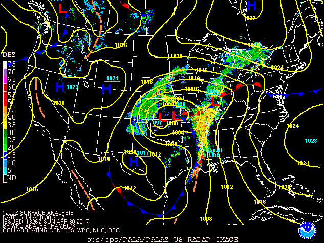
A very strong late season low pressure system moved across the Texas Panhandle on the weekend of April 29-30.
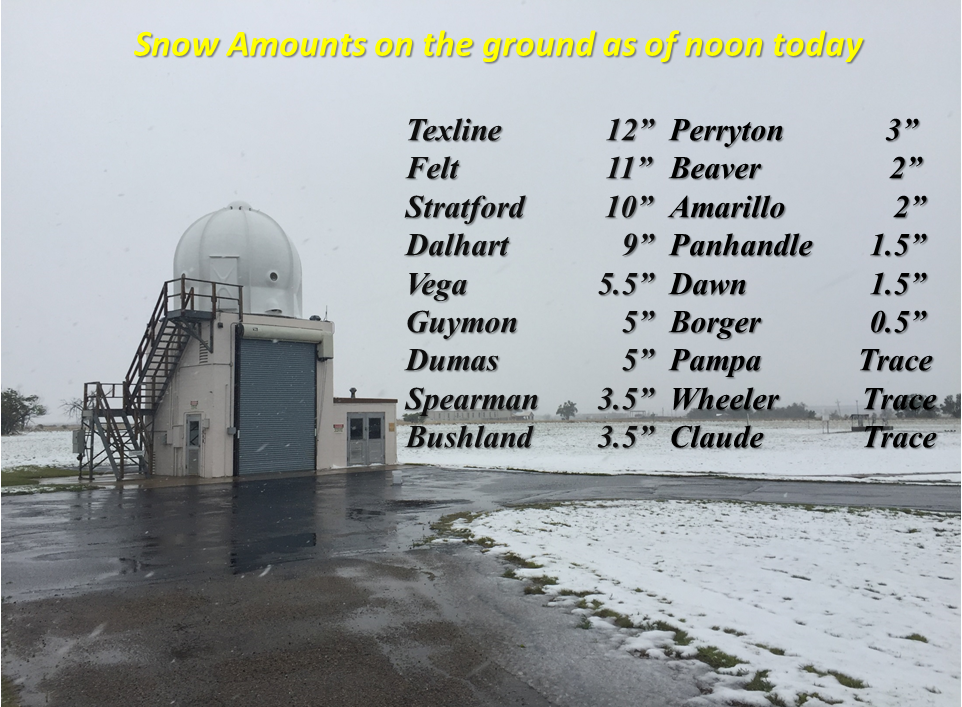
Heavy snow began to fall in the far northwest Panhandles on Saturday morning, April 29th. Snow expanded southeast to Amarillo quickly Saturday morning, but accumulations were minimal or didn’t occur except for the northwest areas through the day Saturday. Snow began to stick quickly in central Panhandles including Amarillo after sunset on Saturday. Winds increased Saturday night as the storm deepened rapidly as it passed over the region and winds gusted to 50 to 70 mph (highest northwest) late Saturday night into Sunday morning. This led to white-out and blizzard conditions in the northwest before conditions improved Sunday afternoon. Event snowfall totals ranged from less than 1” in the southeast to near 12” in the far northwest.
The latest snowfall of an inch or more for the Amarillo area was March 6th, 1917. |
|
 |
 |
 |
|
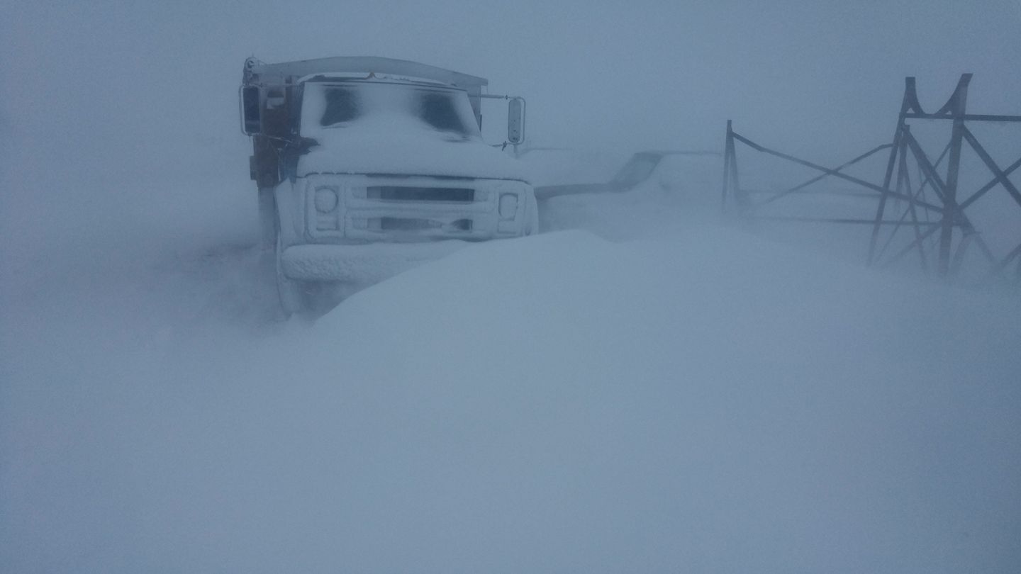
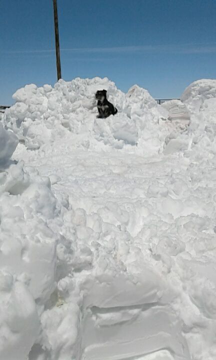
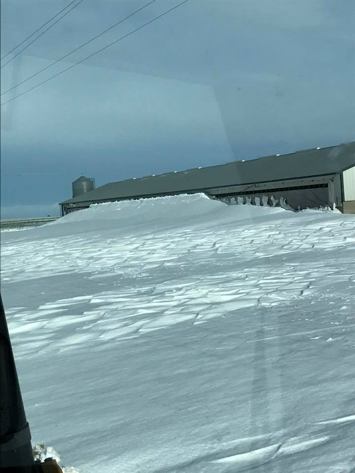
Wheeless, Oklahoma (courtesy of Stuart Hutchison) |
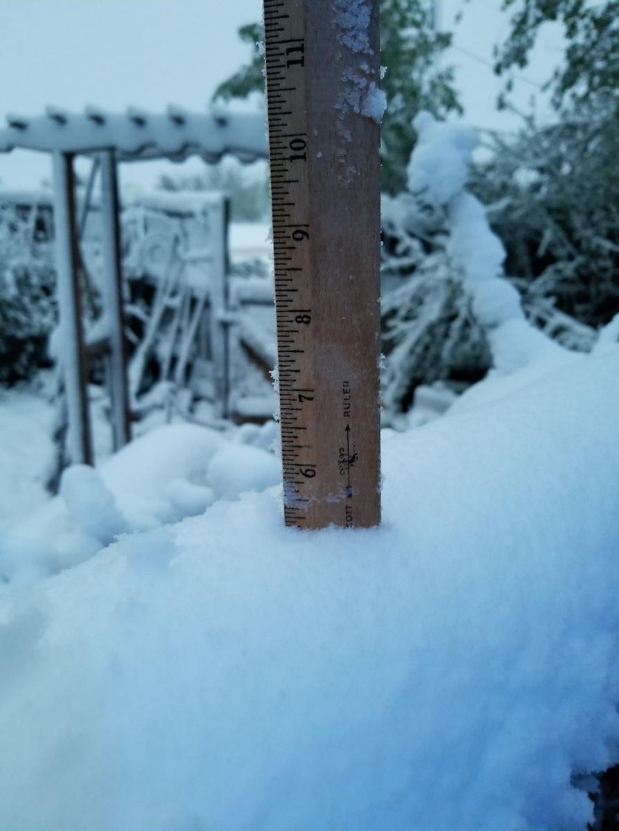
Channing, Texas (courtesy of Sandra Richmond) |
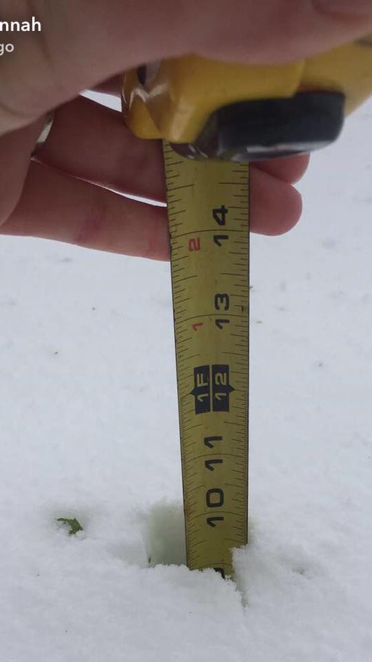
Stratford, Texas (courtesy of Savannah Copley) |
Snow/Ice
 |
 |
Photos & Video:
 |
 |
 |
 |
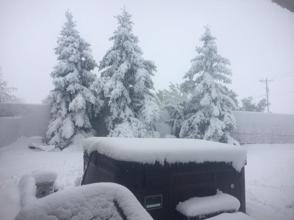
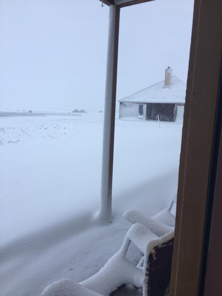
| Oklahoma South of Elkhart, KS (courtesy of Esmeralda Marquez) |
Dalhart, Texas (Courtesy of Mindy Rose) |
Dalhart, Texas (Courtesy of Stephanie Ortez) |
Elkhart, Kansas (Courtesy of Davey Wright) |
Environment
More Photos and Environmental Data Coming Soon
Synoptic summary coming soon.
 |
 |
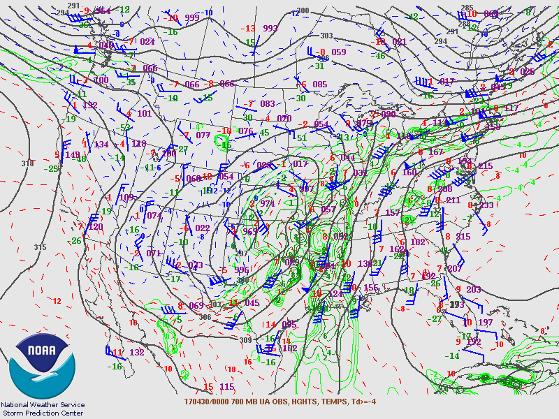 |
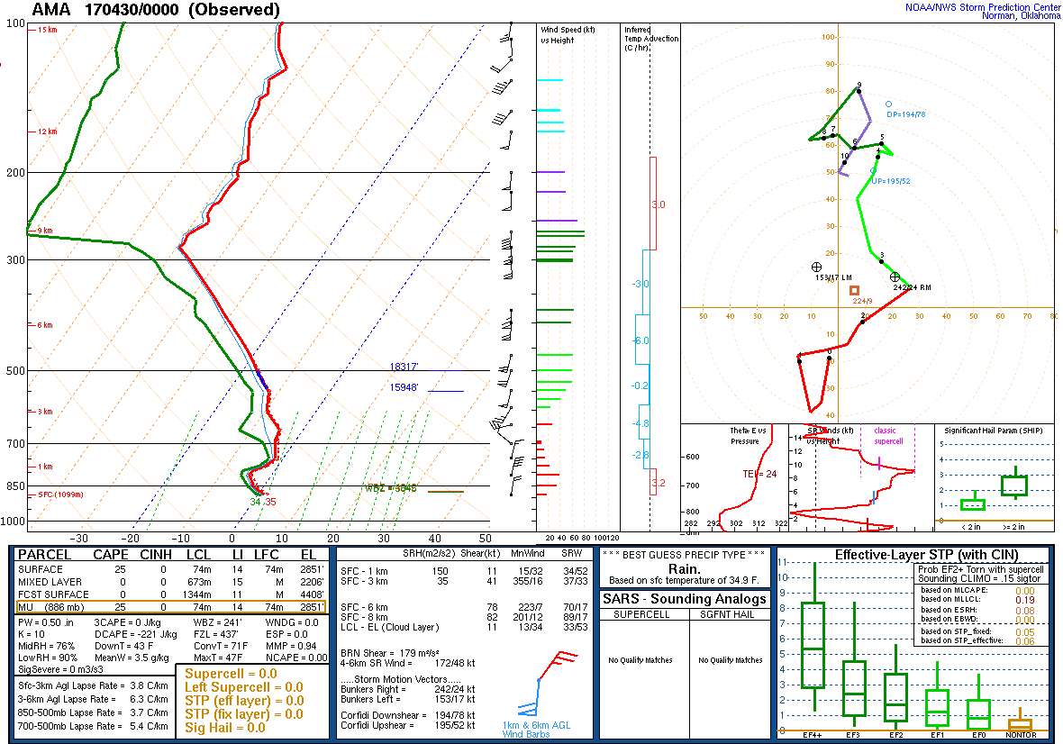
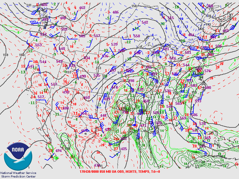
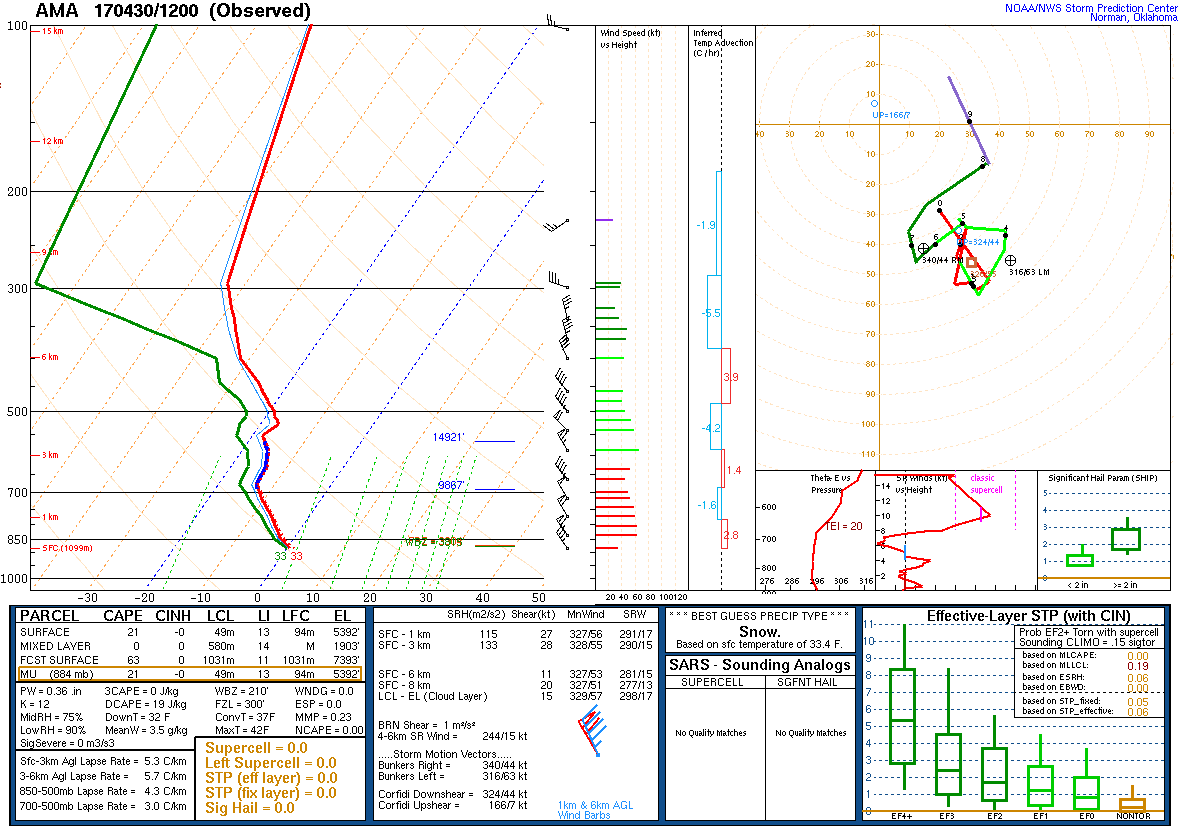
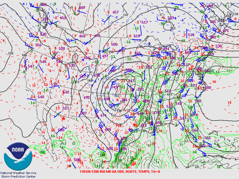
| Figure 1: April 30th: 00Z KAMA Sounding | Figure 2: April 30th: 00Z 850 mb chart | Figure 3: April 30th: 00Z 700 mb chart |
 |
 |
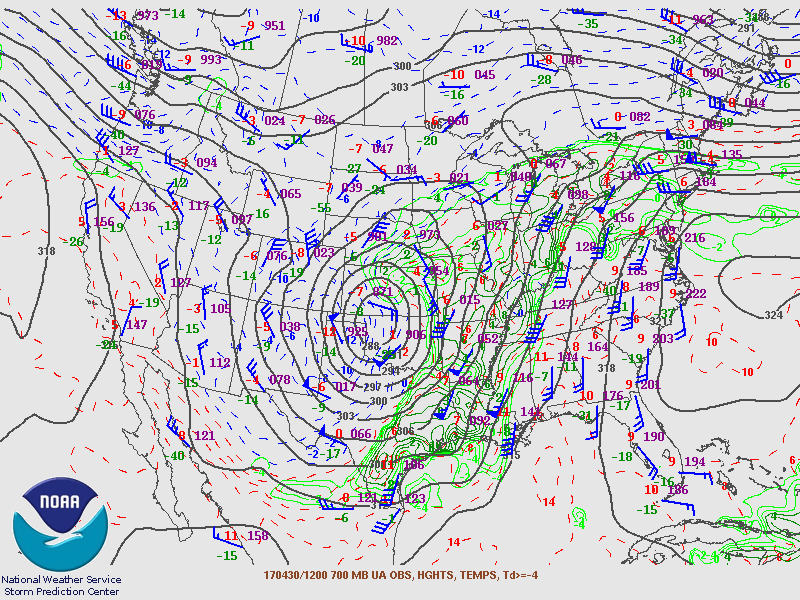 |
| Figure 4: April 30th: 12Z KAMA Sounding | Figure 5: April 30th: 12Z 850 mb chart | Figure 6: April 30th: 12Z 700 mb chart |
 |
 |
 |
| Figure 7: Caption | Figure 8: Caption | Figure 9: Caption |
 |
Media use of NWS Web News Stories is encouraged! Please acknowledge the NWS as the source of any news information accessed from this site. |
|

