
Heat expands across the Desert Southwest, Plains, Mississippi Valley and Midwest into Monday. Fire weather concerns continue for portions of the Intermountain West. Active monsoonal moisture fuels thunderstorms over the Southwest with possible flash flooding. Tropical cyclone Fausto in the Pacific, should weaken as it approaches Hawaii; Dangerous surf, swells and rip currents are expected. Read More >
Arkansas-Red Basin
River Forecast Center
ABRFC River Flood Summary: Minor: 0 (0%)
Moderate: 0 (0%)
Major: 0 (0%)
Use the map below to view forecast locations experiencing flooding and link to detailed forecast information.
US Dept of Commerce
National Oceanic and Atmospheric Administration
National Weather Service
Arkansas-Red Basin
10159 E. 11th Street, Suite 300
Tulsa, OK 74128-3050
Comments? Questions? Please Contact Us.


 ABRFC Storymaps
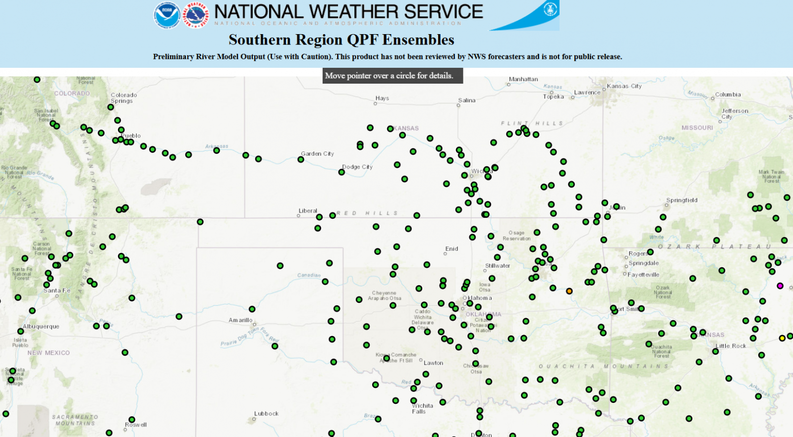 QPF Ensemble Forecasts
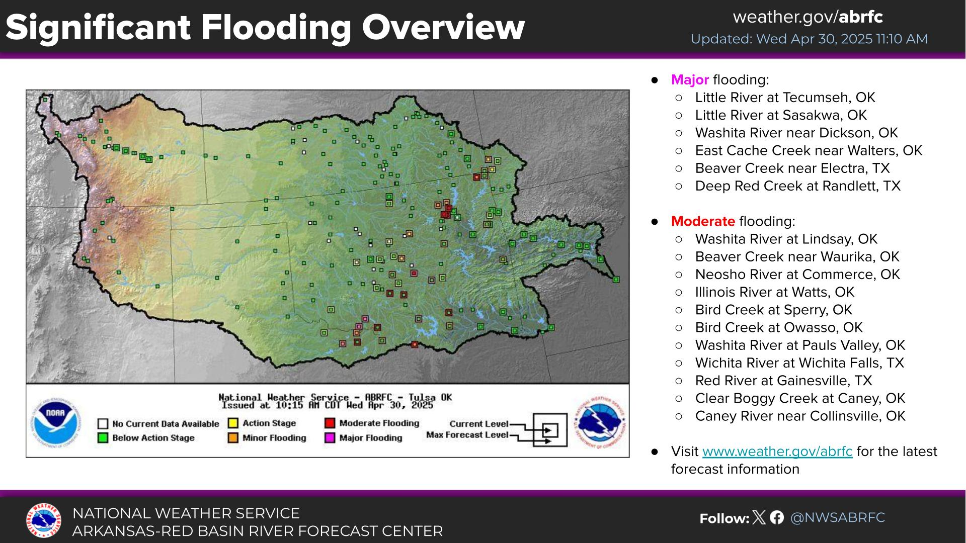 Weather Story
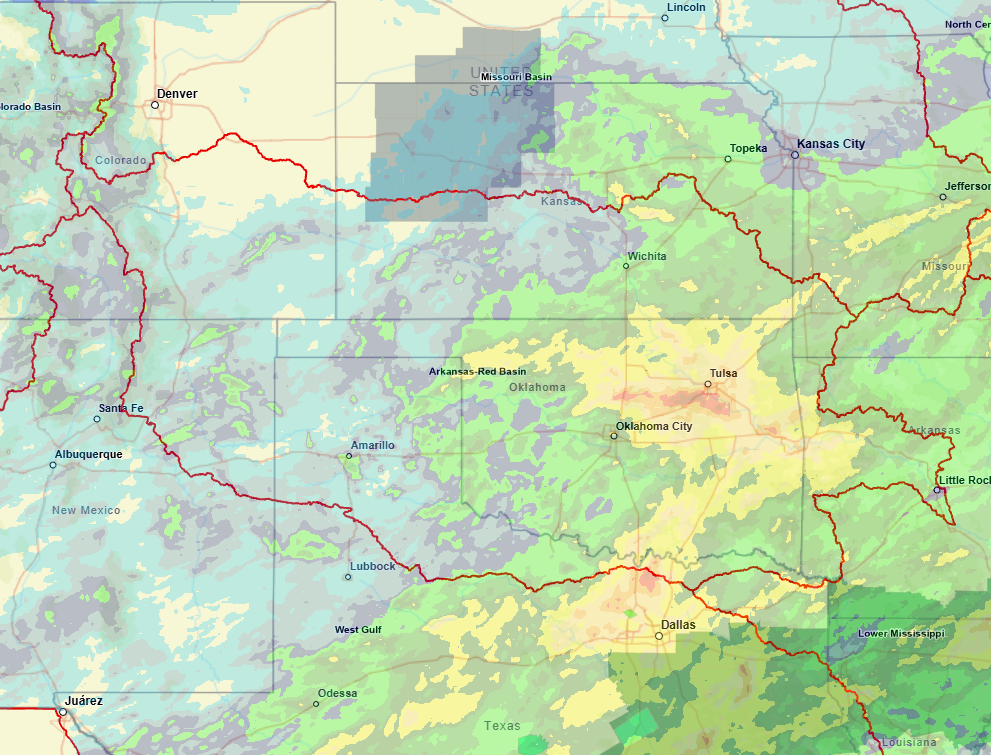 NWS GIS Viewer
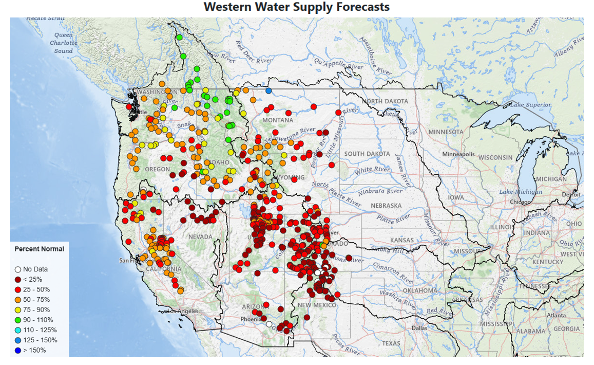 Western Water Supply