Heat expands across the Desert Southwest, Plains, Mississippi Valley and Midwest into Monday. Fire weather concerns continue for portions of the Intermountain West. Active monsoonal moisture fuels thunderstorms over the Southwest with possible flash flooding. Tropical cyclone Fausto in the Pacific, should weaken as it approaches Hawaii; Dangerous surf, swells and rip currents are expected. Read More >
Quick Links
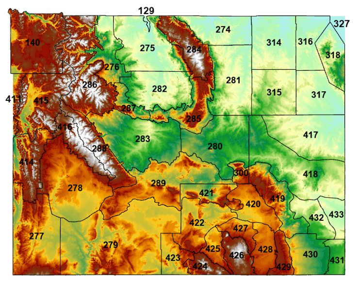
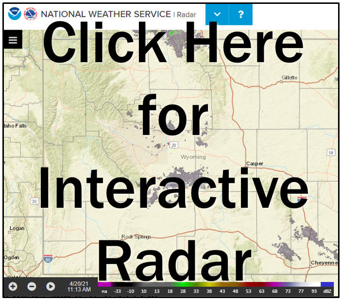
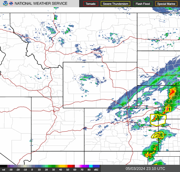
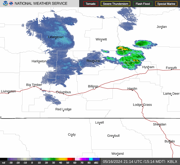
Regional Radar
|
|
|
|
 |
 |
 |
|
|
|
|
 |
 |
 |
Forecast Images
Click on image to enlarge
|
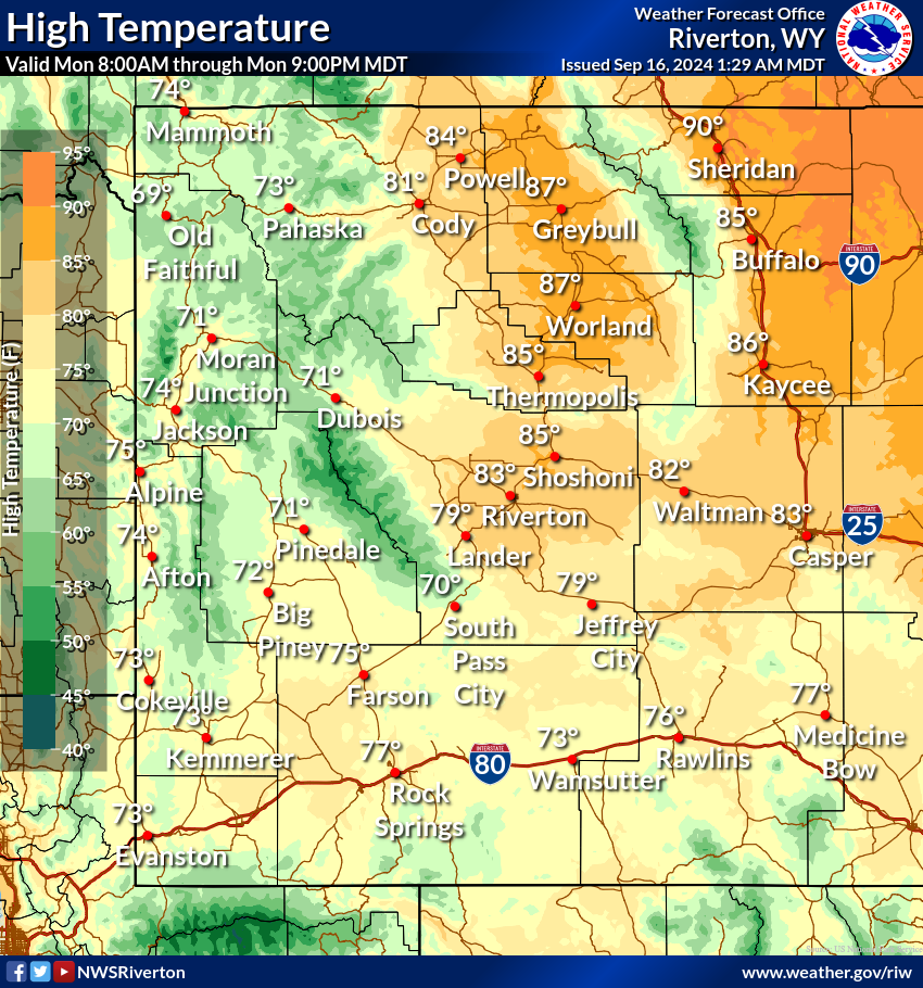
Today's High Temp
|
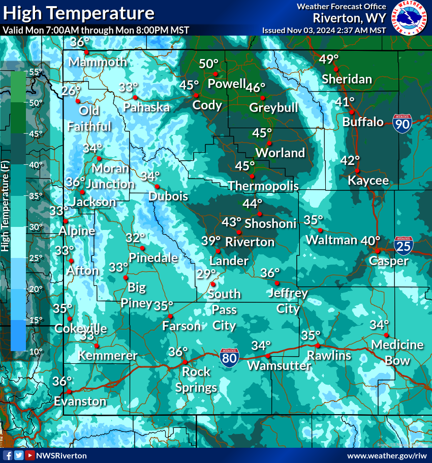
Tomorrow's High Temp
|
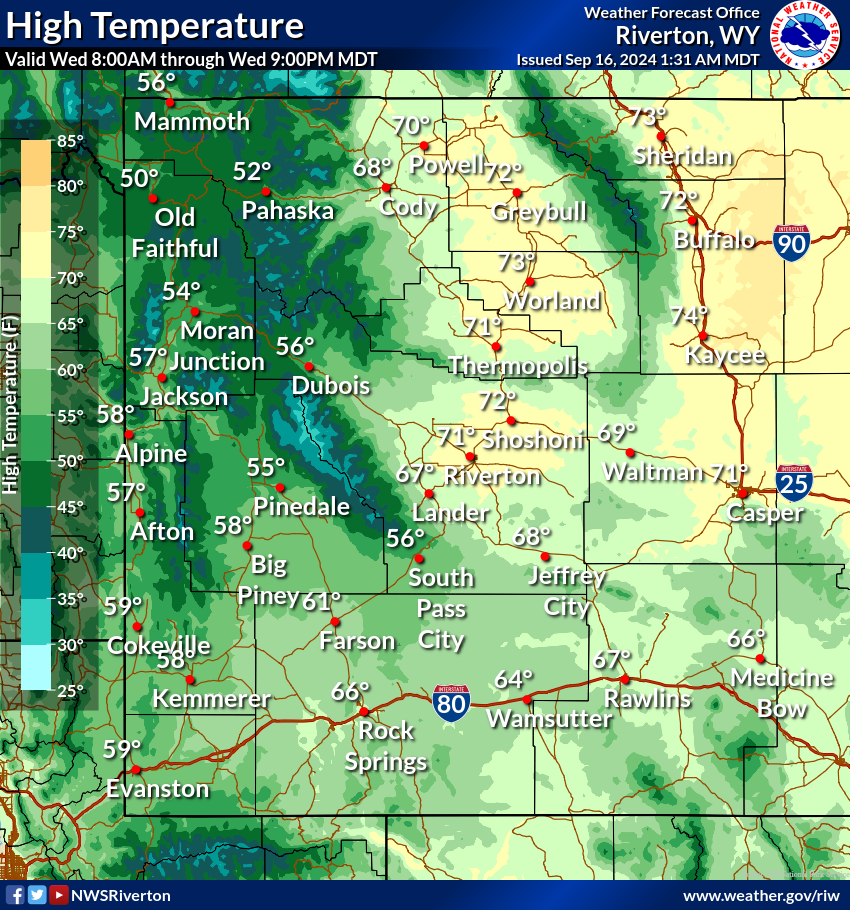
Day 3 High Temp
|
|
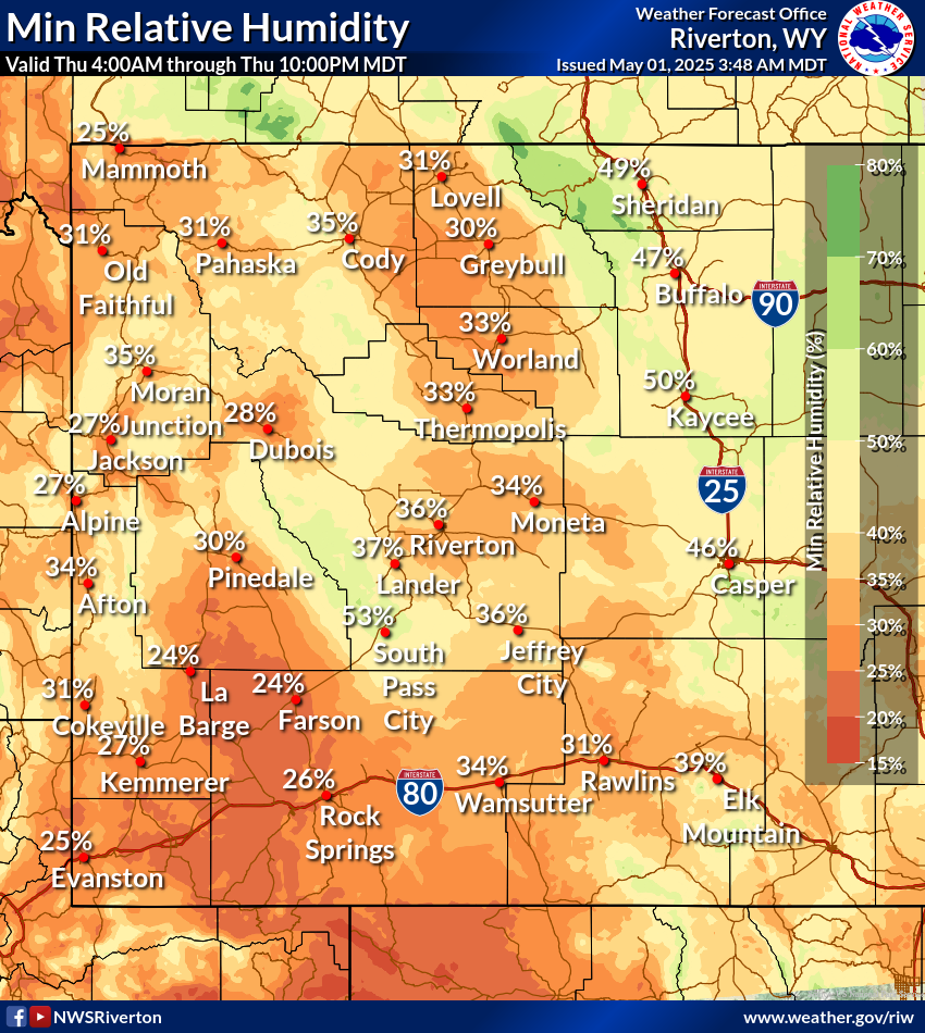
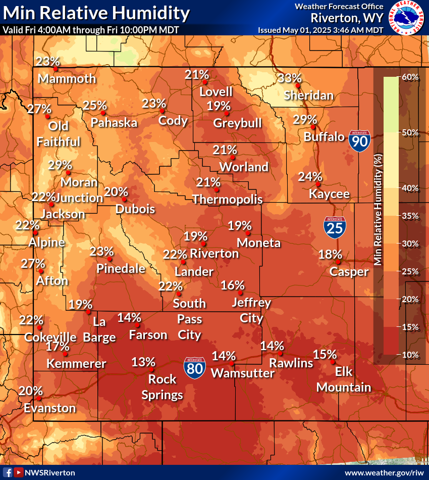
Today's Minimum RH
|
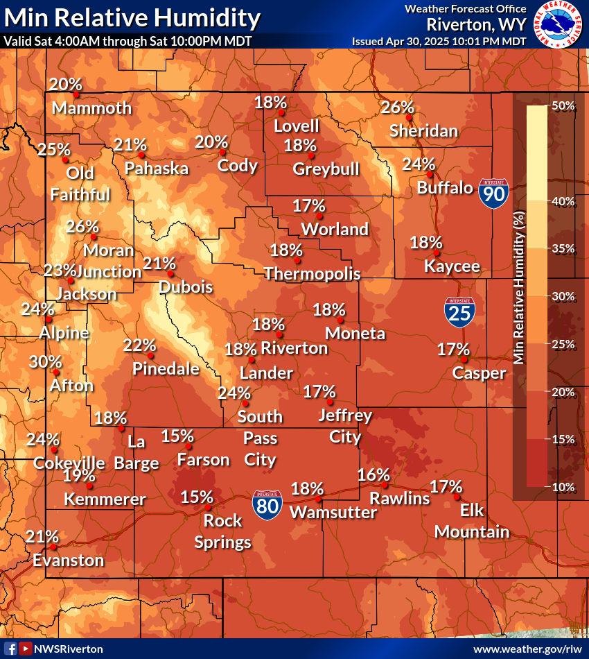
Tomorrow's Minimum RH
|
Day 3 Minimum RH
|
|
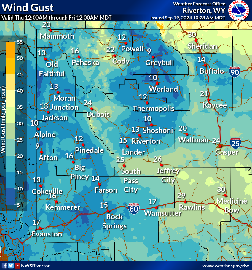
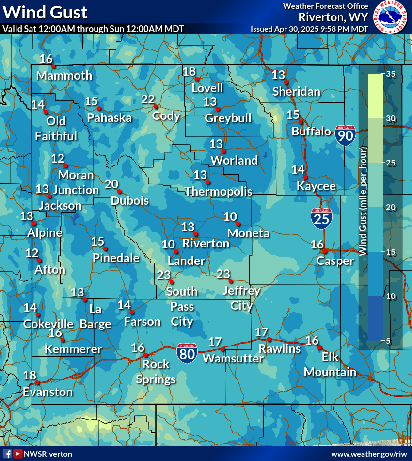
Today's Peak Wind Gusts
|
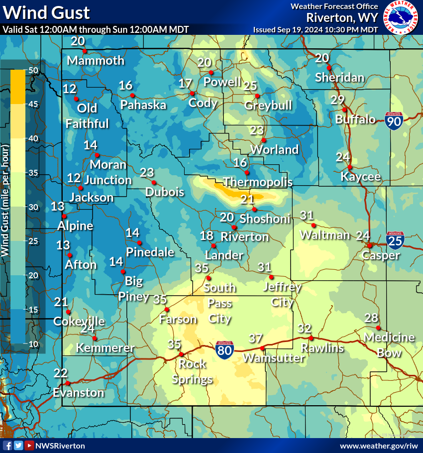
Tomorrow's Peak Wind Gusts
|
Day 3 Peak Wind Gusts
|
|
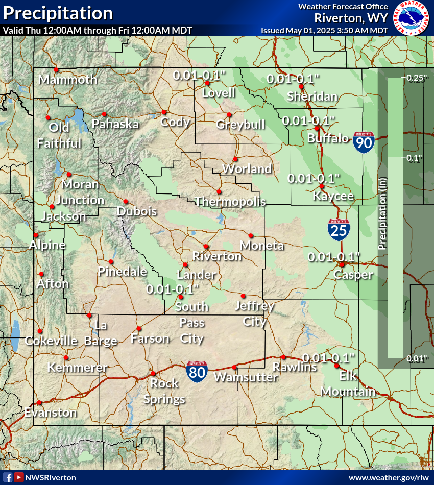
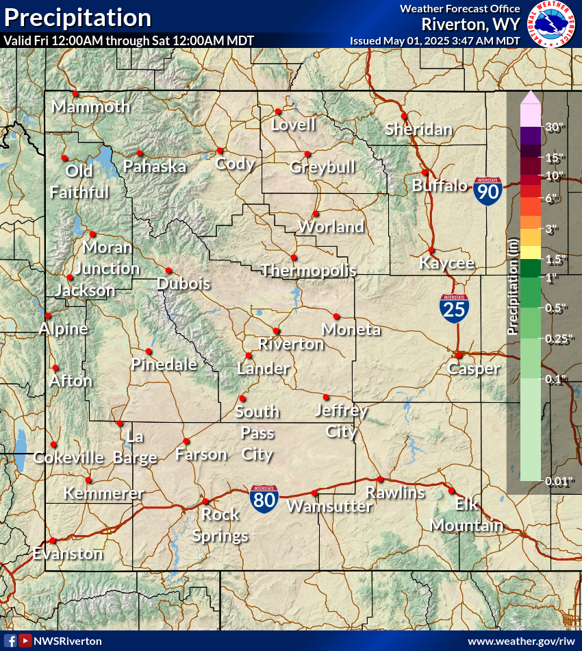
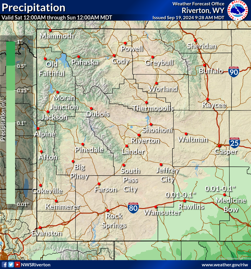
Today's Precipitation
|
Tomorrow's Precipitation
|
Day 3 Precipitation
|
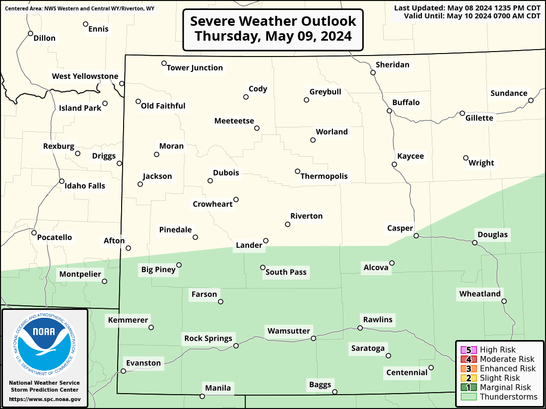
Fire Weather and Thunderstorm Outlook
Click on image to enlarge. Maps from the Storm Prediction Center. For more details, visit spc.noaa.gov
|
Today's Fire Weather Outlook
|
Tomorrow's Fire Weather Outlook
|
Day 3 Fire Weather Outlook
|
|
Today's Thunderstorm Outlook
|
Tomorrow's Thunderstorm Outlook
|
Day 3 Thunderstorm Outlook
|
Precipitation Trends - Percent of Normal
Click on image to enlarge
|
7 Days
|
14 Days
|
30 Days
|
90 Days
|
12 Months
|
Temperature Trends - Departure from Normal
Click on image to enlarge
|
7 Days
|
14 Days
|
30 Days
|
90 Days
|
12 Months
|
Above maps from the High Plains Regional Climate Center (HPRCC). For more maps click here.
Climate Outlook
Click on image to enlarge. Maps from the Climate Prediction Center (CPC).
|
|
|
|
|
|
|
|
|
|
|
|
|
|
|
WFAS - Fire Danger Map
Click here to open a mobile friendly version
Click on image to enlarge.
|
Latest Observed Fire Danger Class
|
Forecast Fire Danger Class
|
Above maps from the Wildland Fire Assessment System (WFAS).
|
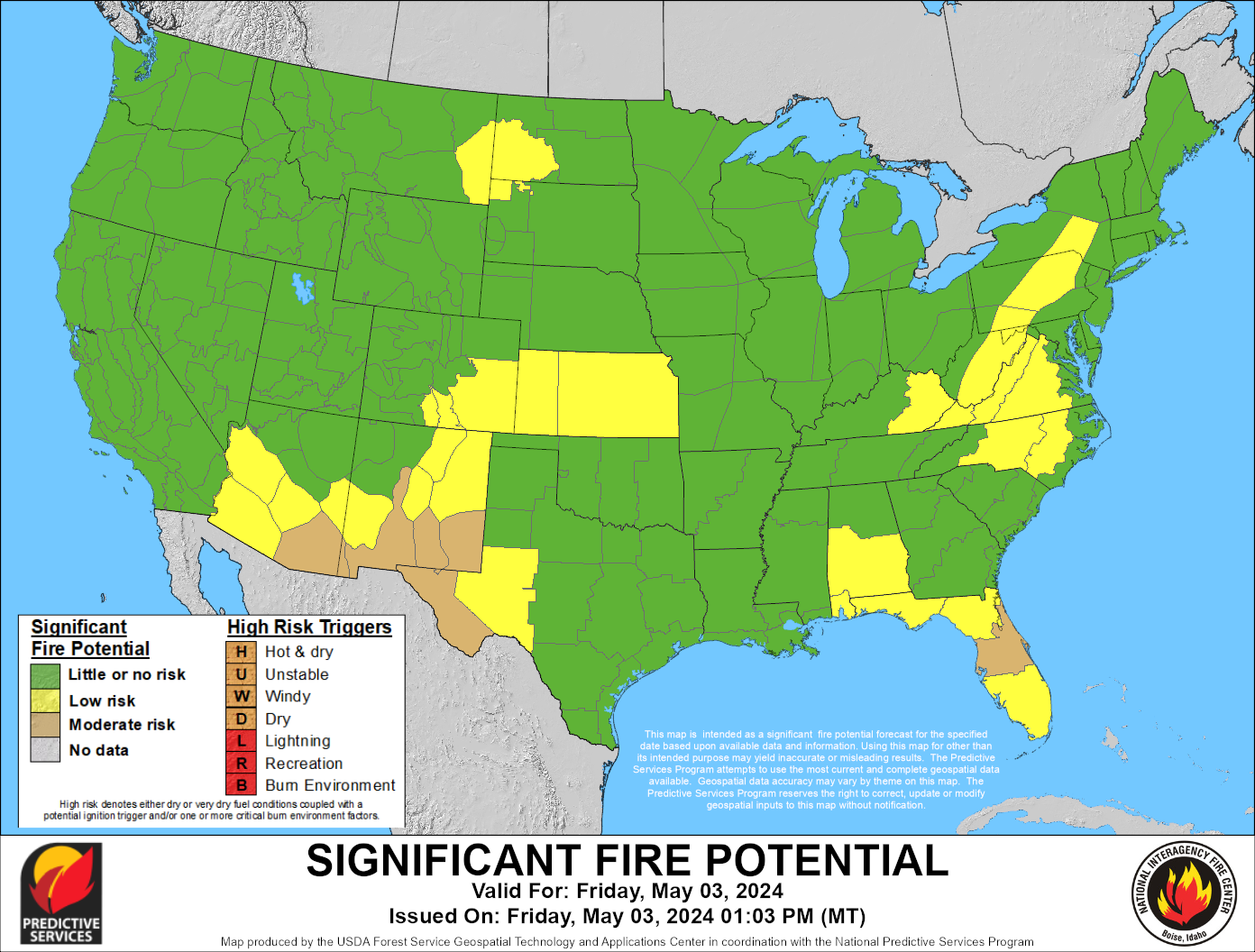
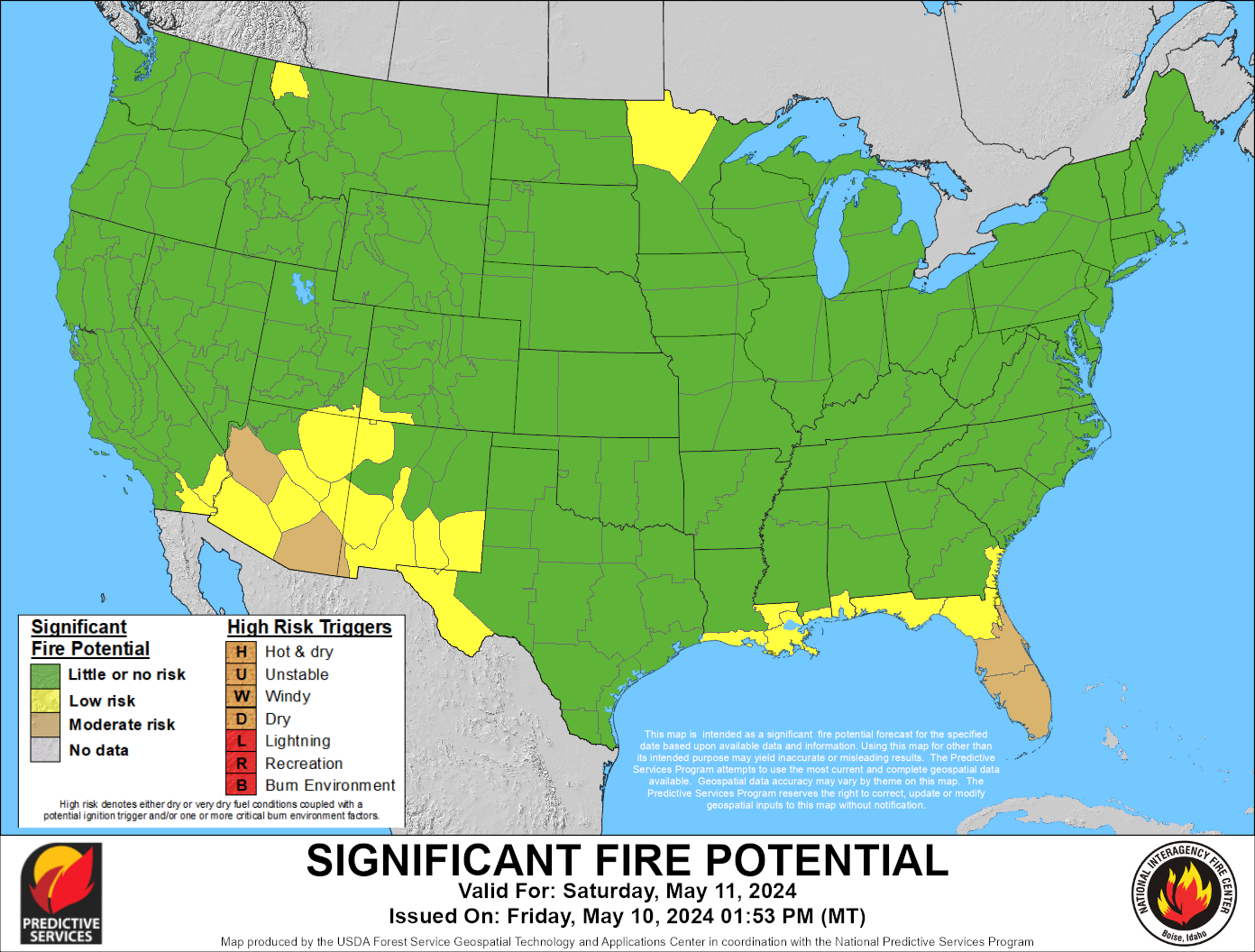
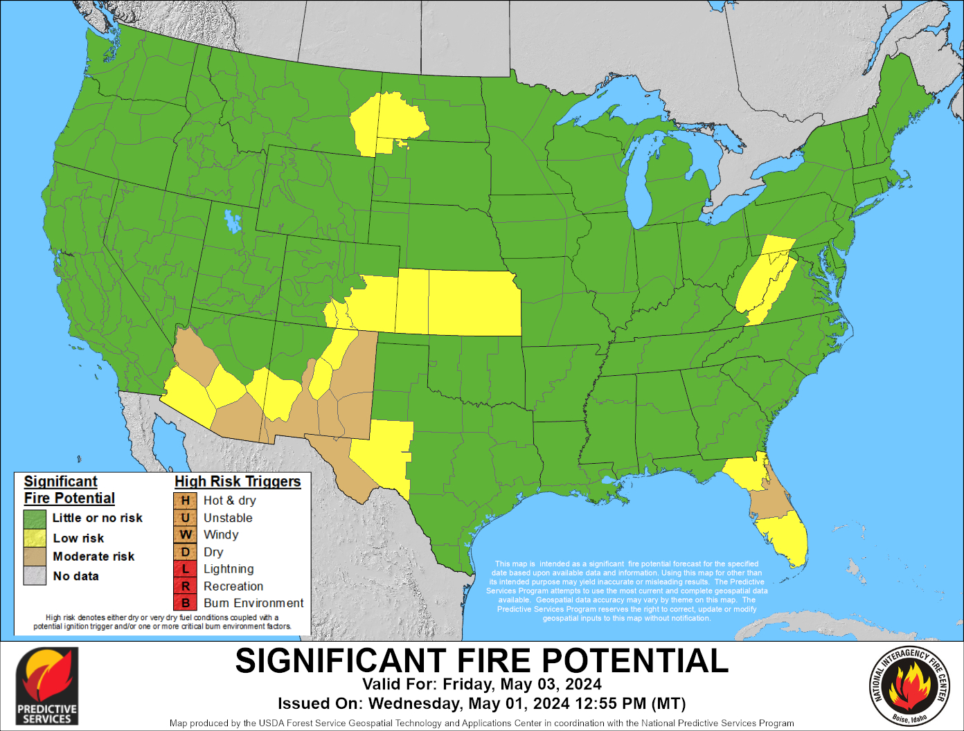
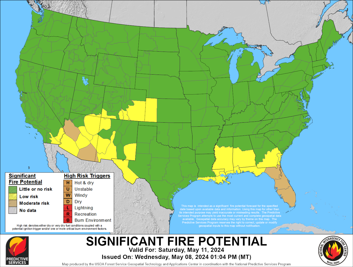
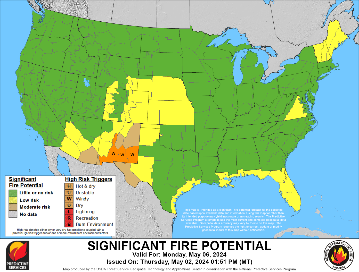
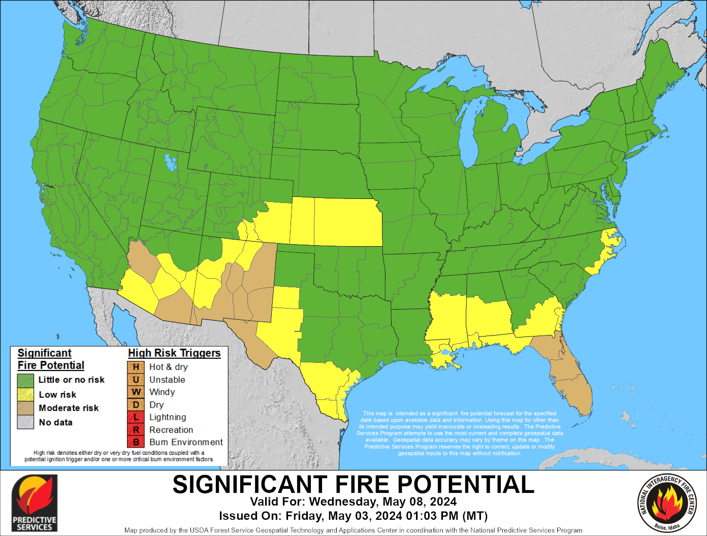
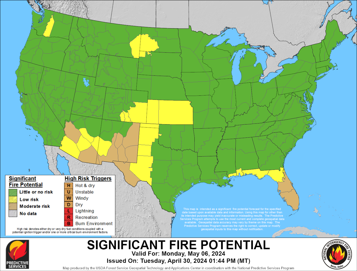
Today's Significant Fire Potential
|
Tomorrow's Significant Fire Potential
|
|
Day 3
|
Day 4
|
Day 5
|
Day 6
|
Day 7
|
|
This Month Significant Wildland Fire Potential Outlook
|
Next Month Significant Wildland Fire Potential Outlook
|
|
Month 3 Significant Wildland Fire Potential Outlook
|
Month 4 Significant Wildland Fire Potential Outlook
|
Above maps from the Predictive Services Program.