National Weather Service United States Department of Commerce

Storm Impacting the Northwest U.S.; Fire Weather Conditions in Southern California; Severe Weather in the South

A Pacific storm is bringing areas of low elevation rain, moderate to heavy mountain snow, and high winds to the Northwest. Strong Santa Ana winds and very dry conditions are producing elevated to critical fire weather conditions in southern California. Isolated strong to severe thunderstorms are possible through early Wednesday morning across parts of northeast Texas into western Tennessee. Read More >

Summary | Forecast | Observed Snow and Wind | Travel Center | Monitoring & Reporting | Safety


SYNOPSIS:  Areas of light snow will persist this morning, gradually tapering off from west to east through the day.  Expect many roads across central Wyoming to be slick with snowfall along with limited visibility through the Monday morning commute time.  Roads are then expected to become mainly wet by midday Monday.


Click to enlarge

Click Image To Enlarge

High-resolution model simulation of snow across Wyoming from
6 am Monday until 6 pm Monday.  The darker blue shades show expected heavier areas of snow. 

Top Menu


 Summary | Forecast | Observed Snow and WindTravel Center | Monitoring & Reporting | Safety
 

NWS Text Products and Forecasts

  Area Forecast Discussion
  Winter Weather Statement
  Special Weather Statement
  What's a "Watch?"
  Observed Snow Totals or High Wind
 High Wind Statement
 Weather Story

Quick View of Hazards and Forecast Snow Totals (updated at 6 PM on 3/25/2018)
Click to enlarge Click to enlarge

Click Image To Enlarge
 Winter Storm Warnings  and
 Winter Weather Advisories  in effect today

Click Image To Enlarge
Forecast snowfall totals from
6 am Monday until 6 pm Monday

 Top Menu


Snow Totals and Wind Reports will be posted and updated here once the storm occurs
(Please double check date and time of product)

                        
984
NOUS45 KRIW 110251
PNSRIW
WYZ001>020-022>030-111451-

Public Information Statement
National Weather Service Riverton WY
851 PM MDT Mon Mar 10 2025

...HIGHEST WIND REPORTS...

Location                     Speed     Time/Date       Elevation (ft.)

...Wyoming...

...Fremont County...
Muddy Gap 7 SW               59 MPH    1150 PM 03/09   7379
Red Canyon - South Pass      53 MPH    0258 AM 03/10   6581
Fort Washakie 10 W           50 MPH    0101 PM 03/10   9234

...Johnson County...
Buffalo 18 NW                61 MPH    0147 PM 03/10   8604
Barnum 7 SW                  59 MPH    1246 PM 03/10   6439

...Lincoln County...
Mount Coffin (BTAVAL)        62 MPH    0315 PM 03/10   10855

...Natrona County...
Claude Creek                 70 MPH    0530 AM 03/10   6282
Casper 2.1 SW (WYDOT)        70 MPH    0630 AM 03/10   5462
Hiland 16 S                  64 MPH    0110 AM 03/10   6379
I25 - Hat Six                62 MPH    0954 AM 03/10   5157
Muddy Creek                  53 MPH    1120 AM 03/10   5571

...Park County...
Sunlight Basin 8 E (WYDOT)   82 MPH    0540 AM 03/10   8083
Cody 10 WNW                  65 MPH    0440 AM 03/10   8400
Dead Indian Ridge            62 MPH    0530 AM 03/10   8145
Irma Lake                    61 MPH    0530 AM 03/10   6222
Wood River South             51 MPH    0840 AM 03/10   7001
Shoshone Southfork           50 MPH    1130 AM 03/10   5896

Observations are collected from a variety of sources with varying
equipment and exposures. We thank all volunteer weather observers
for their dedication. Not all data listed are considered official.

$$


 Top Menu


Summary | Forecast | Observed Snow and WindTravel Center | Monitoring & Reporting | Safety

Current Radar & Web Cams - Click Thumbnails To Enlarge
Northern Rockies Radar
Riverton Radar
Pocatello
Billings
Salt Lake
Cheyenne


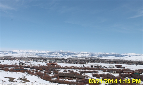
            Road Conditions and Web Cameras
I-90 / I - 25 Interchange at Buffalo
I - 25 at Midwest
I - 25 at Casper
U.S. Highway 20 at Waltman Rest Stop
U.S. Highway 16 - 16 mi east of Tensleep
Highway 789 - Wind River Canyon
Highway 789 - Riverton
Highway 789 - Lander
U.S. Hwy 287 - Beaver Rim
Highway 28 - South Pass
I-80 - Rock Springs
Dubois
Jackson
Highway 22 - Teton Pass
Pinedale
U.S. 191/Hwy 28 Jct - Farson


                                                                       Click Here to See All Webcams                                                  

If you plan to travel, we recommend checking road conditions along your route and staying on top of road closures here. If you are on Twitter, follow the hashtag: #WyoRoad (or look below) for the latest weather affecting roads and road conditions in and around Wyoming. 


Get the play-by-play on this storm and contribute your own snow reports to #wywx

Follow Us on Twitter @NWSRiverton

On the road?

Tweet road conditions to #WyoRoad!


 Summary | Forecast | Observed Snow and WindTravel Center | Monitoring & Reporting | Safety

PLEASE SEND US YOUR SNOW REPORTS (CLICK HERE)

Monitor our Weather Summary Page for current Warnings, Watches, and Advisories. What's the difference?
Current            Weather Story Check the latest Weather Story graphic for an overview of the area forecast.
NWS Riverton Radar Check out what's on the radar.
Riverton | Pocatello | Cheyenne | Billings | Salt Lake City | Rapid City | Mosaic
Submit storm reports/images and keep up to date with us on Facebook!
Submit storm reports/images and keep up to date with us on Twitter!
Other reporting methods include email (nws.riverton@noaa.gov), or by phone at 1-800-211-1448.
Check the latest Public Information Statement for the latest storm reports.
WyDoT's Webpage Monitor current road conditions by visiting the Wyoming Dept. of Transportation (WYDOT) or by calling 5-1-1.
Get current road conditions, web camera images, road alerts, and much more on your mobile device by downloading the Wyoming 511 Mobile App.


Top Menu

 Summary | Forecast | Observed Snow and WindTravel Center | Monitoring & Reporting | Safety


Winter Safety Kit      |      Winter Weather Safety


Learn more about the National Weather Service's efforts to build a Weather-Ready Nation!


 Top Menu