
Tropical Depression Two is expected to gradually strengthen and could bring tropical storm conditions to the Florida Panhandle beginning late Monday. Areas of flash flooding will be possible through Thursday along the eastern and central Gulf Coast. Severe thunderstorms will develop and move along a cold front crossing the Upper Midwest Monday, and through the Ohio Valley/Mid-Atlantic on Tuesday. Read More >
Pacific ENSO Applications Climate Services
National Division
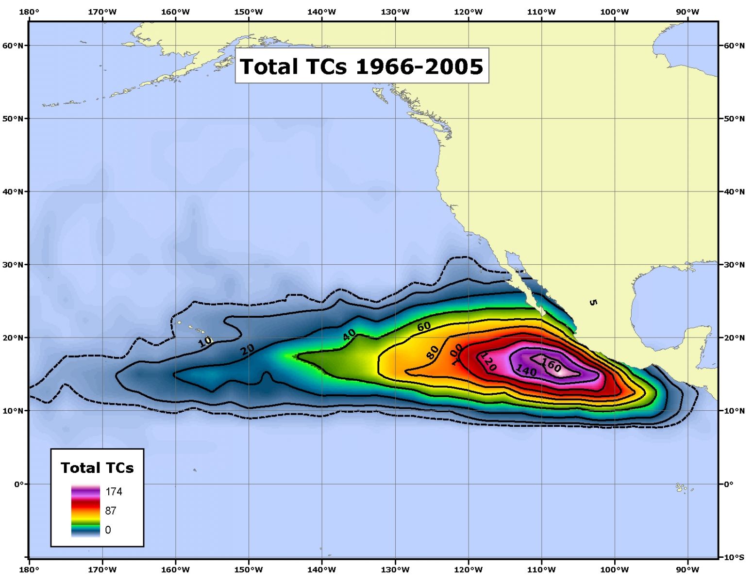
Contour plot of all TC's to occur within each 2.5� x 2.5� latitude-longitude gridbox throughout 1966-2005.
US Dept of Commerce
National Oceanic and Atmospheric Administration
National Weather Service
Pacific ENSO Applications Climate Services
Pacific ENSO Applications Climate Services
2525 Correa Rd. HIG room 340
Honolulu, HI 96822
8089562324
Comments? Questions? Please Contact Us.

