| Overview | |||
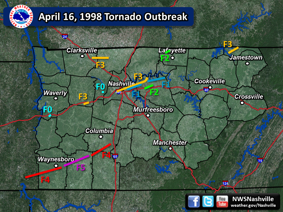
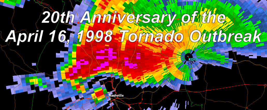
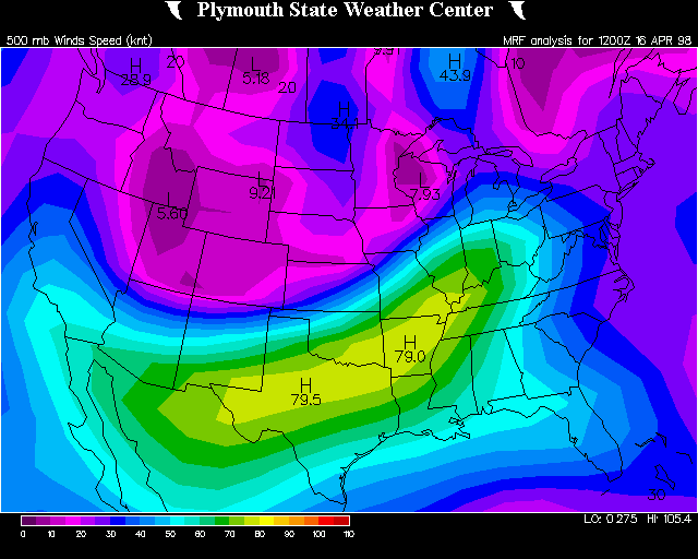
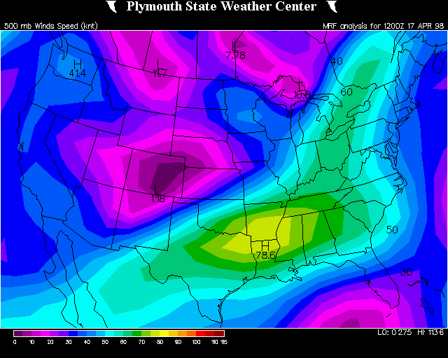
| An historic tornado outbreak of at least 13 tornadoes struck Middle Tennessee on April 16, 1998. Many of these tornadoes were strong or violent and tracked long distances, killing 4 people and injuring nearly 100 people, while causing hundreds of millions of dollars in damage. The most infamous tornado during the outbreak struck downtown Nashville, blowing out numerous windows in skycrapers and causing the collapse of some older buildings. Other notable tornadoes included three violent tornadoes in southern Middle Tennessee that reached F4 to F5 intensity, and an F3 tornado in Pickett County that damaged or destroyed hundreds of homes and businesses. Wilson County was struck by 4 different tornadoes during the event. This tornado outbreak was unusual in several respects. First, the event lasted nearly the entire day, with the first round of severe weather beginning very early (around 4 AM CST), and the second and more significant round of severe thunderstorms and tornadoes occurring during the afternoon and evening. Second, synoptic features with this outbreak were not noticeably intense, with a relatively weak low level jet stream of only 35 to 45 mph at 850 mb (around 5000 feet above the ground), and a weak area of surface low pressure around 1000-1005 mb located well to the north across the Great Lakes. Upper air soundings at Nashville also were not noticeably impressive, with the 18Z sounding showing veered low level winds and only modest convective available potential energy (CAPE) around 1000 J/Kg. However, a large wind maximum at 500 mb (around 20,000 feet above the ground) of 80 to 90 mph extended from Texas into the Tennessee Valley region, which provided considerable lift for severe thunderstorms to develop throughout the day. Due to several errors apparent in official Storm Data records for this historic event, a reanalysis was undertaken in 2013 by NWS Nashville lead forecaster Sam Shamburger using radar data, NWS research and documentation, spotter reports, aerial damage surveys, and Google Earth high resolution satellite imagery. Based on this information, several updates were made to the times, paths, and damage information for these tornadoes. Some of the longer track tornadoes were also determined to be separate tornadoes, and a final total of 13 tornadoes is listed below. However, a few other tornadoes may have also touched down across Middle Tennessee, as suggested by radar imagery. |
|||
| Tornado Statistics | ||||||||
| # | Counties | Rating | Time | Path | Width | Fatalities | Injuries | |
| 1 | Dickson | F3 | 0605 | 2.0 | 1300 | 0 | 5 | |
| 2 | Montgomery/Robertson | F3 | 0914 | 12.5 | 400 | 0 | 0 | |
| 3 | Humphreys | F0 | 1009 | 0.5 | 100 | 0 | 0 | |
| 4 | Macon | F2 | 1108 | 3.0 | 800 | 0 | 0 | |
| 5 | Cheatham | F0 | 1414 | 0.5 | 100 | 0 | 0 | |
| 6 | Davidson/Wilson | F3 | 1426 | 28.0 | 1320 | 1 | 60 | |
| 7 | Wilson/Trousdale | F1 | 1505 | 15.9 | 880 | 0 | 0 | |
| 8 | Hardin/Wayne | F4 | 1550 | 30.1 | 1760 | 3 | 6 | |
| 9 | Wilson | F2 | 1556 | 9.6 | 880 | 0 | 0 | |
| 10 | Wayne/Lawrence | F5 | 1630 | 20 | 1760 | 0 | 21 | |
| 11 | Davidson/Wilson | F1 | 1627 | 5.4 | 200 | 0 | 0 | |
| 12 | Pickett | F3 | 1635 | 8.6 | 880 | 0 | 4 | |
| 13 | Lawrence/Giles/Maury | F4 | 1700 | 20 | 1320 | 0 | 9 | |
| Upper Air Analysis from Plymouth State University & University of Wyoming | ||||||||
| Date/Time | 00Z April 16 1998 | 12Z April 16 1998 | 18Z April 16 1998 | 00Z April 17 1998 | 12Z April 17 1998 | |||
| 300 MB Heights | 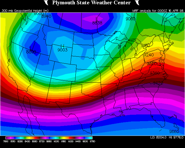 |
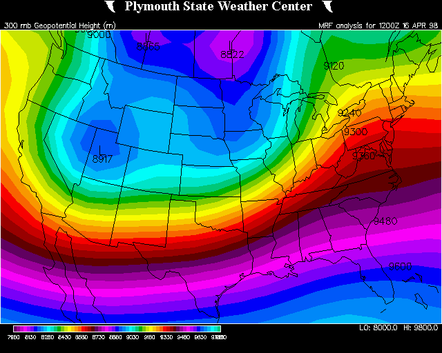 |
N/A |  |
 |
|||
| 500 MB Winds | 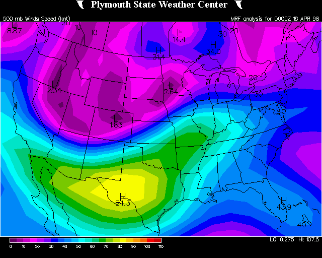 |
 |
N/A | 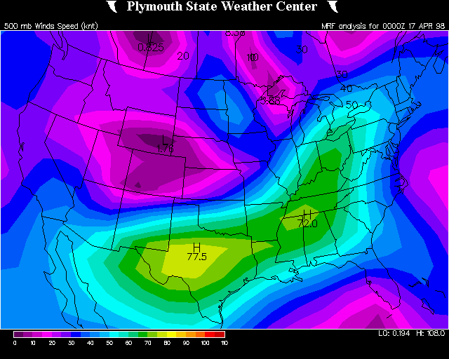 |
 |
|||
| 850 MB Winds | 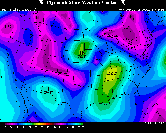 |
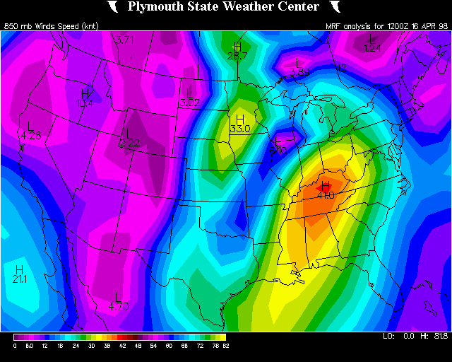 |
N/A | 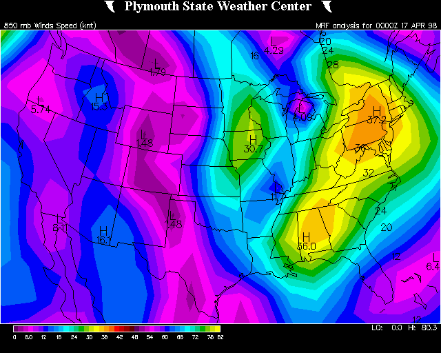 |
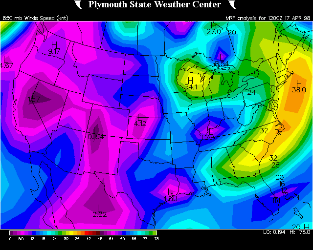 |
|||
| 1000 MB Heights | 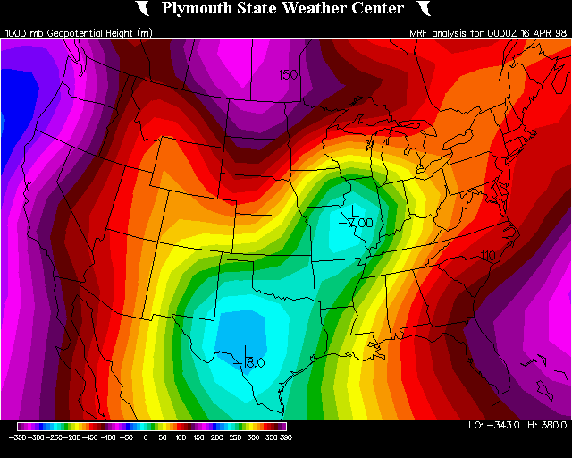 |
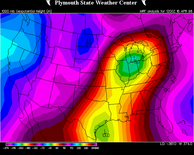 |
N/A | 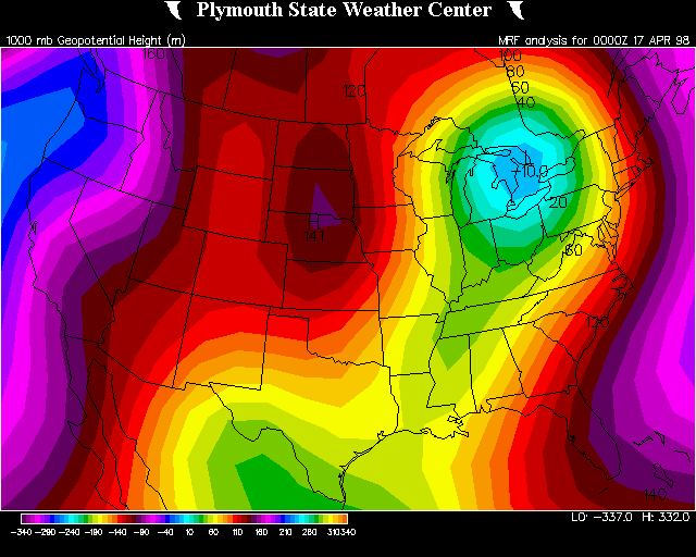 |
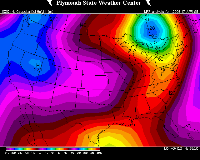 |
|||
| Soundings | 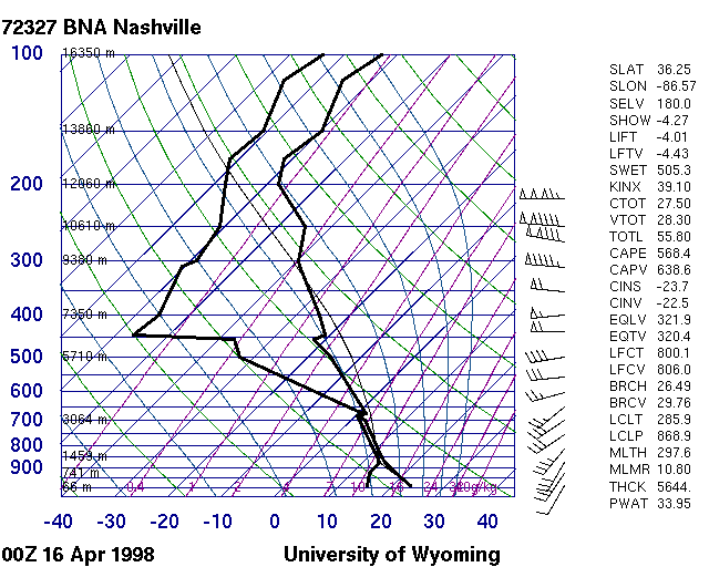 |
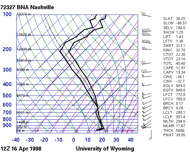 |
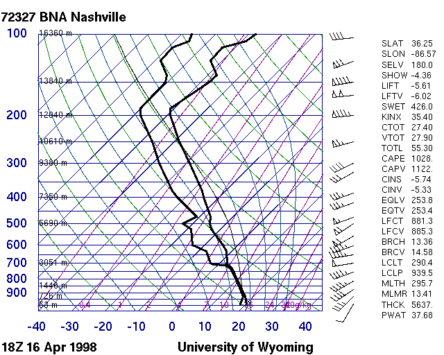 |
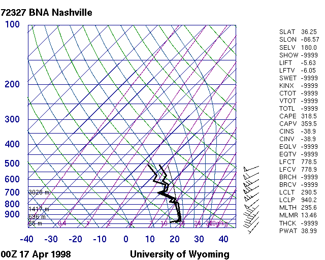 |
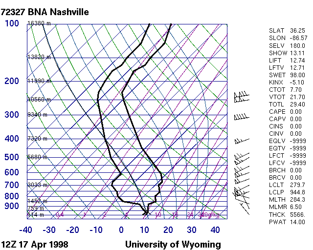 |
|||
| Research & Reports | |||
| NWS Nashville Summary of Storm Surveys of April 16, 1998 - Page 1 / Page 2 | |||
| Aerial Surveys by Tim Troutman, NWS & Tim Marshall, Haag Engineering - Page 1 / Page 2 | |||
| The Forgotten F5 | |||
| NWS Nashville Operations by Forecaster Bobby Boyd | |||
| Comparison of Radar Velocity Signatures to Tornado Damage | |||
| Tennessee State Library and Archives | |||
| April 1998 Storm Data | |||
| Radar Imagery | |
| OHX 0.5° Base Reflectivity Loop (State view) | 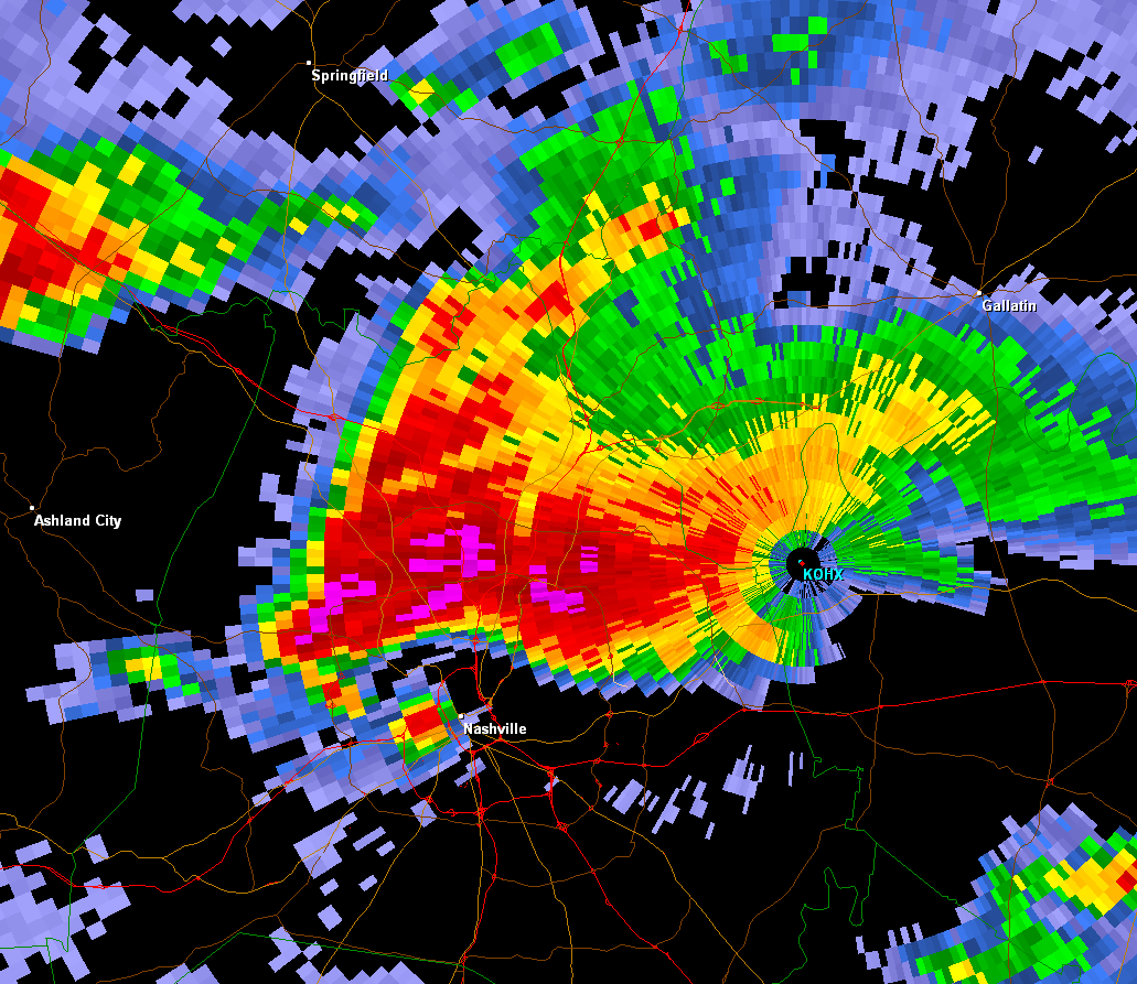 |
| OHX 0.5° Base Reflectivity Loop (Nashville Metro) | |
| OHX 1.5° Base Velocity Loop (State view) | |
| OHX 1.5° Base Velocity Loop (Nashville Metro) | |
| Photos | |||
| Nashville Tornado Photos by Derek Edwards | |||
