|
|
Overview
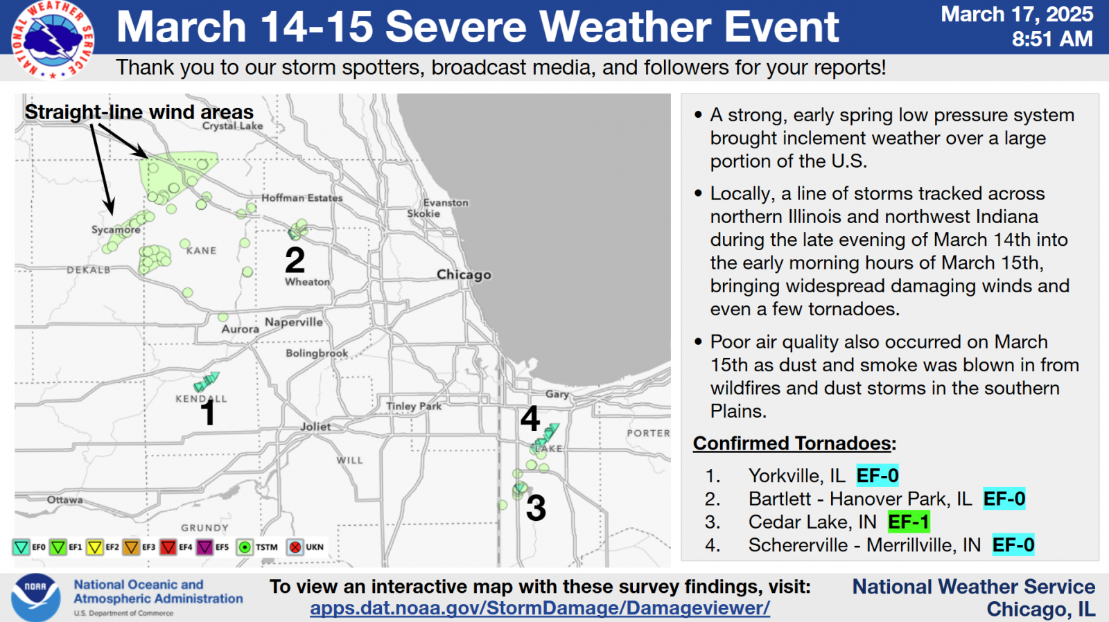
Tornadoes and Straight-Line Winds
|
Downloadable KMZ File with All Tornado Tracks Downloadable Shapefile with All Tornado Tracks
Below is a summary of all of the NWS damage survey findings in the NWS Chicago forecast area from this severe weather event. An interactive map with all of this information can be found on our Damage Assessment Toolkit Viewer website (to see the data from this event, make sure that the date range in the top right corner includes this event's date). Instructions for how to download KMZ files and shapefiles with our survey data are available here. |
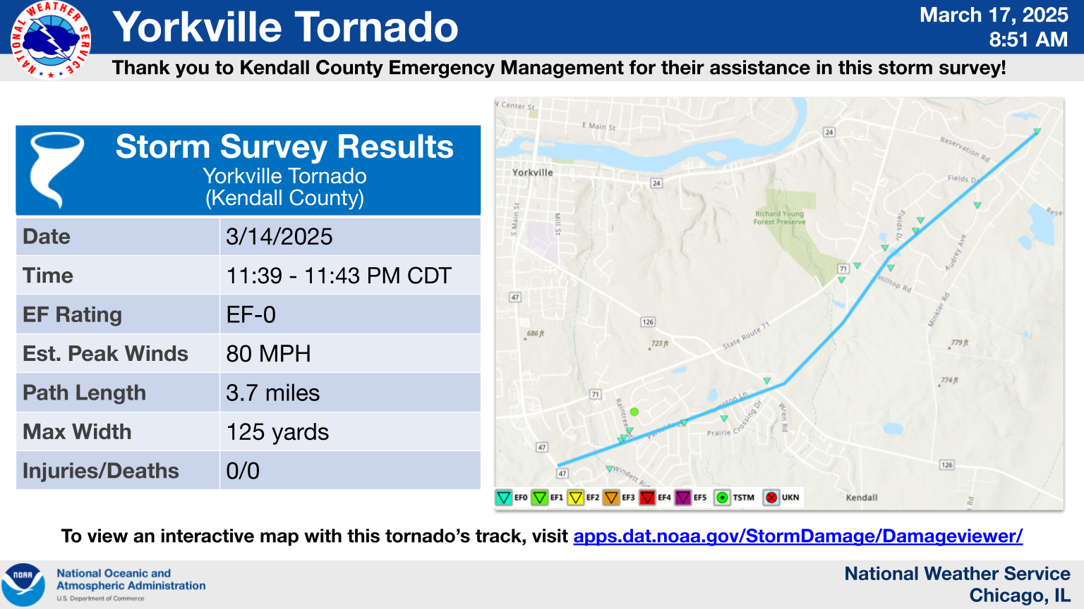
1.) Yorkville Tornado
|
(click on image to enlarge) |
|
Summary: Damage surveys confirmed an EF-0 tornado. A tornado developed near the intersection of Illinois Route 47 and Bonnie Lane and quickly moved east-northeast across a residential area of Yorkville. Wind speeds quickly increased to around 80 mph causing the removal of shingles, fascia trim, and some siding from several homes along Kingsmill St. A fence was also heavily damaged. Winds likely then eased somewhat as the tornado continued east-northeast causing some additional shingle damage as well as damaging several trees as it approached Illinois Route 126. The tornado continued across mainly open land along Illinois Route 71 before crossing Hilltop Road and causing additional shingle and trim damage to several homes in another residential subdivision. The tornado then dissipated near or just northeast of Reservation Road with straight line winds continuing downstream. |
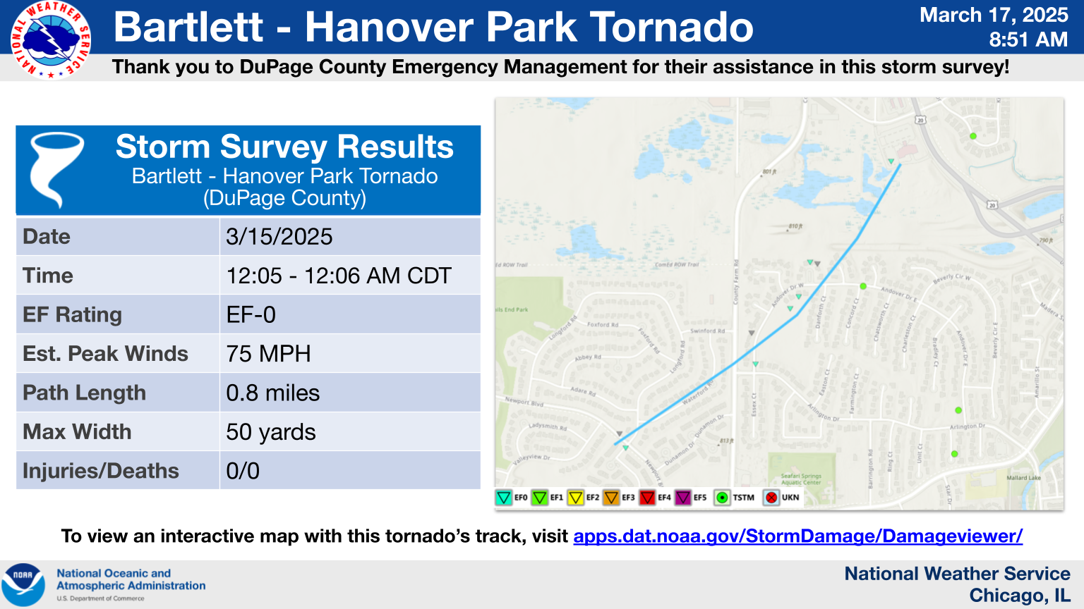
2.) Bartlett-Hanover Park Tornado
|
(click on image to enlarge) |
|
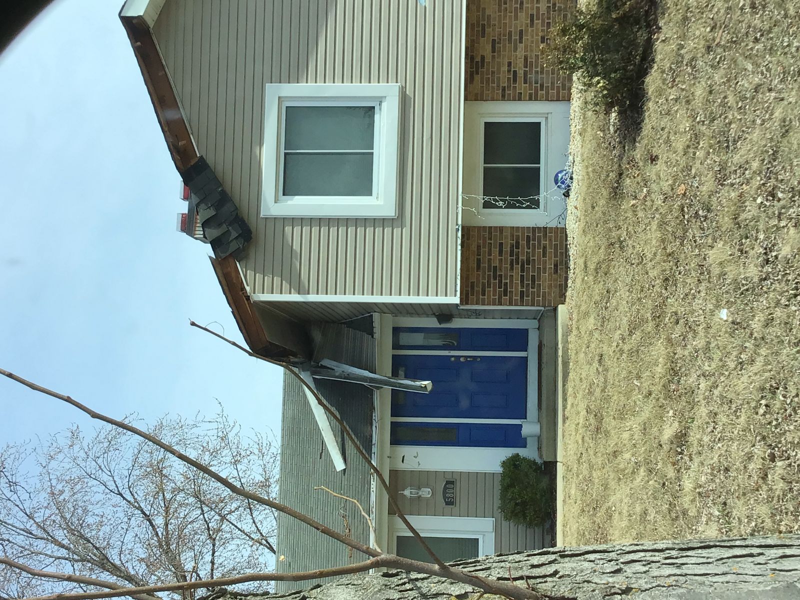
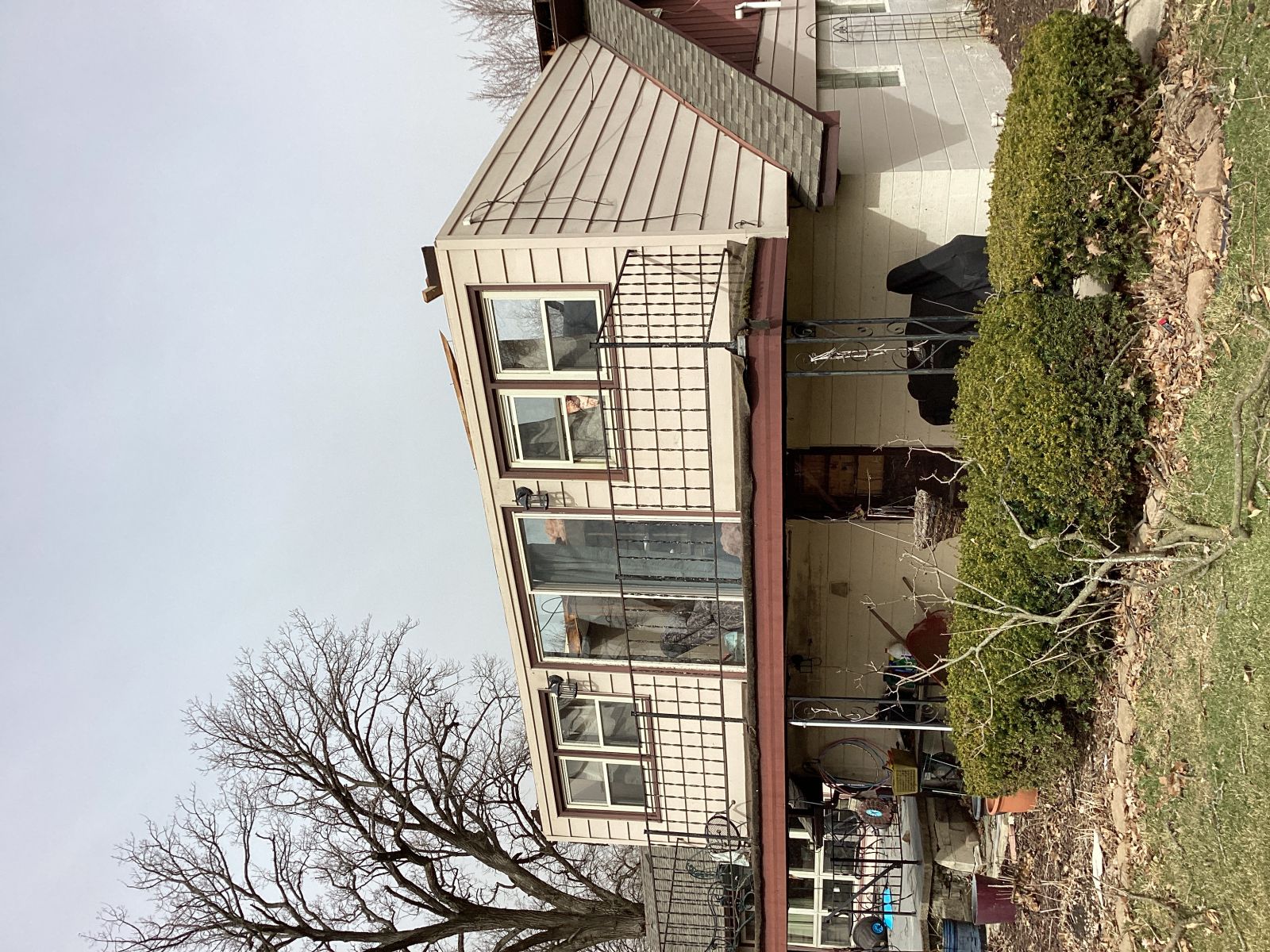
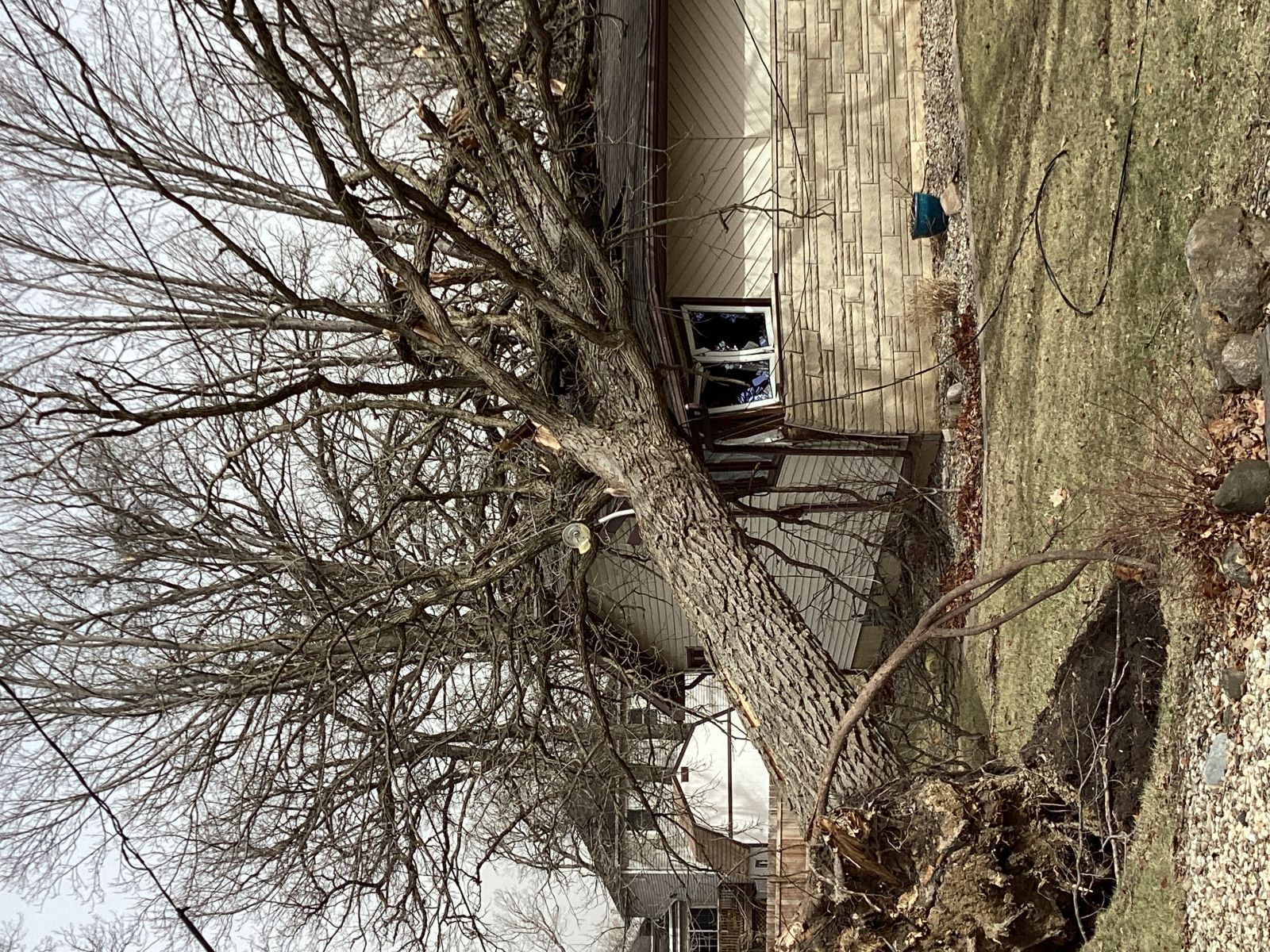
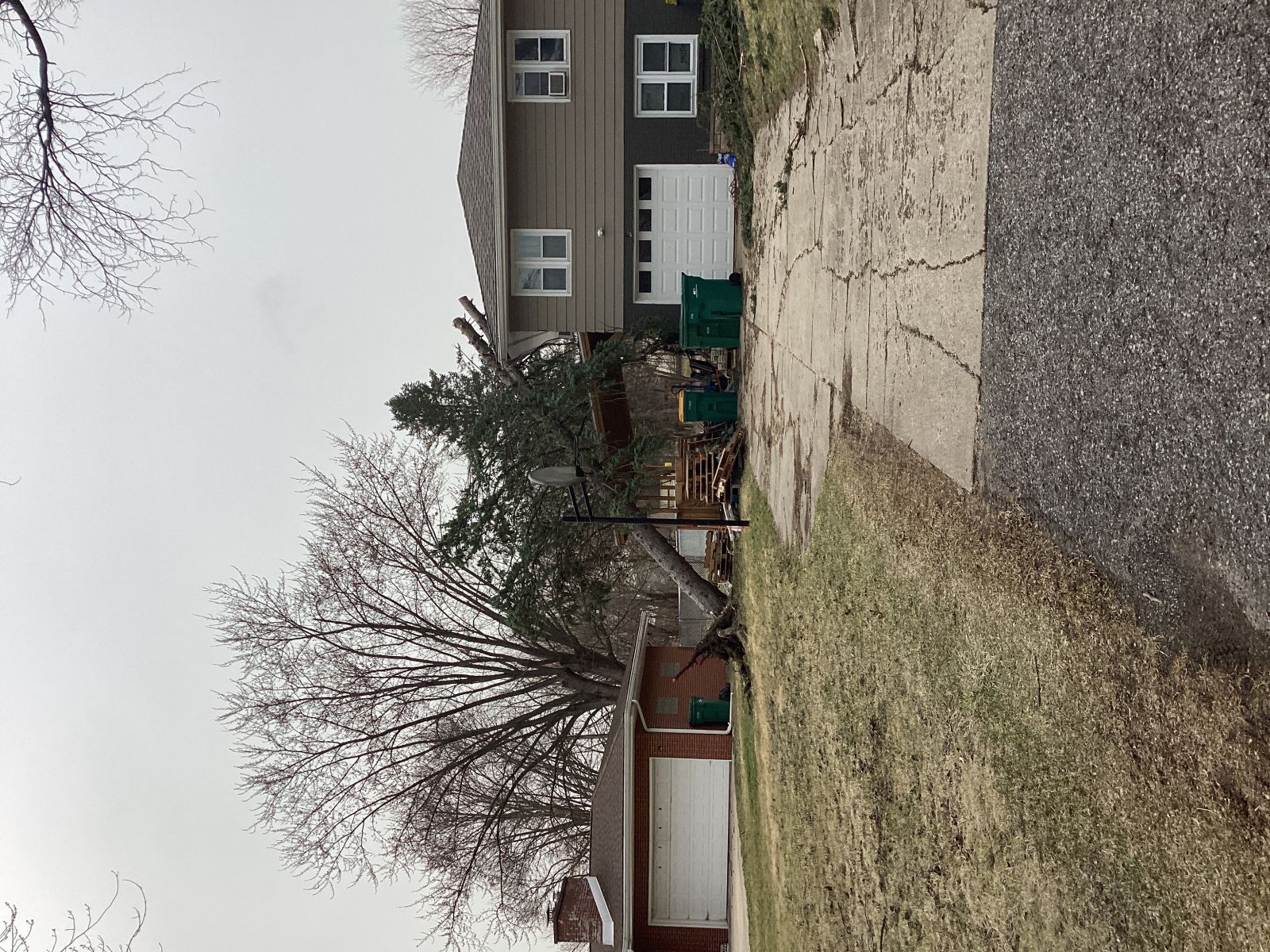
Summary: Damage surveys confirmed a brief EF-0 tornado. A brief tornado began near Newport Boulevard and Longford Road in Hanover Park. The tornado moved rapidly northeastward and dissipated a short time later near Lake Street and Ontarioville Road. Most damage was to trees and fences along the track. The most significant damage was near Andover Drive and Andover Court, where at least one tree was uprooted with peak winds estimated near 75 mph. |
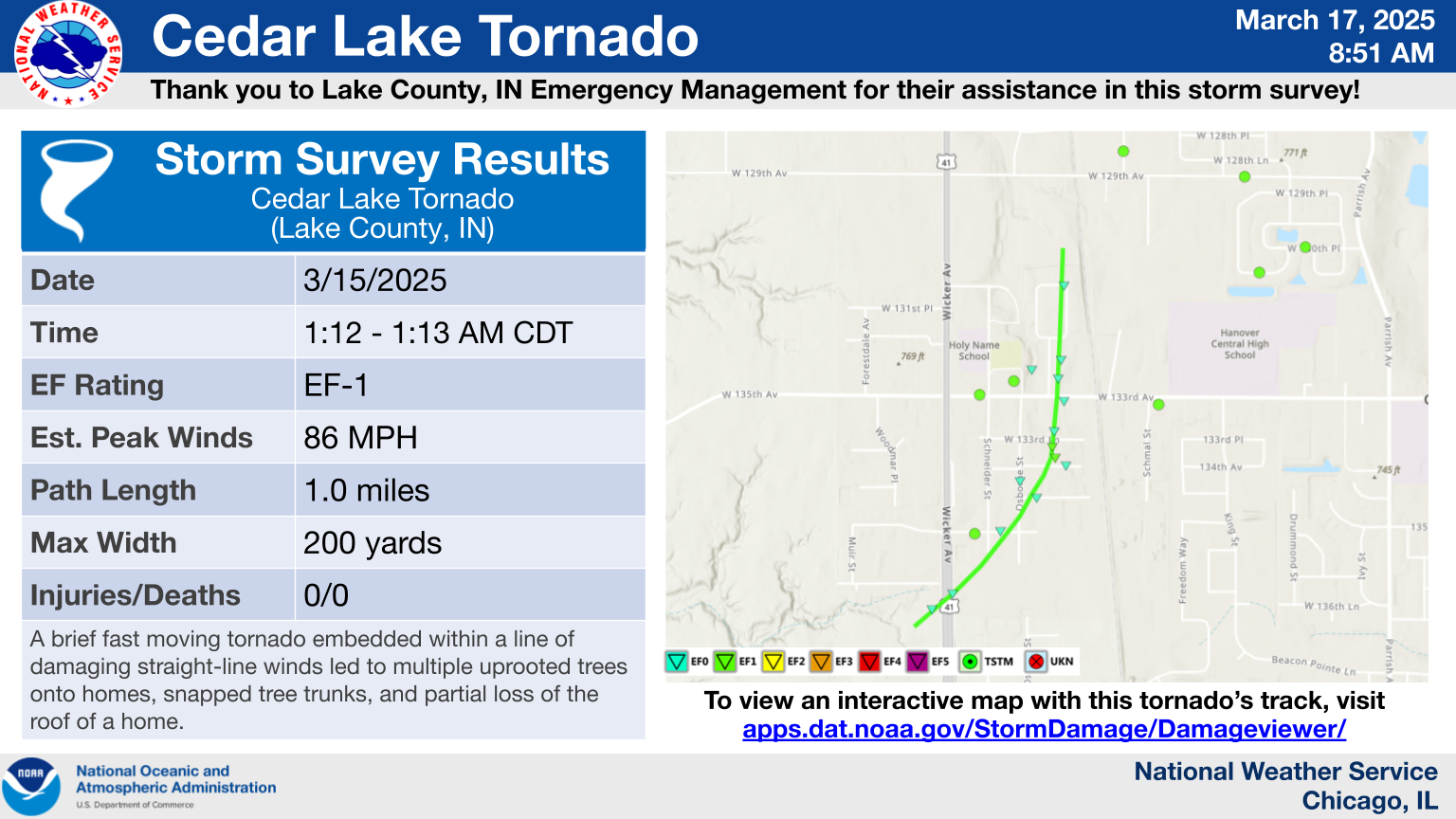
3.) Cedar Lake Tornado
|
(click on image to enlarge) |
|
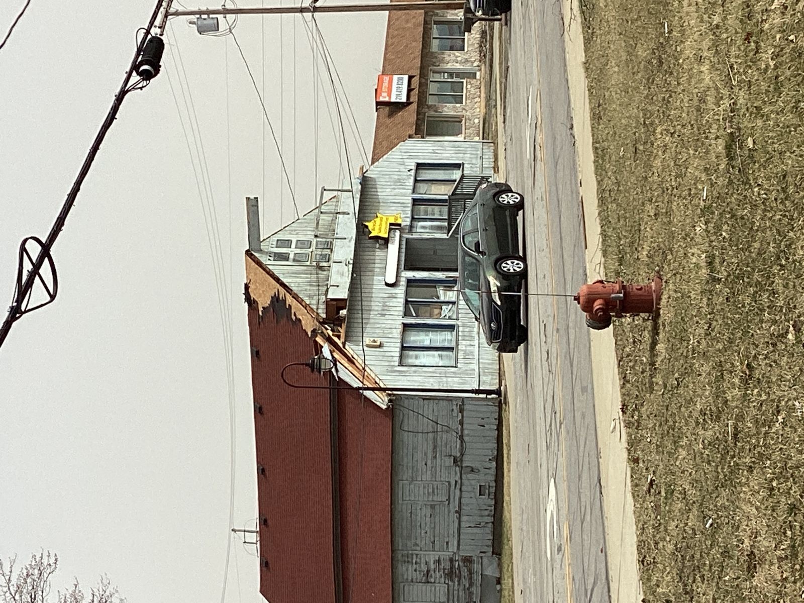
Summary: Damage surveys confirmed an EF-1 tornado. A brief tornado began near Wicker Avenue just south of 136th Place and moved rapidly northeast across Wicker Avenue and through a residential area of Cedar Lake. The tornado then continued north across West 133rd Avenue and along Lindberg Street before ending south of West 129th Avenue. Damage included several large uprooted or snapped trees, some of which fell onto and damaged homes. The most significant damage occurred east of Osborn Street between West 134th Place and West 133rd Lane, where a portion of a roof of a two story home landed in a neighboring yard, with peak winds estimated near 86 mph. In addition, a trampoline was found wrapped around a telephone pole along West 133rd Avenue. |
4.) Schererville-Merrillville Tornado
|
(click on image to enlarge) |
|
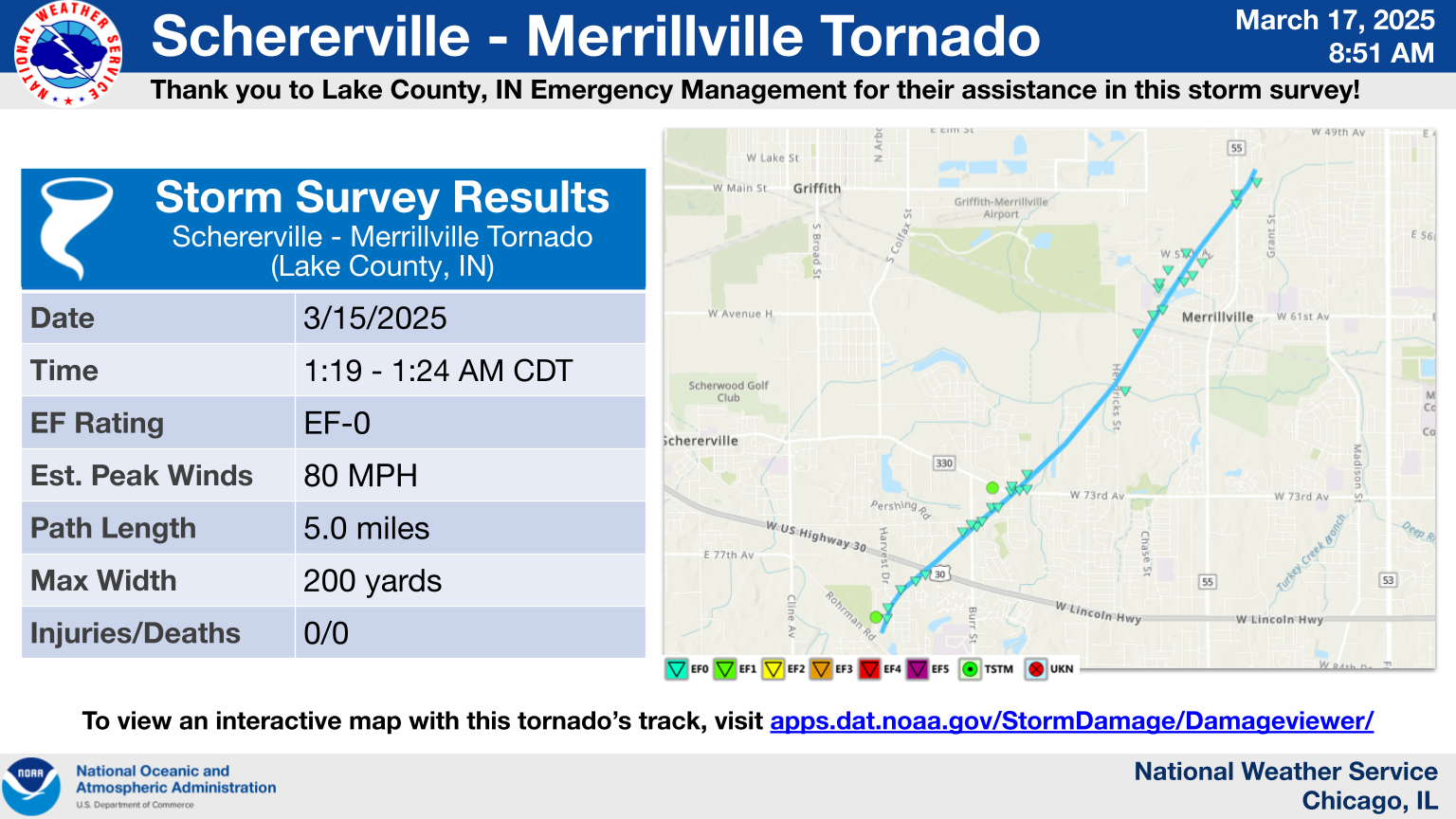
Summary: Damage surveys confirmed an EF-0 tornado. A tornado began just north of Rohrman Drive near a small pond between Rohrman Park and Painted Leaf Drive in southeast Schererville. After snapping multiple trees in Memory Lane Memorial Cemetery, the tornado then moved rapidly northeast across US 30 into west Merrillville, passing just east of Miller Elementary School before ending east of US 55 near West 52nd Place in southeast Ross. Damage included multiple uprooted or snapped large trees along with shingle and roof trim damage to homes across multiple residential areas along the five mile path, with peak estimated winds near 80 mph. |
Straight-Line Winds
|
(click on image to enlarge) |
|
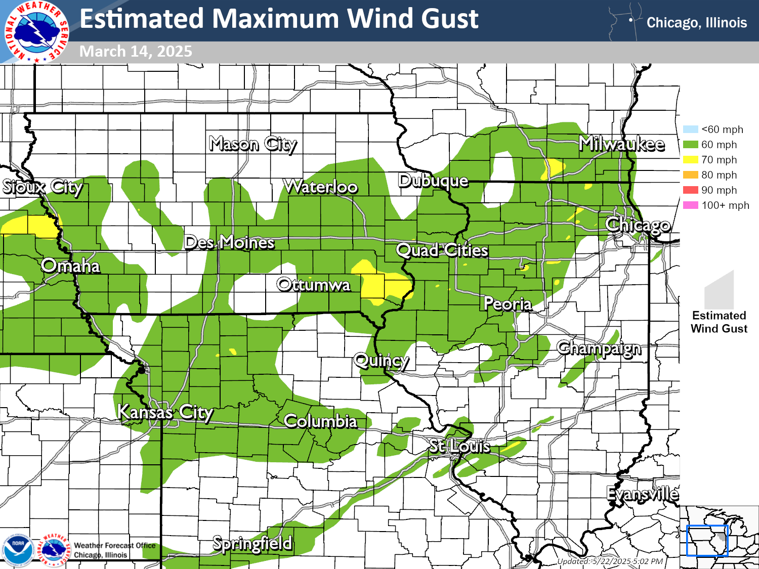
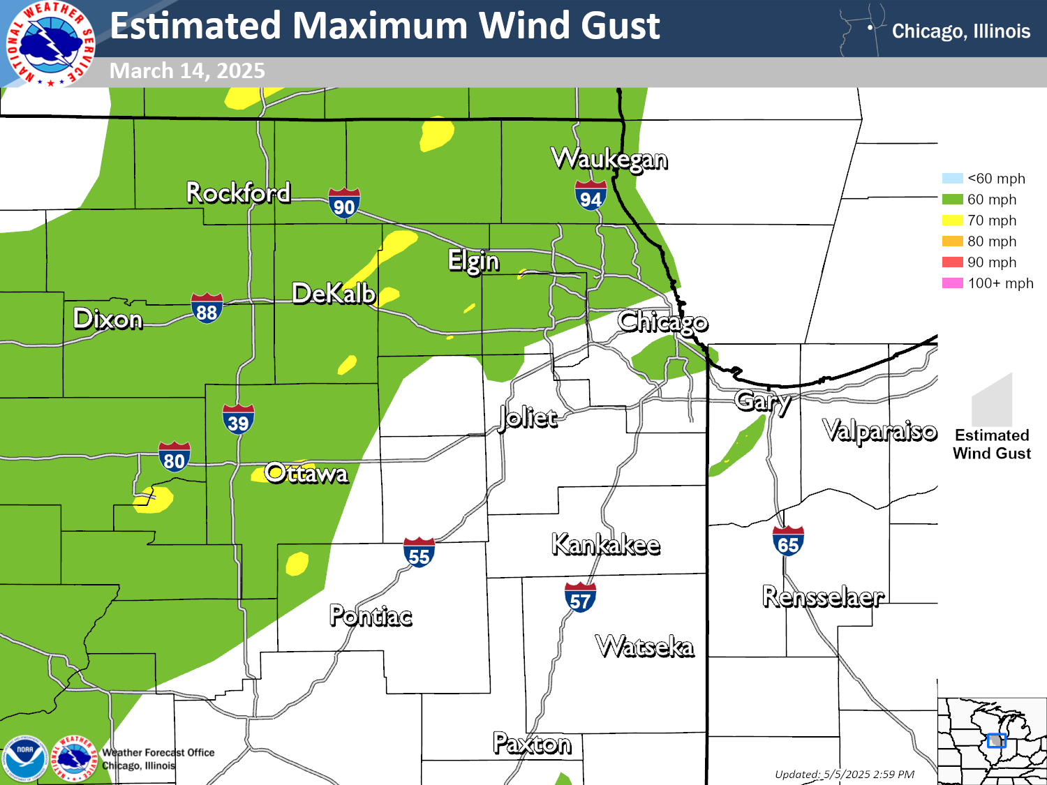
Summary: Straight-line winds in excess of 60 mph were common from eastern Nebraska eastward through Iowa and Missouri to Wisconsin and Illinois. Small corridors of winds up to 70-80 mph were reported by weather stations and confirmed in ground surveys conducted by multiple NWS offices. |
|
(click on image to enlarge) |
|
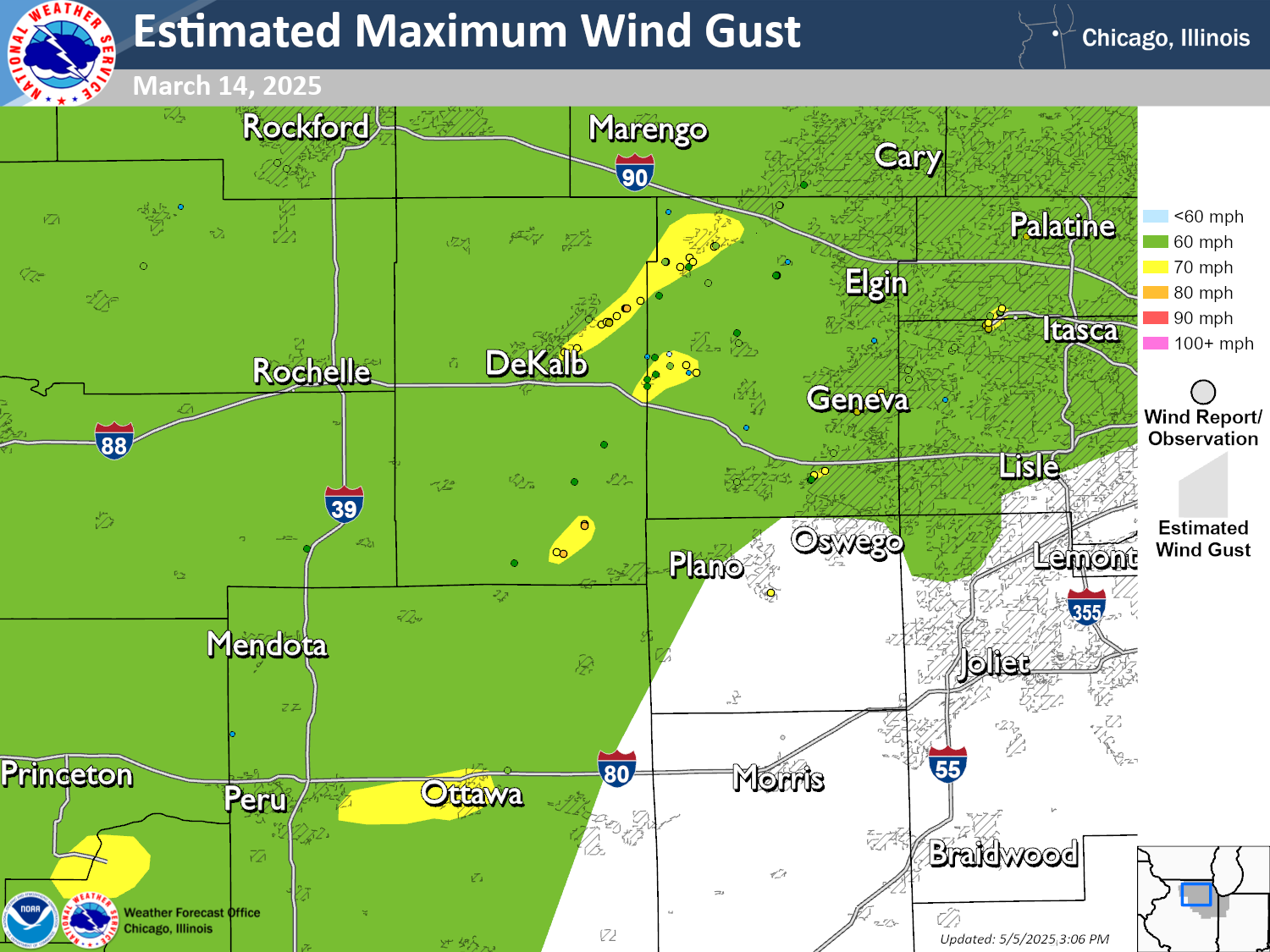
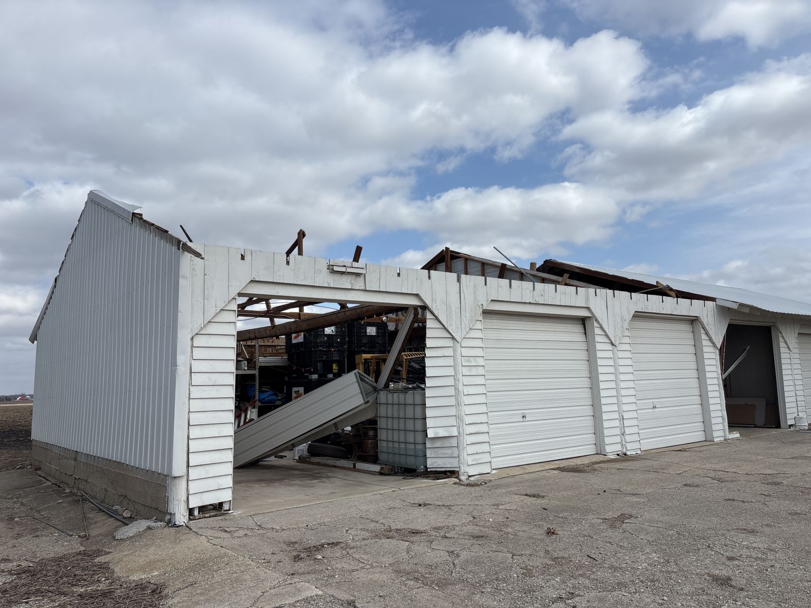
Summary: Straight-line winds up to 70-80 mph occurred near Ottawa, near and northeast of DeKalb, and south of DeKalb. |
The Enhanced Fujita (EF) Scale classifies tornadoes into the following categories:
| EF0 Weak 65-85 mph |
EF1 Moderate 86-110 mph |
EF2 Significant 111-135 mph |
EF3 Severe 136-165 mph |
EF4 Extreme 166-200 mph |
EF5 Catastrophic 200+ mph |
 |
|||||
When a tornado is known to have occurred but does not cause damage to any qualified damage indicators, or if the only damage is located in an area that is inaccessible to NWS storm survey personnel, then a tornado may be assigned the EF-Unknown (EF-U) rating.
Photos
|
|
|
|
| Hanover Park, IL (NWS Storm Survey) | Cedar Lake, IN (NWS Storm Survey) | Cedar Lake, IN (NWS Storm Survey) |
|
|
|
|
| Cedar Lake, IN (NWS Storm Survey) | Schererville, IN (NWS Storm Survey) | Sycamore, IL (NWS Storm Survey) |
Meteorology and Environment
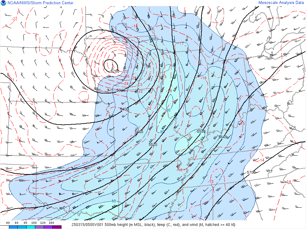 |
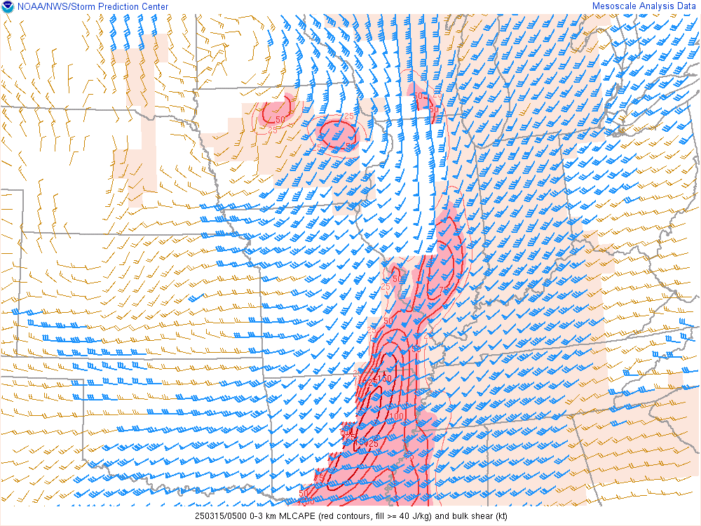 |
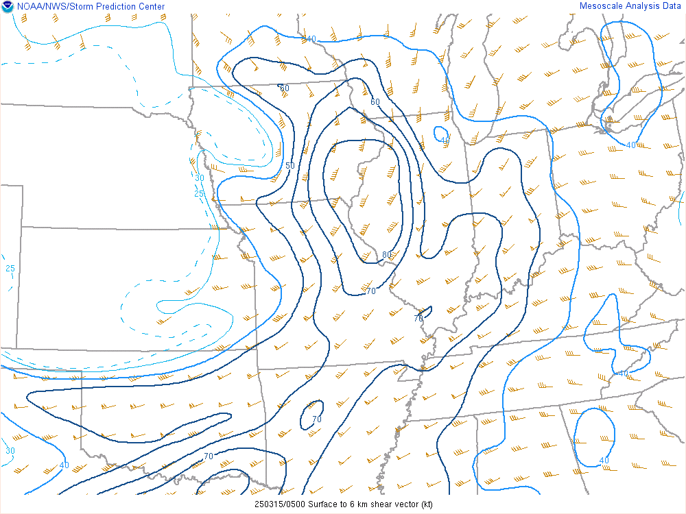 |
| 500 mb winds and heights | Low-level instability and wind shear | Deep layer shear |
 |
Media use of NWS Web News Stories is encouraged! Please acknowledge the NWS as the source of any news information accessed from this site. Additional event recaps can be found on the NWS Chicago Past Events Page |
|



 Follow us on X
 Follow us on Facebook
 Follow us on YouTube
 LOT RSS Feed