Record setting heat is expected over the next several days from the Intermountain West through the northern Plains. Furthermore, fire weather concerns increase with dry and breezy conditions. Meanwhile, heavy rainfall and severe thunderstorm threats for the Ohio/Tennessee Valleys, central Appalachians and Southeast today. The threat shifts to central Gulf Coast and across central Texas this week. Read More >
|
|
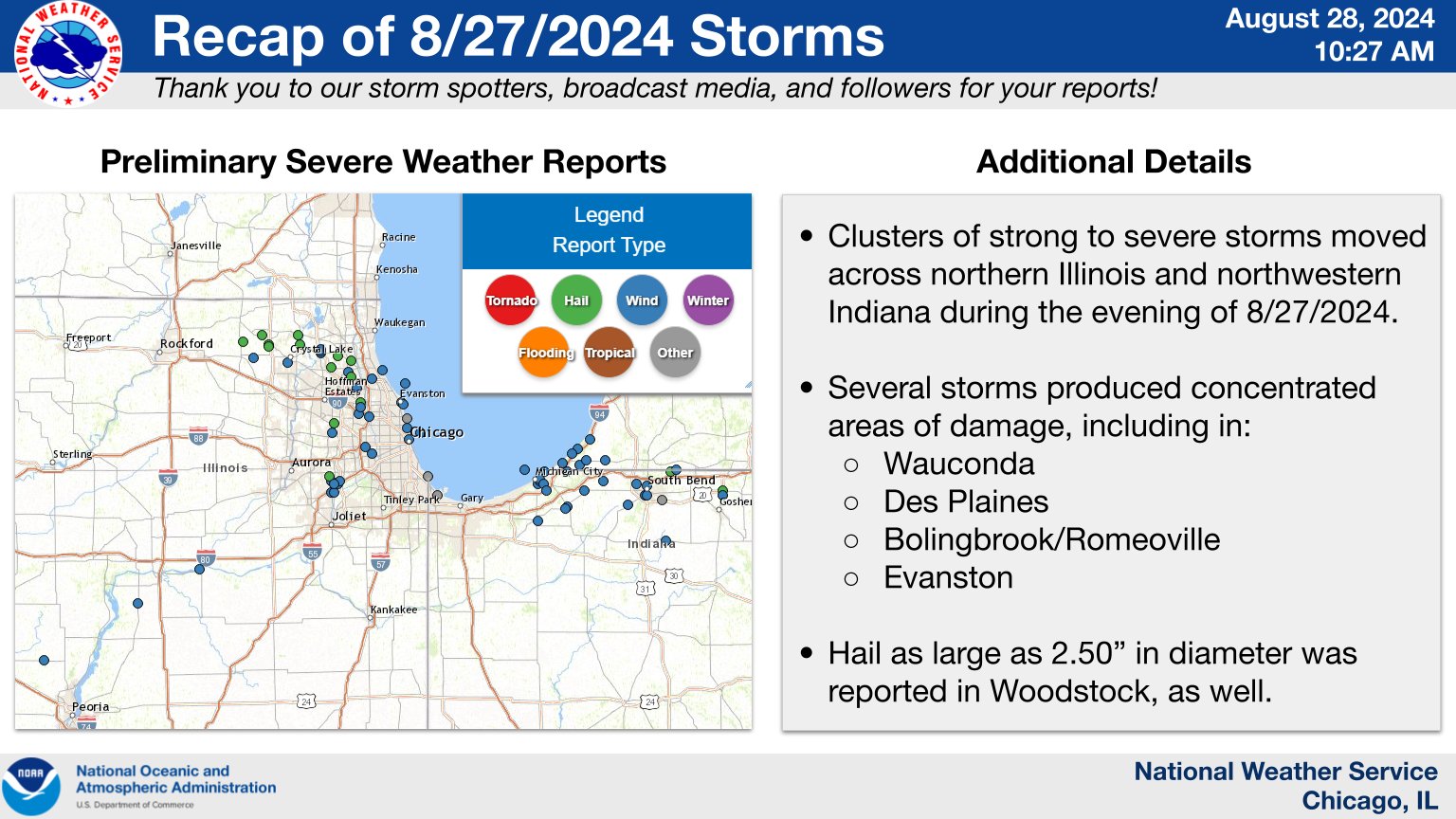
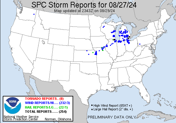
Overview
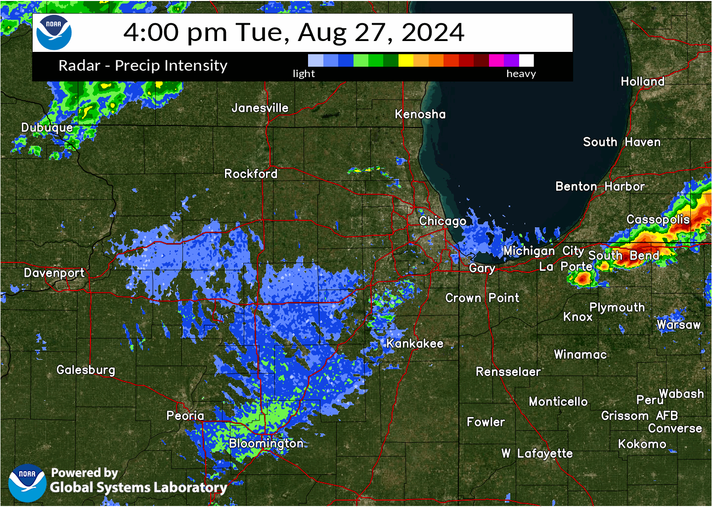
Radar
|
6-hour radar loop (4 PM - 10 PM). Storms after 10 PM were sub-severe. |
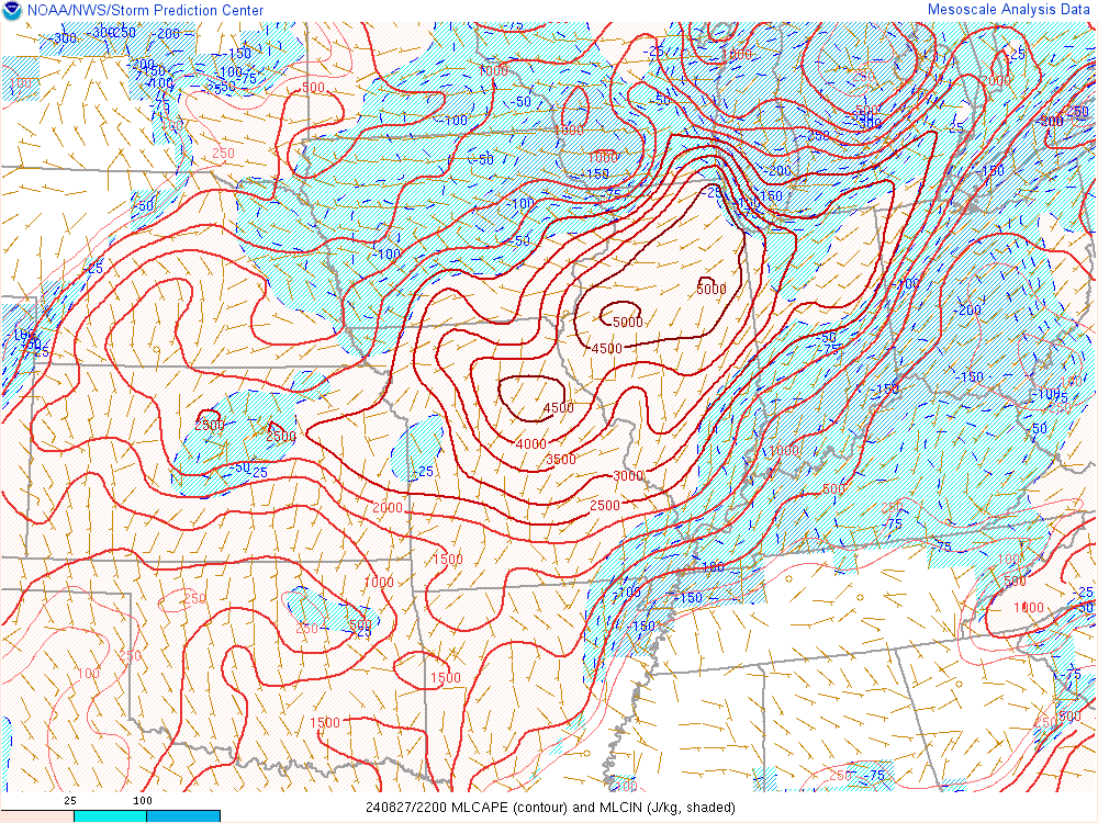
Environment
 |
 |
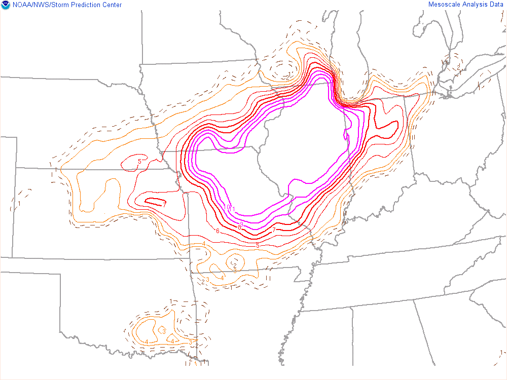 |
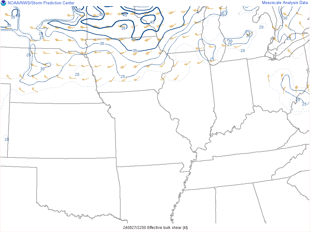
| Convective Available Potential Energy (CAPE), or a measure of "fuel" for thunderstorms at 5 PM. Values above 4,000 J/kg are supportive of explosive thunderstorm development. | Wind shear, or change of wind direction and speed from the surface to about 20,000 feet. Values are generally below 30 knots which is not particularly supportive of supercell (rotating) storms. | Microburst composite parameter, which highlights regions favorable for intense microbursts/downbursts. Values were exceptionally high over northern and central Illinois. |
Additional Information
Links:
 |
Media use of NWS Web News Stories is encouraged! Please acknowledge the NWS as the source of any news information accessed from this site. Additional recaps can be found on the NWS Chicago Past Events Page |
|