
Heat expands across the Desert Southwest, Plains, Mississippi Valley and Midwest into Monday. Fire weather concerns continue for portions of the Intermountain West. Active monsoonal moisture fuels thunderstorms over the Southwest with possible flash flooding. Tropical cyclone Fausto in the Pacific, should weaken as it approaches Hawaii; Dangerous surf, swells and rip currents are expected. Read More >
|
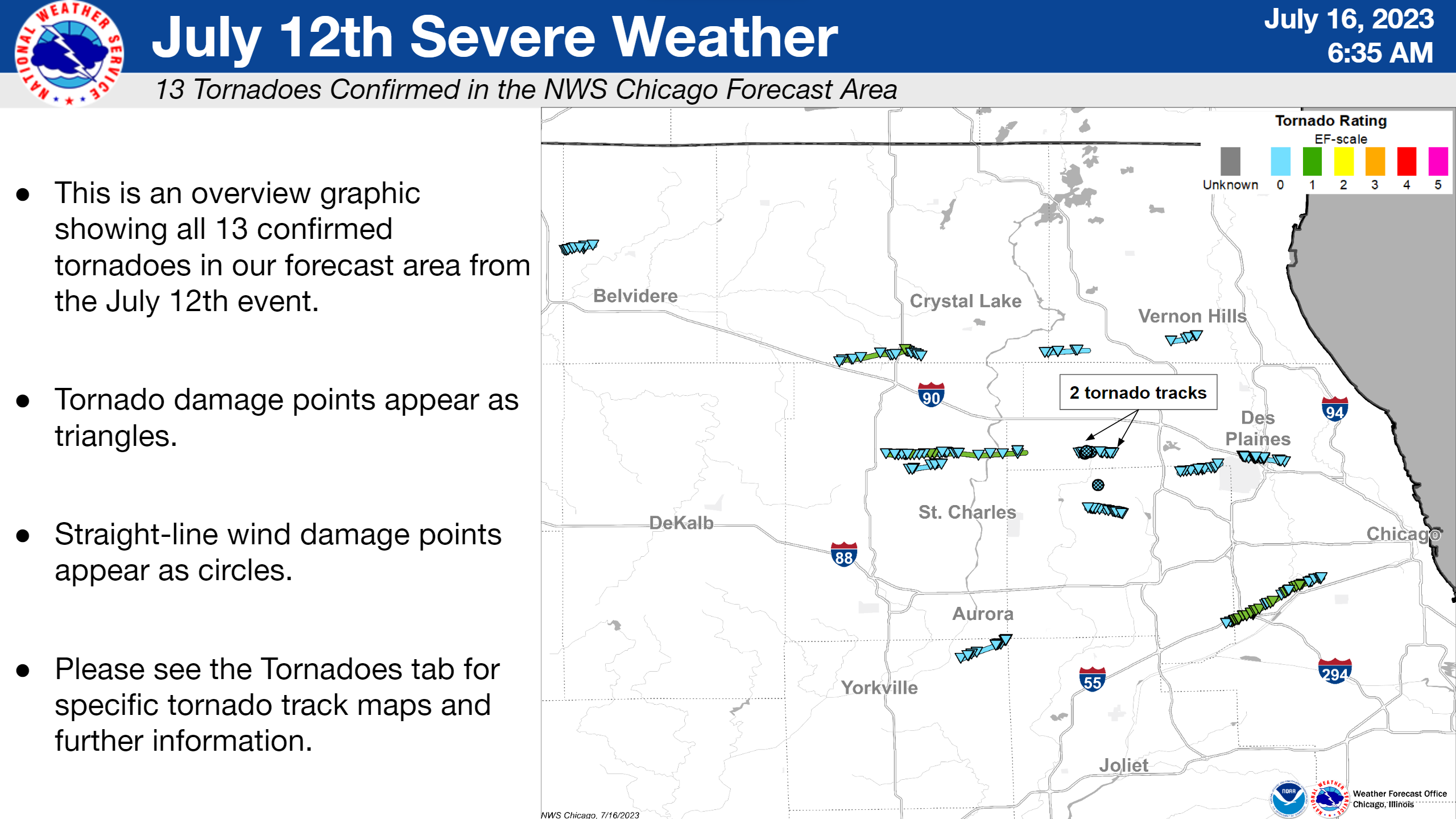
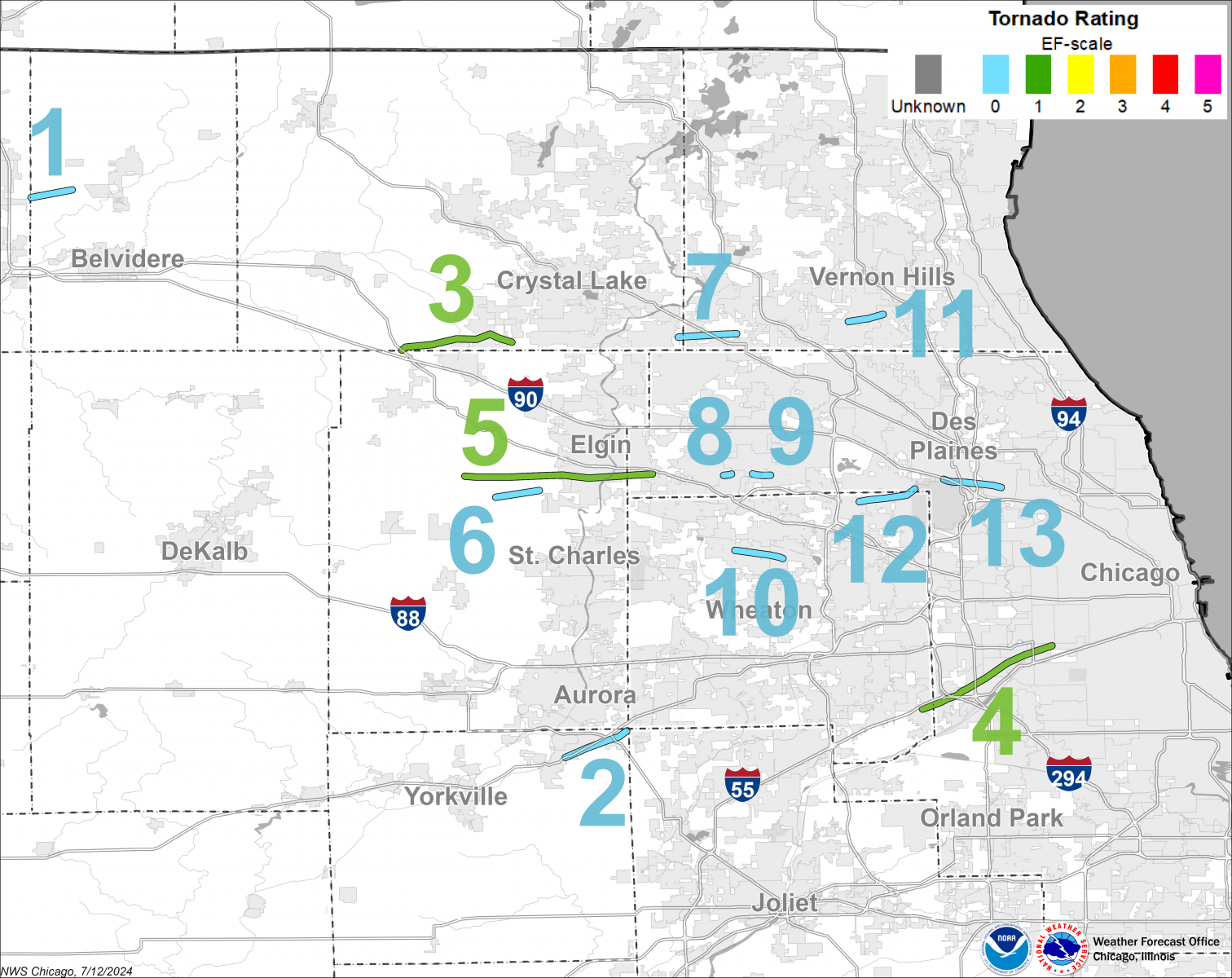
Overview of July 12, 2023 Tornado Tracks |
Fast Facts
|
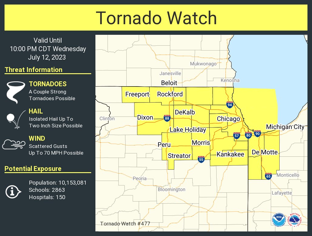
Tornado Watch issued at 3:50 PM |
Tornadoes
|
Overview of the 13 tornadoes that occurred in northeast Illinois |
Details on all 13 tornadoes can be found in this Public Information Statement. An interactive map with all of the tornado tracks can be viewed on our Damage Assessment Toolkit Viewer website (change the date range in the top right corner to include 7/12/2023 and 7/13/2023 to see all 13 tornadoes from this event).
Downloadable KMZ File with All Tornado Tracks
Downloadable Shapefile with All Tornado Tracks
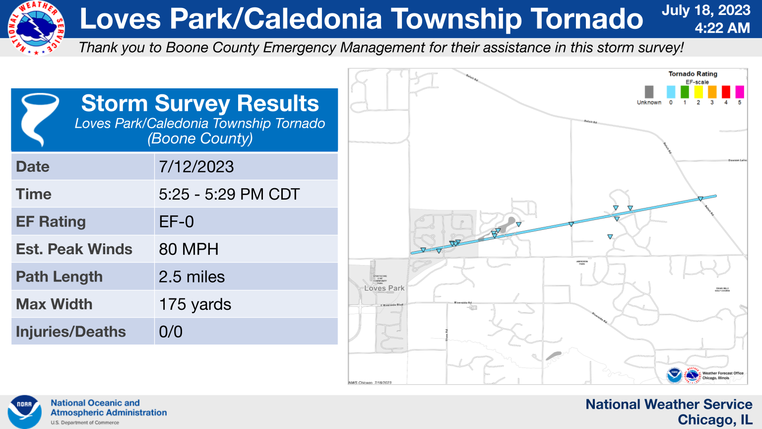
1.) Loves Park/Caledonia Township: EF-0
|
(click on image to enlarge) |
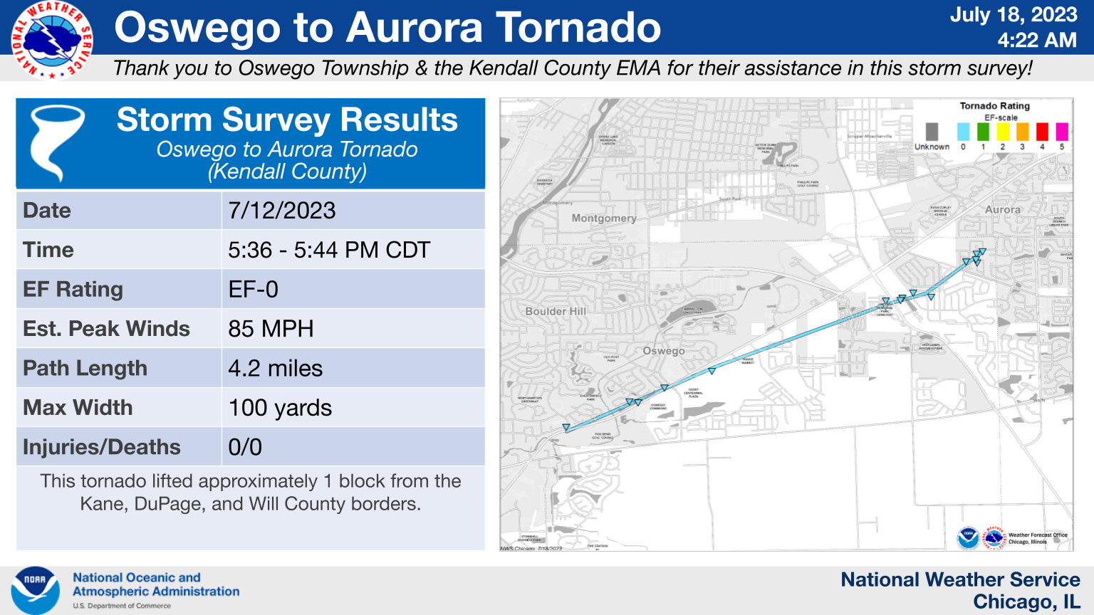
2.) Oswego to Aurora: EF-0
|
(click on image to enlarge) |
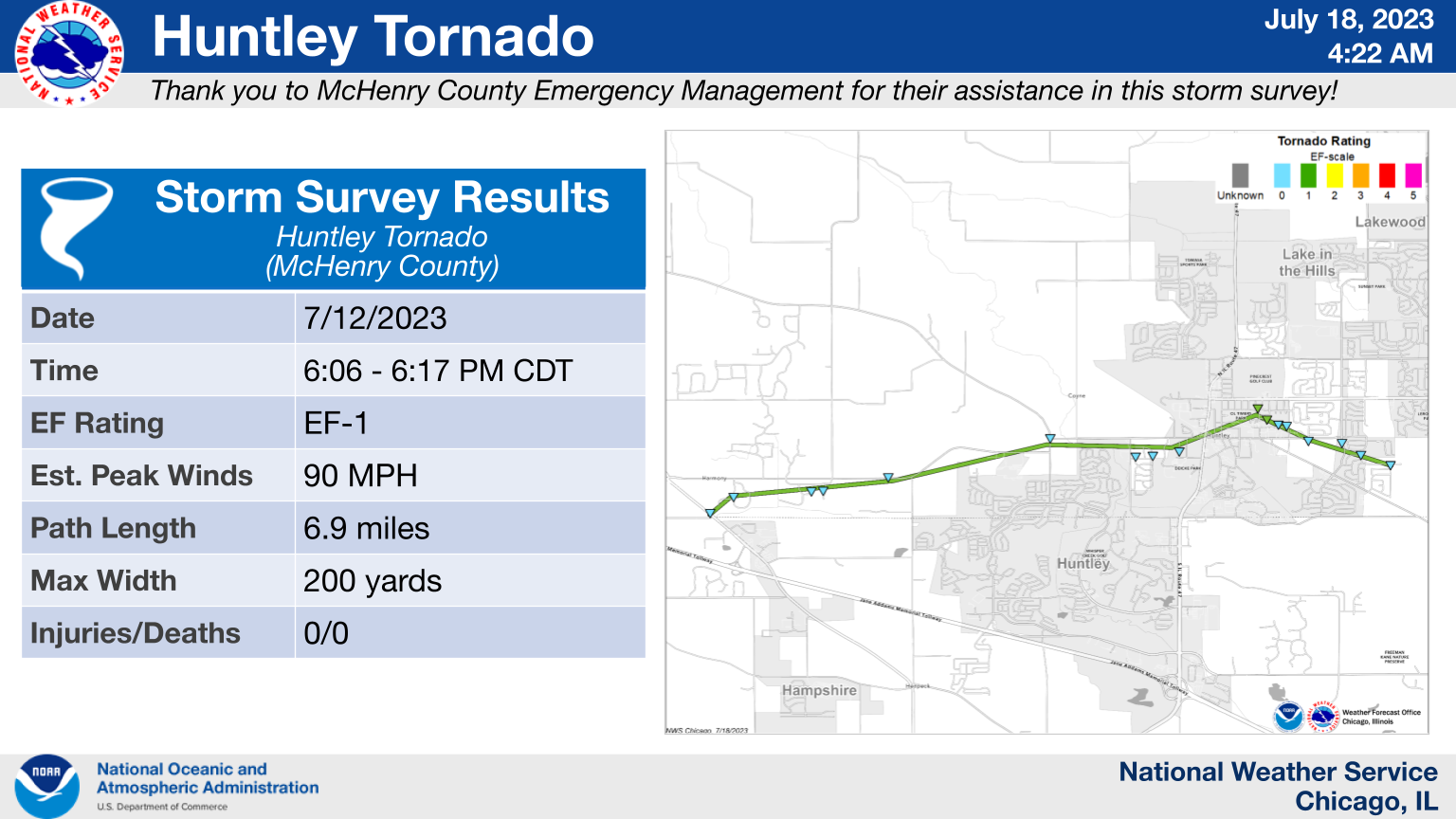
3.) Huntley: EF-1
|
(click on image to enlarge) |
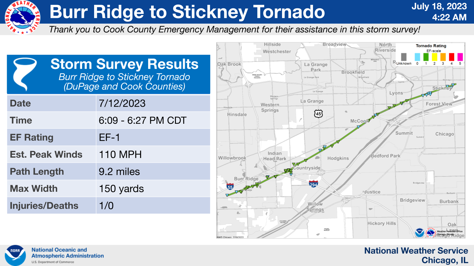
4.) Burr Ridge to Stickney: EF-1
|
(click on image to enlarge) |
5.) Plato Center to Elgin: EF-1
|
(click on image to enlarge) |
6.) Campton Hills to Elgin: EF-0
|
(click on image to enlarge) |
7.) Barrington Hills to Barrington: EF-0
|
(click on image to enlarge) |
8.) Streamwood: EF-0
|
(click on image to enlarge) |
9.) Schaumburg: EF-0
|
(click on image to enlarge) |
10.) Carol Stream to Glendale Heights: EF-0
|
(click on image to enlarge) |
11.) Long Grove: EF-0
|
(click on image to enlarge) |
12.) Itasca to O'Hare Airport: EF-0
|
(click on image to enlarge) |
13.) O'Hare Airport to Park Ridge: EF-0
|
(click on image to enlarge) |
The Enhanced Fujita (EF) Scale classifies tornadoes into the following categories:
| EF0 Weak 65-85 mph |
EF1 Moderate 86-110 mph |
EF2 Significant 111-135 mph |
EF3 Severe 136-165 mph |
EF4 Extreme 166-200 mph |
EF5 Catastrophic 200+ mph |
 |
|||||
When a tornado is known to have occurred but does not cause damage to any qualified damage indicators, or if the only damage is located in an area that is inaccessible to NWS storm survey personnel, then a tornado may be assigned the EF-Unknown (EF-U) rating.
Storm Reports
|
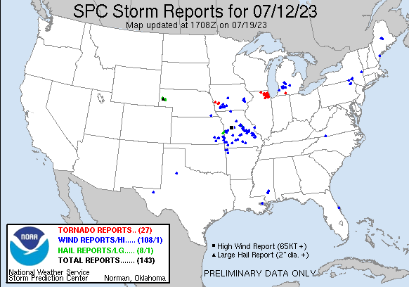
Preliminary storm reports from 7/12/2023 |
Preliminary Local Storm Report...Summary
National Weather Service Chicago IL
532 PM CDT Sat Jul 15 2023
..TIME... ...EVENT... ...CITY LOCATION... ...LAT.LON...
..DATE... ....MAG.... ..COUNTY LOCATION..ST.. ...SOURCE....
..REMARKS..
0525 PM Tornado 2 WSW Timberlane 42.33N 88.89W
07/12/2023 Boone IL NWS Storm Survey
An NWS damage survey determined an EF-0
tornado with estimated peak winds of 80 mph,
path width of 175 yards, and path length of
2.5 miles impacted Loves Park and Caledonia
Townships. Damage along the path of the
tornado consisted of snapped and uprooted
trees as well as exterior damage to roofs.
0536 PM Tornado 1 S Boulder Hill 41.69N 88.33W
07/12/2023 Kendall IL NWS Storm Survey
An NWS damage survey determined an EF-0
tornado with estimated peak winds of 85 mph,
path width of 100 yards, and path length of
2.8 miles impacted Oswego and Aurora. Damage
along the path of the tornado consisted of
snapped and uprooted trees as well as
exterior damage to homes.
0606 PM Tornado 4 N Hampshire 42.15N 88.52W
07/12/2023 McHenry IL NWS Storm Survey
An NWS damage survey determined an EF-1
tornado with estimated peak winds of 90 mph,
path width of 200 yards, and path length of
6.9 miles impacted Huntley. Damage along the
path of the tornado consisted of snapped
tree limbs and uprooted trees. In addition,
roof damage was observed to two homes.
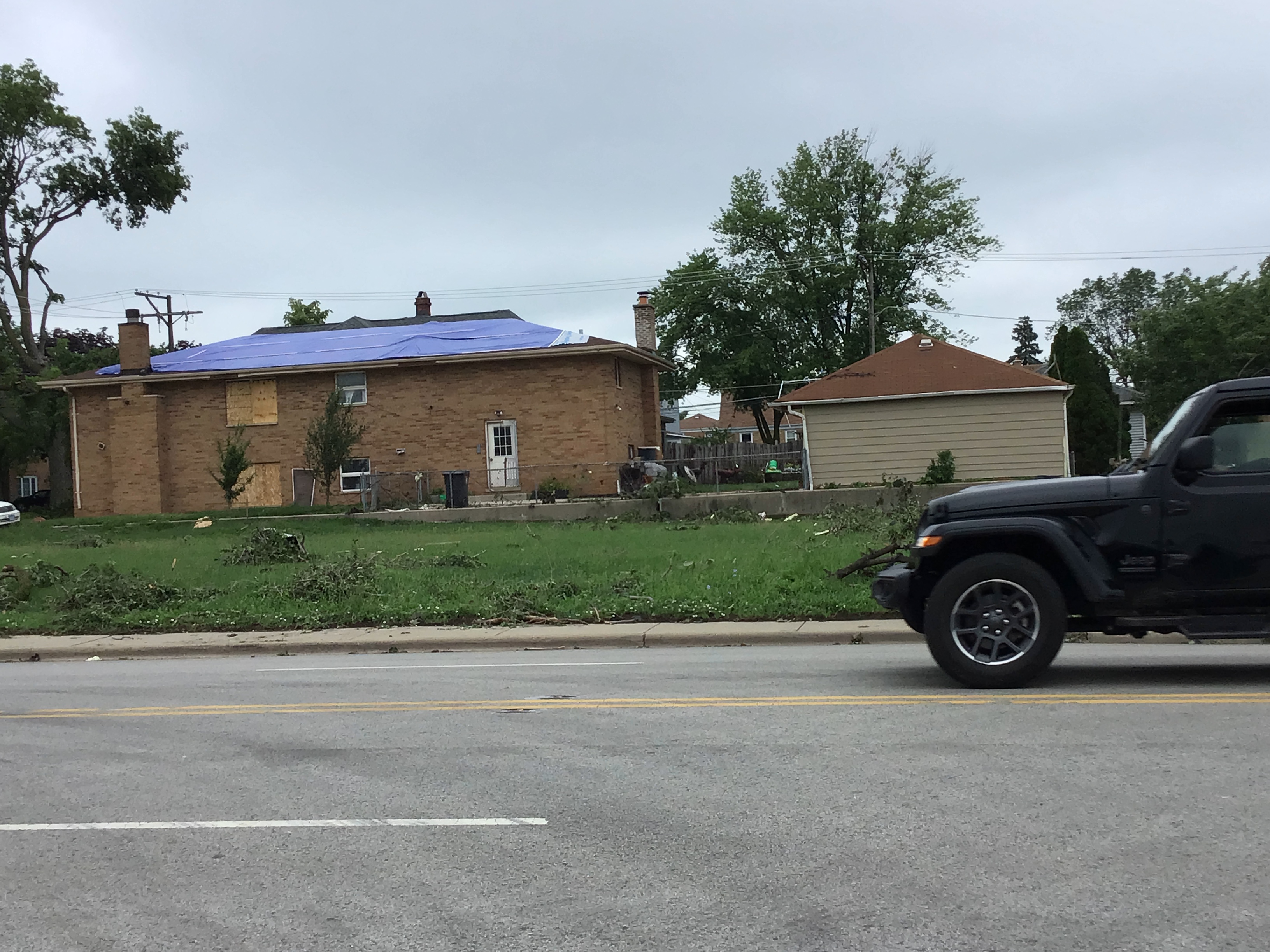
0609 PM Tornado 1 WSW Burr Ridge 41.75N 87.93W
07/12/2023 DuPage IL NWS Storm Survey
*** 1 INJ ***
An NWS damage survey determined an EF-1
tornado with estimated peak winds of 110
mph, path width of 150 yards, and path
length of 9.2 miles started near Burr Ridge
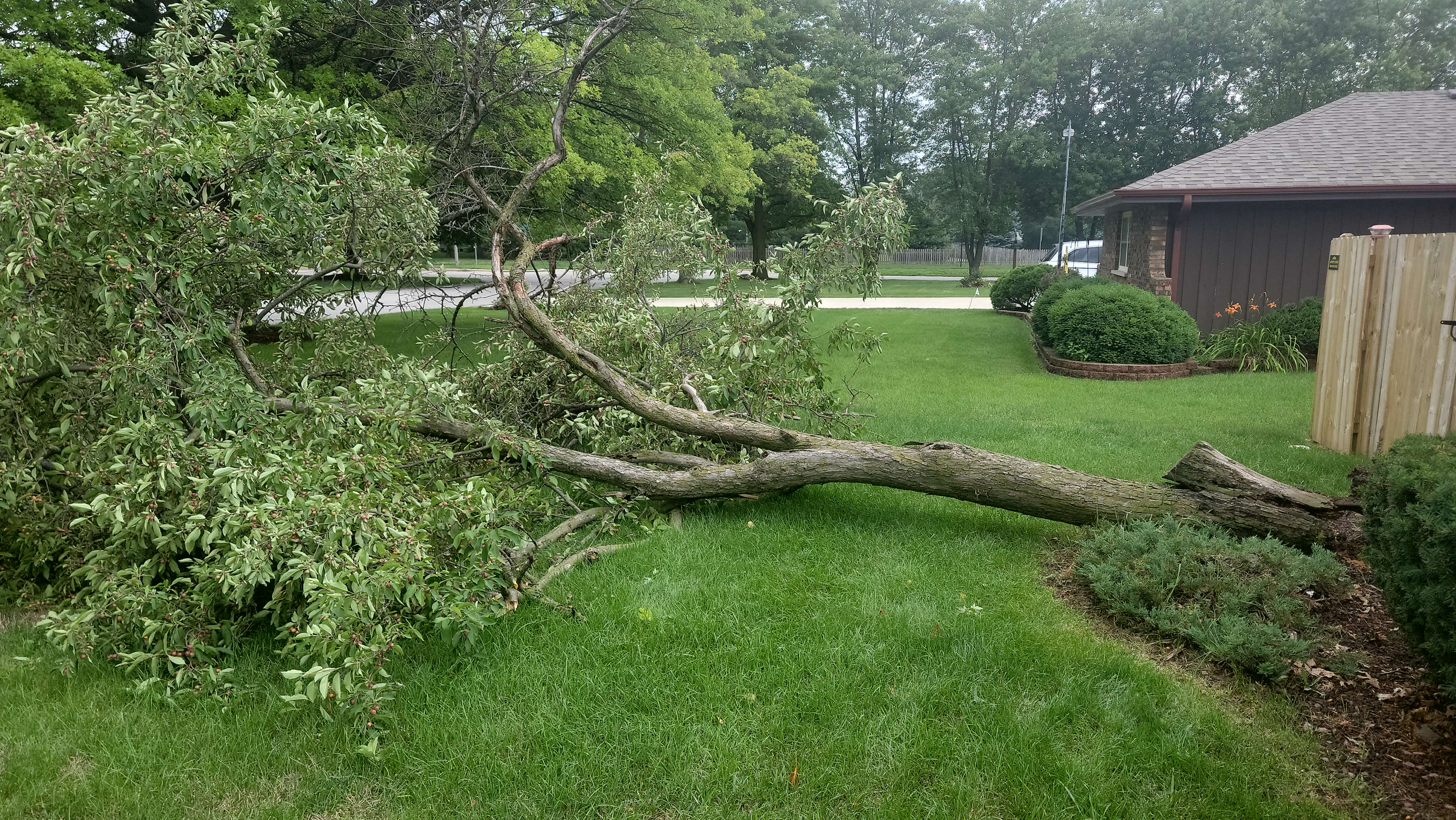
and ended in Stickney. Damage along the path
of the tornado consisted of snapped tree
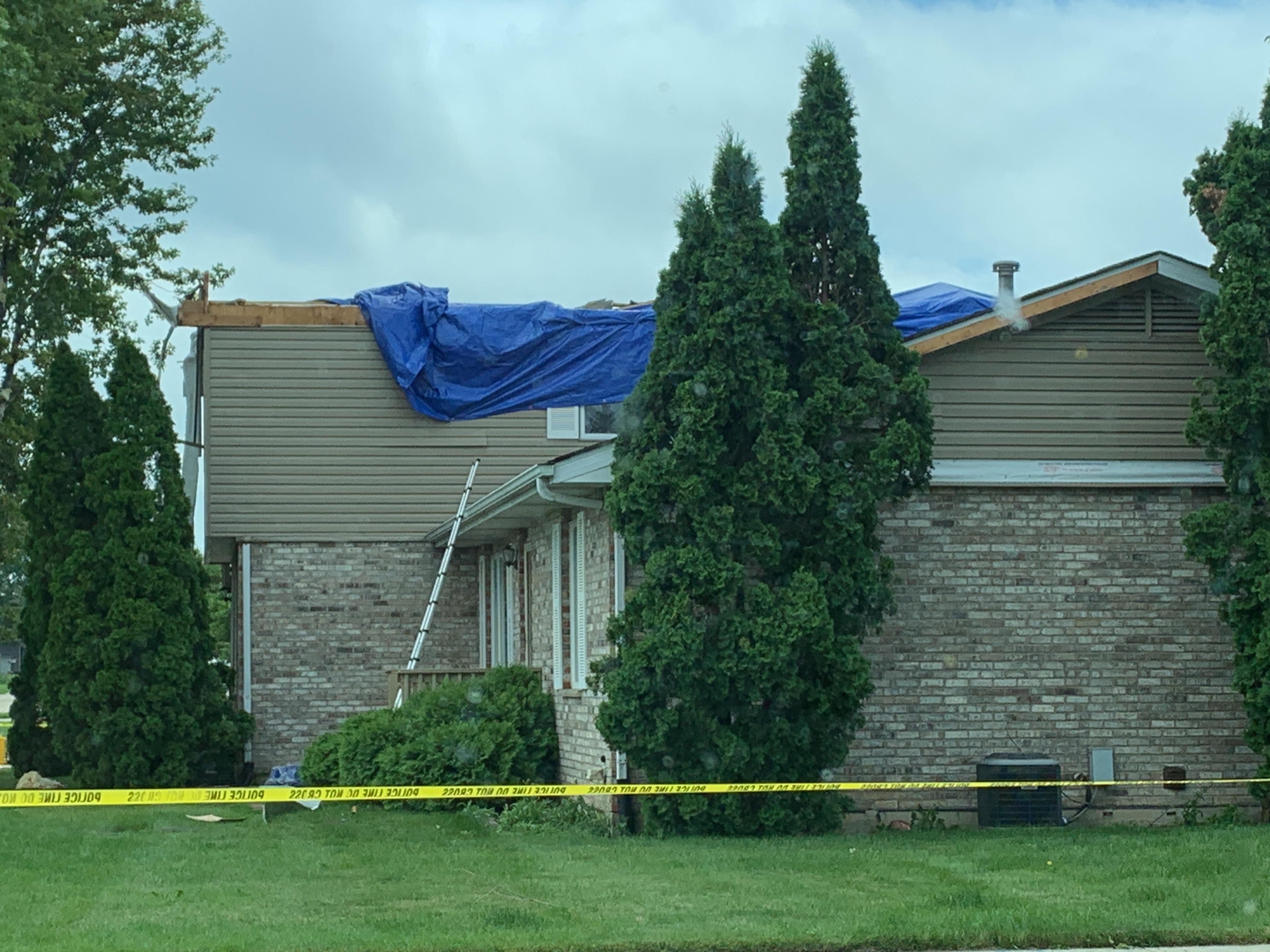
limbs and uprooted trees, damage to walls
and roofs of homes and businesses, and the
movement of shipping containers in
industrial areas. One injury was reported as
a truck was rolled on a roadway.
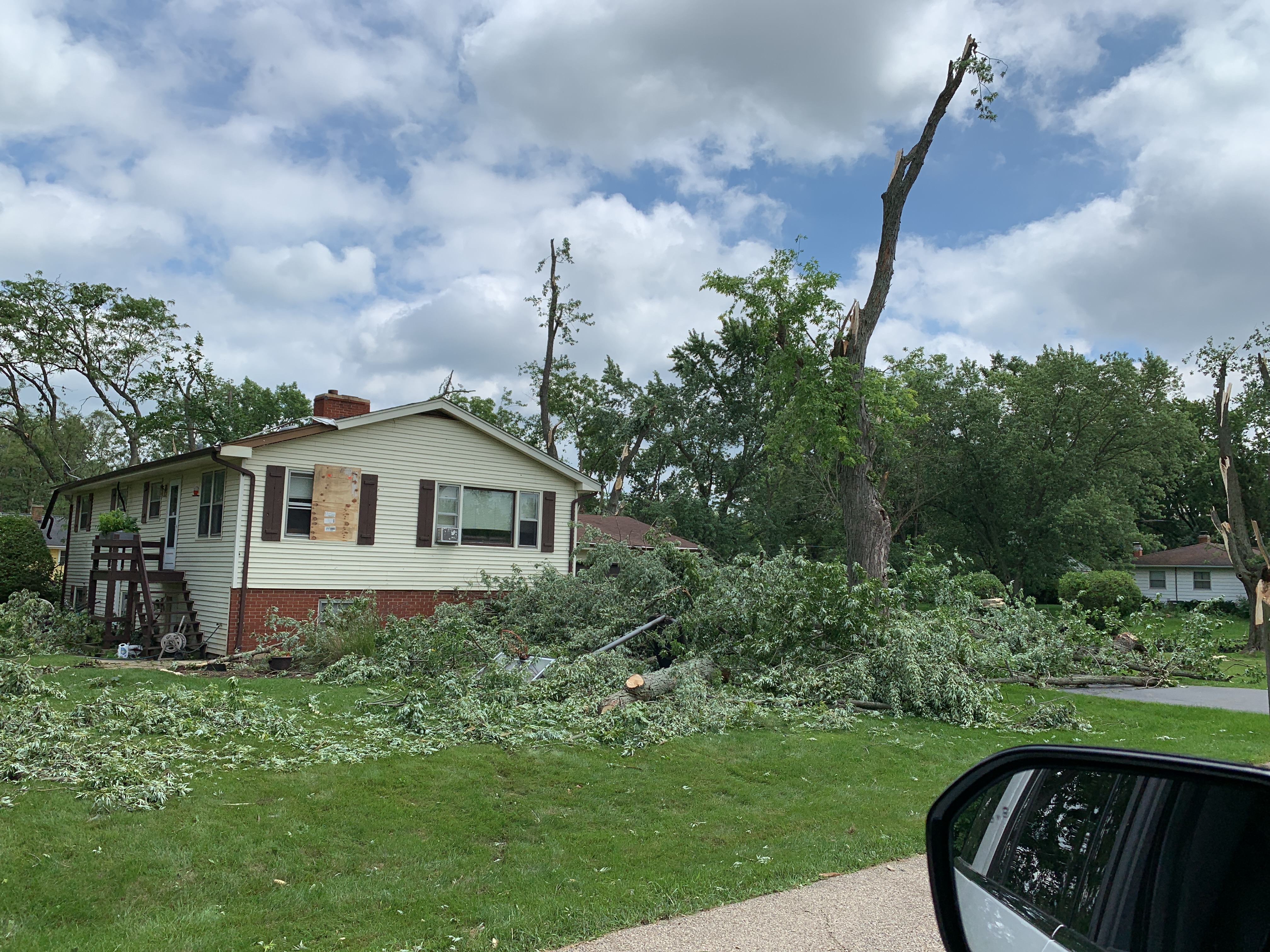
0616 PM Tornado 4 SSW Pingree Grove 42.01N 88.45W
07/12/2023 Kane IL NWS Storm Survey
An NWS damage survey determined an EF-1
tornado with estimated peak winds of 100
mph, path width of 440 yards, and path
length of 11.0 miles impacted Plato Center
and Elgin. Damage along the path of the
tornado consisted of snapped tree limbs and
uprooted trees as well as damage to walls
and roofs of several homes. Several garages
were damaged or destroyed, and the roof of a
church was damaged.
0618 PM Tornado 4 N Campton Hills 42.00N 88.41W
07/12/2023 Kane IL NWS Storm Survey
An NWS Damage Survey determined an EF-0
tornado with max estimated winds of 85 mph,
path width of 100 yards, and path length of
2.6 miles impacted Campton Hills to Elgin.
Damage along the path of the tornado was
almost entirely to trees with one home
sustaining damage to a roof and exterior
wall.
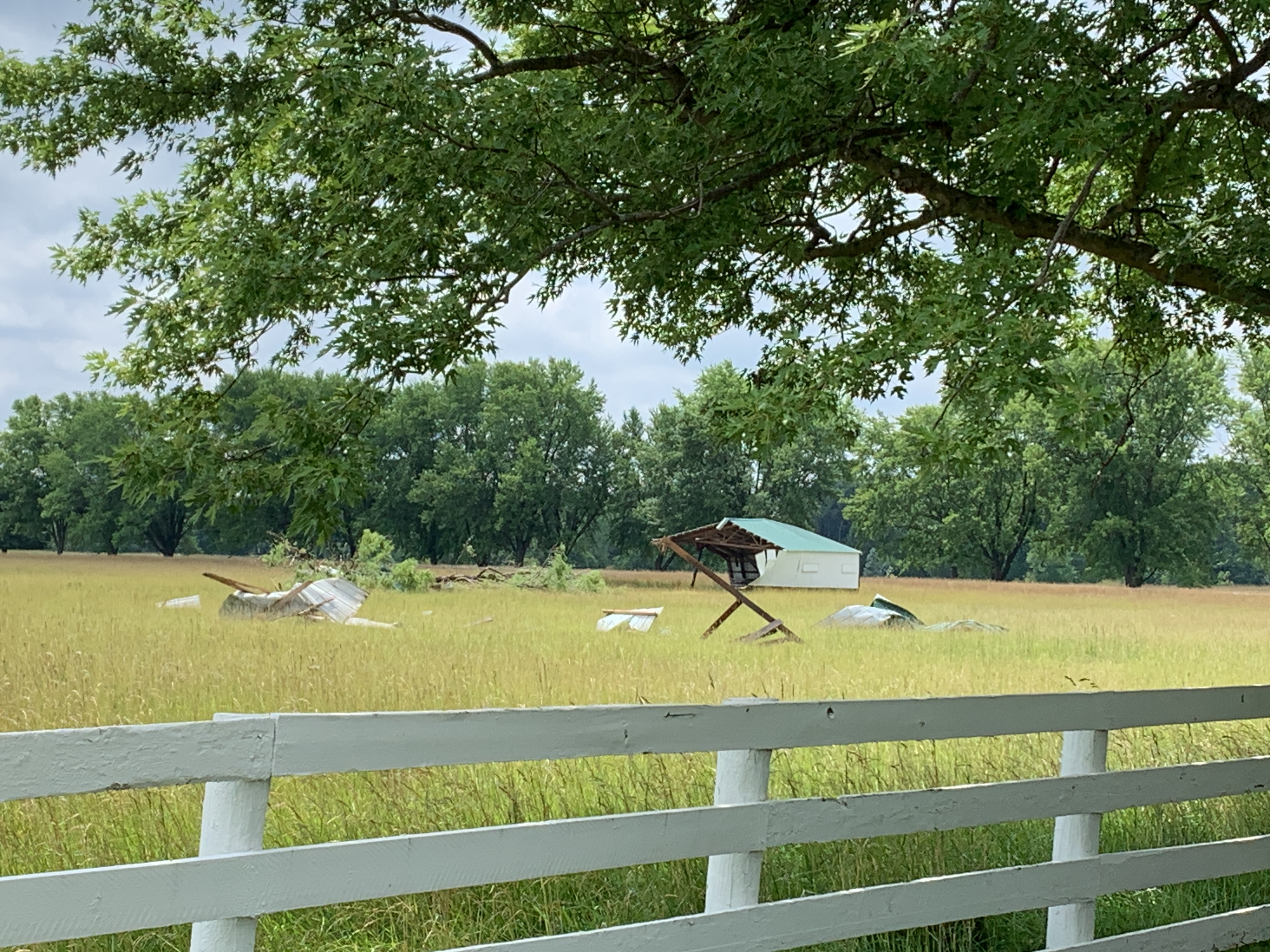
0633 PM Tornado 2 SSE Fox River Grove 42.17N 88.20W
07/12/2023 McHenry IL NWS Storm Survey
An NWS damage survey determined an EF-0
tornado with estimated peak winds of 80 mph,
path width of 125 yards, and path length of
3.4 miles impacted Barrington Hills and
Barrington. Damage along the path of the
tornado consisted of exterior damage to a
farm outbuilding and snapped and downed tree
limbs.
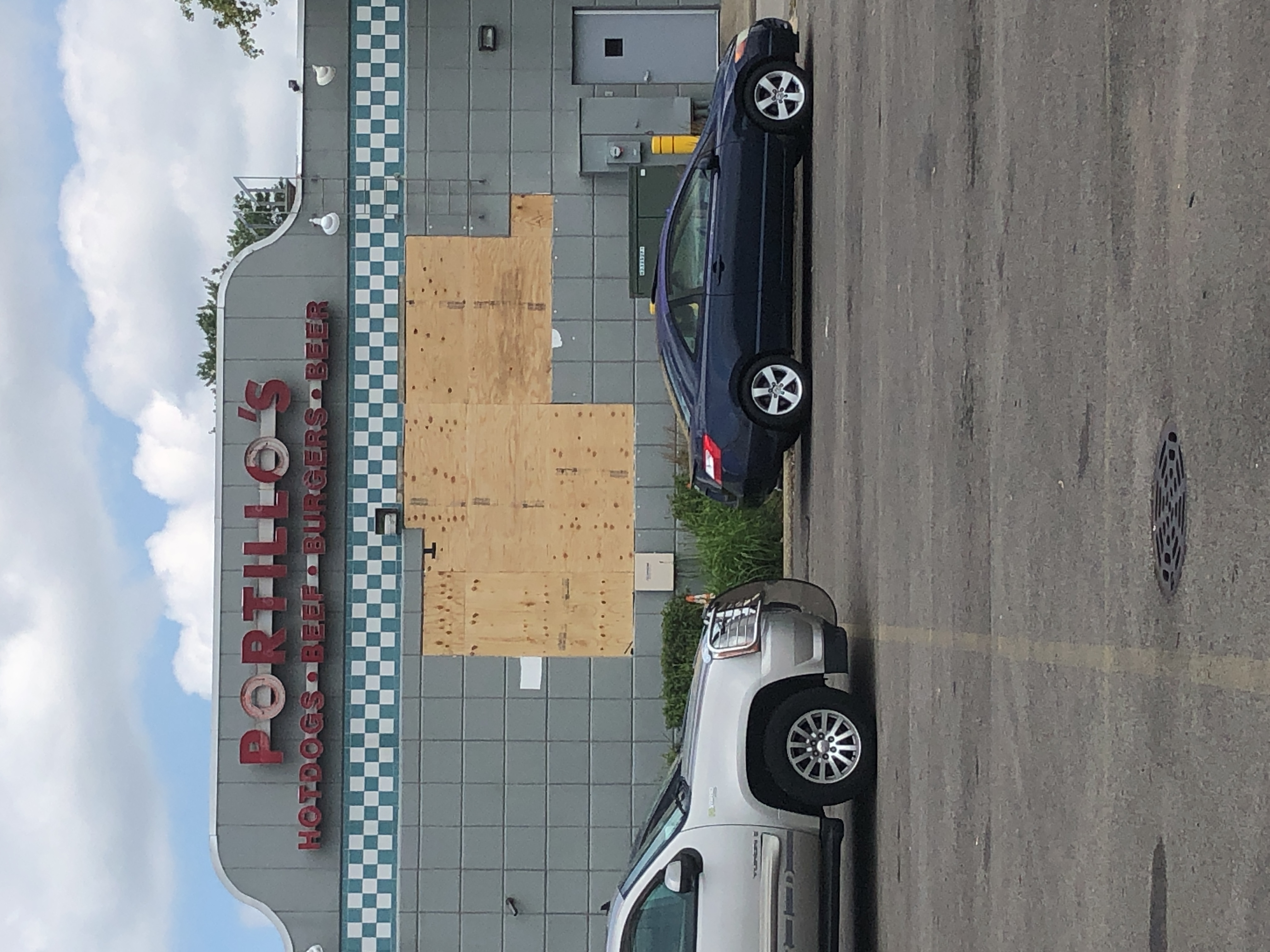
0641 PM Tornado 1 NNW Hanover Park 42.01N 88.15W
07/12/2023 Cook IL NWS Storm Survey
An NWS damage survey determined a brief EF-0
tornado with estimated peak winds of 80 mph,
path width of 80 yards, and path length of
one half of a mile impacted Streamwood. The
tornado stripped siding off two walls at a
restaurant before decomposing into damaging
winds that continued beyond the path of the
tornado.
0643 PM Tornado 1 NNW Carol Stream 41.93N 88.14W
07/12/2023 DuPage IL NWS Storm Survey
An NWS damage survey determined an EF-0
tornado with estimated peak winds of 85 mph,
path width of 125 yards, and path length of
2.9 miles impacted Carol Stream and Glendale
Heights. The tornado produced primarily tree
damage as well as exterior damage to several
homes.
0643 PM Tornado 2 NE Hanover Park 42.01N 88.12W
07/12/2023 Cook IL NWS Storm Survey
An NWS damage survey determined a brief EF-0
tornado with estimated peak winds of 70 mph,
path width of 80 yards, and path length of
1.1 miles impacted Schaumburg. Tree damage
was common along the path of the tornado.
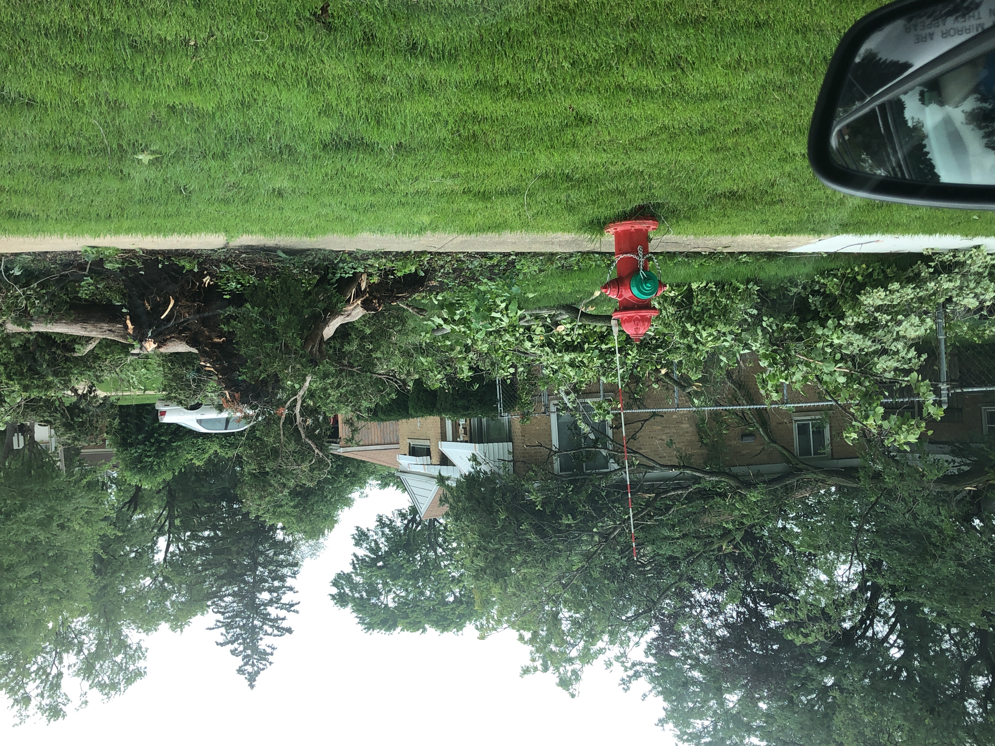
0652 PM Tornado 1 NW Long Grove 42.19N 88.01W
07/12/2023 Lake IL NWS Storm Survey
An NWS damage survey determined an EF-0
tornado with estimated peak winds of 70 mph,
path width of 125 yards, and path length of
2.1 miles impacted Long Grove. The tornado
produced primarily tree damage including at
the Twin Orchard Country Club.
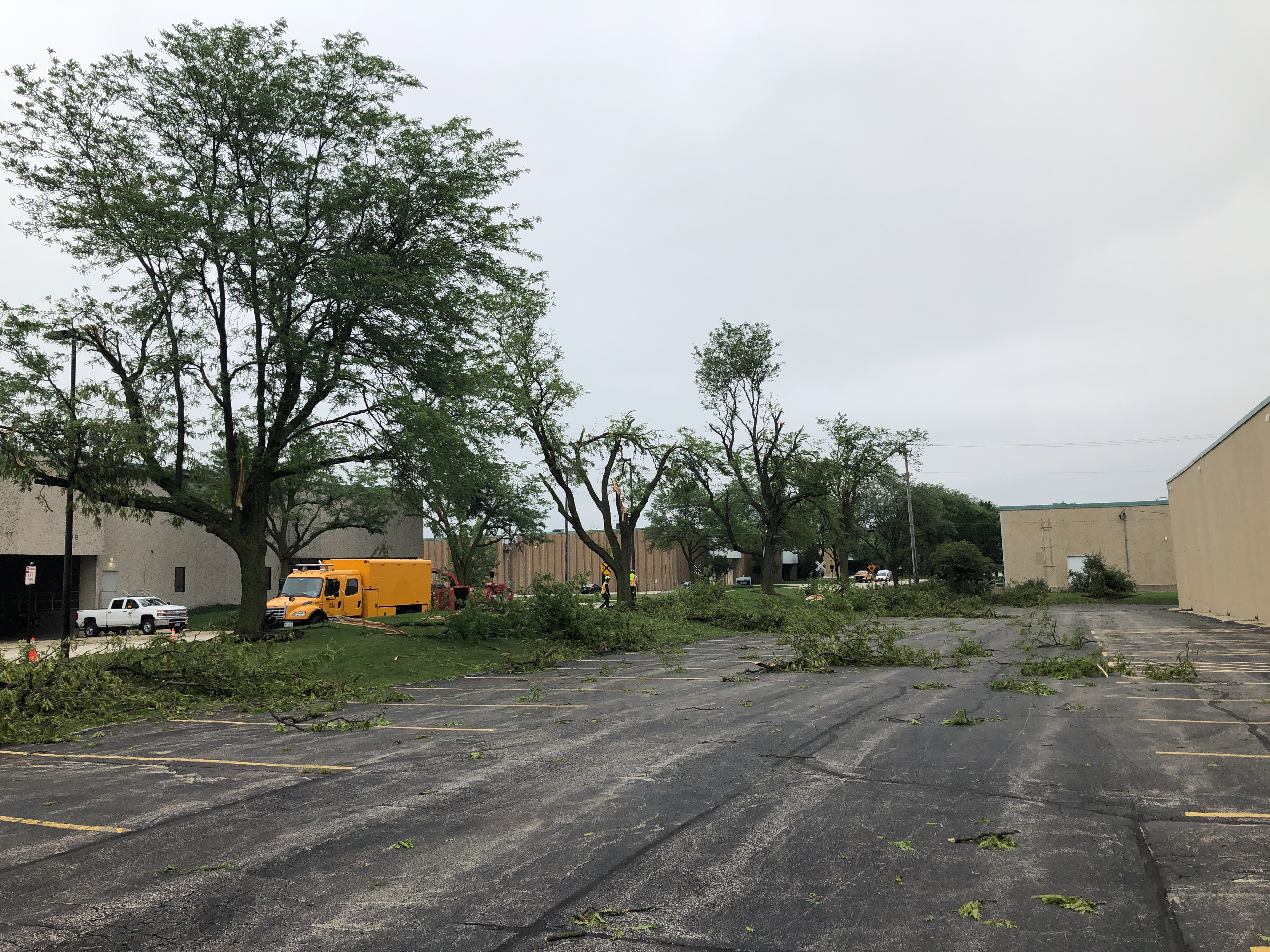
0654 PM Tornado 1 NNE Itasca 41.98N 88.00W
07/12/2023 DuPage IL NWS Storm Survey
An NWS damage survey determined an EF-0
tornado with estimated peak winds of 85 mph,
path width of 225 yards, and path length of
3.5 miles started near Itasca and lifted
over Chicago OHare Airport. Damage along the
path consisted of exterior damage to roofs
of warehouses and snapped and downed tree
limbs.
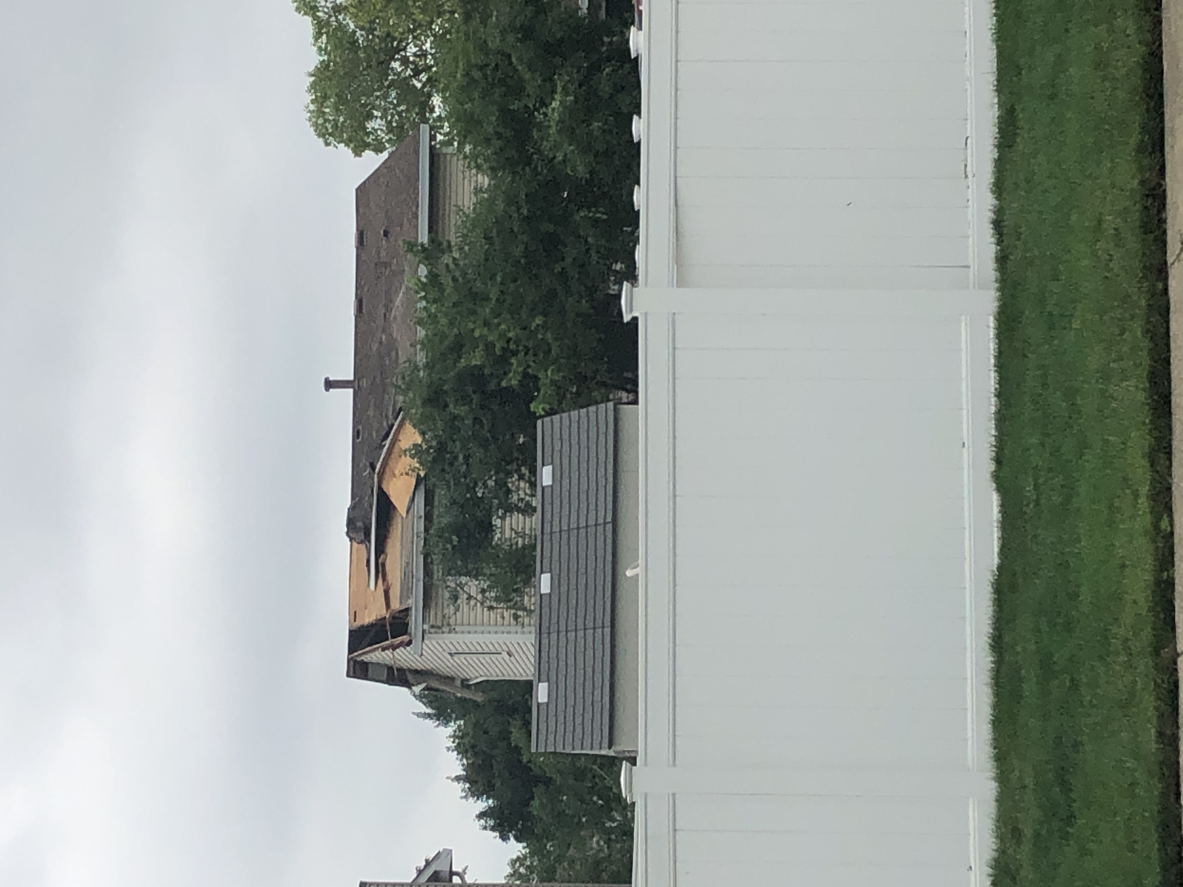
0702 PM Tornado 2 N OHare Airport 42.01N 87.90W
07/12/2023 Cook IL NWS Storm Survey
Corrects previous tornado report from 2 N
Ohare Airport. An NWS damage survey
determined an EF-0 tornado with estimated
peak winds of 85 mph, path width of 300
yards, and path length of 3.5 miles started
near Chicago OHare Airport and continued
into Park Ridge. This tornado started after
an earlier tornado lifted on the far
northwestern side of OHare Airport. The
tornado damaged the exterior of several
structures as well as numerous trees.
&&
|
Photos
 |
 |
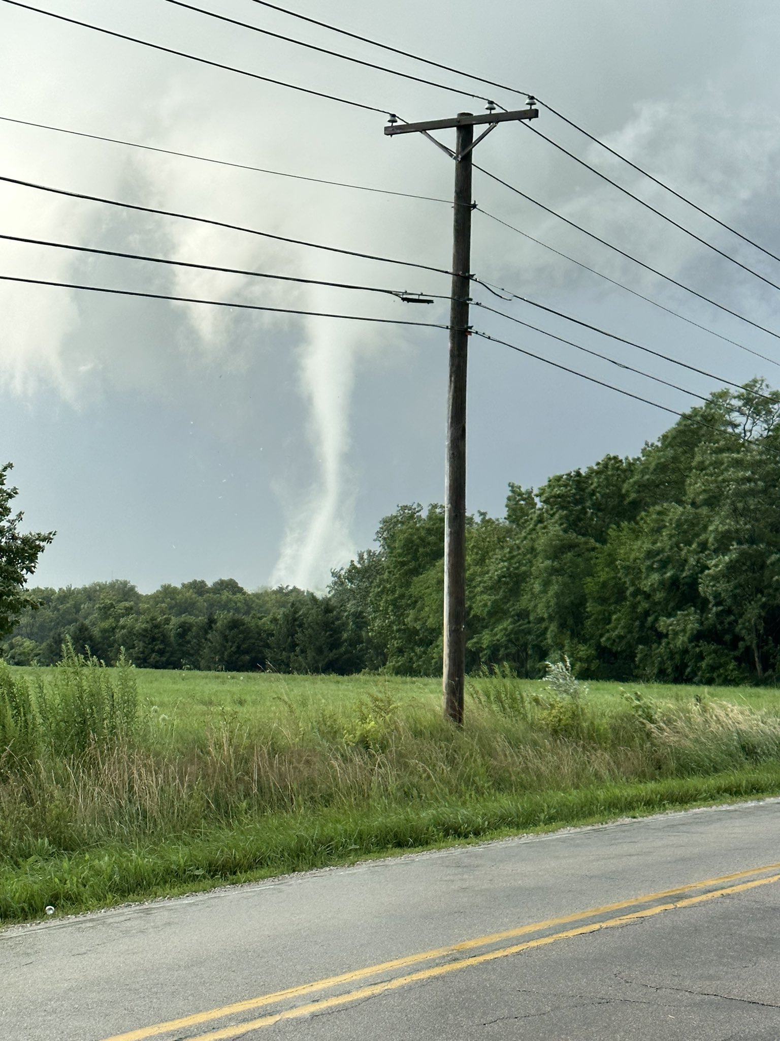 |
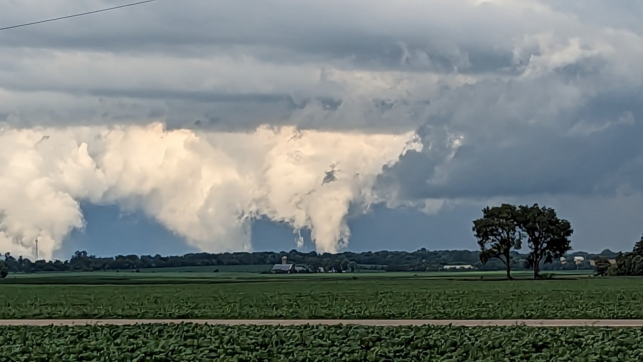
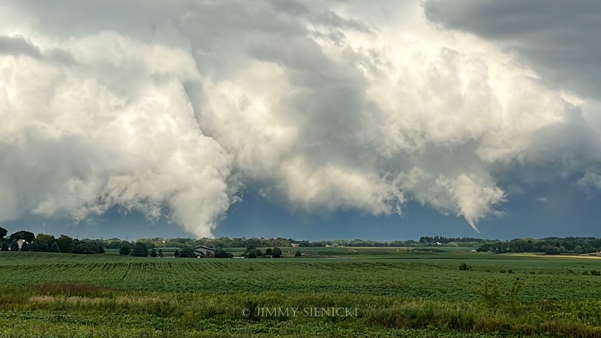
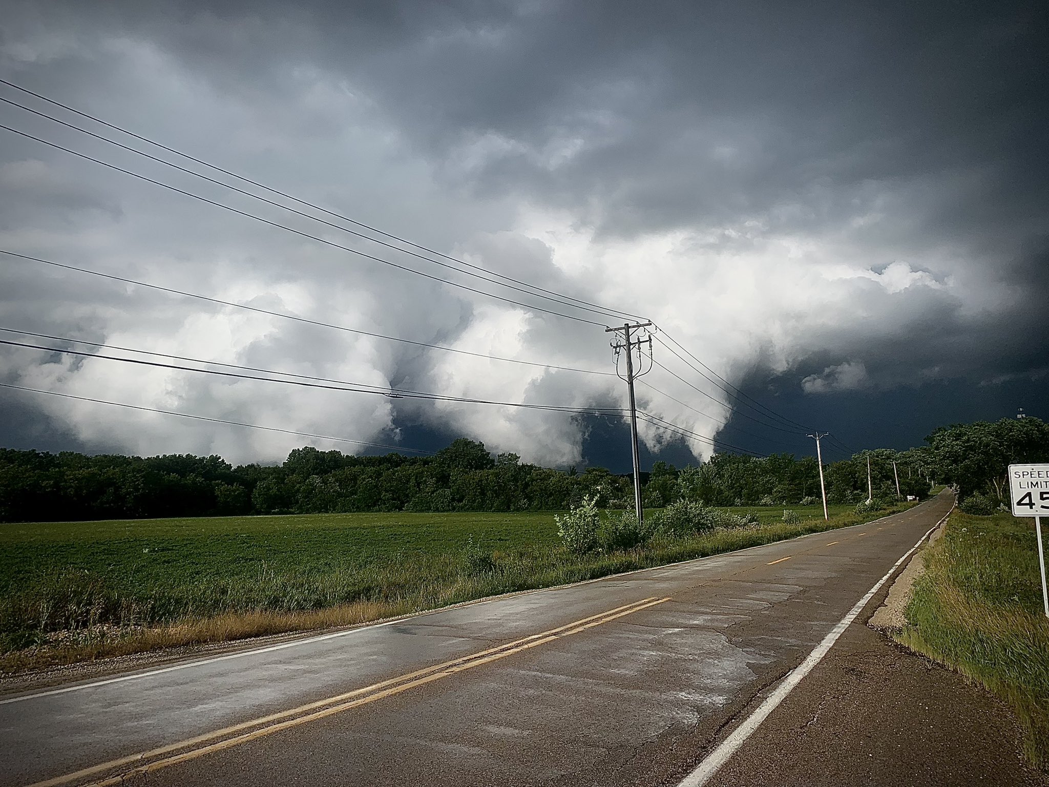
| View of the Plato Center to Elgin (left) and Campton Hills to Elgin (right) tornadoes. Photo courtesy of Bob Waszak. | View from Route 47 looking east at the Plato Center to Elgin (left) and Campton Hills to Elgin (right) tornadoes. Photo courtesy of Jimmy Sienicki. | The Campton Hills to Elgin tornado. Photo courtesy of Brad Skaja. |
 |
 |
 |
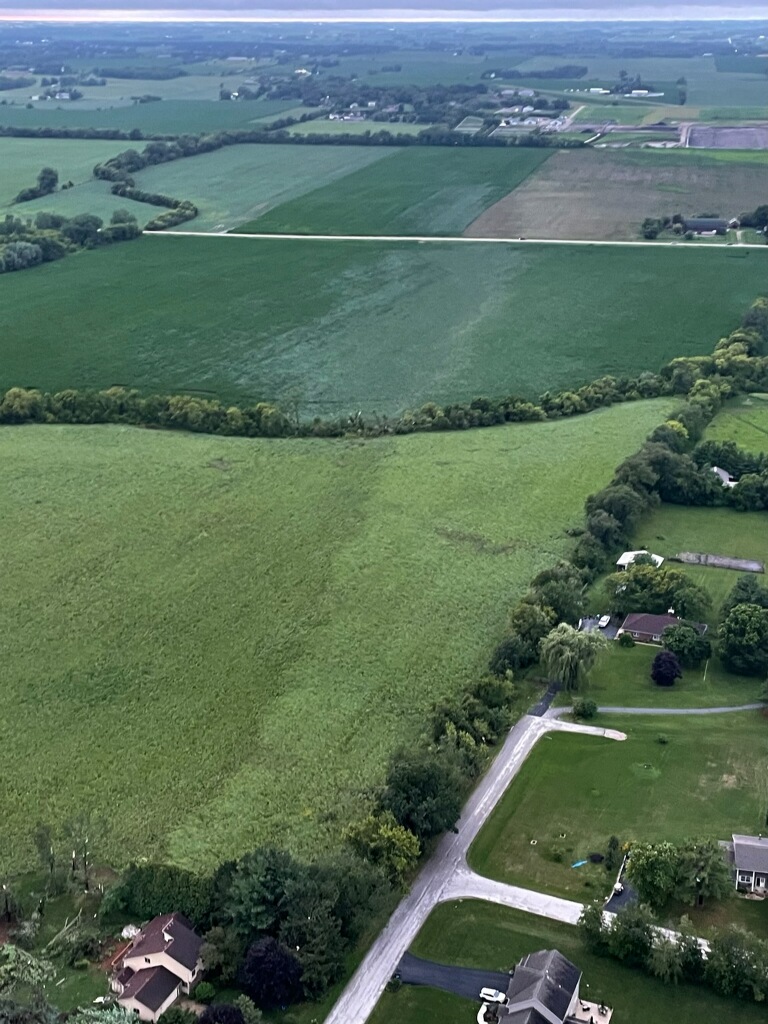
| Additional view of the Plato Center to Elgin and Campton Hills to Elgin tornadoes. Photo courtesy of Patrick Ruff. | Aerial view near the start of the Plato Center to Elgin tornado track near Dittman Rd. Photo courtesy of Kris Habermehl (CBS). | Tornado damage in Elgin. Photo from NWS damage survey. |
 |
 |
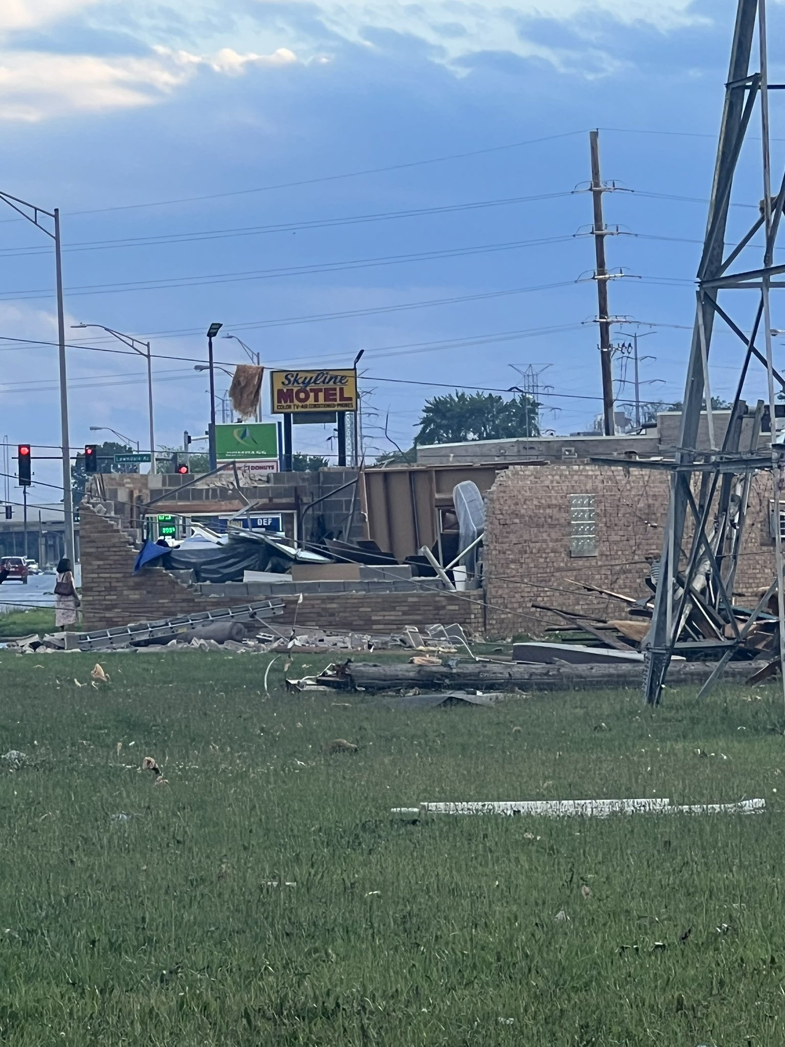 |
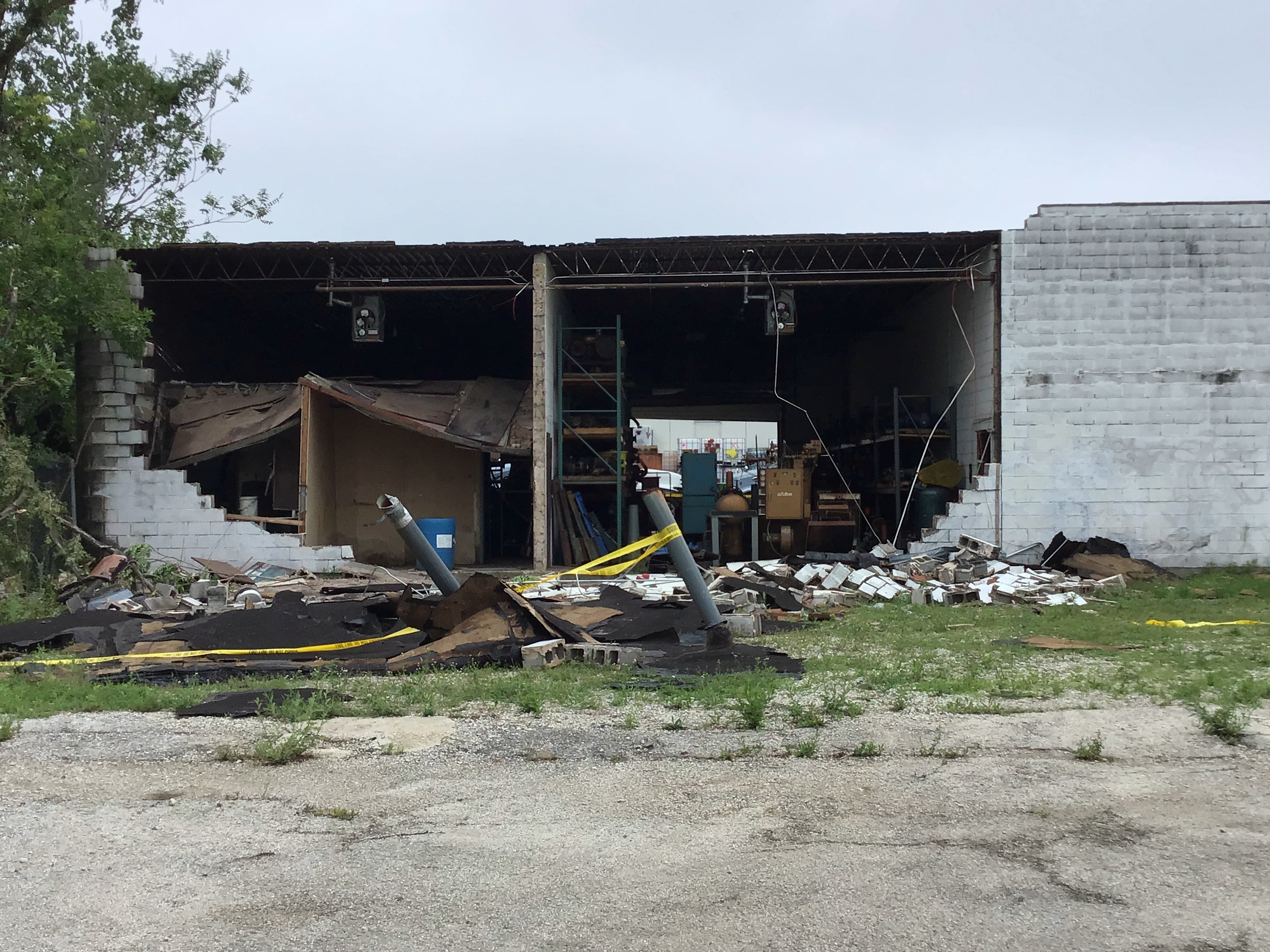
| Tornado damage in Countryside. Photo from NWS damage survey. | Tornado damage in Hodgkins. Photo from NWS damage survey. | Tornado damage in McCook. Photo courtesy of Dana Rebik (WGN). |
 |
|
|
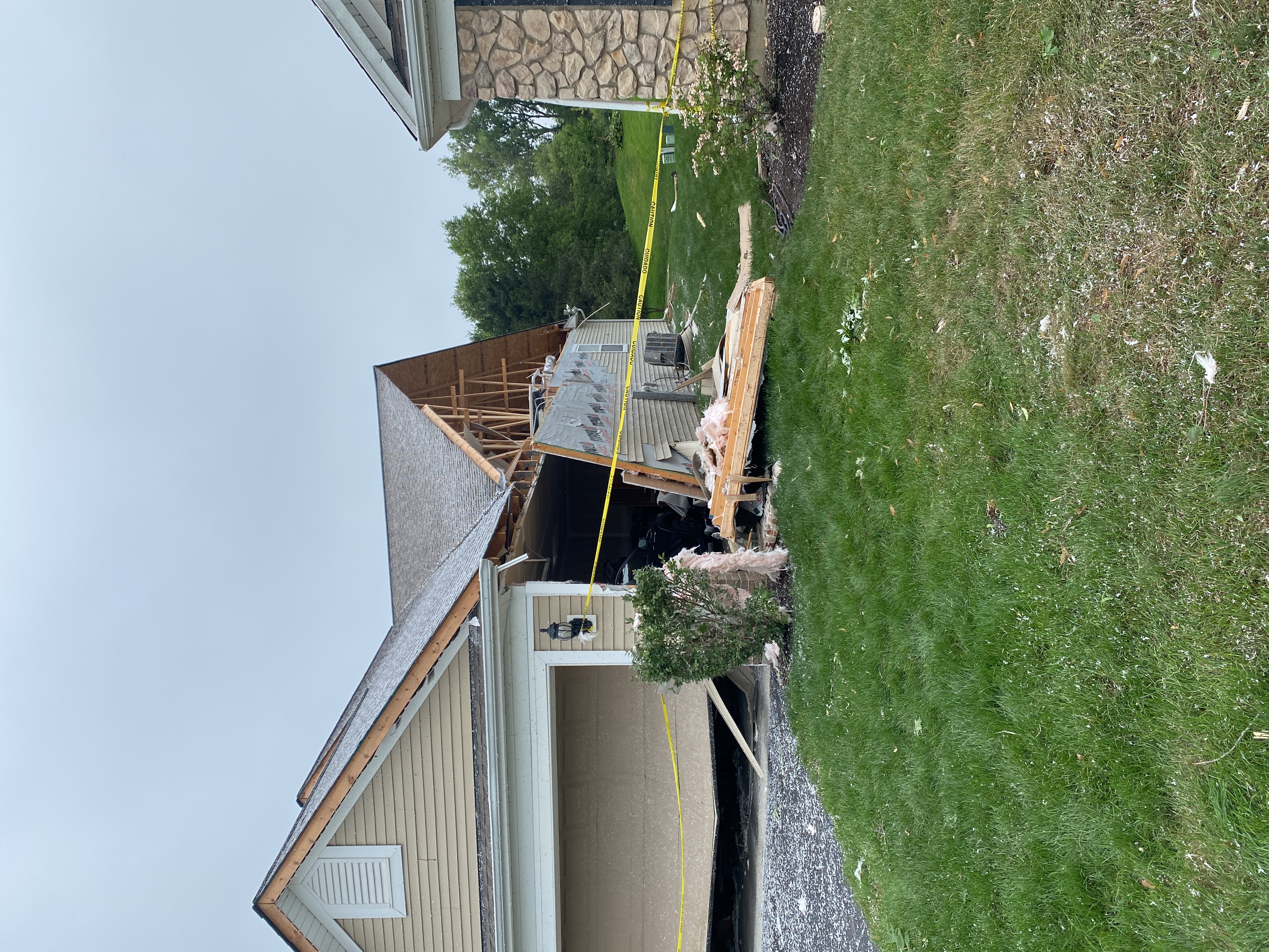
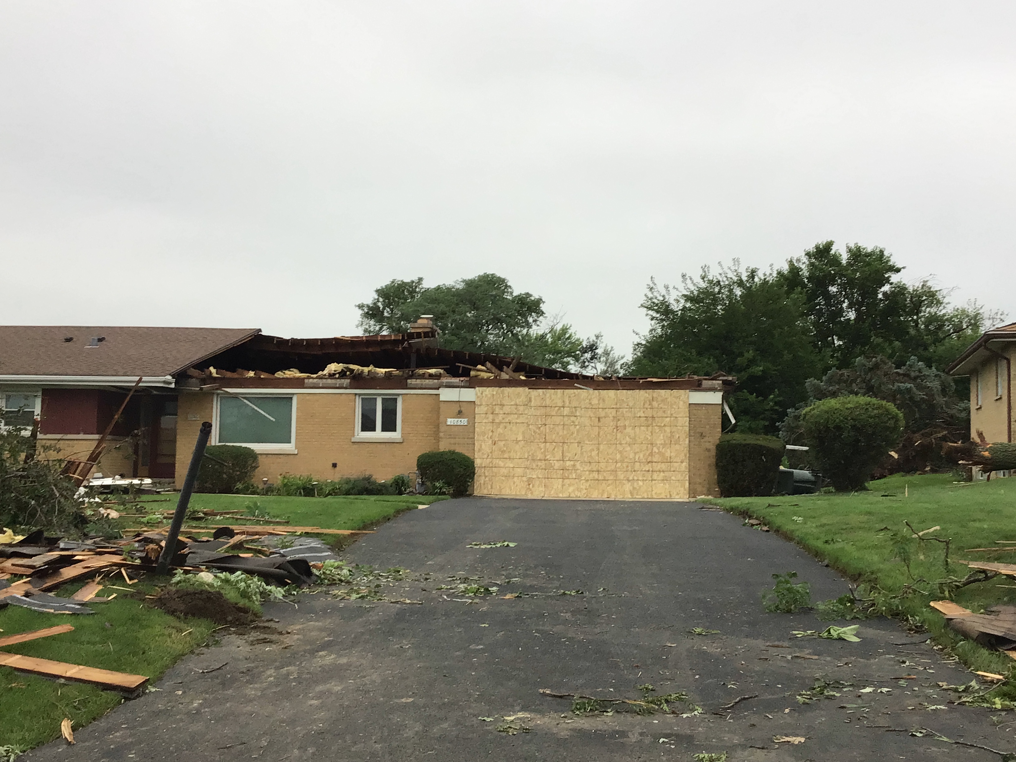
| Tornado damage in Lyons. Photo from NWS damage survey. | Tornado damage in Oswego. Photo from NWS damage survey. | Tornado damage in Huntley. Photo from NWS damage survey. |
 |
 |
 |
| Tornado damage in Barrington Hills. Photo from NWS damage survey. | Tornado damage in Barrington. Photo from NWS damage survey. | Tornado damage in Streamwood. Photo from NWS damage survey. |
 |
 |
 |
| Tornado damage in Elk Grove Village. Photo from NWS damage survey. | Tornado damage in Des Plaines. Photo from NWS damage survey. | Tornado damage in Glendale Heights. Photo from NWS damage survey. |
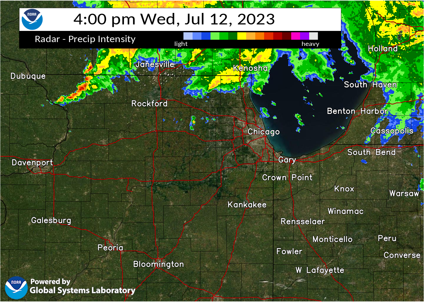
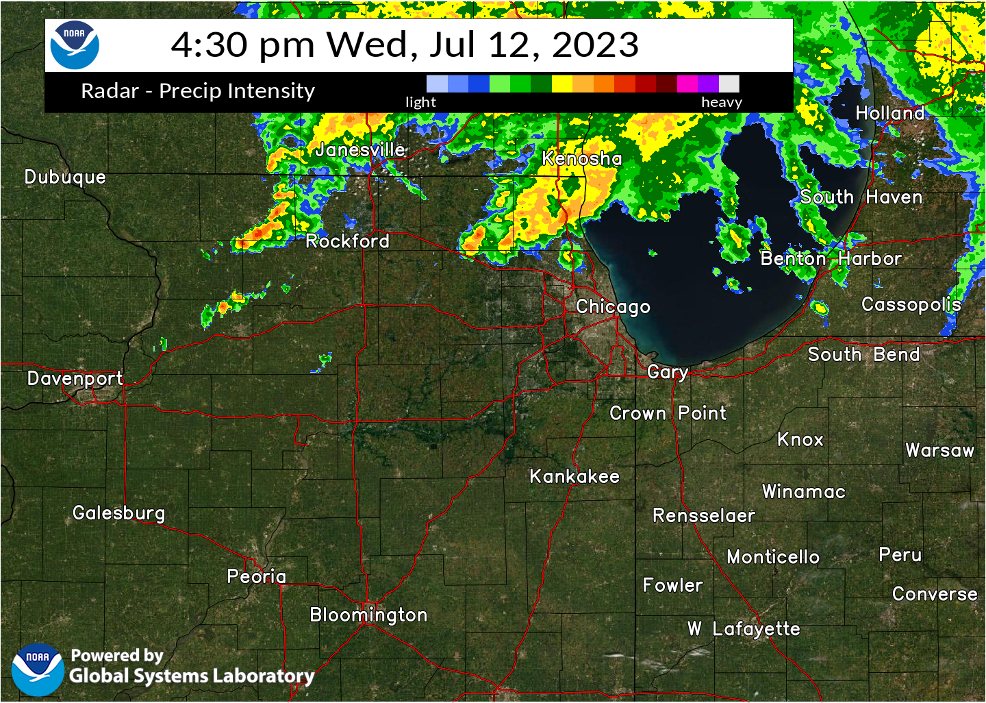
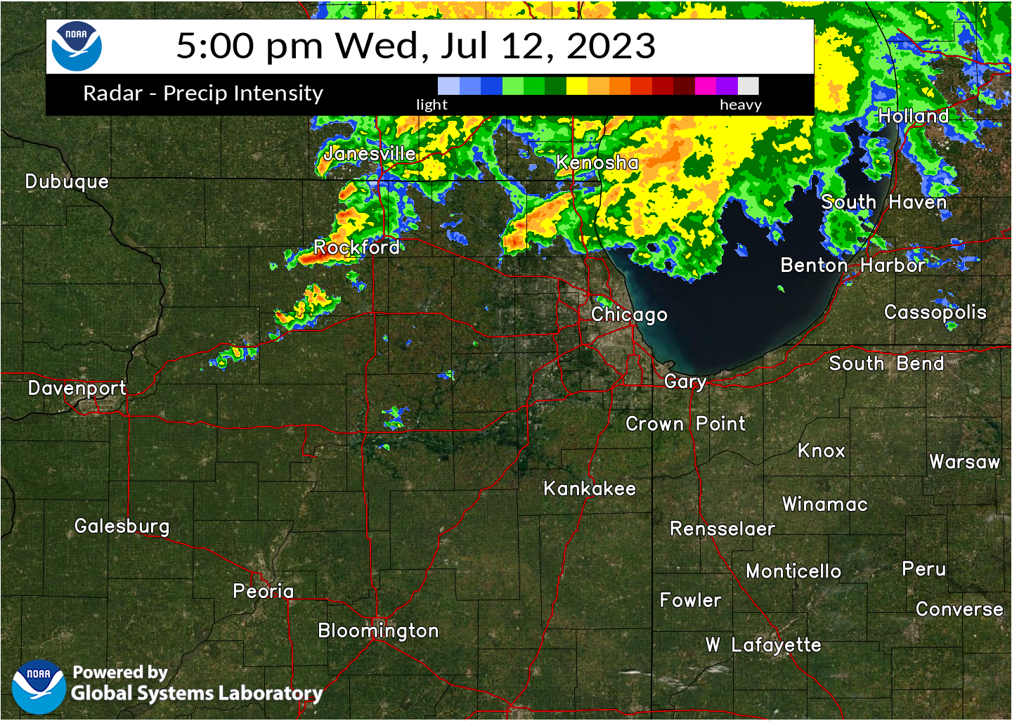
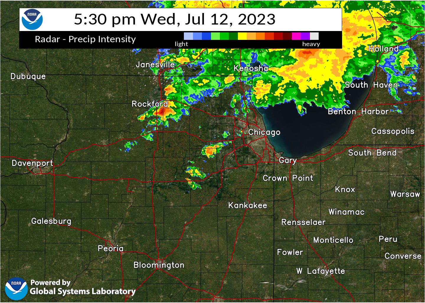
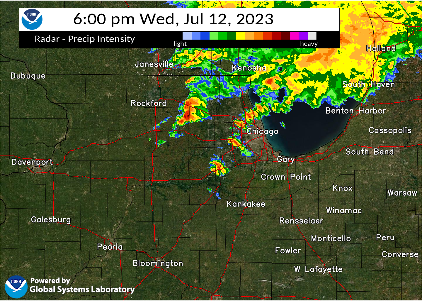
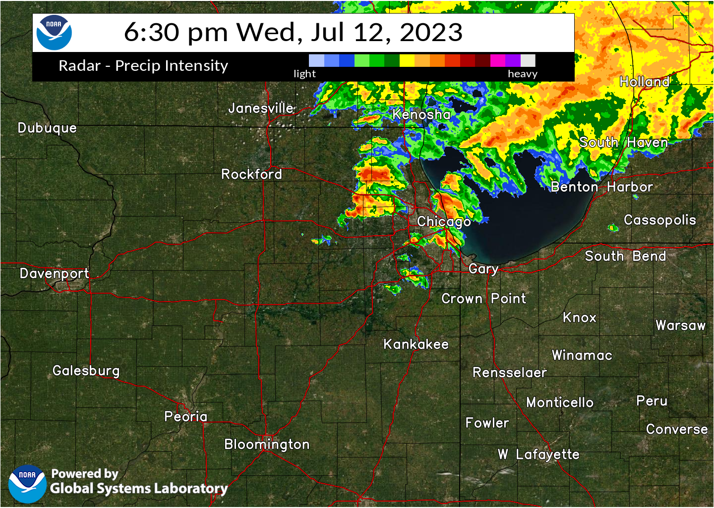
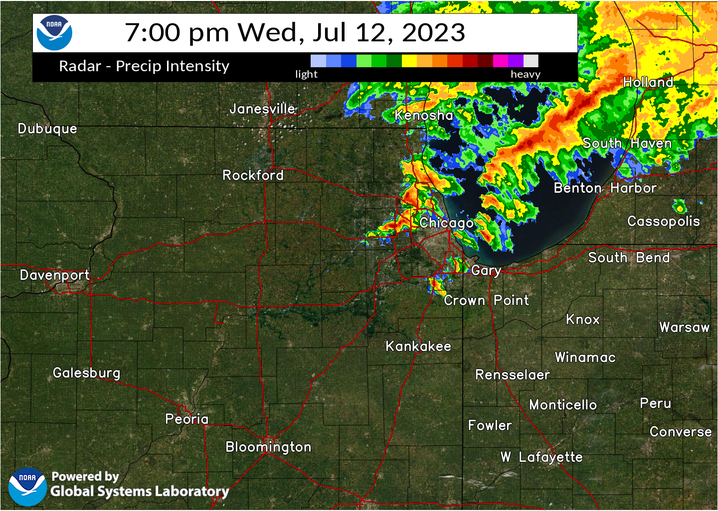
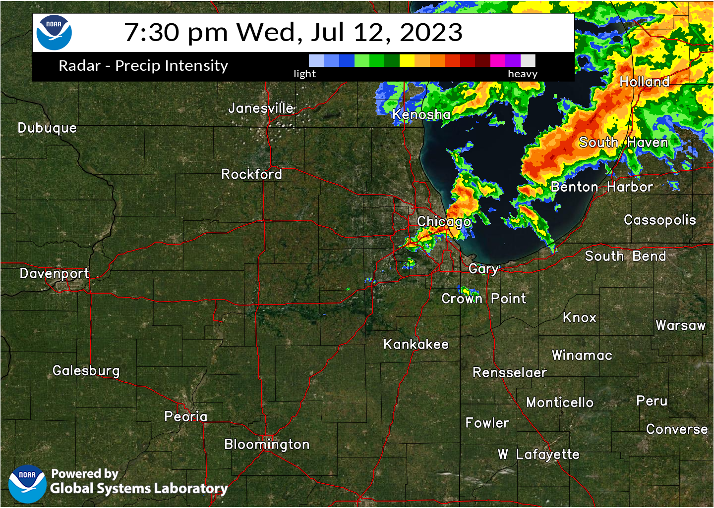
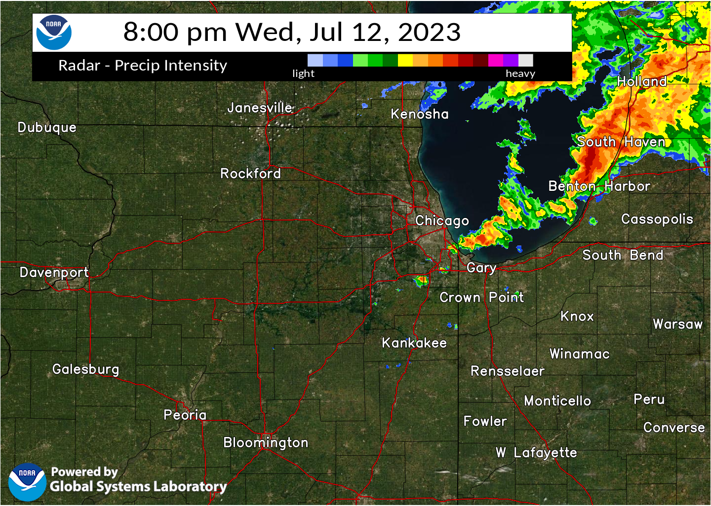
Radar
MRMS Reflectivity at Lowest Level (RALA) between 4:00 PM and 8:00 PM CDT 7/12/2023.


.
Meteorology and Environment
 |
 |
 |
| Analyzed winds at 300 mb, or approximately 30,000 feet, at 6 PM showing a modest jet streak with winds nearing 100 knots. | 500 mb winds, or around 15,000 feet, showing relatively fast flow in excess of 50 knots overhead. | Winds at 925 mb, or very near the surface, were exceptionally strong at over 35 knots! |
 |
 |
.gif) |
| Low-level instability was extremely high -- in excess of 125 J/kg -- supportive of robust storm updrafts near the ground. | A measure of how much turning there was in the winds is shown here. Values over 200 m2/s2 are very high, supportive of low-level storm rotation. | Effective Sig TOR parameter -- a combination of many individual parameters -- showing how favorable the environment is for tornadic supercells. Values over 1-2 are very high for our region. |
 |
Media use of NWS Web News Stories is encouraged! Please acknowledge the NWS as the source of any news information accessed from this site. Additional recaps can be found on the NWS Chicago Past Events Page |
|


.png)

.png)
.png)
.png)
.png)
.png)
.png)