Record setting heat is expected over the next several days from the Intermountain West through the northern Plains. Furthermore, fire weather concerns increase with dry and breezy conditions. Meanwhile, heavy rainfall and severe thunderstorm threats for the Ohio/Tennessee Valleys, central Appalachians and Southeast today. The threat shifts to central Gulf Coast and across central Texas this week. Read More >
|
|
|
Fast Facts
|
|
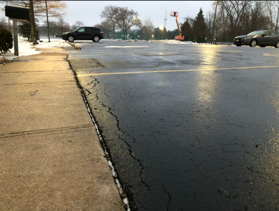
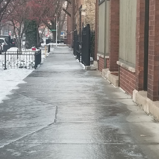
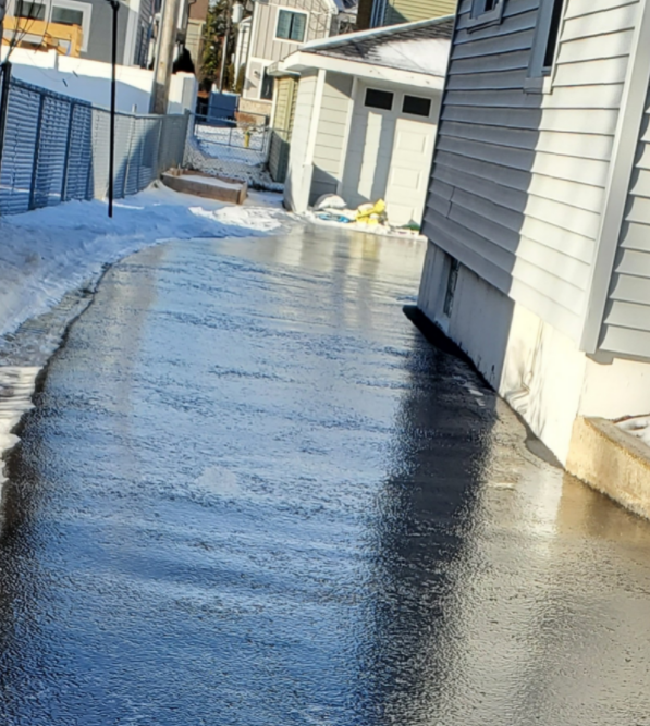
Ice Totals
The below ice totals are from ASOS freezing rain sensors. These use an apparatus that is measuring ice accretion on a flat plane. This is therefore not representative of ice accumulation on elevated radial surfaces, such as trees and wires. For more on ice measurements and the different means, see this video from NWS Caribou, ME.
PRELIMINARY LOCAL STORM REPORT
NATIONAL WEATHER SERVICE CHICAGO IL
920 AM CST SUN JAN 9 2022

..TIME...   ...EVENT...      ...CITY LOCATION...     ...LAT.LON...
..DATE...   ....MAG....      ..COUNTY LOCATION..ST.. ...SOURCE....
            ..REMARKS..

1200 AM     FREEZING RAIN    DUPAGE AIRPORT          41.91N 88.25W
01/09/2022  M0.24 INCH       DUPAGE             IL   ASOS

            MEASURED BY THE ASOS FREEZING RAIN SENSOR.

1200 AM     FREEZING RAIN    AURORA AIRPORT          41.77N 88.47W
01/09/2022  M0.18 INCH       KANE               IL   ASOS

            MEASURED BY THE ASOS FREEZING RAIN SENSOR.

1200 AM     FREEZING RAIN    MIDWAY AIRPORT          41.78N 87.75W
01/09/2022  M0.18 INCH       COOK               IL   ASOS

            MEASURED BY THE ASOS FREEZING RAIN SENSOR.

1200 AM     FREEZING RAIN    OHARE AIRPORT           41.98N 87.90W
01/09/2022  M0.15 INCH       COOK               IL   ASOS

            MEASURED BY THE ASOS FREEZING RAIN SENSOR.

1200 AM     FREEZING RAIN    PALWAUKEE AIRPORT       42.10N 87.90W
01/09/2022  M0.15 INCH       COOK               IL   ASOS

            MEASURED BY THE ASOS FREEZING RAIN SENSOR.

1200 AM     FREEZING RAIN    VALPARAISO AIRPORT      41.45N 87.00W
01/09/2022  M0.14 INCH       PORTER             IN   ASOS

            MEASURED BY THE ASOS FREEZING RAIN SENSOR.

1200 AM     FREEZING RAIN    ROCKFORD AIRPORT        42.20N 89.10W
01/09/2022  M0.10 INCH       WINNEBAGO          IL   ASOS

            MEASURED BY THE ASOS FREEZING RAIN SENSOR.

1200 AM     FREEZING RAIN    WAUKEGAN AIRPORT        42.42N 87.87W
01/09/2022  M0.08 INCH       LAKE               IL   ASOS

            MEASURED BY THE ASOS FREEZING RAIN SENSOR.
Meteorology
 |
 |
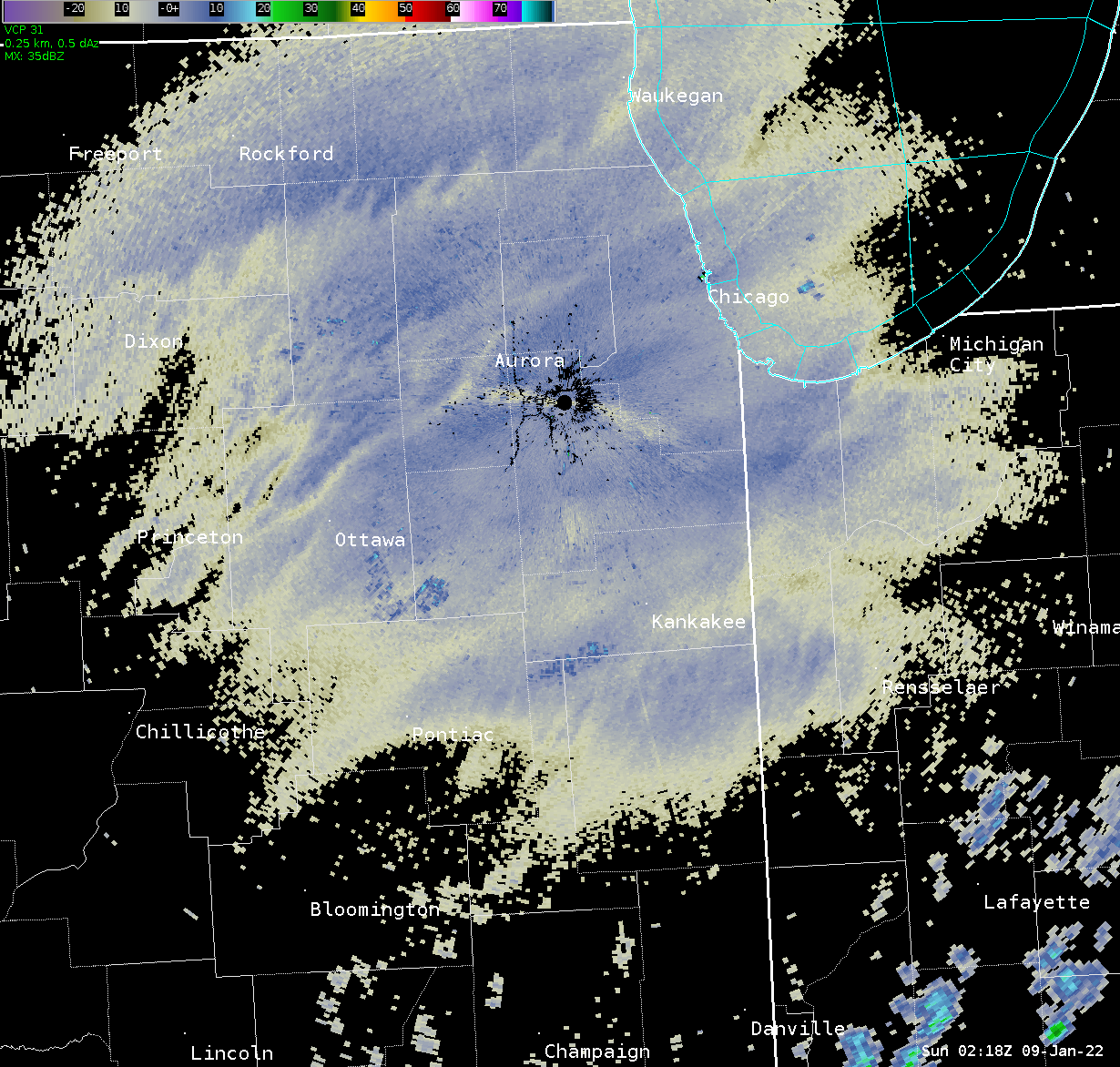 |
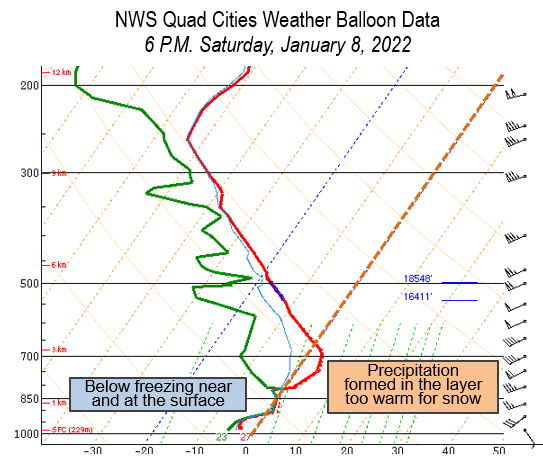
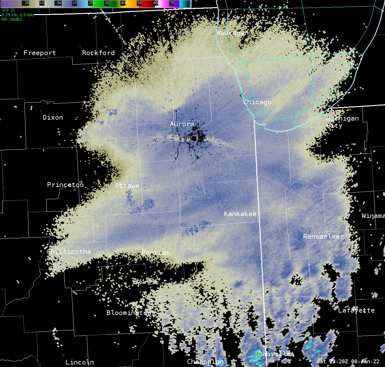
| NWS Quad Cities weather balloon data (sounding) from 6 P.M. on the evening of January 8. Drizzle / light rain was developing in the saturated layer between 5,000 and 6,000 ft AGL on this sounding. | NWS Chicago lowest level radar reflectivity at 5:20 P.M. on January 8, showing the blossomed ~10 dBZ indicative of drizzle (freezing at the surface). | NWS Chicago lowest level radar reflectivity at 9:18 P.M. on January 8, showing the continued drizzle signature over the Chicago metro. Many surfaces were still below freezing at this time. |
 |
Media use of NWS Web News Stories is encouraged! Additional recaps can be found on the NWS Chicago Past Events Page. |
|