Record setting heat is expected over the next several days from the Intermountain West through the northern Plains. Furthermore, fire weather concerns increase with dry and breezy conditions. Meanwhile, heavy rainfall and severe thunderstorm threats for the Ohio/Tennessee Valleys, central Appalachians and Southeast today. The threat shifts to central Gulf Coast and across central Texas this week. Read More >
|
Fast Facts:
|
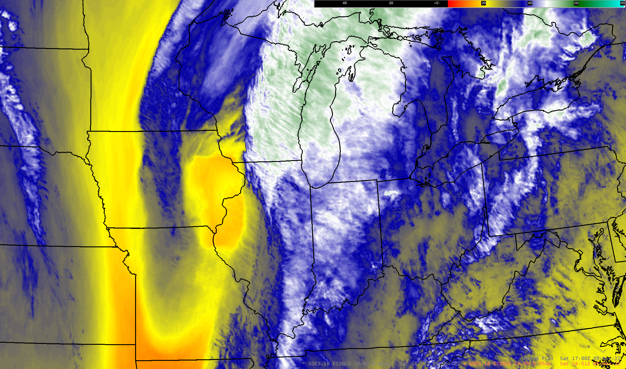
Loop of GOES-16 water vapor imagery between approximately 1:00 and 2:00 PM CDT November 5, 2022. |
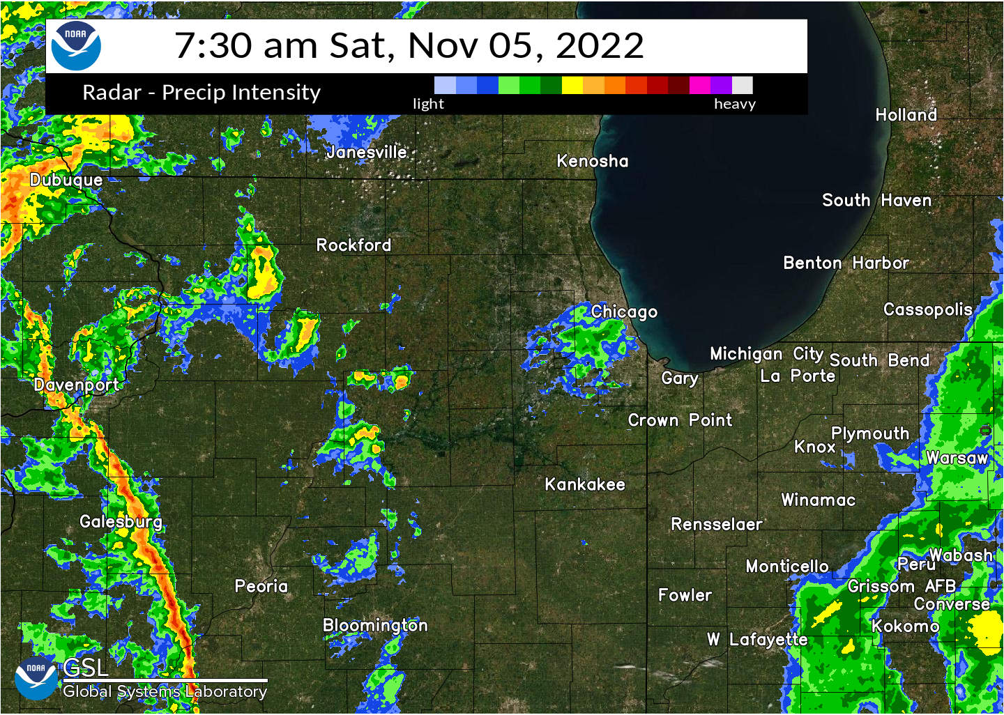
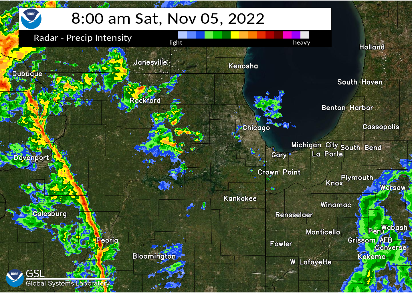
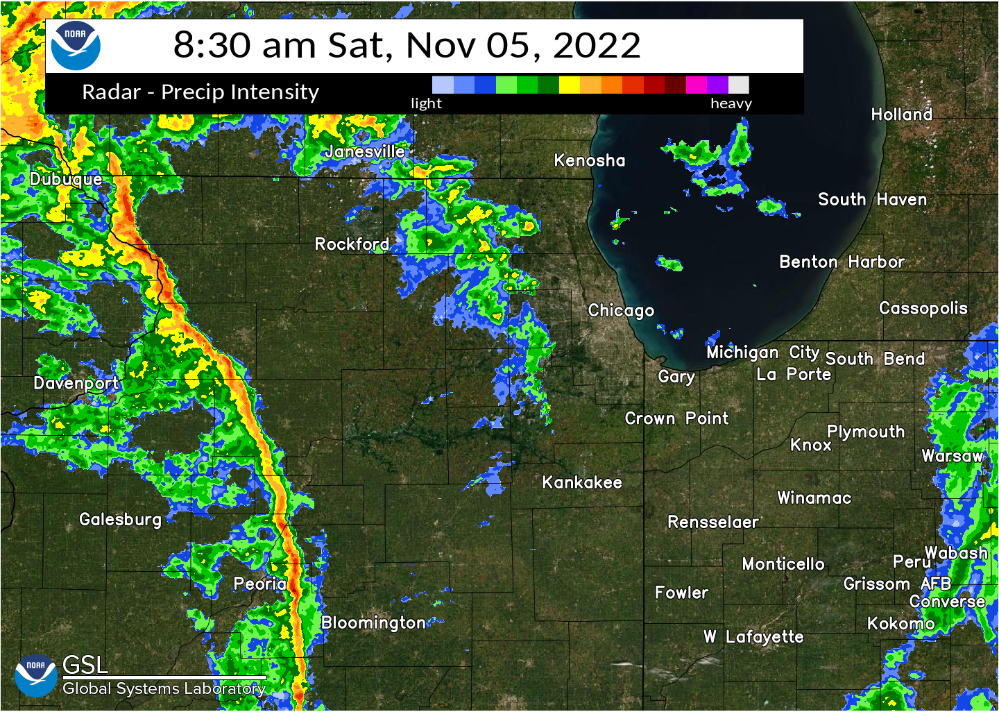
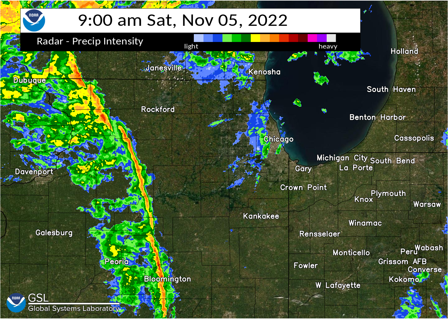
Damaging Winds
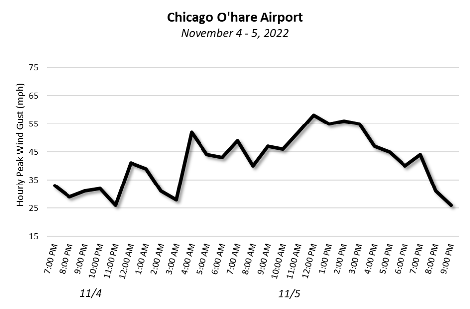
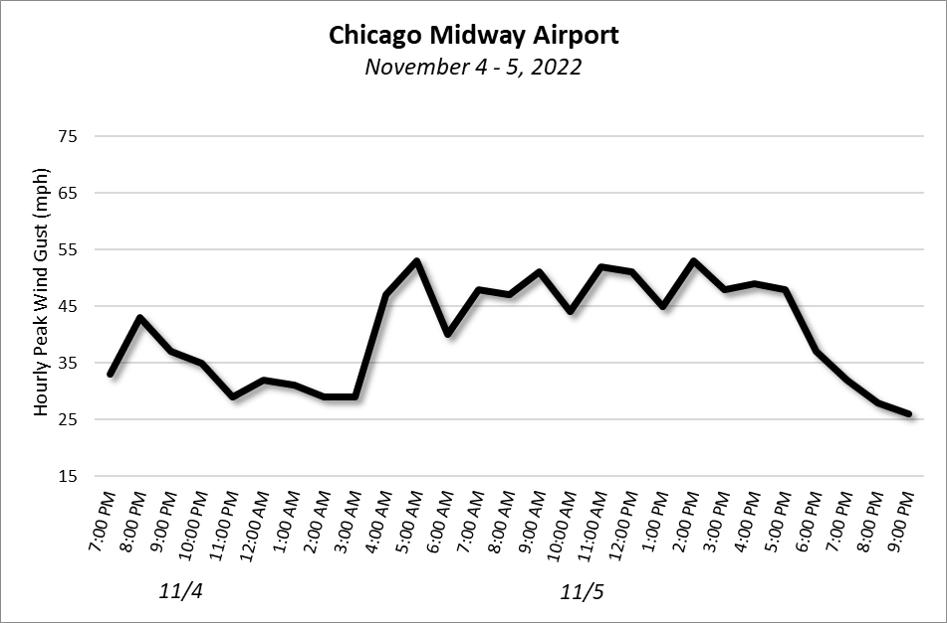
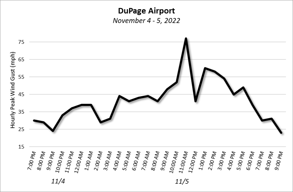
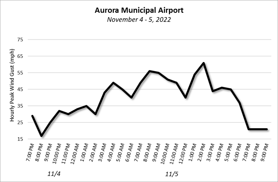
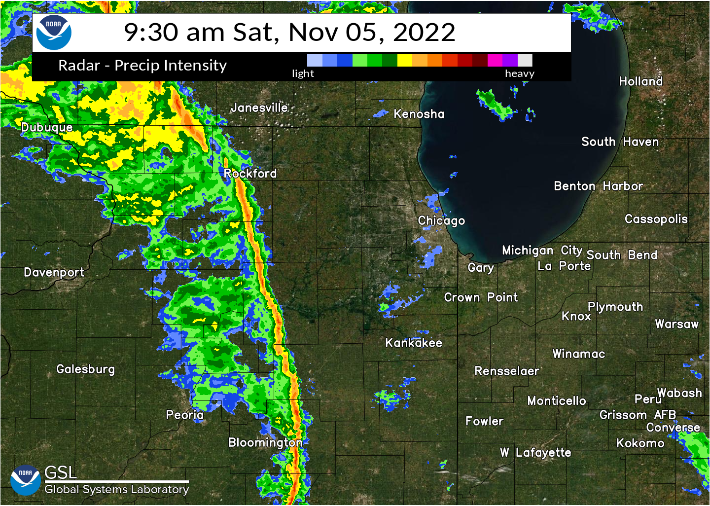
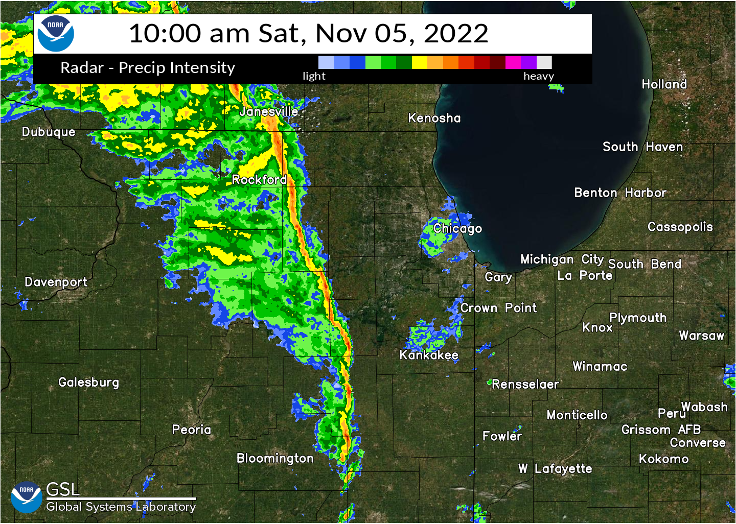
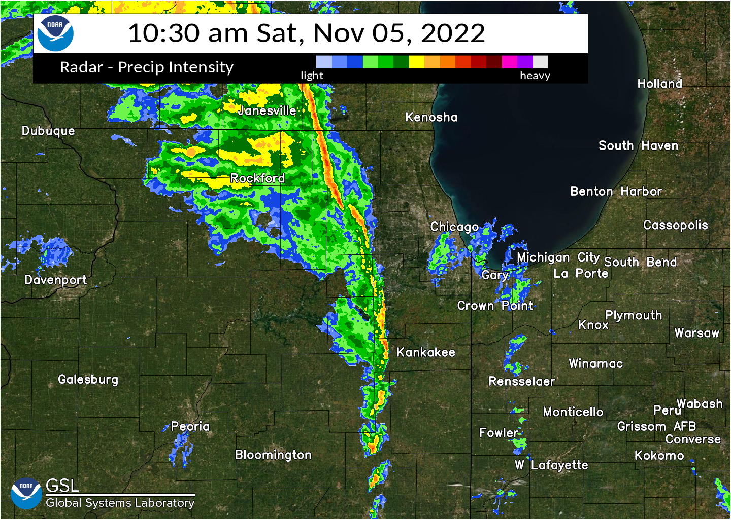
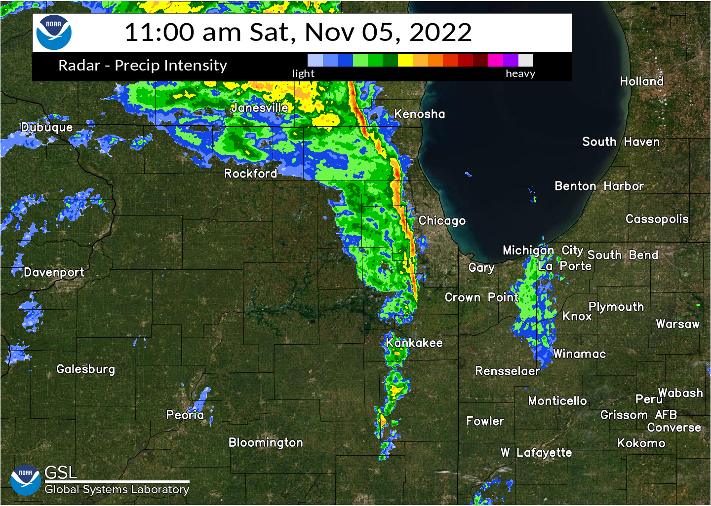
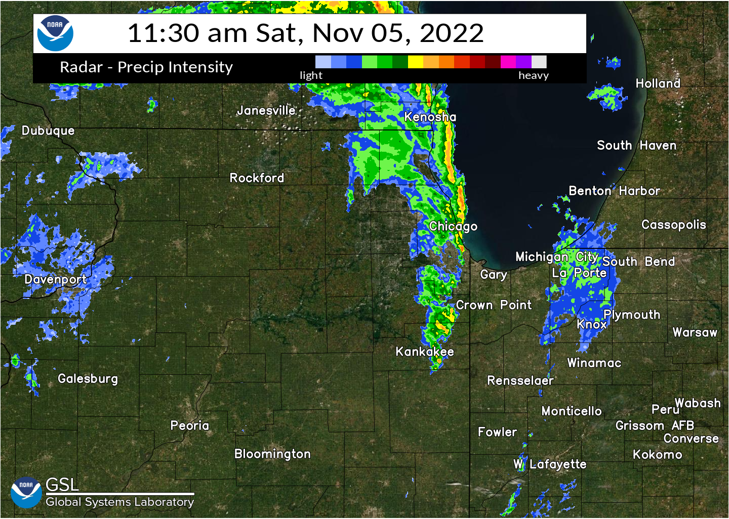
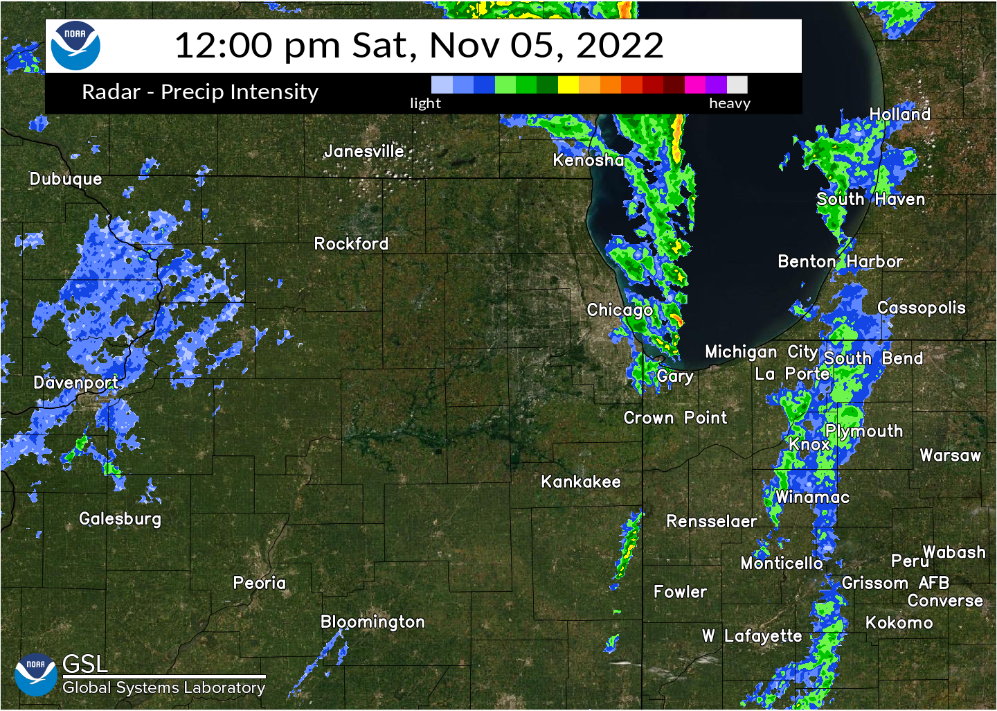
A prolonged (12-hour long) period of damaging winds occurred in northern Illinois and northwest Indiana on November 5, 2022 with measured wind gusts peaking between 55 and 75 mph. Winds first picked up abruptly at approximately 4:00 AM CDT along the back edge of departing showers. At the NWS Chicago office in Romeoville, meteorologists on staff witnessed wind gusts literally increase from 10 to 15 mph to 55 to 60 mph in the matter of minutes. Damaging winds then continued for 10 to 12 hours straight before abating toward sunset.
Below is a table listing the peak measured wind gusts from a variety of sources on November 5, 2022.
Measured Wind Gusts on November 5, 2022
| 77 mph - West Chicago | 75 mph - Manhattan |
| 73 mph - Chicago Crib | 71 mph - 1.7 E Remington (INDOT) |
| 64 mph - Waukegan Airport | 64 mph - 2.7 W Collegeville (INDOT) |
| 64 mph - Montrose Beach Light | 61 mph - Sugar Grove |
| 61 mph - Cline Avenue Bridge | 60 mph - Chicago O'Hare |
| 59 mph - Midway Airport | 59 mph - Crown Point |
| 59 mph - Rockford Airport | 58 mph - Valparaiso |
| 56 mph - NWS Chicago | 56 mph - Wheeling |
| 55 mph - Rensselaer | 54 mph - Kankakee |
| 53 mph - Morris | 51 mph - Lansing |
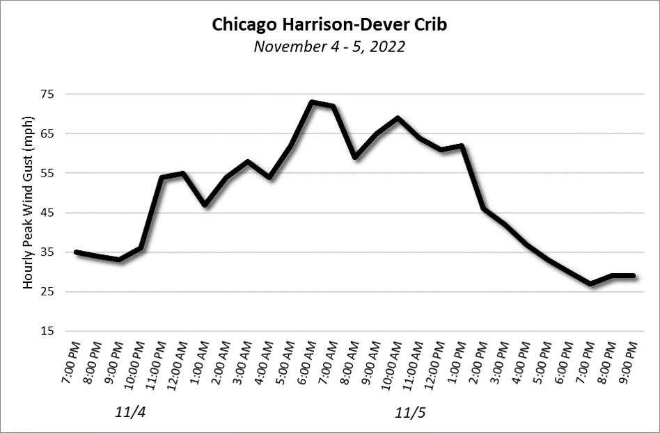
Hourly Peak Wind Gusts at Chicago Area Observation Platforms
(click on individual images to enlarge)
 |
 |
 |
 |
 |
Local Storm Reports Collected from a Variety of Sources
PRELIMINARY LOCAL STORM REPORT...SUMMARY
NATIONAL WEATHER SERVICE CHICAGO IL
607 PM CDT SAT NOV 5 2022
..TIME... ...EVENT... ...CITY LOCATION... ...LAT.LON...
..DATE... ....MAG.... ..COUNTY LOCATION..ST.. ...SOURCE....
..REMARKS..
0359 AM NON-TSTM WND GST 2 W SUGAR GROVE 41.77N 88.48W
11/05/2022 M52 MPH KANE IL ASOS
ASOS STATION KARR SUGAR GROVE - AURORA ARPT.
0429 AM NON-TSTM WND GST 1 NE MONTROSE HARBOR 41.97N 87.63W
11/05/2022 M50 MPH LMZ741 IL MESONET
MESONET STATION XMTB MONTROSE BEACH LIGHT.
0429 AM NON-TSTM WND GST 1 NE MONTROSE HARBOR 41.97N 87.63W
11/05/2022 M50 MPH LMZ741 IL MESONET
MESONET STATION XMTB MONTROSE BEACH LIGHT.
0441 AM NON-TSTM WND GST 1 WSW NWS CHICAGO-ROMEO 41.60N 88.10W
11/05/2022 M56 MPH WILL IL AWOS
AWOS STATION KLOT ROMEOVILLE - LEWIS
AIRPORT.
0500 AM NON-TSTM WND GST 3 NE NAVY PIER 41.92N 87.57W
11/05/2022 M55 MPH LMZ741 IL MESONET
48.2 KT STORM FORCE WIND GUST. MESONET
STATION CHII2 HARRISON-DEVER CRIB.
0741 AM NON-TSTM WND DMG BEAVERVILLE 40.95N 87.66W
11/05/2022 IROQUOIS IL PUBLIC
PICTURE OF LARGE TREE DOWN IN A YARD. REPORT
RELAYED VIA SOCIAL MEDIA.
0805 AM NON-TSTM WND DMG 1 SSW SOUTH HAVEN 41.53N 87.14W
11/05/2022 PORTER IN PUBLIC
PICTURE OF A SMALL TREE UPROOTED NEAR THE
INTERSECTION OF PORTLAND RD AND PRESCOTT RD.
RELAYED VIA SOCIAL MEDIA.
0834 AM NON-TSTM WND GST JOLIET 41.53N 88.08W
11/05/2022 E52 MPH WILL IL TRAINED SPOTTER
REPORT RELAYED ON SOCIAL MEDIA OF A 52 MPH
WIND GUST IN JOLIET.
0911 AM NON-TSTM WND GST 2 WNW SUGAR GROVE 41.77N 88.48W
11/05/2022 M55 MPH KANE IL ASOS
PEAK WIND OF 48 KTS (55 MPH) REPORTED AT
KARR.
0930 AM NON-TSTM WND DMG 2 NE WOODSTOCK 42.33N 88.41W
11/05/2022 MCHENRY IL PUBLIC
REPORT RELAYED VIA SOCIAL MEDIA OF A LARGE
TREE DOWN ON QUEEN ANNE ROAD.
0954 AM TSTM WND DMG 1 N DIXON 41.86N 89.48W
11/05/2022 LEE IL LAW ENFORCEMENT
SHERIFF OFFICE REPORTS TREE BRANCH DAMAGED
POWER LINE AT THE 500 BLOCK OF EAST BRADSHAW
ST IN DIXON. TIME ESTIMATED FROM RADAR.
0954 AM TSTM WND GST 4 SSW DIXON 41.78N 89.50W
11/05/2022 M56 MPH LEE IL MESONET
MEASURED 56 MPH WIND GUST FROM WEATHER
UNDERGROUND STATION NEAR DIXON.
1017 AM TSTM WND DMG 1 ENE OGLESBY 41.30N 89.04W
11/05/2022 LA SALLE IL LAW ENFORCEMENT
LA SALLE SO REPORTS SEVERAL LARGE TREES DOWN
ACROSS ED HAND HIGHWAY SOUTH OF STATE ROUTE
71. TIME ESTIMATED.
1030 AM NON-TSTM WND DMG 2 NW ITASCA 42.00N 88.03W
11/05/2022 COOK IL BROADCAST MEDIA
SEVERAL WEB REPORTS AND PHOTOS OF PART OF A
ROOF BLOWN OFF AN APARTMENT COMPLEX. TIME OF
DAMAGE BASED ON REFERENCED CALL TIMES IN A
NEWS ARTICLE, INDICATING DAMAGE WAS DUE TO
NON THUNDERSTORM WINDS.
1042 AM TSTM WND GST ROCKFORD AIRPORT 42.20N 89.10W
11/05/2022 M59 MPH WINNEBAGO IL ASOS
ROCKFORD AIRPORT REPORTED A WIND GUST OF 51
KTS (59 MPH).
1044 AM TSTM WND DMG LOVES PARK 42.32N 89.06W
11/05/2022 WINNEBAGO IL 911 CALL CENTER
REPORTS OF POWER LINES DOWN ON GRAND BLVD IN
LOVES PARK. TIME ESTIMATED FROM RADAR.
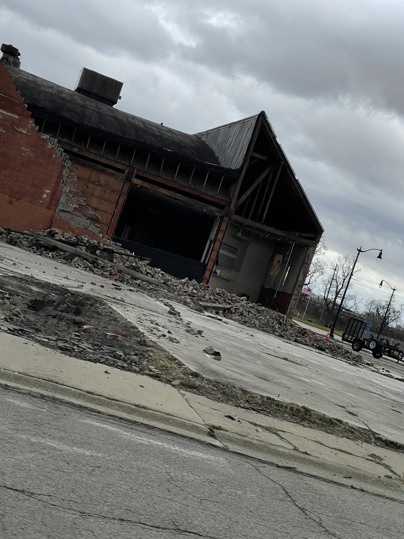
1100 AM NON-TSTM WND DMG 1 E KANKAKEE 41.12N 87.84W
11/05/2022 KANKAKEE IL PUBLIC
PHOTO SHARED ON SOCIAL MEDIA SHOWING A
PORTION OF THE WEST WALL OF A BRICK BUILDING
COLLAPSED AT THE CORNER OF E COURT STREET
AND ST JOSEPH AVENUE.
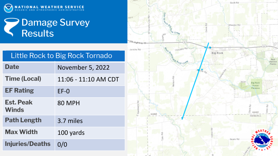
1106 AM TORNADO 3 SSW BIG ROCK 41.72N 88.57W
11/05/2022 KENDALL IL NWS STORM SURVEY
AN NWS STORM SURVEY INDICATES THAT A BRIEF
EF-0 TORNADO WITH WINDS OF 80 MPH STARTED
NEAR LITTLE ROCK, IL AND MOVED NORTHEAST
WHERE IT CAUSED SPORADIC TREE AND POWERLINE
DAMAGE TOWARDS BIG ROCK BEFORE LIFTING
IMMEDIATELY NORTH OF US 30. THIS TORNADO WAS
ON THE GROUND FOR LESS THAN 4 MINUTES.
1109 AM TSTM WND DMG 1 ESE BIG ROCK 41.76N 88.53W
11/05/2022 KANE IL PUBLIC
REPORT RELAYED VIA SOCIAL MEDIA OF NUMEROUS
TREES AND POWERLINES DOWNED NEAR BIG ROCK.
TIME AND LOCATION ESTIMATES.
1132 AM TSTM WND GST DUPAGE AIRPORT 41.91N 88.25W
11/05/2022 M77 MPH DUPAGE IL ASOS
CORRECTS PREVIOUS TSTM WND GST REPORT FROM
DUPAGE AIRPORT. MEASURED GUST OF 67 KTS (77
MPH) REPORTED AT DUPAGE AIRPORT.
1140 AM TSTM WND DMG 1 N CRYSTAL LAKE 42.25N 88.32W
11/05/2022 MCHENRY IL LAW ENFORCEMENT
CORRECTS PREVIOUS NON-TSTM WND DMG REPORT
FROM 1 N CRYSTAL LAKE. MCHENRY COUNTY
SHERIFF REPORTS SEVERAL FELLED TREES AND
DOWNED POWER LINES ACROSS THE COUNTY. EXACT
LOCATIONS AND DETAILS UNAVAILABLE AT THIS
TIME. TIME REPRESENTS TIME OF STRONGEST
WINDS ESTIMATED BY RADAR.
1143 AM TSTM WND DMG 1 E CAROL STREAM 41.91N 88.12W
11/05/2022 DUPAGE IL TRAINED SPOTTER
SPOTTER REPORT OF A 1 FOOT DIAMETER
EVERGREEN SNAPPED AND BLOWN ONTO A HOUSE
FROM THE EARLIER SQUALL LINE. TIME BASED ON
RADAR.
1147 AM TSTM WND GST MANHATTAN 41.42N 87.99W
11/05/2022 E75 MPH WILL IL EMERGENCY MNGR
REPORT RELAYED VIA NWS CHAT.
1150 AM TSTM WND GST 1 NNW ROSELLE 41.99N 88.08W
11/05/2022 E80 MPH COOK IL TRAINED SPOTTER
RELAYED VIA NWS CHAT.
1159 AM TSTM WND GST OHARE AIRPORT 41.98N 87.91W
11/05/2022 M58 MPH COOK IL ASOS
MEASURED GUST OF 50 KTS (58 MPH) REPORTED AT
CHICAGO OHARE AIRPORT.
1215 PM TSTM WND DMG 1 SW LINCOLN SQUARE - C 41.96N 87.69W
11/05/2022 COOK IL TRAINED SPOTTER
TRAINED SPOTTER REPORTS SEVERAL 4 TO 6 INCH
TREE BRANCHES DOWN ON THE 2600 BLOCK OF WEST
WILSON AVE. TIME ESTIMATED BY RADAR.
1215 PM TSTM WND DMG 1 WSW UPTOWN - CHICAGO 41.97N 87.67W
11/05/2022 COOK IL TRAINED SPOTTER
TRAINED SPOTTER REPORTS APPROXIMATELY 3-FOOT
DIAMETER TREE DOWN ON THE 1500 BLOCK OF WEST
WILSON AVE. TIME ESTIMATED BY RADAR.
1215 PM TSTM WND DMG LAKEVIEW - CHICAGO 41.95N 87.66W
11/05/2022 COOK IL TRAINED SPOTTER
TRAINED SPOTTER REPORTS TREE DOWN ON TOP OF
TWO CARS ON THE 3700 BLOCK OF N CLIFTON AVE.
ESTIMATES DIAMETER OF TREE TO BE 2 TO 3
FEET. TIME ESTIMATED BY RADAR.
1217 PM TSTM WND GST 1 SW BEACH PARK 42.42N 87.87W
11/05/2022 M64 MPH LAKE IL ASOS
MEASURED WIND GUST OF 56 KTS (64 MPH) AT
WAUKEGAN AIRPORT.
1220 PM NON-TSTM WND GST 1 NW EAST CHICAGO 41.65N 87.47W
11/05/2022 M61 MPH LAKE IN MESONET
61 MPH WIND GUST AT THE CLINE AVENUE BRIDGE
WEATHERFLOW OBSERVATION.
1222 PM MARINE TSTM WIND 3 NE NAVY PIER 41.92N 87.57W
11/05/2022 M73 MPH LMZ741 IL C-MAN STATION
CORRECTS PREVIOUS MARINE TSTM WIND REPORT
FROM 3 NE NAVY PIER. 63 KT WIND GUST
MEASURED AT THE HARRISON-DEVER CRIB. WIND
DIRECTION SHIFT TO THE SW.
1224 PM MARINE TSTM WIND 1 NE MONTROSE HARBOR 41.97N 87.63W
11/05/2022 M60 MPH LMZ741 IL MESONET
60 MPH WIND GUST AT THE MONTROSE BEACH LIGHT
WEATHERFLOW SITE. ASSOCIATED WITH SQUALLS.
1250 PM NON-TSTM WND DMG PORTAGE 41.57N 87.18W
11/05/2022 PORTER IN TRAINED SPOTTER
ESTIMATES 60 MPH WINDS. SEVERAL TREES DOWN
IN YARDS ALONG ELEANOR STREET.
0148 PM NON-TSTM WND GST 4 ESE VALPARAISO 41.45N 87.00W
11/05/2022 M58 MPH PORTER IN ASOS
RECORDED AT THE VPZ ASOS.
0154 PM NON-TSTM WND GST 1 SSW DUPAGE AIRPORT 41.90N 88.25W
11/05/2022 M60 MPH DUPAGE IL ASOS
RECORDED AT THE DPA ASOS.
0208 PM NON-TSTM WND GST 1 WSW BEACH PARK 42.43N 87.86W
11/05/2022 M58 MPH LAKE IL ASOS
MEASURED AT THE UGN ASOS.
0214 PM NON-TSTM WND GST MIDWAY AIRPORT 41.78N 87.76W
11/05/2022 M59 MPH COOK IL ASOS
MEASURED AT THE KMDW ASOS.
0226 PM NON-TSTM WND GST 1 SSW DUPAGE AIRPORT 41.90N 88.25W
11/05/2022 M62 MPH DUPAGE IL ASOS
MEASURED AT THE KDPA ASOS.
0243 PM NON-TSTM WND GST 2 WNW SUGAR GROVE 41.77N 88.48W
11/05/2022 M61 MPH KANE IL ASOS
MEASURED AT THE AURORA-SUGAR GROVE ASOS.
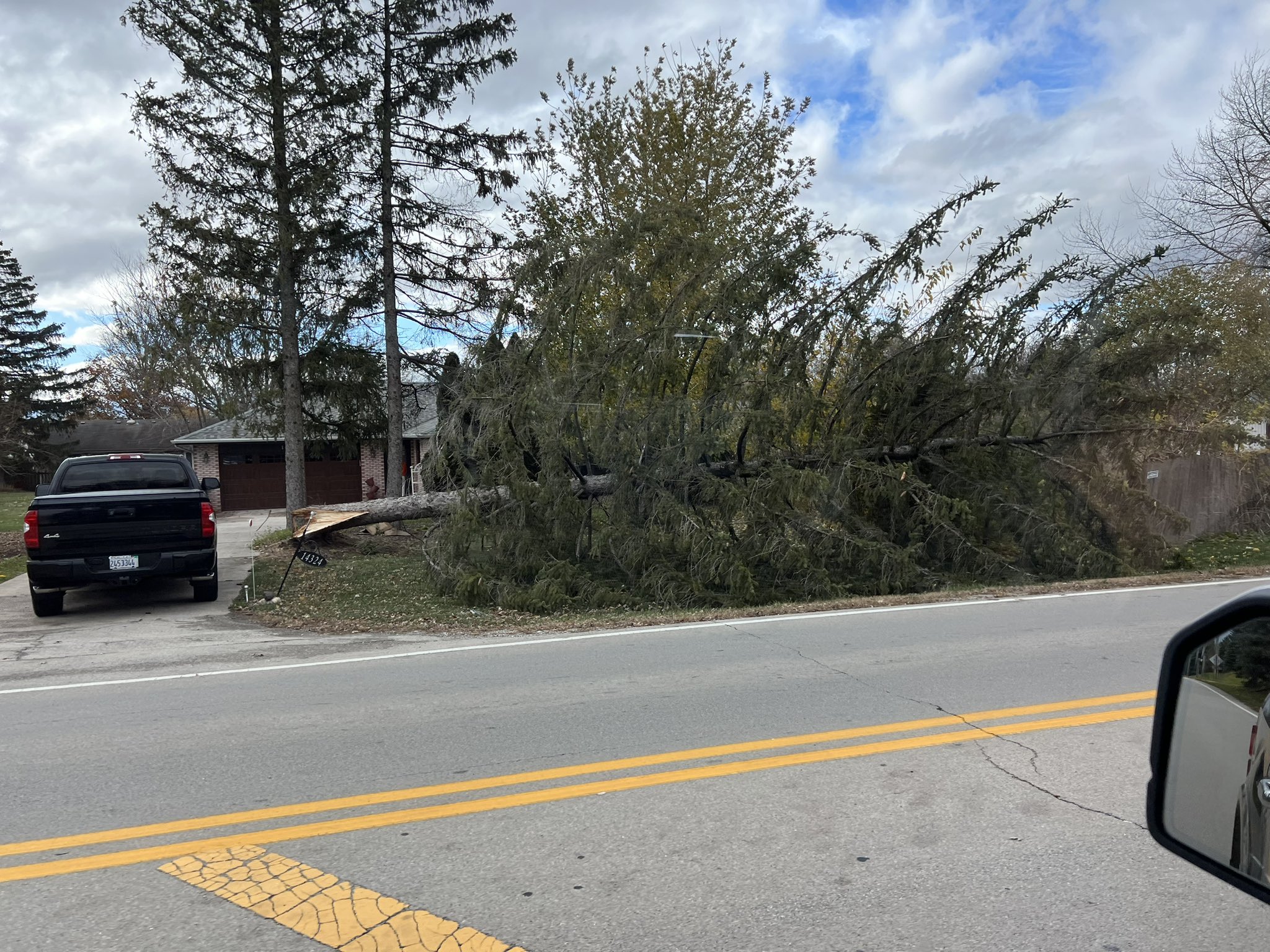
0300 PM NON-TSTM WND DMG 2 NNW HOMER GLEN 41.63N 87.95W
11/05/2022 WILL IL PUBLIC
TWITTER PHOTO OF A LARGE HEALTHY TREE,
LIKELY 2 FEET IN DIAMETER, SNAPPED AT THE
BASE. INTERSECTION OF PARKER ROAD AND 143RD.
|
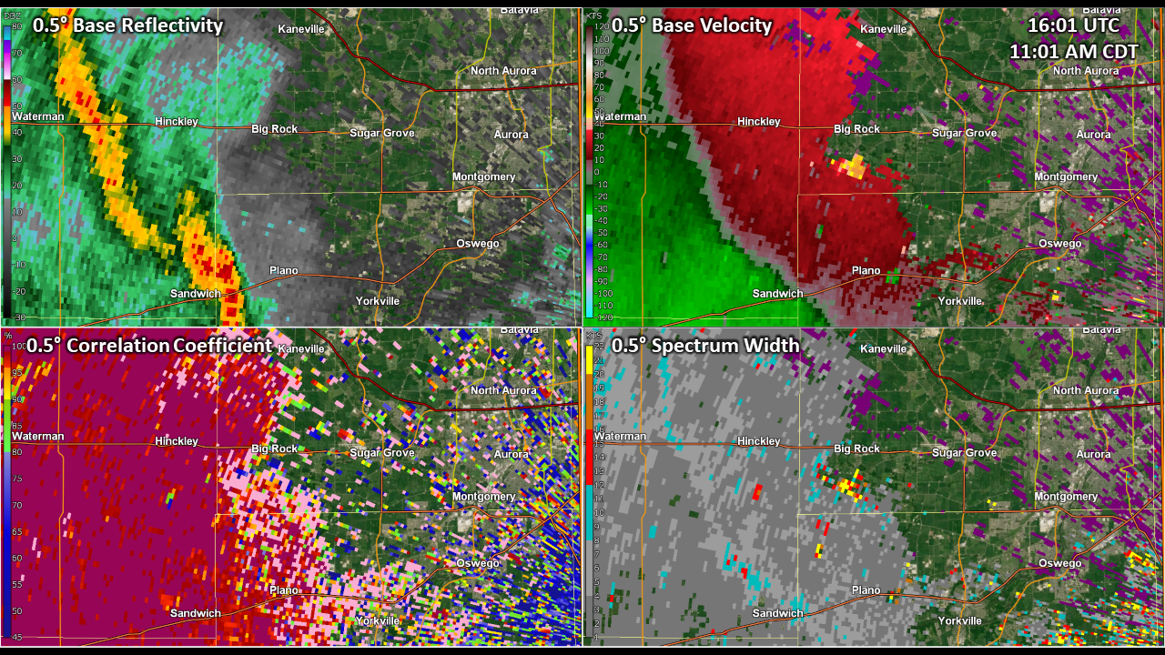
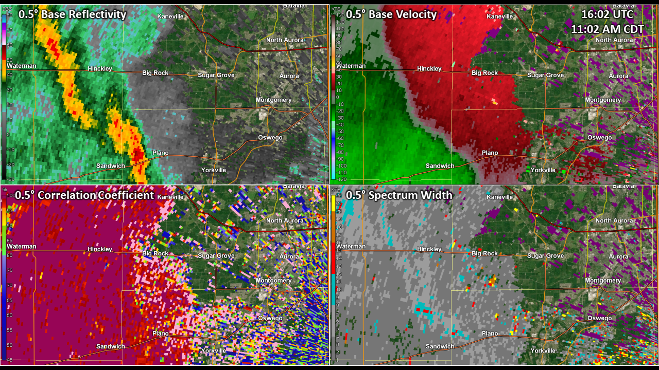
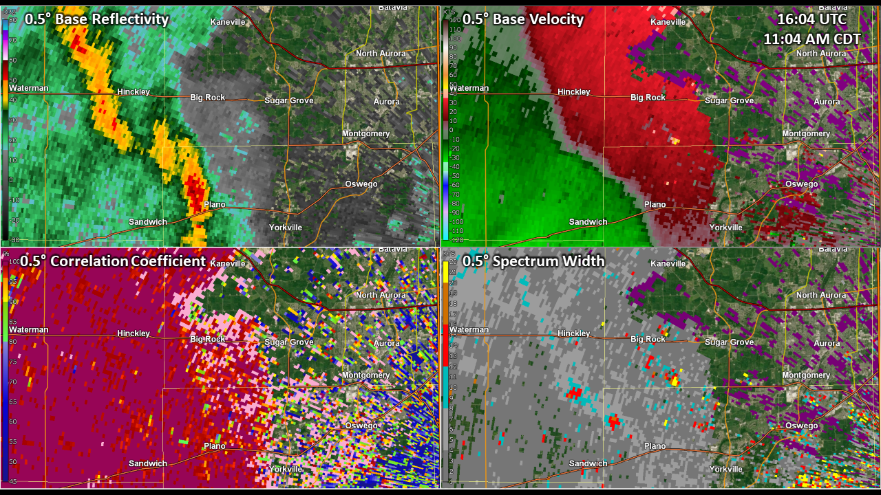
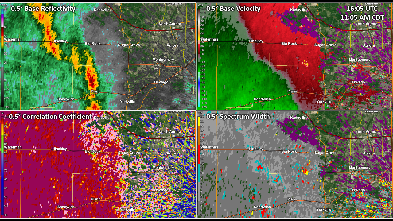
Tornado
During the morning hours of November 5th, a narrow band of showers developed along an eastward-surging cold front. In response to incredibly strong low-level shear ahead of the cold front, several weak circulations developed within the band of showers in spite of little to no instability. One circulation intensified quickly while passing through the northwestern corner of Kendall County and into southwestern Kane County and produced a brief EF-0 tornado that tracked into the village of Big Rock.
|
(click on image to enlarge) |
Below is a four-panel loop of radar imagery from KLOT showing the narrow line of showers, weak circulation, and debris signature identified by NWS meteorologists. Note that debris often remains lofted even after a tornado ends, as it takes time for debris to fall (most of the debris in this case was likely leaves and sticks).
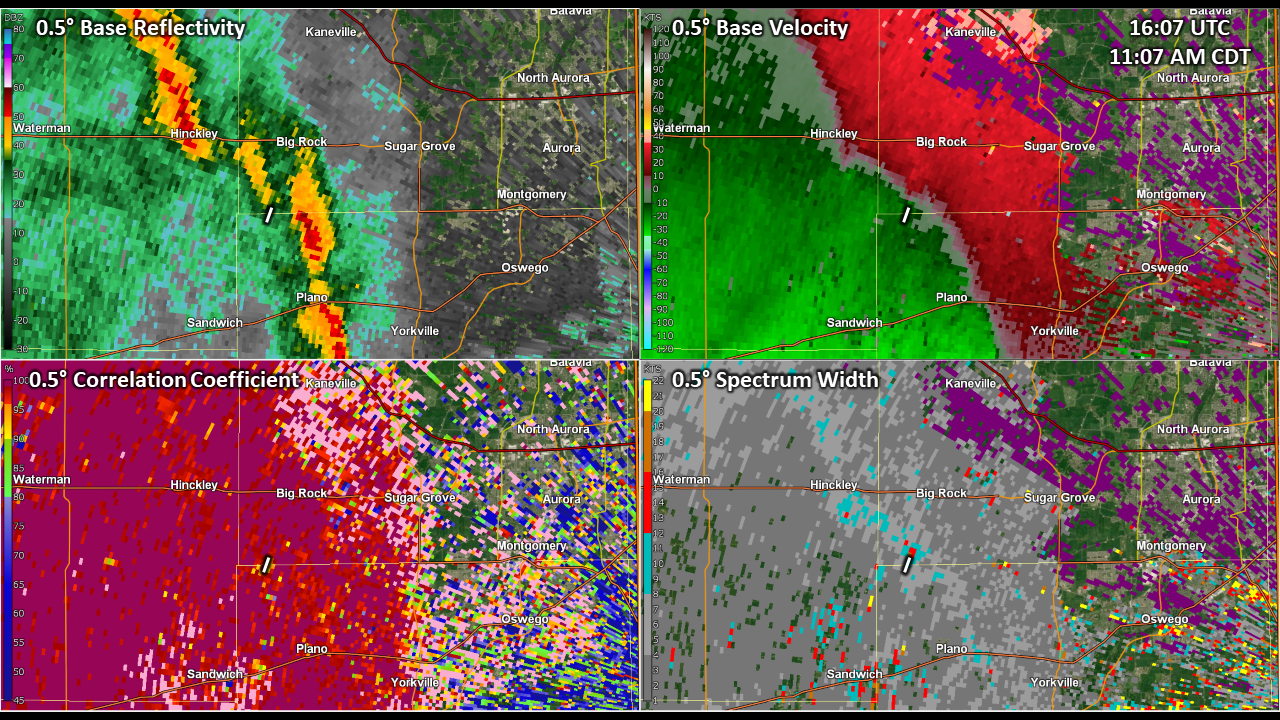
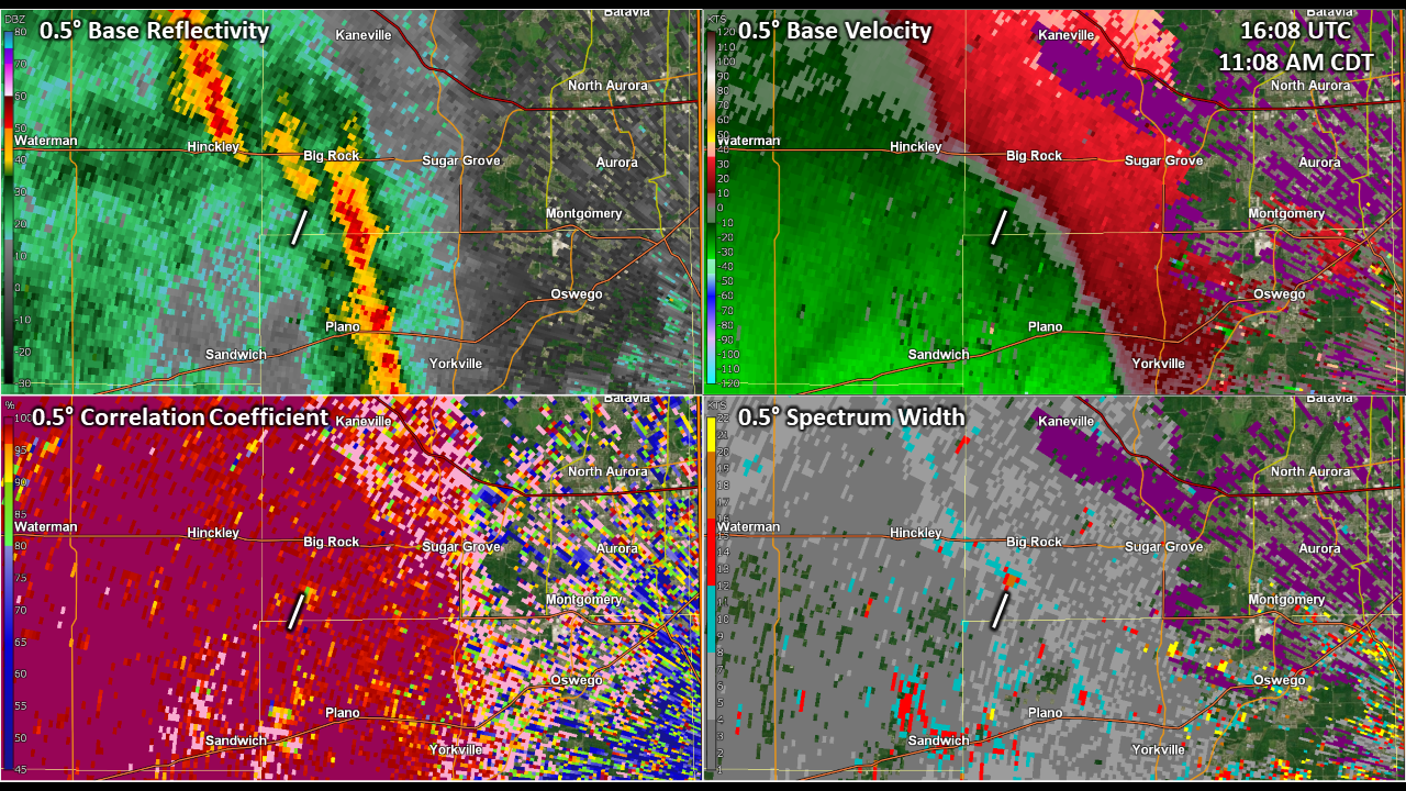
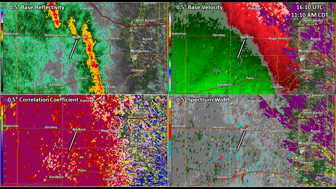
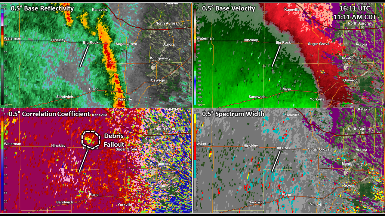
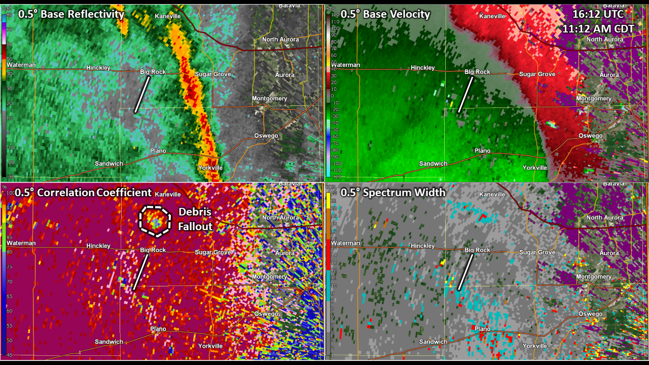
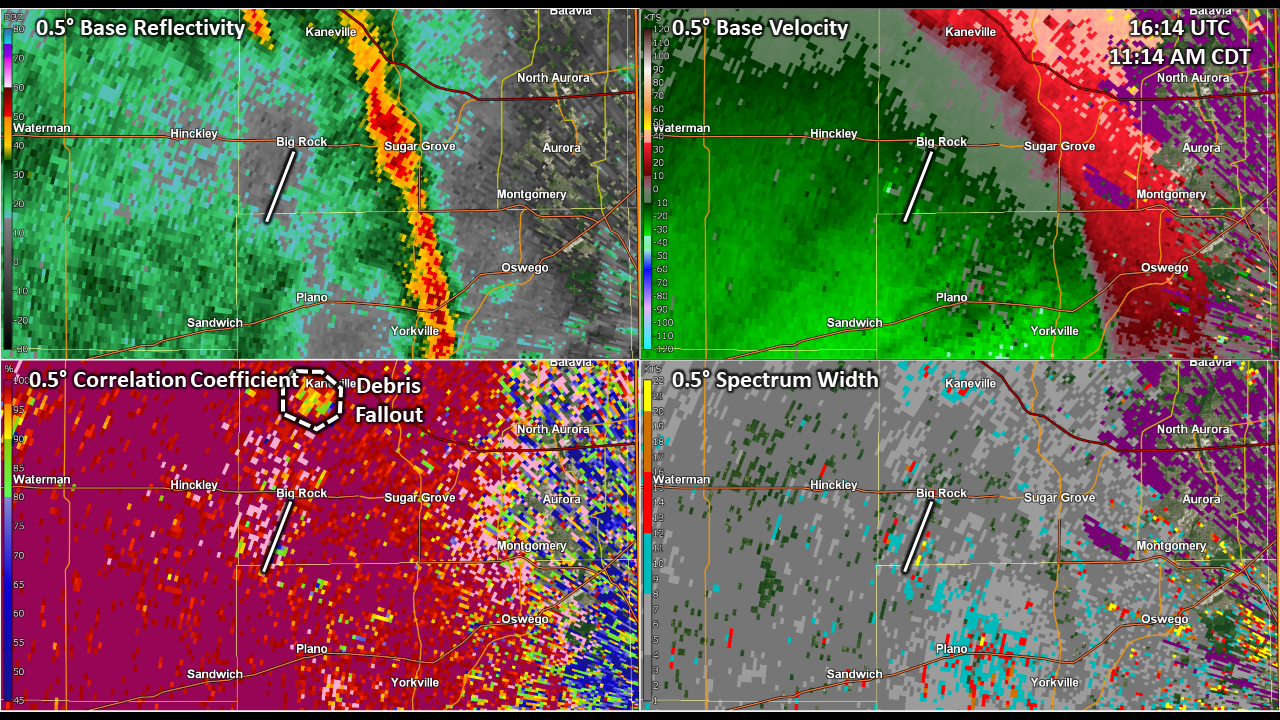
Why was there no Tornado Warning?
The typical ingredients for tornadoes include strong low-level wind shear, low cloud bases, low-level instability, and some sort of mechanism to generate upward motion (thunderstorm updraft, lifting air along a cold front or outflow boundary). While there was little to no instability present during the morning of November 5th, the low-level shear was incredibly strong, cloud bases were close to the ground, and there was a strong cold front producing upward motion. As the narrow line of showers moved eastward across northern Illinois, a small "kink" in the line developed, which allowed for the development of small enhancements to upward motion along the front (i.e., a localized stronger updraft). Evidently, the upward motion was enough to develop a tornado.
The potential for the narrow band of showers to produce brief and weak tornadoes was known by NWS forecasters, and was discussed in the Area Forecast Discussion issued at approximately 2:50 AM on November 5, 2022. Area Forecast Discussions are technical forecast narratives written by NWS forecasters several times a day to outline general expectations for the forecast within a seven day period. In the forecast discussion, an NWS forecaster noted:
The cold front will sweep across the area between 10 am and noon, ushering in a modest wind shift toward the southwest. Anytime one finds themselves within the warm sector of a rapidly deepening low pressure system, they must watch out for surprise severe weather events anytime of day and even with meager instability. High resolution model guidance continues to advocate for a strongly force band of showers along the cold front, which may locally augment wind gusts. Given the literal bare-bones meager CAPE expected, convective updrafts along the front will likely be of limited width and strength. With this in mind, updrafts may very well get ripped apart as they grow upward, limiting their overall longevity and "sucking" power. As a result, the threat for a surprise tornado event along the front appears to be low (<2%). If more instability develops to sustain low-level updrafts than currently expected, the threat for tornadoes would increase. Sometimes, we can't tell whether we have enough instability until, well, tornadoes start developing. At any rate, the most likely scenario is the front sweeps through as an arcing band of showers with locally higher wind gusts. |
While considered an unlikely scenario, the forecast did note the line of showers may produce a tornado.
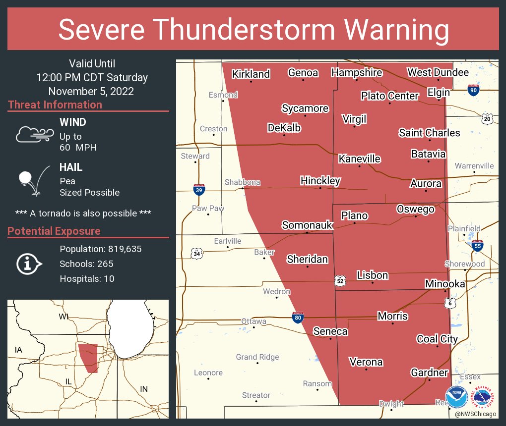
As the line of showers moved across northern Illinois, NWS forecasters issued Severe Thunderstorm Warnings that included a "Tornado Possible" tag. The "Tornado Possible" tag is often used by NWS meteorologists in situations where the potential for a brief and weak tornado exists, but either confidence in one occurring is too low to issue a Tornado Warning or the expected damage produced by the brief and weak tornado would be no more significant than winds already being produced by the shower or thunderstorm. This was the case on November 5th as NWS forecaster confidence in the occurrence of a tornado was too low to issue a Tornado Warning, and if a tornado were to occur, the expectation was that the winds would be of similar strength to the wind speeds already being produced by the storm. At 10:52 AM CDT, approximately 16 minutes before the tornado occurred, a Severe Thunderstorm Warning with the "Tornado Possible Tag" was issued for an area that included both Kendall and Kane counties.
|
|
|
Severe Thunderstorm Warning issued at 10:52 AM CDT that included the "Tornado Possible" tag and Kendall and Kane counties, where the EF-0 tornado touched down. |
Meteorology
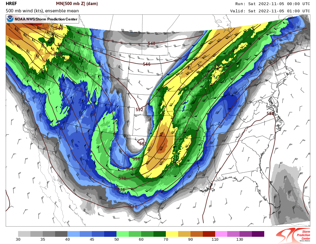
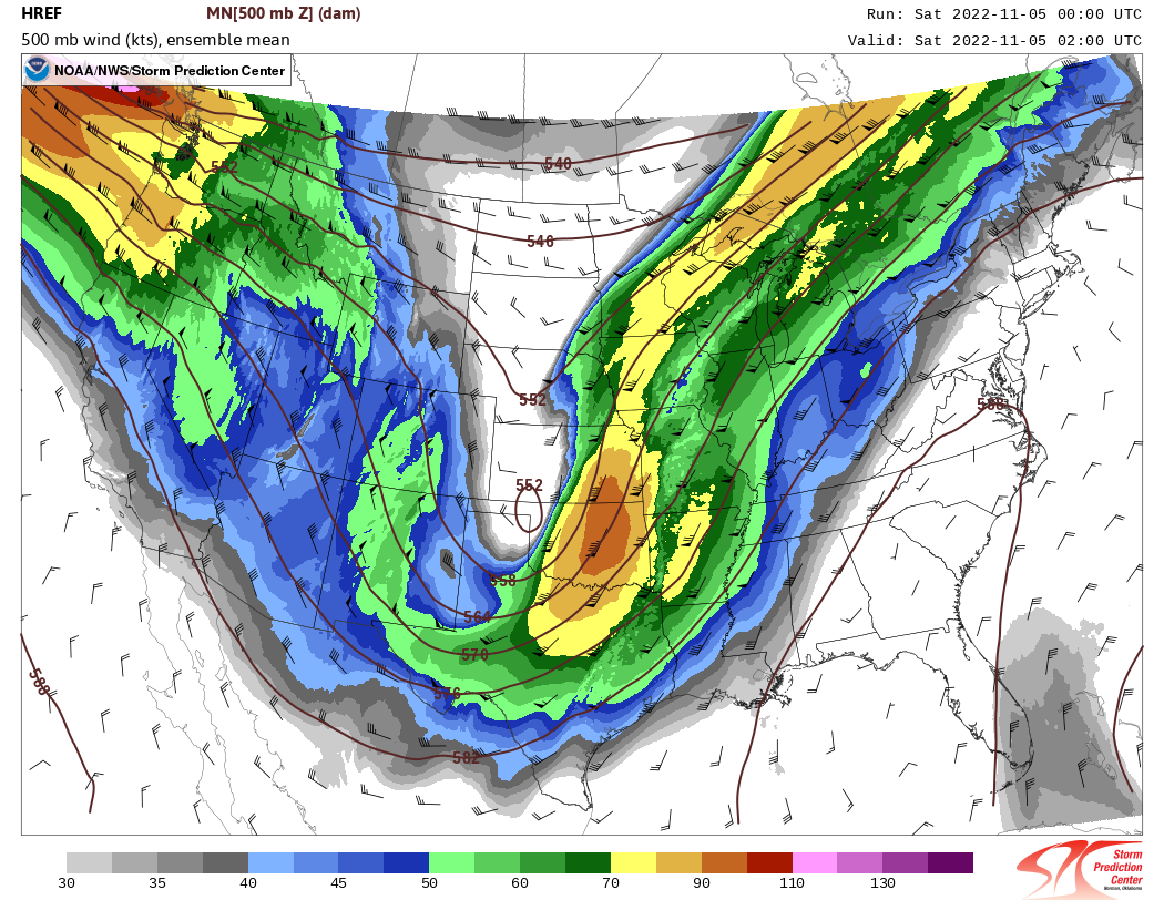
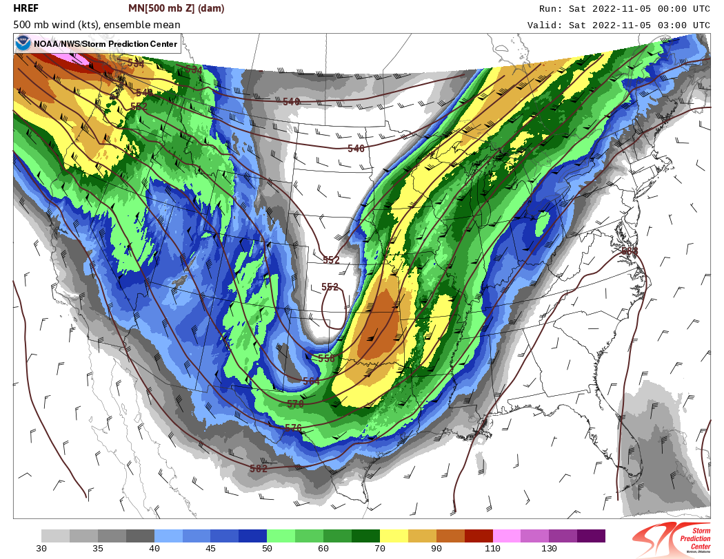
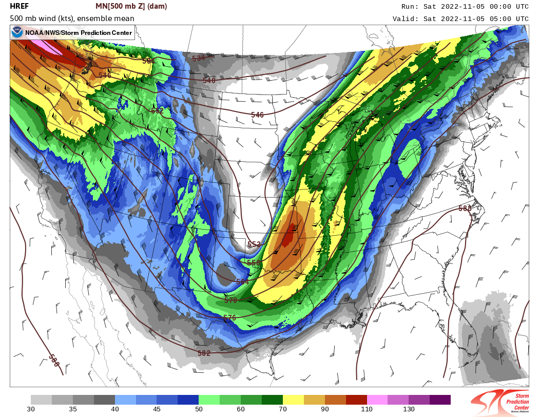
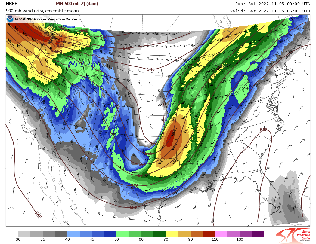
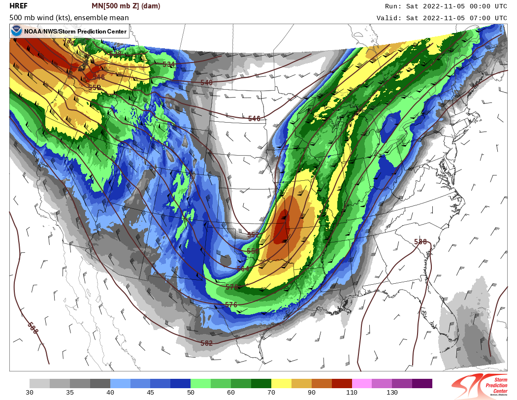
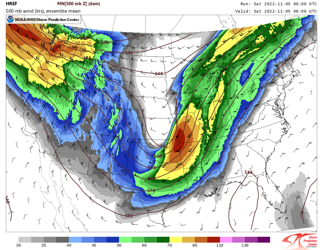
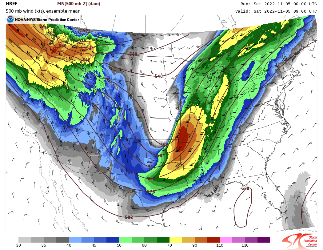
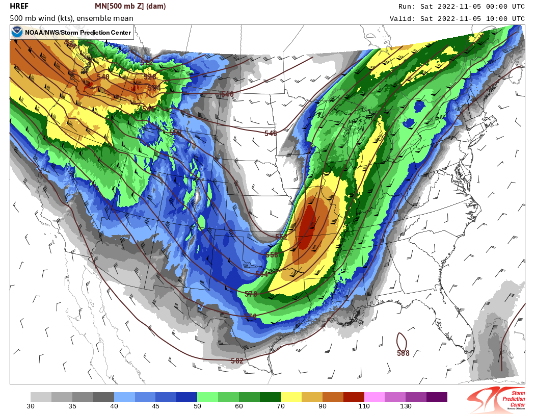
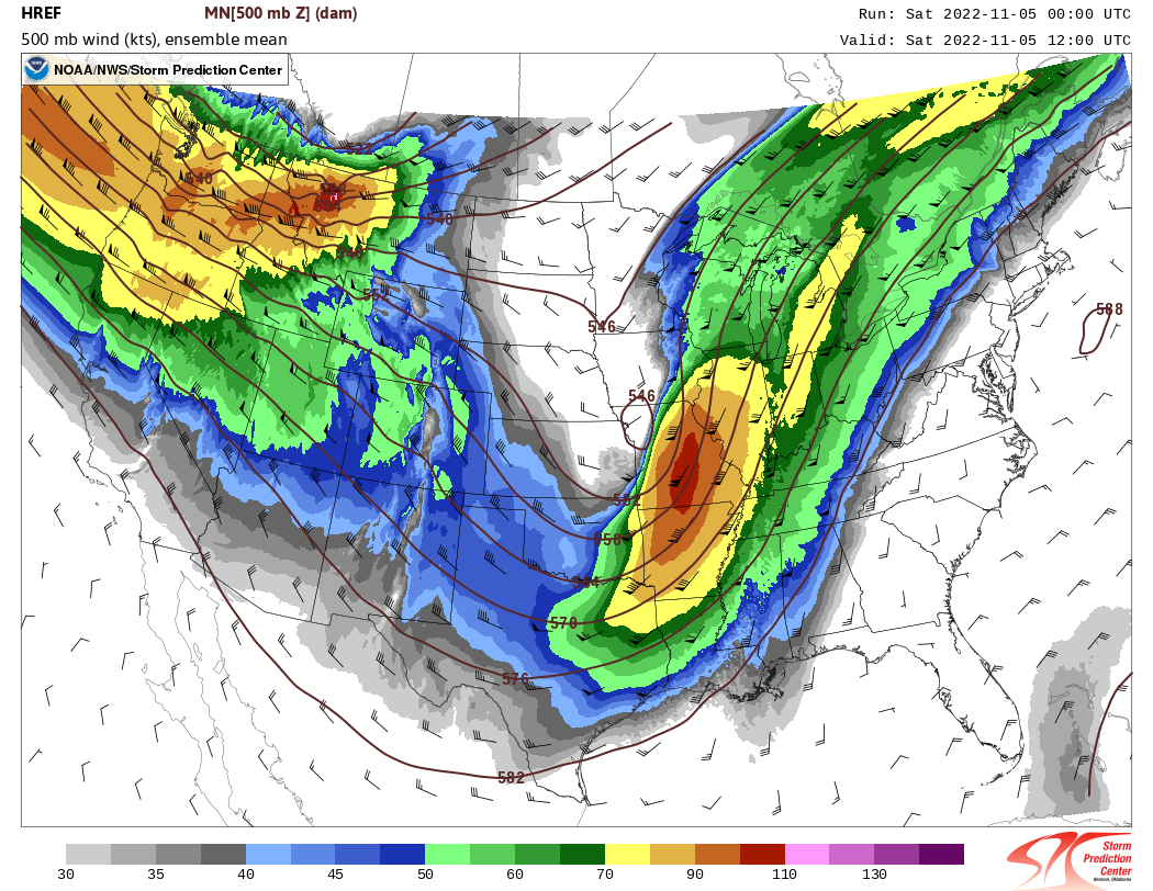
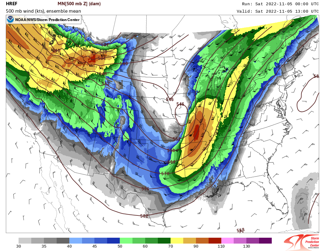
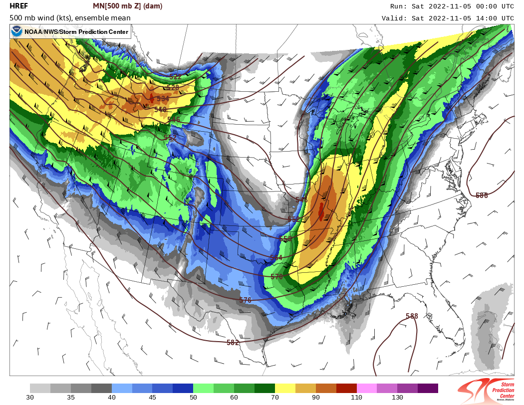
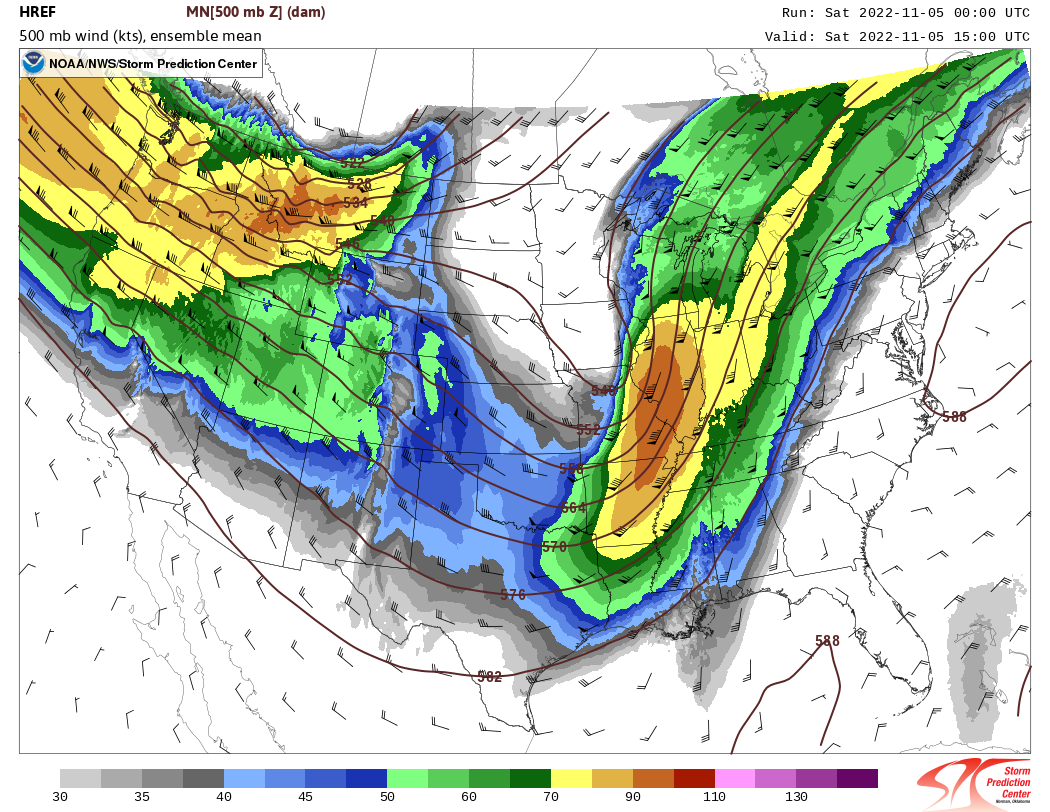
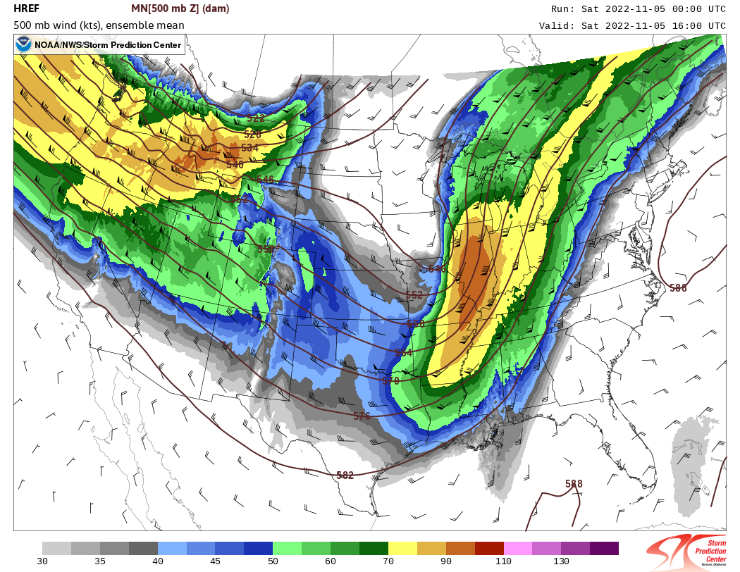
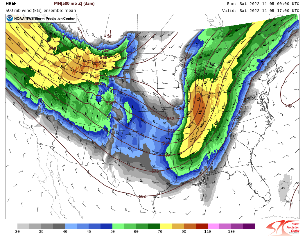
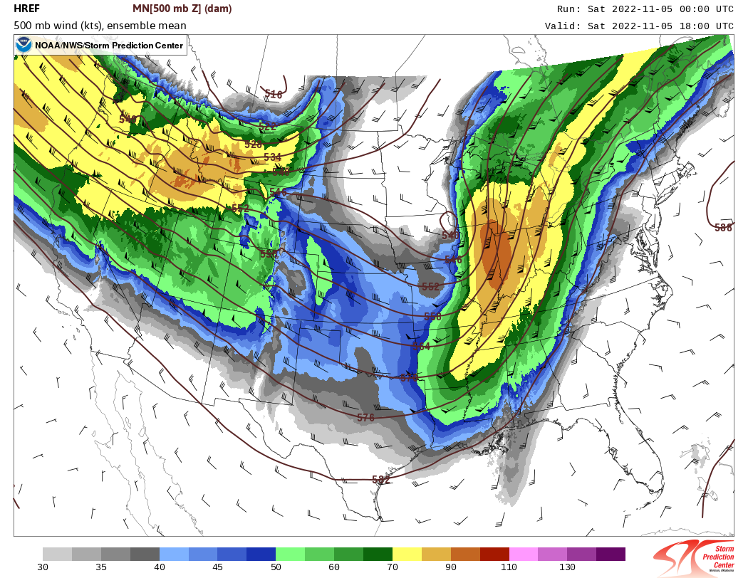
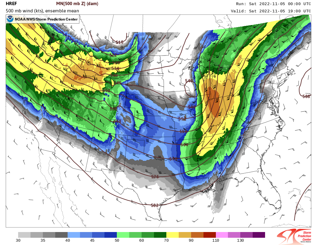
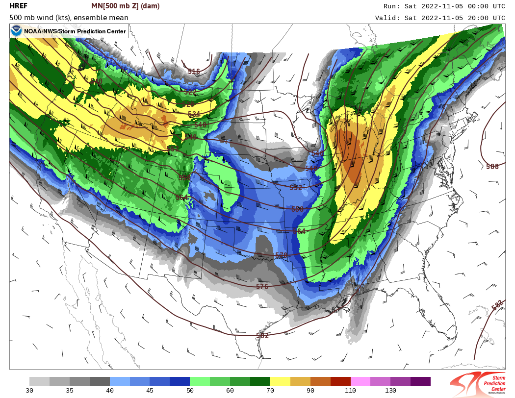
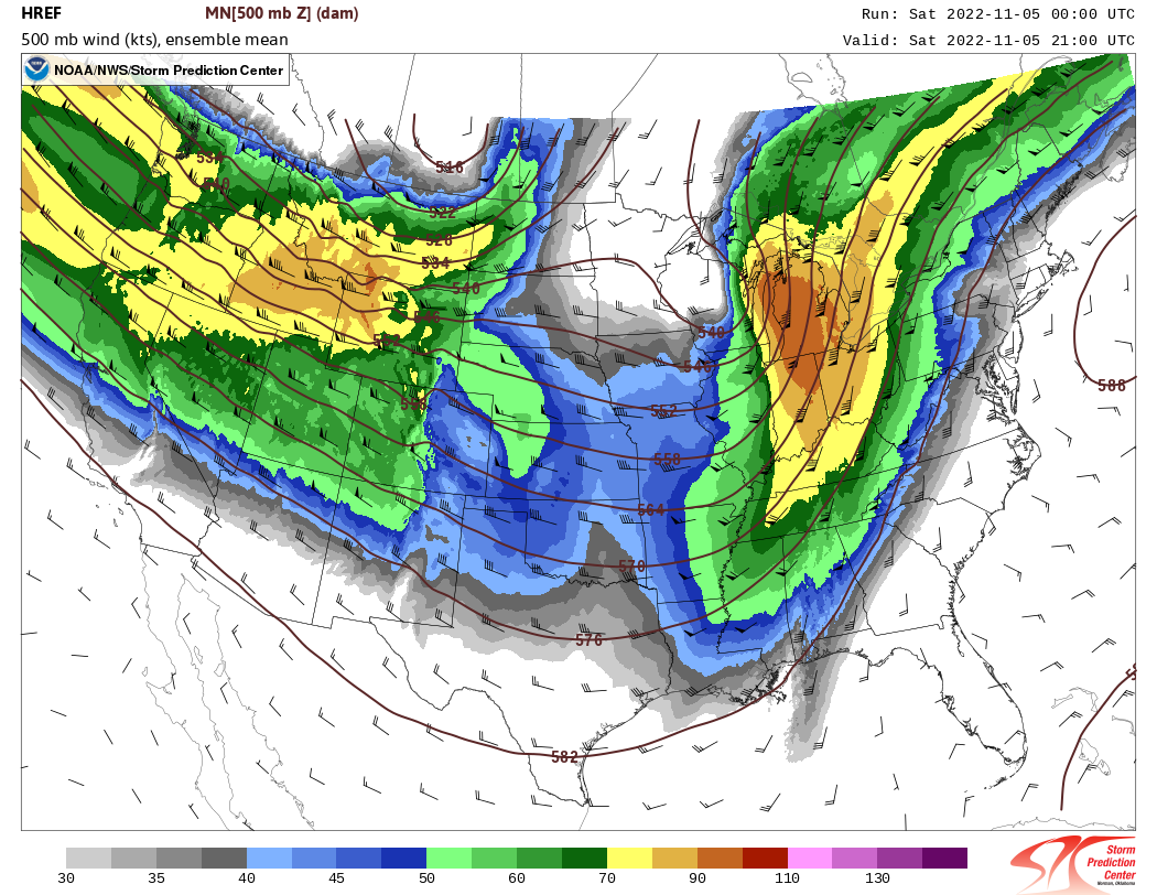
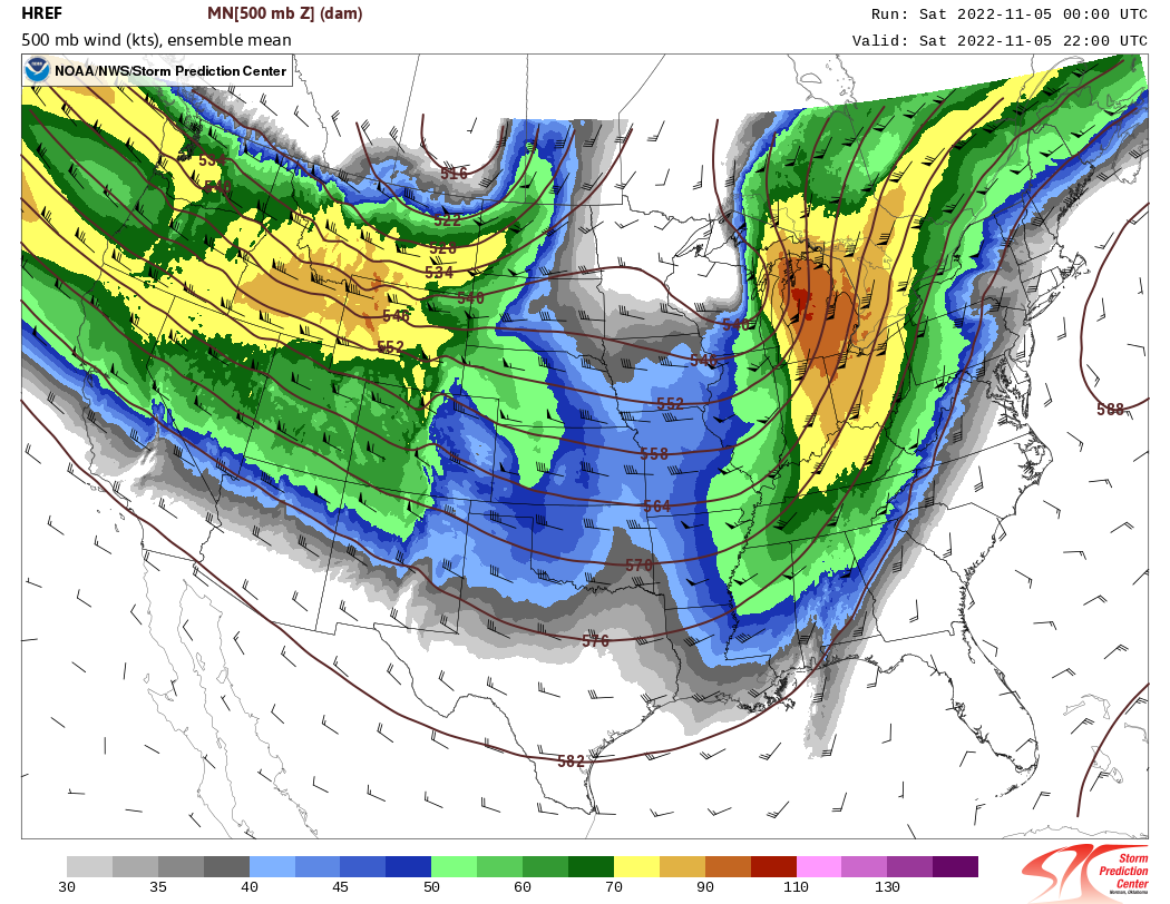
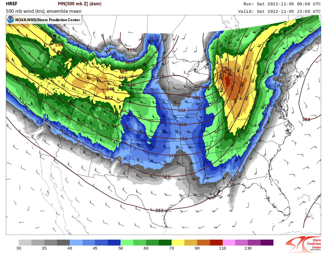
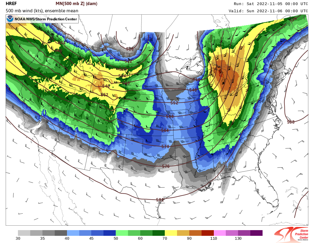
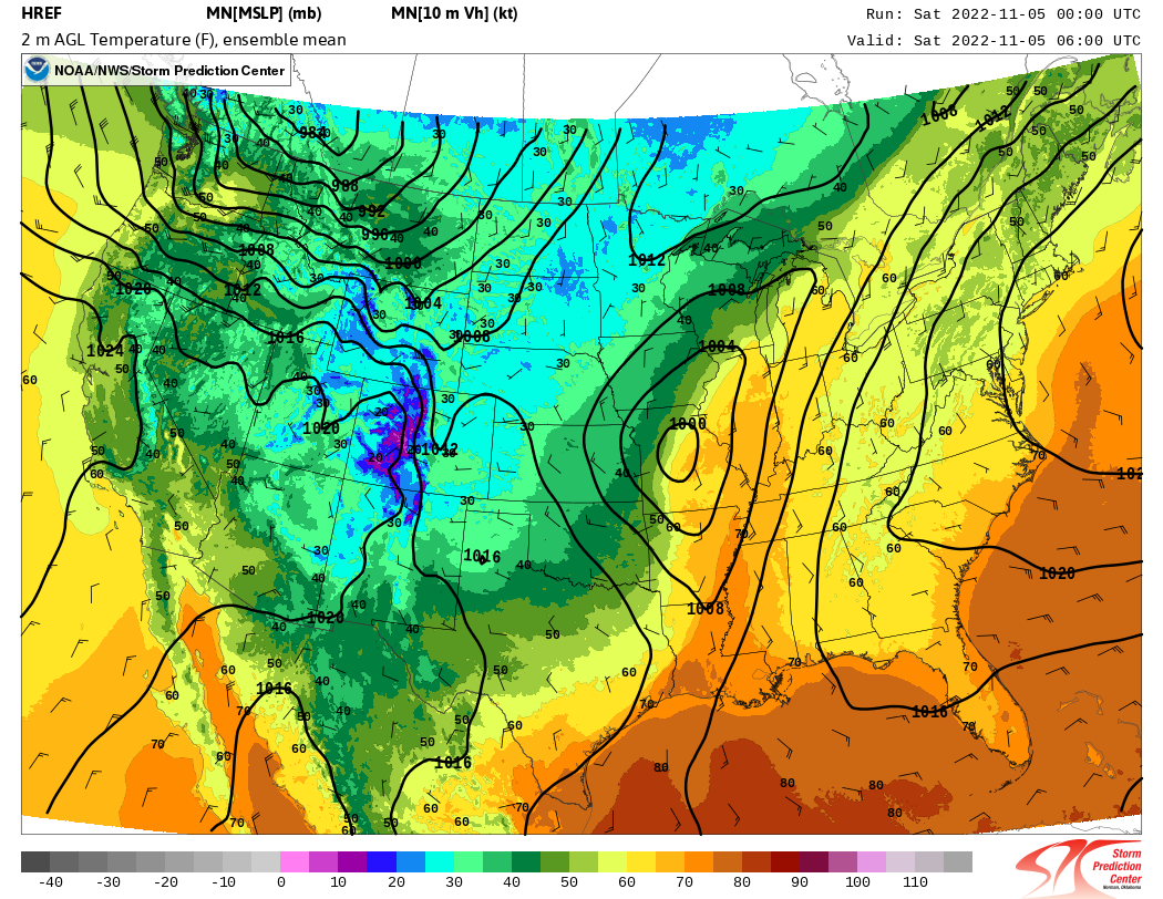
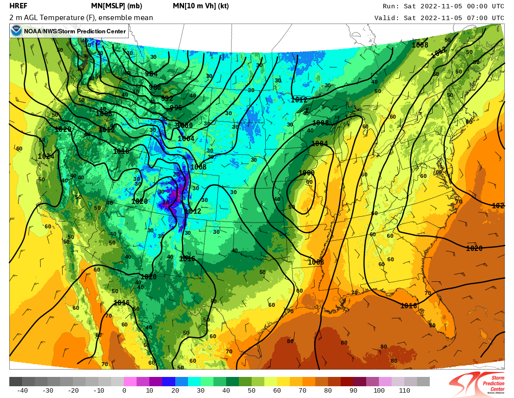
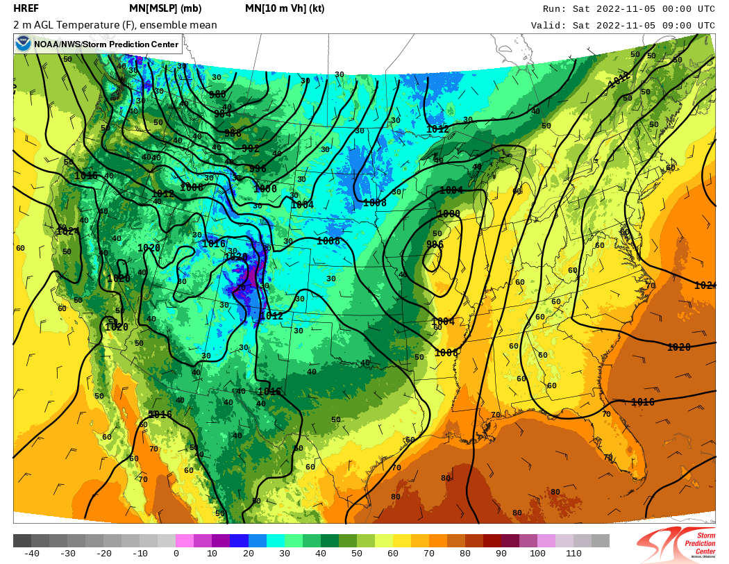
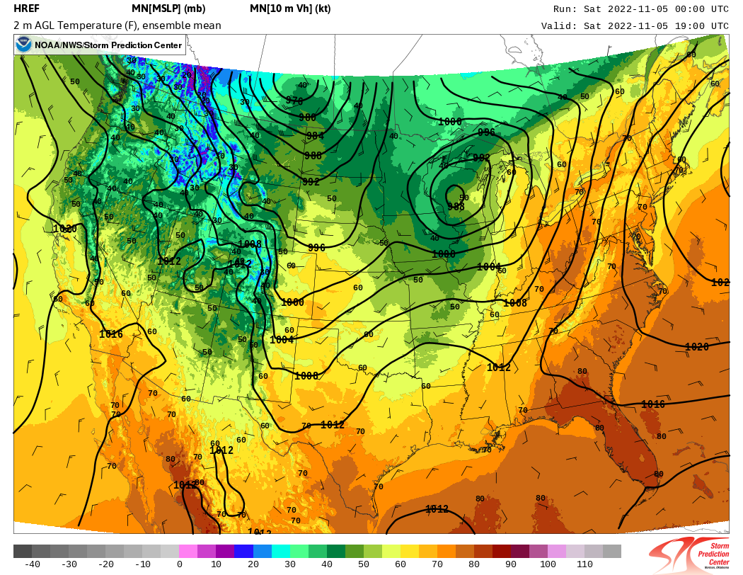
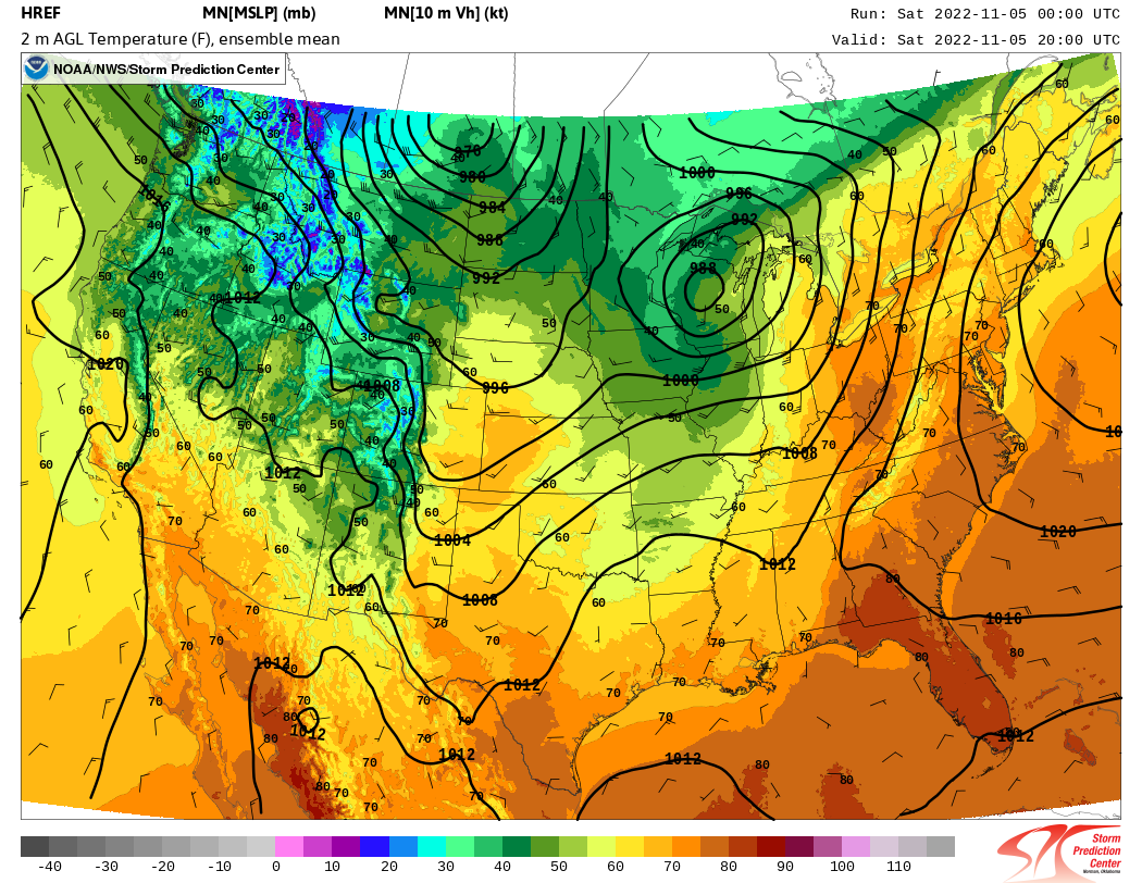
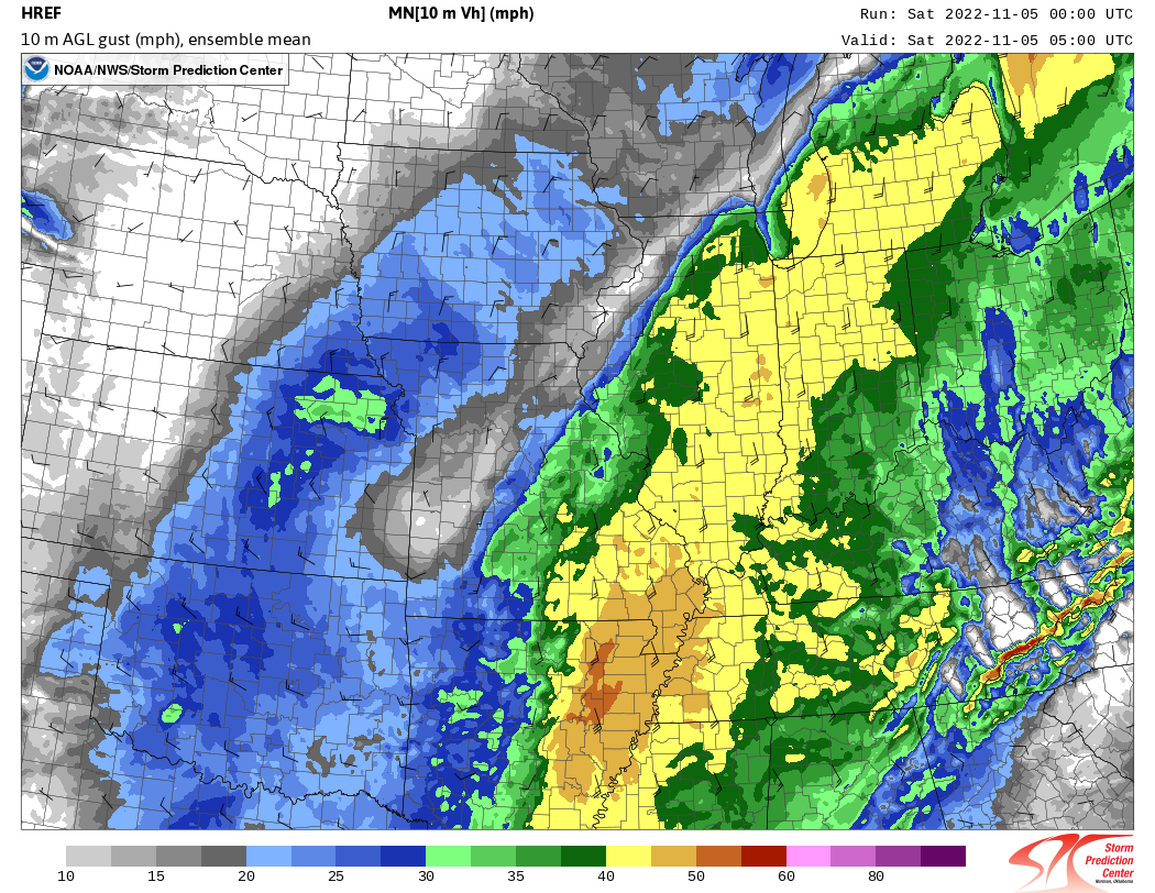
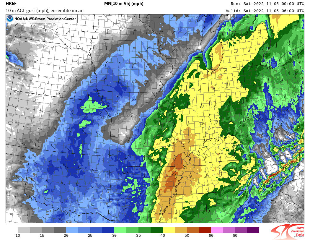
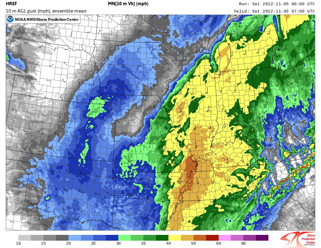
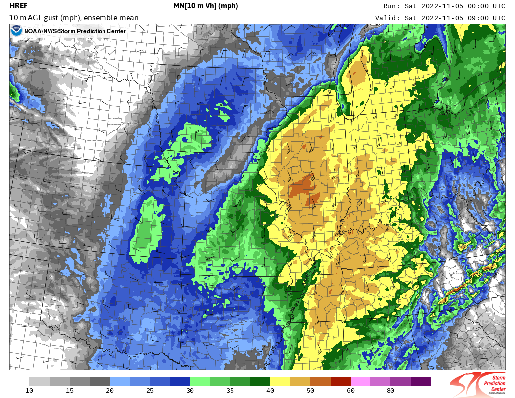
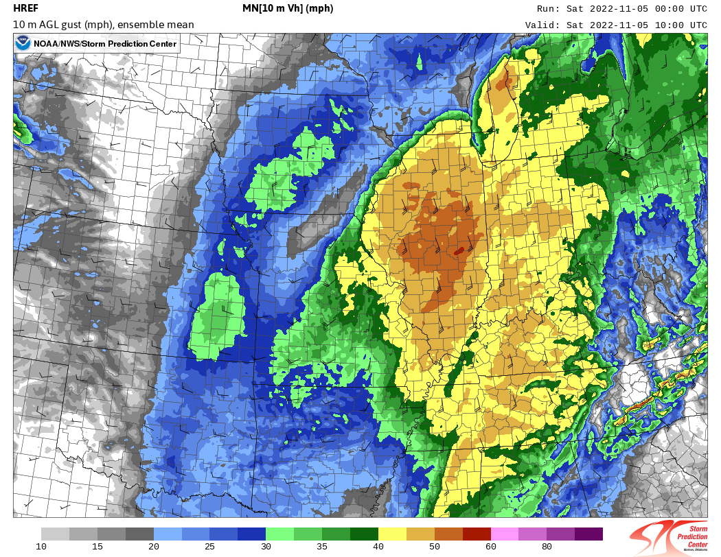
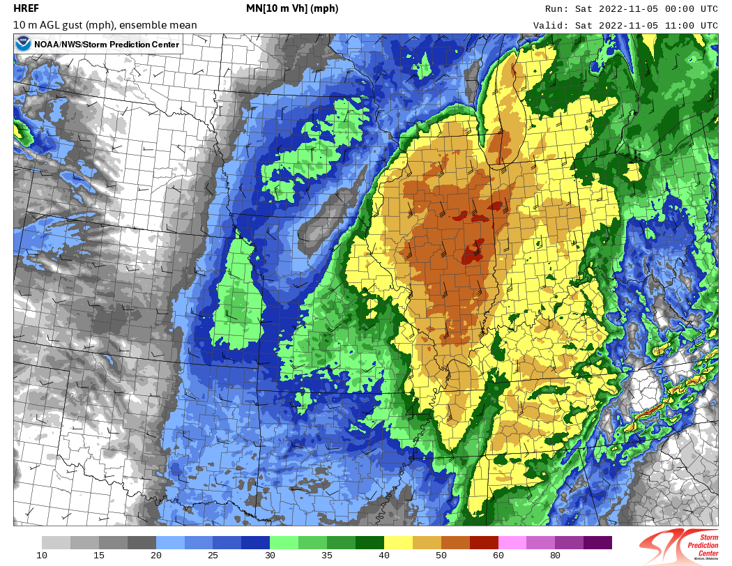
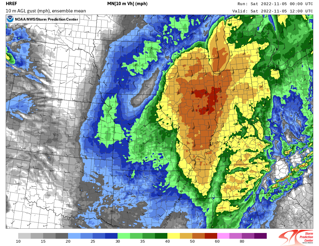
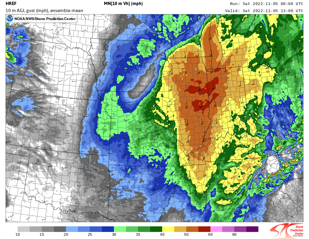
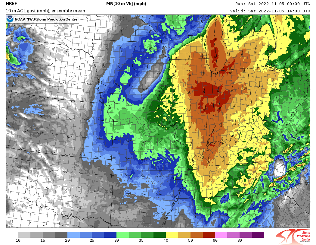
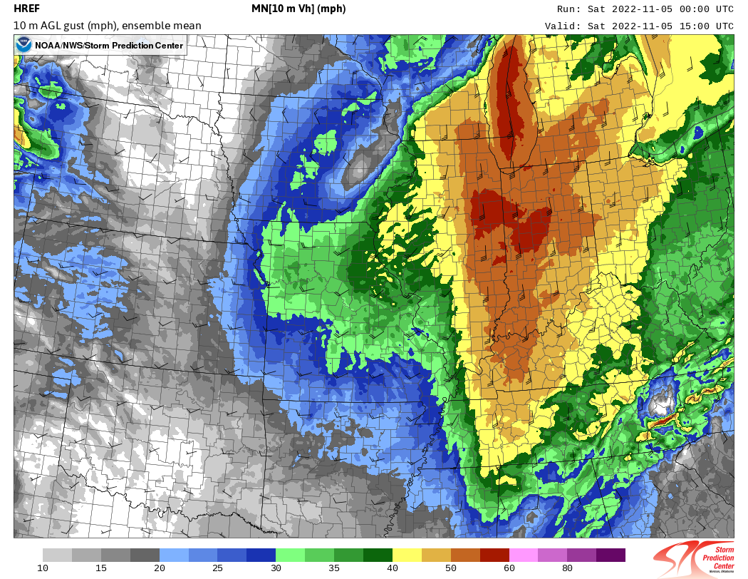
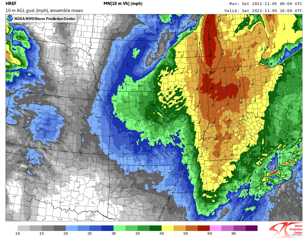
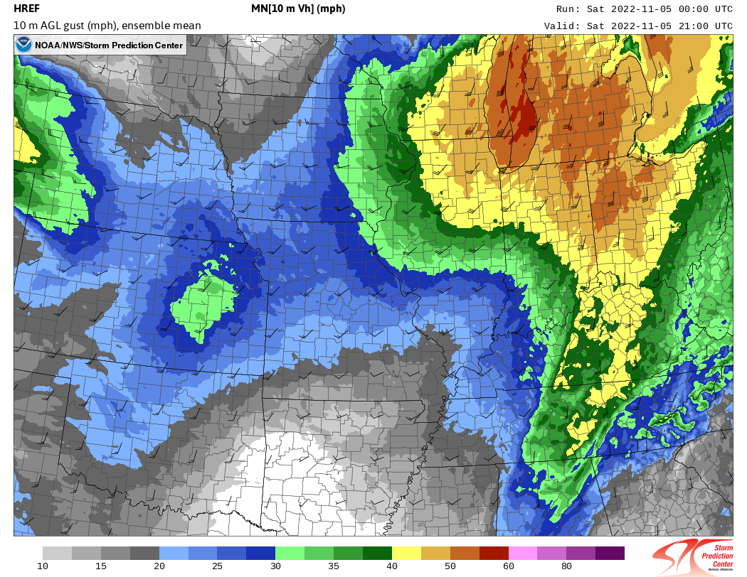
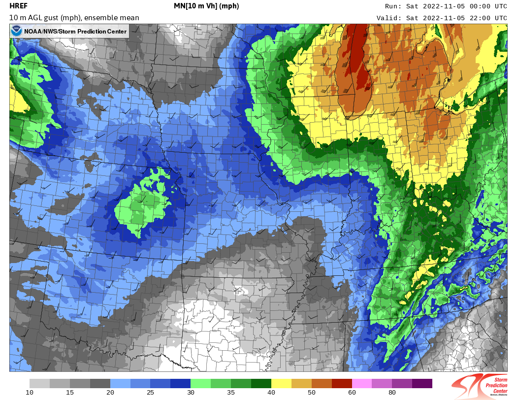
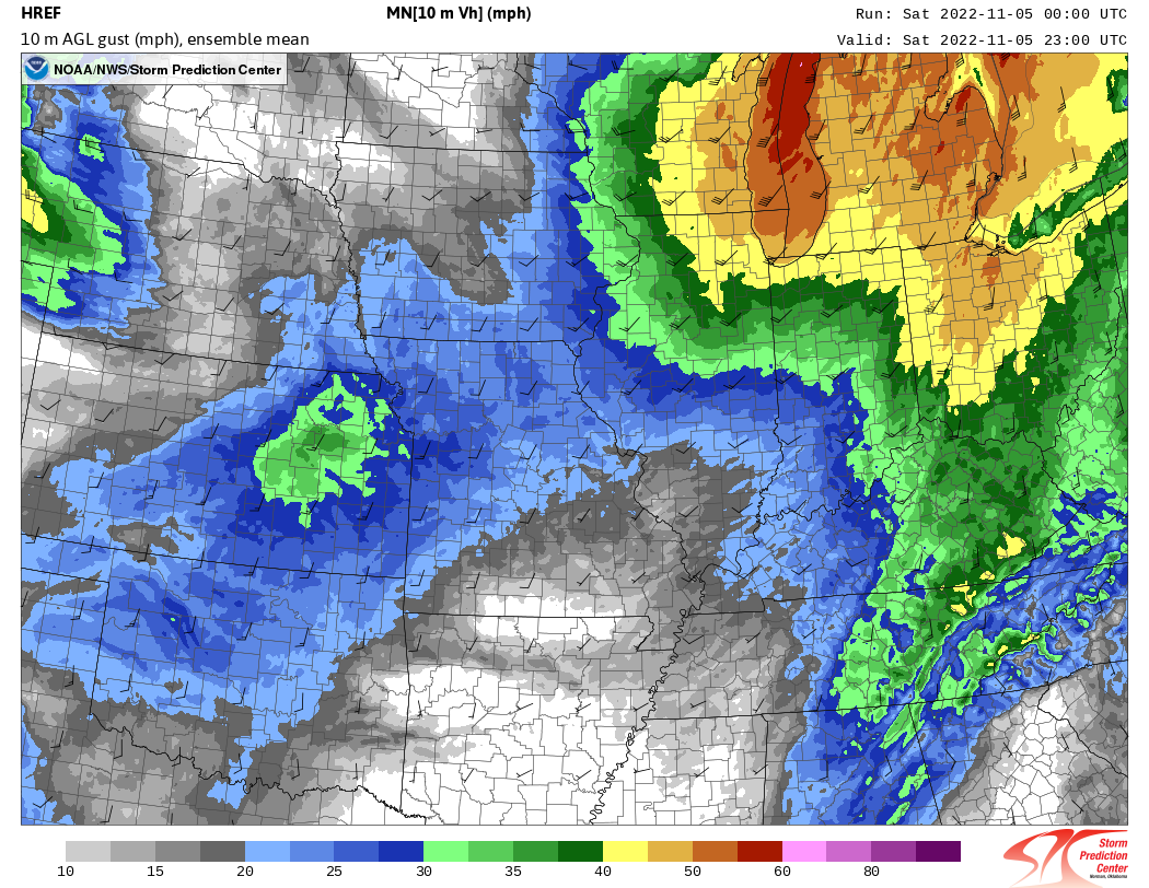
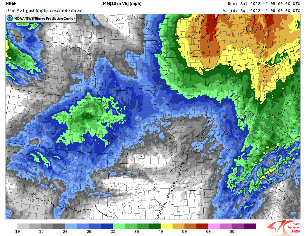
Wind storms in the Great Lakes are not uncommon during the fall and spring months as storm systems feed on temperature gradients across the United States. Indeed, old tales of the "Gales of November" are based on fall storm systems much like the one that impacted our area on November 5th. This section will use data from the 00Z (7 PM CDT) November 5, 2022 run of the HREF (High Resolution Ensemble Forecast) model to demonstrate the meteorological set-up for the damaging wind event on November 5, 2022.
1. Upper-Level Pattern
The upper-level pattern consisted of a compact trough that was changing orientation from "neutrally" to "negatively" tilted. Negatively-tilted troughs are favorable for the rapid deepening of surface low pressure systems, and the upper-level pattern on November 5th was no exception.


2. Surface Pattern
As the upper-level trough passed overhead, a surface low pressure system lifted from near Joplin, MO to southwestern Wisconsin dropping some 12 mb in 12 hours. A pressure drop of 1mb/hour is sometimes referred to as "bomb cyclogenesis," though often carries a requirement to occur for a period of at least 24 hours.
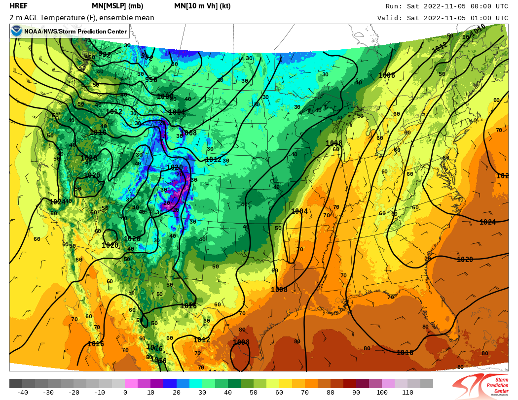
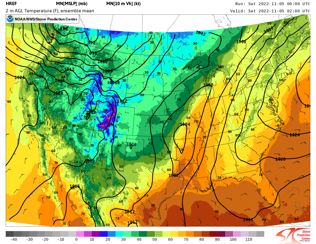
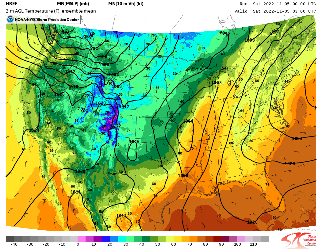
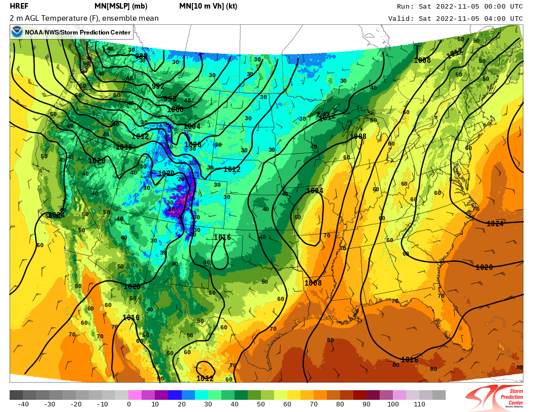
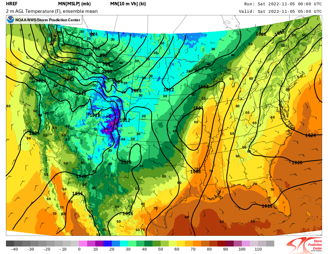

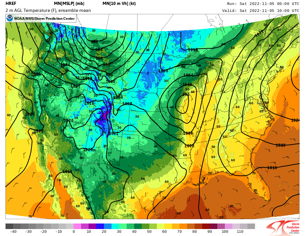
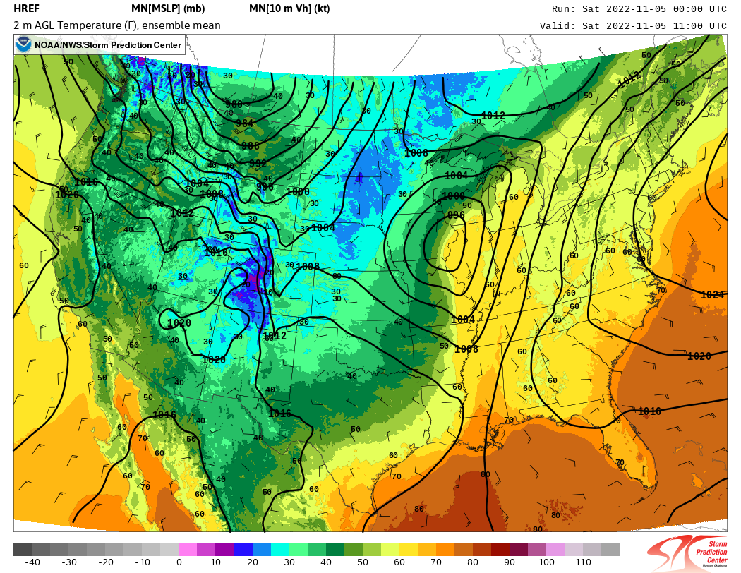
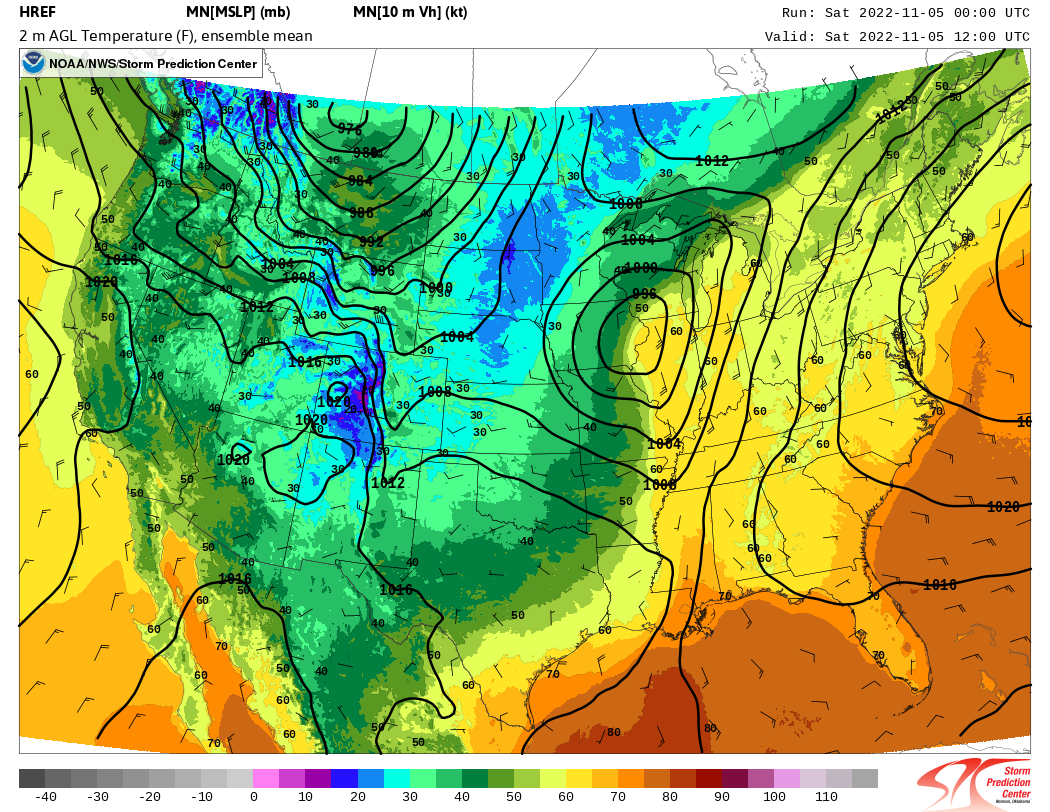
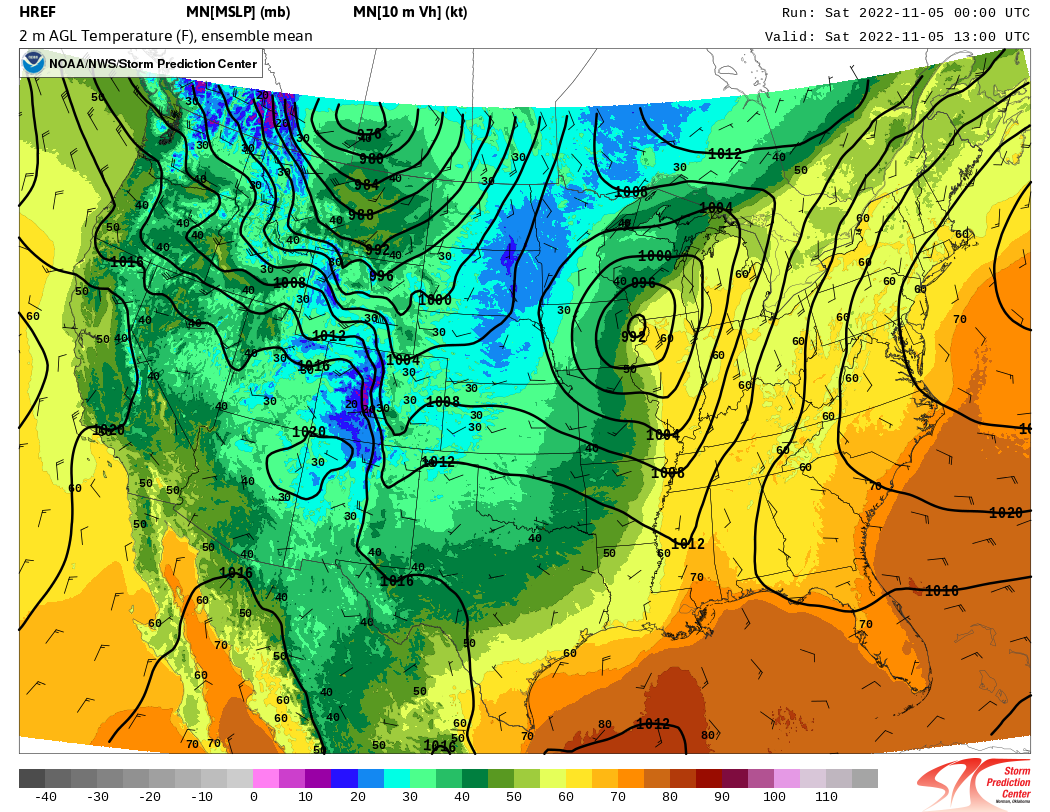
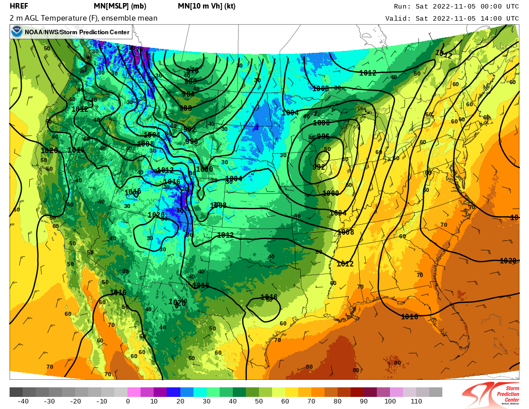
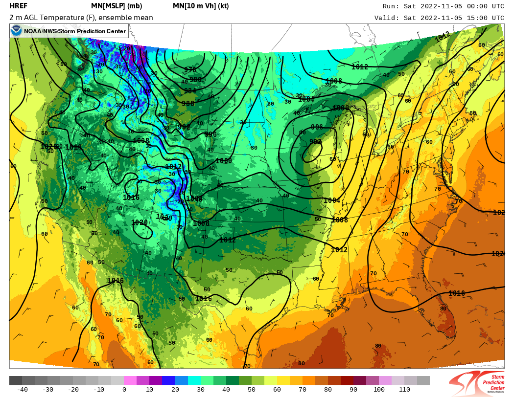
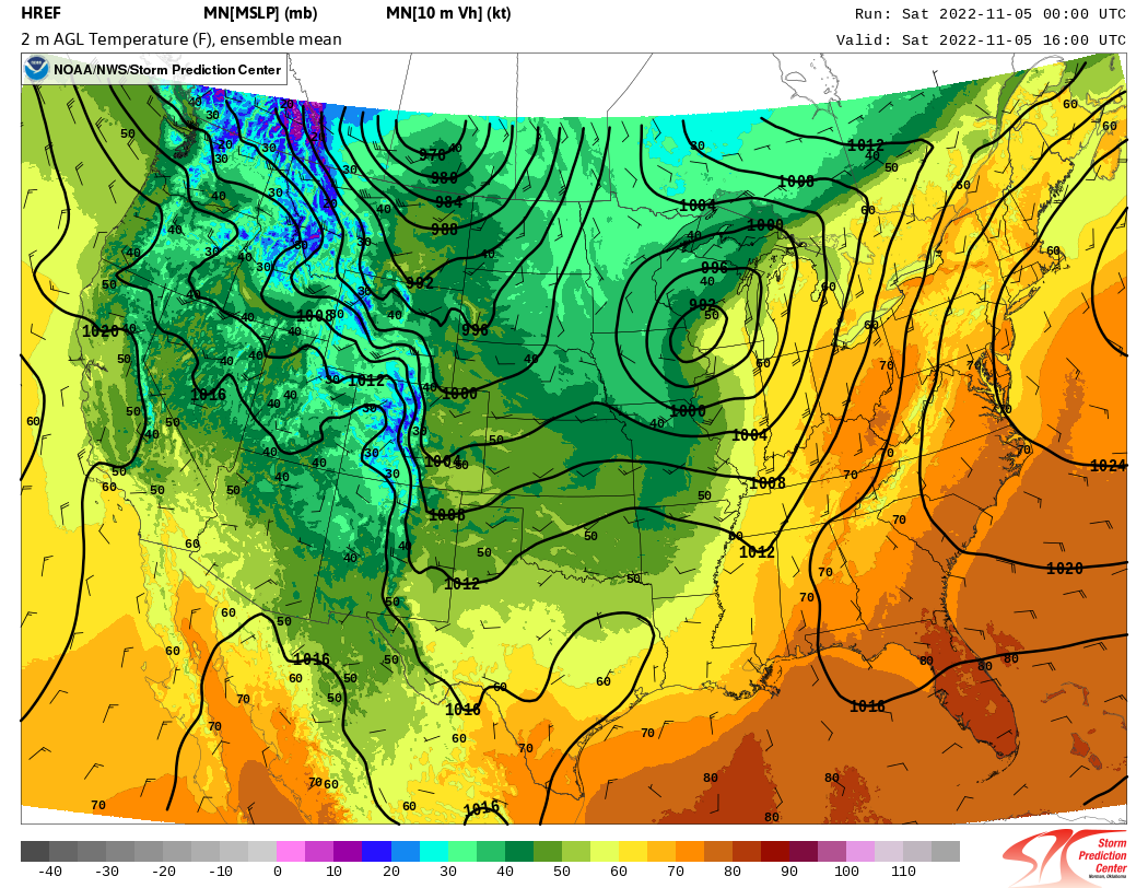
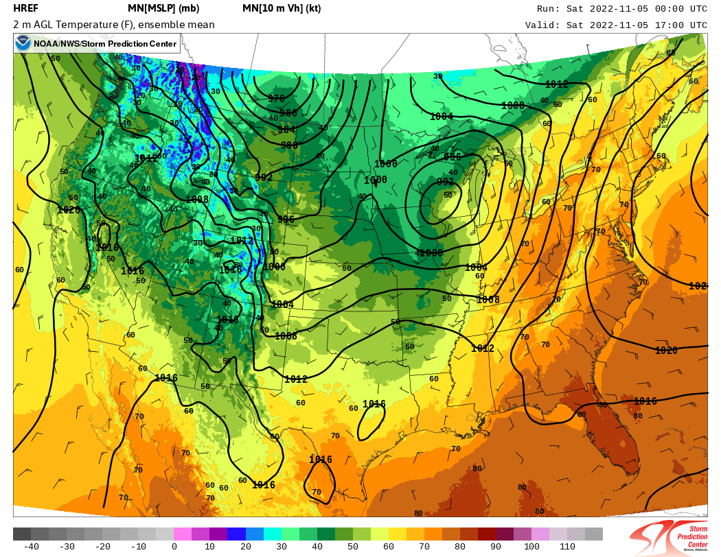
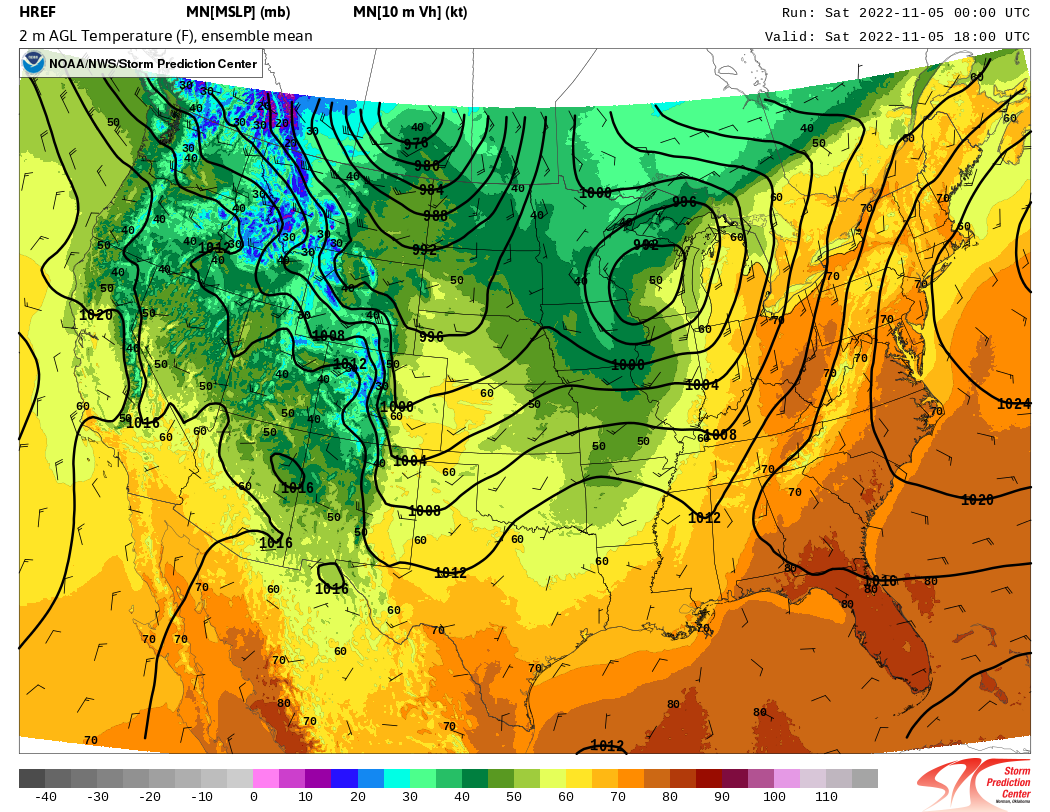
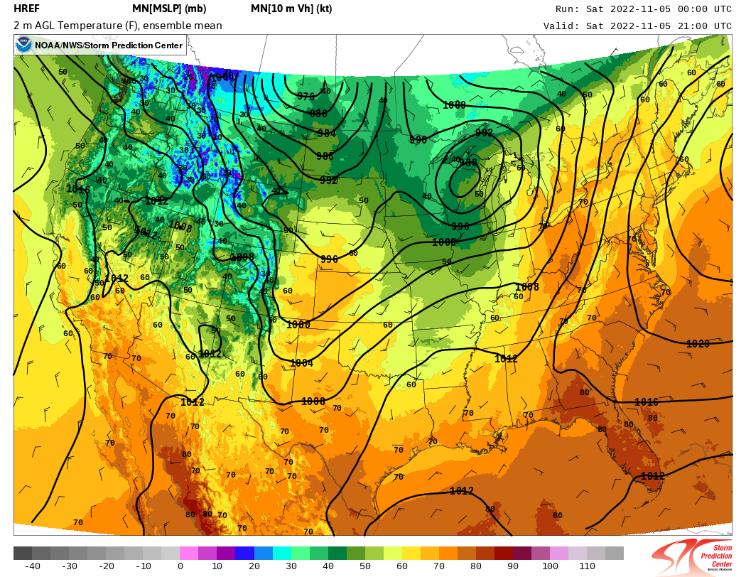
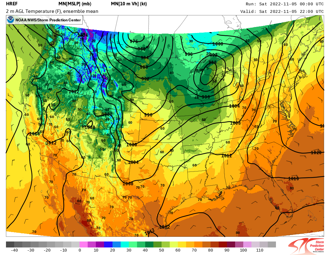
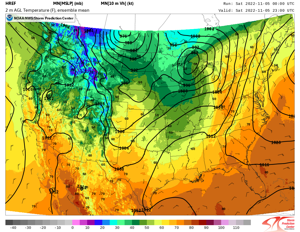
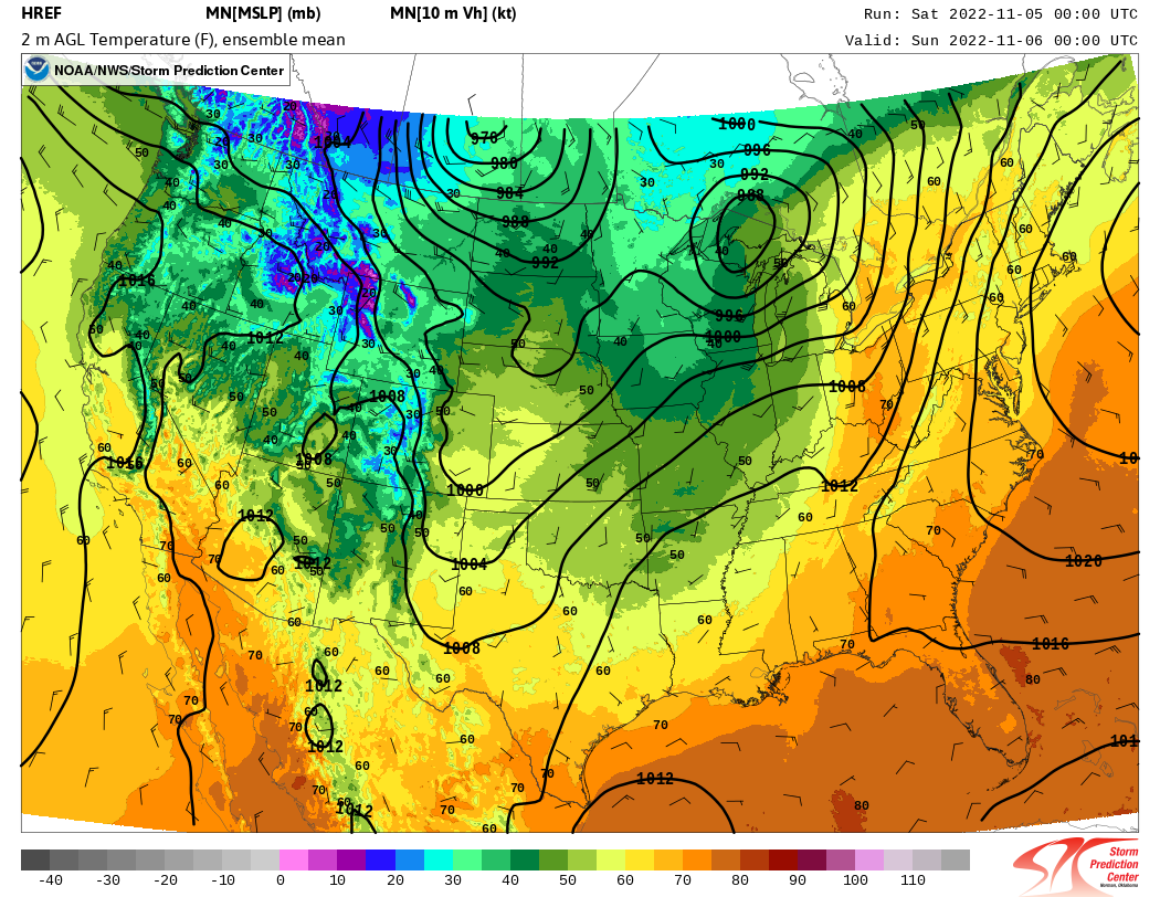
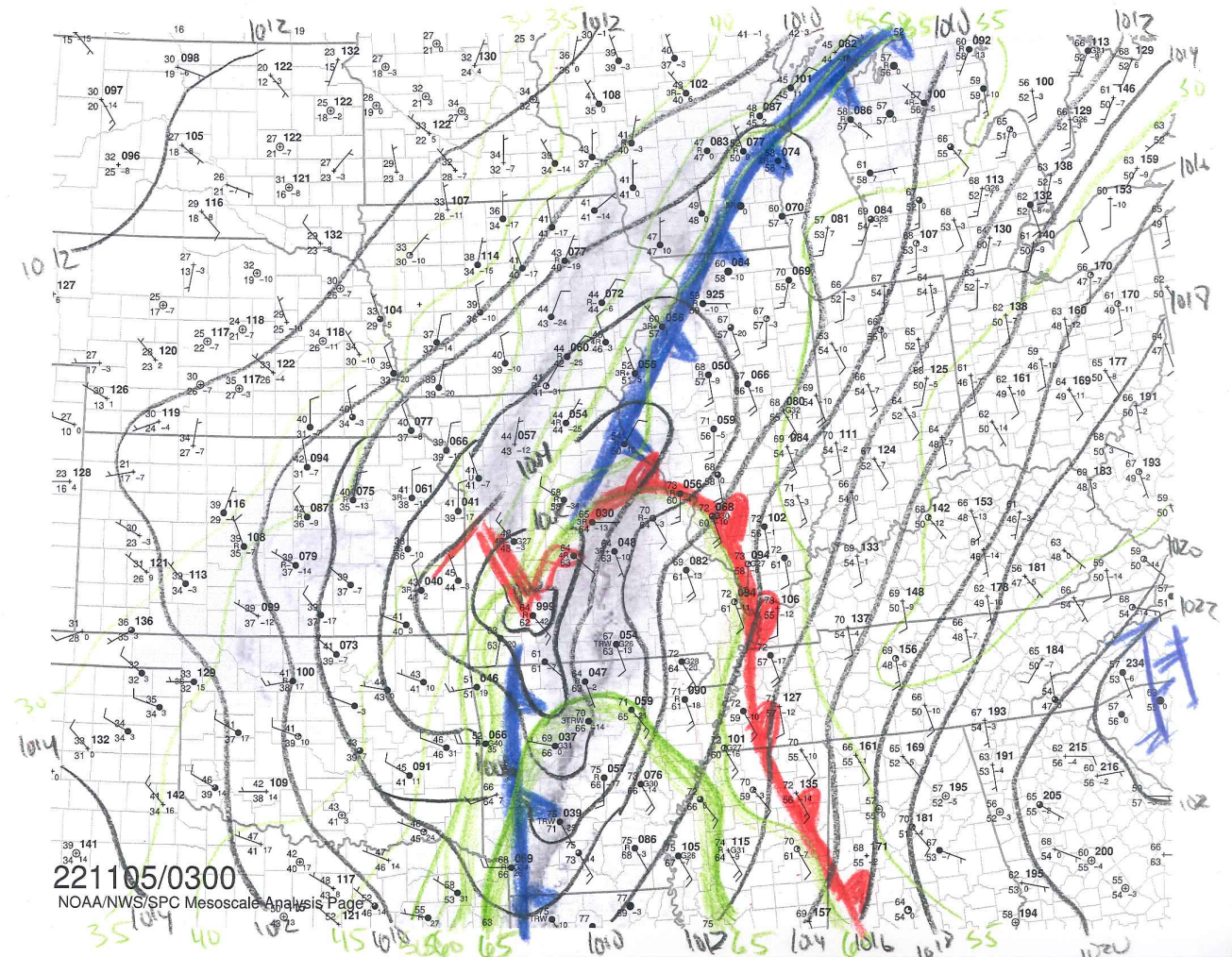
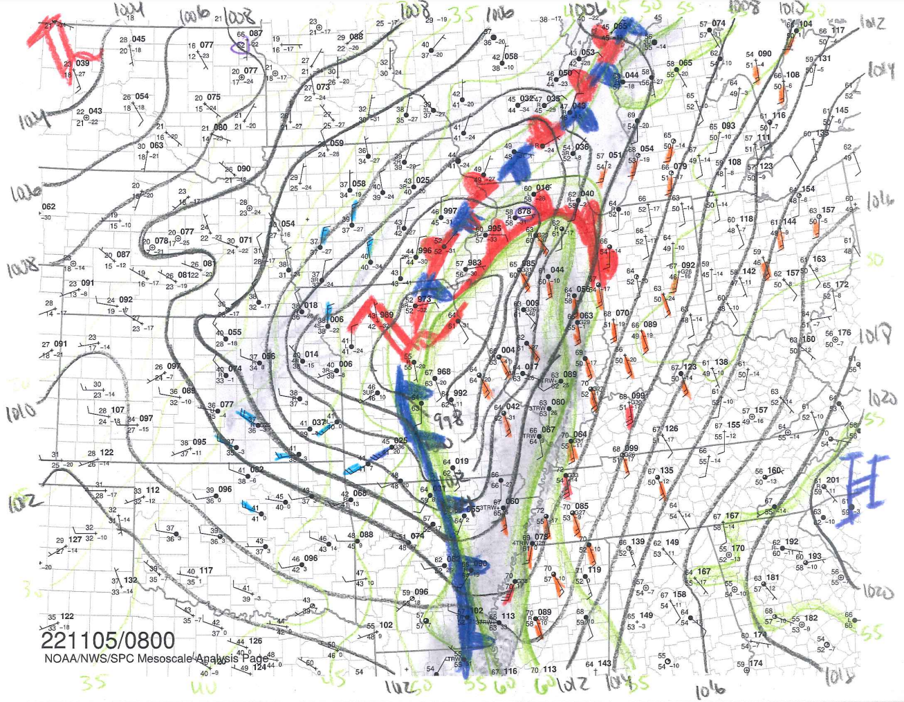
Forecasters at NWS Chicago were keeping track of the rapid pace that the surface low was deepening, as well as the location of a warm front surging northward into northern Illinois and northern Indiana. Areas south of the warm front were locations where damaging winds would become likely after sunrise.
 |
 |
|
(click image to enlarge) Hand-analyzed surface map of pressure (black contours), dew point (green contours), and analyzed fronts valid at 0300 UTC November 5, 2022 (10:00 PM CDT, November 4, 2022). Warm sector (cold sector) winds greater than 15 kts are shaded in orange (blue). |
(click image to enlarge) Hand-analyzed surface map of pressure (black contours), dew point (green contours), and analyzed fronts valid at 0800 UTC November 5, 2022 (3:00 AM CDT, November 5, 2022). Warm sector (cold sector) winds greater than 15 kts are shaded in orange (blue). |
3. Low-Level Jet
In response to the rapid deepening of the surface low pressure system, a strong low-level pressure gradient developed across the Great Lakes. In addition, a strong channel of air called a low-level jet developed on the eastern side of the low, with wind speeds measured as high as 70 to 80 kt (80 to 90 mph) just a few thousand feet off the ground!
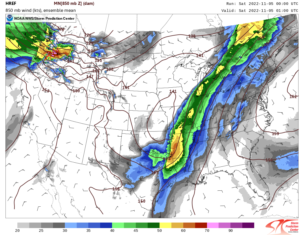
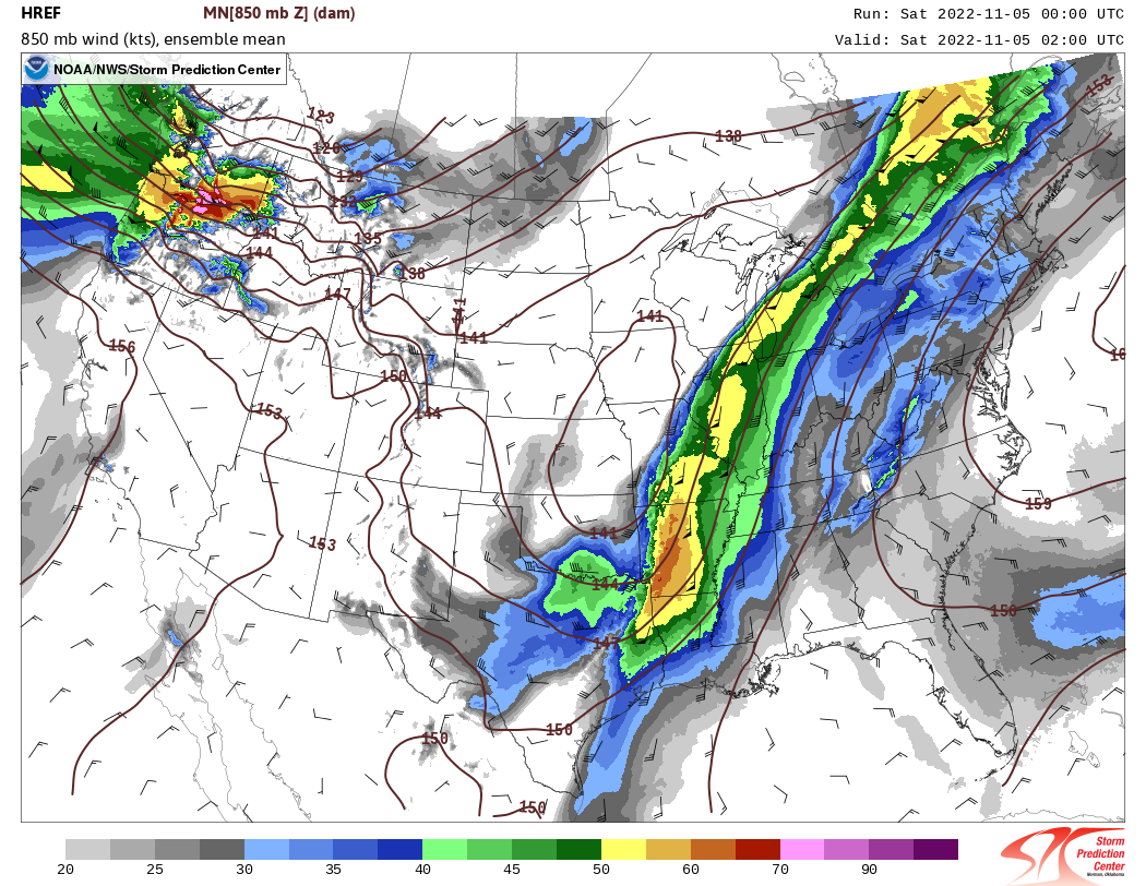
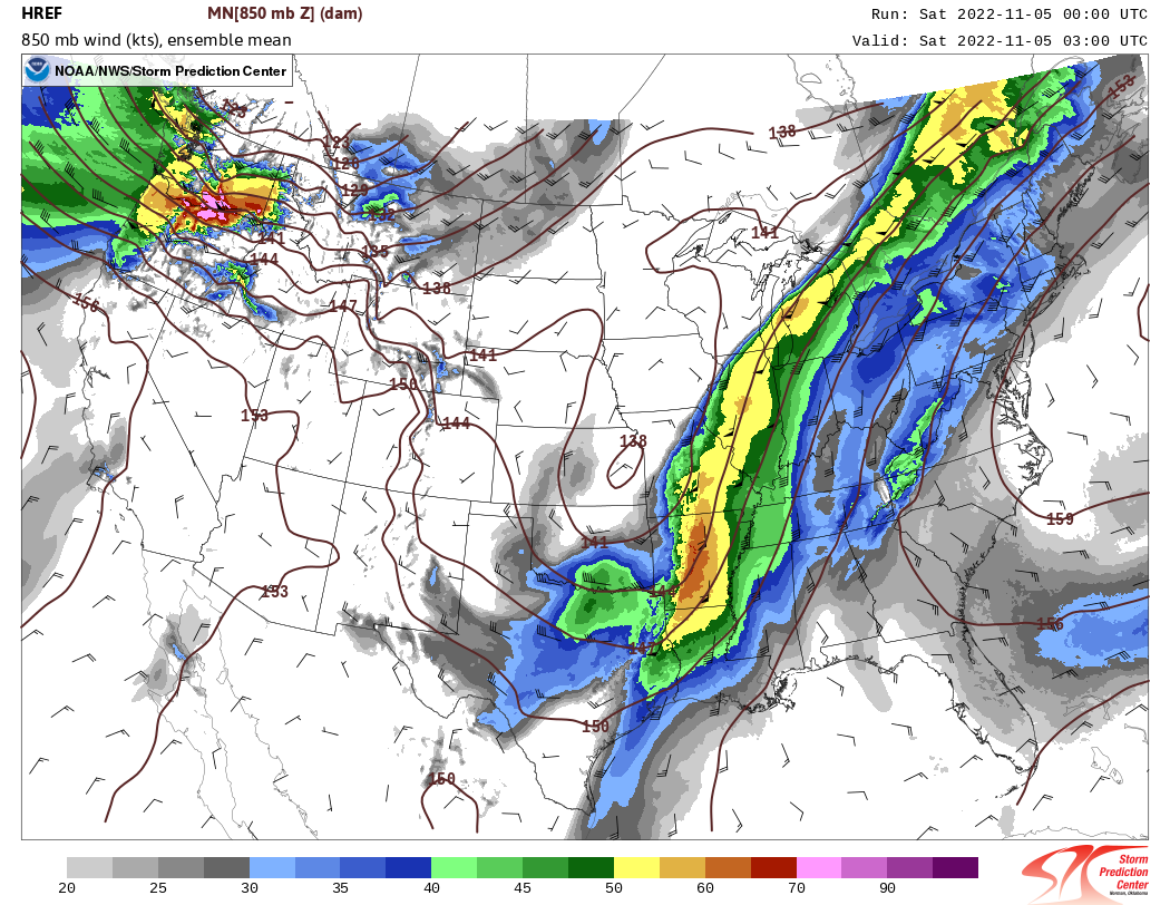
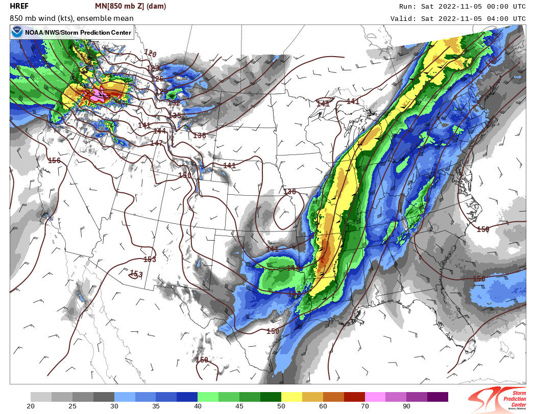
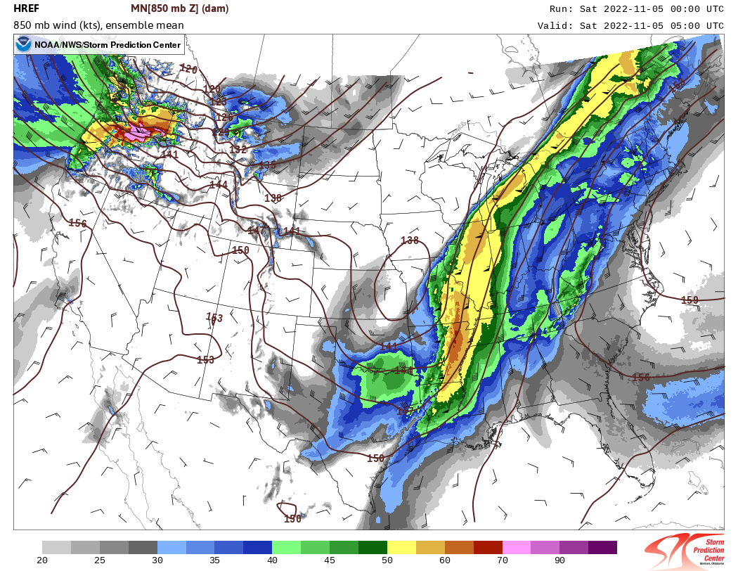
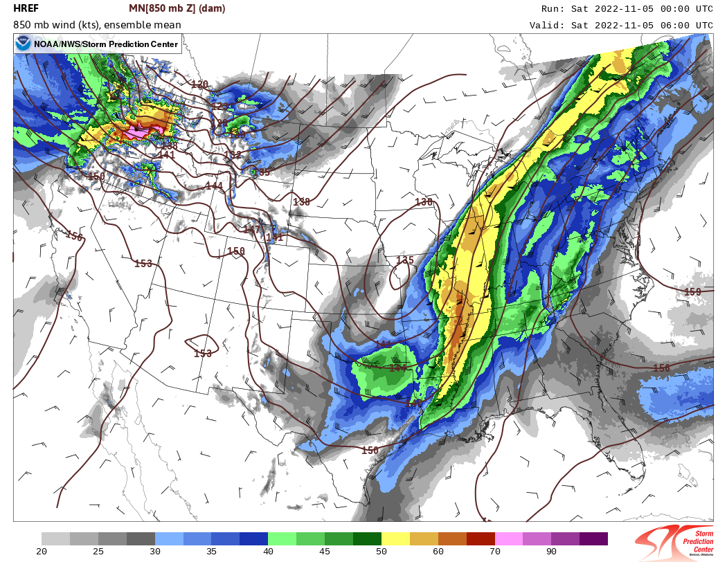
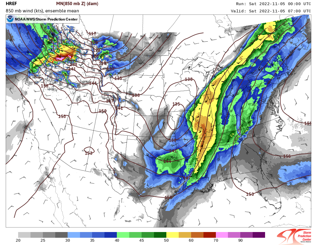
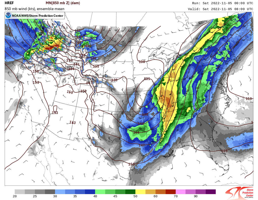

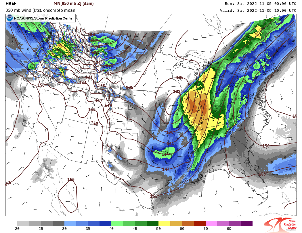
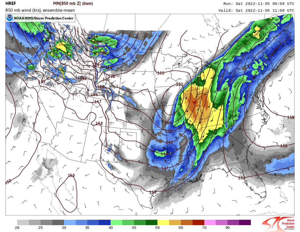
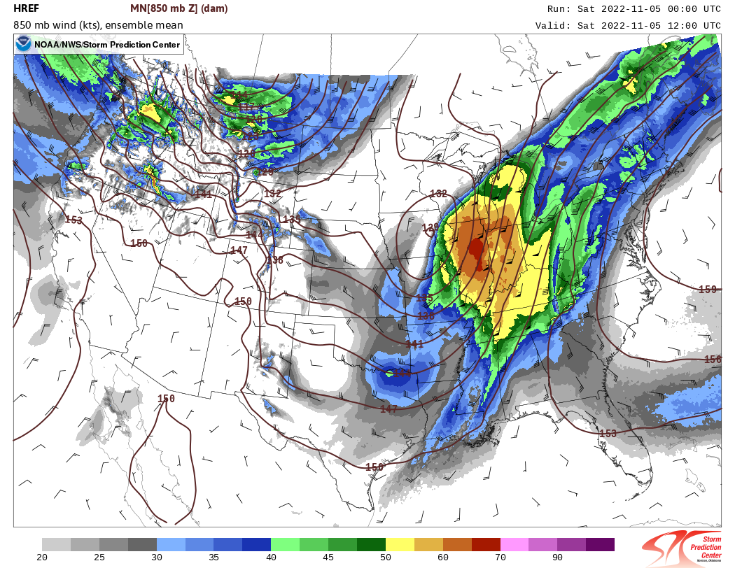
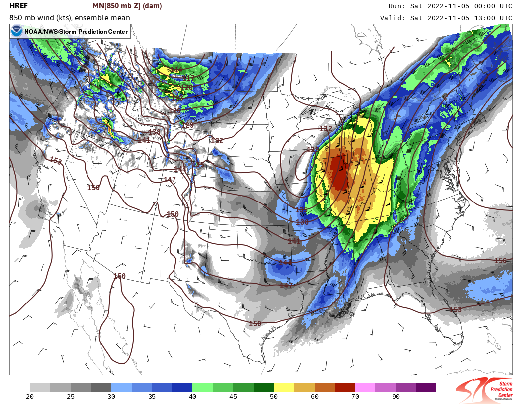
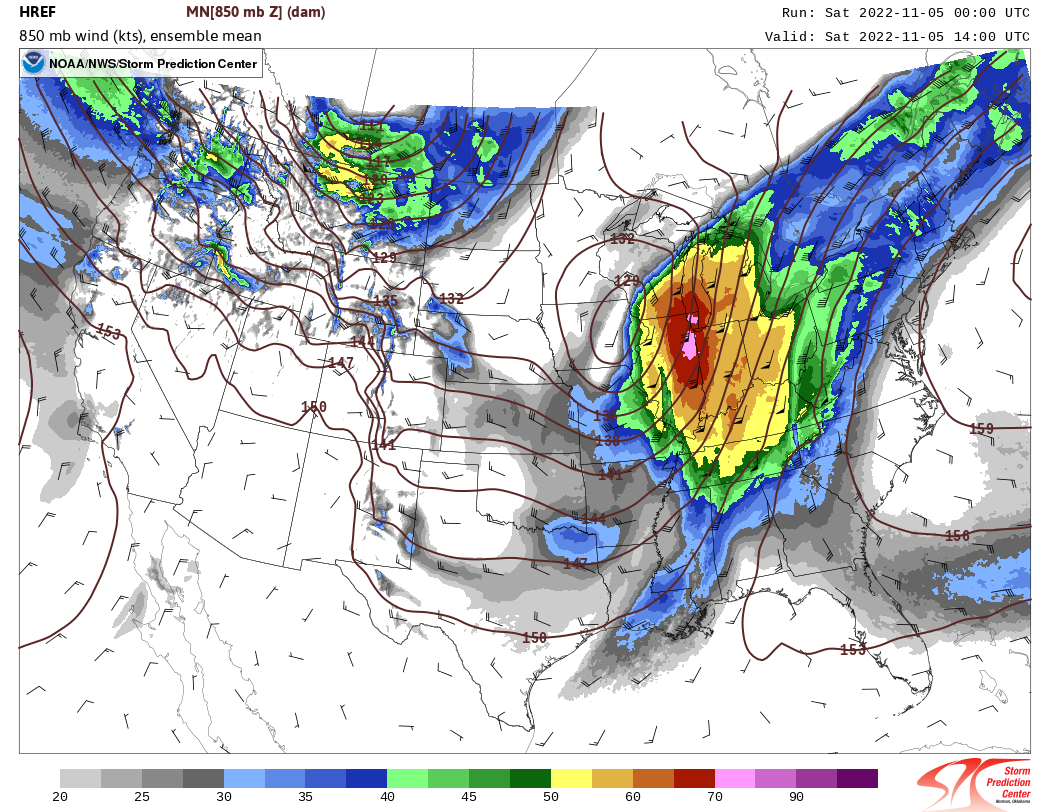
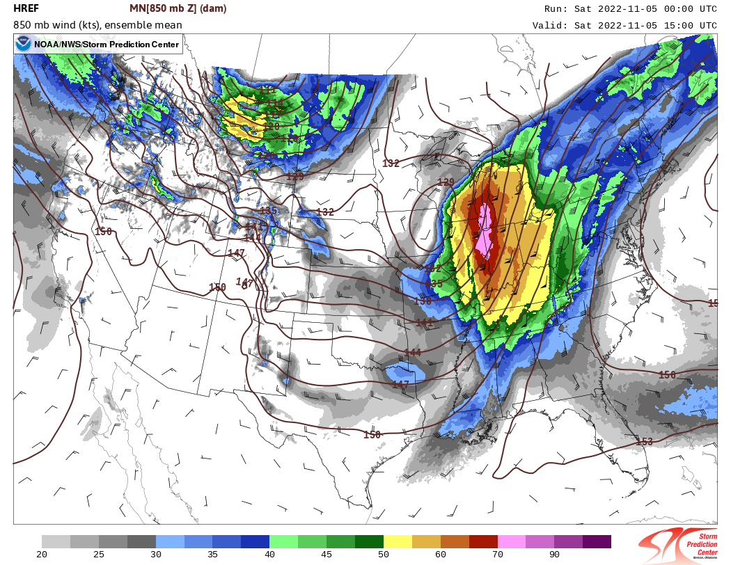
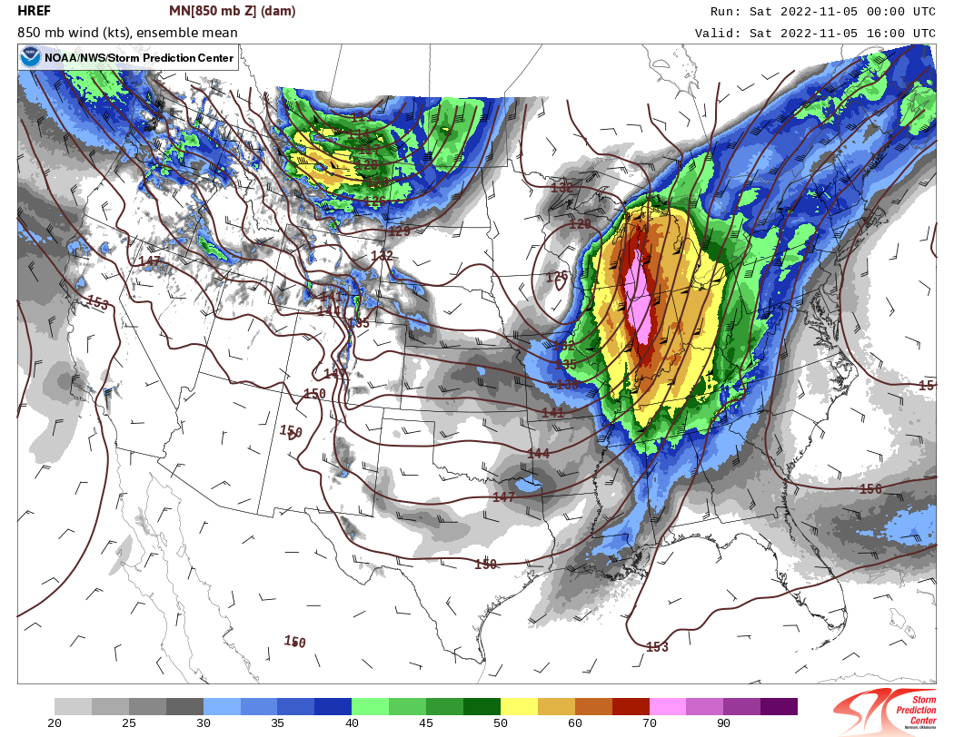
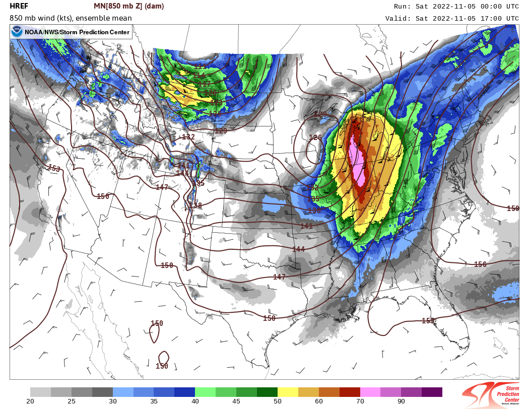
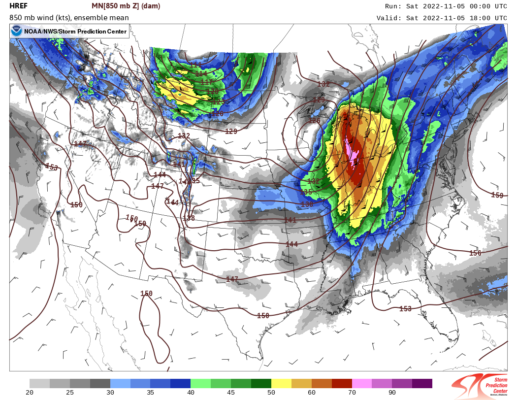
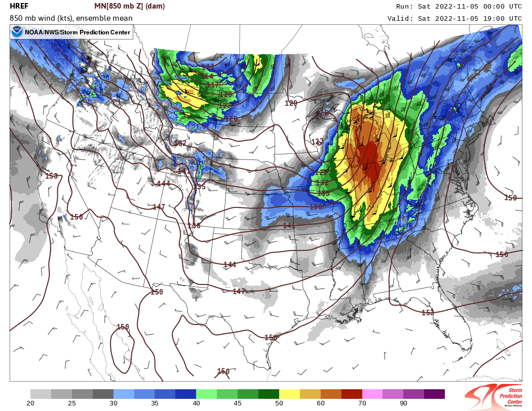
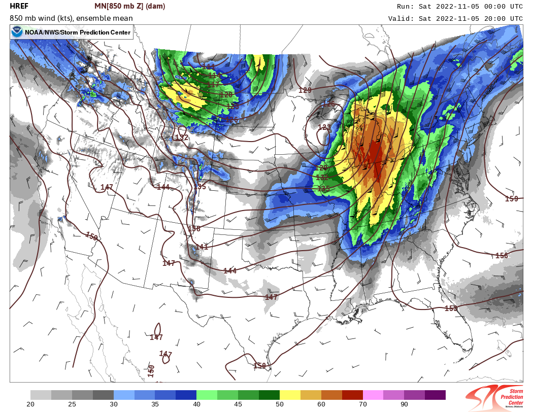
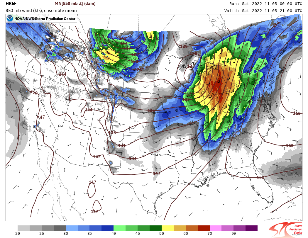
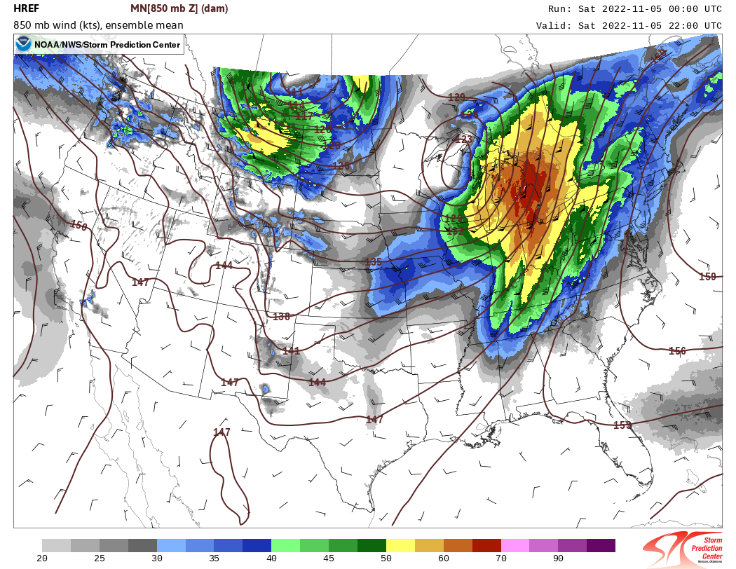
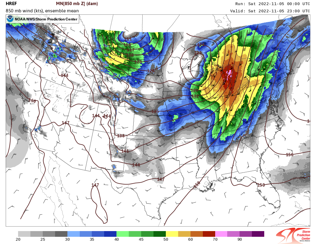
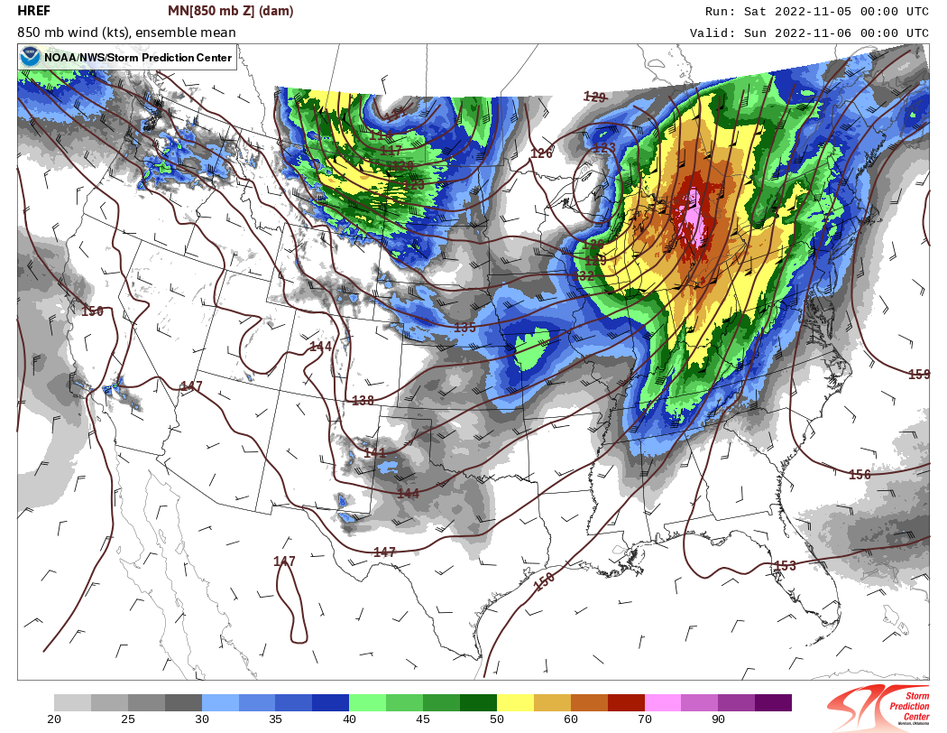
4. Surface Wind Forecast
During the night, there is often a stable layer close to the ground that prevents winds a few thousand feet above from penetrating downward. However, after sunrise on November 5th, the ground warmed and wind from the low-level jet started reaching the ground. Notice how the footprint of the strong surface wind gust forecast matched areas with the low-level jet shown earlier!
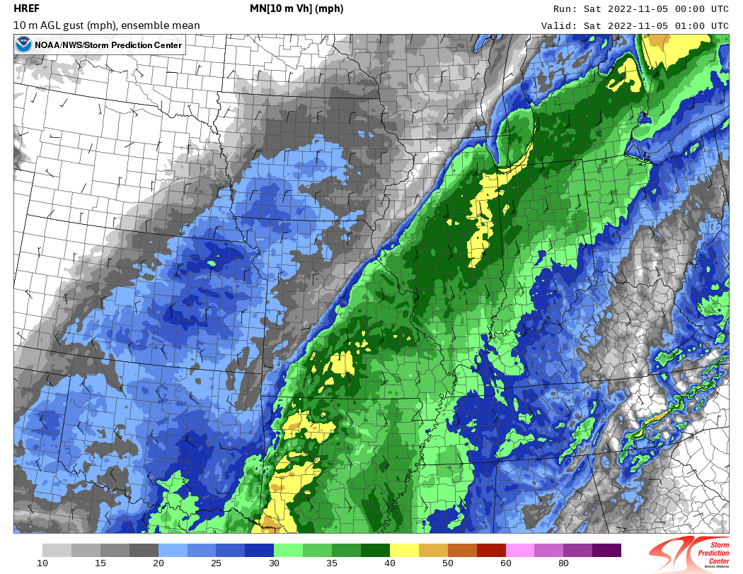
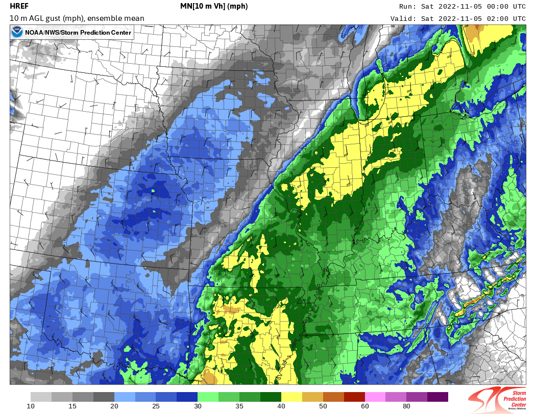
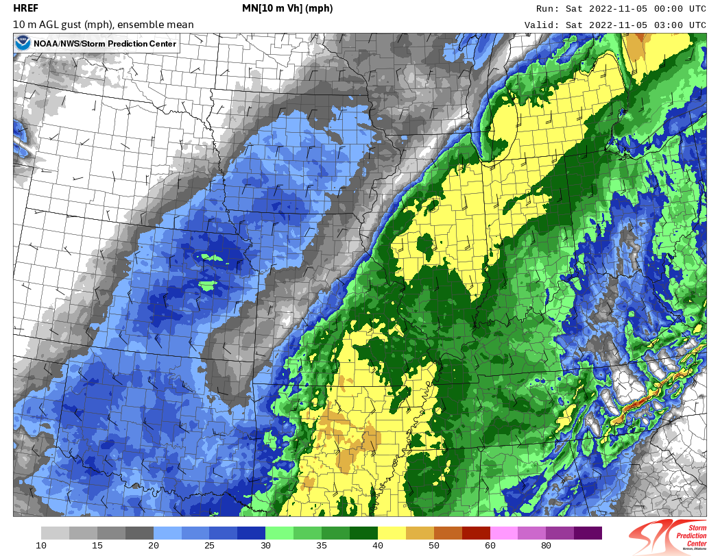
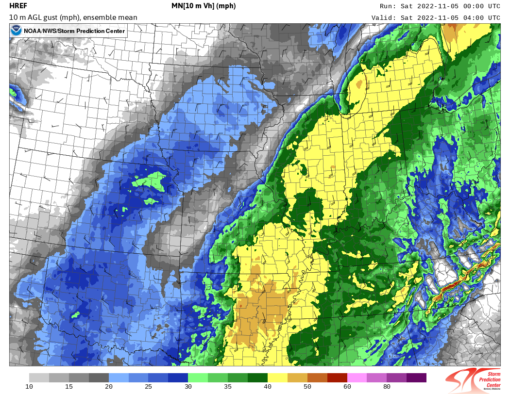
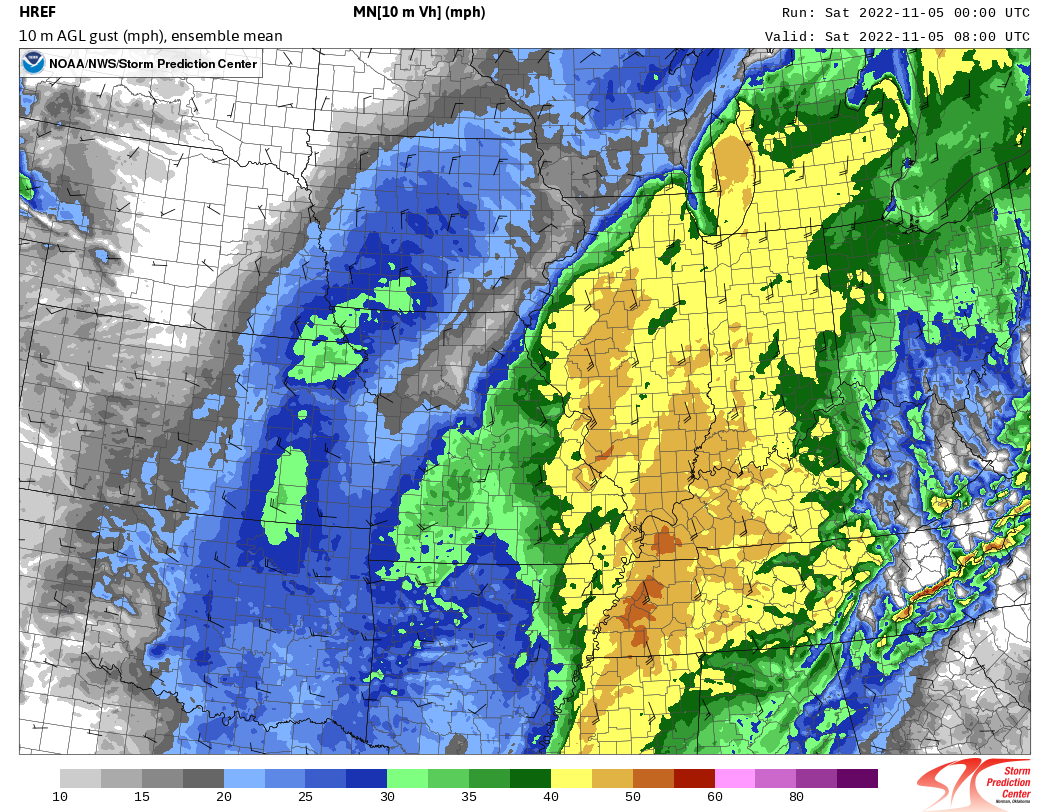
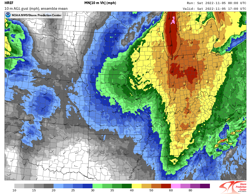
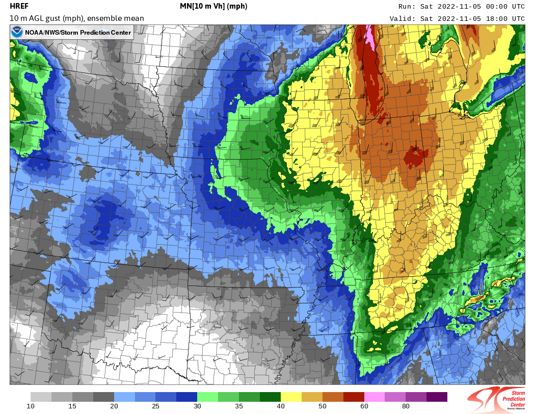
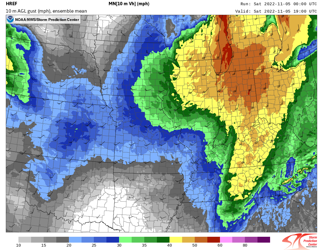
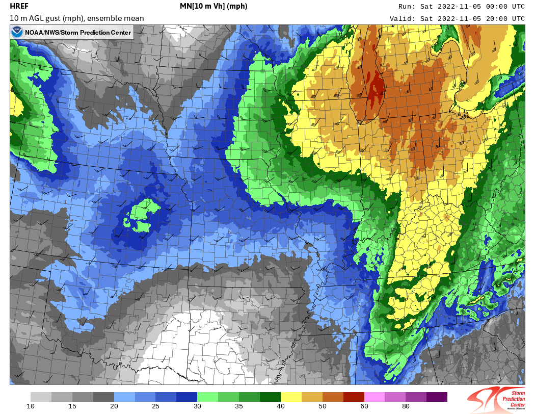
5. Cold Frontal Showers
Finally, a band of showers developed along the cold front and raced across northern Illinois and northwestern Indiana. Even though the showers were narrow and relatively shallow (only grew to about 15,000 feet above the ground; typical thunderstorms are 35,000 to 55,000 feet tall), they were able to transport strong winds in the low-level jet down to the ground. Indeed, some of the strongest winds measured in excess of 70 mph on November 5th, 2022 were associated with the line of showers.
 |
 |
|
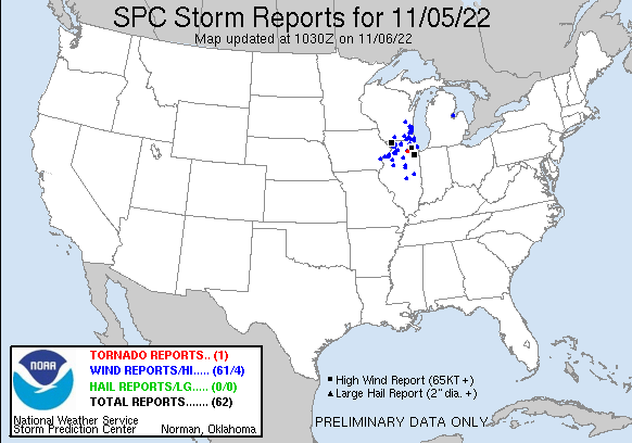
(click image to enlarge) Map of preliminary reported damage produced by the line of showers along the cold front on November 5, 2022. Blue dots represent wind damage reports, black squares represent measured wind gusts greater than 75 mph, and the red dot denotes the location of a tornado. A listing of these reports can be found here. |
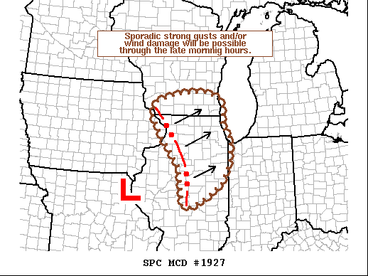
(click image to enlarge) Mesoscale Discussion issued by the Storm Prediction center focusing on the potential for damaging winds with the line of showers along the cold front. Full discussion text is available here. |
Additional high resolution forecast information pertaining to the November 5, 2022 windstorm can be found at this link.
Photos and Additional Information
 |
 |
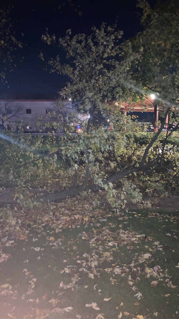 |
| Photo shared by Chris Michael showing a partial wall collapse in Kankakee. | Downed tree due to high winds in Homer Glen. Photo courtesy of Feliciana Gandara. | Tree damage on the campus of Lewis University. Courtesy of @JohnsonWx on Twitter. |
 |
Media use of NWS Web News Stories is encouraged! Please acknowledge the NWS as the source of any news information accessed from this site. Additional recaps can be found on the NWS Chicago Past Events Page |
|