
Record setting heat is expected over the next several days from the Intermountain West through the northern Plains. Furthermore, fire weather concerns increase with dry and breezy conditions. Meanwhile, heavy rainfall and severe thunderstorm threats for the Ohio/Tennessee Valleys, central Appalachians and Southeast today. The threat shifts to central Gulf Coast and across central Texas this week. Read More >
Overview
|
Fast Facts:
For detailed information about this event, see Analysis of the August 12, 2021, Flash flood in and near Gibson City, IL, a NWS Technical Paper detailing the rainfall, flooding, and impacts. |
.png) Event summary information |
Rainfall and Storm Reports
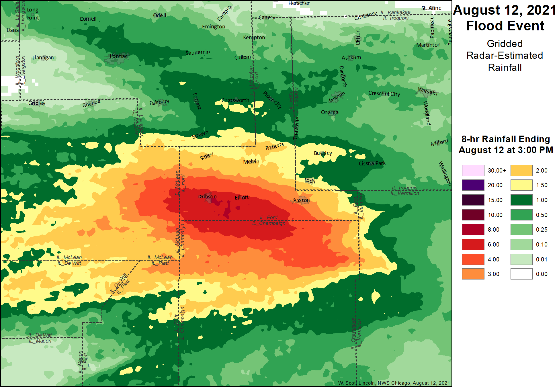 |
| Gridded Radar-Estimate Rainfall showing pockets of 8 to 9 inches of rain near Gibson City. |
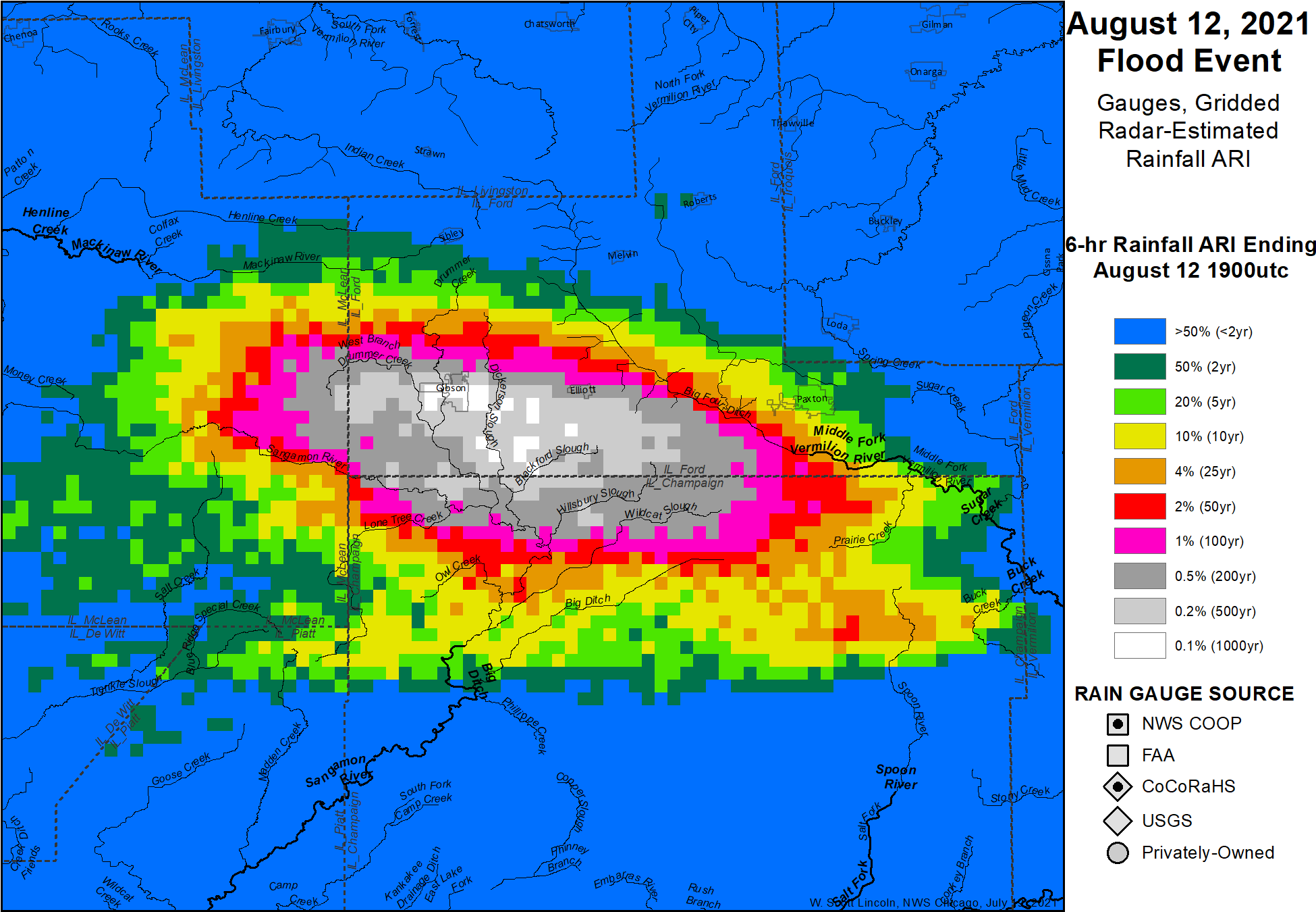 |
| Gridded Radar-Estimate Average Recurrence Interval (ARI). |
..TIME...   ...EVENT...      ...CITY LOCATION...     ...LAT.LON...
..DATE...   ....MAG....      ..COUNTY LOCATION..ST.. ...SOURCE....
            ..REMARKS..
0902 AM     HAIL             GIBSON CITY             40.46N 88.38W
08/12/2021  M0.75 INCH       FORD               IL   BROADCAST MEDIA

            ALSO ESTIMATED WIND GUSTS OF 40 MPH.
1044 AM     FLASH FLOOD      GIBSON CITY             40.46N 88.38W
08/12/2021                   FORD               IL   BROADCAST MEDIA

            PARTS OF ROUTE 9 AND ROUTE 47 HAVE A FOOT OF
            WATER ON THEM IN AND AROUND GIBSON CITY.
            MULTIPLE CARS STALLED IN WATER.
1158 AM     FLASH FLOOD      1 S GIBSON CITY         40.46N 88.38W
08/12/2021                   FORD               IL   BROADCAST MEDIA

            NUMEROUS CITY ROADS WITH 2-3 FEET OF WATER
            IN GIBSON CITY, WITH HOMES BEGINNING TO TAKE
            ON WATER IN PARTS OF TOWN. MULTIPLE ROADS
            ARE CLOSED.
1251 PM     FLASH FLOOD      1 S GIBSON CITY         40.46N 88.38W
08/12/2021                   FORD               IL   EMERGENCY MNGR

            SIGNIFICANT FLASH FLOODING OCCURRING IN AND
            AROUND GIBSON CITY, AND POINTS SOUTH AND
            WEST. WATER IS INUNDATING HOMES AND
            BUSINESSES, SEWERS ARE BACKING UP, AND ALL
            ROADS ARE IMPASSABLE. NUMEROUS WATER RESCUES
            CONTINUE.
0214 PM     FLASH FLOOD      1 SE GIBSON CITY        40.46N 88.37W
08/12/2021                   FORD               IL   EMERGENCY MNGR

            WATER RESCUES CONTINUE AT A SENIOR CITIZENS
            CENTER THAT WAS INUNDATED WITH WATER. MOST
            ROADWAYS REMAIN IMPASSABLE.
1159 PM     HEAVY RAIN       SIBLEY                  40.59N 88.38W
08/12/2021  M2.49 INCH       FORD               IL   MESONET

            PERSONAL WEATHER STATION ONE-DAY TOTAL
            KILSIBLE9.
1159 PM     HEAVY RAIN       1 NE GIBSON CITY        40.47N 88.37W
08/12/2021  M9.33 INCH       FORD               IL   MESONET

            PERSONAL WEATHER STATION KILGIBSO9 ONE-DAY
            TOTAL.

&&

$$
Photos
 |
 |
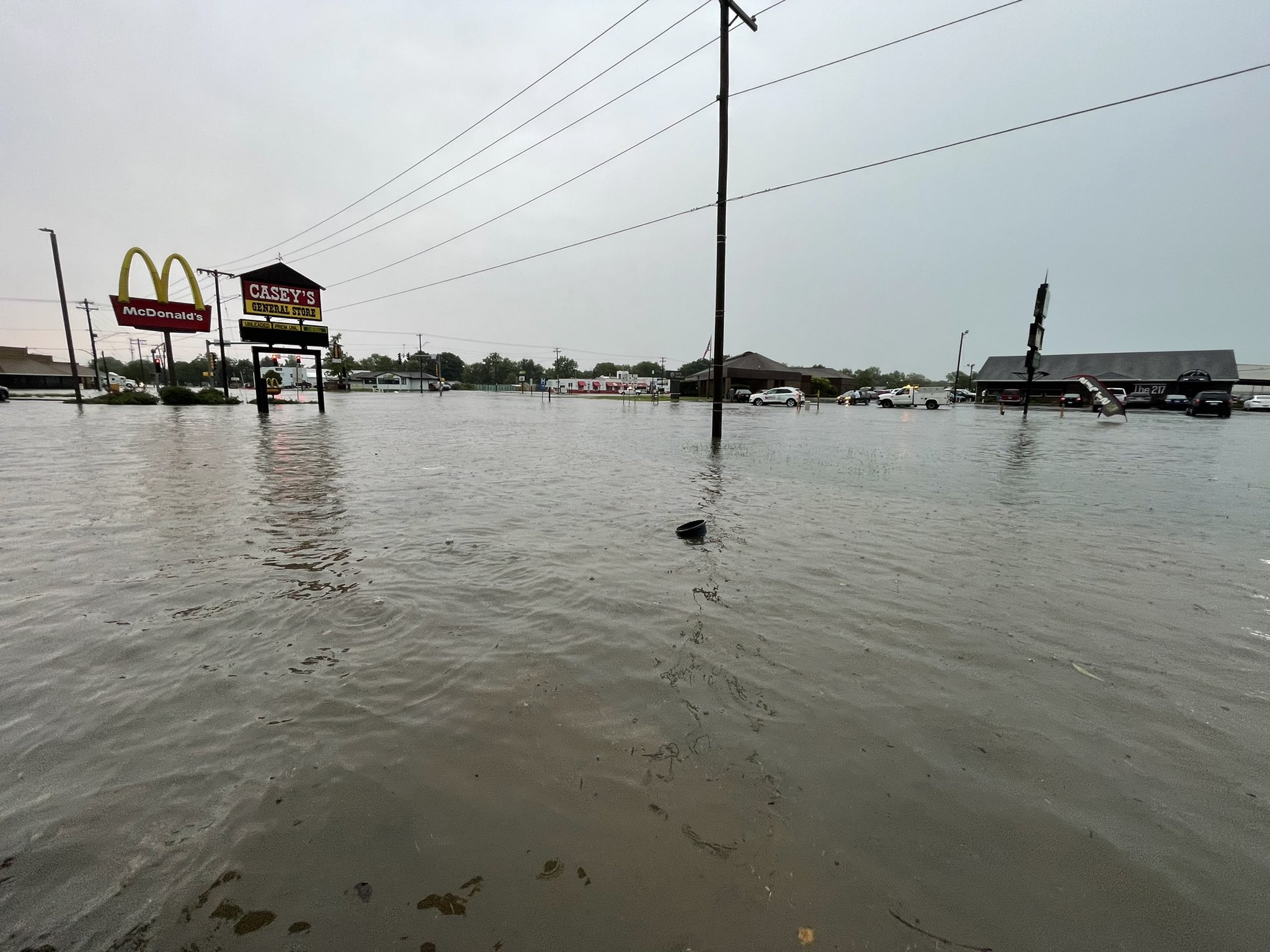 |
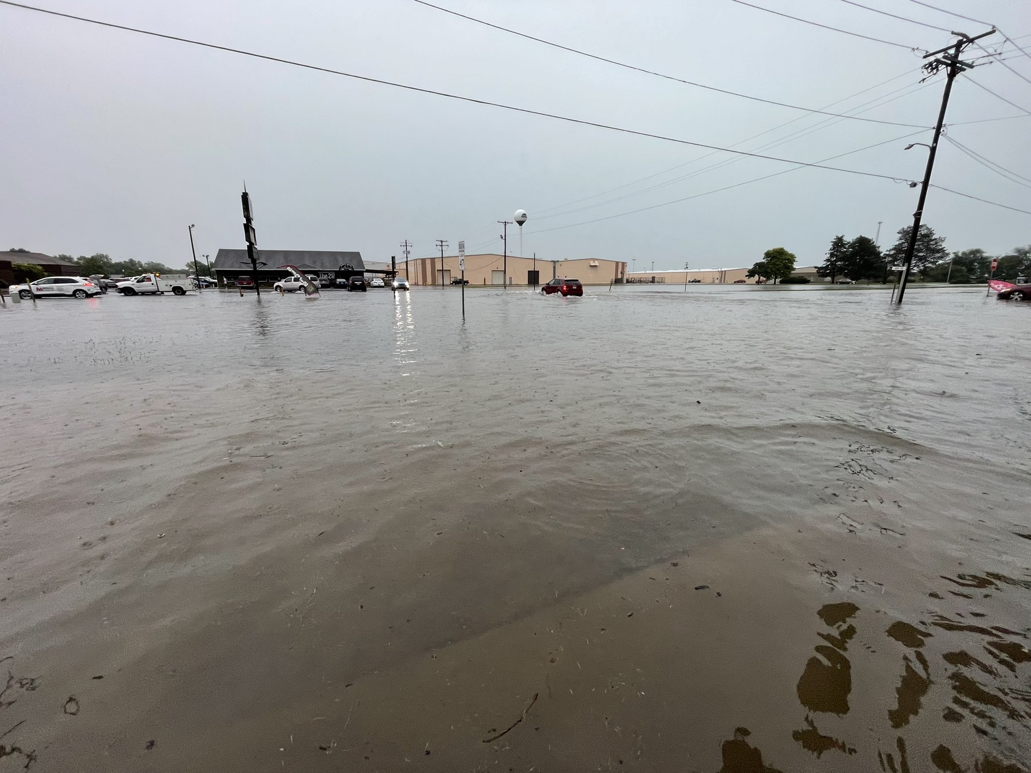
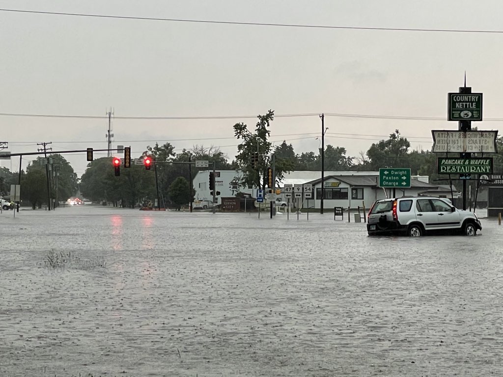
| Gibson City (Andrew Pritchard) |
Gibson City junction of Highways 47, 9, and 54 (Andrew Pritchard) |
Gibson City (Andrew Pritchard) |
Environment
 |
 |
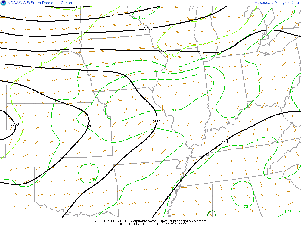 |
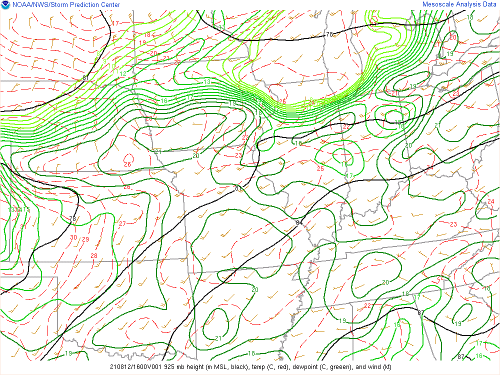
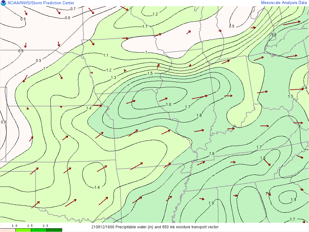
| SPC mesoanalysis of 925 mb dewpoints, showing high levels of moisture pooled along and south of I-80. | SPC mesoanalysis of Precipitable Water (PWAT) values. High values over 1.6" were present over Ford County, indicative of a very moist airmass. | SPC Mesoanalysis of "Upwind Propagation Vectors" showing slow or near-zero net storm motion, indicating a potential for training thunderstorms. |
Additional Info
 |
Media use of NWS Web News Stories is encouraged! Please acknowledge the NWS as the source of any news information accessed from this site. Additional recaps can be found on the NWS Chicago Past Events Page |
|

