Record setting heat is expected over the next several days from the Intermountain West through the northern Plains. Furthermore, fire weather concerns increase with dry and breezy conditions. Meanwhile, heavy rainfall and severe thunderstorm threats for the Ohio/Tennessee Valleys, central Appalachians and Southeast today. The threat shifts to central Gulf Coast and across central Texas this week. Read More >
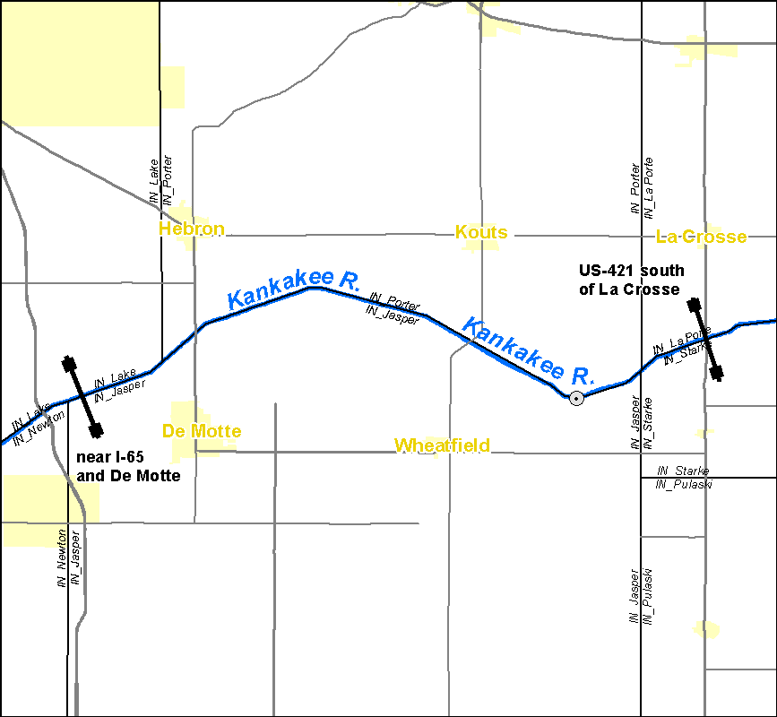
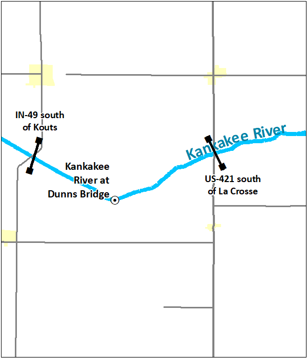
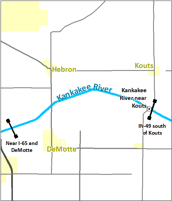
Effective December 15, 2020, river forecast services for the Kankakee River near Kouts, Indiana, gauge (NWS identifier KTSI3) will be discontinued. Flood warnings will continue to be issued for river flooding along the affected portions of the Kankakee River in Jasper and Porter Counties, Indiana, but will be based upon the river gauge at Dunns Bridge, Indiana (NWS identifier DBRI3). River flood impacts in the vicinity of the Kouts gauge closely match the water levels observed at the Dunns Bridge gauge. Thus, no significant changes to warning services provided by the National Weather Service are expected as a result of this change.
These changes are the result of a multi-month review of flood impacts and hydrology in the vicinity of the gauge and feedback provided by the Kankakee River Basin and Yellow River Basin Development Commission, the Porter County Emergency Management Agency, and the Jasper County Emergency Management Department.
Click here for the service change notice issued October 20, 2020, announcing these changes.
Current River Forecasts and Warnings
|
|
 |
 |
Future River Forecasts and Warnings
|
|
|