Record setting heat is expected over the next several days from the Intermountain West through the northern Plains. Furthermore, fire weather concerns increase with dry and breezy conditions. Meanwhile, heavy rainfall and severe thunderstorm threats for the Ohio/Tennessee Valleys, central Appalachians and Southeast today. The threat shifts to central Gulf Coast and across central Texas this week. Read More >
| A powerful low pressure system over the northern Great Lakes brought periods of light snow and snow showers, resulting in light accumulations from a coating to as high as 2.3". Falling temperatures during the snow caused icy roads in some areas, with multiple accidents on the evening of December 30th. Peak wind gusts during the PM hours of December 30th ranged from 35 to 55 mph. |
|
Fast Facts
Snow Totals
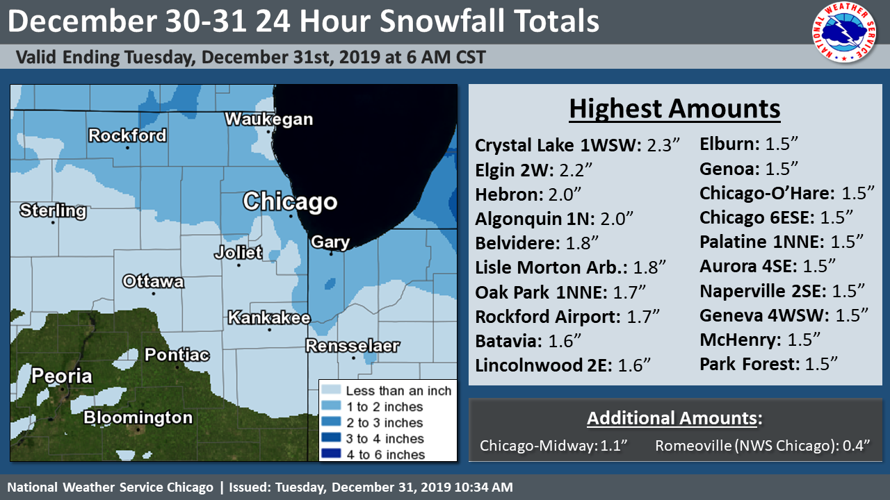 |
| Snowfall Map and Highest Observed Amounts |
Text Listing of Snowfall Reports from Volunteer Observers
Peak Winds
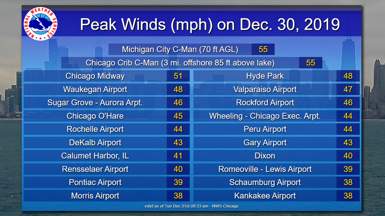 |
| Highest Observed Wind Gusts on December 30th |
 |
Media use of NWS Web News Stories is encouraged! Additional recaps can be found on the NWS Chicago Science & Past Events Page. |
|