
Tropical Depression Two is expected to gradually strengthen and could bring tropical storm conditions to the Florida Panhandle beginning late Monday. Areas of flash flooding will be possible through Thursday along the eastern and central Gulf Coast. Severe thunderstorms will develop and move along a cold front crossing the Upper Midwest Monday, and through the Ohio Valley/Mid-Atlantic on Tuesday. Read More >
Important note: Due to the threat of ongoing flooding along the Rock River on the previously scheduled date of April 1st, the following changes were made effective Tuesday, March 12th.
Effective April 1, 2019, flood impact categories and forecast issuance stages will change for multiple locations on the Rock River in Illinois. These changes are the result of an extensive review of flood impacts along the Rock River and were collaborated with partner agencies and stakeholders through numerous discussions and in-person meetings.
Click here for the service change notice issued February 14, 2019, announcing these changes.
Rock River at Latham Park
Action Stage Minor Flood Stage Moderate Flood Stage Major Flood Stage
River forecasts for this location will now be issued when the water level has reached, or is expected to reach, the forecast issuance stage of 7.0 feet. Forecasts were previously issued based upon the Action Stage of 9.0 feet. Click here for a list of flood impacts that was collected for this stretch of the Rock River. These changes were coordinated with the Winnebago County Emergency Services and Disaster Agency and the city of Machesney Park. |
|
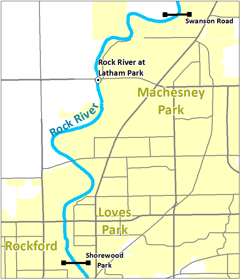 This gauge represents the river reach from Swanson Road in Roscoe downstream to Shorewood Park in Loves Park. This gauge represents the river reach from Swanson Road in Roscoe downstream to Shorewood Park in Loves Park. |
Rock River at Rockford (Auburn Street)
|
|
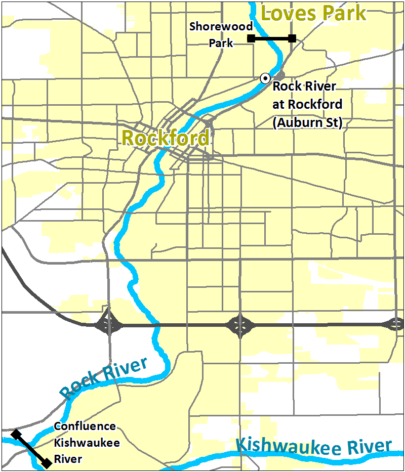 This gauge represents the river reach from Shorewood Park in Loves Park downstream to the confluence with the Kishwaukee River. This gauge represents the river reach from Shorewood Park in Loves Park downstream to the confluence with the Kishwaukee River. |
Rock River at Rockford (Fordam Dam)
Action Stage Minor Flood Stage Moderate Flood Stage Major Flood Stage
No river forecasts are issued for this location. Click here for a list of flood impacts that was collected for this stretch of the Rock River. These changes were coordinated with the Winnebago County Emergency Services and Disaster Agency. |
|
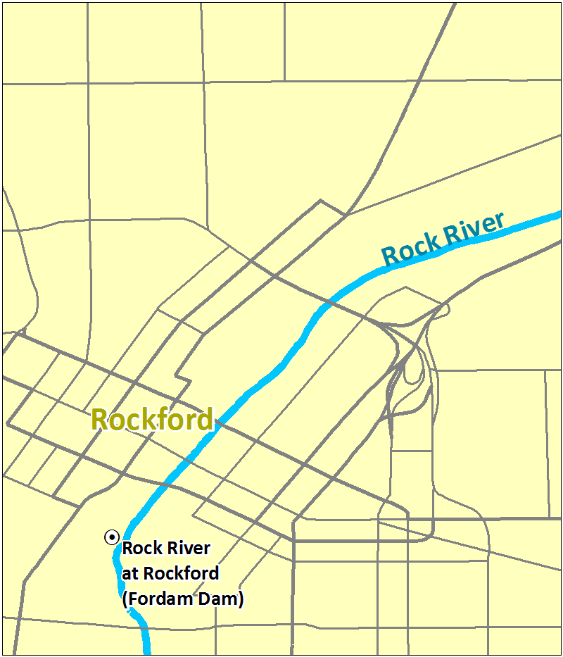 This gauge represents only the areas immediately upstream of the dam in downtown Rockford. This gauge represents only the areas immediately upstream of the dam in downtown Rockford. |
Rock River at Byron
River forecasts for this location will now be issued when the water level has reached, or is expected to reach, the forecast issuance stage of 9.5 feet. Forecasts were previously issued based upon the Action Stage of 10.5 feet. This change was coordinated with the Ogle County Emergency Management Agency. |
|
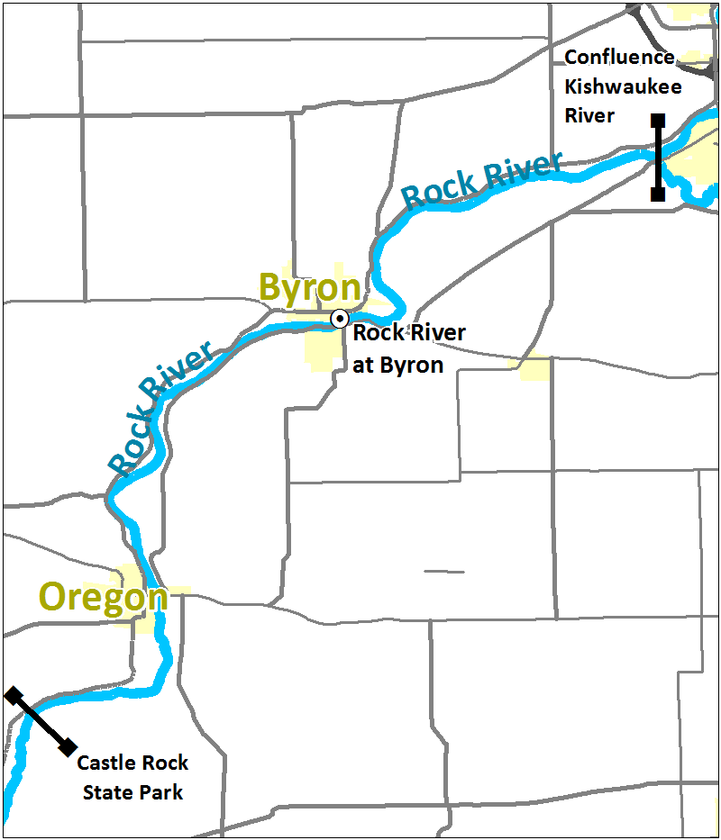 This gauge represents the river reach from the confluence with the Kishwaukee River downstream to Castle Rock State Park near Oregon. This gauge represents the river reach from the confluence with the Kishwaukee River downstream to Castle Rock State Park near Oregon. |

