Record setting heat is expected over the next several days from the Intermountain West through the northern Plains. Furthermore, fire weather concerns increase with dry and breezy conditions. Meanwhile, heavy rainfall and severe thunderstorm threats for the Ohio/Tennessee Valleys, central Appalachians and Southeast today. The threat shifts to central Gulf Coast and across central Texas this week. Read More >
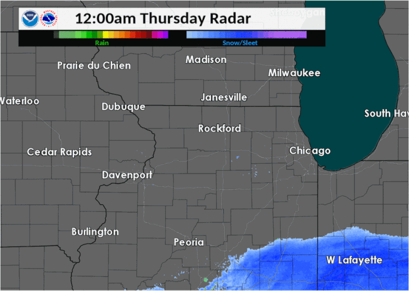
| Thursday, November 15 saw early morning snow from a major weather system to our south spread northwest over northwest Indiana and northern Illinois. The solid snow shield brought 2" to 4" of accumulation in parts of east central Illinois into northwest Indiana by mid-morning. Then a single band of snow continued to move northwest across the Chicago metro area, pivoting, and then weakened as it moved back southeast (though did briefly re-intensify). This band produced mainly 1-2", although there was isolated 2" in Lake County, IL. |
|
Fast Facts
Snow/Ice Totals
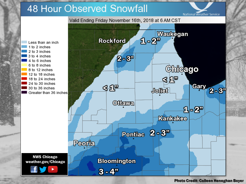 |
| Observed snowfall map from 11/15/18. Also visit the Storm Reports map. |
Text Listing of Snowfall Reports from Volunteer Observers
Storm Reports
Map of Snowfall Local Storm Reports
823

NWUS53 KLOT 110247

LSRLOT


Preliminary Local Storm Report

National Weather Service Chicago IL

947 PM CDT Fri Jul 10 2026


..TIME...   ...EVENT...      ...CITY LOCATION...     ...LAT.LON...

..DATE...   ....MAG....      ..COUNTY LOCATION..ST.. ...SOURCE....

            ..REMARKS..


0354 PM     Tstm Wnd Dmg     1 E Steger              41.47N 87.62W

07/10/2026                   Cook               IL   Local Official


            Report of downed tree limbs, a hanging

            street light, and hail near the intersection

            of Steger Road and State Street. The

            location and time of the report coincides to

            when a single cell thunderstorm collapsed.


&&


$$
Meteorology and Additional
Meteorology
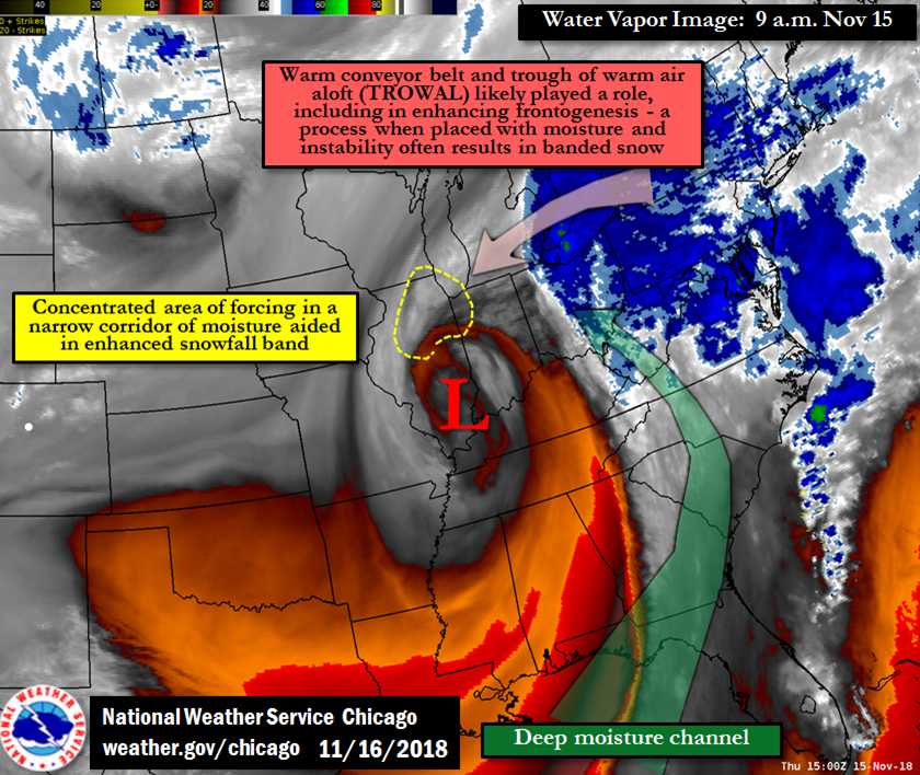 |
| Water Vapor Image |
Links
 |
Media use of NWS Web News Stories is encouraged! Additional recaps can be found on the NWS Chicago Science & Past Events Page. |
|