
Record setting heat is expected over the next several days from the Intermountain West through the northern Plains. Furthermore, fire weather concerns increase with dry and breezy conditions. Meanwhile, heavy rainfall and severe thunderstorm threats for the Ohio/Tennessee Valleys, central Appalachians and Southeast today. The threat shifts to central Gulf Coast and across central Texas this week. Read More >
Overview
|
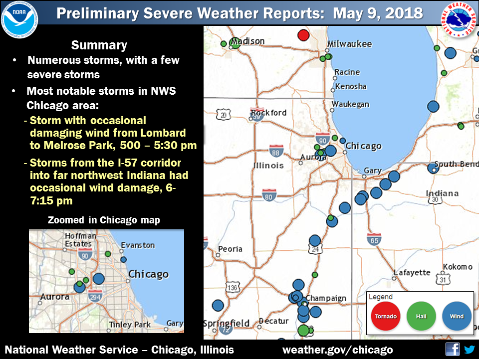
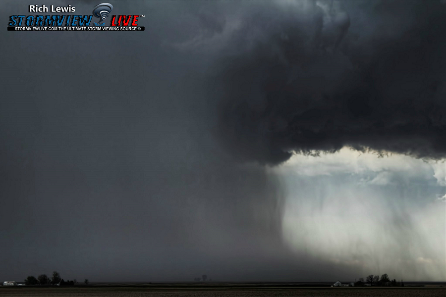
An increasingly unstable airmass combined with an upper-level trough to produce isolated to scattered severe thunderstorms across northeast and east-central Illinois and northwest Indiana during the late afternoon and early evening of May 9th, 2018. Sporadic wind damage was reported across 1) the western suburbs and north side of Chicago and 2) east-central Illinois into northwest Indiana. |
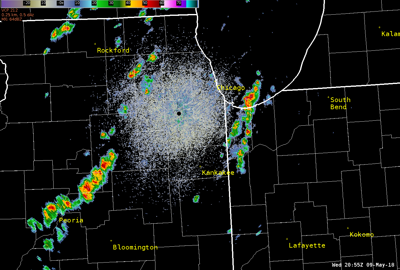 Radar loop from 4pm - 8pm CDT May 9th, 2018. |
Storm Reports
 |
PRELIMINARY LOCAL STORM REPORT...SUMMARY
NATIONAL WEATHER SERVICE CHICAGO/ROMEOVILLE IL
932 PM CDT WED MAY 9 2018

..TIME...   ...EVENT...      ...CITY LOCATION...     ...LAT.LON...
..DATE...   ....MAG....      ..COUNTY LOCATION..ST.. ...SOURCE....
            ..REMARKS..

0437 PM     HAIL             1 ESE BLOOMINGDALE      41.94N 88.07W
05/09/2018  M0.25 INCH       DUPAGE             IL   COCORAHS

0452 PM     HAIL             MORTON GROVE            42.04N 87.79W
05/09/2018  E0.25 INCH       COOK               IL   PUBLIC

            RELAYED BY MEDIA.

0507 PM     TSTM WND DMG     2 S LOMBARD             41.85N 88.01W
05/09/2018                   DUPAGE             IL   BROADCAST MEDIA

            LARGE TREE DOWNED ON HOME, AND SIDING BLOWN OFF A HOUSE.
            ESTIMATED TIME AND APPROXIMATE LOCATION.

0511 PM     HAIL             1 E VILLA PARK          41.89N 87.96W
05/09/2018  M0.75 INCH       DUPAGE             IL   TRAINED SPOTTER

0513 PM     HAIL             LOMBARD                 41.87N 88.01W
05/09/2018  M0.25 INCH       DUPAGE             IL   PUBLIC

            RELAYED VIA SOCIAL MEDIA

0524 PM     TSTM WND DMG     MELROSE PARK            41.90N 87.86W
05/09/2018                   COOK               IL   LAW ENFORCEMENT

            PART OF A ROOF DESTROYED ON A BUILDING, AND 60 FT TOWER
            BENT. TIME ESTIMATED FROM RADAR.

0533 PM     TSTM WND GST     ROGERS PARK             42.01N 87.67W
05/09/2018  M45.00 MPH       COOK               IL   TRAINED SPOTTER

            LIMBS DOWN AND PEA SIZE HAIL

0546 PM     HAIL             KANKAKEE                41.12N 87.86W
05/09/2018  M0.88 INCH       KANKAKEE           IL   TRAINED SPOTTER

0550 PM     TSTM WND GST     4 NE CHICAGO            41.92N 87.57W
05/09/2018  M53.00 MPH       LMZ741             IL   C-MAN STATION

            PEAK GUST AT THE CHICAGO HARRISON DEVER CRIB.

0555 PM     TSTM WND GST     3 SSE KANKAKEE          41.08N 87.84W
05/09/2018  M64.00 MPH       KANKAKEE           IL   ASOS

            MEASURED AT KANKAKEE AIRPORT. NO DAMAGE REPORTED AT
            AIRFIELD.

0559 PM     TSTM WND GST     GRANT PARK              41.24N 87.64W
05/09/2018  E60.00 MPH       KANKAKEE           IL   TRAINED SPOTTER

            NICKEL SIZE HAIL AS WELL.

0559 PM     TSTM WND DMG     GRANT PARK              41.24N 87.64W
05/09/2018                   KANKAKEE           IL   TRAINED SPOTTER

            10 INCH TREE DOWN AND GRAVEL FROM ROAD NOW IN FIELDS NEAR
            1600 AND 10500N. MEASURED 0.5 INCHES OF RAIN IN 15
            MINUTES.

0613 PM     TSTM WND DMG     LAKE DALECARLIA         41.34N 87.40W
05/09/2018                   LAKE               IN   TRAINED SPOTTER

            12 INCH DIAMETER TREE ON A VEHICLE NEAR COLFAX AND CENTER


0616 PM     TSTM WND GST     4 S CROWN POINT         41.37N 87.36W
05/09/2018  E70.00 MPH       LAKE               IN   TRAINED SPOTTER

            TWO FOOT DIAMETER TREE DOWN AS WELL

0618 PM     TSTM WND DMG     7 WNW DANFORTH          40.86N 88.10W
05/09/2018                   IROQUOIS           IL   EMERGENCY MNGR

            SIDE OF A BARN AND PART OF ROOF BLOWN OFF

0632 PM     TSTM WND DMG     4 E LAKES OF THE FOUR S 41.41N 87.15W
05/09/2018                   PORTER             IN   LAW ENFORCEMENT

            LARGE TREE DOWNED ALONG INDIANA STATE ROAD 2. TIME
            ESTIMATED PER RADAR.

0646 PM     TSTM WND DMG     3 NE VALPARAISO         41.51N 87.01W
05/09/2018                   PORTER             IN   LAW ENFORCEMENT

            LARGE BRANCH AND POWERLINE DOWNED IN JACKSON TOWNSHIP.
            MULTIPLE LARGE BRANCHES ALSO DOWNED IN THE COUNTY.

0715 PM     HAIL             PAXTON                  40.46N 88.10W
05/09/2018  M0.25 INCH       FORD               IL   EMERGENCY MNGR

            SMALL BRANCHES DOWN AND LOCALIZED STREET FLOODING ALSO
            OBSERVED
|
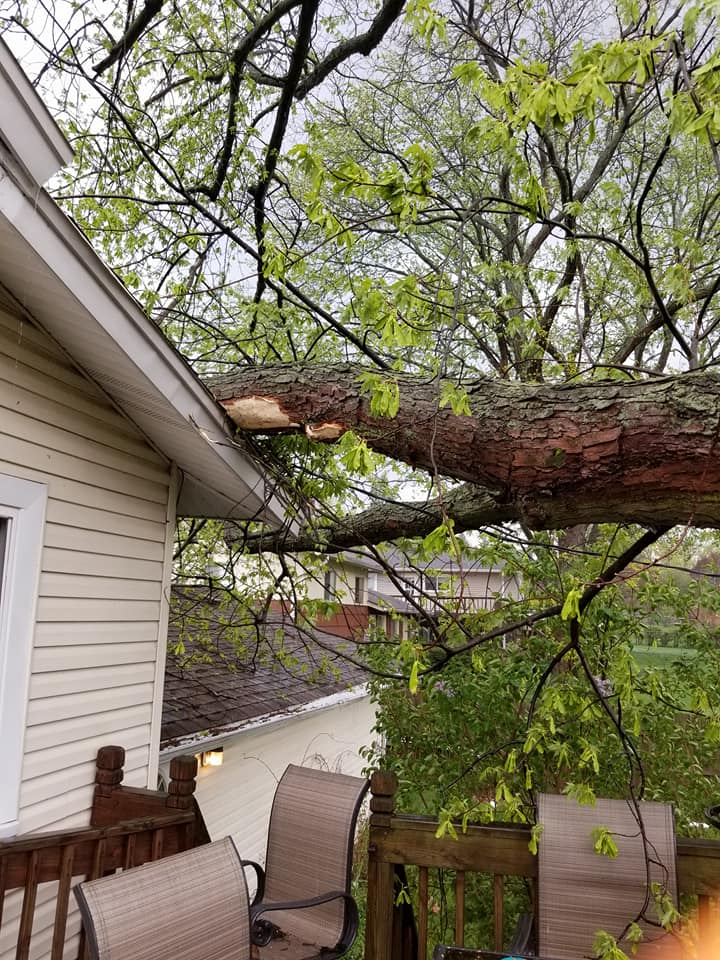
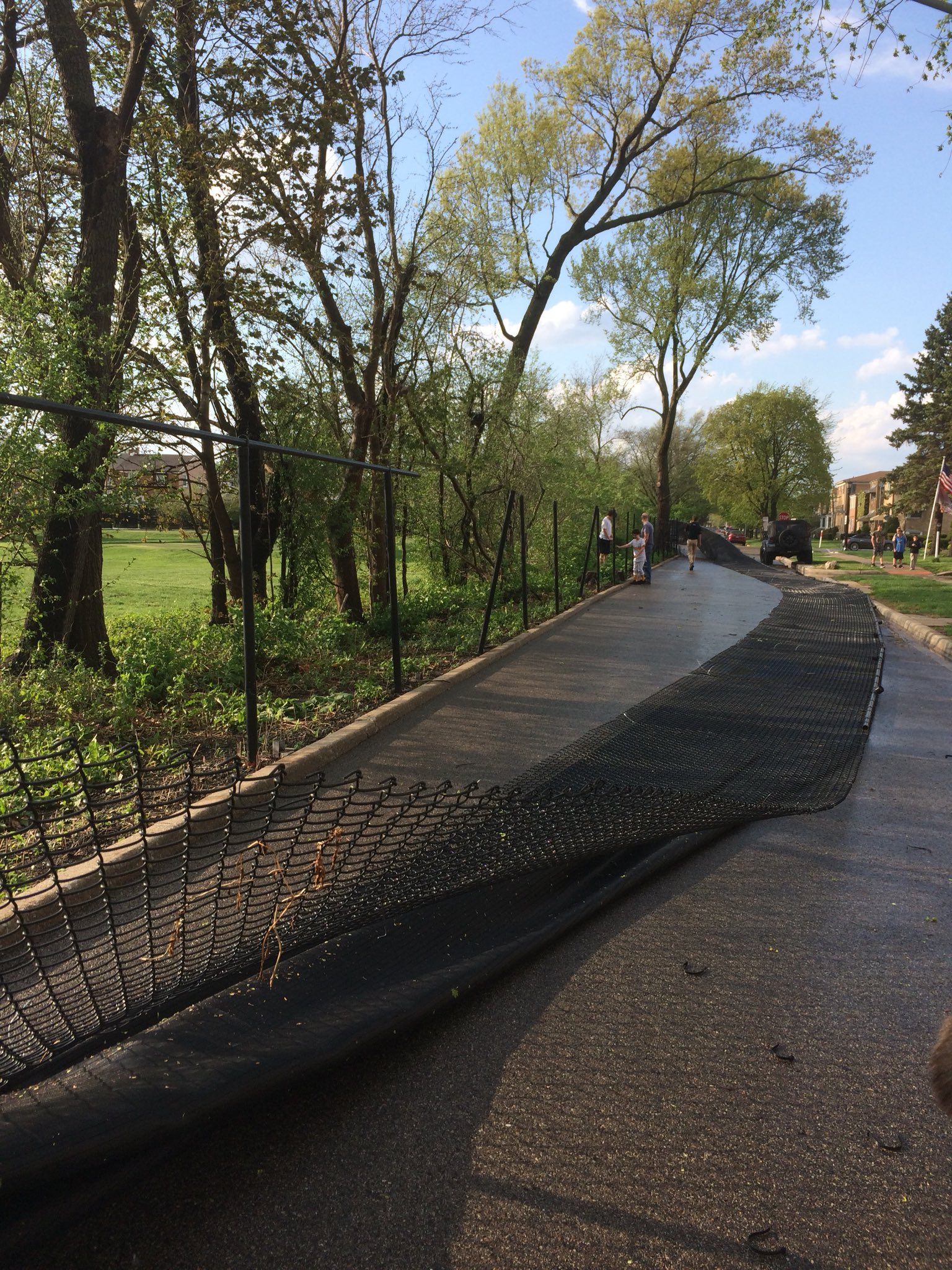
Photos
 |
 |
 |
|
Tree down in unincorporated Lombard, IL |
Fence blown down in Elmwood Park, IL |
Downburst near Chatsworth, IL |
 |
Media use of NWS Web News Stories is encouraged! Please acknowledge the NWS as the source of any news information accessed from this site. Additional recaps can be found on the NWS Chicago Past Events Page |
|

