Overview
|
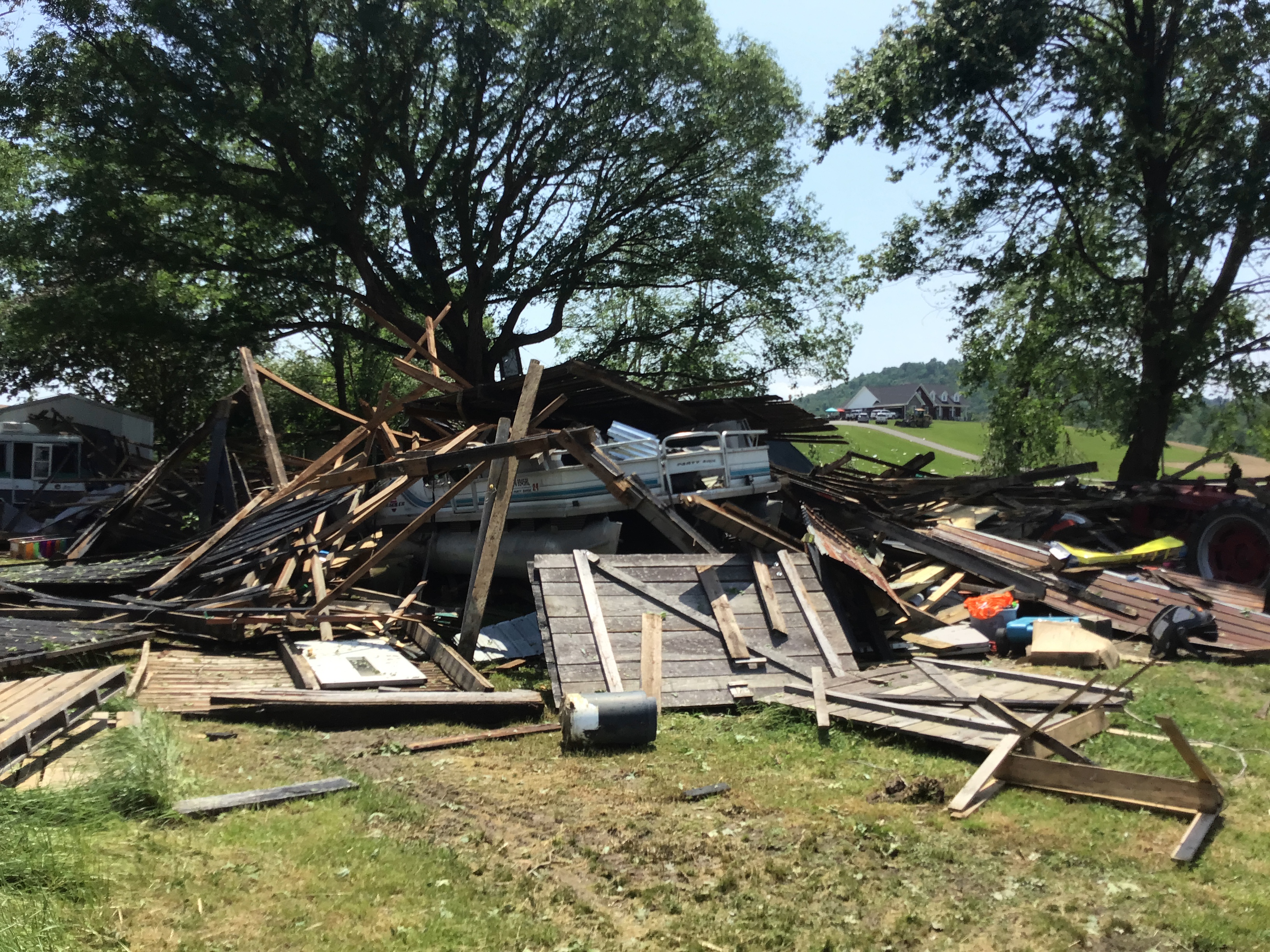
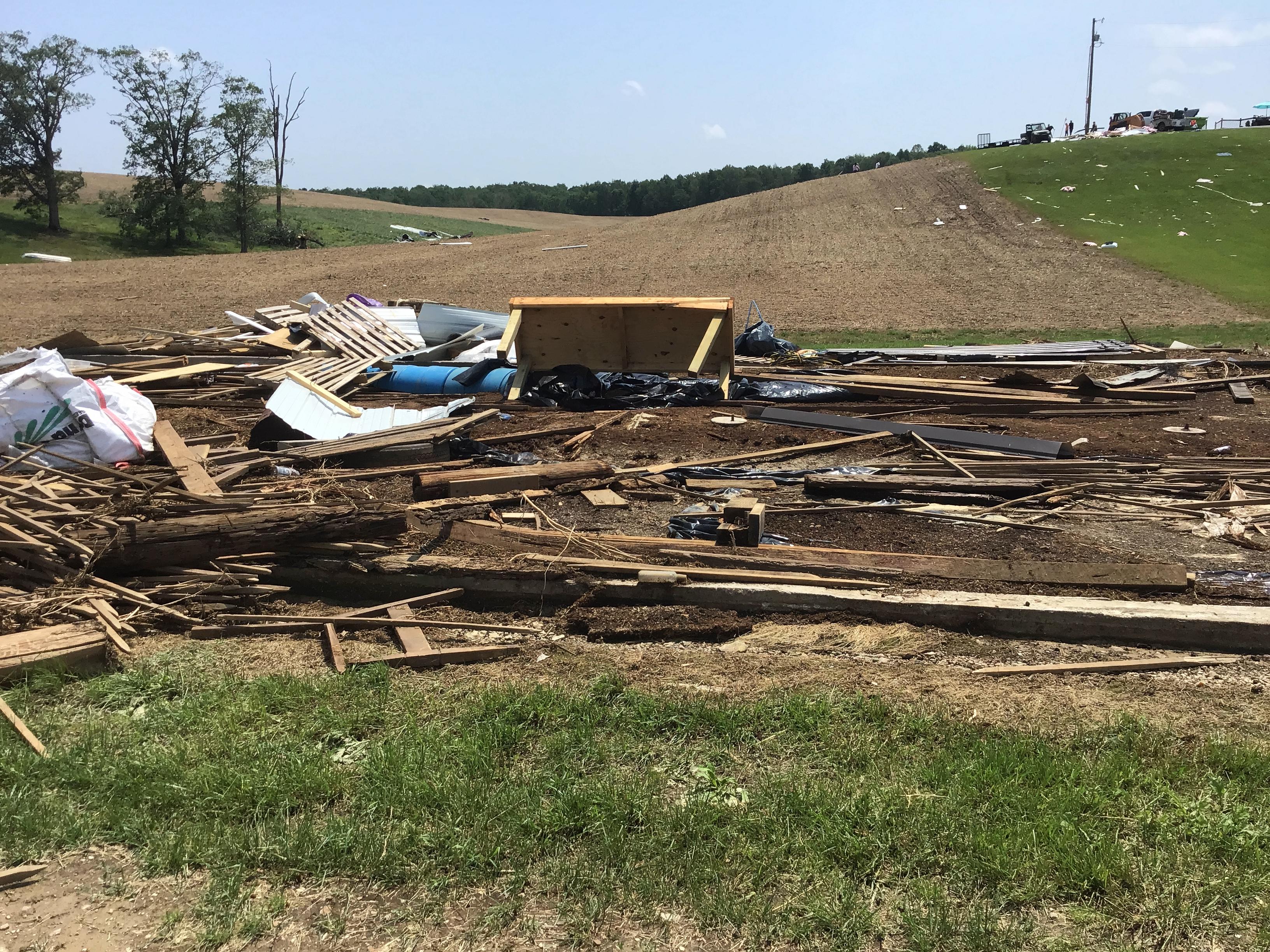
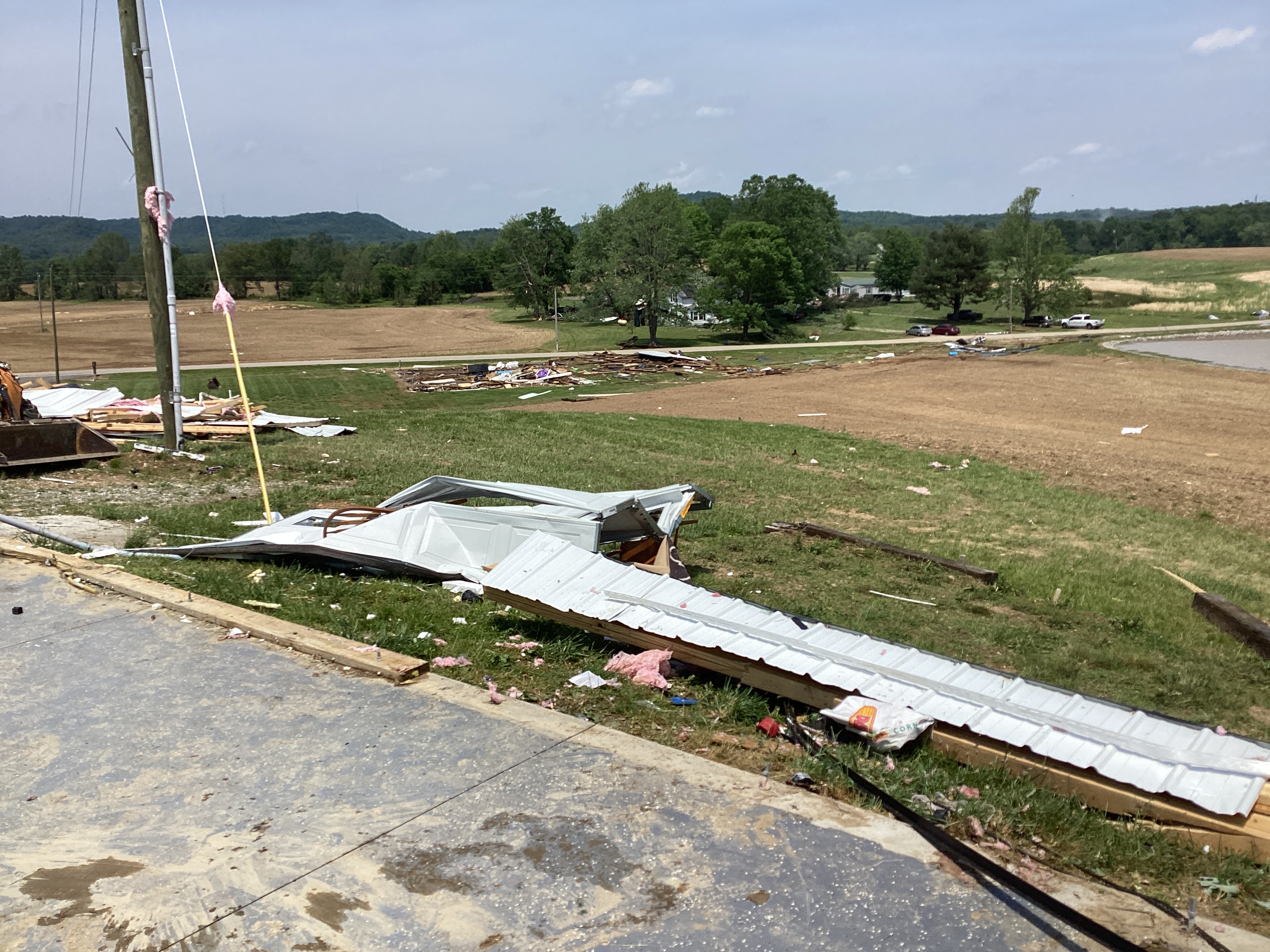
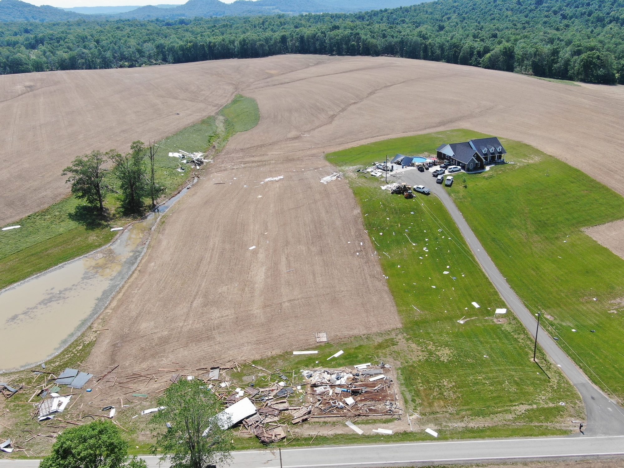
A macroburst caused significant wind damage in southern Marion County on May 18, 2022 with estimated peak winds of 97 mph. Ping pong ball size hail also fell during the downburst and caused significant siding damage.
|
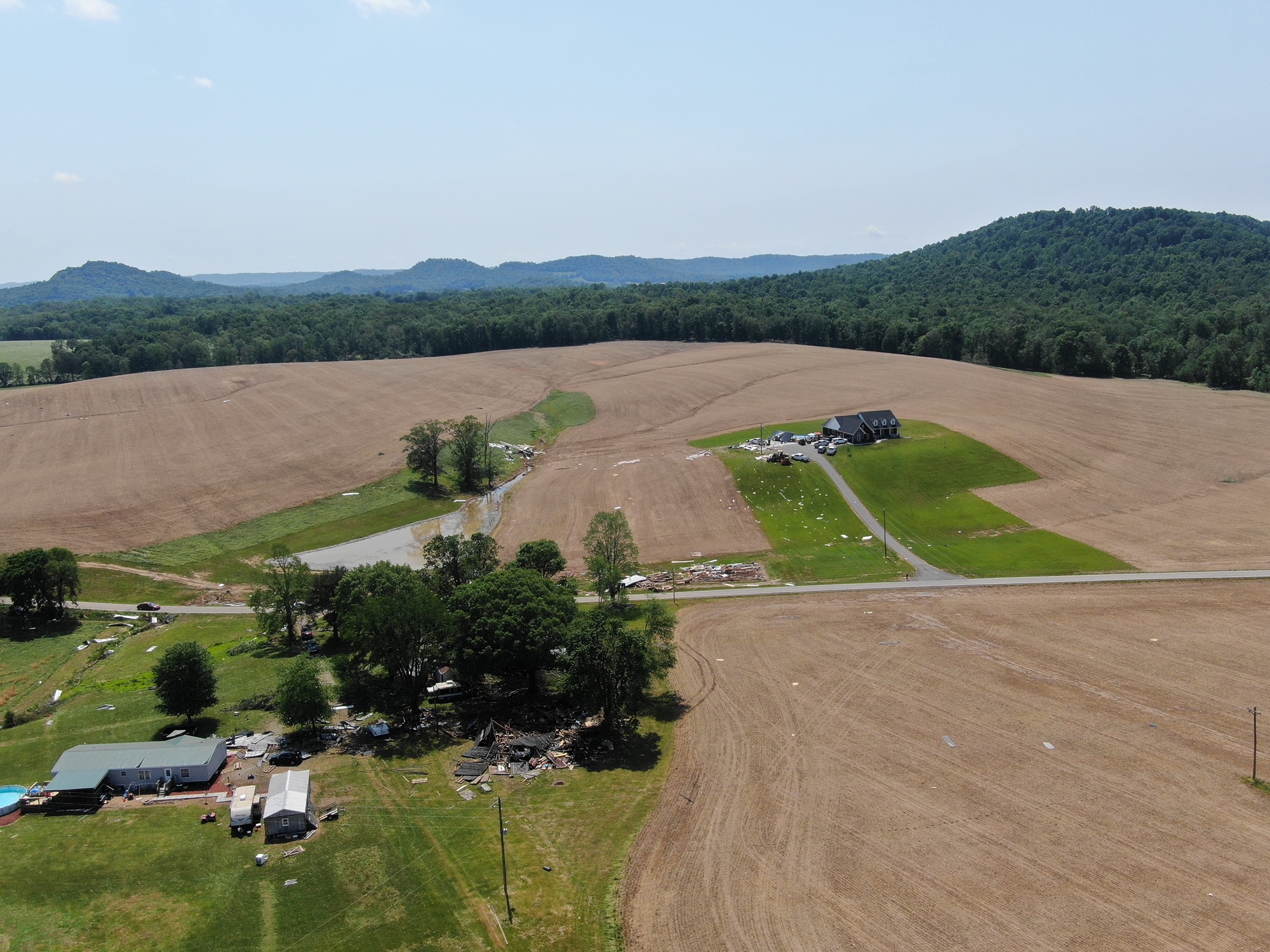 Aerial drone photo of macroburst wind damage in southern Marion County, Kentucky |
 |
 |
 |
| Macroburst Wind Damage in Southern Marion County, KY | Macroburst Wind Damage in Southern Marion County, KY | Macroburst Wind Damage in Southern Marion County, KY |
97 MPH Downburst Winds in Southern Marion County
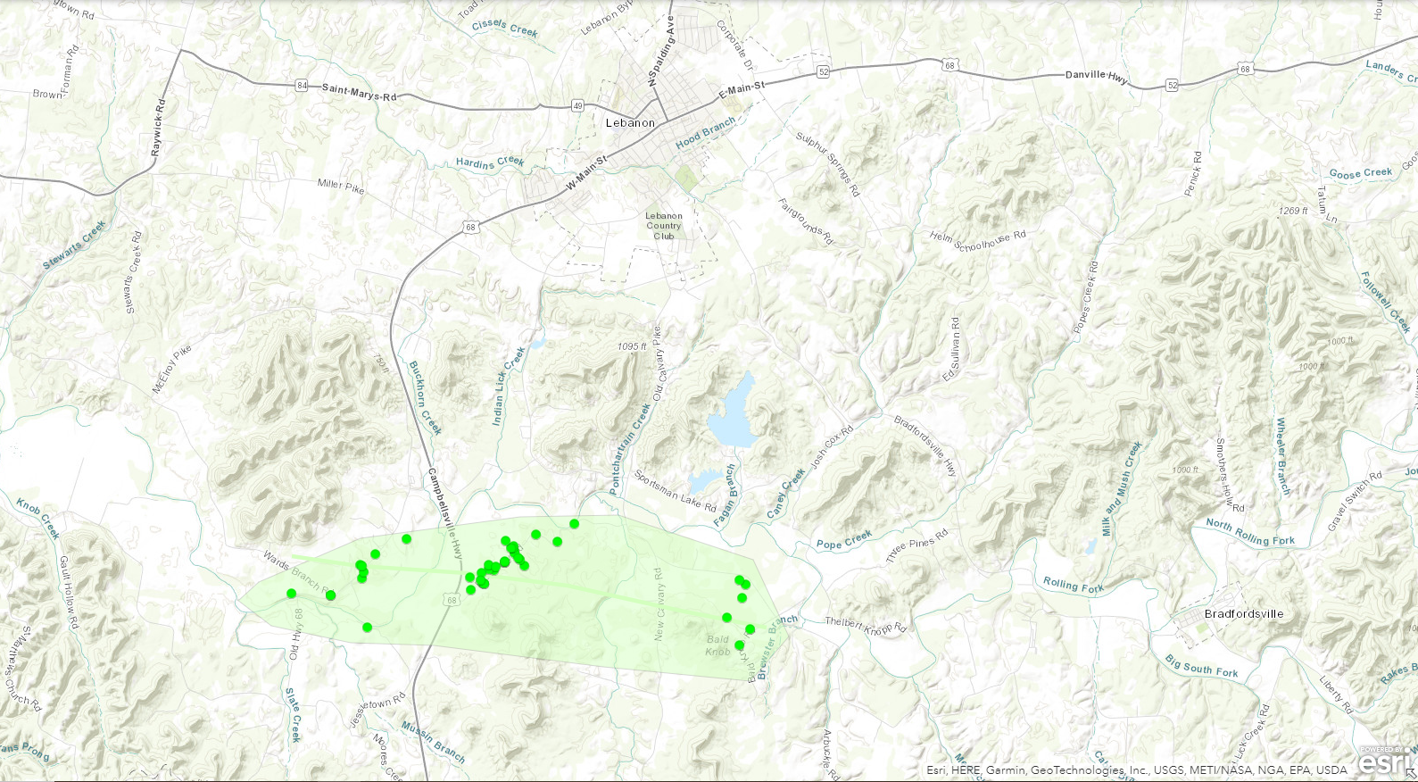
The National Weather Service conducted a storm damage assessment survey across Southern Marion County. The damage areas stretched from Jessietown through Calvary and over to Bald Knob. This is just south of Lebanon.
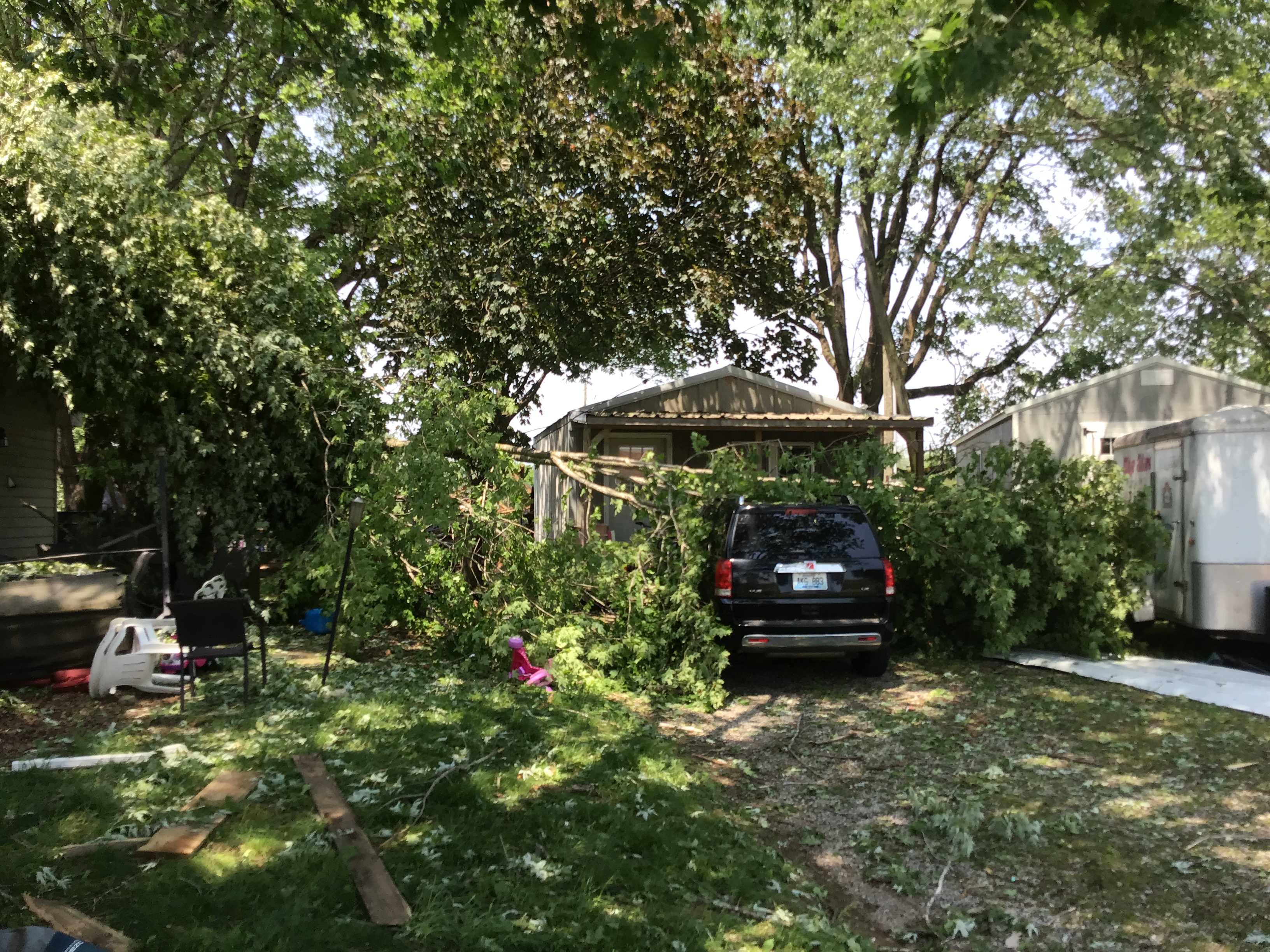
The first area of damage was along Highway 289 in Jessietown. We observed 9 older barns that were destroyed with debris being thrown up to 250 yards down wind. Several trees were on cars and roofs, and many power poles and lines were down. Winds were estimated between 75 and 80 mph and primarily pointing in a southeasterly direction.
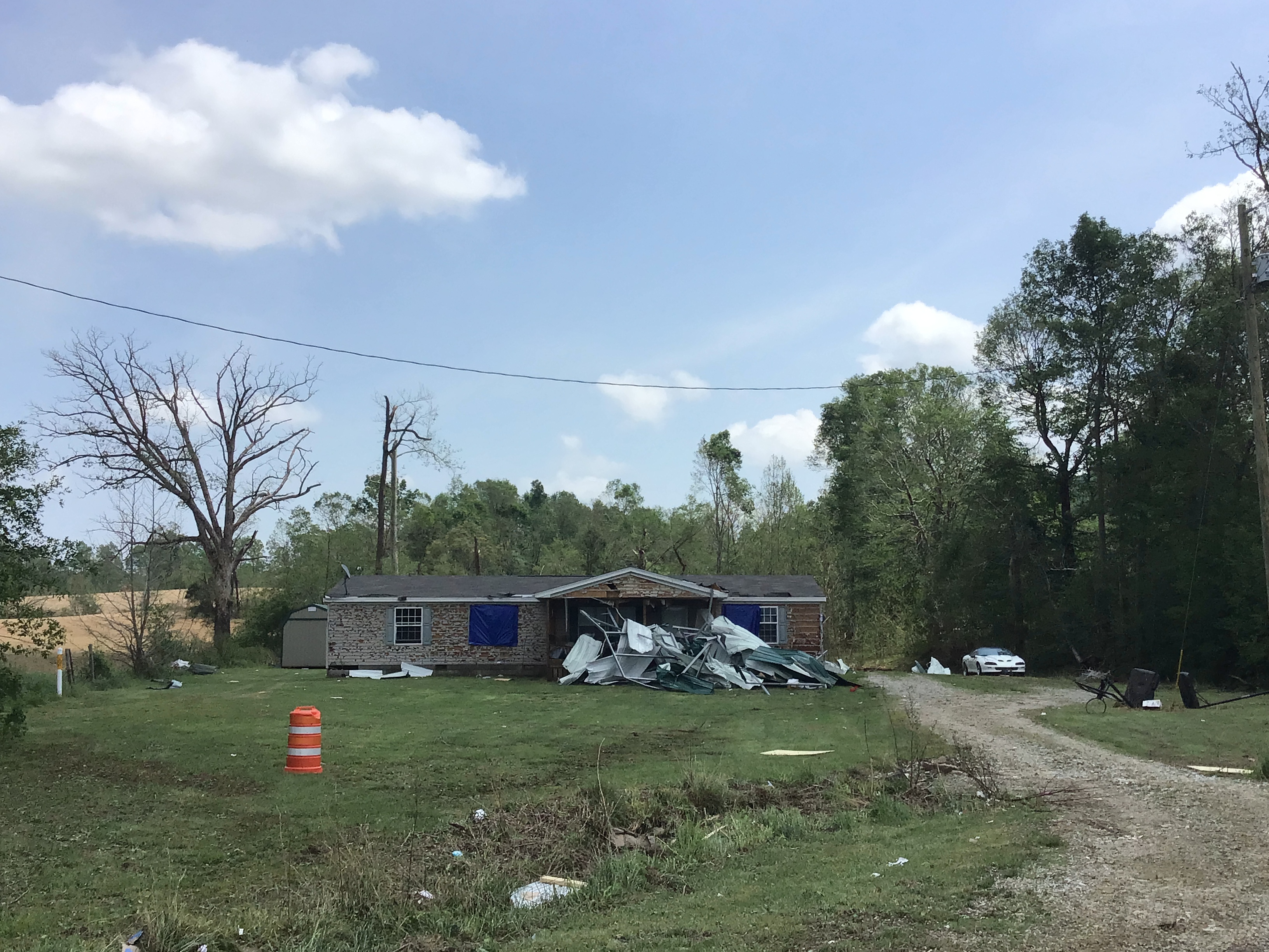
The most significant damage was located on East Calvary Road or 412. A downburst occurred along this road with power poles snapped, and trees snapped and uprooted. Several homes had significant roof and garage damage, and several trees were laying on cars. Very noteworthy, a F-150 truck inside an attached garage moved 4 feet and the garage was destroyed. Ping pong hail fell during the downburst and hit the side of one house doing significant siding damage. Winds in this area were estimated to be 97 mph, with a damage path width of 400 yards. The debris was thrown up to a quarter-mile.
Several witnesses spoke about the wind lasting between 7 and 10 minutes. Drone photography and video was used and you could distinctly see signs of a macroburst, with trees being fanned out in multiple directions and no twisting observed.
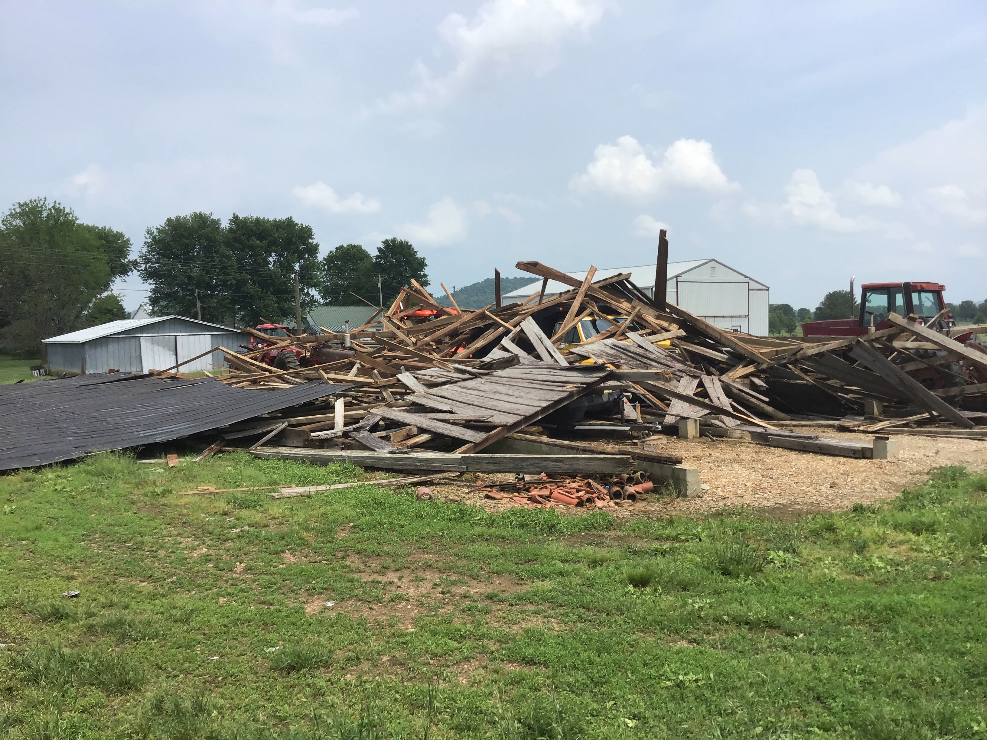
The third area damage was along Bald Knob off of 1157 and especially along Bald Knob Rd. Trees were snapped and downed. Several barns and outbuilding were destroyed. All the downed trees were facing east southeast, as well as barn panels and sheeting. Winds were estimated to be straight line of between 75 and 80 mph. The National Weather Service was in contact with Casey County Emergency Management, and looked at pictures from their survey. We are in agreement that the tree damage in Central Casey County, just north of Liberty is all straight line winds of 65 mph. The National Weather Service would like to thank KYEM and Marion County Emergency Management with their assistance with the survey.
Photos & Video
 |
 |
 |
 |
| Marion County Storm Damage NWS Louisville Drone Survey |
Marion County Storm Damage NWS Louisville Storm Survey |
Marion County Storm Damage NWS Louisville Storm Survey |
Marion County Storm Damage NWS Louisville Storm Survey |
...NWS Damage Survey for 05/18/2022 Macroburst Event

.Marion County Kentucky Macroburst

EF Scale Rating:           N/A
Estimated Peak Wind:       97 mph
Path Length/Statue/:       5.5 miles
Path Width/Maximum/:       2.5 miles wide
Fatalities:                0
Injuries:                  0

Start Date:                05/18/2022
Start Time:                5:30 PM EST
Start Location:            6 miles SW of Lebanon

End Date:                  05/18/2022
End Time:                  5:42 PM EST
End Location:              5 miles SSE of Lebanon
 |
Media use of NWS Web News Stories is encouraged! Please acknowledge the NWS as the source of any news information accessed from this site. |
|


 Weather Story
 Weather Map
 Local Radar