Louisville, KY
Weather Forecast Office
The Climate Prediction Center has issued a La Niña Watch for winter 2021-22. There is a potential for La Niña to emerge this fall and last through the winter, with a 66% chance of La Niña conditions during the November - January time period.
La Niña is a seasonal cooling of water temperatures in the central Pacific, coupled with changes in atmospheric winds, which can affect weather patterns far removed from the tropics. In the lower and middle Ohio Valley La Niña tends to increase our chances of wetter and warmer than normal weather. However, it is very important to remember that La Niña is just one player on the vast team of factors that combine to produce our weather. La Niña/El Niño is one of the better understood signals and can have a significant effect on weather patterns, though, so it's definitely worth watching.
 |
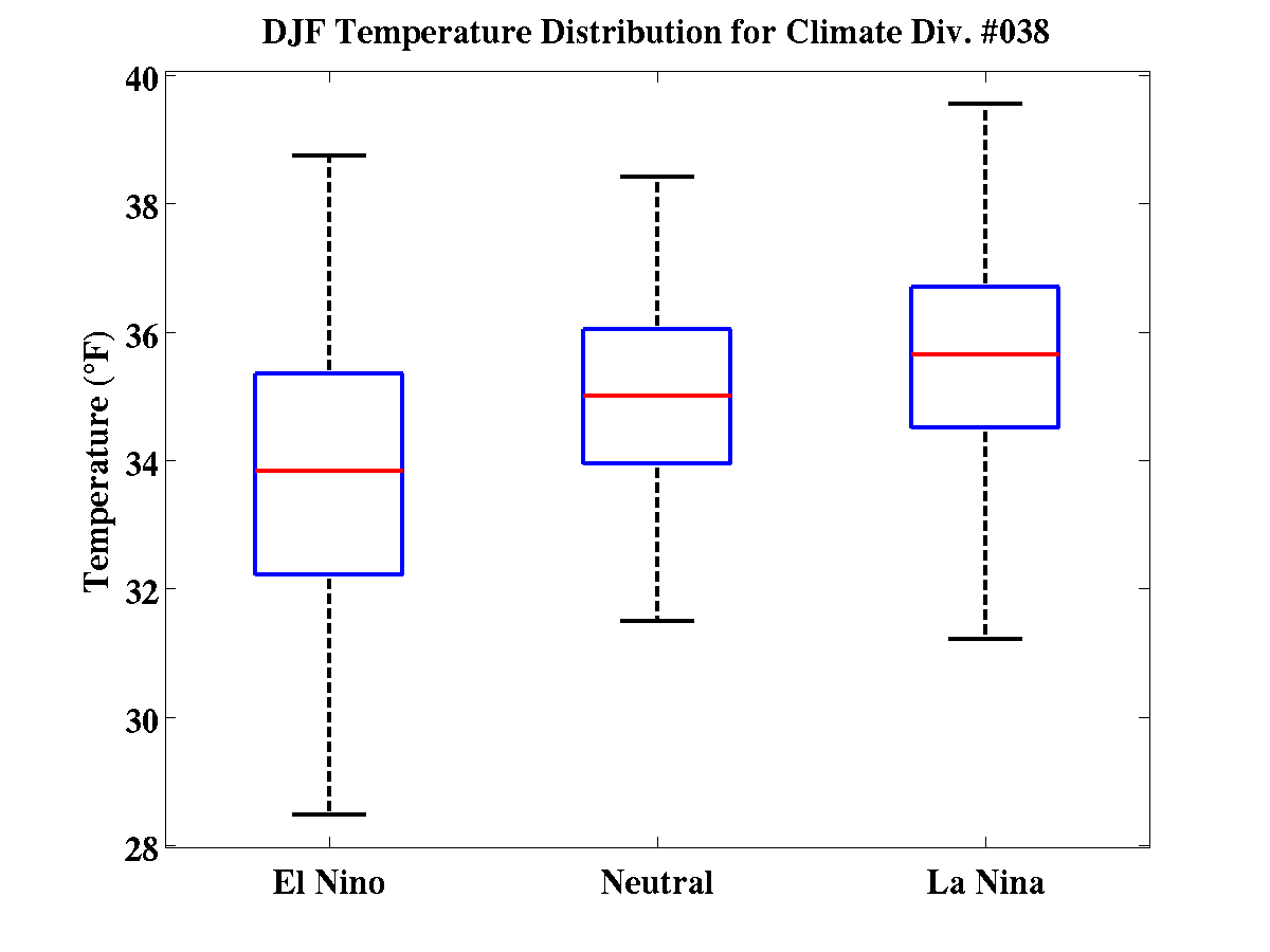 |
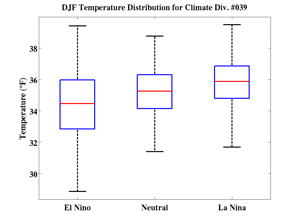
| December - February temperature anomalies during La Niña in western Kentucky and southwest Indiana | December - February temperature anomalies during La Niña in eastern Kentucky and southeast Indiana |
 |
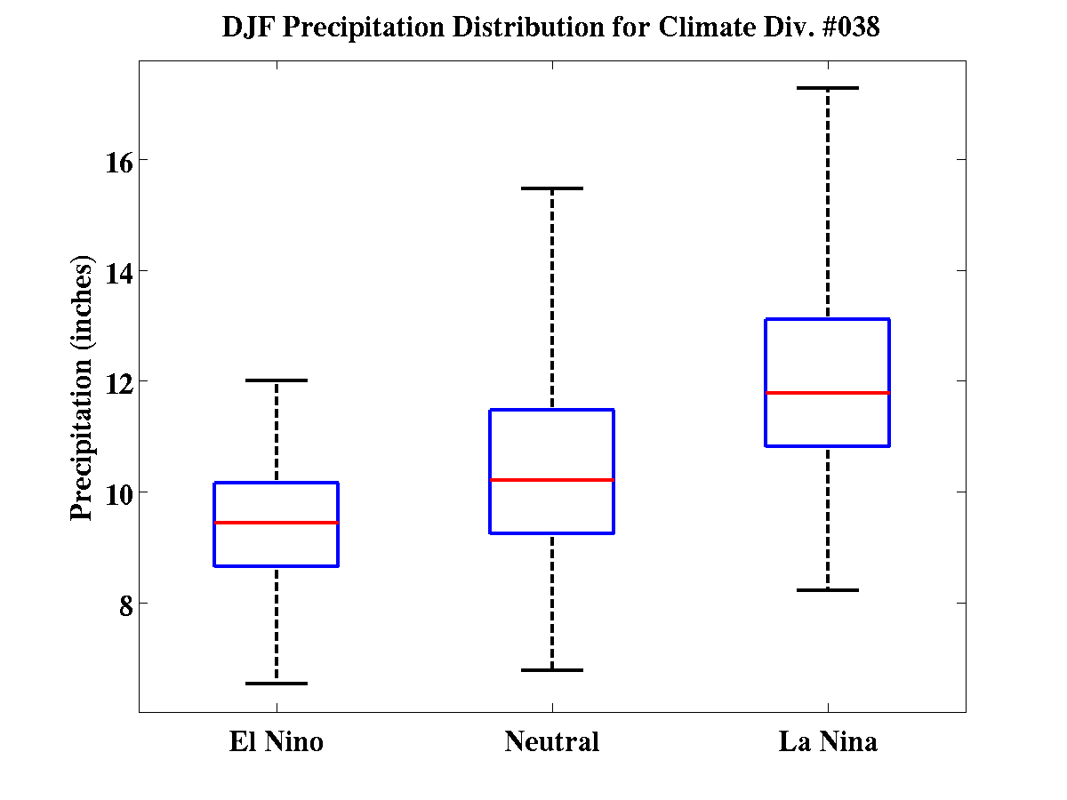 |
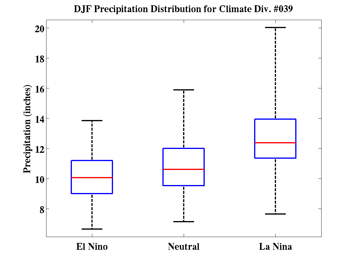
| December - February precipitation anomalies during La Niña in western Kentucky and southwest Indiana | December - February precipitation anomalies during La Niña in western Kentucky and southwest Indiana |
Source: https://origin.cpc.ncep.noaa.gov/products/precip/CWlink/ENSO/box_whiskers/index.php
Current Hazards
Hazardous Weather Outlook
Storm Prediction Center
Submit a Storm Report
Advisory/Warning Criteria
Radar
Fort Knox
Evansville
Fort Campbell
Nashville
Jackson
Wilmington
Latest Forecasts
El Nino and La Nina
Climate Prediction
Central U.S. Weather Stories
1-Stop Winter Forecast
Aviation
IDSS Forecast Points
Air Quality
Fire Weather
Recreation Forecasts
1-Stop Drought
Event Ready
1-Stop Severe Forecast
Past Weather
Climate Graphs
1-Stop Climate
CoCoRaHS
Local Climate Pages
Tornado History
Past Derby/Oaks/Thunder Weather
Football Weather
Local Information
About the NWS
Forecast Discussion
Items of Interest
Spotter Training
Regional Weather Map
Decision Support Page
Text Products
Science and Technology
Outreach
LMK Warning Area
About Our Office
Station History
Hazardous Weather Outlook
Local Climate Page
Tornado Machine Plans
Weather Enterprise Resources
US Dept of Commerce
National Oceanic and Atmospheric Administration
National Weather Service
Louisville, KY
6201 Theiler Lane
Louisville, KY 40229-1476
502-969-8842
Comments? Questions? Please Contact Us.


 Weather Story
 Weather Map
 Local Radar