Louisville, KY
Weather Forecast Office
Some users of NWS radar displays have begun receiving messages about the use of Adobe Flash in the display. Flash is scheduled to be discontinued toward the end of 2020, so web browsers have begun to alert users of this upcoming event.
The NWS's radar.weather.gov website has been the face of NWS radar data since 2003. The site routinely receives around 1.75 million hits on an average day and hundreds of millions of hits per day during active weather. The face of technology has changed dramatically throughout the last decade. By 2018 81% of Americans 13 years and older owned a smartphone. These devices have changed how and where we browse the internet. By 2018 mobile devices generated more than half of all web site traffic worldwide.
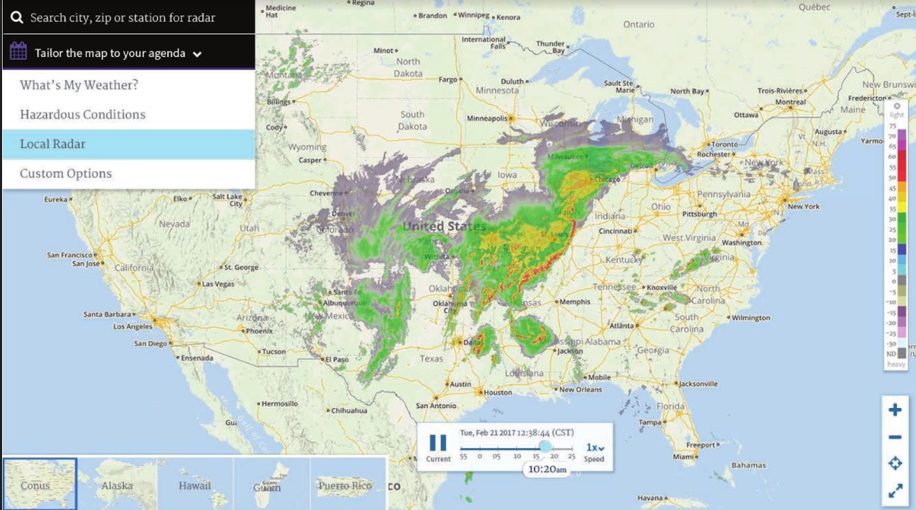
 The radar web site is not mobile-friendly in its current form and some of the displays use Flash. So, in response to these dramatic changes, this spring the NWS will replace the existing site and features with the following:
An example of the planned display is shown at right (subject to change).
In the meantime, we do have a non Flash-based version of the radar displays. This can be accessed from the regular radar page by clicking on the "Go to: Standard Version" link near the top left part of the screen. Or, you can use the following link:
https://radar.weather.gov/radar_lite.php?rid=lvx&product=N0R&loop=yes
(Article originally published by NWS Central Illinois )
Current Hazards
Hazardous Weather Outlook
Storm Prediction Center
Submit a Storm Report
Advisory/Warning Criteria
Radar
Fort Knox
Evansville
Fort Campbell
Nashville
Jackson
Wilmington
Latest Forecasts
El Nino and La Nina
Climate Prediction
Central U.S. Weather Stories
1-Stop Winter Forecast
Aviation
Spot Request
Air Quality
Fire Weather
Recreation Forecasts
1-Stop Drought
Event Ready
1-Stop Severe Forecast
Past Weather
Climate Graphs
1-Stop Climate
CoCoRaHS
Local Climate Pages
Tornado History
Past Derby/Oaks/Thunder Weather
Football Weather
Local Information
About the NWS
Forecast Discussion
Items of Interest
Spotter Training
Regional Weather Map
Decision Support Page
Text Products
Science and Technology
Outreach
LMK Warning Area
About Our Office
Station History
Hazardous Weather Outlook
Local Climate Page
Tornado Machine Plans
Weather Enterprise Resources
US Dept of Commerce
National Oceanic and Atmospheric Administration
National Weather Service
Louisville, KY
6201 Theiler Lane
Louisville, KY 40229-1476
502-969-8842
Comments? Questions? Please Contact Us.


 Weather Story
 Weather Map
 Local Radar