Louisville, KY
Weather Forecast Office
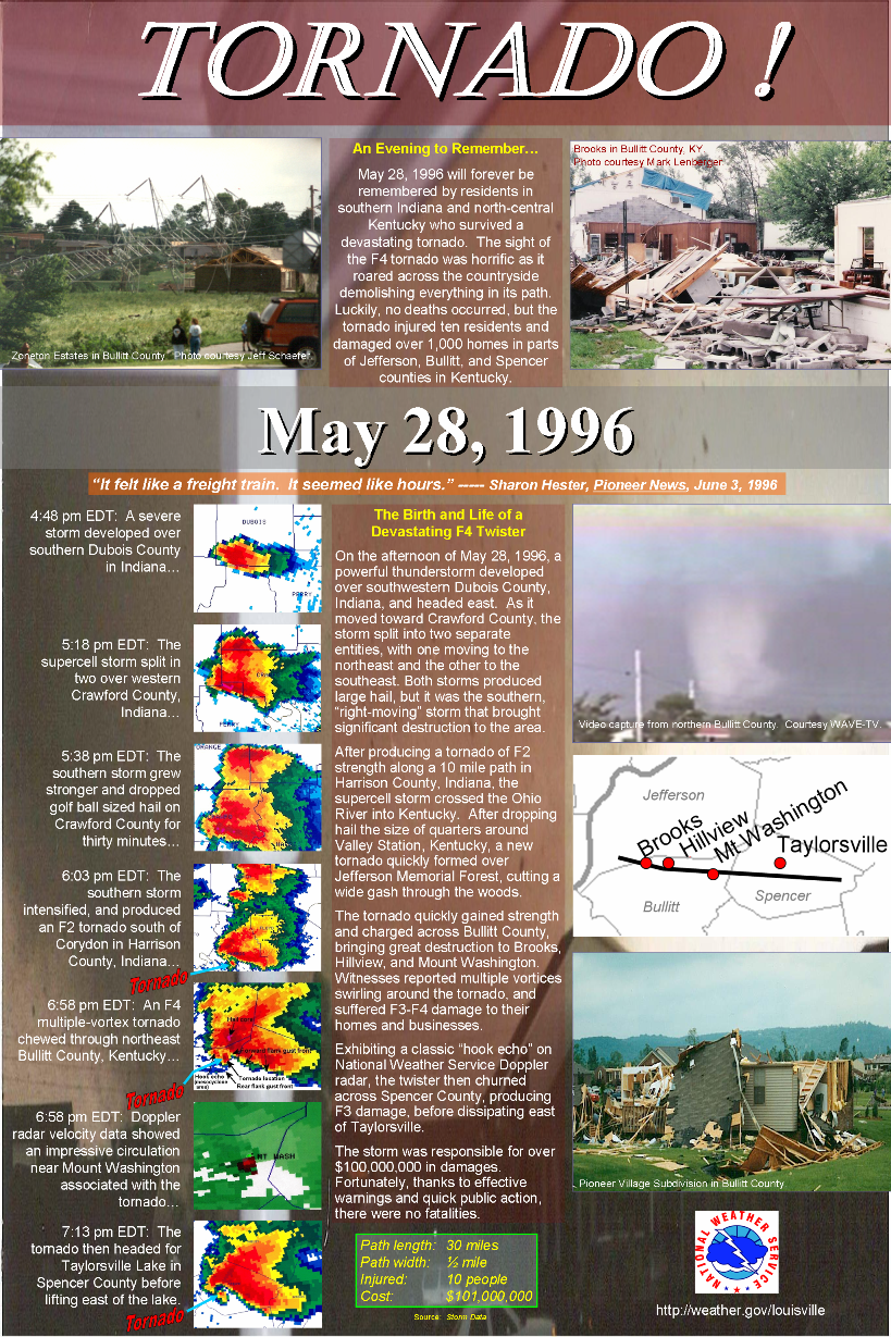
Friday marks 25 years since a tornado touched down in southern Jefferson County, strengthened to F4 as it tore across northern Bullitt County, and produced F3 damage in Spencer County. Below are social media graphics we'll be sending out over the next couple of days, and the educational poster we created several years ago for the event.
If you witnessed the storm, or one of the other tornadoes that occurred that day, and want to share your story, you can post it on our Facebook page, send out a tweet with the hashtag #BullittF4, or send us an email at nws.louisville@noaa.gov. If you send us an email, be sure to let us know if we may share your story.
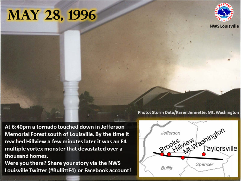
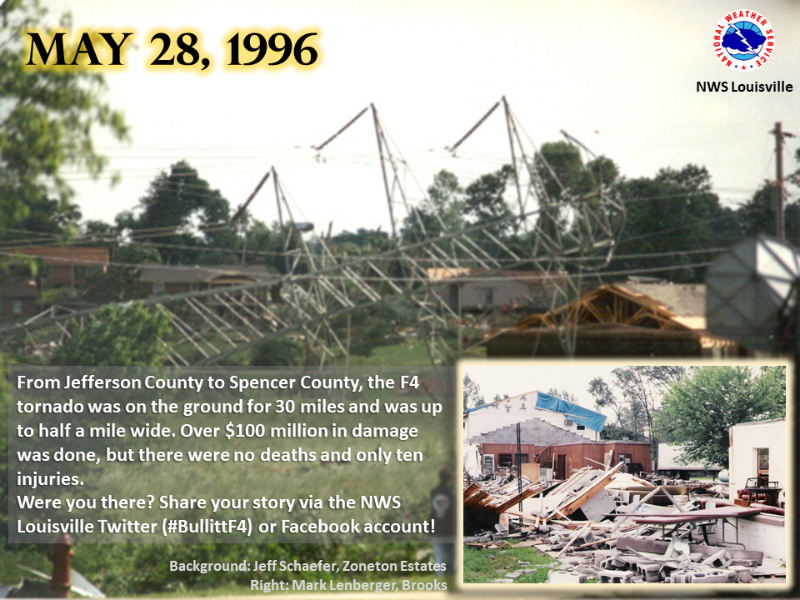
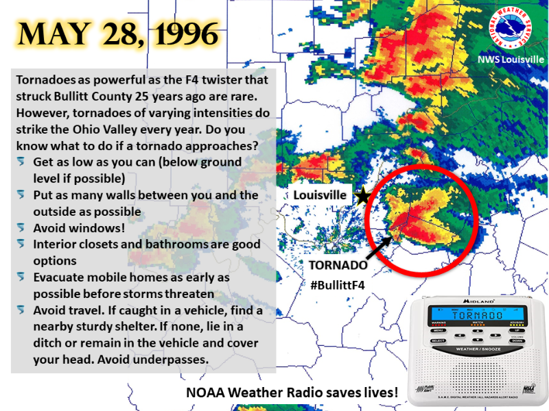
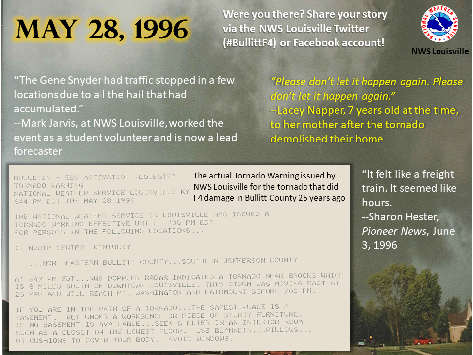
Link to the poster shown below: https://www.weather.gov/media/lmk/pdf/posters/bullittcountytor1996.pdf
Current Hazards
Hazardous Weather Outlook
Storm Prediction Center
Submit a Storm Report
Advisory/Warning Criteria
Radar
Fort Knox
Evansville
Fort Campbell
Nashville
Jackson
Wilmington
Latest Forecasts
El Nino and La Nina
Climate Prediction
Central U.S. Weather Stories
1-Stop Winter Forecast
Aviation
IDSS Forecast Points
Air Quality
Fire Weather
Recreation Forecasts
1-Stop Drought
Event Ready
1-Stop Severe Forecast
Past Weather
Climate Graphs
1-Stop Climate
CoCoRaHS
Local Climate Pages
Tornado History
Past Derby/Oaks/Thunder Weather
Football Weather
Local Information
About the NWS
Forecast Discussion
Items of Interest
Spotter Training
Regional Weather Map
Decision Support Page
Text Products
Science and Technology
Outreach
LMK Warning Area
About Our Office
Station History
Hazardous Weather Outlook
Local Climate Page
Tornado Machine Plans
Weather Enterprise Resources
US Dept of Commerce
National Oceanic and Atmospheric Administration
National Weather Service
Louisville, KY
6201 Theiler Lane
Louisville, KY 40229-1476
502-969-8842
Comments? Questions? Please Contact Us.


 Weather Story
 Weather Map
 Local Radar