Louisville, KY
Weather Forecast Office
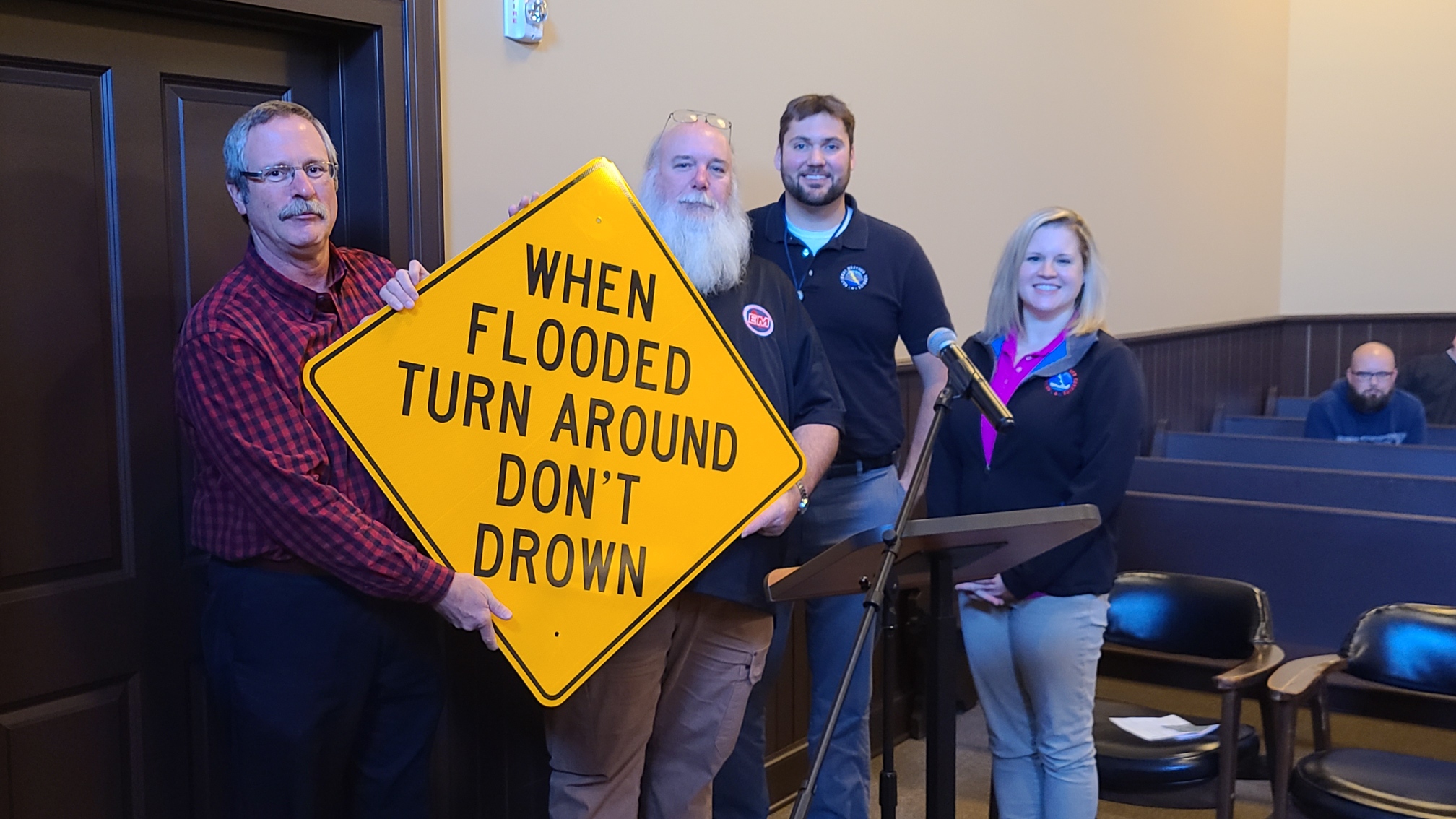
NWS Louisville delivered Turn Around Don't Drown road signs to Simpson County, KY on 12/7/21. The county was awarded these NWS-funded signs to alert travelers of the potential flood hazard at a low water ford on Kenny Parry Dr. Many auto accidents including one recent fatality (2019) have occurred because of flooding at this location in recent years.

Pictured Above From Left to Right: Mason Barnes (Simpson County Judge Executive), Bob Palmer (Simpson County Emergency Manager), Mike Kochasic (NWS Louisville Warning Coordination Meteorologist), Andrea Schoettmer (NWS Louisville Senior Service Hydrologist)
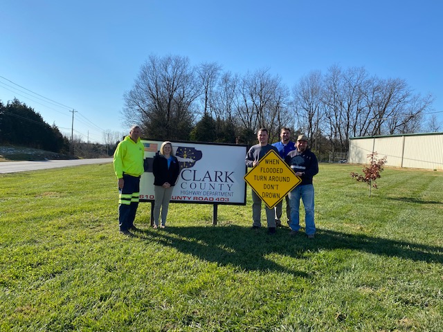
NWS Louisville delivered Turn Around Don't Drown road signs to Clark County, IN on 12/8/21. The county was awarded these NWS-funded signs to alert travelers of the potential flood hazard on Memphis Charlestown Rd near the junction with Hansberry Rd. This location has a history of multiple water rescues in recent years.

Pictured Above From Left to Right: Tim Cochran (Highway Superintendent), Andrea Schoettmer (NWS Louisville Senior Service Hydrologist), Gavan Hebner (Emergency Management Director), Mike Kochasic (NWS Louisville Warning Coordination Meteorologist), Eddie Umbreit (Highway Sign Department Manager)
Current Hazards
Hazardous Weather Outlook
Storm Prediction Center
Submit a Storm Report
Advisory/Warning Criteria
Radar
Fort Knox
Evansville
Fort Campbell
Nashville
Jackson
Wilmington
Latest Forecasts
El Nino and La Nina
Climate Prediction
Central U.S. Weather Stories
1-Stop Winter Forecast
Aviation
Spot Request
Air Quality
Fire Weather
Recreation Forecasts
1-Stop Drought
Event Ready
1-Stop Severe Forecast
Past Weather
Climate Graphs
1-Stop Climate
CoCoRaHS
Local Climate Pages
Tornado History
Past Derby/Oaks/Thunder Weather
Football Weather
Local Information
About the NWS
Forecast Discussion
Items of Interest
Spotter Training
Regional Weather Map
Decision Support Page
Text Products
Science and Technology
Outreach
LMK Warning Area
About Our Office
Station History
Hazardous Weather Outlook
Local Climate Page
Tornado Machine Plans
Weather Enterprise Resources
US Dept of Commerce
National Oceanic and Atmospheric Administration
National Weather Service
Louisville, KY
6201 Theiler Lane
Louisville, KY 40229-1476
502-969-8842
Comments? Questions? Please Contact Us.


 Weather Story
 Weather Map
 Local Radar