Louisville, KY
Weather Forecast Office
NWS Louisville delivered two Turn Around Don't Drown (TADD) road signs to Madison County, KY officials this past Tuesday (8/1/23). These signs will be posted at the junction of Four Mile Road and Hunter Lane where Otter Creek frequently overflows during heavy rains causing portions of these roads to flood. In 2019, a swift water rescue had to be done to save people that had driven into the flood waters at this location. Hopefully with added TADD signs along this frequently flooded roadway, people driving through the area will play it safe when they see flood waters and remember to "Turn Around Don't Drown!"
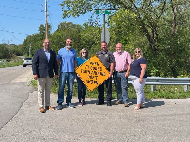
Pictured from Left to Right: Madison County Judge Executive Reagan Taylor, NWS Louisville Observations Program Leader Cliff Goff and Service Hydrologist Andrea Schoettmer, Madison County EMA Director and Fire Chief Tim Gray, Magistrate Brian Combs and Deputy Judge Executive Jill Williams.
Current Hazards
Hazardous Weather Outlook
Storm Prediction Center
Submit a Storm Report
Advisory/Warning Criteria
Radar
Fort Knox
Evansville
Fort Campbell
Nashville
Jackson
Wilmington
Latest Forecasts
El Nino and La Nina
Climate Prediction
Central U.S. Weather Stories
1-Stop Winter Forecast
Aviation
IDSS Forecast Points
Air Quality
Fire Weather
Recreation Forecasts
1-Stop Drought
Event Ready
1-Stop Severe Forecast
Past Weather
Climate Graphs
1-Stop Climate
CoCoRaHS
Local Climate Pages
Tornado History
Past Derby/Oaks/Thunder Weather
Football Weather
Local Information
About the NWS
Forecast Discussion
Items of Interest
Spotter Training
Regional Weather Map
Decision Support Page
Text Products
Science and Technology
Outreach
LMK Warning Area
About Our Office
Station History
Hazardous Weather Outlook
Local Climate Page
Tornado Machine Plans
Weather Enterprise Resources
US Dept of Commerce
National Oceanic and Atmospheric Administration
National Weather Service
Louisville, KY
6201 Theiler Lane
Louisville, KY 40229-1476
502-969-8842
Comments? Questions? Please Contact Us.


 Weather Story
 Weather Map
 Local Radar