
A winter-like pattern will continue over much of the Lower 48 over the next few days, with snow stretching from the Rockies today into the Middle Mississippi Valley on Monday. Showers and thunderstorms will develop along the Gulf Coast and Southeast on Monday. As the storm moves northward late Monday into Tuesday, winter weather is possible from the Central Appalachians to Interior New England. Read More >
Louisville, KY
Weather Forecast Office
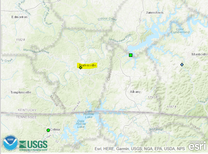
Effective on October 29, 2020, the National Weather Service in
Louisville will begin flood-only forecast services for the
Cumberland River at Burkesville, KY at the request of Kentucky
Emergency Management and Cumberland County, KY Emergency Management.
Flood-only forecasts for the Cumberland River at Burkesville will be
available on the National Weather Service webpage:

https://water.weather.gov/ahps2/hydrograph.php?wfo=lmk&gage=brkk2

The following flood stages have been established at Burkesville, KY:

Action:   43 ft
Minor:    46 ft
Moderate: 55 ft
Major:    64 ft

Forecasts for the Cumberland River at Burkesville will be issued
when water levels are expected to exceed the Action Stage level of
43 feet, and Flood Warnings will be issued when water levels are
expected to reach or exceed the Minor Flood Stage level of 46 feet.

If you have any questions or comments on this new service, please
contact:

Andrea Schoettmer, Senior Service Hydrologist
National Weather Service Forecast Office
6201 Theiler Lane
Louisville, KY 40229
Phone: 502-969-8842
E-Mail: andrea.schoettmer@noaa.gov
Current Hazards
Hazardous Weather Outlook
Storm Prediction Center
Submit a Storm Report
Advisory/Warning Criteria
Radar
Fort Knox
Evansville
Fort Campbell
Nashville
Jackson
Wilmington
Latest Forecasts
El Nino and La Nina
Climate Prediction
Central U.S. Weather Stories
1-Stop Winter Forecast
Aviation
Spot Request
Air Quality
Fire Weather
Recreation Forecasts
1-Stop Drought
Event Ready
1-Stop Severe Forecast
Past Weather
Climate Graphs
1-Stop Climate
CoCoRaHS
Local Climate Pages
Tornado History
Past Derby/Oaks/Thunder Weather
Football Weather
Local Information
About the NWS
Forecast Discussion
Items of Interest
Spotter Training
Regional Weather Map
Decision Support Page
Text Products
Science and Technology
Outreach
LMK Warning Area
About Our Office
Station History
Hazardous Weather Outlook
Local Climate Page
Tornado Machine Plans
Weather Enterprise Resources
US Dept of Commerce
National Oceanic and Atmospheric Administration
National Weather Service
Louisville, KY
6201 Theiler Lane
Louisville, KY 40229-1476
502-969-8842
Comments? Questions? Please Contact Us.


 Weather Story
 Weather Map
 Local Radar