Louisville, KY
Weather Forecast Office
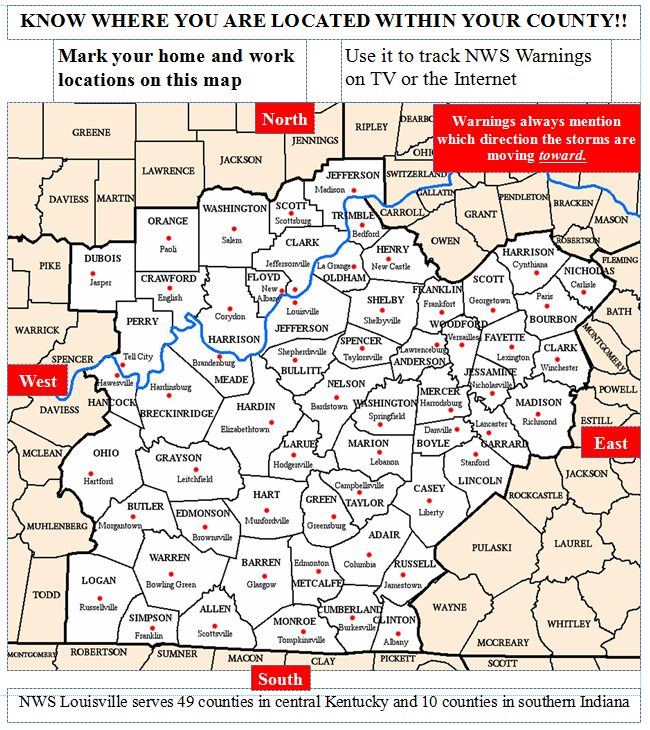
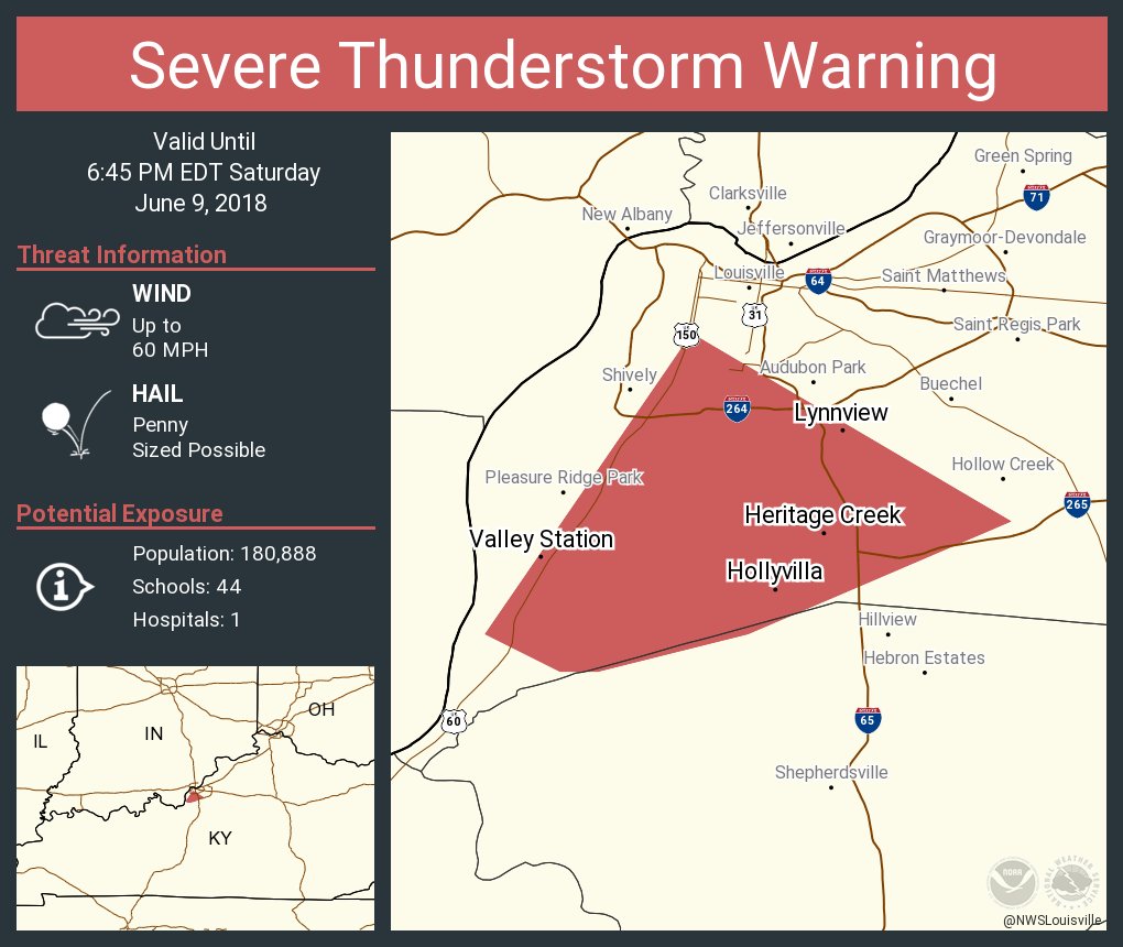
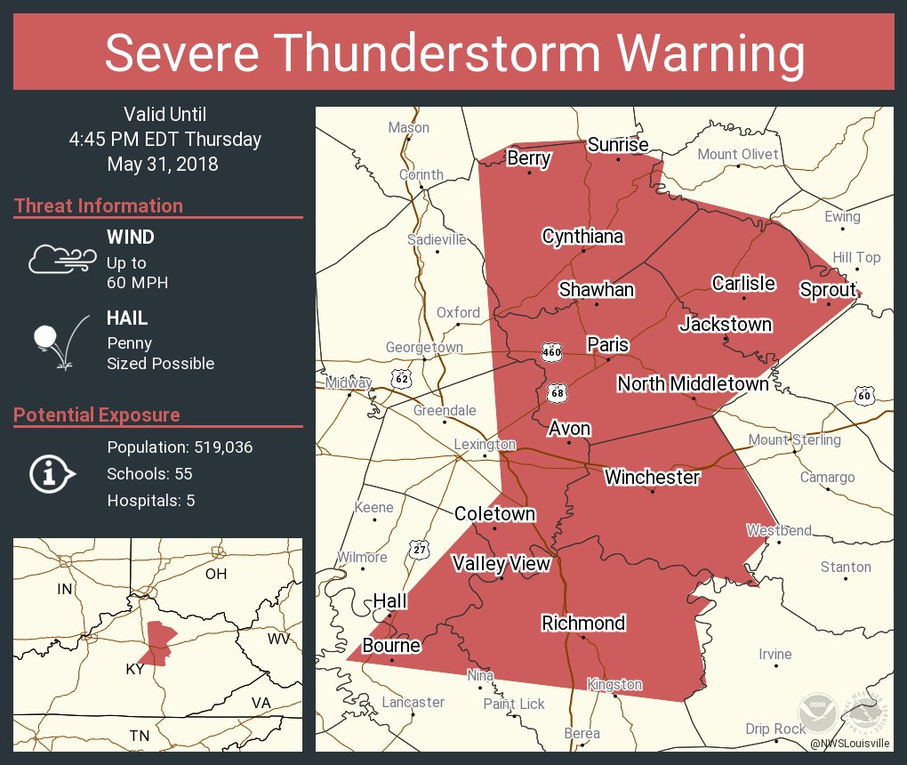
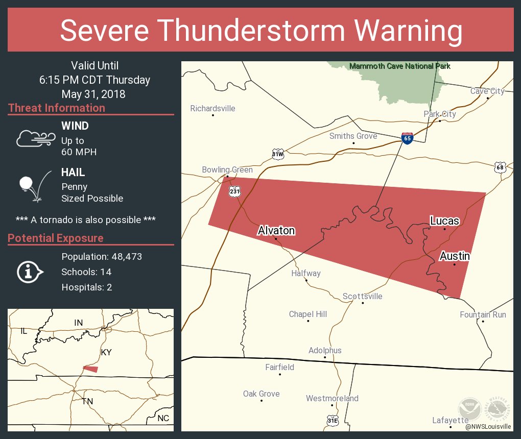
Several years ago, the National Weather Service switched from issuing warnings for entire counties to smaller areas, focused on where we think the best chance for hazardous weather either within a county or across county lines. If a warning were issued for your city, would you know where you are on a map? If not, print out the map below to find your county and then the county seat. Approximate how far you are away from that city and in which direction and then mark it on the map. Keep that as a reference for when you later see a warning either on TV, on our webpage, or when tweeted out by our office. The images farther down the page show example tweets of warnings for near the Louisville, Lexington, and Bowling Green areas.
If you would like to get the images above whenever we issue warnings, follow us on Twitter, @NWSLouisville.
Current Hazards
Hazardous Weather Outlook
Storm Prediction Center
Submit a Storm Report
Advisory/Warning Criteria
Radar
Fort Knox
Evansville
Fort Campbell
Nashville
Jackson
Wilmington
Latest Forecasts
El Nino and La Nina
Climate Prediction
Central U.S. Weather Stories
1-Stop Winter Forecast
Aviation
IDSS Forecast Points
Air Quality
Fire Weather
Recreation Forecasts
1-Stop Drought
Event Ready
1-Stop Severe Forecast
Past Weather
Climate Graphs
1-Stop Climate
CoCoRaHS
Local Climate Pages
Tornado History
Past Derby/Oaks/Thunder Weather
Football Weather
Local Information
About the NWS
Forecast Discussion
Items of Interest
Spotter Training
Regional Weather Map
Decision Support Page
Text Products
Science and Technology
Outreach
LMK Warning Area
About Our Office
Station History
Hazardous Weather Outlook
Local Climate Page
Tornado Machine Plans
Weather Enterprise Resources
US Dept of Commerce
National Oceanic and Atmospheric Administration
National Weather Service
Louisville, KY
6201 Theiler Lane
Louisville, KY 40229-1476
502-969-8842
Comments? Questions? Please Contact Us.


 Weather Story
 Weather Map
 Local Radar